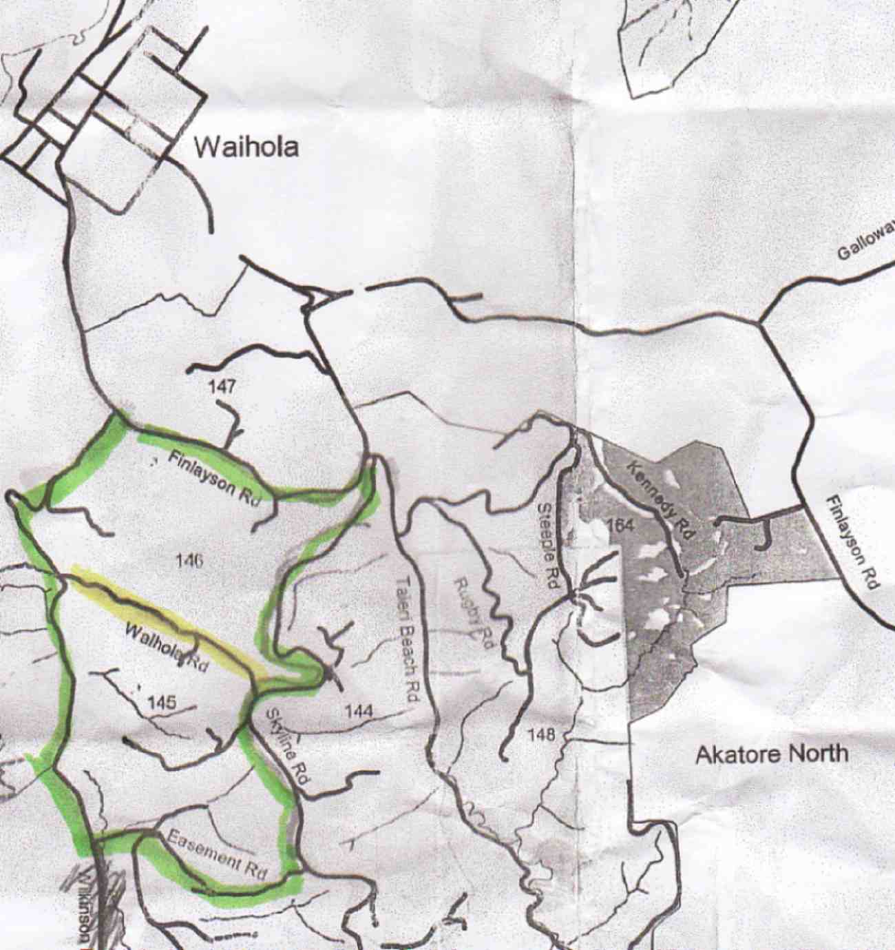
No. 90 on old hardcopy list of 113 club tramps. “Round Hill – Milburn (George) Farm”
42 km from car park.
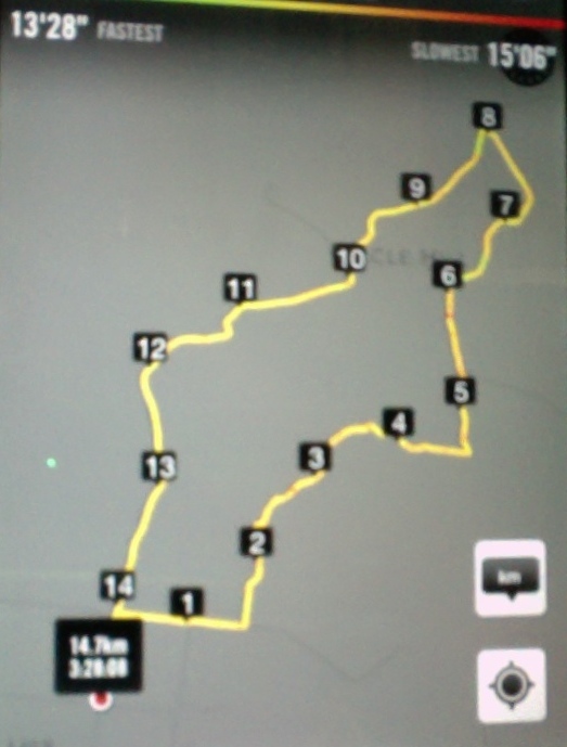
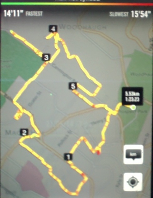
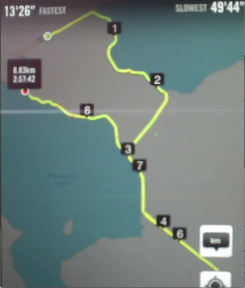
2/6/2014 Both. Fort Hill, Barnes and Circle Hill Roads, Milburn. Moderate. Leaders: Ian, Ken
iPhone GPS of route. Shows shorter than actual because I forgot to turn it on until after the first half km! See also Ken’s GPS for his 2010 route map.
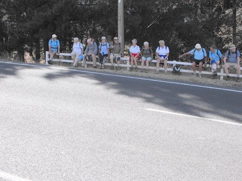
Twenty-six turned out for a sunny first tramp for the winter, on back country roads amongst lovely rolling hill farms to the west of Milburn.
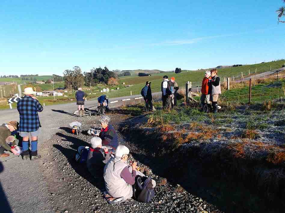
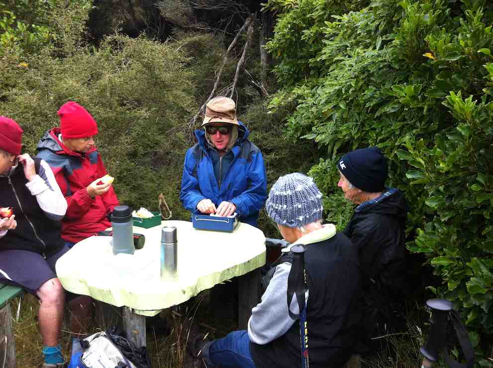
Morning Tea at the Finch Road turnoff from Circle Hill Road. (Heb pic)
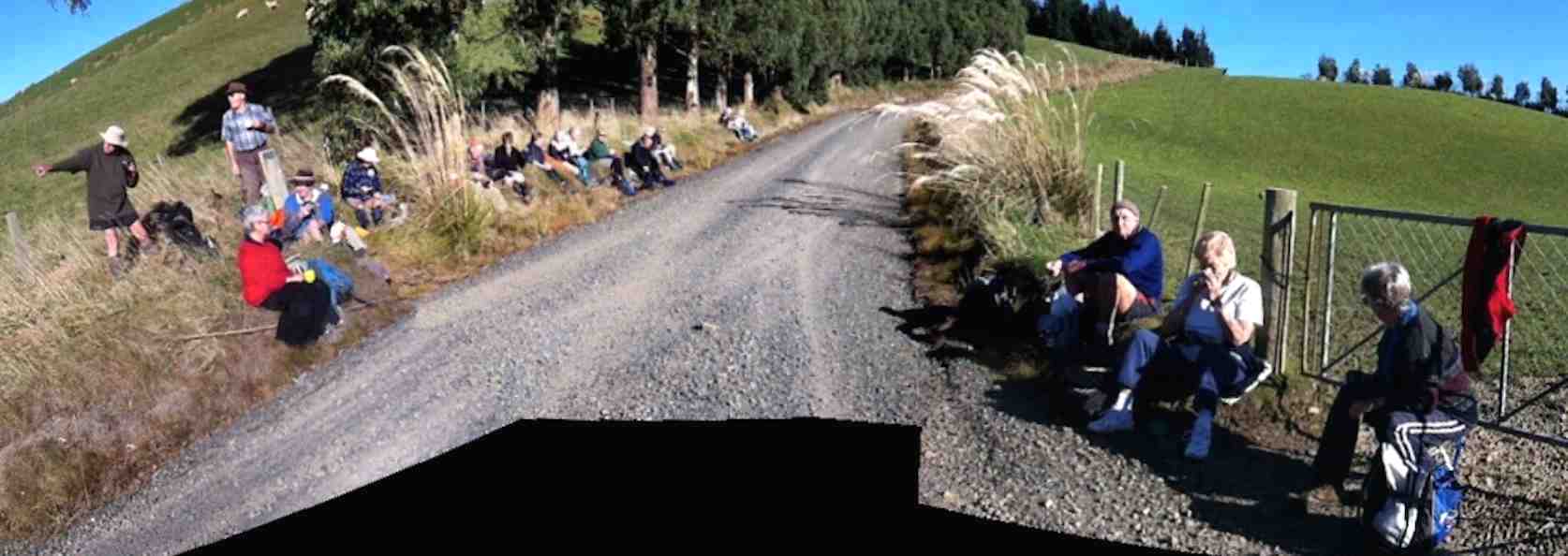
We lunched where Fort Hill Road ended at a T-junction with Barnes Road, which stretched left to meet Circle Hill Road, and right to form to form a larger route to also turn down Circle Hill Road at its end where both these roads joined to form Douglas Road.
Panorama pic. (The black bit at pic bottom results from my inexpert handing of my panoramic app.) Lunch. Here, Barnes Road goes ahead (in the pic) for the shortcut route and to the right for the longer route.
Ken supplied this report regarding this spot. Thanks Ken. : “The people that did the longer walk, covered 15.2km; Moving time 3hrs 9min; We climbed 374mtrs. I guess the ones that took the shortcut walked about 11km.
I base this on the time taken for us to walk around the longer loop, & the ave speed was 4.8km/hr, & it took us nearly an hour to walk around the loop.”
As said before, the day was sunny and calm, and each ample time to make the climbing bits at bits own pace.
Just a personal thought for road walks. With the growing practice of wearing, and of availability of high-viz vests, a good idea would be for more than just the leaders to be wearing them.
And lastly. What is becoming the customary coffee stop was enjoyed this time at Waihola’s Black Swan. – Ian.
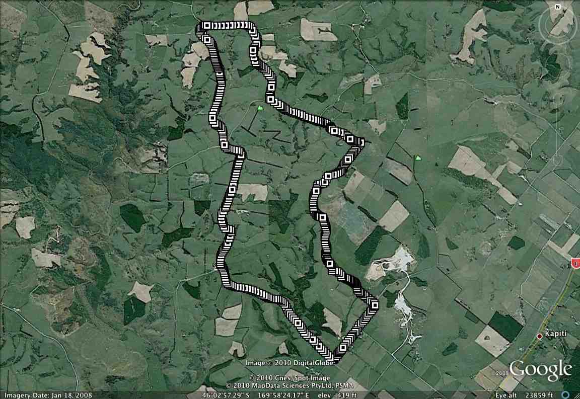
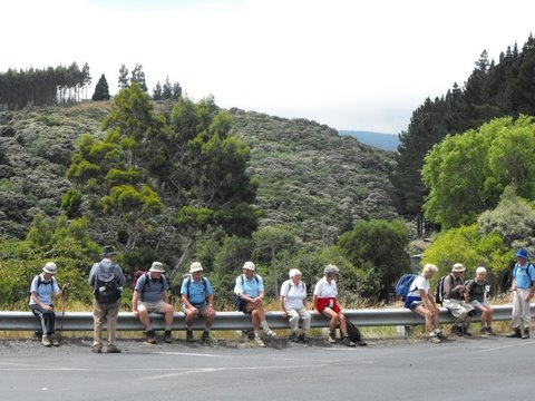
1/9/2010 Both. Fort Hill, Barnes and Circle Hill Roads, Milburn. Moderate. Leaders: Ian, Ken
GPS of route. The short-cut can be readily picked out. (Courtesy, Ken).
21/5/2014. Street Walk: Maori Hill. E. Leaders: Lance and Lois.
GPS
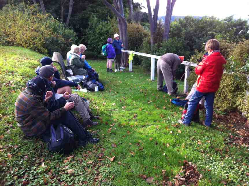
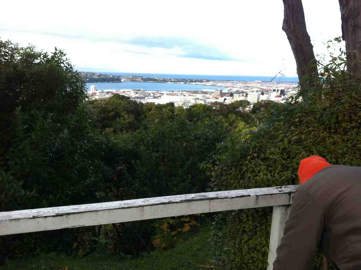
(An inadequate report. Only a summary. Anyone care to improve on/add to/alter it? Please notify.) Cars parked on Queens Drive encircling Prospect Park. Across Lachlan Avenue to Stonelaw Terrace, down a steep track at its end, first seal, then small crushed metal, to emerge on Queens Drive, then up Chamberlain Street for a short distance, along Como Street and up View Park Lane. This was a revelation to the reporter, who had known nothing about this (unique to Dunedin?) lane of letter boxes sited at the end of back sections to properties fronting otherwise onto Como (our left) and Chamberlain (our right) Streets. A gift for posties! Then along Falkland Street, down Drivers Road, to climb Tolcarne Avenue and stop just below Tolcarne Collegiate School Hostel to enjoy morning tea at a view point.
Taking in the view at morning tea. … well, most. Sorry Fred.The view. Sorry again, Fred.
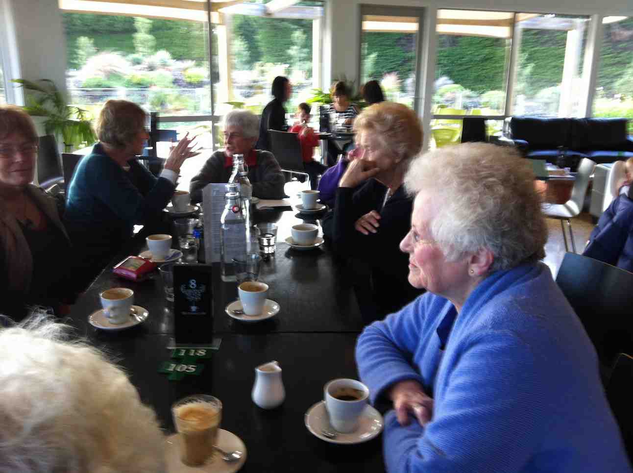
Then up Grendon Street, finding a lane taking in the back properties of houses on left and right with their frontages out on adjacent roads. (Unsure though where this was.) Out onto Highgate, through the village onto Balmacewan Road and up Prestwick Street to its terminus and return. Along Pilkington Road, to take Cannington Road to spot where it ends at the bush, return and follow Cairnhill Street into Braeview Crescent to explore it to each of its terminuses (or termini if you must be linguistically correct) to their ends. Back along Cannington Road to find our way into Brownville Crescent, another new find for the reporter. Here was a road necessarily one-way due to its narrowness. Lance thought it likely than a developer had enforced his wishes on some early Maori Hill Borough Council, narrowing its width to increase adjacent property areas as much as possible. It exited onto Highgate. Then it was back down to the cars at Prospect Park. Early lunch, scheduled to be finished before a forecast storm. However this came only later when driving back home, so lunch was enjoyed in the sun on a bank sheltering us from the wind. Thanks to Lance and Lois for a well reconnoitred, imaginative and most enlightening route. – Ian.
A sneaked lunch view.Birthday Bev at table head. Sorry about the light interference.
6. 22/1/2014. Hikers. Hoopers Inlet from Hall. Easy. Leaders: Barbara and Arthur
GPS of route (record started a bit late!). Total distance more like 11 kms.
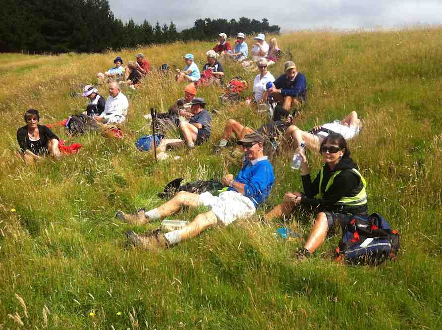
22 Hikers parked their 7 cars at Hoopers Inlet Hall. As recorded on the last report below, we rested for morning tea on the old Hoopers Inlet School grounds. Then over the hill to the the Papanui Inlet Road – Cape Saunders Road – Hoopers Inlet Road to the end. Over the style for lunch on a grassy slope sheltered from the wind.
Lunch at Allans Beach
A quick visit after down to the beach rewarded us with the sight of a sealion sanding himself in the sun. We retraced our steps back to the cars parked at Hoopers Inlet Hall.
(Extract from http://portobello.org.nz/our-community/hoopers-inlet-hall/:
The Hall belongs to the local community and is run and maintained by them. Originally built as a boating club, the hall was for many years “the place to be seen”. Dances have taken place here over the years and many local people have had family members start their courting days at this hall. The hall has extensive views of Harbour Cone (Hereweka) which can be viewed from the deck and double doors built onto a sheltered open space. The reconstructed fireplace is a central feature of the hall. … The kitchen has been modernised. The hall caters for all sorts of occasions. For a booking, call Jackie 478 0508 or email [email protected] to check availability.)
9. 1/5/2013 Both. Steve Amies. Leaders: Ian and George.
This time we left from the schoolhouse, making it more of a road walk. We had morning tea on the lower Rollinson Rd and lunch in the track clearers’ picnic area, after inspecting the helicopter landing pad a little beyond.
As we returned down the road, we were surprised to see the helicopter, and shortly after the tank truck making their way towards where we had been. Apparently this was the day to carry out the weed spraying we had been notified about – and we were now making a timely exit. A tramp for 25 of us and of 10.5 km according to Peter’s pedometer and 25. – Ian.
8. 1/2/2012 Both. Steve Amies from Access Road. Leaders: Arthur and Barbara.
Sixteen of us left our cars at the locked gate on Rollinson access Rd and made our way up to the Track Clearers’ Picnic area. The leaders took us round many of the little nooks and crannies (they just seem to multiply of their own accord), stopping to inspect the labels fronting each bush planting. Of poignant note in front of one bush was a label printed with the name of Les Murcott, whose funeral a number of us had attended only a fortnight earlier.
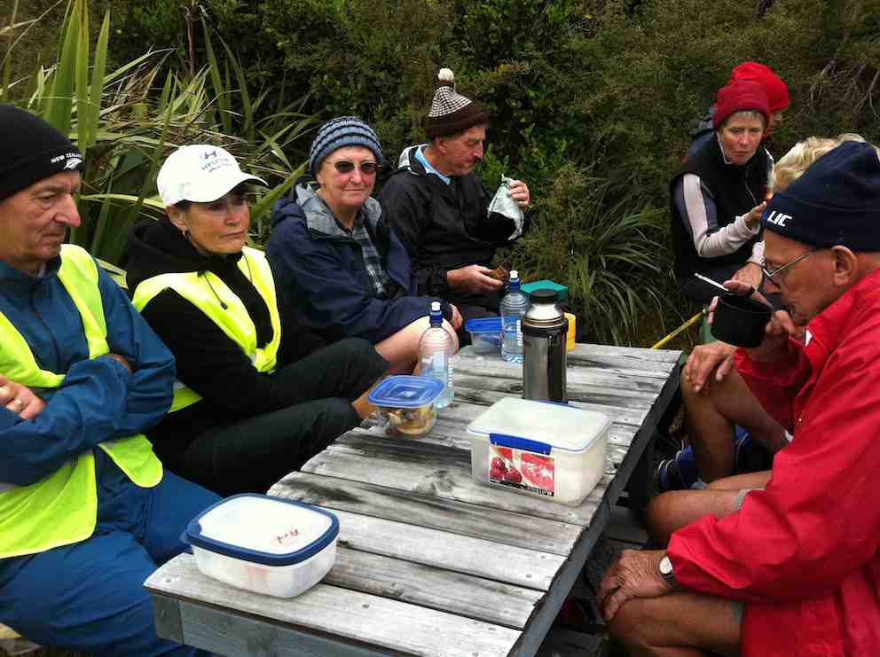
We stopped off for our tea break.
Arthur led us down and across to Trig Q, and then on down Little Coal Creek until we got to the look-out. We careful negotiated some quite steep parts of the track and avoided any casualties. Then came the more arduous climb back up to the trig and across to the Steve Amies.
This latter track had a much more moderate decline (we stuck to only its upper reaches!), past another look-out, before making another turn around further down, to wander back up to the trig and on to the picnic area for lunch.
On the way across the wee saddle, we stopped to investigate the meaning of a sign indicating a sheltered area, whose side track opened out to a large open area in the bush, marked with a large white wooden equal-armed cross, laid flat on the grass. After some discussion, we decided the area was also to serve as a helicopter emergency landing spot. (There was even a ‘waiting room’ bench for passengers.)
Back up at the picnic area, our leaders discovered for us yet another alcove with ample tables and seats for a comfortable lunch.
A large ‘table’.A smaller one. (Admire Bruce’s head attire.)
Our leaders took us out to the road by a route different from the one we had entered by, and lo and behold, a salubrious shelter, doubtless erected by the track clearers for their comfort. Bravo.
Doug
Then we had only a stroll back down Rollinson Road to the cars. A leisurely 5.5 km walk, (as measured by two with their measuring devices.) Thank you, Barbara and Arthur for your careful leadership. – Ian.
7. 18/3/2009. Hikers. Steve Amies from Access Rd Hikers E+ Bev H, Joyce S
6. 25/7/2007. Hikers. Access Road, Steve Amies. Leaders: Bob H, Graham.
click to enlarge
Picnic Area nr Trig Q Fred, Marjorie, Joyce, Angela, Mollie, Wendy, Bev, Peter, Margaret, Elaine, Lesley
5. 19/5/2007 Trig Q from Silverstream via Steve Amies track. Steve Amies Track Circuit Leaders: Ria L, Hazel
4. 27/7/2005. Hikers. Steve Amies, Trig Q. Bob H, Les W, Mary M.
3. 2/2/2000. Trig Q from Silverstream via Steve Amies track. Steve Amies Track Circuit Leaders: Peter B, Lex
2. 23/10/1996. Trig Q. Average. Leaders: Margaret and Les, Doug J.
1. 7/6/1995Trig Q from Whare Flat School. Medium+. Shorter trip available. Leaders: Bob H, George, Jack R, Nancy
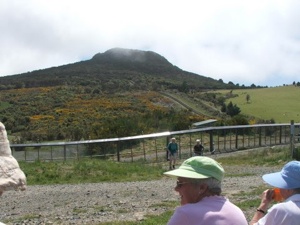
Lunch at top of Orokonui Ecosanctuary. Mopanui beyond.
Well, the Sanctuary is BIG. Much bigger than the writer had imagined.
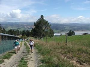
13km we went, with 9 of them around the perimeter, starting from the
bottom carpark, going around the estuary and clockwise thereafter
ascending from sea level
Climbing Orokonui
to near the top of Mopanui (400m+), then down
to the main top gate where the visitor centre will later be built,
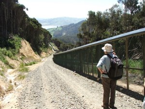
near the junction of Blueskin and Mopanui Roads. We lunched there, couldn’t find the sleeve to Joyce’s thermos though we looked hard (and that was because it was back on her kitchen bench) and then it was all downhill
Orokonui descent
back to the cars, but in calm, warm conditions. A really
pleasant walk.
The fence that encloses the Orokonui Ecosanctuary ( the old Orokonui
DoC reserve which includes NZ’s tallest tree, plus all the additional
land) was closed off in July 2007. Almost all pests have been
eradicated, even down to the last goat. An employee behind the fence
explained that they were currently on a spraying programme around the
fenceline as even a bit of gorse widening a gap in the wire mesh will
create a ‘mouse breach’! While it is not yet open to the public, it
is possible to walk around the fence and marvel at what is being
planned. There are steep sections, especially at the northern end of
the fence but in general the 3 to 4 hour walk was very
straightforward, following the wide, gravelled perimeter track. There
was plenty to see: great views, named fence posts (we spotted No.10
Fleming Street where the PM is in residence) (well, actually it was
Prime Mover Ian and Shirley Fleming’s plaque on fence post No.10) and
varying vegetation. We could hear rosellas and a rifleman, but we
didn’t catch a glimpse of the 6 Kaka that have been released, although
Leslie Gowans, who visits regularly to detail sightings of birds, says
that they have not strayed much further than 100m from their release
site so far. The Orokonui website if you want to know more, can be
found at: www.orokonui.org.nz – Bob M
7. 7/7/2004 Leaders: Ian, Bill, Pat Before fenced in. Right around through entire gully. 6. 1/3/2000. Orokonui, Big Tree. Leaders; Shirley McN, Val.
5 .28/7/1999. Orokonui, Big Tree. Leaders: Shirley McN, Judy C, Val. 4. 30/9/1998. Orokonui, Big Tree. Leaders: Shirley McN, Judy C. 3. 7/5/1997. Orokanui – Big Tree round trip. 2. 6/11/1996. Orokonui – Big Tree Round Trip. Leaders: Shirley McN, Judy C, Wendy. 1. 22/5/1996. Orokonui – Big Tree round trip. Medium+ Leaders: Shirley McN, Judy C, Wendy
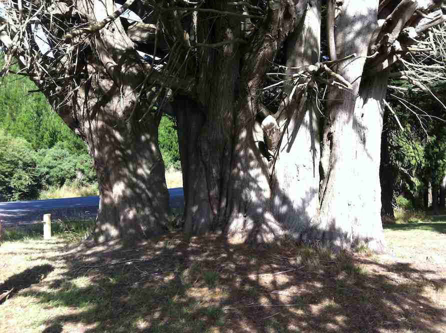
16. 18/1/2012. Hikers. Finlayson Road picnic area. Wilkinson, Easement, Skyline and Waihola Roads, round trip. Leaders: Marjorie and Bruce.
We parked our cars at a rest stop on Finlayson Rd, near Wilkinson Rd turn-off. Bruce led us round the area, planted with a variety of interesting trees, not the least being this large macrocarpa.
3. 20/1/2010. Hikers. Overbridge, Coalstage Road, McMasters Road, Old Brighton Road, Fairfield Park, Morris Road, Overbridge. Leaders: Bev and Chris.
The Rudd Road walk you do when you are not actually doing the Rudd Road walk!!
Our esteemed leaders Bev and Chris decided that views from Rudd Road were unlikely in the misty conditions set to prevail, and that the 12 of us should walk from Saddle Hill to Fairfield and back instead. The intention was to go from Coal Stage Rd up Chain Hills Rd and do a loop, but the general wisdom was to follow Coal Stage. When we got to Saddle Hill Rd, the Left-leaning leaders wanted to turn that way while the majority of Tories voted to turn Right (which was actually less conservative), and so proceed up Saddle Hill Rd to McMasters Rd, where in fact we had a morning tea stop with a view.
It was a warm, still morning here and there was a calming feel about the quiet gravel
road with views out onto the Kaikorai Estuary and Stony Hill, etc.
McMasters Rd towards Stony. (Bob pic and caption)
A bunch of fence sitters – Old Brighton Rd. (Bob pic and caption)
Lunch was at the Fairfield park ( Chris led a long detour in order to use a pedestrian crossing), in the sun. Delicious – especially Fred’s shared chocolates.
Another bunch of fence sitters – Main Rd, Fairfield. (Bob pic and caption)
And so back to the cars at the overbridge via Main Rd and Morris Rd. A very pleasant 10km on a nice day. We even passed a display of hand milking near the ostriches on Morris Rd. And the clouds were still hanging around Flagstaff, so we felt it had been a good choice. – Bob.
Very surprised and delighted to yet again have another fine Wed. after having 2-3 days of mist and rain. A bit cloudy but fine and not too cold. Ten keen hikers parked their cars in Lees St. and set off on a very convoluted walk to get to their final destination which was the Southern Cemetery. It was up hill all the way to our morning tea stop which was the play area in the Mornington Park. After a refreshing cuppa it was off again on the ups and downs of the streets in the Maryhill/ Mornington area till we eventually got to Eglington Rd and the very top gate of the Southern Cemetery. We walked down through the area of very old graves and found a spot on a grave in the sun to sit and eat our lunch. Very peaceful and quiet. No people or traffic to disturb the peace! After lunching we strolled around among the graves, reading inscriptions where they were still legible and finding many of well known early citizens of Dunedin. Also the area where the early Chinese were buried in place that was supposed to be separate for the rest of the community.
All in all an interesting place to visit and the first time for most of the hikers there on Wed. From there it was a fairly short walk back to the cars. Everyone said how much they’d enjoyed the day. Bev.