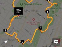
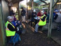
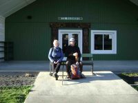
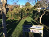
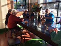
 21/08/2024 . Street Art Walk Grade 1.5. Trampers Leaders: Wendy Langley,Val Cayford.
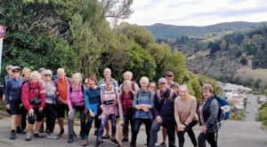
17 of us began our mural art journey on a beautiful sunny and warm day.
Continue reading “Street Art Walk.”
Taieri Recreational Tramping Club
Mid-week recreational and social walking group based in Mosgiel NZ
 21/08/2024 . Street Art Walk Grade 1.5. Trampers Leaders: Wendy Langley,Val Cayford.
17 of us began our mural art journey on a beautiful sunny and warm day.
Continue reading “Street Art Walk.”
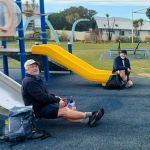 07/08/2024. City to Surf. Grade 2. Combined. Leaders: Gail Williams, Karen McInnes, Jenni and Bruce Wright.
Was it a record? Forty six keen members, including one visitor, met at the Otago Yacht Club carpark in Magnet Street for the City to Surf Combined Trip. Continue reading “City to Surf”
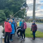 31/07/2024 Mosgiel Ramble. Grade 2. Hikers. Leaders: Ady Whiston, Jenny Finnerty
With the weather the way it was Jenny decided for a walk around Mosgiel (good decision).
Continue reading “Mosgiel Ramble”
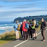 24/07/2024. Delights of St Clair. Grade 1.5. Hikers. Leaders: Neville Griffiths, Wyn Davies.
After parking our cars and meeting up with the Taieri Hikers in Moana Rua Road, 20 Hikers headed off just after 10am and walked across the Kettle Park Sports field towards Marlow Park.
Continue reading “Delights of St Clair”
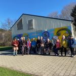 17/07/2024. Hikers. Concord Creations Grade 2. Leaders: Jan Butcher. & Jenny Finnerty.
Just 6 hikers met up at PJ Park & travelled to Emerson Street, Concord to meet up with 7 town folk.
Continue reading “Concord Creations”
 10/07/2024. Street Art Trail and Surrounds, Grade 1.5. Hikers. Leaders: Wendy Langley, Val Cayford.
24 of us began our mural art journey walking from the Southern Cemetery, into town to view and learn about the many murals and their artists, around our city centre. Continue reading “Street Art Trail and Surrounds”
17 km from car park.
St Clair, St Kilda, Kew, Corstorphine, Ocean Grove, Tomahawk – Information and Trips Library
Big Easy, Signal Hill, Ravensbourne, Opoho, Northern Cemetery – Information and Trips Library
Report: Combined Trampers and Hikers
Opoho Odyssey 1 June 2022
In pleasant temperatures 35 Trampers set out from the Botanical Gardens carpark to enjoy our Opoho odyssey. Our first stop was for morning tea at Tannock Glen which is an established rhododendron dell off Warden St.
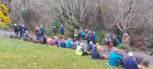
Then we meandered through various streets and Ross’s well researched commentary about various points of interest was much appreciated. (This history will be available for anyone to review on a separate link). Neil added a few memories of his misspent youth in this suburb and talked about his family links to the area.
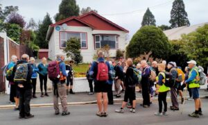
Then it was off down the zigzag to Knox College which while not strictly in Opoho has strong links to the suburb because countless staff and students lived in Opoho and worshipped and preached at the local Church in Farquharson St. Knox College actually opened in 1876 to train and house students wanting to become Presbyterian Ministers. It is now a hall of residence open to all Otago University students.
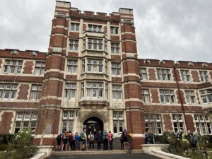
It remains a very well maintained beautiful historic building. Our guide Alec gave us an extensive tour through the various wings and a detailed commentary about the history. In the exquisite dining room which looks straight out of Harry Potter, Phil gave us a tune on the magnificent concert grand piano.
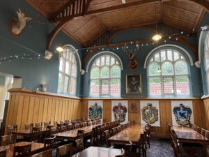
Beautiful Knox College Chapel (photo and caption John)
We all really enjoyed this tour as many had never been in this building.
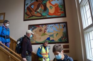
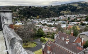
It was also great to climb via steep steps onto the ramparts where we got extensive views over Dunedin.
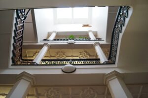
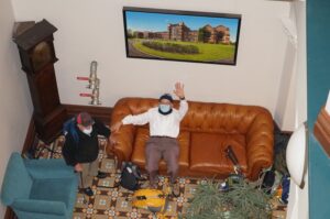
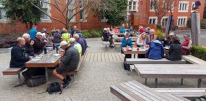
We were invited to have our lunch in the quadrangle outside the building and could wander through the well-maintained gardens which was a pleasant interlude.
After lunch we divided into two groups and the 13 hikers set off for the top gardens and visited the aviaries. Then it was an interesting walk through the Northern Cemetery. This is a major historic landmark in Dunedin and we saw notable graves and tombs. Neil was also able to point out graves belonging to his (and Graeme Souters) great grandparents.
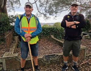
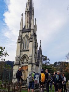
Most prominent in the cemetery is William Larnach’s tomb which was designed by R.A.Lawson and is a miniature replica of First Church.
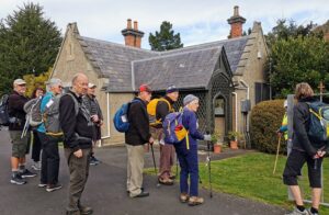
The Sexton’s cottage which is maintained by the Southern Heritage Trust is also very historic.
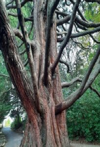
Of interest as well are the more than 1000 heritage roses; about 500 of which were poisoned with herbicide in 2016. Heritage Roses Otago have worked tirelessly to replace the damaged plants with cuttings and many of the graves now sport new plantings. We also stopped for a few minutes to visit the memorial to Thomas Bracken who wrote the National Anthem of New Zealand.
To finish it was a walk through more tracks in the top gardens and back to the cars.
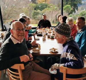
We enjoyed coffee in the café in the lower gardens.
Distance covered was about 8km. We will now hand over to Ross and Wyn to give a short account of their afternoon hike which was no doubt more strenuous!!
Neil and Margreet Simpson
We were the other group, 22 in total, that set off on the more strenuous hike. The 58 steps to the higher part of Arden Street immediately after lunch was a cruel start. We contoured around to Chambers Street which we descended a short way to find the 41 steps up to Taine Street. And then it wasn’t far to the 52 steps to Montrose Street which turned the corner into Maybank Street. Once we reached Blacks Road, it was down a short way to Grey Street and then down, down James Street to North Road.
We enjoyed the flat walking up North Road but all too soon came to Baldwin Street and another 273 steps.

Who doesn’t love Baldwin Street? (photo & caption John)
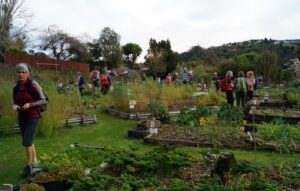
Photos at the top gave plenty of time for getting our breath back before we followed the footpath to the 85 steps down Calder Street to Primrose Bank which led us to the North-East Valley Community Garden. It was a lovely place to chat with the locals and enjoy the afternoon.
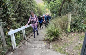
From here, it was all up; first up Dalmeny Street, where some tried to figure out if it was better to zig and zag, or to just take it straight. Eventually another 58 steps brought us to Evans Street, and a little further up Evans Street 137 steps took us to Signal Hill Road, just above the bus terminus. By this stage we were starting to feel the effects of altitude; breathing was becoming harder.
We turned into Northfield Avenue to admire the house that Neil grew up in, before descending another lane to Signal Hill Road. Not far down the road we came to the house that Margreet lived in briefly in her younger days, next door to the house that we now live in. It’s a small world.
We detoured from there around Grandview Crescent which does have a very grand view, down one last lane to Warden Street (10 more steps), identified where the track down the hill to the Big Easy goes off the top end of Blacks Road, and zoomed on back to the cars and then the café at the lower Gardens. Some of the other group were still lingering and luckily they hadn’t eaten all the cakes.
It was a pleasure planning and leading the trip with Neil and Margreet and a constant surprise learning about the parts Neil’s family have played in the history of the suburb we call home.
We learned a lot about the Opoho history preparing for the trip, and shared bits of it as we went along. Some have asked for a copy of our notes, and these are available via this link here Opoho Historical Background Notes
Not all these places were pointed out as we went around, but I’ve left them all in for anyone interested.
On the more strenuous hike, we covered about 10 kms including the morning, with about 345 metres of climbing, and a moving time of 2 ½ hours. And did we mention the steps? 628 steps up (not including climbing the Knox tower).
Ross and Wyn
Street Art Walks Dunedin – Information and Walks Library
4. 7/7/2021. All. Street Art followed by Mid Winter lunch at the Wharf Hotel. Leaders Chris, Gwenda, Clive and Faye
12 Hikers and 24 Trampers met at the Wharf Hotel for Street Art walks around Dunedin.
The trampers headed off to the Vogel Street area and take away drinks from Heritage Coffee in Jetty Street.
They then made their wandering way, via Moray Place and Bath Street, to the University area.


There was time to view the University Library’s Colin McCahon painting “Waterfall Theme and Variations”,

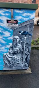
the Castle Street Lecture Theatre’s wonderful mural and

some of the campus sculptures before returning via the rail bridge.
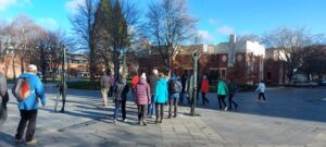
The hikers headed to the downtown area over the rail bridge before making their way back to the Wharf Hotel via the Vogel Street area. Morning tea was enjoyed midway at the Vanguard Café on Princes Street.
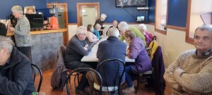
Jill Dodd and Jay organised a lovely mid-winter lunch to follow which was enjoyed by 50 members of the club at the Wharf Hotel. There we also enjoyed a great slideshow of photos from trips over the last 6 months, put together by Clive and John.
Chris
3. 3/7/2019. All. Midwinter Street Art walk and lunch. Leaders: Clive and Heather.







2. 6/7/2016. All. Street Art Walk. Midwinter Lunch. E. Leaders: Bev, Judy and Alex.
31 members gathered at the Wharf Hotel car park and set out for a fascinating walk around Dunedin streets, viewing some of the amazing street art adorning our buildings’ walls.
First stop was just along the foreshore where mulled wine was served, (courtesy of Elaine and Judy), really hitting the spot on a coldish morning. Then it was up and across the over-bridge to Jetty Street, to Princes St and Manse St. The back entrance to the Scenic Hotel provided a look at the spectacular Cloud Catcher mural.

We did wonder just how the artist managed to hang up there to do this amazing work.
A short puff up Rattray St, to Dowling St and then up to Tennyson St,

down View St (glad it wasn’t up), across Moray Place, through the car park and along the alleyway to the Octagon. This alleyway is full of excellent art work, well worth browsing through. From here it was around the Octagon, down Stuart St, and along to Queens Gardens, before crossing to Vogel St again, and over the bridge back to the Wharf just after midday. Thank you Bev for organising this and turning out in spite of a miserable head cold.
Here we found the rest of the crew gathered, raising the number to 62, a great turn out. It was pleasing to see so many ‘senior’ members in attendance.
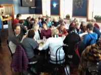
After birthday greetings to Margaret and Adrienne, Judy ran a short quiz, testing observational skills from the walk. Thanks to Eric for his help, and for the chocolates donated. Judy then read her ‘Ode to the Club’. (Attached [at the bottom of the Club’s History page] if you want to read it for yourselves!).
Congratulations and thanks to the hotel staff, who took orders and prepared and delivered meals so efficiently and promptly. This was much appreciated – the blue cod was great! While some indulged in dessert, the ‘Four Jolly Tramping Mates’ presented two songs, ably led by Bruce.
Thanks boys, you did well!
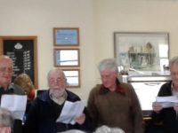
All in all this was a really successful day, with everyone relaxed and happy, enjoying the food, the company and the entertainment. – Judy and Bev.
1. 15/7/2015. Hikers. Street Art Street Walk. E. Leaders: Lance and Lois.
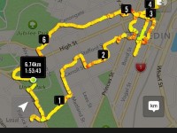
It was another of the Lance and Lois’ well-planned, well-commentated walks. We surprised them with our large group, numbering 31, crowding up at street corners and filling pedestrian crossings, but they coped. Beginning at Unity Park lookout, we first walked down Eglington Road to the former Montecillo property being developed for new housing. Lance told us the driveway in was a solid 8 inches thick concrete slab!) We then returned out to walk down through the Town Belt by way of of the ‘Steep Street’ track, stopping on a grassy slope…
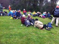
…for morning tea just above the zig-zag steps.
The steps are of those awkward sloping kind, enforcing either a stretched stride or two tiny ones per step. Anyway we arrived a bit up Maitland Street above Carroll St, to enter an unobtrusive lane that led into a large centre-of-the-block grassy area that led us diagonally through to Stafford St. Having enjoyed this delightful mid-block section, we turned down Melville St to Carroll St to view the former St Andrews Church. Lance had already prepared us at our morning tea for this visit. He had told us of Rutherford Waddell’s greatest sermon of all time at this church on the ‘sin of cheapness’, where the Minister had declaimed against the sweated labour of the Dunedin seamstresses of the time, a clarion call that was to bring about far-reaching legislation reform of working conditions. So we viewed the historic church which has in more recent times been used by the Word of Life Pentecostals, and since 2001 by the Coptic Orthodox Church. We rounded the large old Bell Tea Co building corner into Hope St and up again to Stafford St to walk down it to our first street art, the Haast Eagle.

We continued down and across to the corner of Princes and Jetty streets to view the “Riding Dreams” mural.

Around the corner, “Love is in the air” on Bond St was delightful.

I could go on. We went hither and thither, as you can perceive from he route map, far too much to list here. This reporter can recommend such a stop-go walk, studying buildings, renovated and old, treading pavements some, no doubt we had never planted foot on before.
Just two more ‘works of art’ now, and lunch at First Church before heading back up the hill.
First the waka and steam-punk submarines exiting a fish’s mouth. (Quietly: But aren’t the sails billowing backwards?)

Our lunch at First Church.
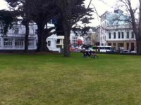
And finally, an art work in Rattray St.

Then up Maclaggan St and High Street and back to the cars.
Thanks to Lance and Lois for a carefully thought out day.- Ian
(Grateful acknowledgement to Dunedin Street Art Trail information.)
2. 17/4/2019. Hikers. Edgar Centre to Rotary Park, return. E. Shona and Jill D.
28 hikers assembled at the Edgar Centre, before walking along Portsmouth Drive to Bayfield Park stopping en route to admire the memorial stone “RONGO”.
1. 16/8/2017. Hikers. Edgar Centre to Rotary Park, return. E. Leaders: Judy and Adrienne.
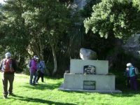

26 hikers met at the Edgar Centre carpark in clear sunshine after a frosty start to the morning. We walked along Portsmouth Drive a short way to the Bayfield sports fields for a leisurely morning tea on the comfortable seats in front of the pavilion.
From there it was another short leg to the bus stop at the bottom of Silverton Street, where we boarded the bus for the ride up to the Shiel Hill terminal. Another short walk took us further up the hill and across the road into Rotary Park for an early lunch. A lazy breeze found us well spread out, seeking sunshine and shelter – hard to find both. The views of the city and harbour are magnificent from this park.
Soon we were joined by Les and Margaret, with welcome birthday chocolates – thankyou! It was good to see Les up and about again after a bout of pneumonia.
Unfortunately it was a bit too cool for the proposed lengthy lunch and sunbathe, so by midday we were off again for the walk down the hill, via McKerrow St, Larnach Rd and Shandon Rd to the top of Arthurs Walk. With knees creaking a bit we descended the many steps down to Portobello Rd, and so back to the cars, and coffee at Nichols. – Judy and Adrienne.
17 km from car park.
City to Surf – Information and Trips Library
3. 20/9/2017. Hikers. Portsmouth Drive to Marina. E. Leaders: Judy and Dorothy.
Twelve harbour strollers, went to Andy Bay.
We parked beside the inlet – it was a windy day.
Along the Portsmouth Drive we went, trudging in a row.
We passed the harbour molars, and onward we did go.
A sunny sheltered spot was found, and morning tea was had,
Relaxing in the sunshine, it wasn’t half too bad.
Then on we went, around the wharves, and round the harbour basin –
We found that walking in the wind, was really somewhat bracin’.
We viewed the plaque in memory of “Neptune”, sunk in war.
She hit a minefield in the Med, and then she was no more.
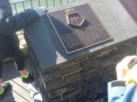
On we went and onwards, across the Leith we strode,
Then Clive led us along the groyne, to where the water flowed.
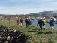
Back around the boat harbour, some picnic tables found,
For lunch and chatter in the sun, then homeward we were bound.

A cracking pace was soon set up, the wind was at our backs.
Perhaps the increase in our pace, was due to lighter packs?
We viewed a lot of logging trucks, a queue a mile long –
Sending all those logs away, we feel it is quite wrong.
A photo stop was taken, beside the harbour molars –
And so we coined the title, “The Mosgiel Harbour Strollers.”
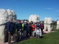
The cars in view, we stepped it out and headed fast for home.
A coffee stop at Blackstone – and then I wrote this “pome”….
(Well, try to find a better rhyme!) – Judy.
Stats for the day: 11.7 kms; 3 hours and 4 minutes walking time; 480 calories. – Clive.
2. 14/1/2015. Hikers. Portsmouth Drive to Marina. E. Leaders: Peter and Wendy.
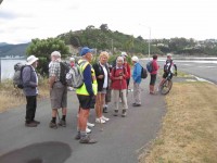
We parked in the carpark by the Bayfield High School. And 21 of us set out.
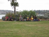
We walked along Portsmouth Drive past the molars, turned down Kitchener St, huggiing the harbour edge and stopped off for morning tea.
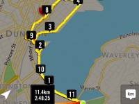
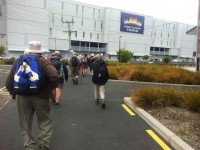
Carrying on, we turned round into Birch St, across the top of the harbour basin then down along Fryatt St almost to its end. Then it was up Wickliffe St, across the railway overbridge, briefly on Anzac Avenue, down Parry …
…and Minerva Streets to cross the Leith on SH88 bridge, and on the north side to turn under the bridge and out along Magnet St to get to our lunch stop at the Marina.
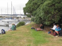
On our return, we walked the length of Anzac avenue. Then onto the railway station platform, where Dorothy performed a most believable but all too brief strut down the catwalk. Out at the other side, on past Toitu Settlers Museum and along the grassy verge ahead where we stopped, briefly thwarted by the railway bridge overpass pathless on-ramp ahead. So it was across all four laned SH1 Cumberland St, with the assistance of the lights further back. This safely accomplished, it was Les and Peter led us up Water St, along Vogel St, back down Jetty St and onto the pedestrial spiral ramp to get us onto the bridge. Then via Birch St, Buller St and French St we rejoined Kitchener St which took us back out onto Portsmouth Dr and back to the cars. From talking to one or two others, I must say coming to the end of eleven kilometres on hard pavement had taken its toll of leg muscles, on this the first tramp after the holidays. A good walk, not too hot or windy. Thanks to Peter and Wendy for a good start to the year. – Ian.
1. 20/11/2013. Hikers. Midland St, Portsmouth Drive to Marina. Leaders: Bev and Chris.
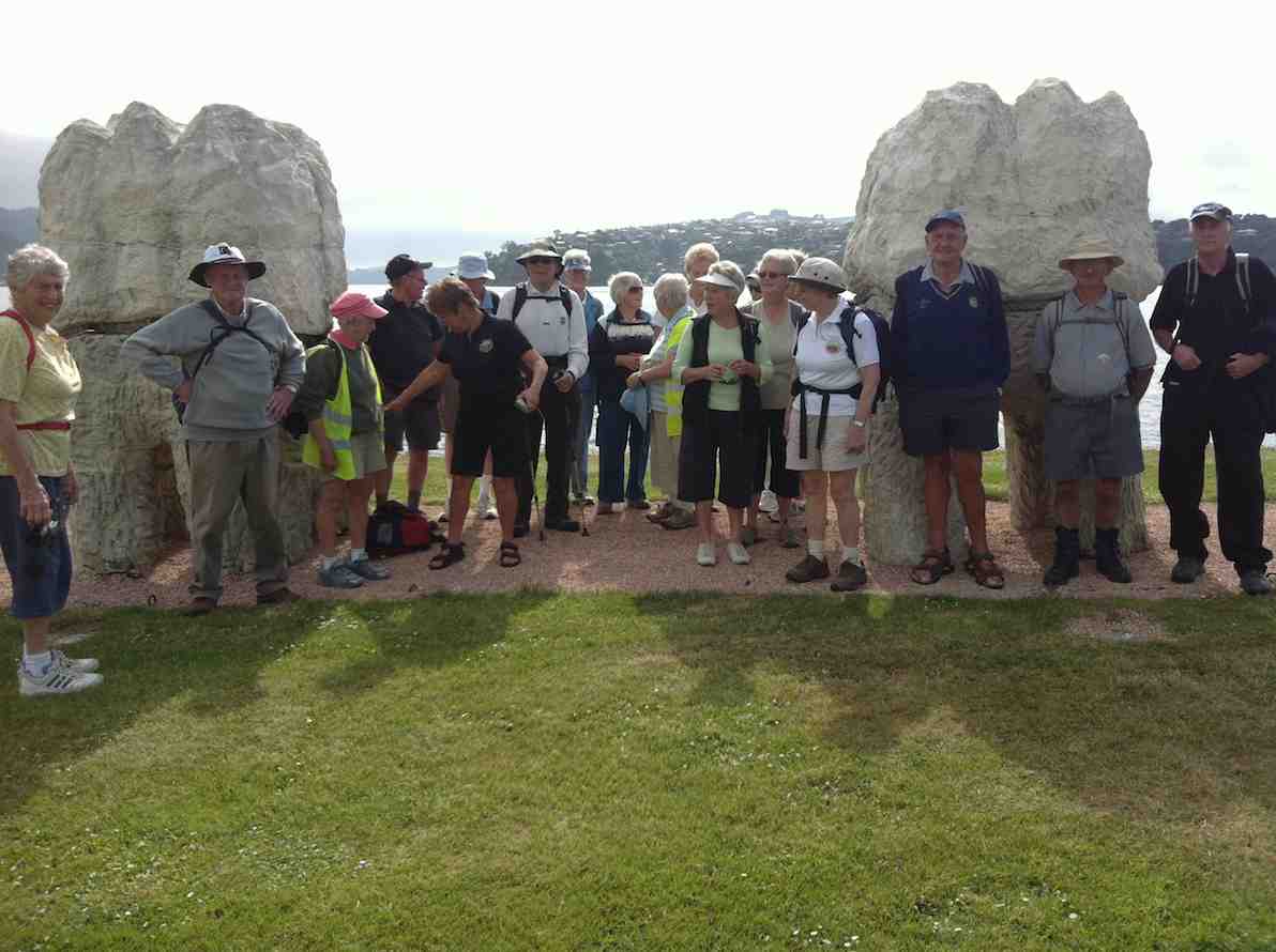
The walk was most inventive and interesting, leading us along back streets few of us had ventured on before. We parked at the bottom of Midland Street where we could cross onto Portsmouth Drive with the safety assistance of traffic lights. The laying of cable along the walkway forced us onto a less inviting traffic-coned path along the road till we returned to the walkway at the molars.
A little further on we turned down to the length of Kitchener St turning left up at its end into Birch St to join Wharf St esplanade and have morning tea on the seats, to admire the inner harbour view as well as a gentleman, lent back on a camp seat, fishing, hat over face, asleep.
A happy surprise was Lex sharing round chocolate marshmellows in anticipation of his 85th birthday the following day.
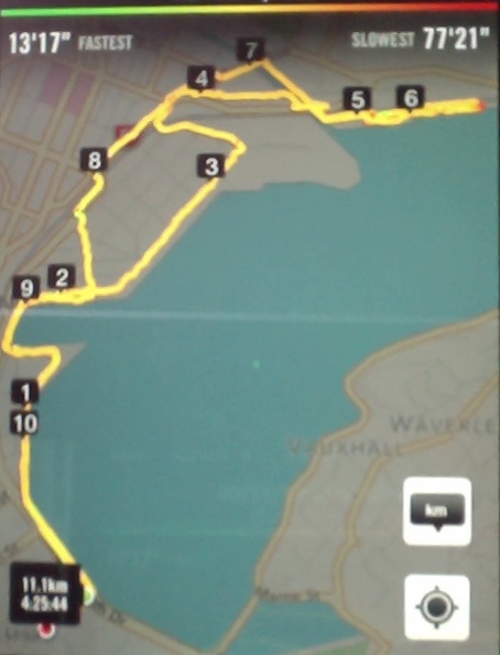
Then it was up and on again, down virtually the entire length of Fryatt St to turn left up Wickliffe Street and over the elderly railway overhead bridge, down the other side to the right, and to stop and admire (?) the special road-coned entrance/egress of Hall’s work-yard and the still-hooded traffic lights. We gingerly made it across Anzac Ave, across Frederick St, back again across Anzac Ave to join Parry St, make way across the SH88 Leith Bridge very wide pedestrian walkway, down, back, under the bridge and along Magnet St. (4 km)
and the Harbour Walkway (5 and 6 kms) to lunch at the northern end of the map in what shelter we could find from the nor-easterly wind.
We retraced our steps to the SH88 Bridge underpass, this time following the Leith bank up to Anzac Ave (7 and 8 kms)
which we followed right to the St Andrew St lights where we turned down along it to the roundabout, followed Mason St, then into Tewsley St and into Fryatt St to retrace our route alongside Wharf St (9 km), Birch St, Kitchener St and Portsmouth Drive back to the cars. 11 km in all. The harbour wind-blast along Portsmouth Drive almost blew us off our feet. Many thanks to Bev and Chris for a varied and interesting streets exploration around a corner of the harbour. – Ian.
City to Surf – Information and Trips Library
2. 23/8/2017. Hikers. Gardens to Surf. E. Leaders: Pam and Dawn.
We Parked our cars in Duke Street, near the Woodhaugh gardens. 22 members started off. We walked through the Varsity and had morning tea at the Polytech outdoor area. Walked along Portsmouth Drive to Queens Drive down to St Kilda beach. Walked along playing fields and some track to picnic area above beach, where we had our lunch. We then continued on to St Clair, via street and caught the bus back to the Botanical gardens where we enjoyed a hot drink. Back to our cars and home to Mosgiel by 3.45pm. A very enjoyable day was had by all. – Dawn.
1. 19/8/2015. Hikers. Gardens to Surf.
We had a good day walking from the Botanic Gardens…
…to St Kilda beach…

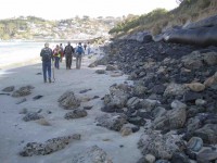
…and along the beach to St Clair. I had not been on the beach since the June storms and was blown away by the damage to the beach.
The piles…
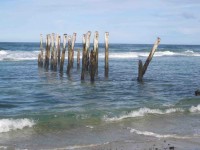
…are nearly all bent over by St Clair. Thank goodness I have done 3 paintings of the piles. Judy Knox was on TV Wed. night and did a very good interview on the local TV channel.
We all went back on the bus to the Gardens and all (I think) 27 of us didn’t pay. I think the bus driver got a bit of a surprise. – Elaine. [An unintended report, purloined from an email. – Ed]
7/12/2016. Belleknowes. E. Leaders: Lester and Peter B.
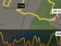
The walk was short but far from lacking in interest. First surprise was at the bend at the extreme top corner of York Place where it turns sharply down into Russell Street. Behold, a path through the Town Belt, leading across Queens Drive into Alison Crescent. Here on our right was a gully of seriously shaded houses each reachable only by a wooden bridge across the ditch.
Further on. Houses in the Greek-letter-named streets of Delta, Beta, Epsilon and Gamma (where was Alpha?) were notable for well-maintained three and four groupings of identical designs, (one group even with finials), and strikingly, as the street curved around, so did the house alignments, parlours strictly front-facing, regardless of where the sun struck them. Of course nothing new, but made obvious by the similar wooden buildings.
An interesting Accessway between Delta Street and Belleview Crescent was new to us. Knowledgeable ones among us said this was part of an old cable car route.
We lunched early (11.20 a.m!) in a light drizzle in a hidden playground reserve off Falcon Street. It had the longest stainless steel slide down a steep slope the writer has seen. How on earth was present day Health and Safety permission for it obtained, one wonders. Sadly it was far too wet on this occasion for any of us to give it a go.
We were struck by some grand house and gardens along Highgate. Lester pointed out where the original owners had built houses for their servants down a side street. In one case, (Kilgour St?), built as they were on a steep falling away slope, they required small bridges from street path to front door. Goodness only knows what Health and Safety requirements (as too in the Alison Street bridges) they would be obliged to meet today. One couldn’t help reflecting today on the contrast between our own land-owning gentry class, of which we are part, and that of the thousands of New Zealanders unable to access even basic decent accommodation, with winter on the horizon.
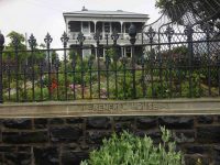
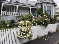
Anyway, enough of that. An interesting return trip down Braid Street through an extensive bit of the Town Belt soon got us back to the cars.
As noted at the beginning of the report, the ‘tramp’ was short but full of previously unexplored interesting gems. Our thanks to Lester and Peter for searching it out. – Ian.
27/7/2016. Street Walk. area roughly between Arthur St. and Dowling St. E. Leaders: Lester, Peter.
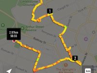
28 left the car park on time at 9.30 after Judy wished two members a very happy birthday. Unfortunately things turned sour in the Moana Pool car park.
Lester had been give permission to us the parks, but it was noticed these are only 2-hour parks.
No option but to find other parks. Passengers out and drivers away to find parks, then all meet again in from of the O.B.H.S. memorial gate.
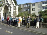
Walk finally started about 10.30. Lucky the morning tea spot was close and our host, Mrs Scorgie, and her lovely dog were out front waiting to greet us.
We divided into small groups and all had a good look round the three floors of “Stranraer”,
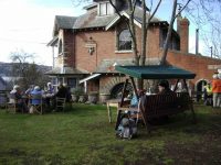
complete with it nursery area. Mrs Scorgie kindly gave us a detailed history of this grand old 1910 stately home. (No, it was not a 15 minute stop – more like a 1 hr – 15 min. stop.)
The remaining walk went well. Lunch a bit late at Canongate. Walk finished in York Place where Bruce was able to tell us is was Olveston that had influence the architect when he designed “Haeta”. Many visited Rockbourn Gallery at 298 York Place.
Then on to Roslyn for coffee in the old Fire Station.
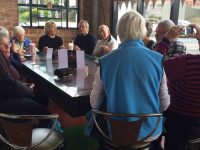
Quite a short walk – about 4 kms – but with a lot of stops for history. – Lester.
29/6/2016. Kaikorai Stream Walk. E. Leaders: Jan and Lesley.
