 09/03/2025 to 14/03/2025 . Queenstown Camp (Kelvin Heights)
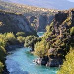
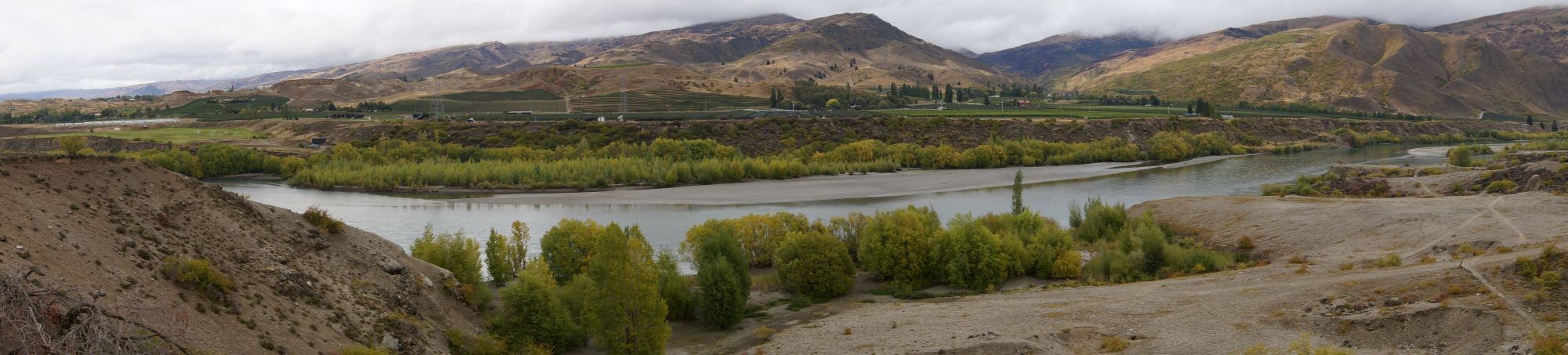
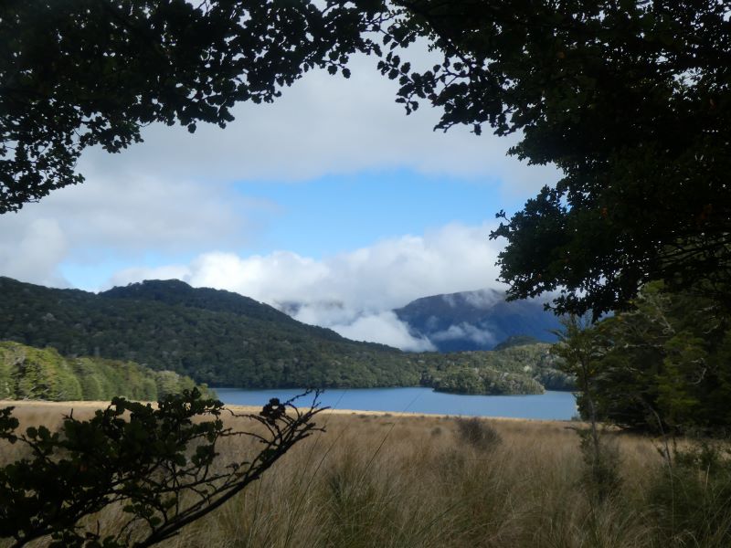
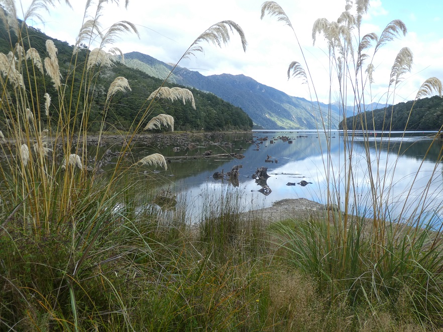
Sunday 9th March 2025 travel to Lakeland Park Christian Camp on Kelvin Heights Peninsula.
Taieri Recreational Tramping Club
Mid-week recreational and social walking group based in Mosgiel NZ

09/03/2025 to 14/03/2025 . Queenstown Camp (Kelvin Heights)
Sunday 9th March 2025 travel to Lakeland Park Christian Camp on Kelvin Heights Peninsula.
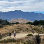
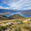
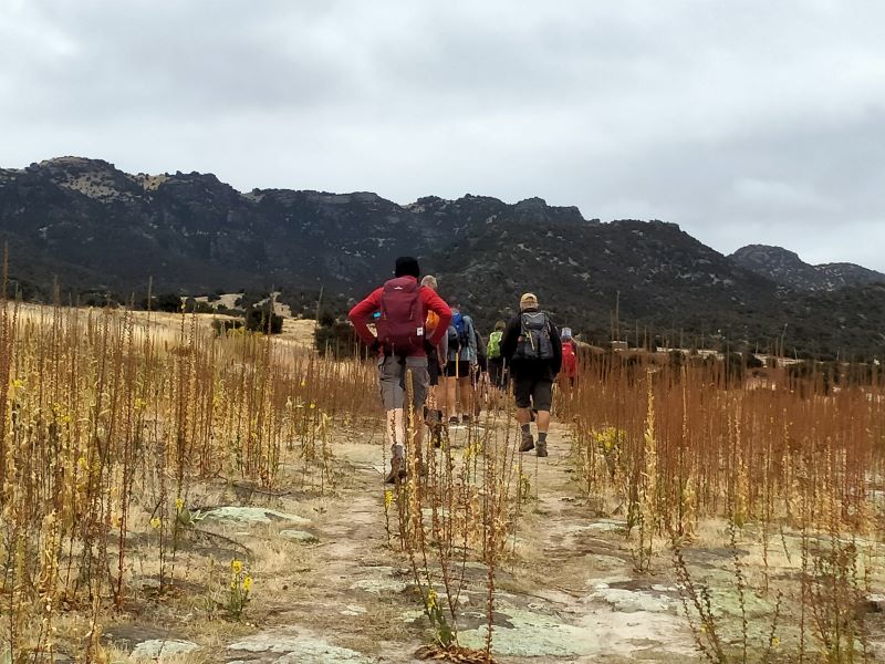
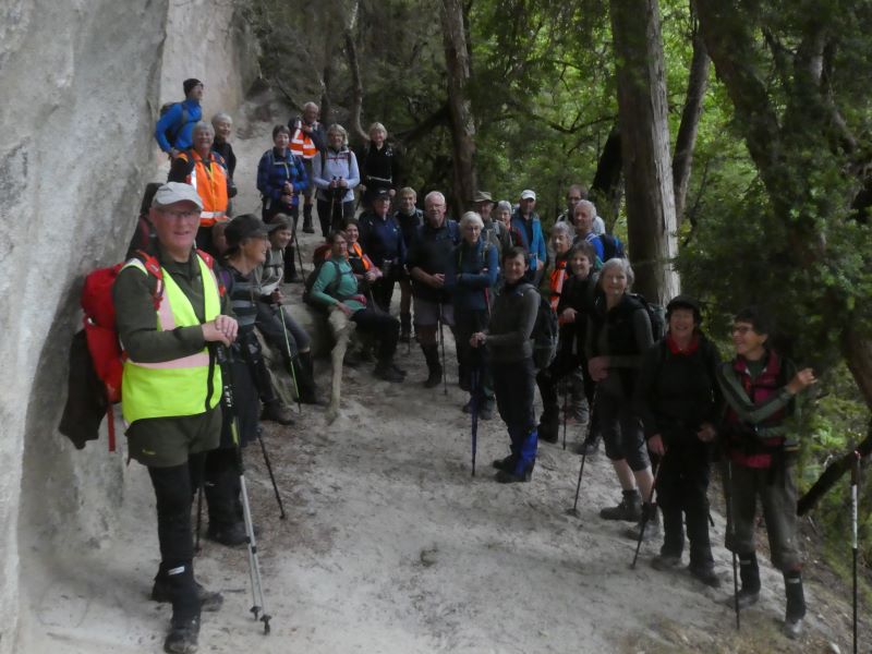
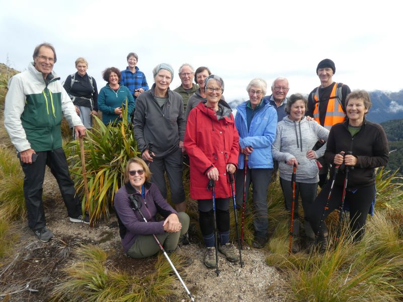
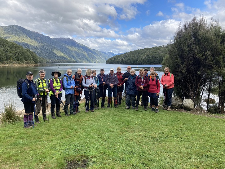
 09/03/2025 to 14/03/2025 . Queenstown Camp. Queenstown Hill, Wilsons Bay, Bobs Cove. Trampers, and Hikers. Leaders: Anne and Rod Ward, Di and Chris Bezett.
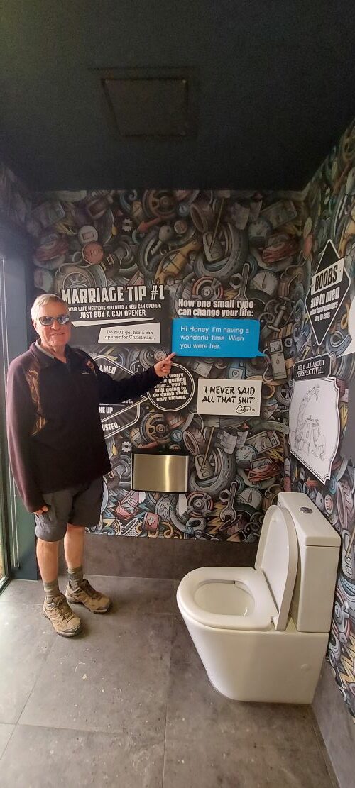
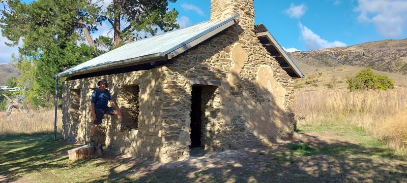
Continue reading “Queenstown Camp 2025 Day 1: Queenstown Hill, Wilson’s Bay, Bobs Cove”
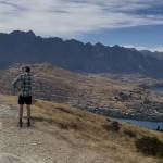
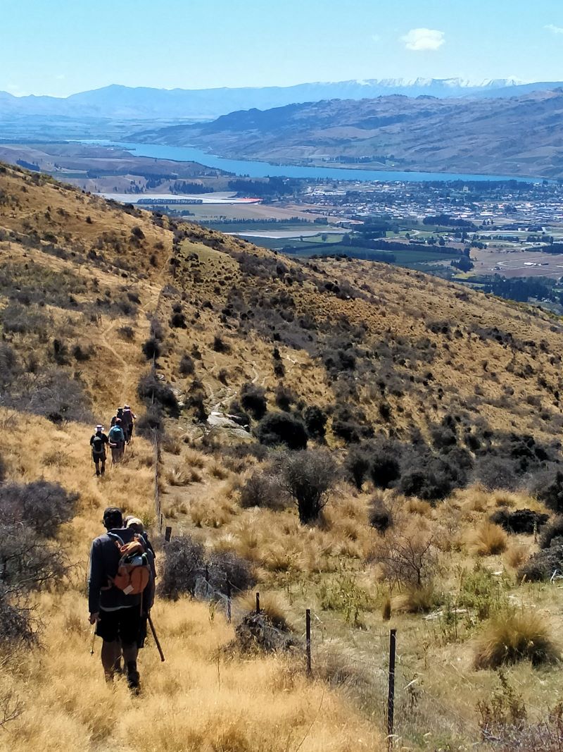
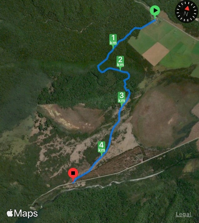
 09/03/2025 to 14/03/2025 . Queenstown Camp. Moonlight Track from Arthurs Point. Combined. Leaders: Anne and Rod Ward.
Continue reading “Queenstown Camp 2O25 Day 2: Moonlight Track from Arthurs Point”
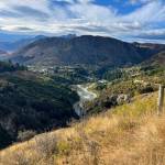
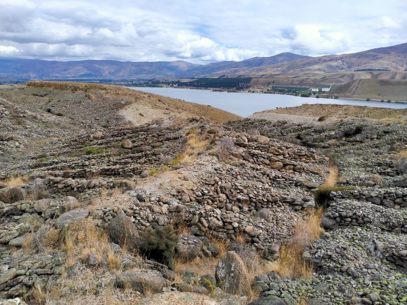
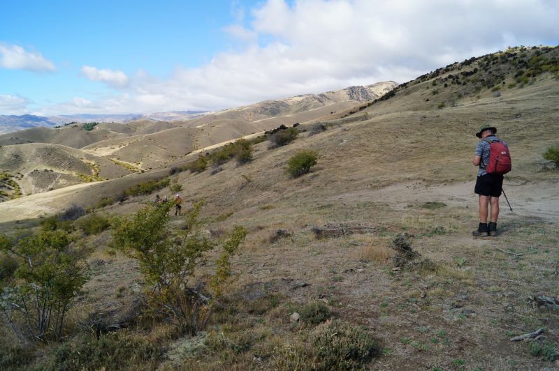
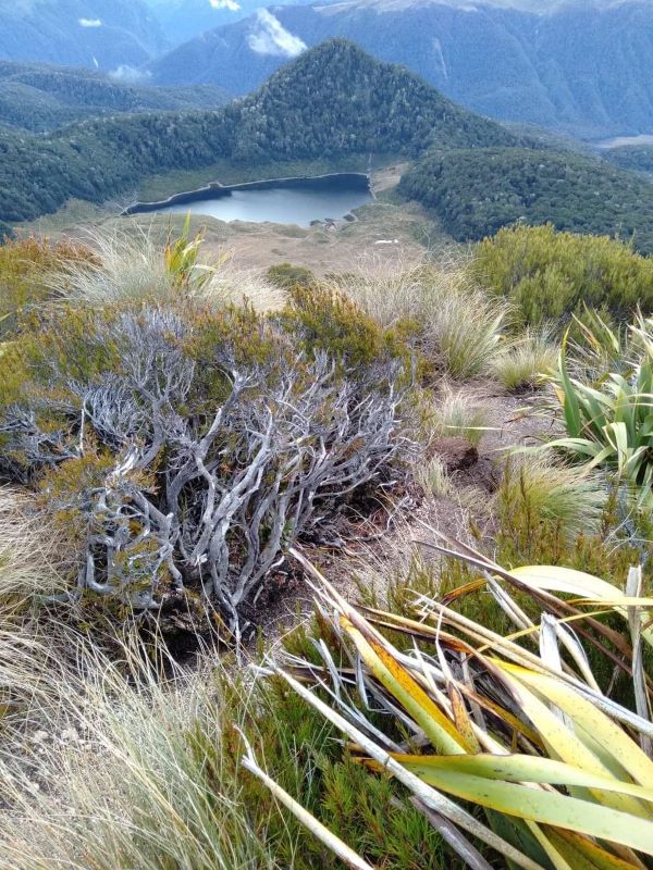
 09/03/2025 to 14/03/2025 . Queenstown Camp – Mt Crichton Loop, Sawpit Gully, German Hill, Bush Creek. Trampers & Hikers. Leaders: Anne and Rod Ward, Di and Chris Bezett.
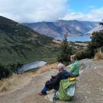
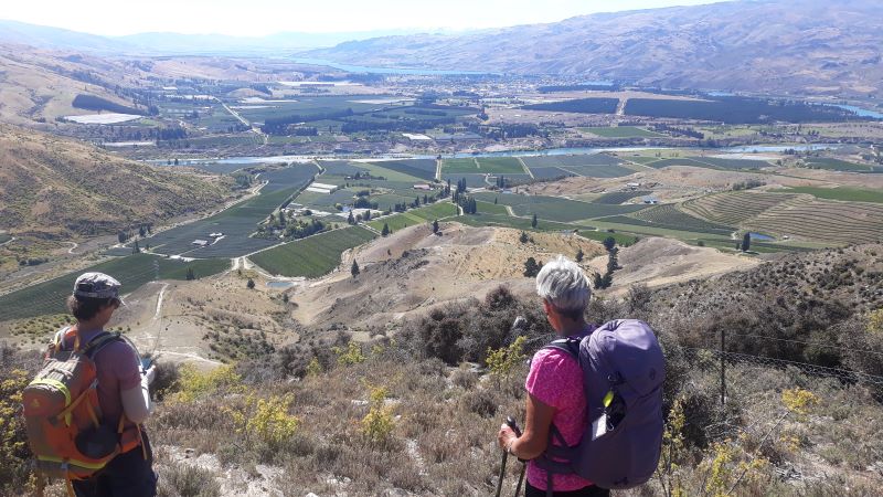
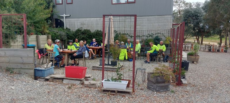
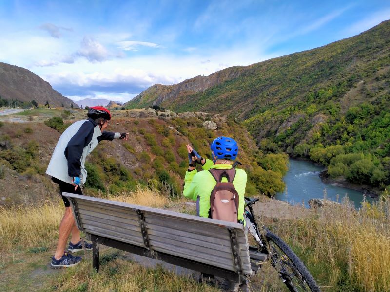
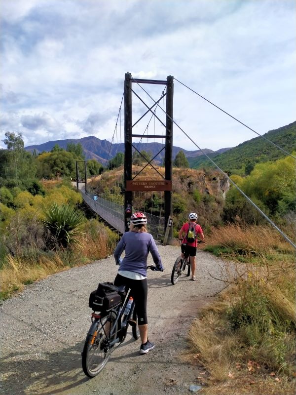
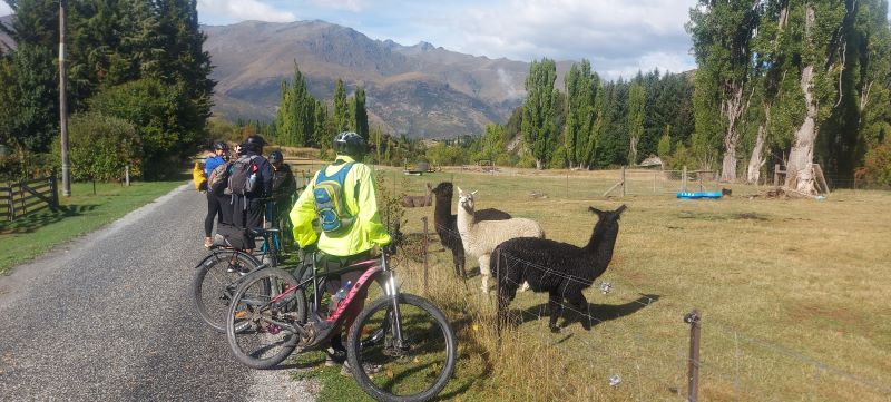
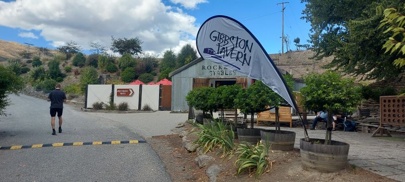
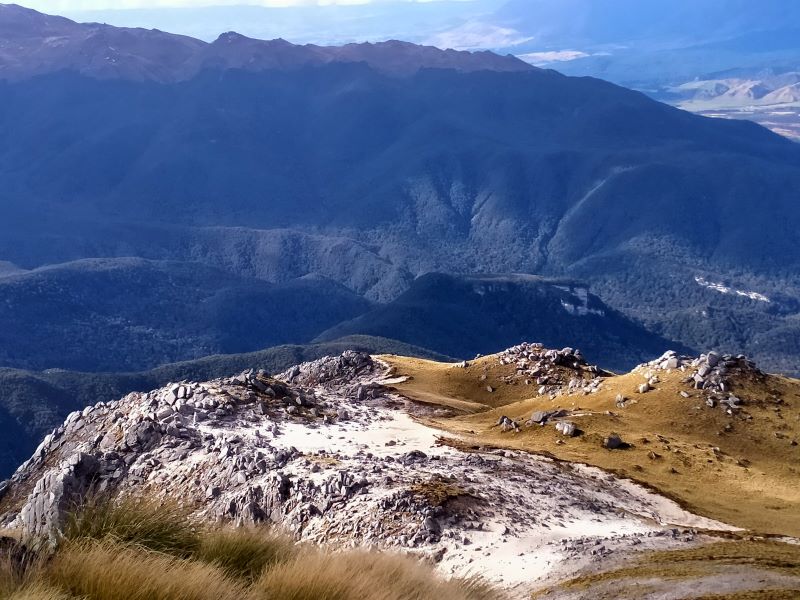
 09/03/2025 to 14/03/2025 . Queenstown Camp. – Wye Creek, Kawarau Bike Trail, Gibbston Tavern. Trampers, and Hikers. Leaders: Anne and Rod Ward, Di and Chris Bezett.
Continue reading “Queenstown Camp 2025 Day 4: Wye Creek, Kawarau Bike Trail, Gibbston Tavern.”
This page groups together the multi day trips (camps) undertaken by TRTC
Click Bannockburn History for background information of that area.
09/03/2025 to 14/03/2025 . Queenstown Camp.Trampers and Hikers. Leaders Anne and Rod Ward
Monday 10 March – Trampers & Hikers
Link to Report – Queenstown Hill, Wilsons Bay, Bobs Cove.
Tuesday 11 March – Combined
Link to Report – Moonlight Track from Arthurs Point
Wednesday 12 March – Trampers & Hikers
Link to Report – Mt Crichton Loop, Sawpit Gully, German Hill, Bush Creek
Thursday 13 March – Trampers & Hikers
Link to Report – Wye Creek, Kawarau Bike Trail, Gibbston Tavern.
25/02/2024-01/03/24. Queenstown Tracks. Combined. Leader Anne Bennett
03/03/2023 -10/03/2023. Bannockburn. Trampers and Hikers and Bikers. Leaders: Anne and Rod Ward.
Saturday 4th March – Tramping.
Day 1 – Kanuka Track plus Trail to Old Cromwell Town.
Sunday 5th March – Tramping.
Day 2 – Kawarau River Track.
Monday 6th March – Tramping.
Day 3 – Bannockburn Sluicing’s, Stewart Town, Long Gully Loop Track.
Tuesday 7th March – Biking
Day 4 – Bike to Bannockburn Camp to Smiths Way and return.
Wednesday 8th – Biking
Day 5: Biking Lake Dunstan Trail and Millennium Track to Alexandra.
Thursday 9th – Biking
Day 6: Biking from Gibston to Arrowtown and Back.
12/04/2021 -16/04/ 2021. Borland Trip. Leaders: Raewyn and Phil Keene.
12/11/2018 – 16 11/2018. Hollyford Camp. Trampers. M. Phil.
12/02/2018 – 15/02/2015. Mt Aspiring Hut Trip. Trampers.
Oct, 2017. West Coast Bike Trip.
16/04/2010 – 19/04/2010. April Camp. Albert Town Lodge. Leaders: Bill and Pat.
27/04/2007 – 29/04/2007. Alexandra Holiday Park Camp Leader: Ian
07/11/2005 -11/11/2005. Glenburn Camp.
18/04/2005 – 22/04/2005. Gore Camp. Leaders: Tom and Dorothy.
07/02/2005 – 11/02/2005. February Camp. Pounawea.
02/04/2004 – 05/ 04/2004. Mavora Camp. Leader: Ian
16/02/2004 – 20/2/2004. Cromwell Camp.
1. 25/02/2024-01/03/24. Queenstown Tracks. Combined. Leaders Anne Bennett
 Our group arrived at Lakeland Christian Youth Camp on Sunday 25th February to a lovely hot afternoon and spectacular views over Lake Wakatipu. Once unpacked our 1st cooking group prepared the first of many great meals. Continue reading “Club excursion to Queenstown”
3 -10 March 2023. Bannockburn. Trampers and Hikers and Bikers. Leaders: Anne and Rod Ward.
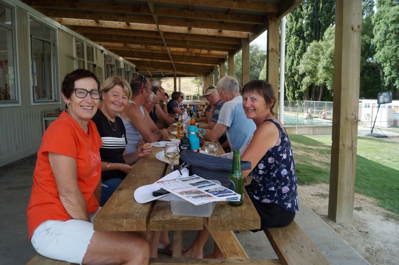
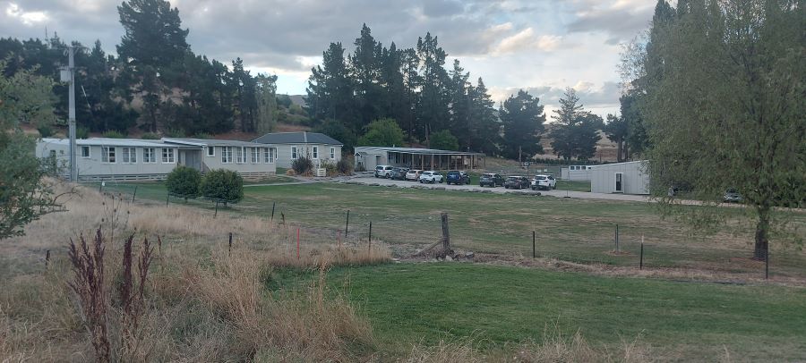
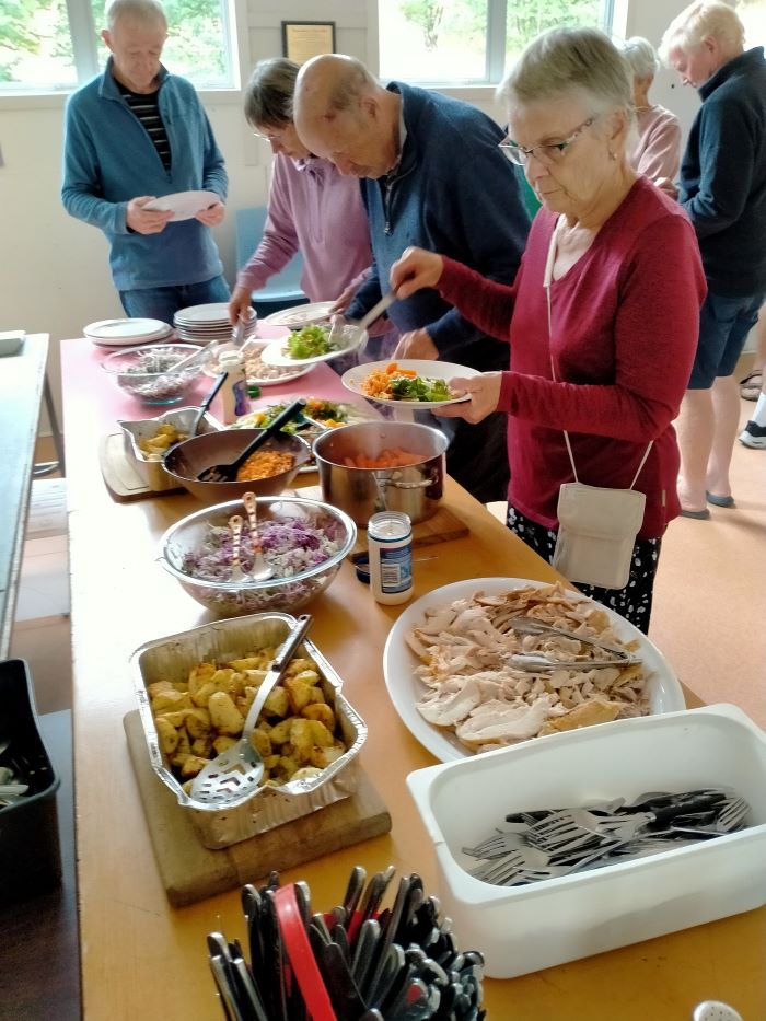
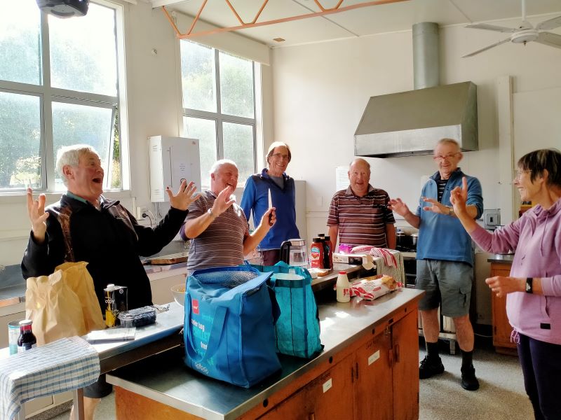
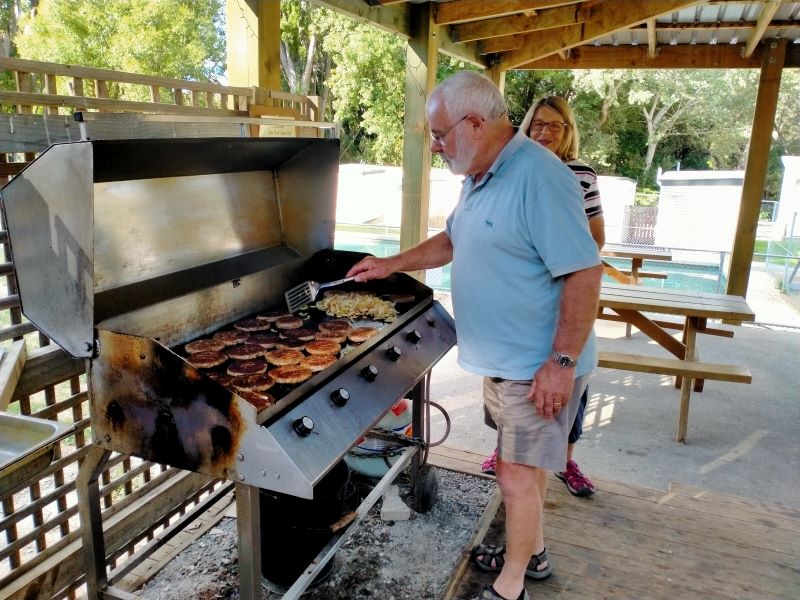
The club planned a trip to Bannockburn for three days of tramping and three of bike rides. This all started on Friday 3rd of March with accommodation at the old Bannockburn school now run by the Otago Outdoor Education Trust. Accommodation was a mix of the old schoolhouse, an attached cottage and the barracks for boys and girls at the other end. Anne and Rod had a full programme of activities for the six days, including delegating the evening meals to teams for the first four nights, this included providing nibbles, main course, dessert, and home baking for supper.
Friday 3rd March – Day 0
Travelled to Bannockburn and settled into the camp. It was a beautiful hot afternoon/evening under the veranda soaking up the atmosphere. With rooms sorted some had a swim, others happy to watch. Team 1 prepared scrumptious ham, salads, etc as required for the duty team.
Saturday 4th March – Tramping
Link to Day 1 tramping report: Kanuka Track and Trail to Old Cromwell Town.
Sunday 5th March – Tramping
Link to Day 2 tramping report: Kawarau River Track.
Monday 6th March – Tramping
Link to Day 3 tramping report: Bannockburn sluicings, Stewart Town and Long Gully Loop Track.
Tuesday 7th March – Biking
Link to Day 4 biking report: Bannockburn Camp to Smiths Way and return.
Wednesday 8th March – Biking
Link to Day 5 biking report: Lake Dunstan Trail and Millennium Track to Alexandra.
Thursday 9th March – Biking
Link to Day 6 biking report: Gibston to Arrowtown and Back.
Friday 10th March
All that remained to do for those who stayed overnight was to pack up, tidy up, and head back home.
Thanks to all cooking groups for preparing and organizing meals, that were varied and enjoyable, great menus for the week.
Also to all the drivers for ferrying us to various start and pickup points, your service was invaluable and very much appreciated.
Overall our accommodation was well suited for our tramping group. Bannockburn Outdoor Trust was very obliging to our needs. I’m sure we’ll return for more adventures.
Thanks, Anne
Saturday 4th March – Tramping
Day 1 – Kanuka Track plus Trail to Old Cromwell Town.
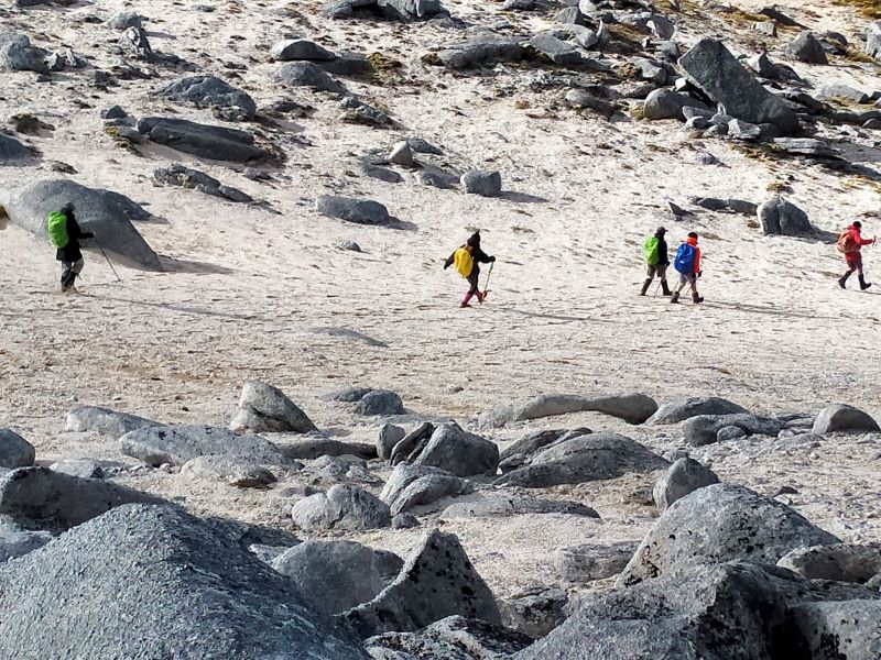
Lunches made, the tramping group (20) travelled to the Bendigo DOC Historic Reserve to complete the Kanuka Loop Track – 14kms from the Cromwell bridge to the turnoff onto Bendigo Loop Road and onto Mines Road to the carpark. The day was overcast with periods of drizzle so required jackets off and on as needed.


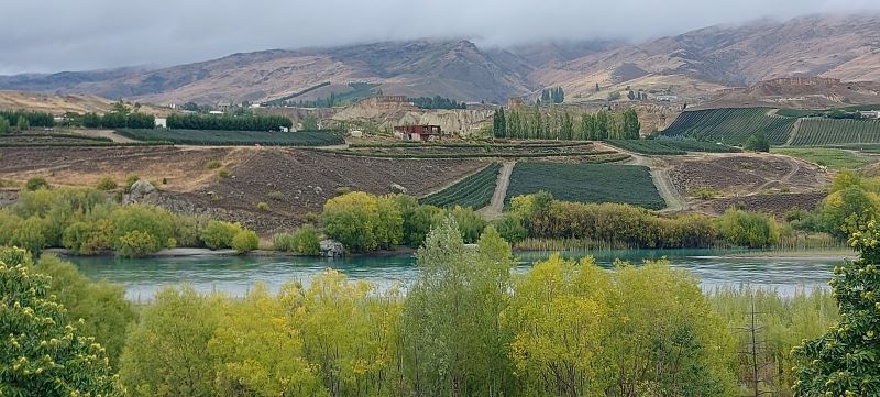
This track is 10.6km long, with elevation gain of 487vertical metres. It is a rugged trail with steep sections, but the elevation gains give you views from the Old Woman Range to the Saint Bathans. Underfoot it’s a variation of grass, tussock, rocky outcrops, with some good cover from the Kanuka and Manuka bush, Lunch was at the skyline ridge. Moving time for our tramp was just over 4 hours. Once back to the cars we drove up the hill to have a look at the relics of the old goldmining settlement of Welshtown, stone buildings and mineshafts from a bygone area. After much discussion we agreed the track rating would be 4.5.

The Hikers (3) enjoyed a walk on the track to Old Cromwell Town for coffee and return 5.2km each way.
Sunday 5th March – Tramping:
Day 2 –Kawarau River Track.
Due to rain overnight and start of Sunday morning we changed our walk to River Walk from Bannockburn Bridge up Kawarau River track (combined walk). Some walked return and others were given a lift back to camp where we had lunch. (4.5km each way) Very interesting walk which one day will join up with the carpark at the Goldfields Mining Centre.
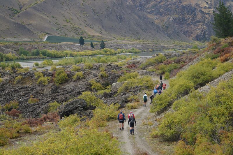
In the afternoon Ross took us to the Quartz Reef Point Track about 6kms up the lake from the Cromwell bridge for a brisk 30 min walk from the carpark to view the formation of diggings in the shape of leaves (herringbone tailings).

Some travelled back to Cromwell Pool for well-earned spa & swim while others visited Highland Park racetrack.
Monday 6th March – Tramping.
Day 3 – Bannockburn Sluicings, Stewart Town, Long Gully Loop Track
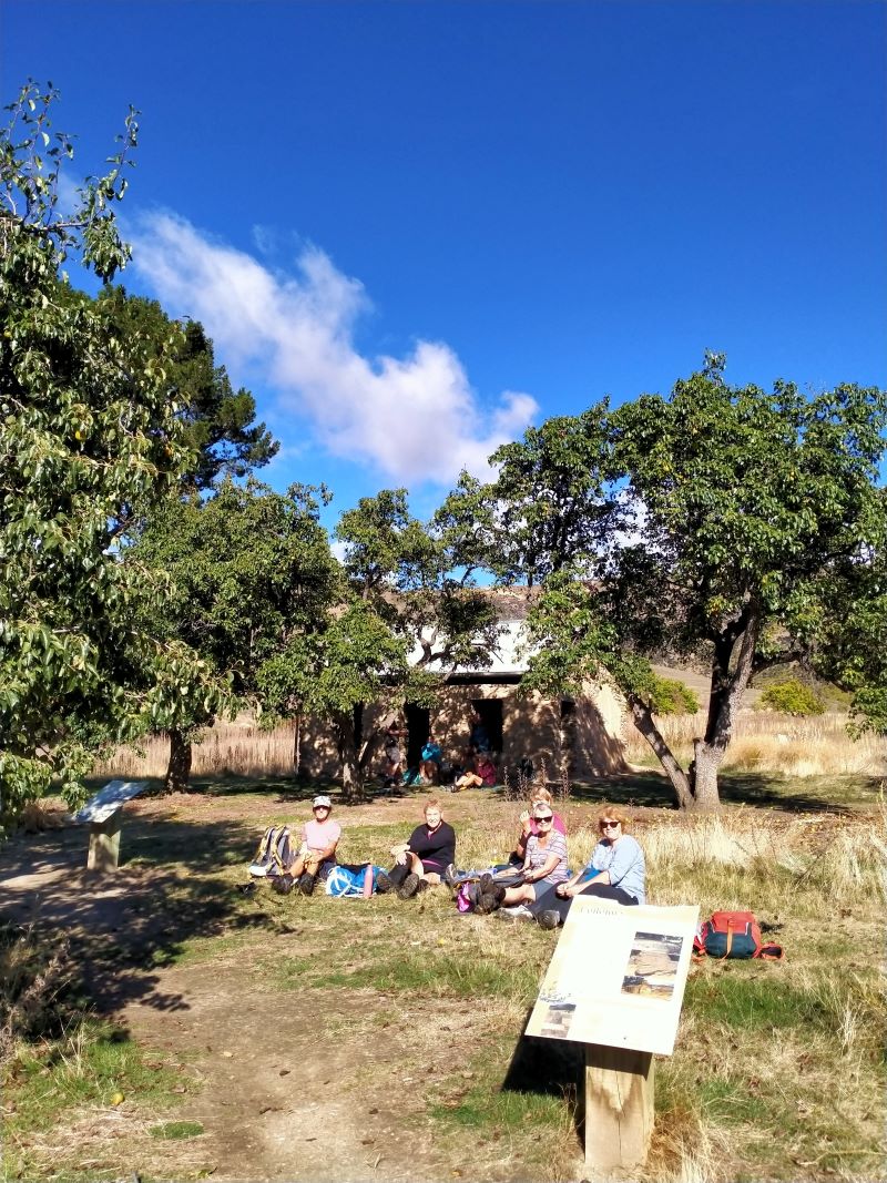
Beautiful weather for start of the day. Lunches made. We left cars at Bannockburn Camp just a short distance from School Camp and headed along Domain Road/Gibson Road to the start of sluicings and up to Stewart Town for morning tea with all of group.
Here hikers and trampers parted ways, the hikers walking around through sluicings to Felton Road and back to carpark via coffee stopover.

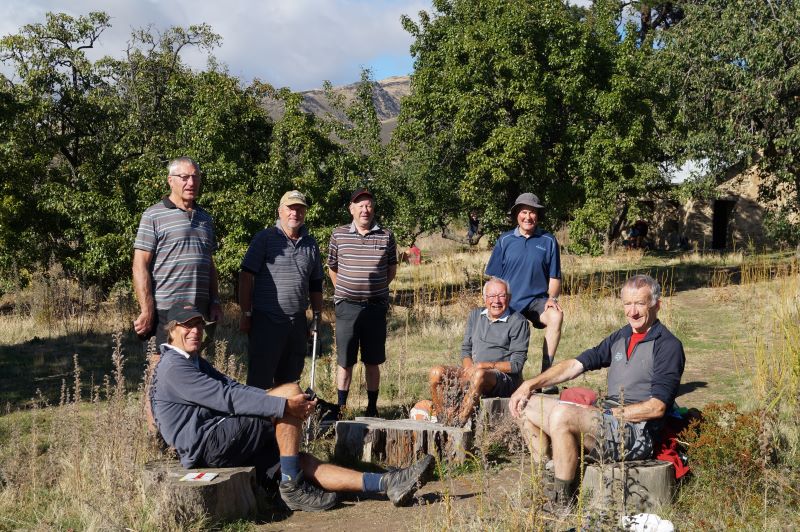
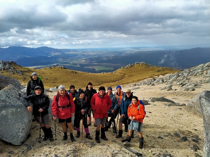
The trampers headed further afield to complete Long Gully Loop Track 7kms, a steady uphill climb, where we stopped for lunch at the top and admired magnificent views of Bannockburn, its wineries and further down to Cromwell and Lake Dunstan. We couldn’t have chosen a better day; the scenery was amazing. Lunch over and back down steep incline to complete Loop Track, a tired but very satisfied group on completion of track.

Many sore and tired muscles took refuge in the pool back at camp.
Neil started the evening meal with his version of grace, very apt for our group. Our yummy meal was followed by Neil’s quick wit for ‘News of the Day’ very entertaining thanks Neil. Shona and Keith arrived just in time to assist with meal preparation.
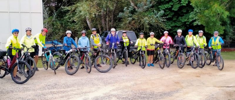
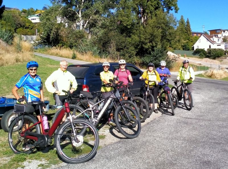
Tuesday 7th March – Biking
Day 4 – Bike to Bannockburn Camp to Smiths Way and return.
This was the start of the biking days so some of the trampers headed home after breakfast. After swapping poles for bikes our (15 bikers) first ride was from Bannockburn camp to Old Cromwell, Pisa Moorings and up to Smiths Way a round trip of about 52kms, on the return we stopped at the coffee shop for mostly our own homemade lunch; jolly decent of them to allow this for just a few cups of coffee. This was a 3-hour trip so we were home early.
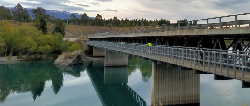

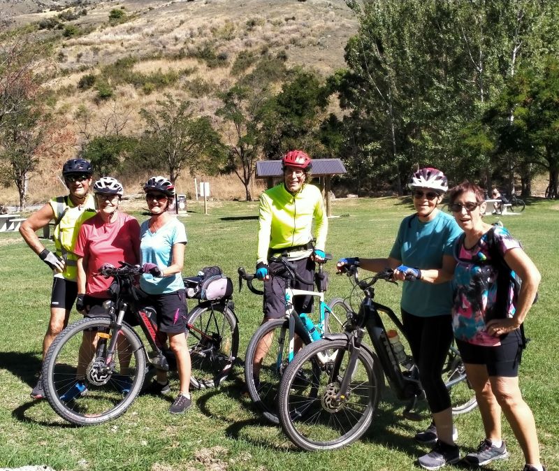
Wednesday 8th – Biking
Day 5: Biking Lake Dunstan Trail and Millennium Track to Alexandra.
Getting a bit more adventurous, so this was a big day for some. The logistics keep our coordinator on the ball with lots of options offered and only one trailer to pick up bikes.
Some headed off from the camp to the Lake Dunstan Trail and others did the same but went down another 12kms on the Millennium track to Alexandra. Others started at the other end and came back, and a few did only the Millennium track. Everyone met at the Clyde Rowing club for lunch. It was perfect weather.

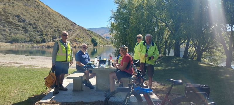
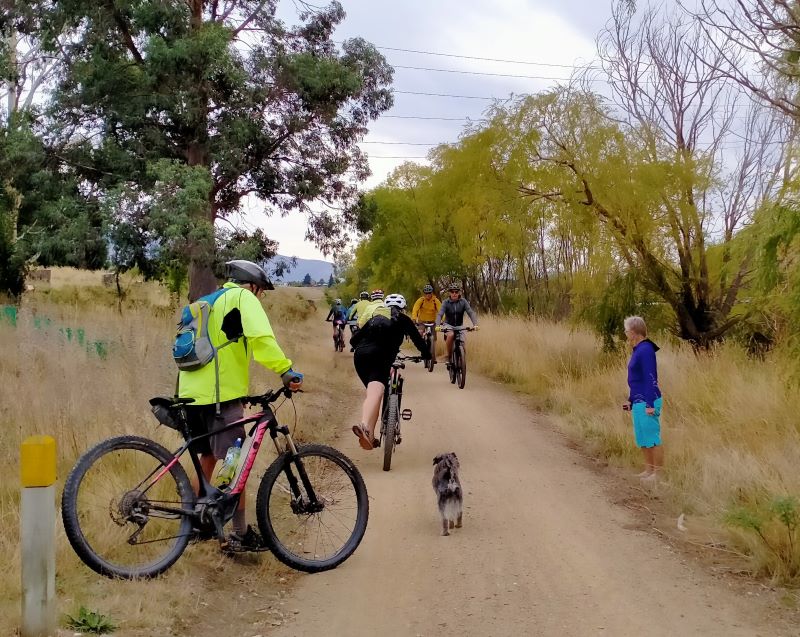
Thursday 9th – Biking
Day 6: Biking from Gibston to Arrowtown and Back.
Final day, so we loaded the trailer and two cars with 12 bikes and headed to Gibbston Tavern, from there we rode to Arrowtown on the Gibbston River Wine Trail and Arrow River Bridge Trail, via the bungee jump bridge: 22km each way.
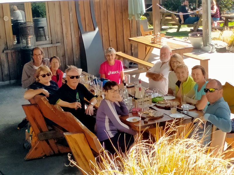
Lunch at Arrowtown was pretty much a pie for everyone with a coffee or tea to wash it down, the riders returned to the Gibbston Tavern for a cool drink and pizza mid-afternoon, tea that night was light with all the leftovers from the week.


4. 12-16 April 2021. Borland Trip. Leaders: Raewyn and Phil Keene.
Day 1
At last, after a few weeks of planning, and watching weather reports etc. we were underway, and all before 9am on the day!
After 2 hours of driving we emerged through the forest at the Dunsdale reserve, at 1 minute past the estimated time on Raewyn’s manifest; this proving to be an ongoing source of feedback as we completed each part of the day and week. A pretty impressive lineup of cars too, and the groundsman cutting the lawns had to move on until we had departed.
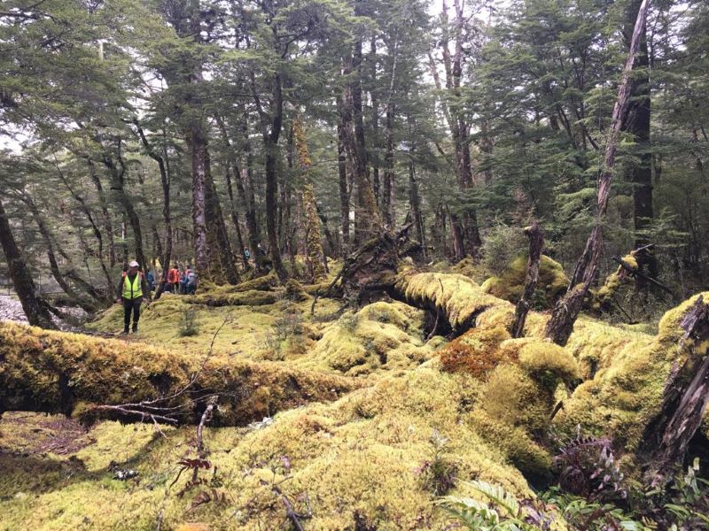
We were walking by 11.30am up the true left side of the Dunsdale stream, to emerge at Forks Flat clearing, before crossing a bridge and returning down the true right side, where there were some impressive matai and other podocarp trees.
Back by 12.30pm for lunch at the various picnic tables and away at 1pm, on time!
Some topping up of petrol at Winton was followed by one of those road trips where all roads lead to Clifton Suspension Bridge, except when you have too much chatter in the vehicle, miss a turn off and end up nearly at Mossburn for a venison pie….. with one vehicle down Peter gave an interesting outline, on the Bridge, of the ups and downs of the Manapouri Project. The major down being the adverse effects on the Waiau River and it’s life force and downstream communities. Having communicated with the errant vehicle we moved on up the Southern Scenic Route turning off near Blackmount onto the Lake Monowai Rd and up to Borland Lodge. Black skies into the west were foreboding….. We all settled in quickly and hey presto the first of 4 lovely evening meals was whipped up and devoured, in anticipation of some hard tramping ahead. After searching the web pages of the weather gods, it was decided we would start with the easier of the 4 main walks on the agenda.
Day 2
South-North Borland to Lodge
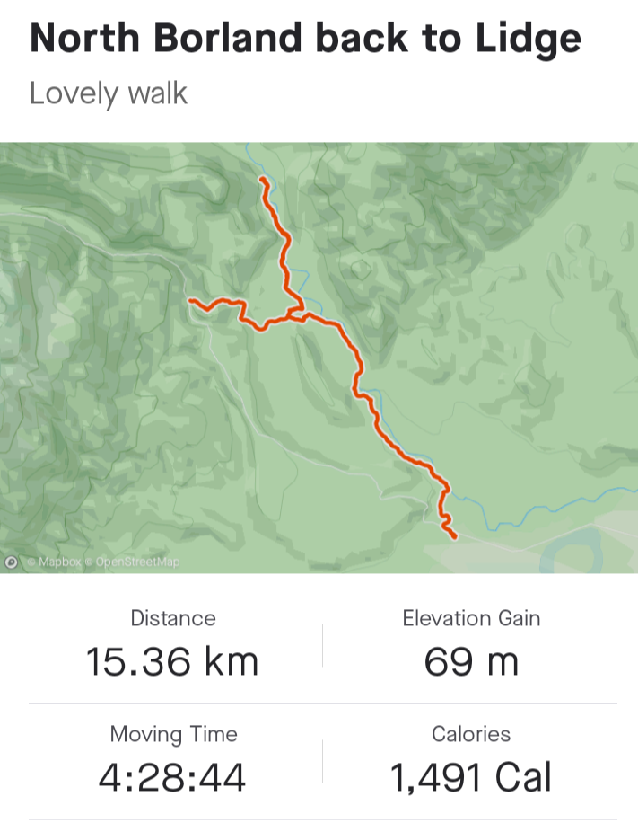
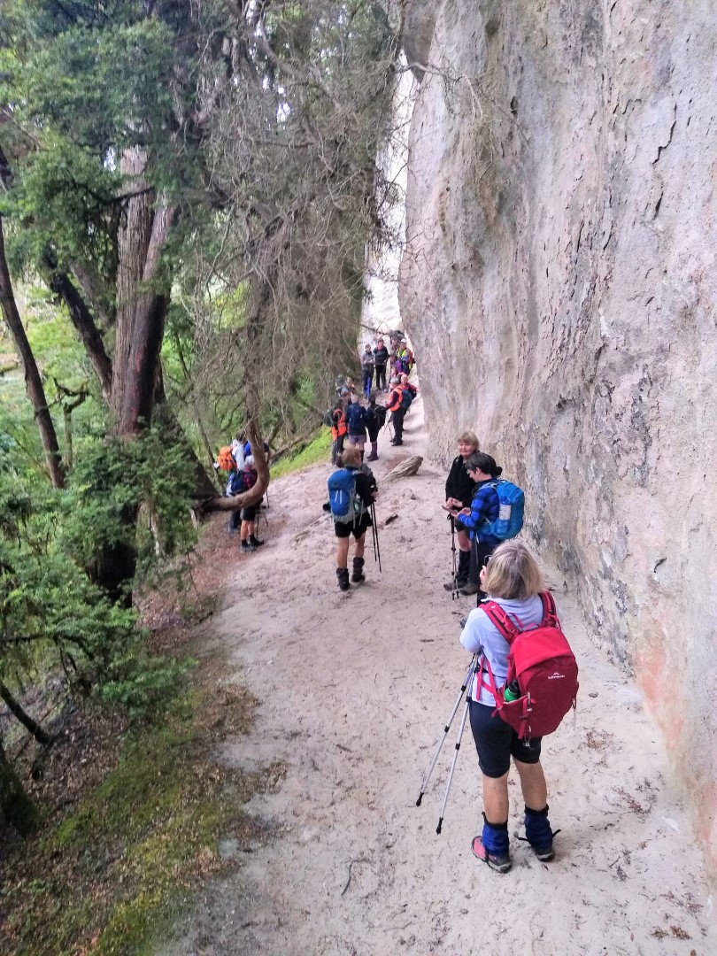
Up up and away on time at 9am, with the bulk of the group opting to do the South ‘n’ North Borland/Rock Bivvy return to the Lodge, whilst Raewyn’s group did Lodge to South Borland return. With help from the smaller group, we ferried everyone to a drop off on the Saddle Rd, and set off across, down and through fields of moss carpets and crown ferns at the base of high limestone cliffs.
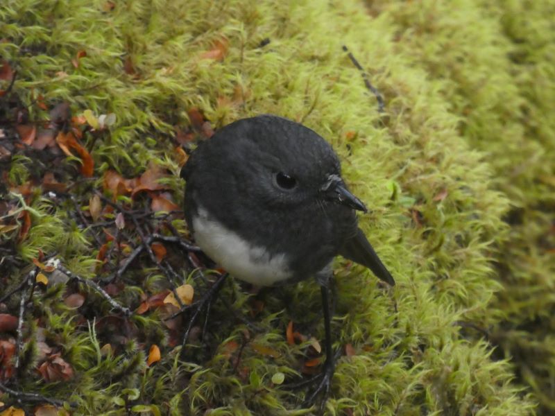
Along the way we were accompanied by tomtits, fantails and the odd Robin or two.
We morning tea’d on a high bank overlooking the South Borland stream, with views of Mt Titiroa in the foreground.
From here we turned off, walked across a swing-bridge over the stream, and carried on to what has to be the best rock bivy in the world?
Along the way we had an interesting chat with Fiordland’s Robin Hood, who was hoping to get a deer with his bow and arrow! We lunched sharpish at the rock bivy, then returned down the North Borland and over the swing-bridge, turning left to follow the track above and alongside the main Borland River back to the Lodge. The babbling brook was quite large in places, and oh those deep pools must be home to some gigantic trout? We returned to the lodge over the swing-bridge on the Pig stream, past lots of emergency shelters, erected by school pupils as part of their outdoor training activities. In parallel, Raewyn’s group (or rather Keith’s harem?) set off from the Lodge just after 10am once the ferrying of hikers and cars was complete. Walking in reverse of the above, they enjoyed their walk through the moss covered forest and Keith too was interested in those trout pools (even to the extent of standing beside a tree to peer into the depths, to later discover it was overhanging the stream with no roots below!). Final destination was the turn-off spot above, and once they discovered that no-one was waiting to return with them, they had lunch back further on the track around a previously used campfire. Sandflies were biting, so the journey back was soon started.
The only first aid required was to Jan’s shoe which lost its sole.
Everyone’s efforts were rewarded by another lovely meal, a great social atmosphere with lots of board and card games underway. But earlyish to bed to ready for the day ahead, this time on the Borland Bivy to Green Lake and return walk, and hopefully on the Mt Burns Alpine tarns walk.
Day 3
Borland Bivy to Green Lake return – Mt Burns Alpine Walk
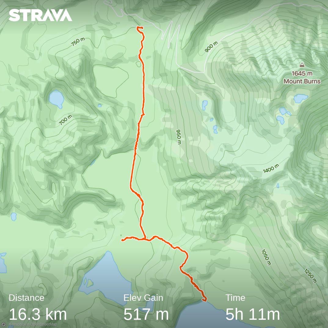
A perfect split of people to vehicles meant Phil’s group was away sharpish at 8.20am, arriving through the mist to a clear Borland Saddle, where some time was taken to take in the views and anticipate the Alpine walk on our return later in the day. Then on down the Grebe Valley side of the Saddle to find ample parking under the pylons near the entrance at the bivy. A slightly wetter forest than on day 2 meant the yellow carpet had given way to a rich green, and we bobbled along through a low saddle, then down and across a large but boggy clearing.
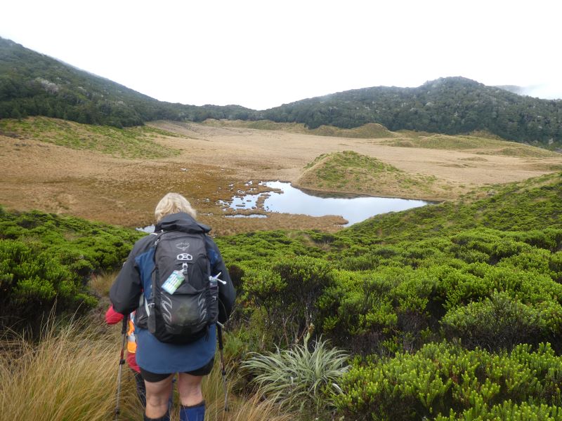
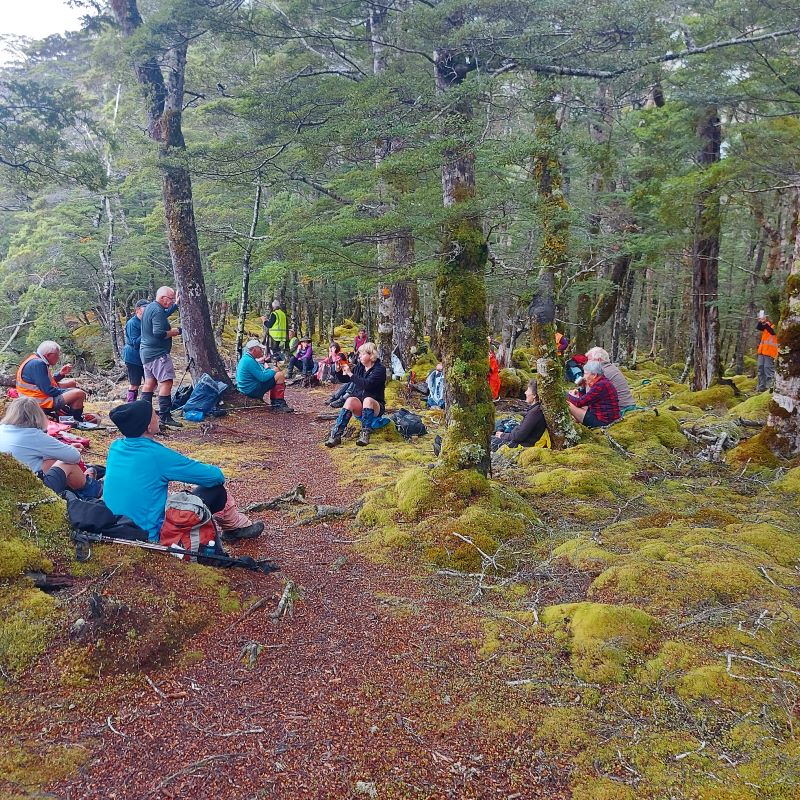
Bang on 10.00am we had morning tea, either in the edge of the forest or around patches in the sphagnum moss.
On through another low forest saddle, this time with a picturesque tarn surrounded by sharp colours, not unlike a geothermal pool. The bush and tussock tracks were more pronounced than at the time of the recce, thanks no doubt to the pitter patter of hunters feet through the roar period, and no wonder with hearing regular bugles all day long, and a bit later on, some Kea squawking. The next tussock clearing was on another scale, vast wonderful high red tussock, and drier under foot and eventually we entered another short forest walk and came to the junction with the Island Lake track. Everyone was travelling well, so we agreed to stay together and box on. We were immediately met by a good old fashion ‘grunt’, requiring good breathing spots about each third of the way up; it didn’t quite look this steep on the map! Having ascended we travelled along the ridge, but with 3 hours gone and still wanting to do some of the Alpine walk later in the day, the majority of the group opted for lunch. The famous five moved (rumoured to be running?) on to the edge of the Green Lake, descending and ascending the quite steep ridge.
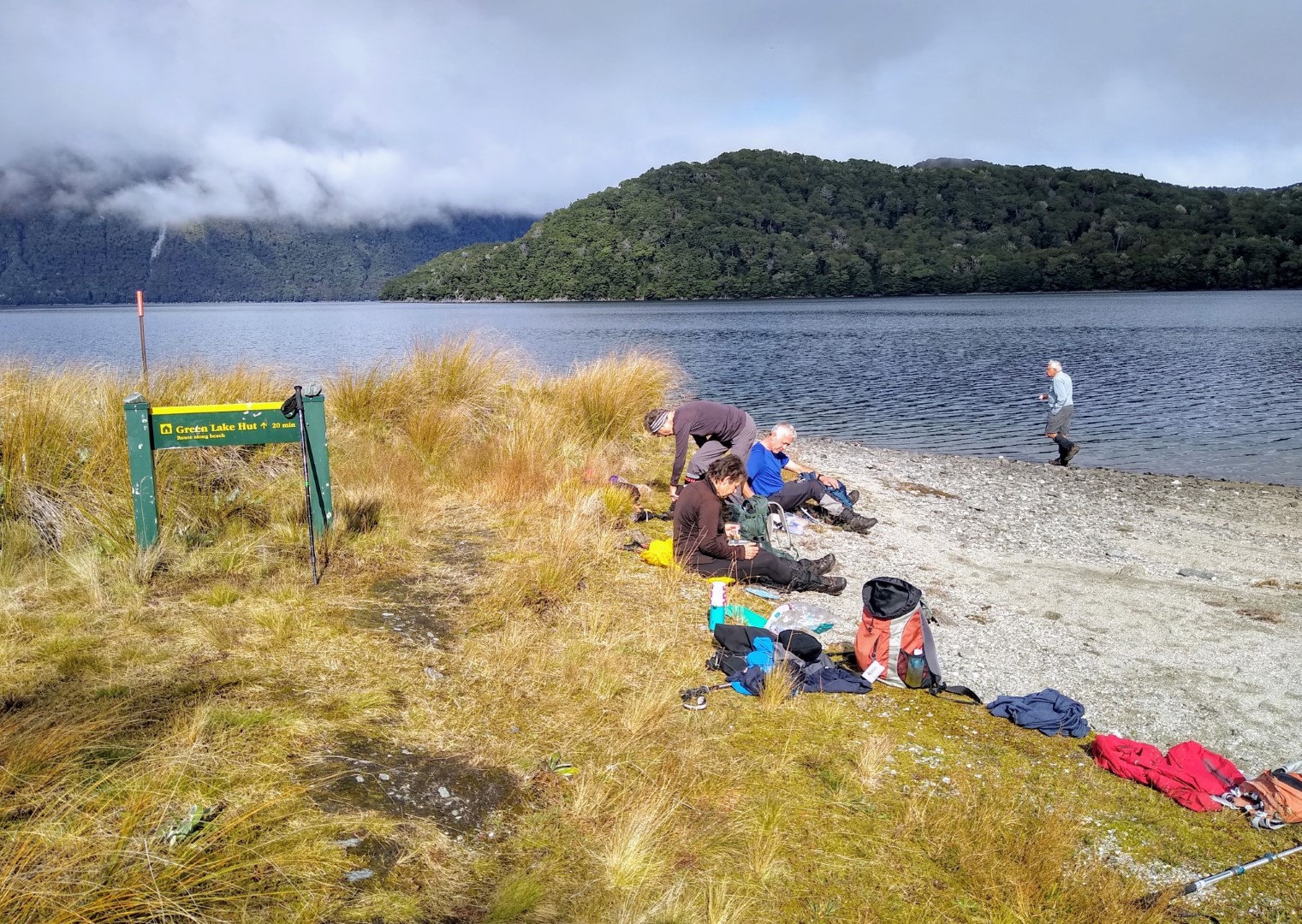
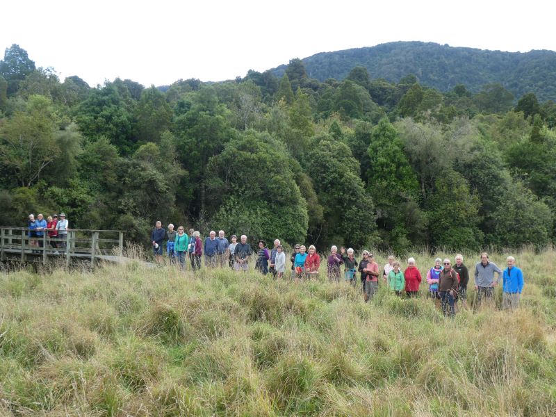
The majority returned to the Island Lake track and went down to the outlet, catching up with the famous five an hour and a half later, allowing for a nice group photo with the lake in the background. Island Lake was rumoured to be the most picturesque on the day?
From here we returned at a solid pace back to the cars, visualising the best spot to put our bush hut close to nearby tarns, and guessing where those roaring stags were. An inspection of the bivvy found an entry in the hut book from Raewyn’s group, who had completed part of the walk. Their three cars left later and also stopped at the saddle for a look. Still a little misty, they headed down to the pylon park and walked through the forest to the first clearing on the Green Lake walk to view the valley. Too boggy for morning tea there, they back tracked to find a dryer spot in the forest. Back to the cars, they drove on another 5kms to the Grebe Valley lookout where the mist had cleared for a great view down the valley. Also stopped there were a couple of deer hunters using modern technology to look for deer down below. Discussion developed and soon a few binocular sets were out, deer seen and photos taken. From there they returned to the Saddle for lunch, ventured through the Goblin forest and completed the Alpine Walk up far enough to enjoy the spectacular scenery.
This was the point Phil’s group returned to, and most went above the bush line to enjoy the big picture, which was pretty good!
On down the Saddle road and returned to the Lodge for more, well you know, great food and socialising but noticeably most sneaking off to bed a little earlier than the night before.
Day 4
Mt Eldrig ascent/descent
Lodge to Lake Monowai and return Mt Eldrig:
A close to even split for either walk, with 15 ready and willing at 8.45am to head for Mt Eldrig (an unofficial name, there is a Loch Eldrig in Scotland. Eldrig has become synonymous with deer trapping, named after a 10 th century monk Aelric who dug trenches to lead deer into net traps). With just 3 vehicles the steep ascent and parking arrangements up the pylon road was easily achieved, and off we went through quite an overgrown entrance, but the track settling down to one of steady to steep beech track, some fallen logs and bogs, and large rocks making it a little difficult to navigate; fortunately DOC had placed more numerous -markers on the trees. We morning tea’d right on10.00am where we had some great views but also had to seek some shelter from a strong NW wind. Another 45 minutes saw us emerge above the bush line onto
steep tussock/bog country with the track progressively giving way to poled markers. We followed these for another half hour, where 3 of the group decided to rest, awaiting the return of the main
group. They carried on and up and around to come to a significant white granite outcrop, providing spectacular views into and beyond the Borland valley, as well as to Te Wae Wae Bay,
Lake Monowai and the Takitimus, and up to the forward peak of Eldrig.
We took some group photos, with two folk returning to the other 3 and then on down to a car and back to the Lodge. The remaining 10 had a good lunch break and then over the next hour and half ascended/descended this forward peak, through lovely alpine herb-fields, gentians, with some Edelweiss flowers seeking shelter at the base of rocks; this brought forward the inevitable song from the Sound of Music and we could hear the ‘echo’ albeit at a much higher and tuneful pitch, from Raewyn’s group the day before on the Alpine Walk just over the hill! Finally all 10 ascended to admire the views, and the 1000m vertical drop a few metres behind us.
Group photos, into the west, and into the east were taken before we made the steady, steep, slippery descent, with one or two slightly embarrassing moments along the way.
Lodge to Lake Monowai:
With Raewyn overseeing, Esther & Pam led 18 on the track from behind the lodge and over Burnt Ridge. Different forest again, gave way to a couple of boggy areas, then a climb up to the ridge for morning tea. Onward across the ridge and down the other side with a few narrow and/or steep areas to negotiate before coming out on the flat. Following the clear markers, the walk travels through broom etc and then along the pine forest edge to the main Monowai road. A 1km walk along the road comes to the main car park & boat ramp at Lake Monowai.
The boat harbour area of Lake Monowai – Photo Gordon
Meantime, a few of the team had stayed behind, so they drove two cars round to the same spot to join them for lunch. Lunch was under the beech trees at quite damp picnic tables with the lake below. After lunch, a stroll to the flood gates and group photo with the lake.
A few opted to return by car, the rest were led back by Esther & Pam (thanks ladies).
During the evening meal breaks Judge Mellish outlined an extensive list of sins that everyone had committed during the days, except himself of course! He had spies everywhere, resulting in the singing of Happy Birthday to Ross. Helen thanked the leaders and their teams for the great meals, while Esther expressed thanks to Raewyn and Phil for the organisation of the week and made a presentation from the group. To which Raewyn and Phil say thanks again to everyone for making it a successful foray into Fiordland. This part of Fiordland, apart from the power lines and road, is close to what it has always been, and provides a sense of adventure for those who encounter it on it’s terms. Phil encapsulated this by reading Wendell Berry’s lines from “the ancient fear of the unknown”
“Always in the big woods when you leave familiar ground and step off alone into a new place there will be, along with the feelings of curiosity and excitement, a little nagging of dread. It is the ancient fear of the unknown, and it is your first bond with the wilderness you are going into”.

Day 5
Ah parting is such sweet sorrow – An orderly departure unfolded with the camp being left spick and span; it was heartening to see many follow Raewyn’s final manifest, with many visiting Rakatu Wetlands where we encountered Mark Sutton, the project manager and a board member of the Game Bird Habitat Trust, who had received our blog on the Takitakitoa wetland – small world. Also just like a run on the bank in days of share market collapse, there was a run on Venison pies at Bracken Hall in Mossburn, the quality of the pies passing the test of all who ate, and ate…..
Raewyn and Phil


Mo 7/4/03-Fri 11/4/03 Leaders:
1. Friday 27/10/1995 – Monday 30/10/1995. Combined meals. Arranged car passengers. Camp Parents: Bill and Lesley, Dot and Nelson. 33 attended.