Whare Flat, Waiora, Schoolhouse, Tunnels Track, McRaes Weir, Racemans

Do I Run Or Walk Helen Square26 June 2024. Hikers. Whare Flat. Grade 2.5. 11km. Leaders: Bruce Spittle,  Adrienne Ensor.

Sixteen hikers assembled at 0950 after parking on the side of the Silverstream Valley Road near the McKerrow Bridge Fields near the end of the tar sealed part of the road, 3.74 km along the road. Continue reading “Whare Flat, Waiora, Schoolhouse, Tunnels Track, McRaes Weir, Racemans”

Tramps Associated with the Whare Flat Schoolhouse

11 kms to Silverstream car park.


30. 22/2/2017. Hikers. Whare Flat. Leaders: Peter D, Janice.

Whare Flat/McRaes Weir (not quite) Wednesday 22nd Feb

26 happy hikers on a lovely sunny morning – what could go wrong?

Seven opted to drive up to the locked gate on Rollinson Rd and walk on to the start of the Steve Amies Track, where they enjoyed a pleasant amble to the picnic area and a leisurely lunch in the sun, before returning to the cars and off to Topiary for the usual coffee stop.

Little did they know of the drama that was developing below….

The other 19 left the cars at the park near the pump house, and set off up the track on the steep grunt that takes longer but avoids the water crossing and the possibility of wet feet.

However, Ian opted to do the shorter, easier version, risking wet boots, and meeting us in the clearing just past the swing bridge.

Ian reached the clearing safely and with plenty of time. In his own words –

’Ho hum. Oh! Time to get out the puffer and see how it might get me up the next climb and manage to avoid that first 5 min. heavy breathing before the blood vessels adjust and let me get away. Bummer.

(I had not used it for ever so long as usually I remember when it’s too late to use. It’s worked well on earlier occasions, but not in this case, standing, waiting, for such a long time before climbing.)

Started to feel faint. Got worse. Lay down, ended looking like a wee gnome in the grass, as one of you said. The rest you know better than I do!!!’

So, here was Ian, looking worse by the minute. While he was attended to by those with medical experience, we debated the options.

  1. Cell phone call for help. No signal.
  2. Use the locator beacon. Was there enough room for a chopper to land? Debatable.
  3. Go back to the cars and phone for an ambulance.

It seemed at this point that Ian was recovering – his colour was better and he was lucid. Two people set off for the cars. Over the swing bridge and just past the gate to the road they realised the house on the right was occupied. But no landline and still no cell phone coverage. The wonderful lady (who had a key to the gate!) drove them out to the cars. One went on to get coverage and call for help. The other returned, to find that Ian’s condition had worsened, necessitating CPR. Gulp. Back down the road – kind lady again drove. The police car was met at the (un)locked gate and immediately radioed URGENT to the ambulance.

Things happened fast. In just over an hour from Ian’s collapse the ambulance was at the swing bridge and Ian was stabilised and stretchered across the bridge, and off to A & E.

It was now 11.30 and we were all rather shell-shocked. Five decided to call it a day. Two went to break the news to Shirley, and the other three heading home.
The remaining 13 headed up the track to the next clearing where a very sober lunch was had. Then up the track we climbed to McRaes Weir Track. It was decided that the weir could wait for another day, and we headed back along the race track to the road and down to the cars, with rain starting to fall and the track becoming muddy and slippery.

Coffee at Topiary was welcome!
Thanks to everyone for the able assistance that was provided in so many ways. Ian is fine – he had a reaction to the ‘puffer’ and after tests and checks, was allowed home that evening.

LESSONS LEARNED:

  1. IF for any reason the group SPLITS, there must be at least TWO PEOPLE and preferably FOUR so that in the event of an emergency, one can stay with the ‘victim’, and two go for help. The same should apply to anyone deciding to turn back and in future this needs to be enforced by the leader.
  2. In a later debrief with Police, we were praised for the efficient handling of the situation. However, they said that we should never hesitate to use the beacon because a few precious minutes could be saved. On the beacon signal, our precise position is shown and authorities can then make the decision as to which services to use. So in future, no hesitation! Better a false alarm than a death.

29. 1/5/2013 Both. Steve Amies. Leaders: Ian and George.

This time we left from the schoolhouse, making it more of a road walk. We had morning tea on the lower  Rollinson Rd and lunch in the track clearers’ picnic area, after inspecting the helicopter landing pad a little beyond.

As we returned down the road, we were surprised to see the helicopter, and shortly after the tank truck making their way towards where we had been. Apparently this was the day to carry out the weed spraying we had been notified about – and we were now making a timely exit. A tramp for 25 of us and of 10.5 km according to Peter’s pedometer and 25. – Ian.


26. 15/6/2011. Trampers. Schoolhouse, Tunnels, McRaes, Racemans, ret. Medium.

Plan 1: Swampy to Green Hill via Sleepy Hollow. Cold winds too fierce on tops.
Plan 2. Schoolhouse, Little Coal Creek, Steve Amies. But wet weather meant steep tracks would be too slippery and dangerous.
Plan 3. The actual tramp (see above). – Racemans level and safer, (except for the gradual Tunnels ascent/descents). However wet tree roots still had to be carefully negotiated.
Although rain for a start, but it soon went off and only drippy bush had to be endured. Track still muddy in places, but in many places a grand avenue and well cleared. Seven of us ventured out and enjoyed what looked at first to have been an unpromising day. – Ian.
GPS of route. Courtesy, Ken. (Route double-tracked for some inexplicable reason.)
12.33 p.m. Ready to return from lunch spot on Racemans.
2.23 p.m. Top of Tunnels track. Rest stop on pine-needles on return.

6. 23/10/1996. Trig Q. Average. Leaders: Margaret and Les, Doug J.


5. 7/6/1995 Trig Q from Whare Flat School. Medium+. Shorter trip available. Leaders: Bob H, George, Jack R, Nancy


No. 57 on old hardcopy list of 113 club tramps.

Whare Flat School

Starting from a whare of stones, built by Mr Birnie in 1857 at the junction of Whare Creek and the Silverstream, the settlement at Whare Flat consisted manly of Scots, nearly all of whom spoke Gaelic. The first school opened in 1868 in a ‘but’ and ‘ben’ with Mr Neil McLeod as the teacher. The earliest roll call has a strong highland flavour: Macmillans, McQuilkans, Camerons, Kays, McDoalds, McInnesses, McLachlans, Jollys, McKenies, Leishmans, Pages, McRaes, McIntyres, Andersons, Hays, Thomsons, Rollinsons, Lambs, Lennies, Dodds, Gilchrists.
Later, the present wooden schoolhouse and school were built and Mr Robert Leishman, who owned the only bullock dray in the valley carted all the timber. This one-class, sole-charge school had 42 pupils at one time before it closed in 1943 and the pupils came from as far as Strath-Taieri and boarded in the valley during the week. The building was the centre of social, educational and religious life of the community and on Sundays public worship was held there by preachers from Knox Church and later from North Taieri Church, with Dr Stuart presiding on special occasions.
The first southern exit from Dunedin was by Halfway Bush along the Silverstream to North Taieri so that this settlement, with its two flax-mills and rope works, was until about 1860 a busy highway. Travellers would be mainly on foot, carrying heavy loads as bullocks and horses were scarce. Stock for the farms was driven this way from Port Chalmers and Dunedin where it was landed from Australia and thousands of sheep passed each year at shearing time to and from the woolshed on Flagstaff. About 100 diggers set to work on the surrounding hills when gold was discovered at Darkie’s Gully and there was said to be an illicit still at Powder Creek. In the mid 1870s however, the Dunedin Corporation took over the whole area as a watershed and the settlers gradually moved out as the trees were planted. – “Taieri Buildings” 1970 by Daphne Lemon
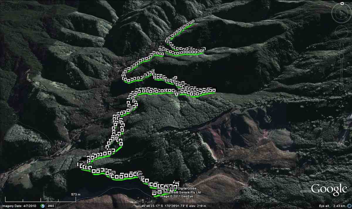
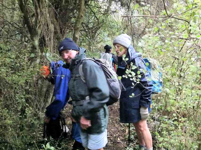
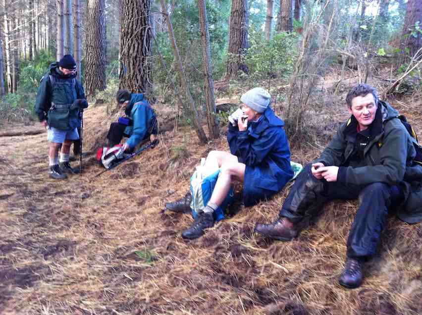