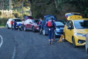
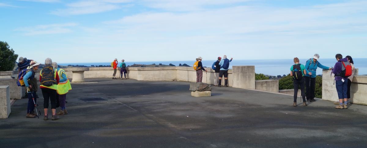
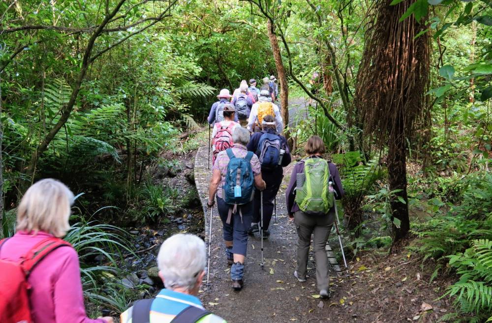
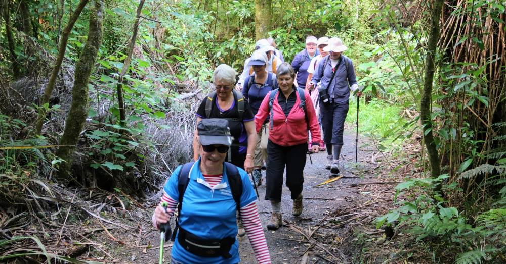
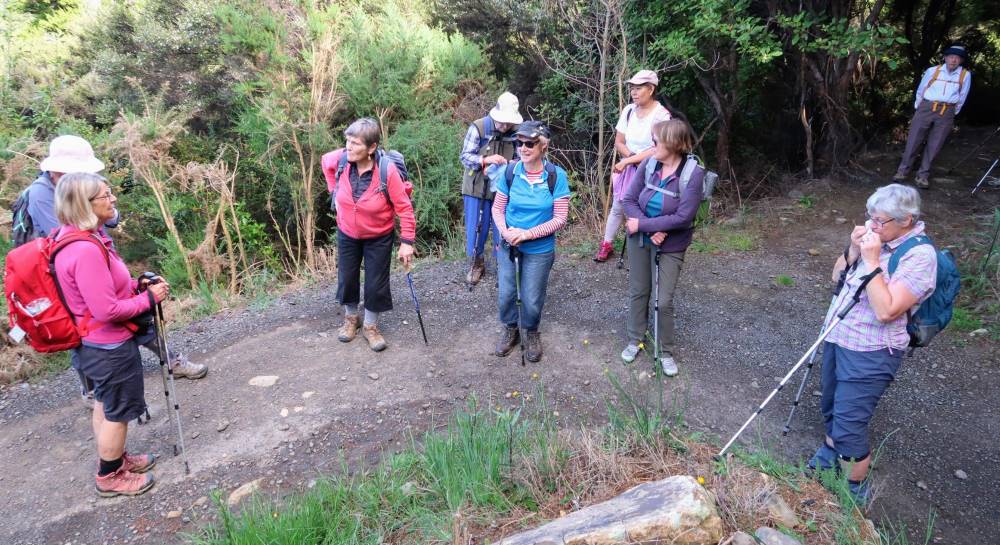
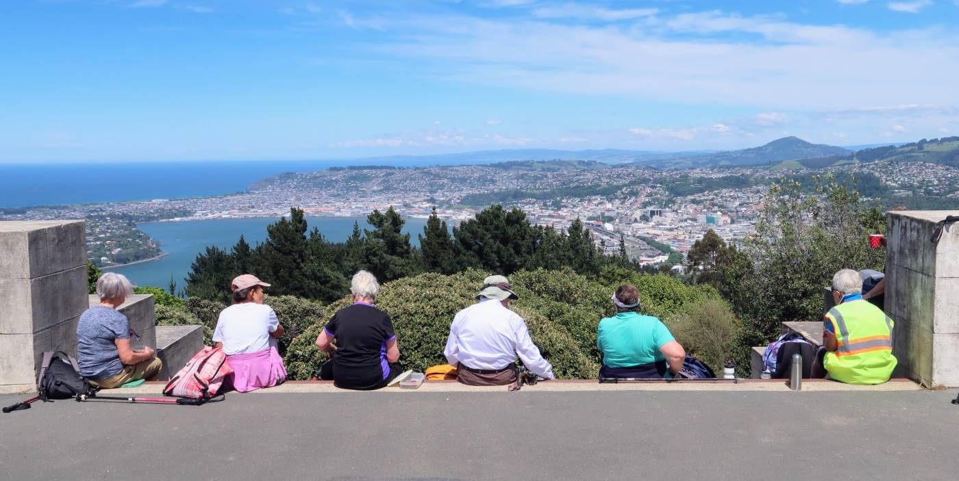
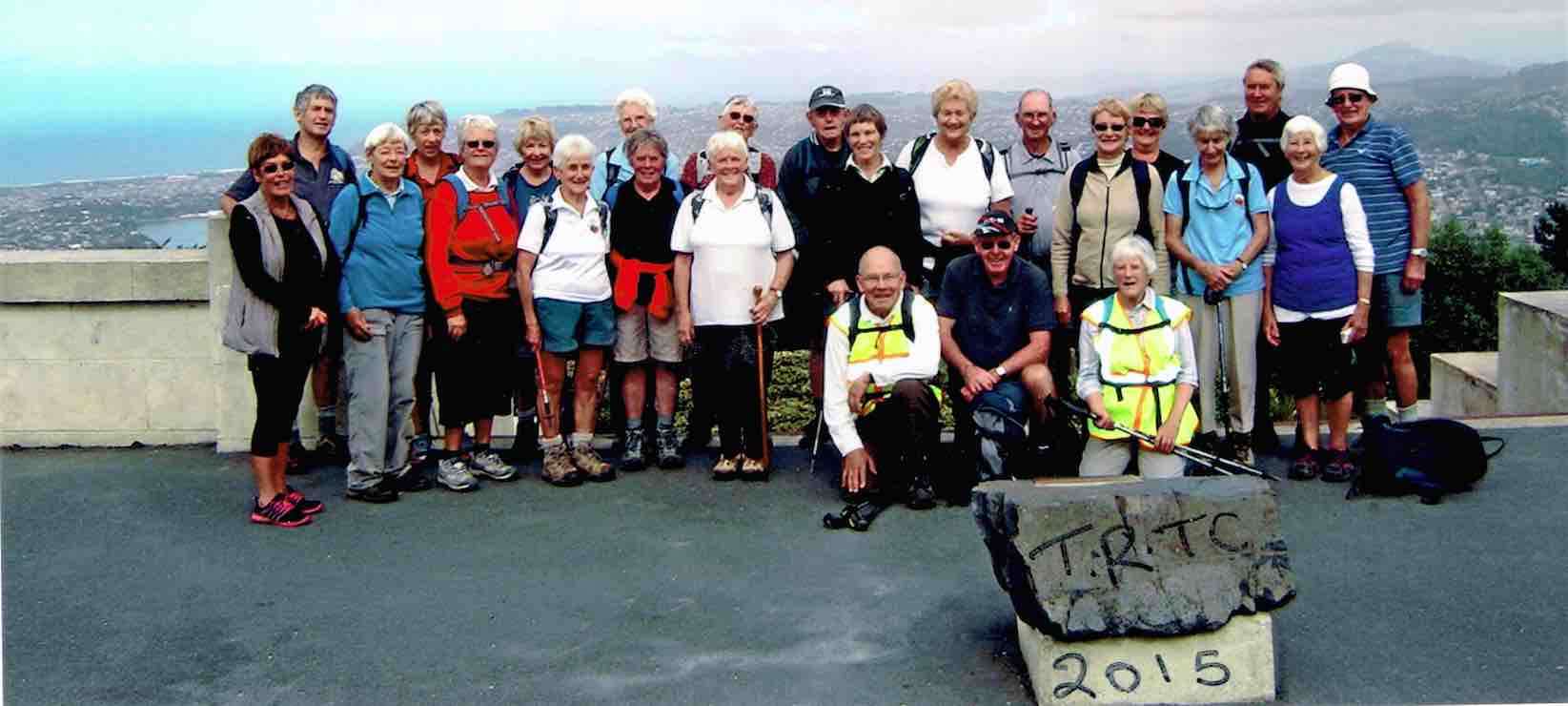
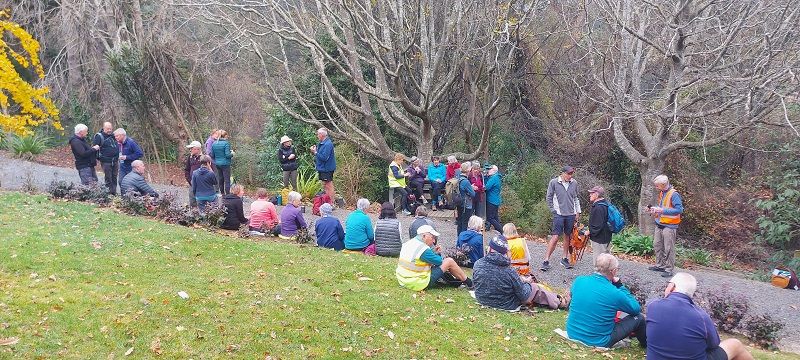
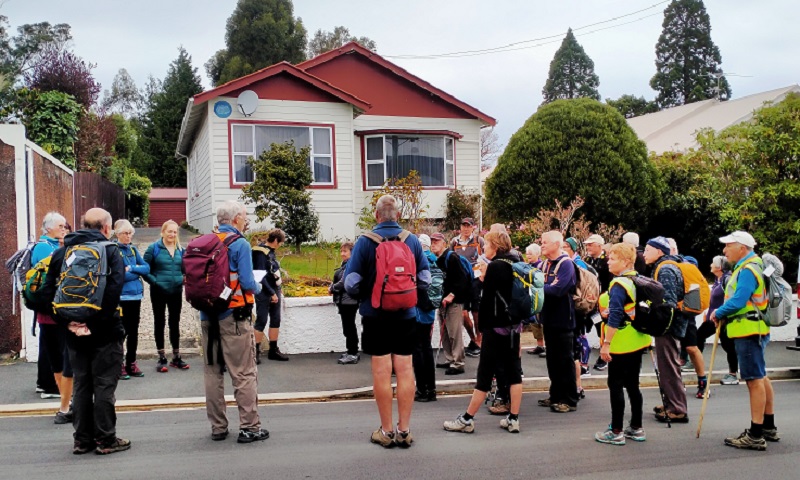
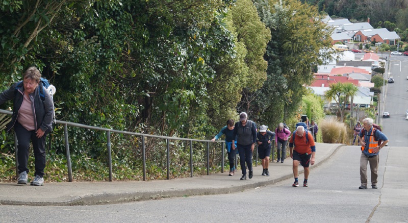
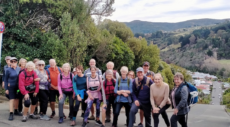
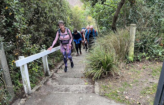
13/11/2024. Chingford Park, Cleghorn Street, Opoho Circuit. Grade 4. Trampers. Leaders: Ross and Wyn Davies.
20 trampers met up up North Road in North East Valley, on the corner of Crown Street. We headed off at about 9:45am up the valley in sunshine.
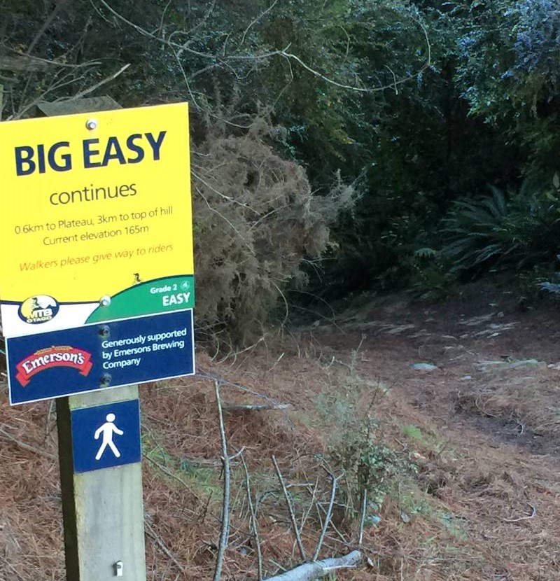
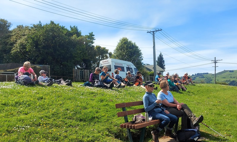
24. 26/07/2023. Big Easy. Hikers. Grade 2.5, $5, 19km, Leaders: Pam Clough, Jay Devlin.
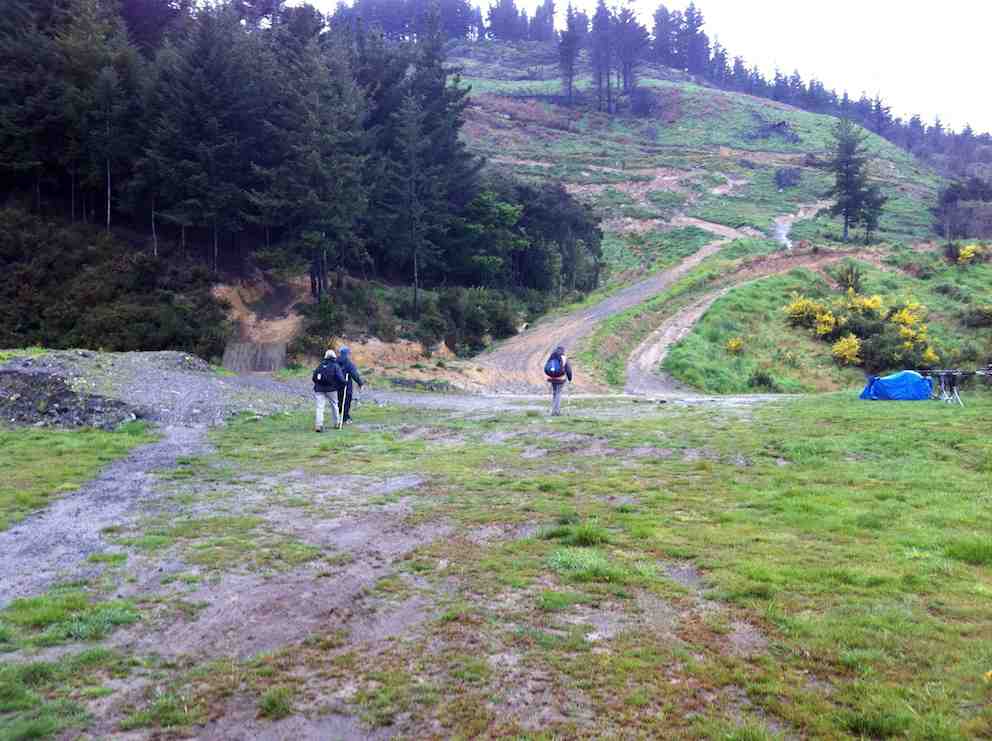
23 enthusiastic Hikers parked opposite the old Ravie Pub in very cold windy conditions as we started our walk to the Otago Yacht Club, where we took shelter for morning tea.
Taking shelter – Photo Alex
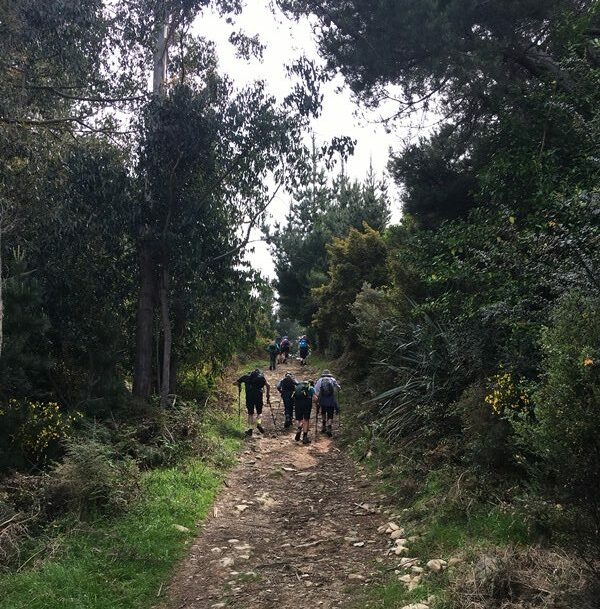
We then made our way past the stadium then down Butts Road to the beginning of the Big Easy Track behind Logan Park High School.
At the start of the Big Easy Track – Photo AlexPhoto Alex
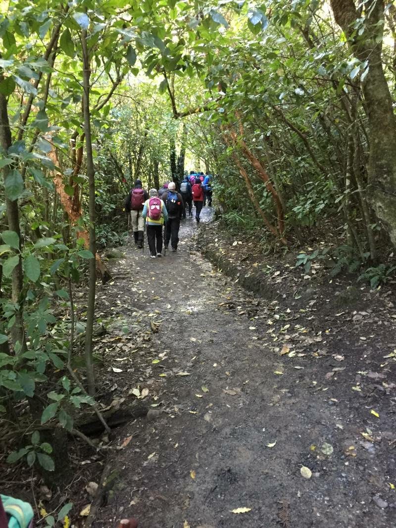
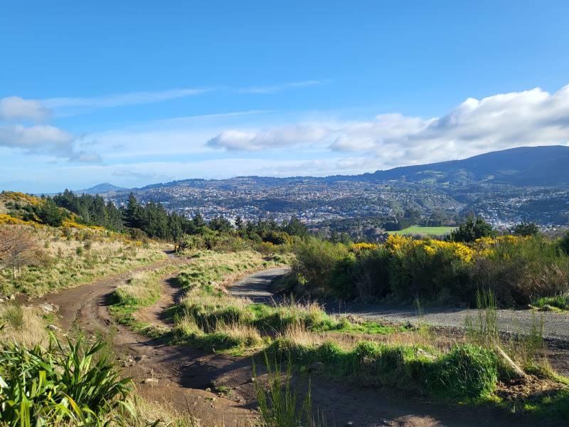
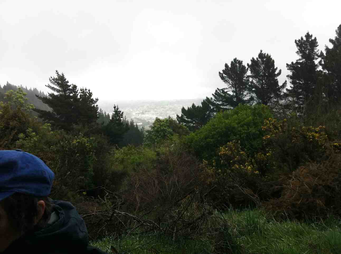
The track is a zigzag gentle climb for 3.6ks to the Plateau where we stopped for lunch in very cold windy conditions so needless to say we didn’t linger too long to enjoy the lovely views of Dunedin.
Dunedin City from Big Easy – Photo & Caption Michael WebbJay organising afternoon coffee – Photo & Caption Michael Webb
After lunch we followed the track and various steep streets back to Ravensbourne 11.3kms all up.
Photo Alex
Coffee was at Sunnyvale where we enjoyed a roaring fire.
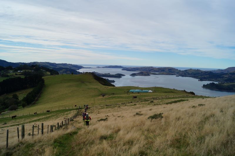
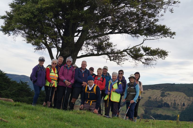
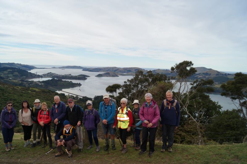
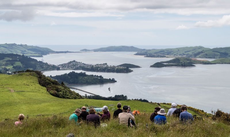
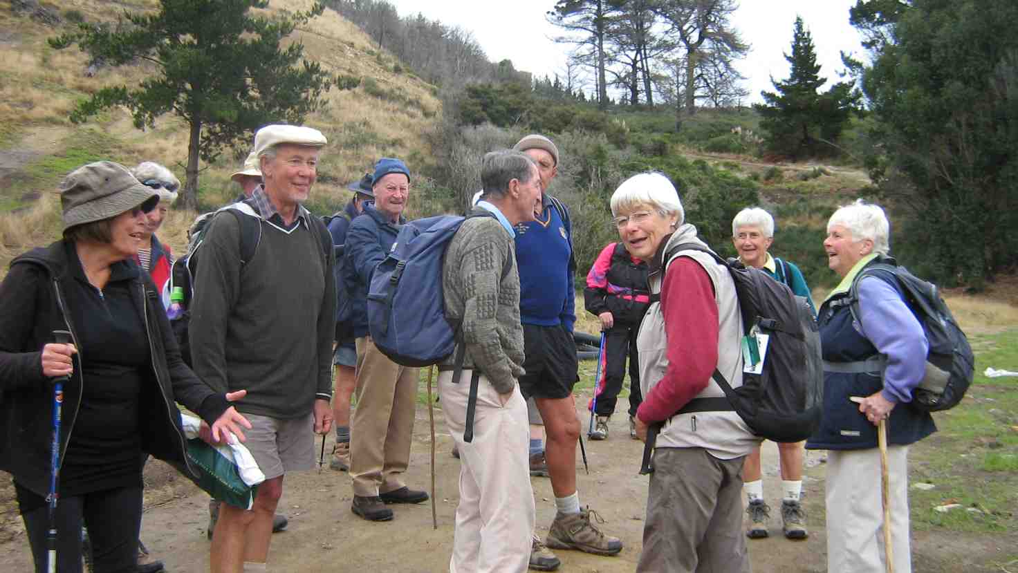
Cleghorn Street to Signal Hill Lookout. A very pleasant day weatherwise saw 14 of us undertaking this walk. We parked near Cleghorn Street and walked up the road before entering the farm track which was a bit muddier than expected.
Getting ready to start out at Cleghorn Street (photo & caption John)
There were a number of cattle on the farm and guess they churn up the ground. They took no notice of us – guess they are used to people walking across their land. Bit of a grunt up to the top of the hill, and a couple of stiles to cross, one of which was a bit of a mission for us shorter folk.
Stunning view 5 minutes into hike (photo & caption John)
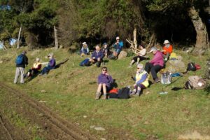
Beautiful hiking conditions (photo & caption John)Morning tea in the sun (photo & caption John)
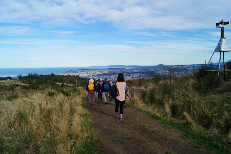
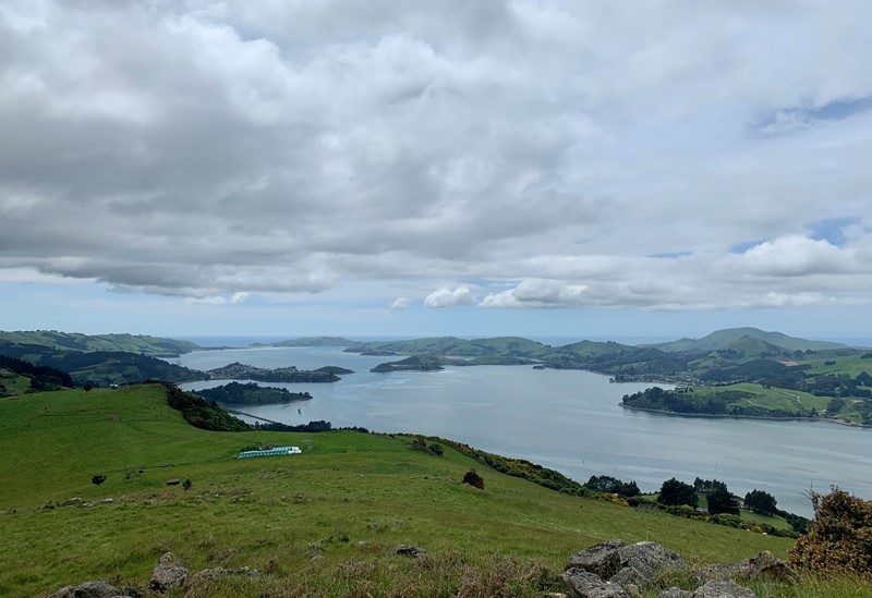
Then a long downhill stretch to come out on to Signal Hill Road. Headed up as far as the Signal Hill Lookout where we had lunch. After a reasonably lengthy lunch, as we were at the Lookout shortly after 11.30, headed back to the cars the same way we had come. Previously we had done a round trip, which necessitated car shuffling and a very steep descent via Blacks Road, so the leaders decided a ‘there and back’ would be easier.
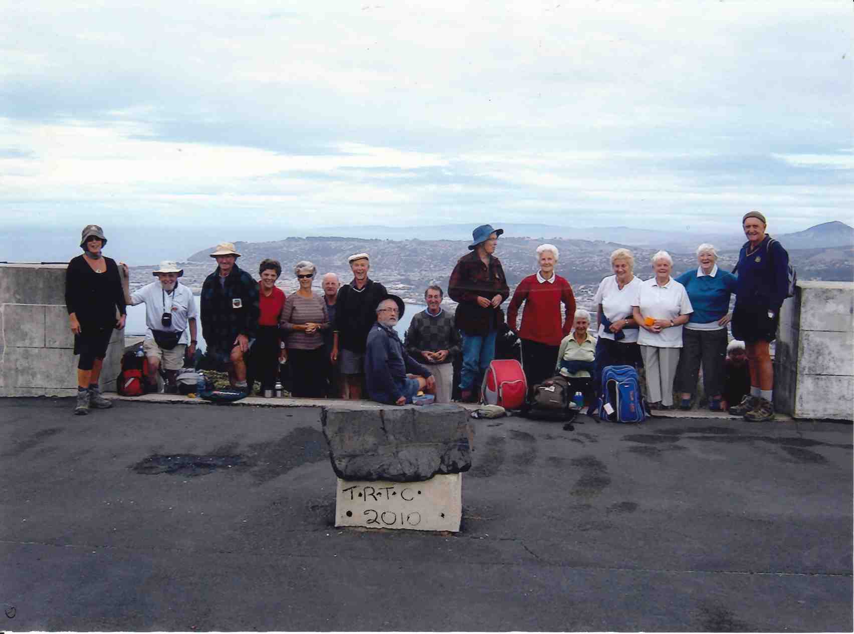
Downhill leg overlooking Dunedin (photo & caption John)The Signal Hill Lookout (photo & caption John)Start of the trek back to the cars (photo & caption John)Group photo – Yes the camera is on a slope (sitting on a rock) (photo & caption John)An example of Pam’s photographic skills (photo & caption John)
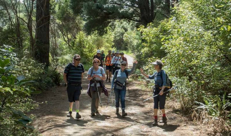
Great views of the harbour and peninsula on the way back, as evidenced by John’s fine pictures. The day ended with coffee at the Botanical Gardens cafe – a most memorable day enjoyed by all. Pam and Jan.
22. 8 December 2021. Hikers. The Big Easy. M. Leaders: Jay Devlin & Pam Clough
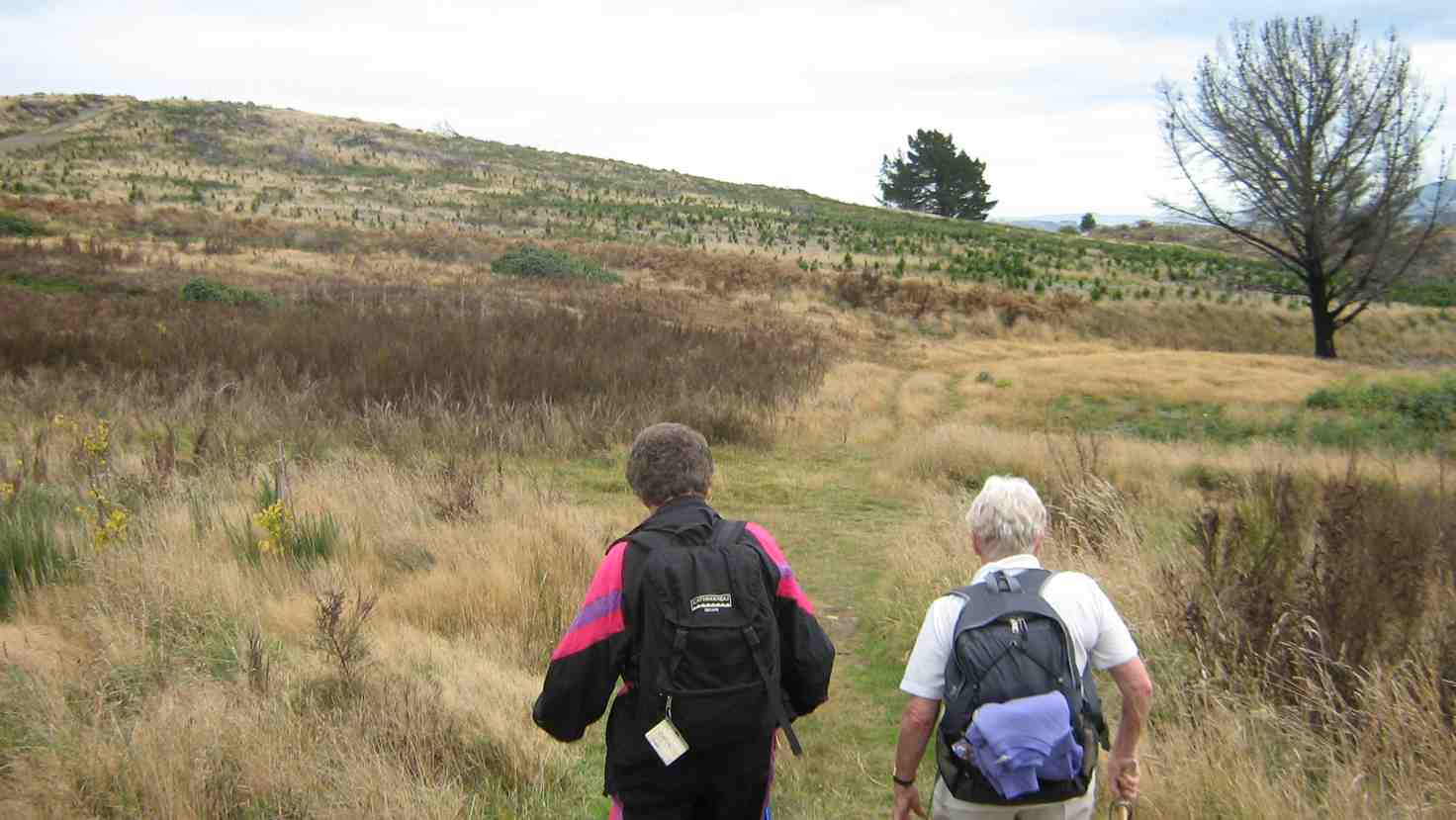
18 eager hikers reported to the carpark behind Logan Park High School on a beautiful sunny calm day. We looked up to where we were going and it looked a steep climb up but in fact it was a very gentle zigzag climb.
Heading off up the Big Easy (photo and caption Ross)Warming up up the Big Easy (photo & caption Ross)Gaining height (photo and caption Ross)
A third of the way up the track we stopped for morning tea with lovely views over Dunedin to Taieri Mouth. This is a pleasant walk in amongst native bush with lots of lovely tree ferns and abundant bird life.
Morning tea spot on a big bend on the Big Easy (photo and caption Ross)
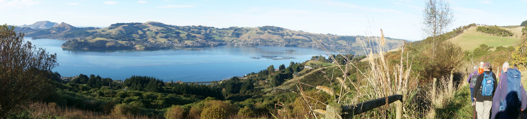
We reached the monument right on lunchtime. This area really showed off the beauty of Dunedin and surrounding coastline and suburbs.
Lunchime at the monument (photo and caption Ross)Lunch with a view (photo and caption Ross)
After lunch we walked back down a steep Signal Hill Road which was a bit ouch on the knees. We then turned left into Blacks Road where we again entered the Big Easy Track that wasn’t signposted as it seemed to look like a driveway, but was shown on a map when we did the recce. This part of the track was particularly steep and had to be negotiated carefully but thankfully no one slipped over. 11k completed. We had coffee at The Hub which is in the University precinct. Leaders for the day were Pam and Jay.
21. 24 November 2021. Trampers. Ravensbourne, Signal Hill, Big Easy. M. Leaders: Theresa White & Ross Davies
We were greeted with a beautiful day and 16 members set off from the Marina, along the walk/ cycle way at a good pace. We crossed the road at the hotel, across Adderlay Terrace, to a walkway up the hill. Morning tea at the Manuka St playground got the breathing back on track.
Morning tea (caption and photo Helen)
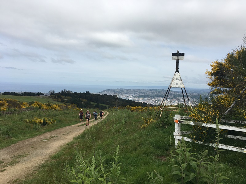
Street walking for a bit until we reached the entrance to the Signal Hill track. At the top the new planting of native trees had grown quite a lot since we were there last time. The way to the top from the Plateau was by the Telecom Track. Up and up we continued.
Walking up to the Signal Hill Lookout from the Ravensbourne Track (caption and photo Pam)
A short break with a view of our beautiful city of Dunedin was enjoyed from the Monument. Onwards along the Signal Hill road until we came to the “No Exit “street on the right (used to be Cleghorn Street).
Looking back south over Dunedin from the ‘No Exit’ road off Signal Hill Road
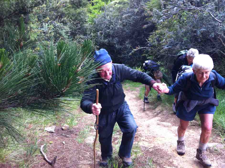
We all wondered if the rescue teams would find us!! Up the gravel Cleghorn Street until we got to the many masted site at the top. At this point there was a small mutiny among the troops. NO MORE UP!!! Our intrepid leader Ross said “Just a bit more and the view will be worth it“. We followed a small track through some broom, over a style, into farm land, along a pine plantation and true to his word there was the view. The whole harbour and all the surrounding small settlements were there for us to” ooh and ahh” at over lunch.
Lunch with a view (caption and photo Ross)
Our lunch stop presented us with a magnificent view, like a Colin McCahon painting (caption and photo Marijke)
The return trip was thankfully down.
Signal Hill Track called Centre Road (caption and photo Ross)
We choose the shortest route down the cycle trails to Logan Park School.
Coffee at the Plaza before returning to the cars at the Marina.
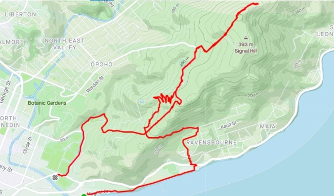
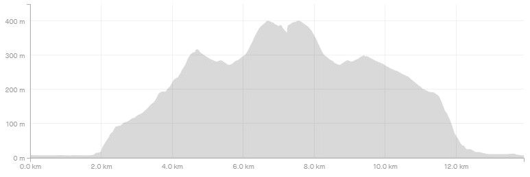
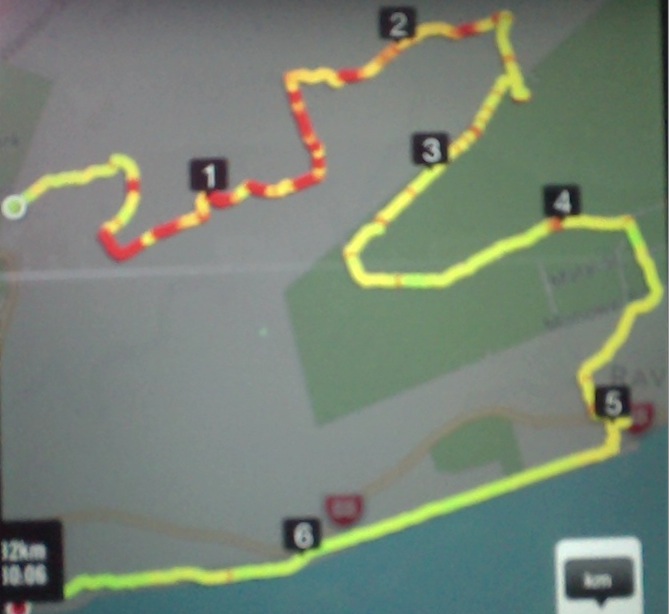
Screenshot Strava Signal Hill Route (Ross)Screenshot Signal Hill Elevation (Ross)
Theresa & Ross
20. 24/8/2016. Trampers. Signal Hill Tramp. Leaders: Neil and Margreet.
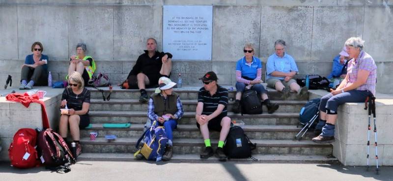
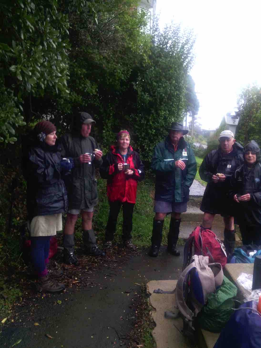
Well the chilly Nor’easterly was ‘thin’ and the drizzle was horizontal; but 7 hardy trampers set out from the yacht club and walked to Ravensbourne along the walkway/cycleway. After crossing SH88 we found shelter in the lee of the War Memorial for morning tea.
Morning tea in shelter of the Ravensbourne war memorial. (Helen pic and caption.)
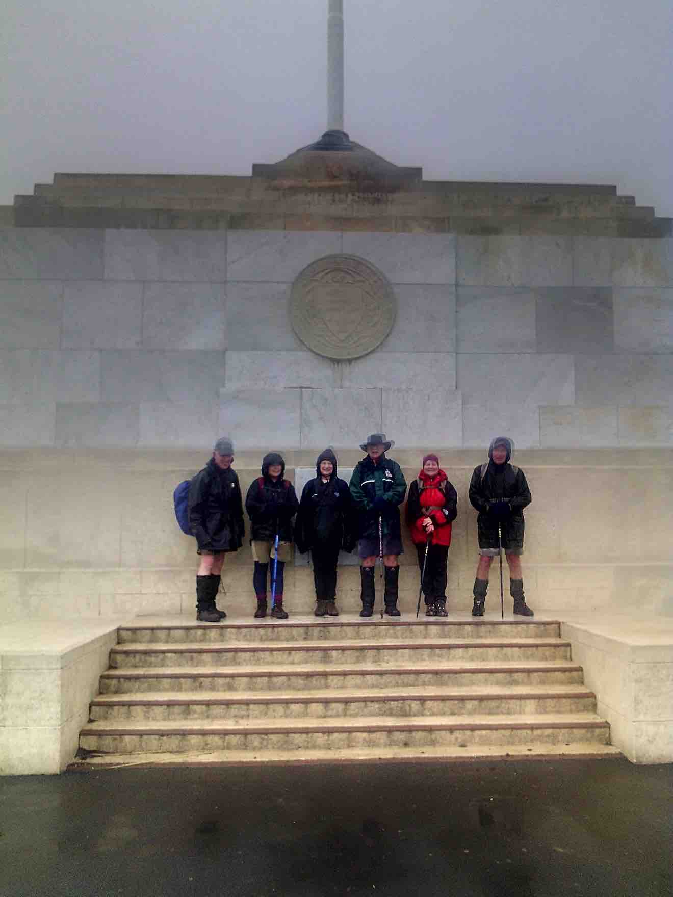
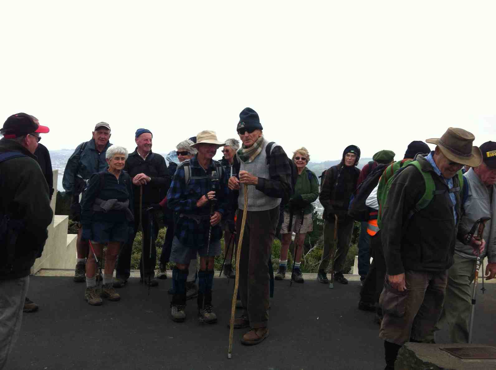
It was a nuggety wee zig-zag up Manuka St to find the track entrance to Signal Hill. A steady climb in dripping bush for 20 minutes saw us break out at the Plateau. Following the Telecom track, another energetic climb took us to the Centennial Monument.
Top of Signal Hill. (Helen pic and caption.)
We should have had stunning panoramic views over the city but sadly it was just a pea soup vista!
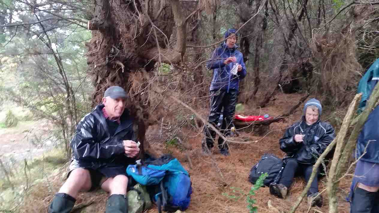
Leaving the two large bronze figures (‘History’ and ‘The Thread of Life’) to the raging elements, we quickly descended to the sheltering bush line where a nice ‘possie’ for lunch was discovered.
Lunch today. (Margreet pic and caption.)
After a leisurely (obviously Neil Morrison was absent!) lunch, the team continued down the ‘Big Easy’ mountain bike trail to Logan Park High School and onward to the start point. On the way we did see the restored Opoho Creek fish ponds which are home to the Banded Kokopu (a type of whitebait); and also the old Pelichet Bay infectious diseases hospital established in 1908 above Butts Road.
Highlight of the day had to be a hot drink at the warm and welcoming Emerson’s Brewery. Distance 10.5 KM.
– Neil and Margreet.
19. 11/3/2015. LPHS to Ravensbourne. Leaders: Jim and Betty.
Centennial Memorial (Elaine pic)
18. 27/11/2013. Both. Marina, LPHS, Memorial, Ravenbourne, Harbour Walkway, Marina. Leaders: Jim and Betty.
Route. Turned GPS on only at LPHS car-park. Sorry! Add abt 1.5 km gap from our cars to the 6.82 total (obscured) to get 8.32 km.
Steep climb. Somewhere between the 1 & 2 km indicators on map.
Memorial photo.(At the little tail between the 2 & 3 km indicators on map.)Lunch at 4 km indicator on map – I think.
16. 14/4/2010. Hikers. Signal Hill, Logan Park. Leaders: Bev H, Chris.
The two trampers for the day joined the hikers. A surprising group of mushrooms behind the Logan Park High School were quickly “gobbled” up. The steep hill beyond was heavily marked with zig-zag BMX tracks.
We tackled the climb.
Further up was a pleasant walk through an avenue of bush.
A lane through the trees
We sat on the steps of the Centennial Memorial for lunch. Several groups of people came and went before us, including one group who came to scatter the ashes of a family member. A member of a bus group offered to take our picture with Elaine’s camera.
Who thought to include the sign? (From Elaine’s positive)
Leaving the memorial, we made our way down through trees and cleared ground to Ravensbourne. This was the first time several of us had made the Ravensbourne-Signal Hill- Logan Park trip in the reverse direction.
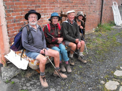
Down at Ravensbourne, several ‘went to bed’ on a mattress stored outside beside a shop.
After that, it was along the walkway beside the railway and then back to the cars at Logan Park High School parking area. Thanks to Bev and Chris for a well-planned and guided walk. – Ian
15. 17/10/2007. Hikers. Logan Park, Signal hill. Medium. Leaders: Barbara and Arthur.
14. 27/9/2006. Trampers. Logan Park, Ravensbourne, Signal hill, Opoho. Easy. Leaders: Evelyn C, Lesley S
13. 7/7/2004. Both. Logan Park, Ravensbourne, Signal Hill. Medium. Leaders: Ian, Arthur and Barbara.
12. 17/9/2003. Hikers. Logan Park, Signal Hill. Medium. Leaders: Betty, Colleen.
11. 14/8/2002. Logan Park School – Signal Hill. Medium. Leaders: Molly, Hazel, Barbara McC.
10. 28/3/2001. Ravensbourne to Signal Hill. Leaders: Jack and Rosemary, Catherine.
9. 18/10/2000. Ravensbourne – Signal Hill Road. Leaders: Sabina, Anne, Wendy B
8. 19/5/1999. Ravensbourne, Adderley Terrace, Signal Hill. Leaders: Jack and Rosemary, Doreen.
7. 8/4/1998. Signal Hill, via West Harbour return via Opoho. Park at old Art Gallery. Leadrs: daphne, Shirley R.
6. 27/3/1996. Signal Memorial return Adderley Terrace. Leaders: Les and Mavis, Margaret D, Judy
5. 31/8/1994. Logan Park, Ravensbourne, Adderley Tce, Signal Hill, Opoho. Medium. Leaders: Daphne, Margaret D, Mary L, Myrie.
4. 21/7/1993. Logan Park, Ravensbourne, Adderley Terrace, Signal Hill, Opoho, Logan Park. Medium. Round Trip. Cars at Art Gallery. Leaders: Betty B, Daphne, Margaret D, Pet A
3. 28/8/1991 Signal Hill via West Harbour. Return via Opoho. Leaders: George, Barbara M, Evelyn M, Peg C
2. 2/5/1990 Signal Hill via Logan Point and up Adderley Terrace, Ravensbourne. Back through Opoho and Northern Cemetery. A good city walk with plenty of history. Average. One hill only. Leaders: Nancy, Margaret B, Bev M, Molie
1. 28/9/1988. Signal Hill Memorial. Interesting Dunedin history. Harbour views. Leaders: George, Peg C, Molly.
This grouping of Club tramps and hikes covers trips involving the Big Easy to Signal Hill Memorial, Ravensbourne, Opoho (incorporating Willowbank), the Northern Cemetery. (map)
Opoho Odyssey 1 June 2022
In pleasant temperatures 35 Trampers set out from the Botanical Gardens carpark to enjoy our Opoho odyssey. Our first stop was for morning tea at Tannock Glen which is an established rhododendron dell off Warden St.
Morning tea at Tannock glen (photo & caption Helen)
Then we meandered through various streets and Ross’s well researched commentary about various points of interest was much appreciated. (This history will be available for anyone to review on a separate link). Neil added a few memories of his misspent youth in this suburb and talked about his family links to the area.
Jack Lovelock’s home (photo & caption Phil Keene)
Then it was off down the zigzag to Knox College which while not strictly in Opoho has strong links to the suburb because countless staff and students lived in Opoho and worshipped and preached at the local Church in Farquharson St. Knox College actually opened in 1876 to train and house students wanting to become Presbyterian Ministers. It is now a hall of residence open to all Otago University students.
Knox College (photo and caption Pam)
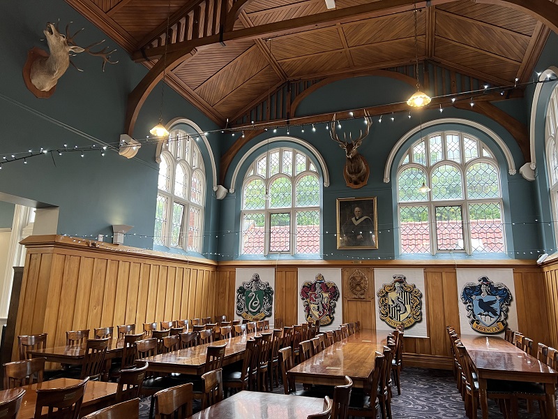
It remains a very well maintained beautiful historic building. Our guide Alec gave us an extensive tour through the various wings and a detailed commentary about the history. In the exquisite dining room which looks straight out of Harry Potter, Phil gave us a tune on the magnificent concert grand piano.
Dining room, Knox College. Beautiful oak roof, dining chairs and tables (Photo & caption Pam)
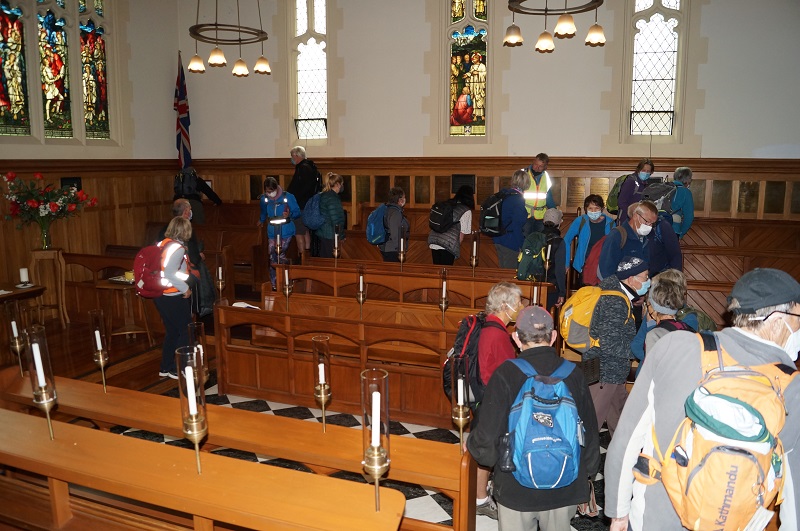
Beautiful Knox College Chapel (photo and caption John)
We all really enjoyed this tour as many had never been in this building.
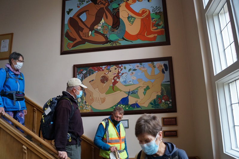
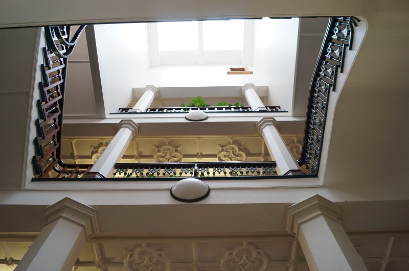
Admiring the stairway artwork (photo & caption John)
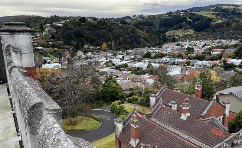
It was also great to climb via steep steps onto the ramparts where we got extensive views over Dunedin.
Parallax – Looking up the Knox Stairway (photo and caption John)View North from Knox Tower (photo and caption Pam)Jim and Lester at bottom of Knox stairs, greeting us on our return (photo and caption John)
We were invited to have our lunch in the quadrangle outside the building and could wander through the well-maintained gardens which was a pleasant interlude.
Lunch in Knox College quad (photo Helen)
After lunch we divided into two groups and the 13 hikers set off for the top gardens and visited the aviaries. Then it was an interesting walk through the Northern Cemetery. This is a major historic landmark in Dunedin and we saw notable graves and tombs. Neil was also able to point out graves belonging to his (and Graeme Souters) great grandparents.
Neil and Graeme Souter in front of their Great grandfathers grave in the Northern Cemetery (photo & caption Margreet)
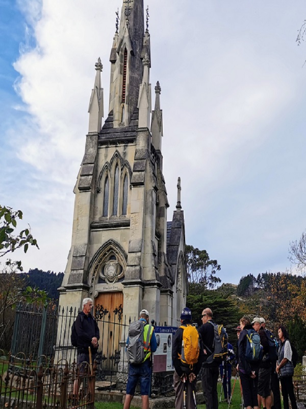
Most prominent in the cemetery is William Larnach’s tomb which was designed by R.A.Lawson and is a miniature replica of First Church.
The Mausoleum of William Larnach (photo & caption Margreet)
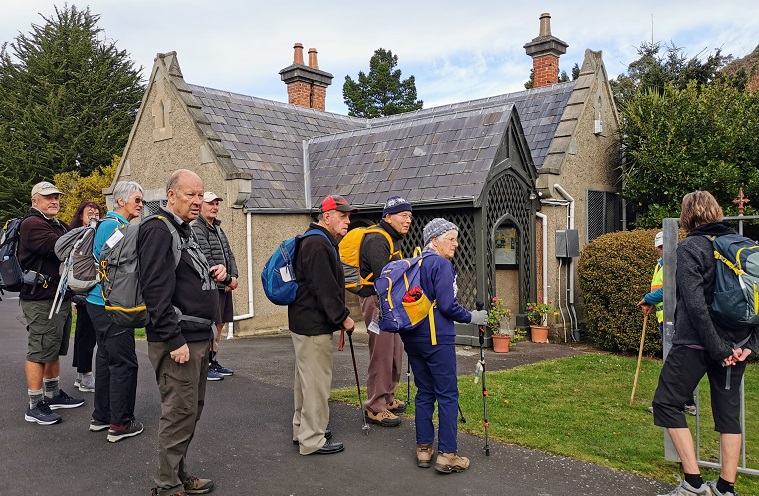
The Sexton’s cottage which is maintained by the Southern Heritage Trust is also very historic.
In front of the Sextons Cottage (photo & caption Margreet)
Of interest as well are the more than 1000 heritage roses; about 500 of which were poisoned with herbicide in 2016. Heritage Roses Otago have worked tirelessly to replace the damaged plants with cuttings and many of the graves now sport new plantings. We also stopped for a few minutes to visit the memorial to Thomas Bracken who wrote the National Anthem of New Zealand.
To finish it was a walk through more tracks in the top gardens and back to the cars.
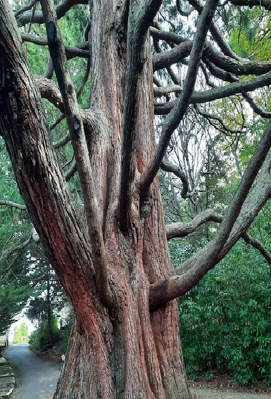
Massive tree between northern cemetery & gardens (photo & caption Ady)
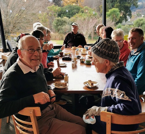
We enjoyed coffee in the café in the lower gardens.
Afternoon coffee (photo & caption Margreet)
Distance covered was about 8km. We will now hand over to Ross and Wyn to give a short account of their afternoon hike which was no doubt more strenuous!!
Neil and Margreet Simpson
We were the other group, 22 in total, that set off on the more strenuous hike. The 58 steps to the higher part of Arden Street immediately after lunch was a cruel start. We contoured around to Chambers Street which we descended a short way to find the 41 steps up to Taine Street. And then it wasn’t far to the 52 steps to Montrose Street which turned the corner into Maybank Street. Once we reached Blacks Road, it was down a short way to Grey Street and then down, down James Street to North Road.
We enjoyed the flat walking up North Road but all too soon came to Baldwin Street and another 273 steps.
Baldwin Street poem There’s a pigeon … (photo & caption Phil Keene)
Who doesn’t love Baldwin Street? (photo & caption John)
We knocked the B…. off (photo & caption Phil Keene)
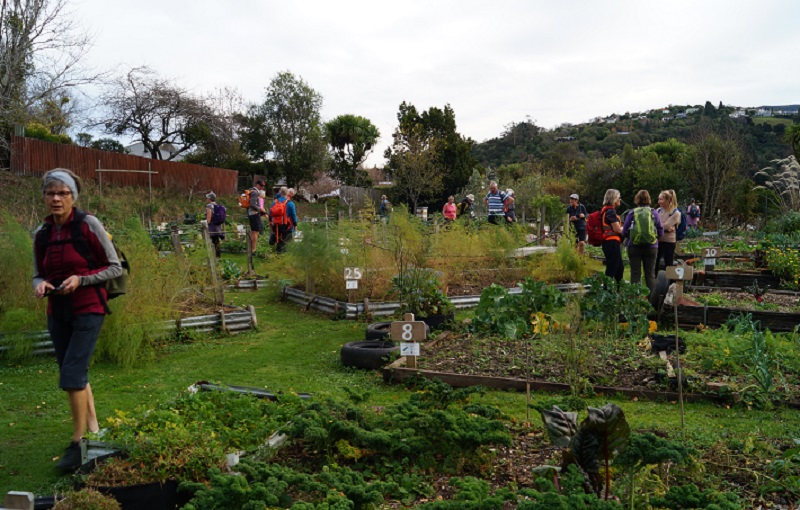
Photos at the top gave plenty of time for getting our breath back before we followed the footpath to the 85 steps down Calder Street to Primrose Bank which led us to the North-East Valley Community Garden. It was a lovely place to chat with the locals and enjoy the afternoon.
Impressive N.E.V. Community Garden (photo & caption John)
From here, it was all up; first up Dalmeny Street, where some tried to figure out if it was better to zig and zag, or to just take it straight. Eventually another 58 steps brought us to Evans Street, and a little further up Evans Street 137 steps took us to Signal Hill Road, just above the bus terminus. By this stage we were starting to feel the effects of altitude; breathing was becoming harder.
Quote from Ross- only one more “bunch” of steps (photo & caption Pam)
We turned into Northfield Avenue to admire the house that Neil grew up in, before descending another lane to Signal Hill Road. Not far down the road we came to the house that Margreet lived in briefly in her younger days, next door to the house that we now live in. It’s a small world.
We detoured from there around Grandview Crescent which does have a very grand view, down one last lane to Warden Street (10 more steps), identified where the track down the hill to the Big Easy goes off the top end of Blacks Road, and zoomed on back to the cars and then the café at the lower Gardens. Some of the other group were still lingering and luckily they hadn’t eaten all the cakes.
It was a pleasure planning and leading the trip with Neil and Margreet and a constant surprise learning about the parts Neil’s family have played in the history of the suburb we call home.
We learned a lot about the Opoho history preparing for the trip, and shared bits of it as we went along. Some have asked for a copy of our notes, and these are available via this link here Opoho Historical Background Notes
Not all these places were pointed out as we went around, but I’ve left them all in for anyone interested.
On the more strenuous hike, we covered about 10 kms including the morning, with about 345 metres of climbing, and a moving time of 2 ½ hours. And did we mention the steps? 628 steps up (not including climbing the Knox tower).
Ross and Wyn
Opoho – ‘Here my head is level with hills and sky’ – (Janet Frame)
[These historical notes were prepared by Ross for our wanderings around Opoho on 1 June 2022 on a tour led by Neil and Margreet Simpson and Wyn and Ross Davies. Only parts of it were recounted as we zoomed around, and some asked for a chance to read a bit more about what was talked about. What follows is the whole lot.] Name of Opoho
Maori have been present in the area for 800-900 years. Two groups of Maori ovens have been found on the contours of the hill, said to have been used by people of the Ngatiwairua.
Poho is said to have been a Ngatiwairua chief in the 1700s, head of a family occupying a small kaika (village) by the outlet of the stream which flows down the hill into what was once Pelichet Bay (now Logan Park). O-poho simply means ‘Poho’s place’ and it came to be applied to the neighbouring stream – Opoho Creek.
Later it was adopted by one of the early English landowners for a subdivision on the middle slopes beside where the stream flowed (the Logan Park side), and gradually the name became applied to the whole suburb (on both sides of the ridge). Opoho Odyssey Part 1 – Botanic Gardens Top Car Park to Knox College Lovelock Avenue
Formerly Cemetery Road because of the Northern Cemetery halfway down. Renamed Lovelock Avenue in 1968, after Jack Lovelock who lived in Opoho while studying medicine at Otago University. It was the street he ran down every day going to university. Jack Lovelock kept running, and broke the world record for the mile in 1933. He went on to win the gold medal in the 1500 metres at the Berlin Olympics in 1936 (the first Kiwi to win an Olympic track event). Signal Hill Road
The most enduring street name in Opoho is Signal Hill Road. It appears on all the maps. The top of Signal Hill provides a good view of the harbour and may have given the Maori a place to watch for hostile war canoes and signal from. With European settlement, the same hill was used to signal immigrant ships and perhaps to announce their approach to Dunedin residents. It remains one of the best-known landmarks in Dunedin. Opoho Road and Trams
The original Opoho subdivision, called Estate of Opoho, to form Opoho Township was created by Captain Boyd in 1873. We’re going to wander some of the streets of this Opoho Township this morning, making our way down to Knox College for a tour at 11am. Opoho Road was the southern boundary of the Opoho Township, originally called District Road. It was the first access to the suburb from the Gardens although there was also a road to Dundas Street down Lovelock Avenue. Opoho Road was too steep where it meets Signal Hill Road for the trams, so a new loop was created through part of the Upper Gardens where the road now goes. It was the steepest line attempted by electric trams. The terminus was at the corner of Signal Hill Road and Blacks Road, and that was steep too. At least two trams ran away from the terminus when the brakes failed – with serious consequences. The tramline opened in 1924. Continue reading “Opoho – Historical Background Notes”

 13/11/2024. Chingford Park, Cleghorn Street, Opoho Circuit. Grade 4. Trampers. Leaders: Ross and Wyn Davies.