Sep 15 2022

Street Walk: Town Belt areas.

Published by under Hikers

10. 14/09/2022. Hikers. Street walks of Dunedin – from the Oval. Leaders Jenni and Bruce

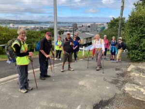
Memorials, buildings and landmarks that we drive past regularly were revisited when 24 hikers ventured out on a clear but cold Wednesday. Wearing many layers of clothing, we set off from the Oval, which as one clever quiz team recalled, covers 22.9 acres.

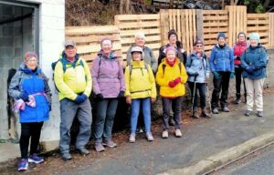
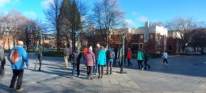
14 Sep Oval Setting off from the Oval Jenni

Oval Setting off from the Oval (Photo & caption Jenni)

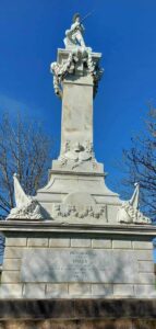
14 Sep Oval Perfect detailing, Boer War memorial, pic Helen

Perfect detailing, Boer War memorial (Photo & caption Helen)

Henry Ely Shacklock, Prince of Wales Hotel, Carnarvon Station, Bell Pepper Blues, the Empire Hotel – the home of the Dunedin Sound, all conjured up memories of time passed.

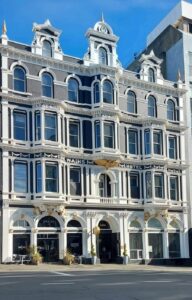
Further along Princes Street, we admired the beautiful refurbishment of Wains Hotel, now a 5 star boutique hotel and its across the road neighbour, Distinction Hotel, formerly the 1937 Chief Post Office. This building housed a huge number of public servants over the years.

14 Sep Oval Pristine Wains Hotel , Helen

Pristine Wains Hotel (Photo & caption Helen)

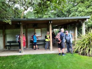
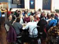
Morning tea was taken in the sunshine on the Dunedin Cenotaph.

14 Sep Oval Morning tea Helen

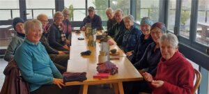
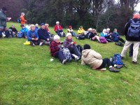
Morning tea (Photo & caption Helen)

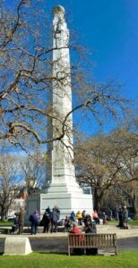
There was much to observe and discuss in the Exchange. The Cargill Monument, originally erected in the Octagon, but shifted to the Exchange in 1872. A mammoth effort, considering the detail.

14 Sep Oval What a task relocating this in 1872 Helen

What a task relocating this in 1872 (Photo & caption Helen)

It was interesting to visit Queen Elizabeth II’s, great-great-grandmother, Queen Victoria, who reigned for 63 years and seven months. What an amazing length of service from our two stoic royals.

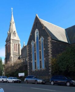
Rattray Street, today a crumbling collection of buildings, has huge memories for many of the team ….. Hong Kong Café, Sunset Strip, Dragon Café, Tai Ping Restaurant, the Rolling Stones party place, Calder Mackay and the Crown Hotel to name a few. Along Manse Street, up Stafford Street. Ross and Glendining Ltd, Kempthorne Prosser, Sew Hoys and the St Mathew’s Anglican Church. The architect for the church was William Mason, MP and Dunedin’s first mayor and yes related to Mason and Wales of today.

14 Sep Oval St Mathew's Church Helen

St Mathew’s Church (Photo & caption Helen)

14 Sep Oval Admirable skills here Helen

Admirable skills here (Photo & caption Helen)

Next came the stories from the Rugby Hotel, topless waitresses (from one who knows) and the Bell tea building.

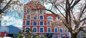
14 Sep Oval NZ's oldest tea producing company Helen

NZ’s oldest tea producing company (Photo & caption Helen)

The Market Reserve was our next destination, and there’s miles of history around what was formerly a tidal inlet, the original shore of Otago Harbour. The Victorian style men’s toilets were discussed, ladies were no where to be found. The Crown Roller Mills building has now been beautifully restored and houses 12 luxury apartments and a restaurant.

14 Sep The Crown Roller Mills Building Helen

The Crown Roller Mills Building (Photo & caption Helen)

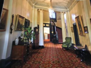
We admired the house Johnny Jones lived in (39 Melville Street) which is still in great shape and then popped our heads into The Dunedin Club which was built for him. Royalty have stayed there. This is used today as a hub for business people, weddings, conferences etc. It also has eight luxurious suites for accommodation. As an aside did you know that Jones donated the land for the building of St Paul’s Church in the Octagon?

14 Sep Oval The grand hall, photo courtesy of The Dunedin Club

The grand hall, photo courtesy of The Dunedin Club

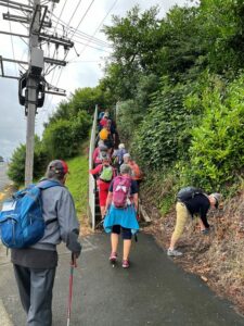
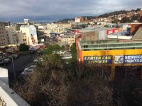
We zigzagged up the 98 steps (one of the quiz questions), to Maitland Street and some viewed the Bottled Sunshine sign for the Lanes lemonade factory. Some missed that! Carroll Street which was previously known as Walker Street, was the red-light district of Dunedin and associated crime. The top block of Carroll Street was known as the Devil’s half acre. The arrival of the Lebanese community helped improve the area, but the reputation was renowned. Now, we’re informed the red-light district is all around us, with online ordering and home deliveries!

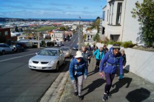
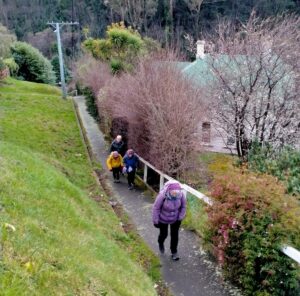
14 Sep Oval Up Maitland St, looking back occasionally for great views John

Up Maitland St, looking back occasionally for great views (Photo & caption John)

The team made good progress up the steep Maitland Street and arrived at our lunch stop at Unity Park. The wind chill factor caused us to depart sooner than we would have liked. We were happy to know the Trampers had reached the top of Mt Cargill for their lunch stop but they couldn’t see us waving!

The only other site worth mentioning was from Walter Street and overlooking where Carisbrook once was and pondering what might be in store for the Forbury Trotting site.

Back through the Southern Cemetery, a rather sad place with many delipidated plots.

At the Oval, we popped into the Kensington for a short quiz on the day’s findings. One of the team’s names was “Time for Ovalteam” – clever! The team though who won the quiz was “Outram Plus 1” and received boxes of Smarties, which seemed appropriate. Drinks and homemade nibbles were enjoyed, service was a bit slow.

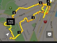
Walk was around 9 km.

We would like to thank everyone for their keen participation for an enjoyable day out.
Bruce and Jenni.

Note: Toilets on this walk are few and far between. If you want the Oval toilets open, you need to organise this with the DCC – www.dunedin.govt.nz/do-it-online/book/facility-bookings or phone 477 4000. The ones in the Exchange area where the ACC building is being erected, are no longer available.


9. 16/02/2022. Hikers. Town Belt Circuit. M. Leaders Linda Partridge and Diane Paterson

Thirteen keen hikers met at Woodhaugh Gardens for morning tea before setting off on a circuit of the northern/central part of the town belt.

16 Feb Woodhaugh Gardens morning tea Ady resize

Morning tea at Woodhaugh Gardens (photo & caption Ady)

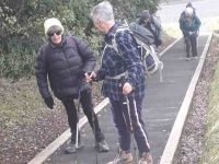
We began by taking the zigzag path and steps up from Duke Street. When we reached Queen and Warrender streets, after our first ascent, we viewed the university in the distance and saw up close where many of the students lived in their hillside flats. We met some students from Auckland moving into their new abode and friendly banter ensued between the students and the sprightly TRTC hikers. We also marvelled at the parking arrangements in these narrow steep streets.

16 Feb More steps Diane resize

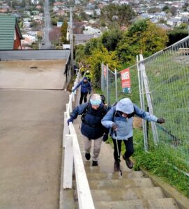
More steps! (photo & caption Diane)

We continued on to Cosy Dell and took time to view the tennis courts and the array of historic homes, many now flats that are located in a small area.

16 Feb Street walkers Raewyn

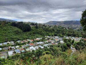
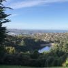
Great views of the city along the way (photo & caption Raewyn)

16 Feb Betty on scooter Linda resize

Betty keen for something different! (photo & caption Linda)

16 Feb Freddy Mercury Raewyn

‘Queen’ Freddie Mercury on Queen Street (photo & caption Raewyn)

More steps (and groans) and we made our way along Park Street to Heriot Row, London Street and then around by Moana Pool to our lunch spot at Olveston.

Unfortunately we felt we were a little early for lunch so low and behold another set of steps were located and we climbed up to Wallace Street and then found a pleasant route back down to Olveston for a well-earned lunch.

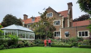
16 Feb Olveston lunch Ady resize

Lunch at Olveston (photo & caption Ady)

After lunch and a brief look at the lovely Olveston gardens our route back took us along streets and tracks through the town belt until we regrouped at Stonelaw Terrace. Given we were making good time we did a detour down Cannington Road and Braeview Crescent before descending on the historic Bullock Track to our cars at Woodhaugh Gardens.

16 Feb Looking to NE Valley Ady resize

View of the Leith Valley (photo & caption Ady)

It was a great day with lots of interest including history, panoramic views, friendly students, the very special Green Belt and a few laughs along the way. The circuit we took was around 9kms.

Afternoon tea was enjoyed at the café in the Botanic Gardens.

Linda and Diane


8. 11/9/2019. Hikers. Town Belt- walk, bus trip. Leaders: Pam and Jenny.
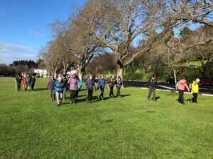
B.1. Morning tea at Dunedin City Petanque. No shorrage of seating, perfectly sheltered from any breezec

B.1. Morning tea at Dunedin City Petanque. No shorrage of seating, perfectly sheltered from any breeze. (Barbara pic and caption.)

B.3. Playtime for a youngster! c

Playtime for a youngster! (Barbara pic and caption.)

B.4.Lunch time at Olvestonc

Lunch time at Olveston. (Barbara pic and caption.)

B.64. Lesson on tackling step before teacher heads actoss the ditch!c

Lesson on tackling step before teacher heads actoss the ditch! (Barbara pic and caption.)

Continue Reading »

No responses yet

Aug 23 1988

Wikipedia Town Belt article

Published by under Uncategorized

The Town Belt is a green belt which surrounds the centre of the New Zealand city of Dunedin. Covering a total of over 200 hectares (490 acres), it extends around three sides of the city’s centre at a distance from it of some 1-3 km (1-2 mi) in a broad 7 km (4 mi) crescent from the Oval at Kensington in the south through the suburbs of Mornington, City Rise, Belleknowes, Roslyn, Maori Hill, Prospect Park, Glenleith, Woodhaugh, The Gardens and Dunedin North and the slopes of Signal Hill. The fourth side of the central city is bounded by the Otago Harbour.

One of the world’s oldest green belts, the Town Belt was planned in Scotland at the time of the advent of the Otago settlement in 1848.[1] Residential areas outside the belt became separate boroughs, and were not amalgamated with Dunedin until much later. The town belt now forms a break between the city’s inner and outer suburbs. The belt was originally a combination of native bush and scrubland, but is now largely replanted forest and open parkland. Many species of plant can be found in the belt, including tree fuchsia, lemonwood, lancewood, manuka, and broadleaf, and the forested area is home to many species of birds, including some uncommon and endangered species such as the kereru, eastern rosella, bellbird, tomtit, tui, rifleman, morepork, and shining cuckoo, and kotare.

A long, narrow road, Queens Drive, winds along much of the length of the belt and provides easy access to it for Dunedinites. Queens Drive is linked to many of the city’s main streets, including Stuart Street and High Street. Numerous walkways lead through the bush and parks, and the belt is a popular recreation area for Dunedinites.

The Town Belt includes many open areas and parks, including the Kensington Oval, Dunedin Southern Cemetery, Montecillo Ground, Unity Park, Mornington Ground, Jubilee Park, Belleknowes Golf Course, Robin Hood Park, Littlebourne Ground, Prospect Park, Woodhaugh Gardens, the North Ground, Dunedin Botanic Gardens, Dunedin Northern Cemetery, Logan Park, and the University Oval.

Notable buildings and structures in the belt include Moana Pool, Olveston, Otago Boys’ High School, and the Beverly-Begg Observatory.

No responses yet

Aug 23 1988

Town Belt Article

Published by under Uncategorized

The Town Belt is a green belt which surrounds the centre of the New Zealand city of Dunedin. Covering a total of over 200 hectares (490 acres), it extends around three sides of the city’s centre at a distance from it of some 1-3 km (1-2 mi) in a broad 7 km (4 mi) crescent from the Oval at Kensington in the south through the suburbs of Mornington, City Rise, Belleknowes, Roslyn, Maori Hill, Prospect Park, Glenleith, Woodhaugh, The Gardens and Dunedin North and the slopes of Signal Hill. The fourth side of the central city is bounded by the Otago Harbour.

One of the world’s oldest green belts, the Town Belt was planned in Scotland at the time of the advent of the Otago settlement in 1848.[1] Residential areas outside the belt became separate boroughs, and were not amalgamated with Dunedin until much later. The town belt now forms a break between the city’s inner and outer suburbs. The belt was originally a combination of native bush and scrubland, but is now largely replanted forest and open parkland. Many species of plant can be found in the belt, including tree fuchsia, lemonwood, lancewood, manuka, and broadleaf, and the forested area is home to many species of birds, including some uncommon and endangered species such as the kereru, eastern rosella, bellbird, tomtit, tui, rifleman, morepork, and shining cuckoo, and kotare.

A long, narrow road, Queens Drive, winds along much of the length of the belt and provides easy access to it for Dunedinites. Queens Drive is linked to many of the city’s main streets, including Stuart Street and High Street. Numerous walkways lead through the bush and parks, and the belt is a popular recreation area for Dunedinites.

The Town Belt includes many open areas and parks, including the Kensington Oval, Dunedin Southern Cemetery, Montecillo Ground, Unity Park, Mornington Ground, Jubilee Park, Belleknowes Golf Course, Robin Hood Park, Littlebourne Ground, Prospect Park, Woodhaugh Gardens, the North Ground, Dunedin Botanic Gardens, Dunedin Northern Cemetery, Logan Park, and the University Oval.

Notable buildings and structures in the belt include Moana Pool, Olveston, Otago Boys’ High School, and the Beverly-Begg Observatory.

– From Wikipedia.

No responses yet

May 18 2024

Upcoming Trips

Published by under Both Hikers & Trampers

Link to Trip Organisation Guidelines for leaders and trip participants.
Link to Track Grading information.
Link to Copy of Trip Programme for printing.
Gradings are provisional and may change following recce. Distances are for road travel from Mosgiel car park. Costs may change with fuel price fluctuations and distance changes. This page has all current updates.
Last updated 7/04/2024.


Wednesday 22 May.
Trampers. Glenfalloch MacAndrew Bay to Boulder Beach and Return. Grade 3.5. $7. 24 km. Leaders: Pam Cocks, Gwenda Farqharson.
Hikers. Burkes to Port Chalmers. Grade 2. $7. 25 km. Leaders: Mike Webb, Max Wilson.


Wednesday 29 May.
Trampers. Graham’s Bush, Organ Pipes, Buttars Peak, Mt Cargill. Grade 4. $8. 29 km. Leaders: Gail Williams, Karen McInnes.
Hikers. Future Forest Project Working Bee. Grade 2.5. $8. 30 km. Leaders: Jenny Flack, Jenni Wright.


**** Change to Winter Start Times ****

Meeting time at the car park,  June to end August, is 9.15 a.m. for 9.30 a.m. prompt departure.


Wednesday 5 June.
Combined. Town Belt. Grade 2. $5. 18 km (distance PJP to Woodhaugh Gardens). Leaders: Carol Thurlow, Julie MacKenzie, Linda Partridge, Diane Paterson .

Continue Reading »

No responses yet

May 17 2024

Ross Creek and environs

No. 94 on old hardcopy list of 113 club tramps. “Ross Creek – McGlashan College Year Round” 17 km from car park.


34. 15/05/2024 Ross Creek/ McGouns Track Grade: 2.5  Leaders: Pam and Jay

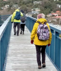
Square 100On a fabulous autumn Day 25 keen walkers parked in Booth Road which is at the bottom of the Pineapple Track.


Continue Reading »

No responses yet

Aug 13 2023

Mornington Ramble

Published by under Hikers

7. 9/08/2023. Hikers. Mornington. Grade 2, $5, 18km, Leaders: Ady Whitson, Pam Clough.

Meeting at PJ Park we decided to go ahead with our hike. We decided to park further up Mornington Road which turned out not to be far enough up. Down Elgin Road we went, all 13 of us, and down the steps ending up at the steps at Caversham Valley Road. Morning tea we had on the steps that looked along Main South Road.

202308_09102210 Phil Res 1600

Morning tea (photo and caption Phil)

It was here two departed to return home as somebody had forgotten their pack and it was very cold.
We started off along Barnes Drive at a reasonable pace as I thought the weather might turn on us…

20230809_104018 Helen Res 1200

Pond by Southern Motorway (photo and caption Helen)

20230809_103413 Phil Res 1000

Walking the overbridge (photo and caption Phil)

20230809_1058scotsmen Phil Res 1400

A scotsman’s fence, near the ‘auld’ scotsmans terrace (photo and caption Phil)

…up Glen Road and turned up steps to end up in Carson Road. From there we travelled up Cooper St with a few stops here and there for a breather.

20230809_110404 Phil Res 1200

A bit of up (photo and caption Phil)

Turning right into Glenpark Avenue I put a fast clip on as the weather was probably going to turn at about 11am. Another set of steps up to Mornington…

20230809_112524 Phil 1200

And up 152 more steps (photo and caption Phil)

…and just at the top the weather did change completely. After a quick conflab, it was off to the Mornington Tavern for a warm up and a coffee.

20230809_114429 Helen Res 1600

(photo by Helen)

20230809_121309 Helen Res 1600

A+ menacing ‘front row’? (photo by Helen, caption by Phil)

We left about 12.15pm to head back to the cars and this was where I decided we had parked the cars far too far down Mornington Road as the weather really turned to custard. Home by 1.15pm.
We did have lots of laughs and Lynley was the only one from Trampers to show up (I don’t think she read the email in the morning and I didn’t let on I hadn’t either).
Like I’ve said before, don’t put me in charge as it is always wet when I’m at the front. Thank you Pam for all the help as I have no idea round some of those streets.
Cheers Ady. Continue Reading »

No responses yet

Jul 08 2021

Midwinter Street Walk. Street art.

Published by under Midwinter Dinners,Uncategorized

4. 7/7/2021. All. Street Art followed by Mid Winter lunch at the Wharf Hotel.  Leaders Chris, Gwenda, Clive and Faye

12 Hikers and 24 Trampers met at the Wharf Hotel for Street Art walks around Dunedin.

The trampers headed off to the Vogel Street area and take away drinks from Heritage Coffee in Jetty Street.

They then made their wandering way, via Moray Place and Bath Street, to the University area.

Stunning colours

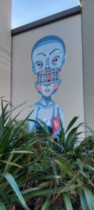
Stunning colours (photo and caption Helen)

More bright colours

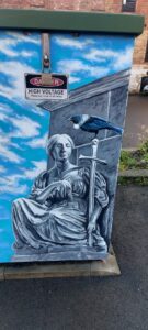
More bright colours (photo and caption Helen)

Love the tui

Love the tui (photo and caption Helen)

There was time to view the University Library’s Colin McCahon painting “Waterfall Theme and Variations”,

Painting at the OU library

Painting at the Otago University Library (photo and caption Helen)

the Castle Street Lecture Theatre’s wonderful mural and

Students at OU

Students at Otago University (photo and caption Helen)

some of the campus sculptures before returning via the rail bridge.

Group at OU

The group on Otago University campus (photo and caption Helen)

The hikers headed to the downtown area over the rail bridge before making their way back to the Wharf Hotel via the Vogel Street area. Morning tea was enjoyed midway at the Vanguard Café on Princes Street.

Jill Dodd and Jay organised a lovely mid-winter lunch to follow which was enjoyed by 50 members of the club at the Wharf Hotel.  There we also enjoyed a great slideshow of photos from trips over the last 6 months, put together by Clive and John.

Lunch

Lunch at the Wharf Hotel (photo Chris)

Chris

3. 3/7/2019. All. Midwinter Street Art walk and lunch. Leaders: Clive and Heather.

C.2) Some were smallc

Some were small. (Clive pic and caption.)

C.3) There was a lot to see at 76 Vogel Streetc

There was a lot to see at 76 Vogel Street. (Clive pic and caption.)

H.2c

(Helen pic.)

H.4c

(Helen pic.)

H.5c

(Helen pic.)

H.6c

(Helen pic.)

H.8c

(Helen pic.)

H.9c

(Helen pic.)

C.4) Lunch at The Wharf Hotelc

Lunch at The Wharf Hotel. (Clive pic and caption.)

2. 6/7/2016. All. Street Art Walk. Mid-Winter Lunch. E. Leaders: Bev, Judy and Alex.
31 members gathered at the Wharf Hotel car park and set out for a fascinating walk around Dunedin streets, viewing some of the amazing street art adorning our buildings’ walls.
First stop was just along the foreshore where mulled wine was served, (courtesy of Elaine and Judy), really hitting the spot on a coldish morning.  Then it was up and across the over-bridge to Jetty Street, to Princes St and Manse St.  The back entrance to the Scenic Hotel provided a look at the spectacular Cloud Catcher mural.

Cloud Catcher

Cloud Catcher. Oops Just cut “the catch” off. Dash!

We did wonder just how the artist managed to hang up there to do this amazing work.
A short puff up Rattray St, to Dowling St and then up to Tennyson St,

View

Got “the catch”! but too far away really. City view from bottom of Tennyson Street.

down View St (glad it wasn’t up), across Moray Place, through the car park and along the alleyway to the Octagon.  This alleyway is full of excellent art work, well worth browsing through.  From here it was around the Octagon, down Stuart St, and along to Queens Gardens, before crossing  to Vogel St again, and over the bridge back to the Wharf just after midday.  Thank you Bev for organising this and turning out in spite of a miserable head cold.
Here we found the rest of the crew gathered, raising the number to 62, a great turn out.  It was pleasing to see so many ‘senior’ members in attendance.
After birthday greetings to Margaret and Adrienne, Judy ran a short quiz, testing observational skills from the walk.  Thanks to Eric for his help, and for the chocolates donated.  Judy then read her ‘Ode to the Club’.  (Attached [at the bottom of the Club’s History page] if you want to read it for yourselves!).
Congratulations and thanks to the hotel staff, who took orders and prepared and delivered meals so efficiently and promptly.  This was much appreciated – the blue cod was great!  While some indulged in dessert, the ‘Four Jolly Tramping Mates’ presented two songs, ably led by Bruce.
Thanks boys, you did well!

The boys. (Adrienne pic.)

The Mates/boys. (Adrienne pic.)

All in all this was a really successful day, with everyone relaxed and happy, enjoying the food, the company and  the entertainment. – Judy and Bev.

1. 15/7/2015. Hikers. Street Art Street Walk. E. Leaders: Lance and Lois.

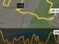
iPhoto GPS of route

iPhoto GPS of route

It was another of the Lance and Lois’ well-planned, well-commentated walks. We surprised them with our large group, numbering 31, crowding up at street corners and filling pedestrian crossings, but they coped. Beginning at Unity Park lookout, we first walked down Eglington Road to the former Montecillo property being developed for new housing. Lance told us the driveway in was a solid  8 inches thick concrete slab!) We then returned out to walk down through the Town Belt by way of of the ‘Steep Street’ track, stopping on a grassy slope…


Morning Tea stop

Morning Tea stop

…for morning tea just above the zig-zag steps.

The steps are of those awkward sloping kind, enforcing either a stretched stride or two tiny ones per step. Anyway we arrived a bit up Maitland Street above Carroll St, to enter an unobtrusive lane that led into a large centre-of-the-block grassy area that led us diagonally through to Stafford St. Having enjoyed this delightful mid-block section,  we turned down Melville St to Carroll St to view the former St Andrews Church. Lance had already prepared us at our morning tea for this visit. He had told us of Rutherford Waddell’s greatest sermon of all time at this church  on the ‘sin of cheapness’, where the Minister had declaimed against the sweated labour of the Dunedin seamstresses of the time, a clarion call that was to bring about far-reaching legislation reform of working conditions. So we viewed the historic church which has in more recent times been used by the Word of Life Pentecostals, and since 2001 by the Coptic Orthodox Church. We rounded the large old Bell Tea Co building corner into Hope St and up again to Stafford St to walk down it to our first street art, the Haast Eagle.

Haast Eagle

Chinese artist DALEast represents New Zealand’s extinct Haast Eagle and is reflective of his unique style which presents the frenetic shape of animals and people as if they have been constructed out of shards of metal. On Stafford St

We continued down and across to the corner of Princes and Jetty streets to view the “Riding Dreams” mural.

Boy on horse

“Riding Dreams” by Pixel Pancho demonstrates a complex interweaving of the human form, flora, and metal to create the surreal image of a ‘not quite human’ boy riding a fantastical metal horse reflecting his fascination with 1950s robots.

Around the corner, “Love is in the air” on Bond St was delightful.

Love is in the air

Polish artist Natalia Rak’s mural entitled “Love is in the air” is characteristic of her cheeky, playful and hyper-realistic  style and reflects her passion for bold colours.

I could go on. We went hither and thither, as you can perceive from he route map, far too much to list here. This reporter can recommend such a stop-go walk, studying buildings, renovated and old, treading pavements some, no doubt we had never planted foot on before.

Just two more ‘works of art’ now, and lunch at First Church before heading back up the hill.

First the waka and steam-punk submarines exiting a fish’s mouth. (Quietly: But aren’t the sails billowing backwards?)

waka and fish

Maori waka and a steam-punk like submarine emerge from a fish’s mouth in this piece by Phlegm. On Vogel St.

Our lunch at First Church.

IMG_2775Lunch

Panorama of lunch on seats in First Church grounds.

And finally, an art work in Rattray St.

"Chasing the Thin White Cloud"

“Chasing the Thin White Cloud” , three stories high is the largest work to date of Fintan Magee.

Then up Maclaggan St and High Street and back to the cars.

Thanks to Lance and Lois for a carefully thought out day.- Ian

(Grateful acknowledgement to Dunedin Street Art Trail information.)


No responses yet

Dec 07 2016

Street Walk: Belleknowes

Published by under Uncategorized

7/12/2016. Belleknowes. E. Leaders: Lester and Peter B.

Route Map, Belleknowes, courtesy Ian.

Route Map, Belleknowes, courtesy Ian. 15 Hikers. York Pl, Town Belt, Alison Cr, Michie St, Bellevue St, Hart St, Highgate, Cuppa, Delta St, Beta St, Epsilon St, Gamma St, Beta St, Accessway, Belgrave Cr,Highgate, Falcon St. lunch in playground park, Highgate, Kilgour St, Leven St, Braid St,York St. Coffee at Green Island.

The walk was short but far from lacking in interest. First surprise was at the bend at the extreme top corner of York Place where it turns sharply down into Russell Street. Behold, a path through the Town Belt, leading across Queens Drive into Alison Crescent. Here on our right was a gully of seriously shaded houses each reachable only by a wooden bridge across the ditch.

Further on. Houses in the Greek-letter-named streets of Delta, Beta, Epsilon and Gamma (where was Alpha?) were notable for well-maintained three and four groupings of identical designs, (one group even with finials), and strikingly, as the street curved around, so did the house alignments, parlours strictly front-facing, regardless of where the sun struck them. Of course nothing new, but made obvious by the similar wooden buildings.

An interesting Accessway between Delta Street and Belleview Crescent was new to us. Knowledgeable ones among us said this was part of an old cable car route.

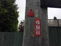
Red ticketed power pole. (Ian pic and caption.)

Red ticketed power pole. (One of two supporting large transformer.) Corner of the Accessway. (Ian pic and caption.)

We lunched early (11.20 a.m!) in a light drizzle in a hidden playground reserve off Falcon Street. It had the longest stainless steel slide down a steep slope the writer has seen. How on earth was present day Health and Safety permission for it obtained, one wonders. Sadly it was far too wet on this occasion for any of us to give it a go.

We were struck by some grand house and gardens along Highgate. Lester pointed out where the original owners had built houses for their servants down a side street. In one case, (Kilgour St?), built as they were on a steep falling away slope, they required small bridges from street path to front door. Goodness only knows what Health and Safety requirements (as too in the Alison Street bridges) they would be obliged to meet today. One couldn’t help reflecting today on the contrast between our own land-owning gentry class, of which we are part, and that of the thousands of New Zealanders unable to access even basic decent accommodation, with winter on the horizon.

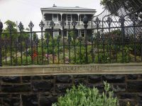
House. (Ian pic and caption.)

Renfrew House, Highgate. (Ian pic and caption.)

House and garden. (Ian pic and caption.)

Lovely house and garden. Leven St. (Ian pic and caption.)

Anyway, enough of that. An interesting return trip down Braid Street through an extensive bit of the Town Belt soon got us back to the cars.

As noted at the beginning of the report, the ‘tramp’ was short but full of previously unexplored interesting gems. Our thanks to Lester and Peter for searching it out. – Ian.

No responses yet

Dec 12 1980

Pineapple and Flagstaff Walk

No. 31 on old hardcopy list of 113 club tramps. “Pineapple Track – Swampy Summit. Year Round”

The hills around Dunedin are superb viewpoints to see the city, coastline and ranges of inland Otago. Flagstaff is one such hill and like Mt Cargill to the north allows the walker to pass through several types of vegetation en route to the summit.

Most of the features seen from the walk have strong historic significance. Beyond Signal Hill, the site of Otakou can be seen. When the first European settlers arrived, this Maori settlement was the largest in the region. In 1817 this ‘kaika’ contained 600 very “fine houses, neatly furnished”. From 1833-1841, a whaling station was operating from here. The whalers’ township, known as Musselburgh was nearer the heads. By 1840, 250 Europeans were living around the harbour entrance. It was from Otakou that the earliest immigrants received their first supplies of fresh meat, milk, butter and vegetables. The region south to the Nuggets and inland by the Clutha to as far as the Lammerlaw Range and West Taieri was bought for European settlement of $4,800.

Almost immediately apparent from the walk is the distinctive layout of the centre of the centre of Dunedin. Charles Kettle and a party of surveyors laid out the streets in 1848, using the special features of the Scottish capital, Edinburgh as a guide. The planned settlement took its name in 1845 from the Highlander’s name for Edinburgh. The town belt, the ribbon of bush threading its way through the suburbs, cutting off the inner city from the suburbs also dates from the early surveys. Immigrants were offered land packages on or before their arrival in Otago. Each consisted of a 1/4 acre (1012 sq m) town allotment, a 10 acre 4 hectare) suburban allotment, and a 50 acre (20 hectare) rural allotment, all sold at the rate of £2 an acre ($9.60) a hectare). The town belt separated the town and suburban allotments. Most rural blocks were on the Taieri Plains.

Kettle’s name was given to Flagstaff Hill, but through common usage the term Flagstaff became accepted and superseded Mt Kettle.

As early as 1925 there was skiing on Swampy Hill and Flagstaff. Sixteen years later an exceptionally heavy snowfall convinced many of the return of very cold winters. Many Otago skiers spent several weekends clearing the hillside of stones and boulders but unfortunately for them the snow never came back.

In these early days of settlement the forests all but cut off Dunedin to the north. Long before a road was made around Mt Cargill, the track known as ‘Johnny Jones’ (the Waikouaiti whaler) track linked the Dunedin area with Waitati via Flagstaff and Swampy. In 1859 snow poles were put up along the track to guide travellers caught out in storm or mist.

A road was made between Whare Flat along the inland flank of the hill to near the saddle between Flagstaff and Swampy Hill in 1870. The settlers at Whare Flat used it to draw their supplies of timber from the bush on the other side of Flagstaff. In later years these old roads fell out of use.

The settlers, utilising a number of small sawmills, ‘cut-out’ much of the bush on the eastern flank of Swampy Hill and Flagstaff. The Pineapple Track at the northern end of Flagstaff passes through such ‘cutover’ forest. From here podocarps were milled to provide local building materials. Only an occasional remnant podocarp remains. Mahoe (whitey wood) is plentiful here while on the forest floor and tree trunks, many species of fern abound. The upper part of the track here includes totara saplings and old stunted broadleafs with twisted limbs, growing in a slightly drier soil. Hounds tongue and “hen and chicken” type ferns hang from the dead tree trunks.

The tussock on the part of the walk from the Whare Flat Road car park (known as the ‘Bullring’) is being taken over by native scrub: flax, manuka and the occasional Olearia – although these get knocked back by fires from time to time. Native orchids are common here, especially in early summer. Skylarks can be heard on this hill from sunrise to sunset.

The summit: An unobtrusive plane table helps point out the many interesting places which can be seen from here. To the north you can see the higher hill of Swampy with its buildings from aviation and scientific experiments, and to its east is Mt Cargill, topped by a TV transmitter. Further away is the city and the drowned valley of Otago Harbour with the Peninsula beyond and the sand dune suburbs of St Clair and St Kilda connecting this with the mainland.

Turning northwards, the track crosses the tussock-covered scenic reserve beyond the summit. In spring and summer, orchids and violets can be seen between the snow tussock. Boulders of volcanic rock are scattered over the hill top, some of which are clustered in lines of ‘stone stripes’ down the hillside.

The tussock grassland now largely covering the summit and upper slopes is only 2-300 years old. Before this , forest covered the entire area. Periodic fires have encouraged the tussock grassland. Snow tussock, mountain flax and Astolia are the most common native plants, while manuka is encroaching into the grassland that fire has not recently reached.

Once into the bush, the track drops through regenerating shrub-land from the signpost at the top of the Pineapple Walk. It was near this spot that in the 1920s a well-known grocer and tramper guiding parties to see the views would pause, and pass around a tin of pineapple. It became a tradition that once empty the tin would be left on a tree or fence post – giving the track the name.

From clearings on this track can be seen Ross Creek Reservoir and the city beyond, also the Mt Cargill television transmitter and the northern side of Leith Valley. Many shrubs are invading clearings from the bush edge. Fuchsia and pepperwood are common. Grazing has determined the nature of this vegetation with only the unpalatable species surviving.

The Booth Road water treatment station sits in a clearing of ornamental plants. A small round concrete tank in the pines on the left of the track halfway down  from this station is also part of the water supply scheme built before the 1950s. A tap near the edge of the bush gives cool refreshing water to the walker on his or her return.

At the Booth Road end of the walkway, the track passes through the Dunedin City Council exotic plantation. Spruce, ash, radiata pine and Douglas fir were planted over 30 years ago as part of growth experiments with these species in the area.

– From DoC hard copy information sheet.

One response so far

Dec 11 1980

Dunedin’s Water Supply

The first settlers drew their water from the creeks and springs in the area below the Town Belt, the principal sources being the Maclaggan Street, London Street and Regent Road creeks. In 1860 the Town Board tapped a spring in High Street and erected a public pump at the Manse Street corner. Continue Reading »

No responses yet

May 04 2024

Pyramids, Victory Beach

No. 48 on old hardcopy list of 113 club tramps. “Pyramids & Beach Area. (Victory Beach) Beach Walk only. Year Round”
Location: 38 km from car park.

Topo of Area


Off To Egypt (1)30. 1/05/2024. Combined. Pyramids/Victory Beach. Grade 2.5. Leaders Jenny, Alison, Wendy and Alex

A great turn out for my first time as a co leader with Alison, Wendy, Alex and John. We had a combined group of 30 trampers and hikers. Continue Reading »

2 responses so far

May 03 2024

Track Clearing

Published by under Track-clearing

Upper Swinespur (2)27. 2/05/2024. Track clearing. Leader Phil Keene

Autumn is moving along, colours are fading, the tracks were wet and muddy, aided by some impressive pig work but the team were not defeated and completed a full day’s work on McQuilkans. Continue Reading »

2 responses so far

Apr 09 2024

Sandymount – Sandfly Bay

No. 24 on old hardcopy list of 113 club tramps. “Lovers Leap – The Chasm – Sandfly Bay. N Strang. Farm. Year Round.” No. 73 on old hardcopy list of 113 club tramps. “Sandymount – Lovers Leap. Year Round”.
29 km from car-park.
See Sandymount for area background information.
Sandymount closed for lambing Aug-Oct. Track unformed in places, grassy, slippery when wet.
(See also article on pingao planting.)


Resized Square25. 27/03/2024. Hikers.  Sandymount Grade 2.5 Leaders: Jenni and Bruce Wright
Today was all about preparedness. The elements indicated that those who ventured out were hardy souls.

Continue Reading »

One response so far

Dec 09 2023

Middlemarch Area Tramps

Published by under Uncategorized

Information
Rock and Pillar via Six Mile Creek This climbs 1,005 m. (3300 feet) up the eastern face from Glencreag Station up a leading ridge south of Six Mile Creek. This is the most direct approach.
Rock and Pillar via spur south of Lug Creek. Information: Climbs 910 m. (3000 feet) up the eastern face of a well-graded vehicle track up a leading spur south of Lug Creek. Average time to Leaning Lodge is 3 hours on foot.
DoC access. 9.5km north of the Middlemarch store on SH87, just before Lug Creek, is a farm entrance (RAPID 7219 – no DoC sign). A short way up the driveway is a DoC car park. There is public access up the vehicle track to the conservation area boundary. The track is now a recreation reserve administered by DoC.
Easiest route to Big Hut from Leaning Lodge (foot only – unmarked – good visibility essential) is another 45+ minutes climbing gently southwards to cross a steep gully and then climb a gentle shelf to above the eastern basins. Sidle several hundred metres past the lower prominent rock tors before gently descending to Big Hut once it becomes visible. Route very wind and cloud-prone. Ice axe and crampons may be necessary to traverse steep snow slopes near Leaning Lodge.
64 km to Middlemarch. 66 km to Stonehurst Track.
Redan Crater- contact for access Ken Rennick.


Sutton Salt Lake Katrina Square13. 06/12/2023. Hikers. Sutton Salt Lake – Glencreag Track. Grade 2.5. $16. 60km. Leaders: Wendy Langley/Katrina McKenzie

17 of us headed to Sutton where we walked the Sutton Lake loop. Continue Reading »

No responses yet

Oct 15 2023

Chrystalls Beach, Toko Mouth

No. 47 on old hardcopy list of 113 club tramps. “Toko Beach. M Young”; also No. 65 on old hardcopy list of 113 club tramps. “Chrystalls Beach Farm”. Location: 59 km from the car park. Best in Summer. The stock winter over.
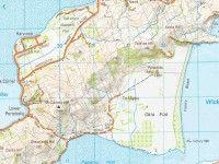
Directions: On SH1, before Milton, at Helensbrook intersection, left onto Forsyth Road, right onto Back Road, left onto Glenledi Road.


22. 11/10/2023. Trampers. Crystalls Beach. Grade 2.5, $15, 59km, Leaders: Dave Roberts, Jill Reid
IMG_7384 100x100A fine overcast morning greeted us at Peter Johnstone Park with 19 trampers in 5 cars beginning our tramp at 10am. Continue Reading »

No responses yet

Next »