
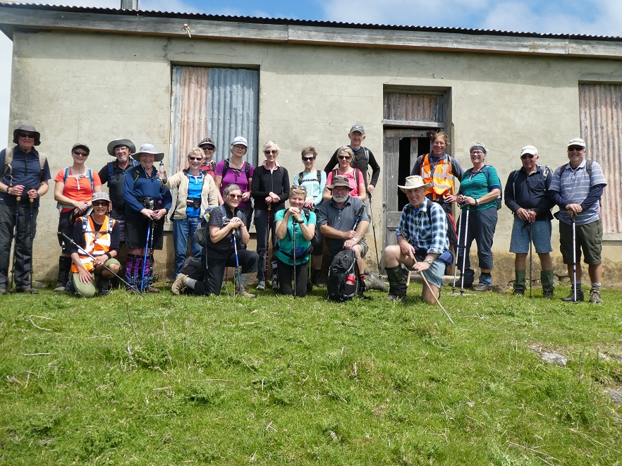
No. 86 on old hardcopy list of 113 club tramps. “Heyward Point – Melville’s Farm Farm”. 40 km from car park.
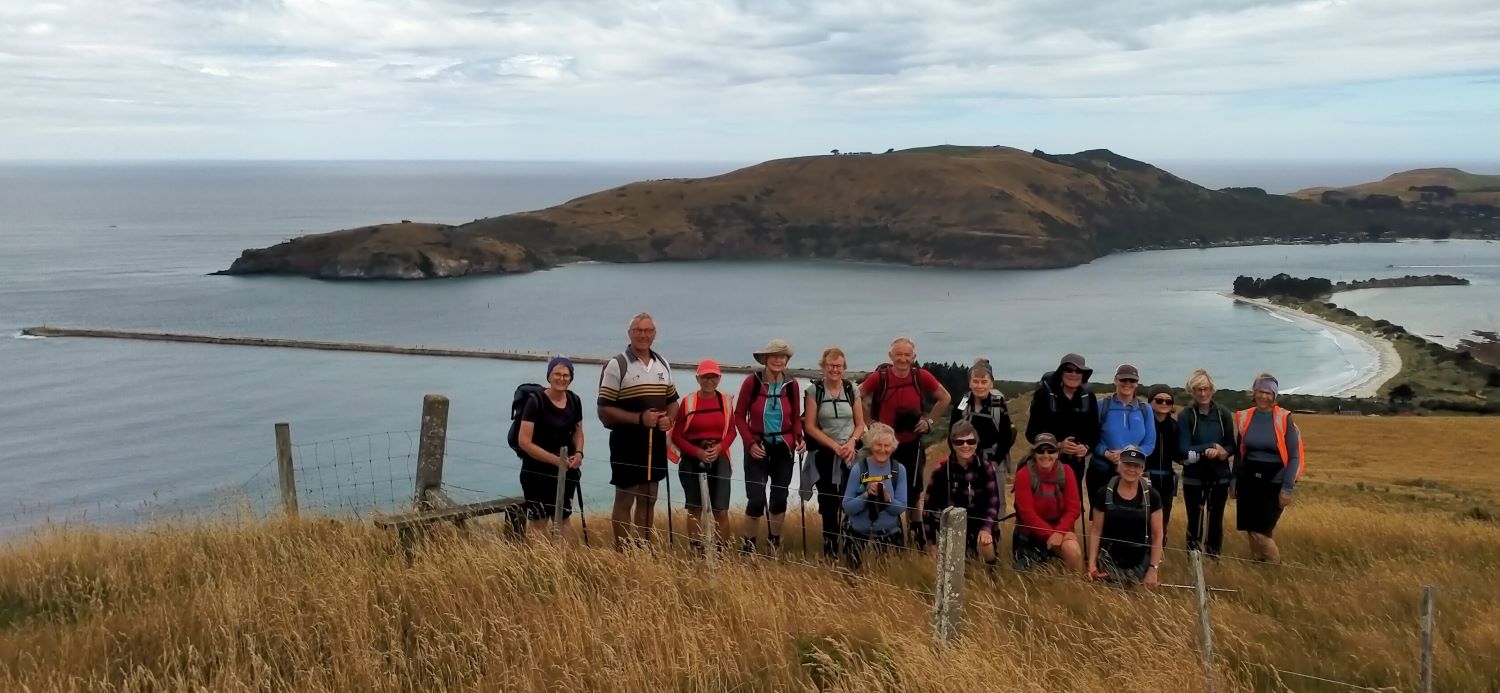
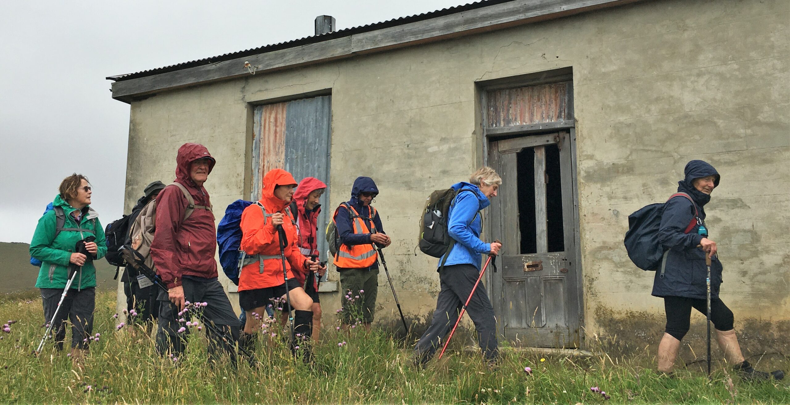
 Hikers: Leaders Heather and Val Cayford
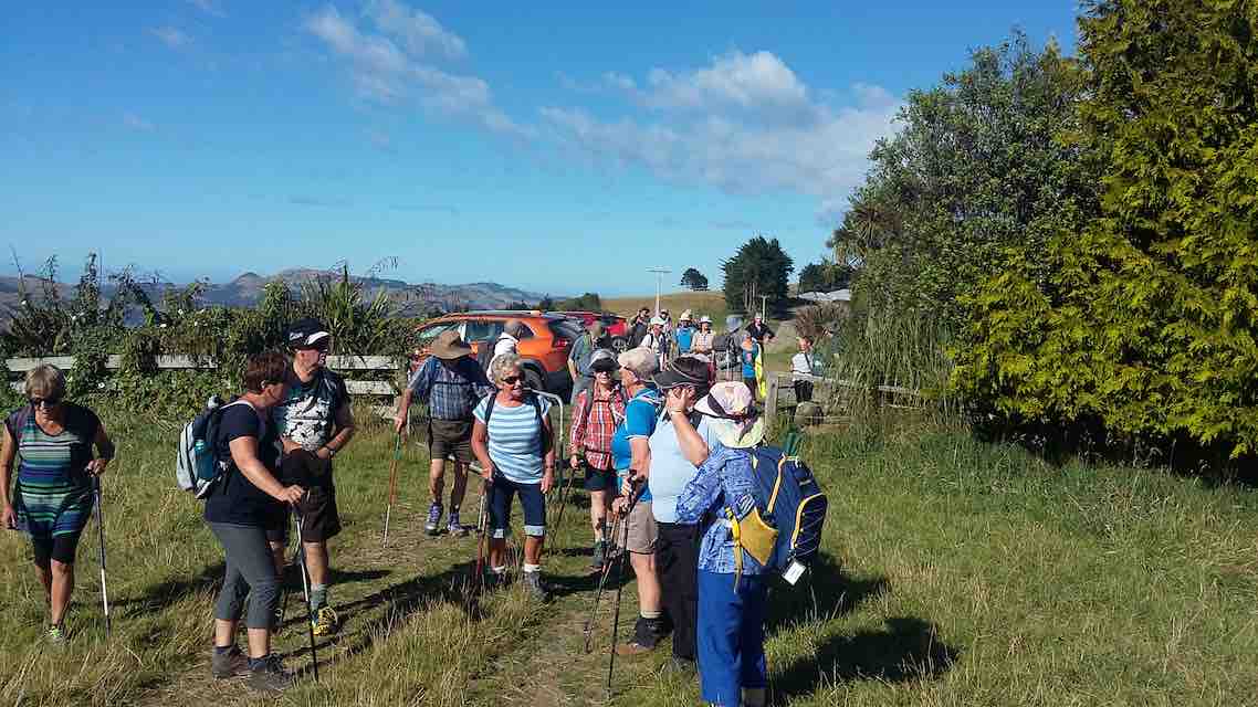
‘Pathway to the Sea” – 7th February 2024 at 8.45am on a grey overcast morning with slight drizzle 15 hikers left Peter Johnstone Park and arrived at the small coastal settlement of Aramoana at approx. 9.45am – a peaceful place with 260 permanent residences as of 27th January 2024.A place that takes you back in time – a place with no streetlights or shops – a place with history and a place of tragedy – a place of many wildlife species – native New Zealand sea lions – yellow eyed penguins nest near the beach past the key hole rock – the salt marsh is a special wildlife reserve.
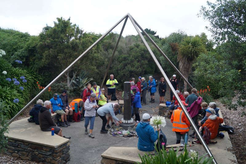
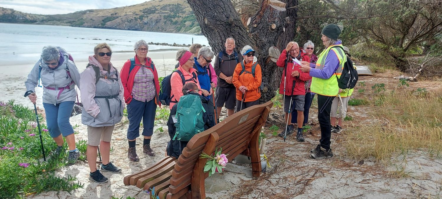
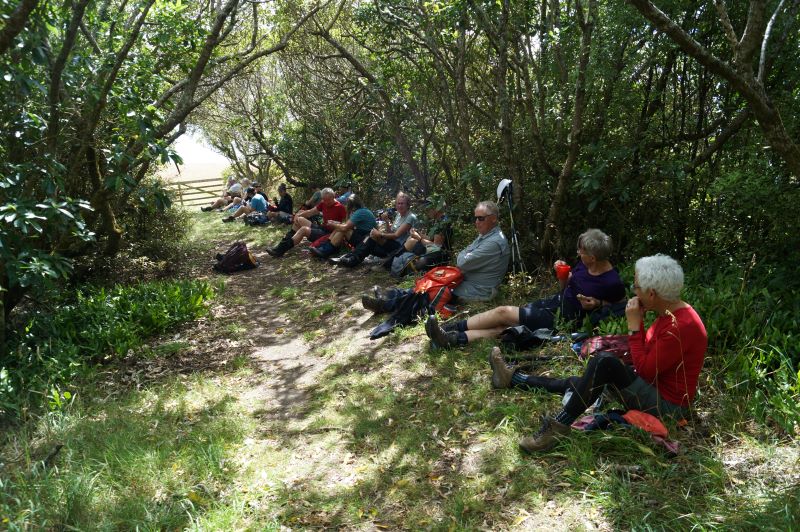
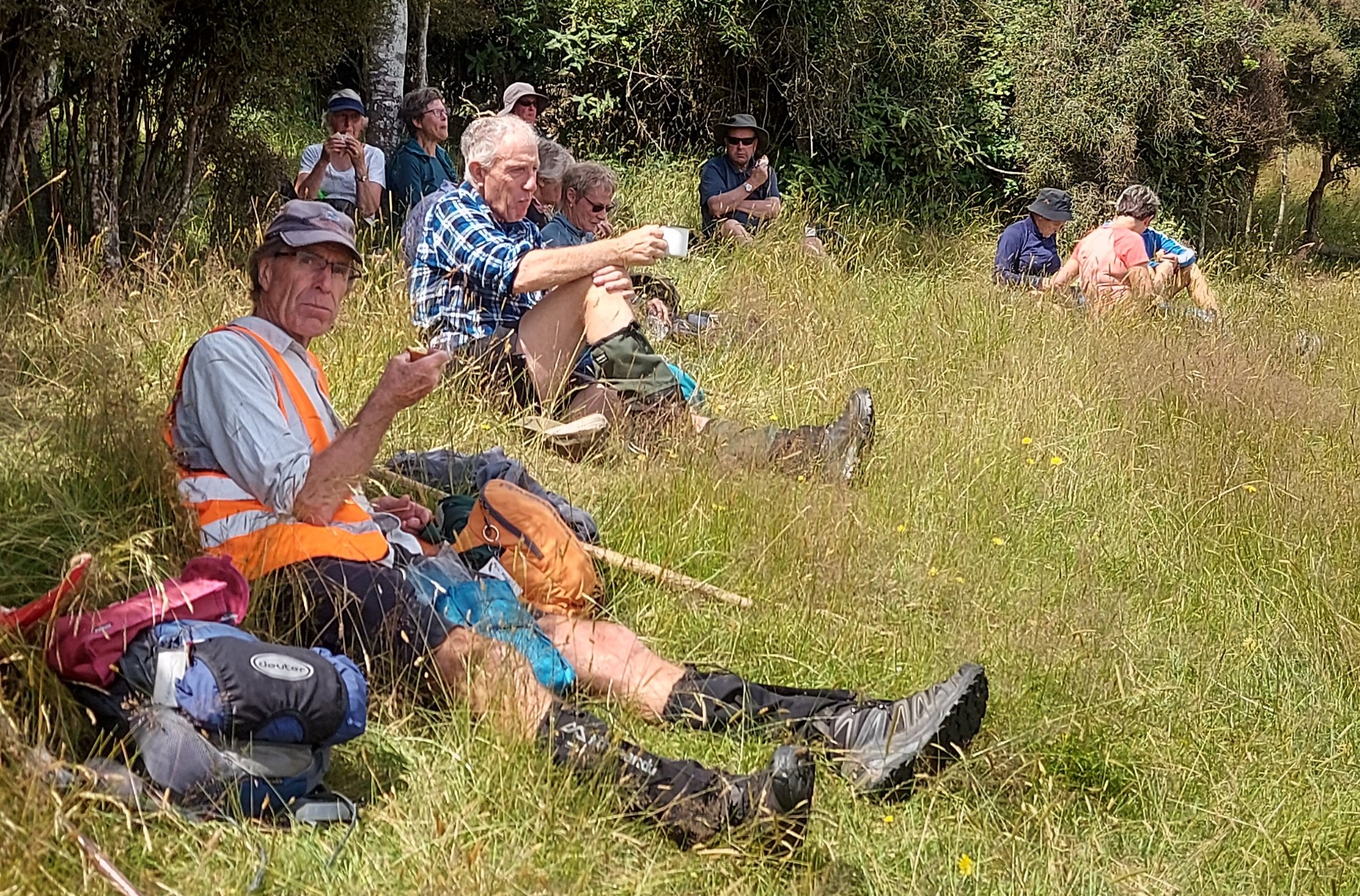
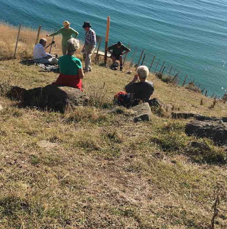
Though fine here it was quite windy. The trampers joined us for morning tea – we were going to have it on the beach however due to the wind factor we decided to have morning tea at the Aramoana Memorial – a memorial for the thirteen people that died at Aramoana due to David Grey, a local resident going on a shooting rampage. We held a moments silence and for those, that wished to, a sprig of rosemary was placed on the memoriam in memory of the lives lost. (Rosemary is the herb of remembrance).
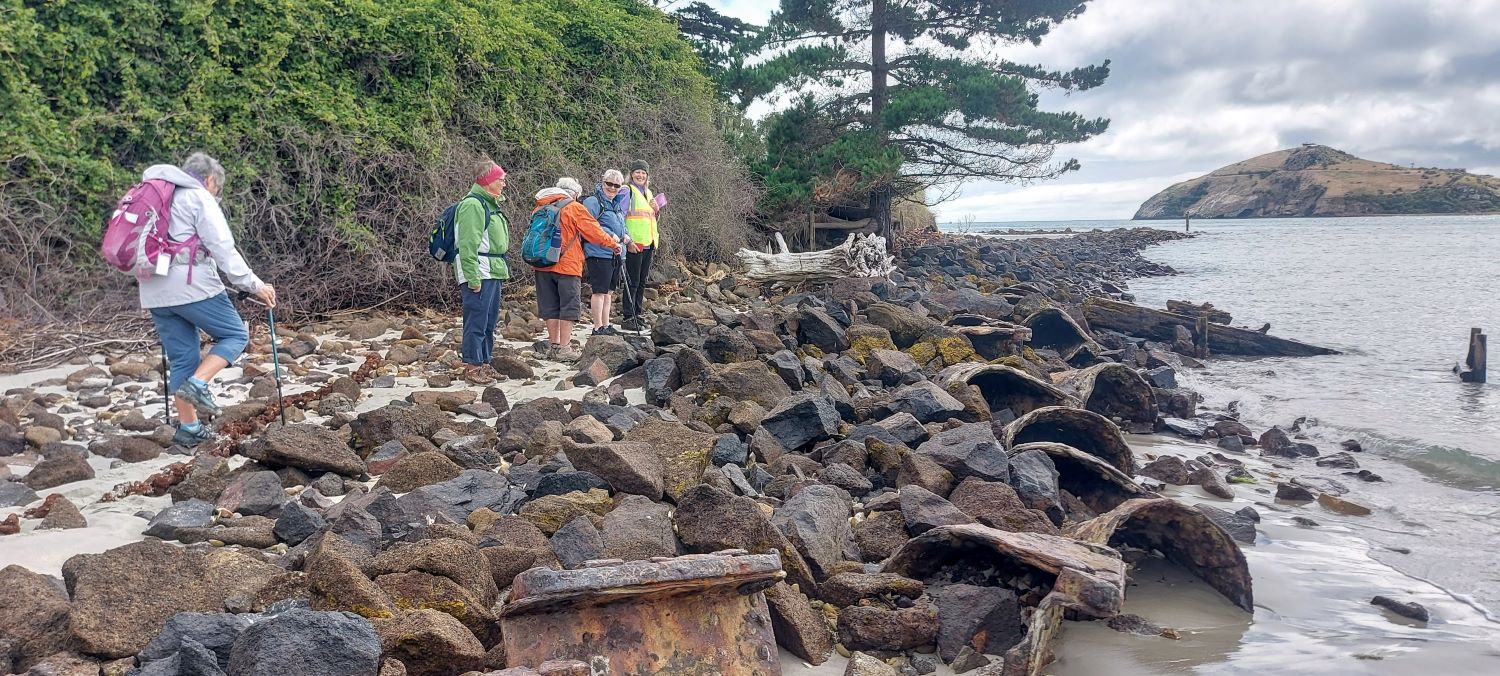
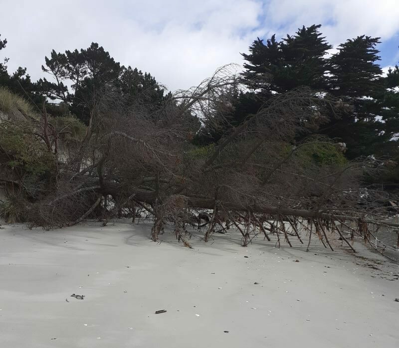
After morning tea, the hikers walked along the salt marsh and on to Shelley beach. We came across a couple of obstacles that required careful navigation-fallen trees blocked our beach walk and slippery rocks that we had to walk on to get around past the trees and back on to the beach.
We walked along the beach and stopped at the first Pilot house -a memoriam seat was there in memory of Janaye Ellen Eketone. Inscribed on the back of the seat was music notes however as none of us read music we wondered what the music was and maybe someone in the TRTC can advise when viewing the photos.
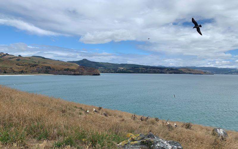
We continued along the beach enjoying the beautiful views of sea and land continuing to walk along the street to Aramoana beach where we met several sea lions resting. We had been instructed on what to do if this situation arose and all was well. A baby sea lion called a pup was all alone with no sign of its mother. We were concerned its mum might have come out of the sand hills to protect her baby, but the pup woke up and ventured into the sea.

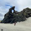
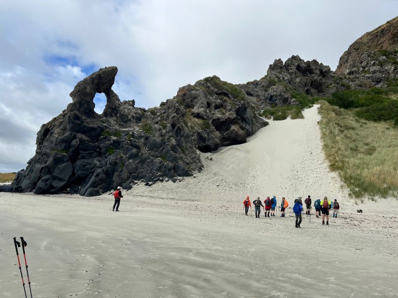
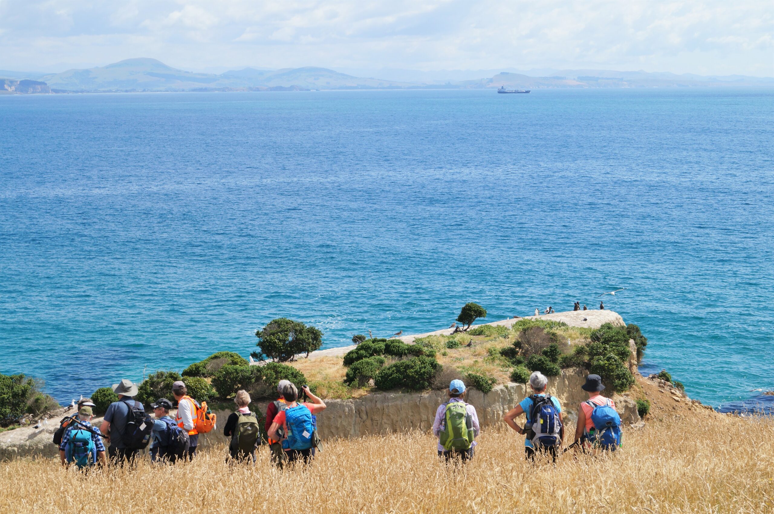
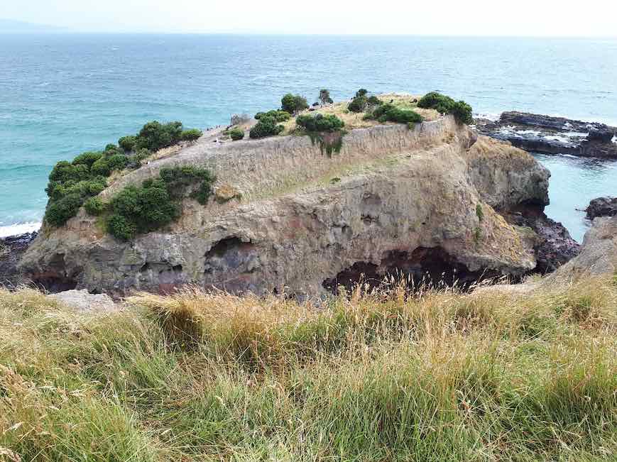
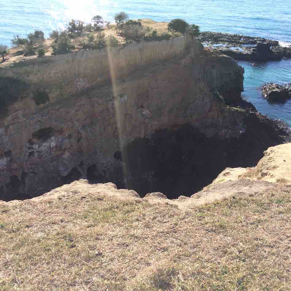
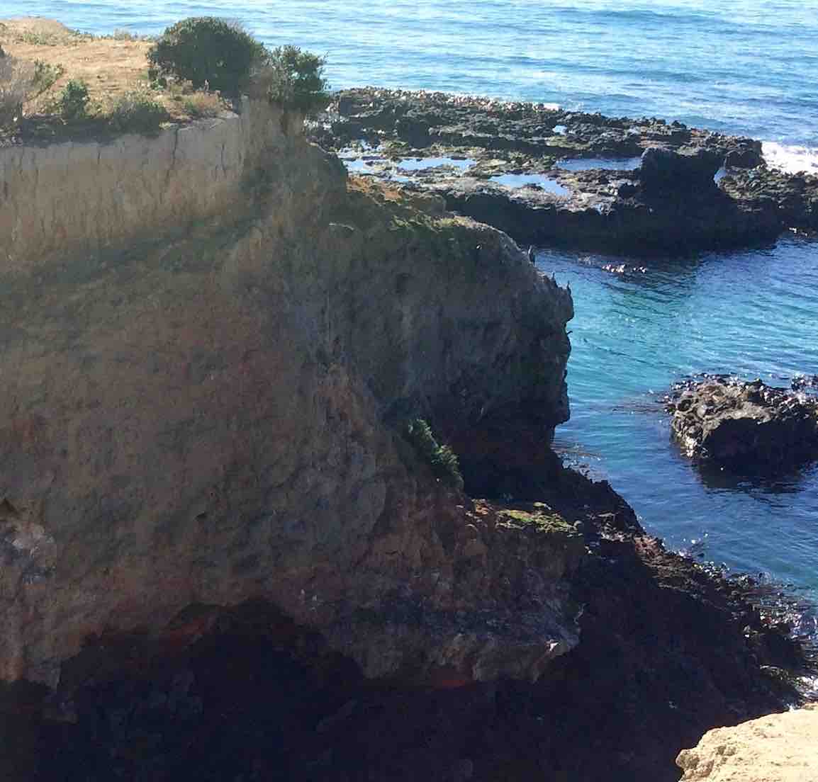
We continued along the beach to the keyhole rock which the locals call the heart rock. It is quite spectacular. A very pleasant walk with the tide coming in so we didn’t loiter at the keyhole rock very long and we also had to get past the sea lions again.
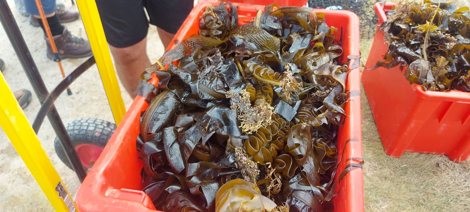
We then walked back along the beach and walked along the mole. Halfway along we stopped and talked to a diver employed by the Otago University who with his helpers were collecting undaria seaweed which is an invasive seaweed. They then took it to compost it but evidently it is commonly used in Japanese cuisine. It was very interesting to learn about this seaweed.
We continued along the mole where we were going to have lunch however it was very windy, and we didn’t want to share our lunch with the several sea lions who were resting therefore we walked back to the memorial and enjoyed our lunch there. It was very sheltered there from the wind.
By this time, it was 1.15pm and the next part of our hike was to walk the boardwalk however we stopped outside the boat house and the owner came out and invited us in to see inside it. We were going to walk the boardwalk however it was unanimously decided to take this wonderful opportunity. Words cannot describe this home; it was amazing and so unique in so many ways. The owner Doi Seiffert built it himself and there had been a lot of controversy with the council etc as to the question “is it a home or a boat”. He took on the bureaucrats and it was deemed to be a home. It is a must see if you are down that way. He is a very clever man, interesting to listen to and to appreciate this home you need to see it. It was like stepping into a different time. His journey building the boat began when he helped a friend build the Castle which is in Muri Street another must see. We walked around to the Castle and wow it’s amazing. Unfortunately, we didn’t get to go inside so maybe on another hike down there we could try and arrange a visit. The Boat home and The Castle are both on the internet if you are interested in taking a look. These two interesting homes were not on the plan however was a highlight of the hike.
Back to our cars and drove to Port Chalmers and enjoyed refreshments at the Cafe Santosha, great service and lots of laughter and chatter as the day was talked about. A great day shared with great company. Thanks everyone.
Trampers. Leaders Wyn and Karon
After the previous few days of sunny weather, it was a surprise to wake up to light rain and cloud around the hills. By the time us Townies arrived at our meeting place at the Yacht Club, it was definitely low fog. Some of us were still confident in our weather forecast and lo and behold; when we got to Aramoana to meet at Memorial Park, we found to our delight it hadn’t been raining and was clearing.
There was a cool sou-west breeze (which turned out to be a blessing on the climb up the hill) so it was decided to have our Combined morning tea sheltered at the memorial to those killed in the shootings in 1990.

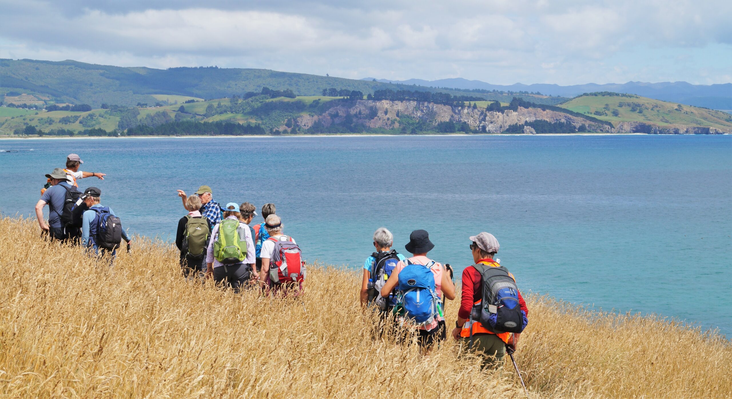
Ross gave a short talk on what to do when you encounter a sea lion on the sand (“be boring”). After morning tea, we separated and 17 trampers headed off west along Spit Beach to Lion Rock (Heart Rock), almost walking into the only two seals we came across. The high sand hill behind the rock is a favourite place for sand sledging. There were no takers today though. Some of our group hadn’t been to the rock before and Marijke told some of us that her daughter got married there.
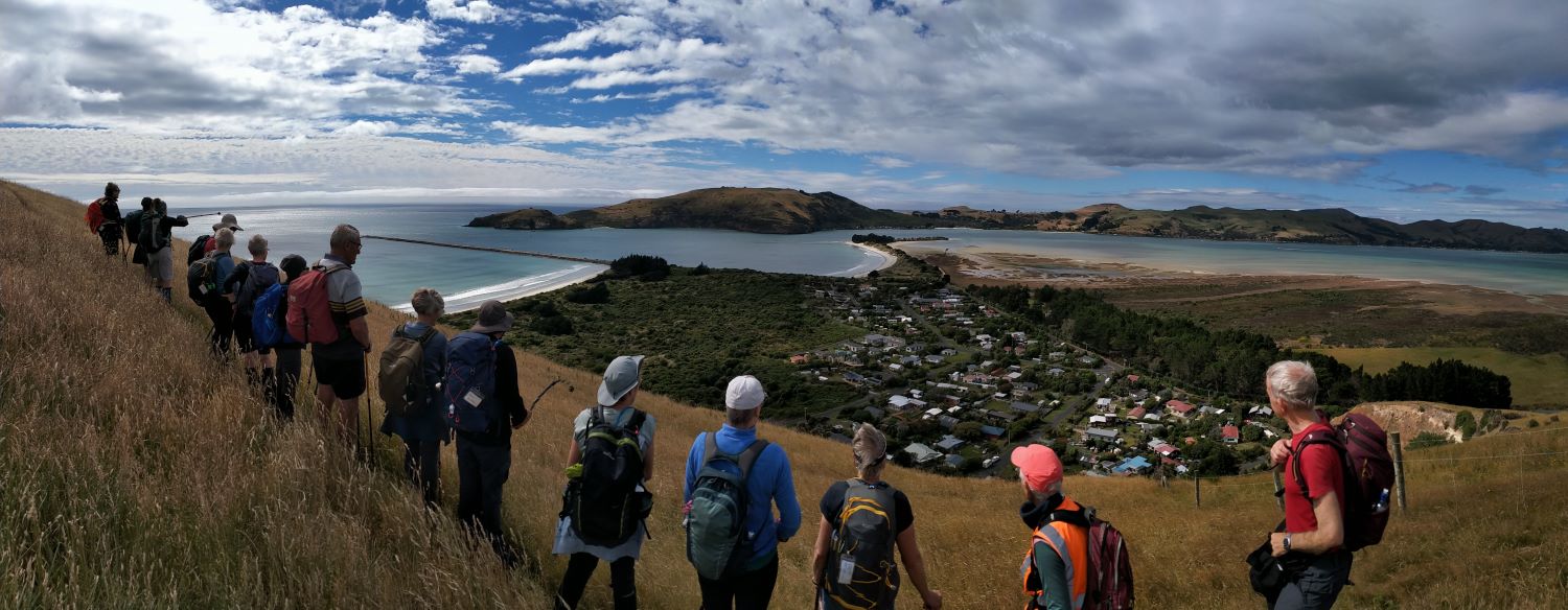
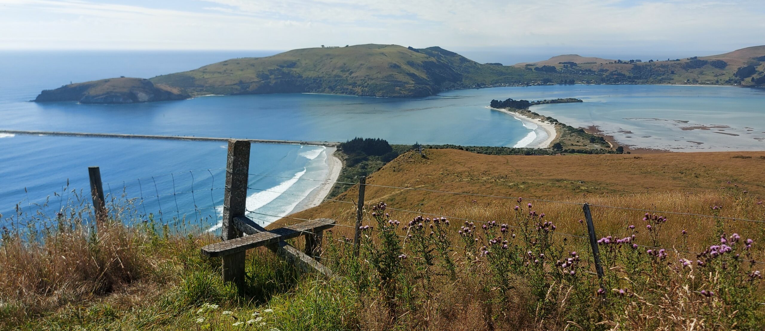
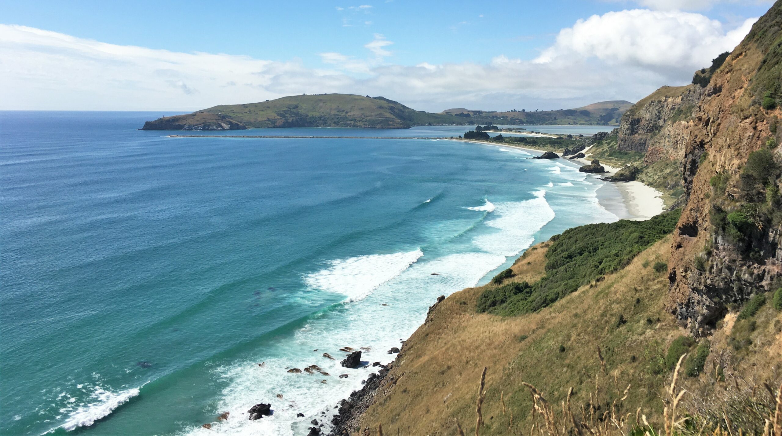
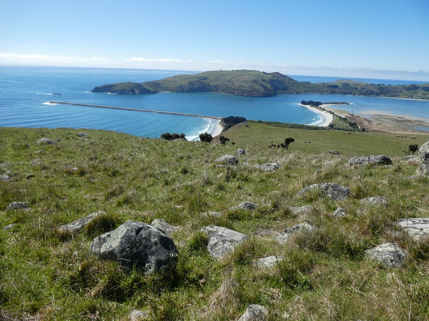
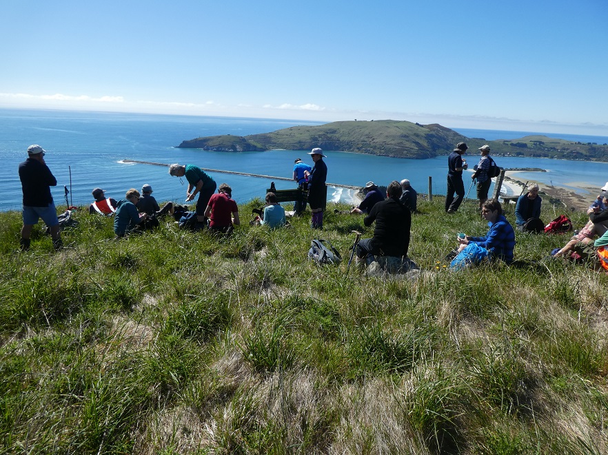
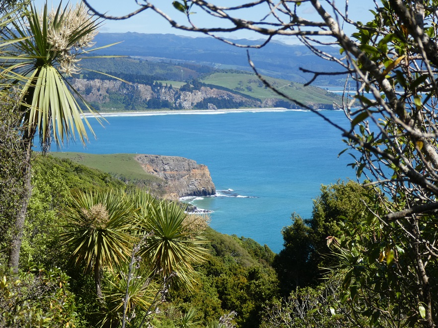
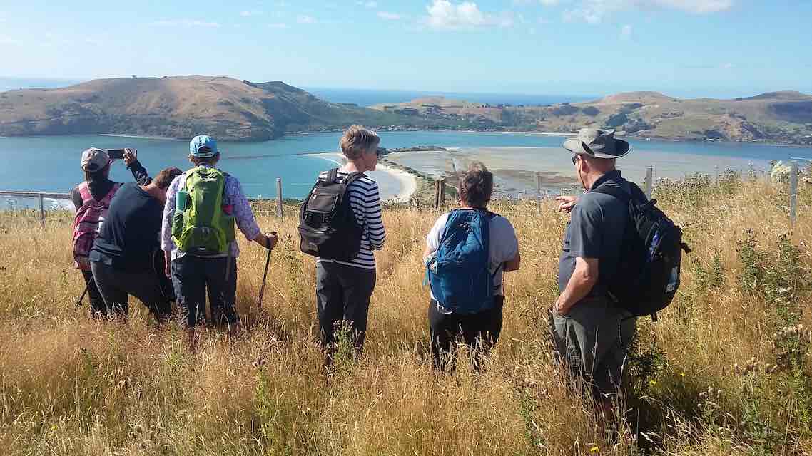
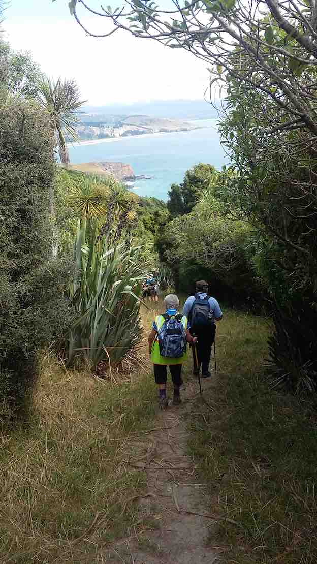
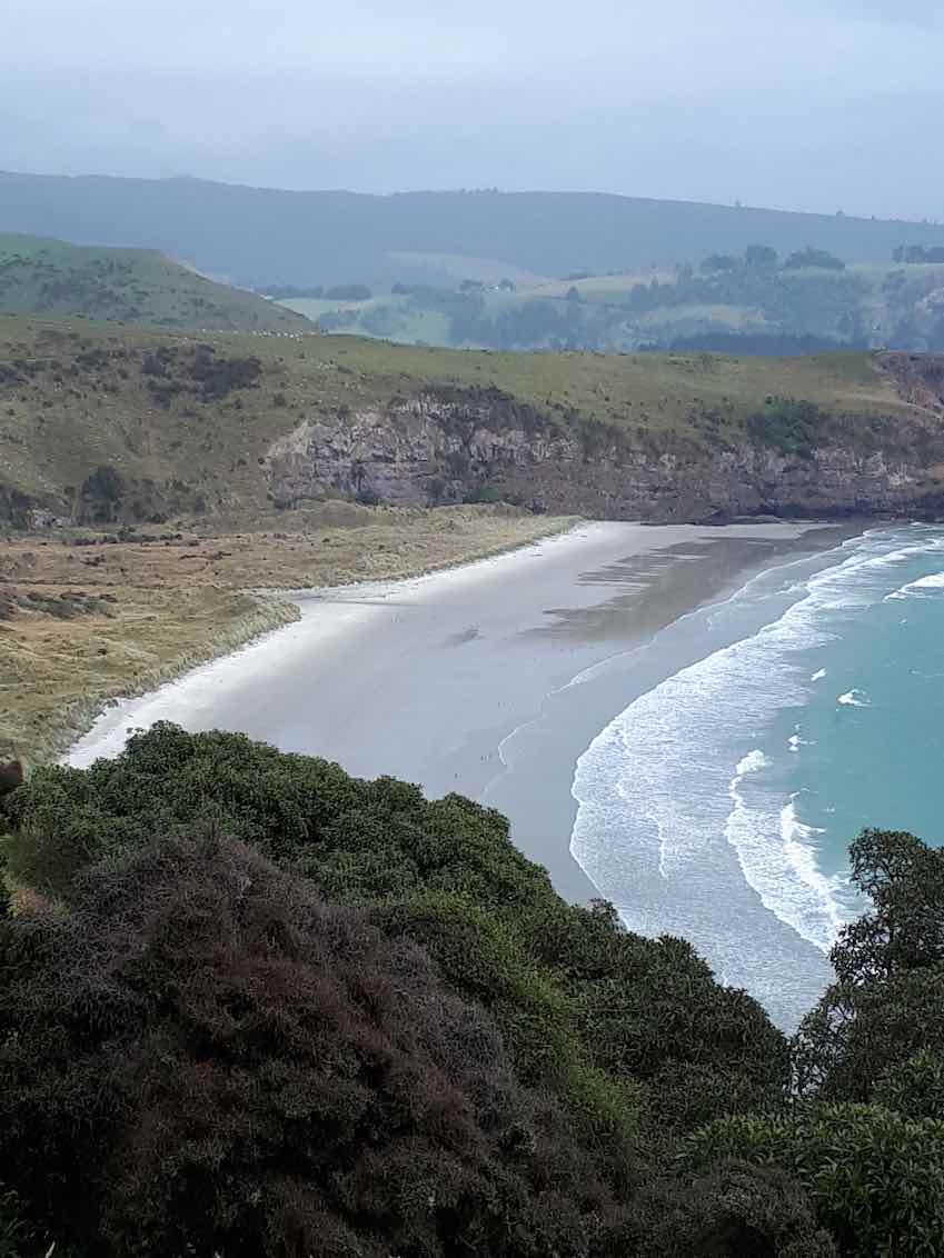
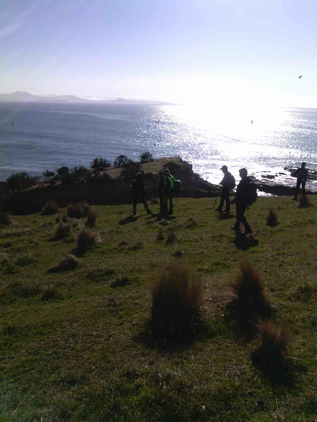
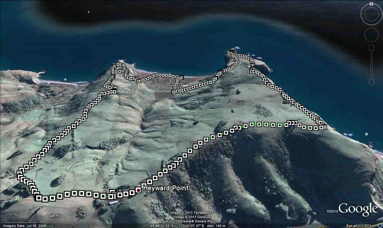
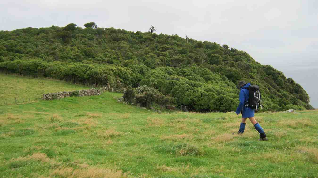
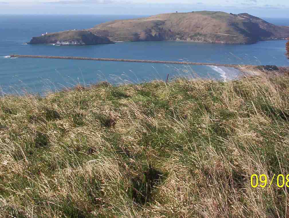
After walking through a short track in the sandhills and thankfully not encountering any more wildlife, we made our way up Pari Street towards the beginning of Heywood Point track located beside some Pine trees at the entrance to Aramoana. The track climbed beside the old quarry and then kept on going up and up. We gained birds eye views over Aramoana and the harbour entrance.
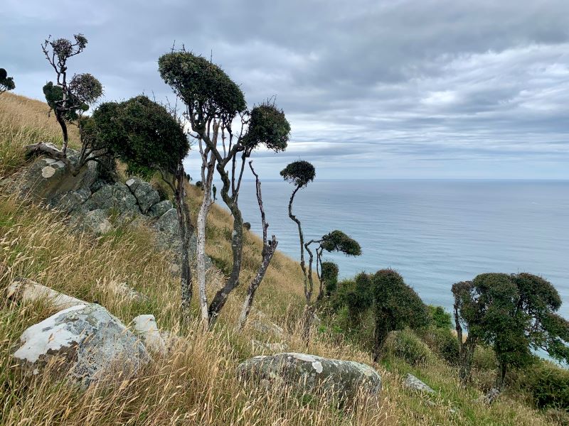
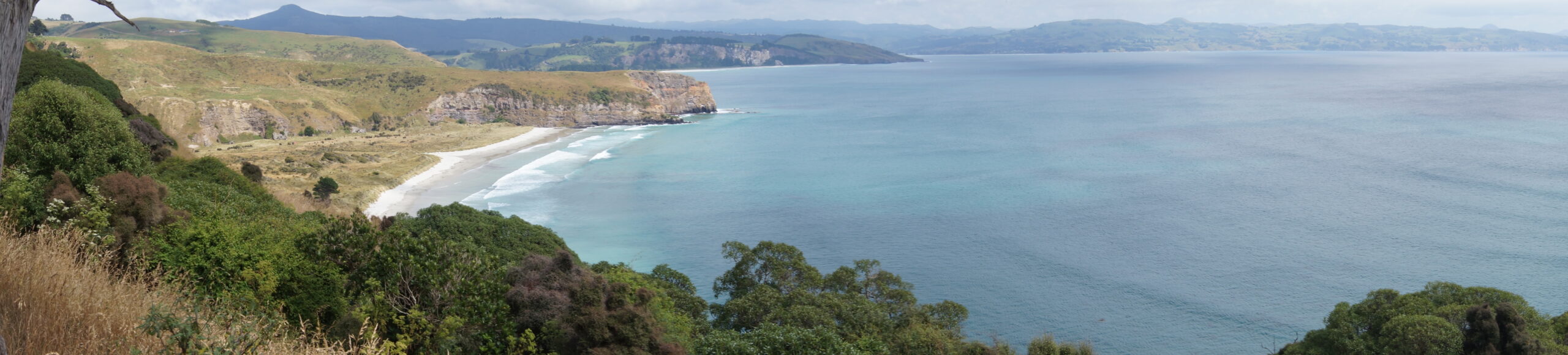
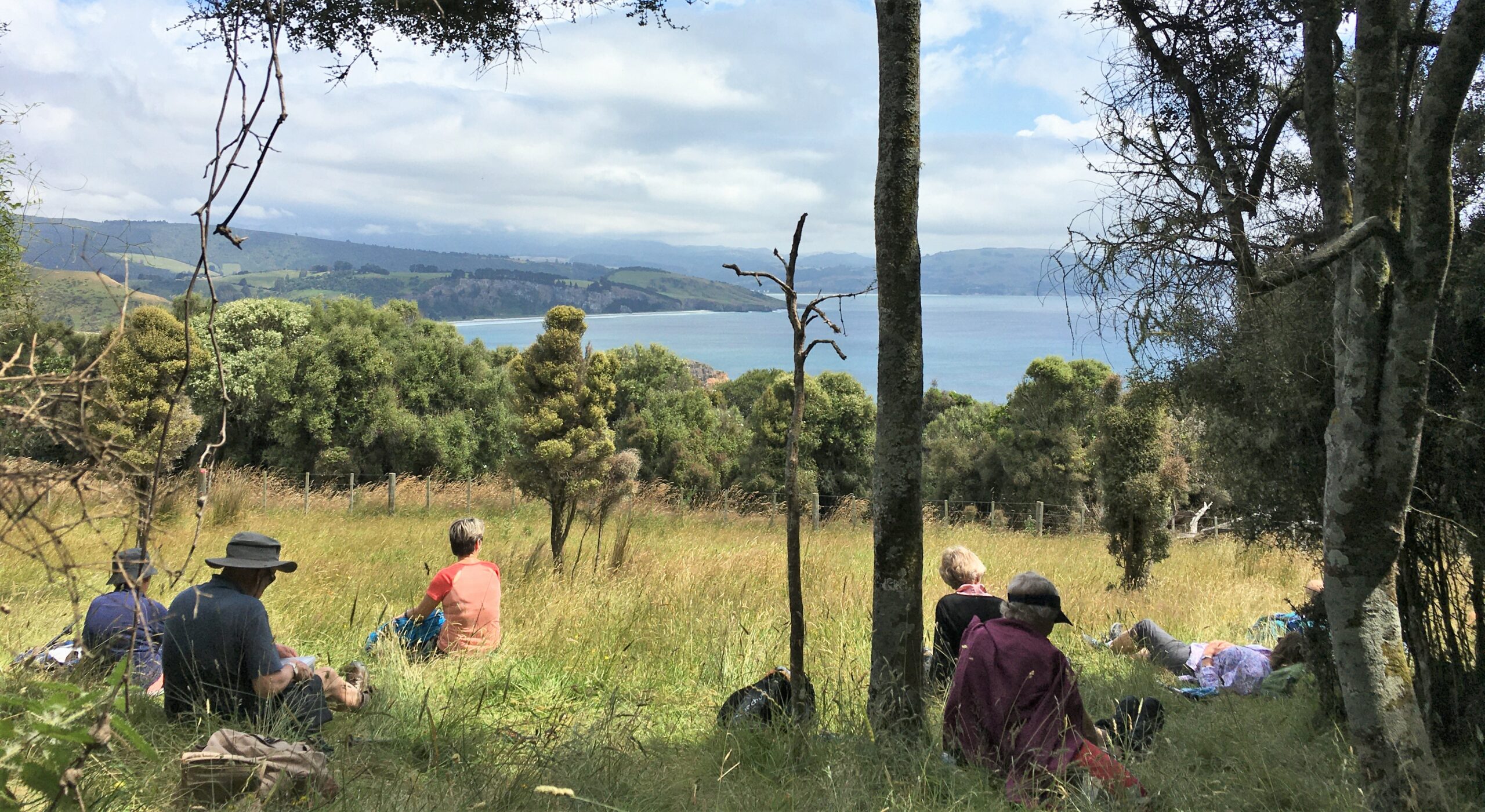
We could also wave to the Hikers making their way along Shelly Beach. We sidled about the cliffs and then climbed some more to a plateau. Eventually we reached the junction with the track from Heyward Point Road. From here we followed the track mostly above the cliff edge. We reached Heyward Point Reserve which contains rare coastal vegetation A wide track descends through the bush.
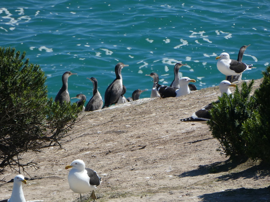
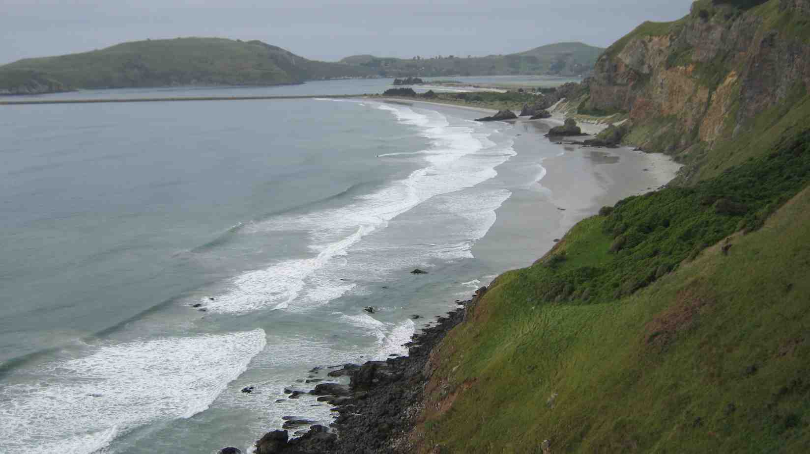
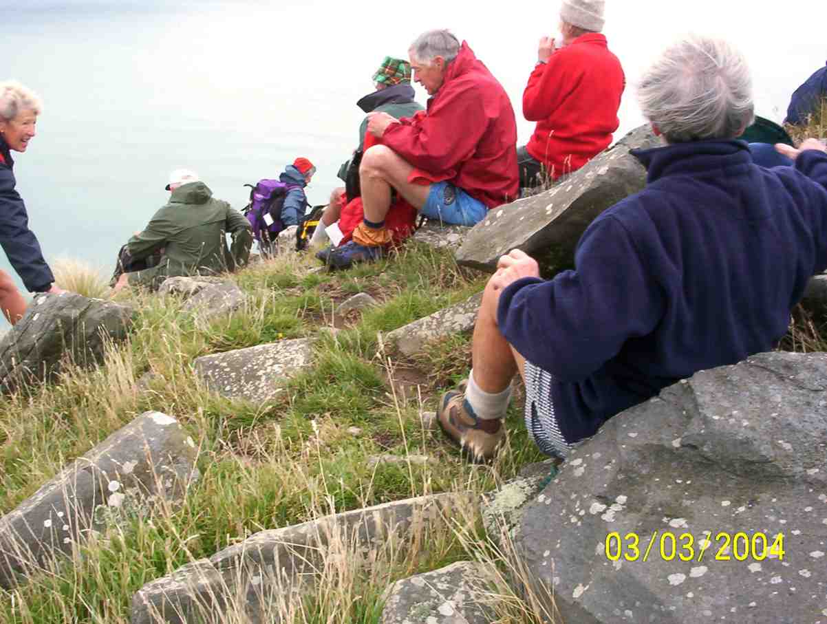
We stopped for lunch in the welcome shade where the bush opens out above Heyward Point. After lunch we made our way down in sunshine trying not to disturb the black backed gulls and their juveniles. From here we had panorama views north to Long Beach, Warrington and Seacliff and on and on. We watched the soaring gulls for a while before retracing our steps back up the hill.
Eventually it was back down the grassy slopes to Aramoana, fortunately nice and dry.
Back at the road we waved to the Hikers setting off to Port Chalmers and it wasn’t long before we followed. We caught up with them at the Café Santosha in Port Chalmers. Once again, the Café was very accommodating.
Another great day with good weather, grand views and good company. Thanks to my co-pilot Karon.
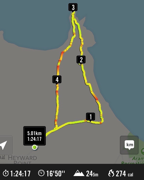
Distance – almost 10 kms; elevation gain – 440 metres; walking time – 2 hrs 40 mins.
Wyn


The tramp was approx 9.5km and a nice day,
Cheers Helen and Phil Morris.
**Our thanks go to the kind permission of the farm owner, whose permission was required to tramp the final part of this tramp on her farm property**
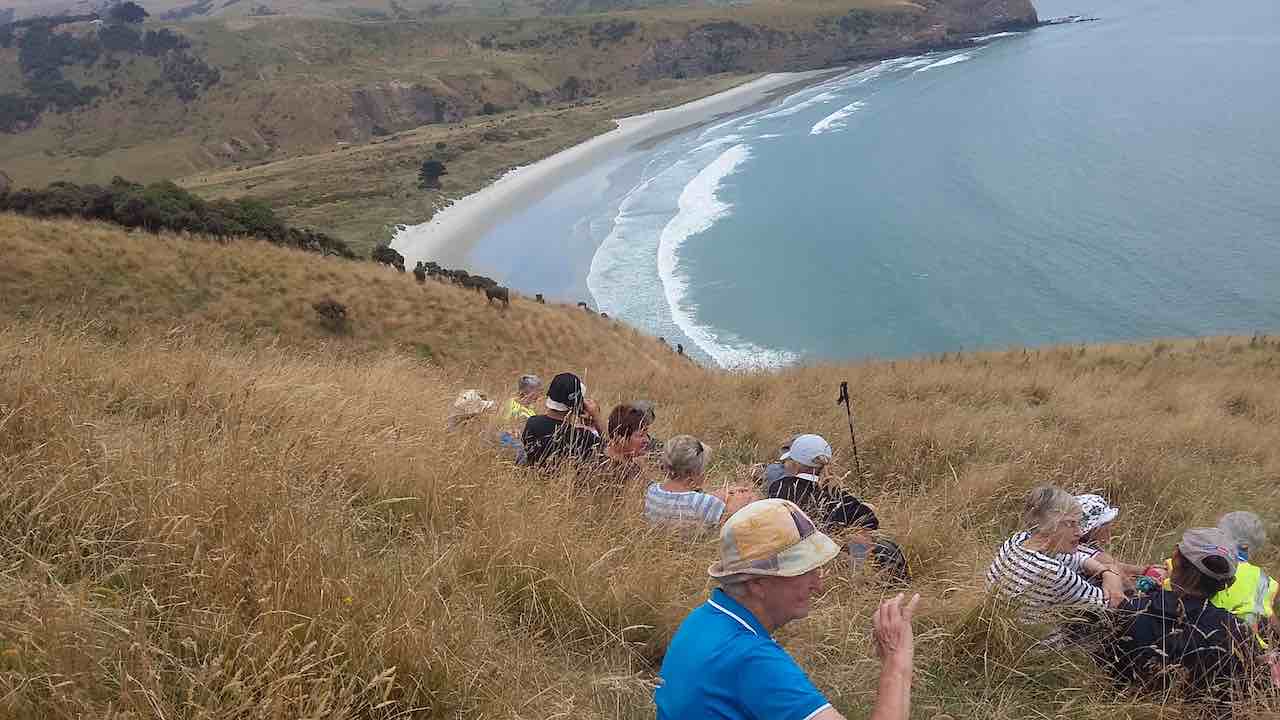
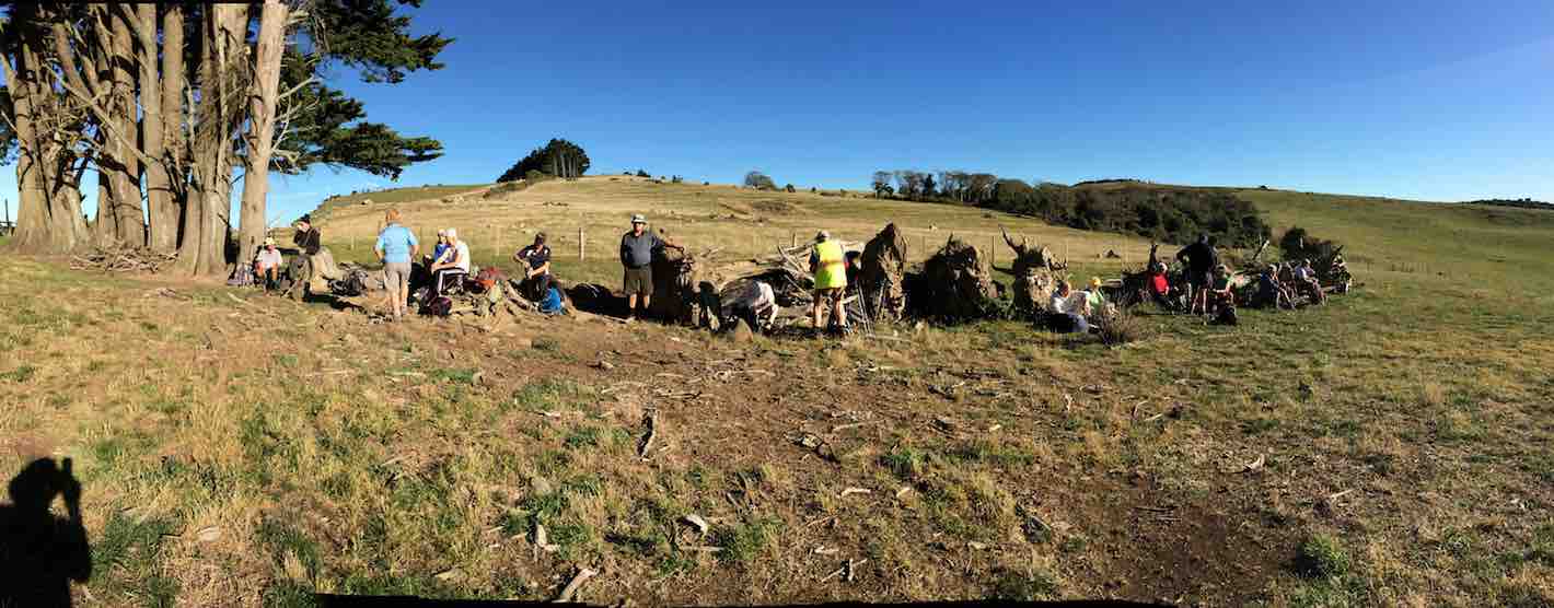
We headed off, just after 10 am, and after 15 minutes we came to a great lookout, 600/700metres below were the spit beach, the Mole and Aramoana.
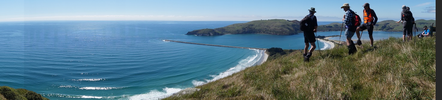

A fishing ship was also making its way toward the sea lane between the spit and Harrington point toward Port Chalmers.
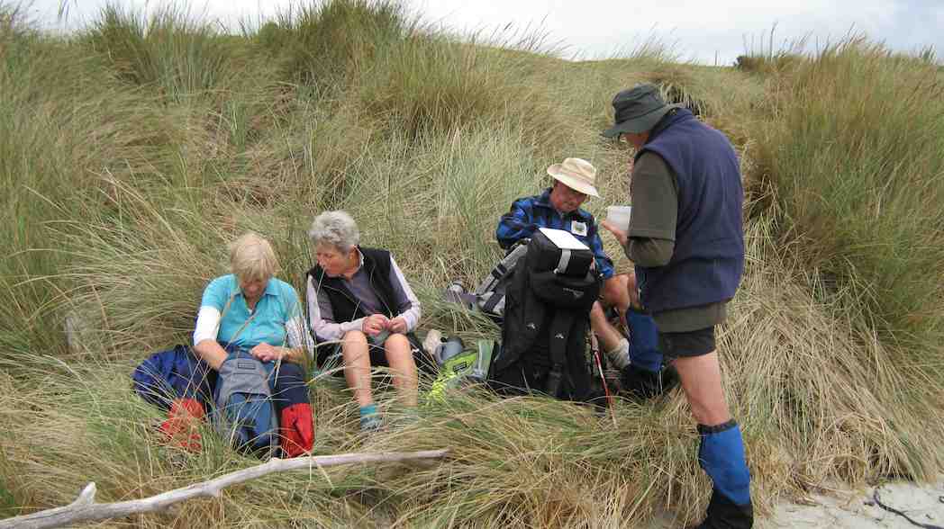
An ideal time for morning tea. The chatter was aplenty.
Moving on we walked on through a small pine forest and Ngaio bush above the cliffs, on a good track. What went up, must go down 200/ 300 meters. But, before doing so, to the north, we could see Warrington beach and township, Karitane, Waikouaiti, and Shag Point.
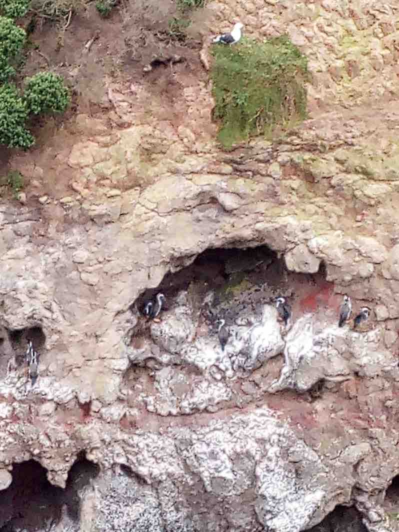
As we jumped the stile at the bottom, we could see numerous seagulls in the grass, sitting on their nests and in flight, and on cliff faces were black shags.
Along the next cliff, we could see remnants of the boat called the Renegade, which was beached in September 2016 due to a fire onboard, a wet owner Warren Lewis spent time on the beach with seal pups, before being rescued by the Rescue Helicopter.
We worked back up from the cliff, working round the nests and moving around the cliff to a lunch spot that could take in the scenes to the west, a pristine view.

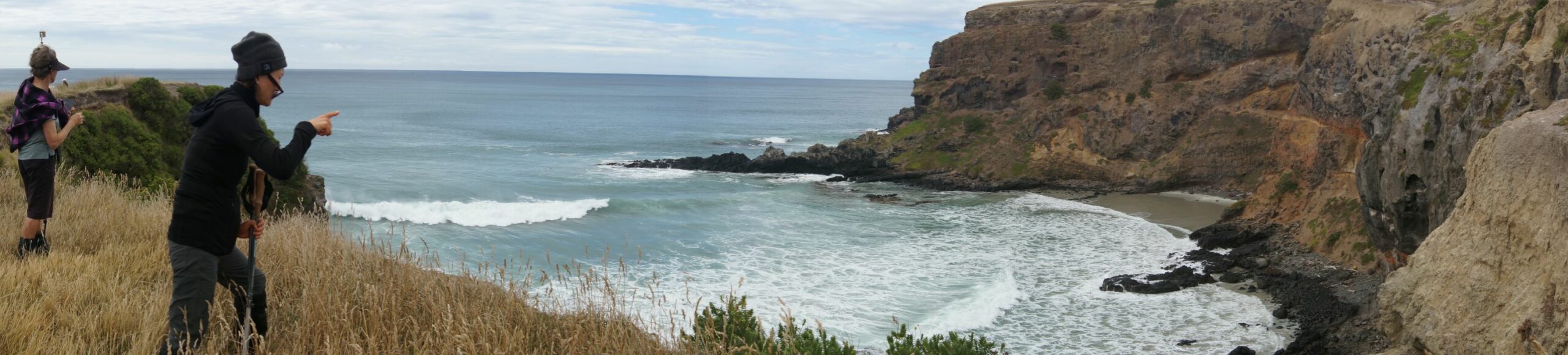
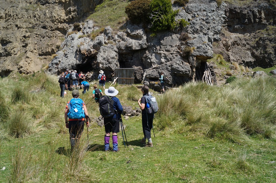
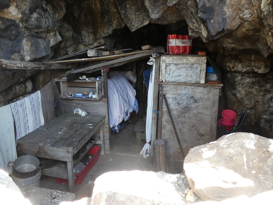
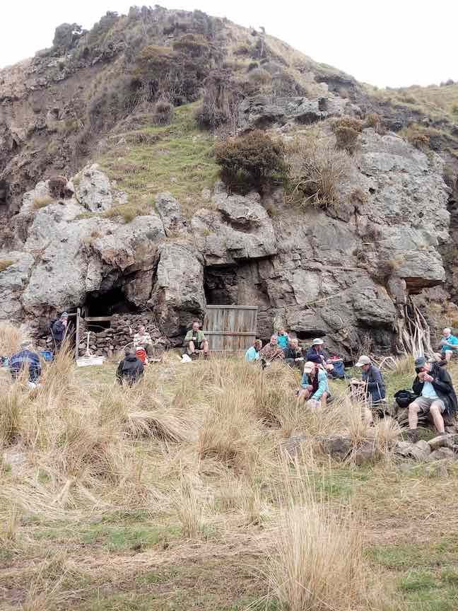
Kiki Beach, Purehurihu point, calm sea, and Maori caves. After lunch we got down a steep incline and onto the beach, due to the tide were could not get around to Murderers beach, so we walked along the beach and then into caves. One had an ablution and another had bedding etc.
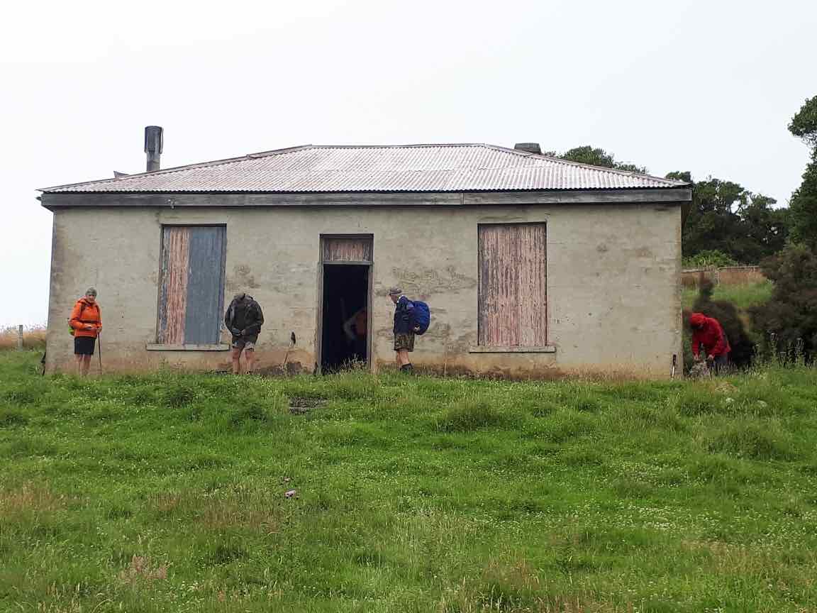
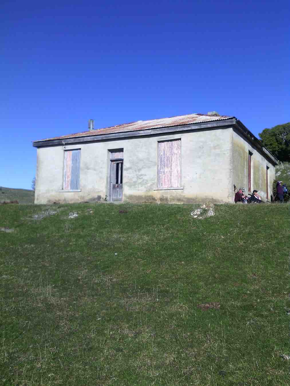
We continued up the fields to an old Jennings derelict home. We stopped and had a look, then continued on the final trek up the hill, and back along the road to our cars.
Finally, we must have coffee and edibles at the Careys Bay restaurant.
Good Company and Great Day,
Leaders Helen, Keith, and Phil M.
17. 20/2/2019. Hikers. Leaders: Jan B and Jay
before carrying on around the cliff line to decend through a tree lined track for a while then climbing up onto a clearing again. We continued along the clearly marked track
and around to our left through a paddock of long grass until we reached a point for the lunch stop overlooking Kai Kai beach and beyond.
16. 23/1/2019. Trampers. Hayward Point, Kaikai Beach, Whareakeake Road circuit. M. Leader: Keith.
we headed up hill and over the stile into Chapman’s farm. We followed some ribbons ( put out by the farmer) up hill to the top gate then followed a steep descent on slippery grass to the beach.
We strolled along Kai Kai beach where a large leopard seal kept a watchful eye on us, before we followed the cliff back to the bivvie for lunch.

We continued uphill again on a good farm track to the Jenning’s house,
then back to the cars. The predicted rain arrived 10 mins too soon so we were quite wet by the time we returned to the cars. Coffee at Emersons. – Keith.
15. 9/8/2017. Trampers. Hayward Point, Kaikai Beach, Whareakeake Road circuit. M. Leader: Janine.
On what looked like a lovely clear day, 15 trampers set off in from Mosgiel in 4 cars. Difficulties set in very early when 2 of the cars were delayed by a car accident on the motorway – 2 other cars were fortunate to be able to detour through Fairfield. Next difficulty was the further we drove, the thicker the sea mist became and on reaching the end of Heyward Point Road, after the 20 minute delay, visibility was extremely limited in the murky fog.
We set out through the mist and after a short walk stopped under some pine trees for a late morning tea
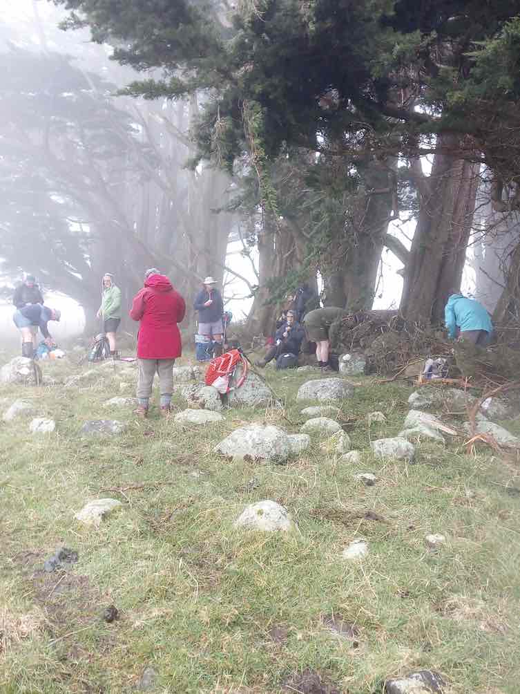
then pushed on to the coast edge above Aramoana- BUT still no view on offer!! Disappointing for those of us who knew what we should be seeing and unable to show those who hadn’t been to the location before just what a spectacular coastline we have!
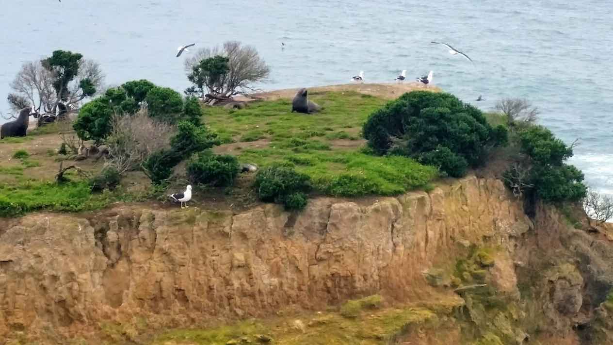
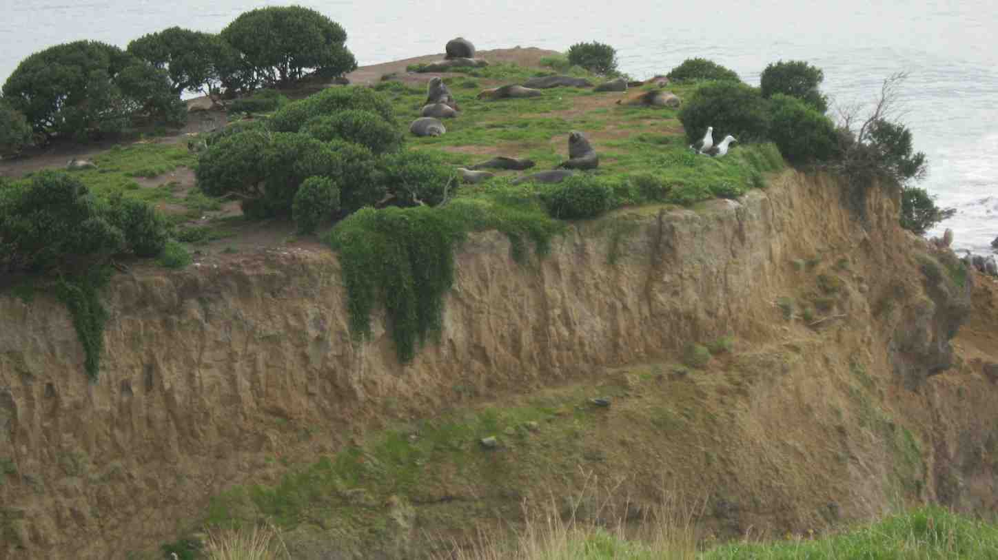
With care we followed the cliff edge, passed through some pine trees, scrambled a short rocky hill to suddenly find the mist had lifted and we had a view. Along to Heyward Point we were able to see the Mole, Aramoana, 2 ships at sea, numerous seal and pups, and a multitude of seabirds.
Onward and we tackled a steep hill – up and down still skirting the cliff edge till dropping onto Kaikai beach area. Due to the late start and time limitations we didn’t venture to the sandy beach but cut accrss the paddock straight to the nearby cave/holiday home where groaning stomachs were replenished.
With the late lunch, we were all delighted with the original Maori fantail legend told to us in real ‘storyteller’ style by Bob.
All refueled, it was another steep climb to the historic ‘Jennings house’- after a quick viewing and discussion on the sturdy foundations of this old homestead – we continued on through paddocks meeting young curious cows and arriving back to the road above Whareakeake beach. The road walk to us back again through thickening mist to where the cars were left. Despite all that water vapour the walk wasn’t too ‘wet’ and the 9.75km ramble appeared to be enjoyed by all. Each car then made their own arrangements for coffee / home drop offs. – Janine.
14. 10/8/2016. Trampers. Hayward Point, Kaikai Beach, Whareakeake Road circuit. M. Leader: Arthur H.
Another short walk took us to the start of the DOC track to Hayward Point itself. Great views up here, of the Otago Harbour entrance, the Aramoana Mole and across to Tiaroa Head.
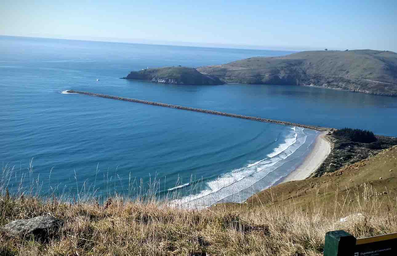
A large ship was heading into the harbour. A very scenic spot indeed.
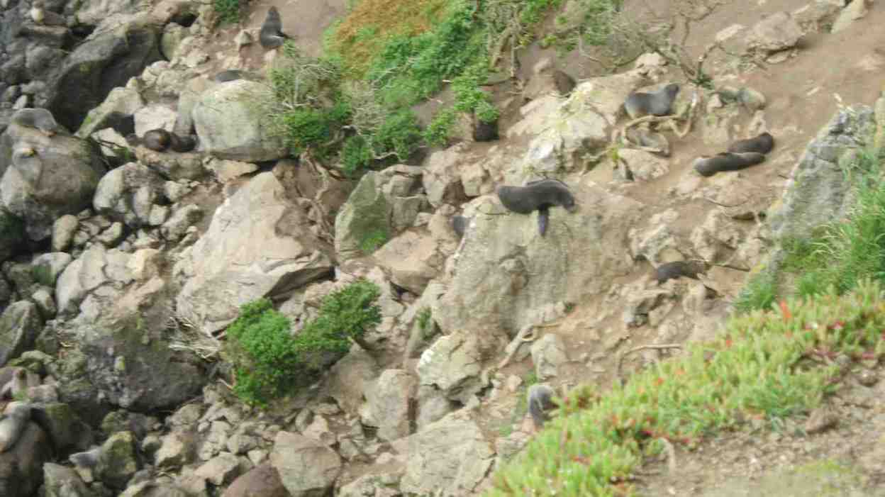
Following the cliff-top track, we came to the grassy headland block on which were grazing a mob of hoggets. We descended down to Heyward Point but could see only two seals (usually twenty or more can be seen) and two shags on the little off-shore islet.
Plenty of seagulls about though.
The tide was halfway out as we walked along Kaikai beach. A very beautiful place away from civilisation. At the end of the beach we turned inland to admire the holiday cave dwelling.

From sea level it is all uphill back o the cars, so we ascended the first hill to lunch at the old house (the Jennings house).
Some stomachs were complaining by then, but morning tea had also been late.
13. 11/5/1016. Hikers. Heyward Point, anti-clockwise loop return over paddocks. M. Leaders: Judy, Adrienne.
21 intrepid hikers parked at the end of the Heyward Point road and set off in beautiful weather after almost forgetting the Bathgate car load who took a wrong turning….
After a leisurely morning tea …
… in the first group of pines, Dorothy came to grief at the first hurdle (style), making a great job of scraping her leg. She was ably patched up …
… by a bevy of nurses and returned to the cars with Chris for a quiet sit in the sun for the rest of the day.

The remaining 19 proceeded along the cliff path where the ups and downs tested our fitness in the rapidly increasing heat. Clothes were shed in all directions before we reached the paddocks above the point. Six keen souls went down to the rocks
and were rewarded by the sight of families of seals cavorting in the rock pools. The bulk of the party proceeded to the style perched steeply on the hillside above Kai Kai Beach where we stopped for lunch and were soon joined by the other six.
Then it was a steady slog uphill and across farm paddocks for another hour, to reach the track a couple of hundred metres from the cars.
Fantastic weather, incredible views and good company made this a most enjoyable hike, concluding with a coffee stop at the Stadium Cafe.
-Judy and Adrienne.
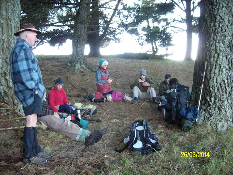
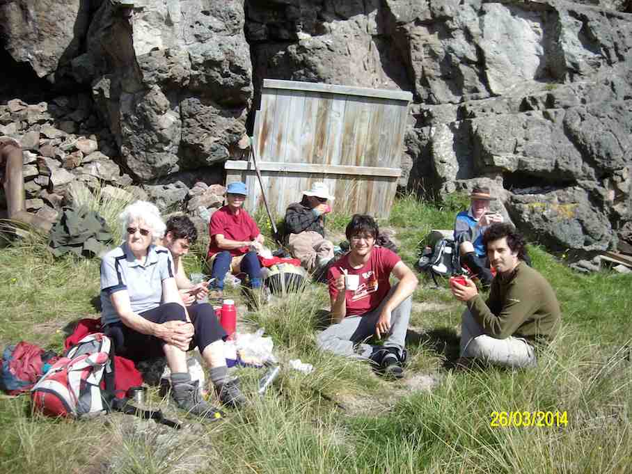
12. 26/3/2014 Trampers. Heyward Point, Kaikai Beach, Whareakeake Road.
We had 8 people today, our numbers were boosted by 3 young men from Israel, who were bought along by Hazel.
We had good weather apart from a strong wind on the way back up to the top road again, & all agreed it is a good walk. – Ken
11. 16/1/2013 Trampers. Heyward Point, Kaikai Beach, Whareakeake Road.
We had a very good walk today, with great weather, a good mix of terrain, & we had a good chat to Sue & Partner. Judy is related to both Sue, & the woman who live at the very start by the gate, she is Sue’s sister. So lots of ‘catching up’ was done.
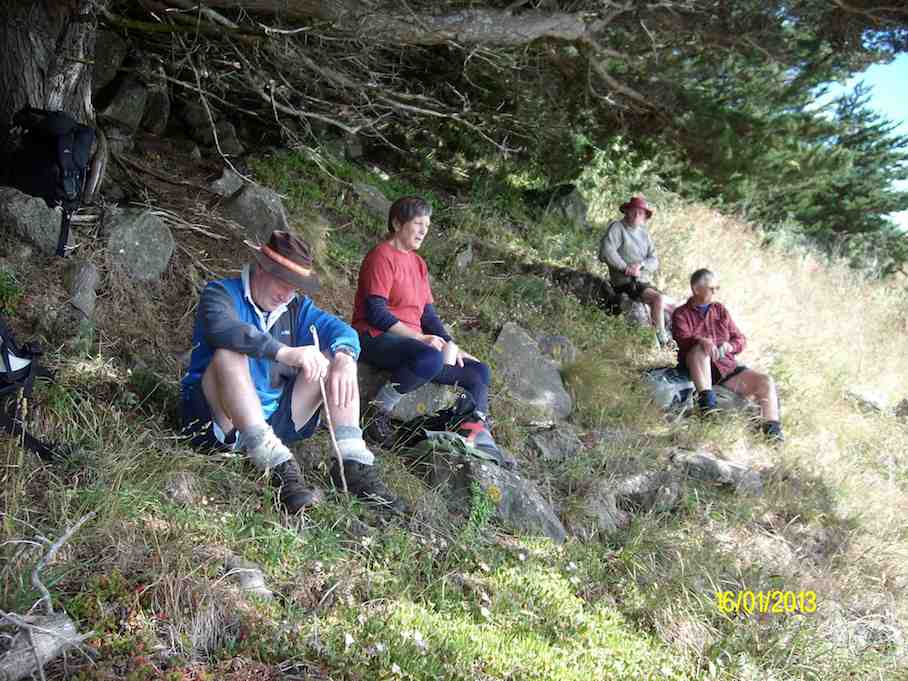
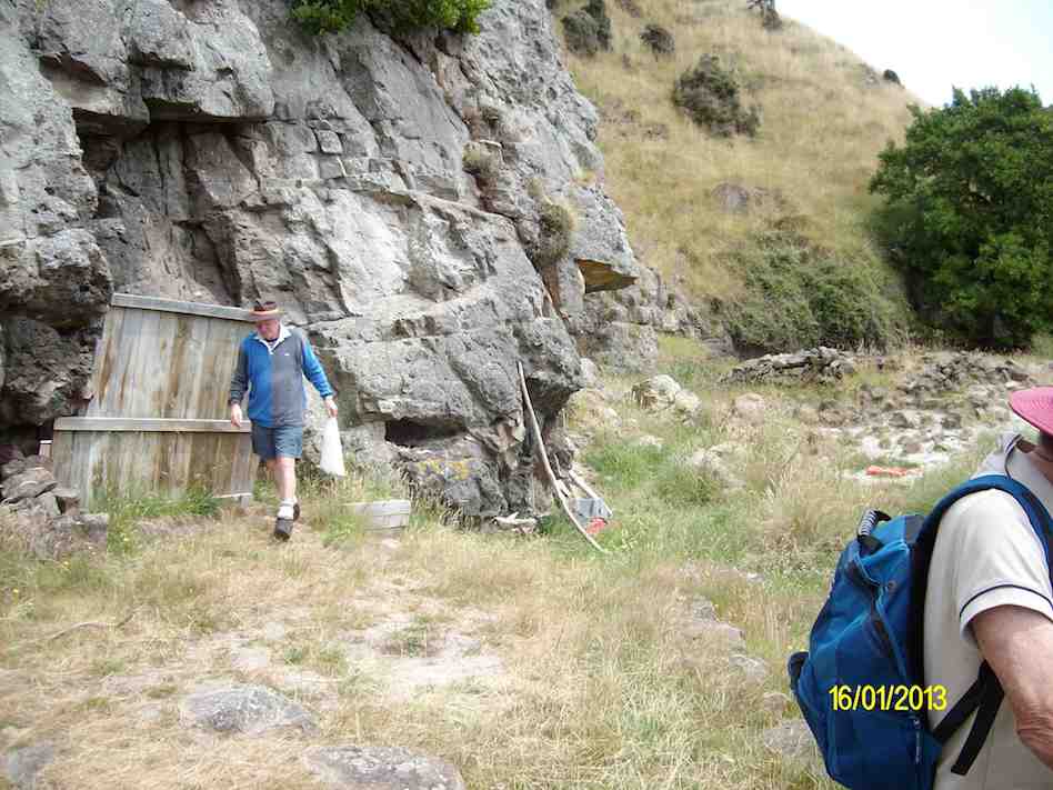
This time, on leaving the “cave homestead”, instead of scrambling up the steep bank further towards the sea, we went up the 4WD track
Apparently the people that use the cave have been going there for about 40yrs. & there are some small children with them, so I guess it’s a good playground for them.
We did 9.7km; ave. 3.7km/hr; moving time 2h 37m; climbed 447m. – Ken.
10. 24/3/2011 Trampers. Heyward Point, Kaikai Beach, Whareakeake Road.
9. 13/2/2008. Trampers. Heyward Point, Kaikai Beach. Leaders: Doug, Sabina.
8. 28/3/2007. Trampers. Heyward Point. (Park cars.) Kaikai Beach, Murdering Beach Road. Leaders: Ian, Arthur H
7. 10/8/2005 Aramoana, Heyward Point, Kaikai Beach. Leaders: Ian, Hazel
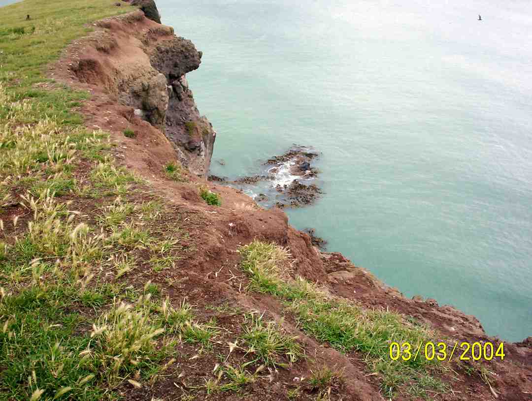
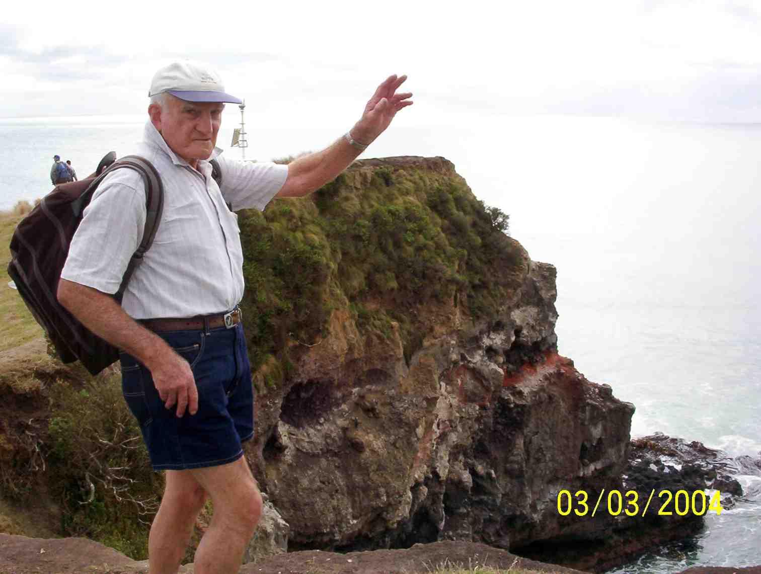
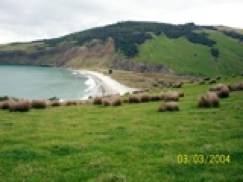
6. 3/3/2004 Aramoana, Heyward Point, Kaikai Beach, H-Pt Rd, ret. Leaders: Arthur, Lex

5. 27/3/2002 Leaders: Les, Margaret, Doug.
4. 10/5/2000 Leaders: Bill, Leslie
3. 21/4/1993. Heyward Point. Easy. Leaders: Ted, Jack M, Daphne.
2. 6/3/1991 Heyward Point. Lovely sea views and interesting history. Average. Leaders: Ted, Margaret B, Peg C, Nel
1. 21/4/1989 Leaders: Barbara, Shirley
Thanks. Ian