Mar 15 2024

Upcoming Trips

Published by under Both Hikers & Trampers

Link to Trip Organisation Guidelines for leaders and trip participants.
Link to Track Grading information.
Link to Copy of Trip Programme for printing.
Gradings are provisional and may change following recce. Distances are for road travel from Mosgiel car park. Costs may change with fuel price fluctuations and distance changes. This page has all current updates.
Last updated 15 December 2023.


Wednesday 20 March.
Open to All. Flax Clearing. Grade 3. $5. ? km. Leaders: Phil Keene Co-ordinator.

Hikers.        Broad Bay Future Forest.
(New Hike), Grade 2.5. $9. 30 km. Leaders: Jenny Flack/Vivienne Manning.

Wednesday 27 March.
Trampers. Split Rock. Grade 2.5.
$13. 46 km. Leaders: Dave Roberts/John Gardiner.
Hikers.       Sandymount. Grade 2.5.
$8. 29 km. Leaders: Neil and Margreet Simpson Bruce and Jenni Wright.

Wednesday 3 April.
Combined. Sinclair Wetlands. Grade 1.5.
$10. 35 km. Leaders: Sarah McCormack/John Gardiner, Jay Devlin/Linda Partridge.


Wednesday 10 April.
Trampers. Mt Charles. Grade 4.
$8. 27 km. Leaders: Graham and Carol Thurlow.
Hikers.       Waihola Cycle Track
(New Hike). Grade 1.5. $8. 29 km. Leaders: Margaret Maxwell/Kay Seddon.


Wednesday 17 April.
Trampers. Yellow Ridge/The Gap. Grade 5.
$12. 41 km. Leaders: Ross Davies/Neil Hodgkins.
Hikers.       Bullring/Ben Rudd/Flagstaff. Grade 2.5.
$5. 15 km. Leaders: Max Wilson/Mike Webb.


Wednesday 24 April.
Trampers. Frasers Road/Southern Resevoir. Grade 2.5.
$5. 16 km.  Leaders: Gwenda Farqharson/Graeme Souter.
Hikers.       Graham’s Bush. Grade 3.
$8. 27 km. Leaders: Maria McNee/Theresa White.


End of current programme


No responses yet

Mar 16 2024

Evansdale, Careys Creek, Honeycomb, Rongomai

Published by under Trampers

Location: 37 km.
From Evansdale Glen. Route. DOC. Stream crossings. Preferably February when water most likely to be low.
Track up Careys Creek alone: an easy walk.

Click information on the Seacliff Dam, historical creek track and pipeline.


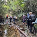
Img 8974 Thumbnail17. 13/03/2024. Trampers. Carey’s Creek, Rongomai, Honeycomb Tracks. Grade 3.5. $11. 39km. Leaders: Pam Cocks, Graeme Souter.
After a few concerns about the weather earlier in the week we were greeted with a cracker of a day. The Dunedin crew met at Woodhaugh Gardens as usual with our team leader deciding she simply must put on a pair of leggings to protect her legs whislt she “crushed” the overgrown grass that greeted us on our recce the previous week.
Continue Reading »

One response so far

Mar 15 2024

Chain Hills-Friends Hill Tramps

Published by under Hikers

No. 102 on old hardcopy list of 113 club tramps. “Friends Hill Chain Hills Year Round”
Saddle Hill Hotel


20240313 110151 Thumbnail46. 13/03/2024 Flower St and Chain Hills.  Grade 2.5. Leaders: Avis Williamson/Jan Butcher.
About 16-17 hikers caught the bus into Fairfield and met up with the townsfolk at the Petrol station.


Continue Reading »

No responses yet

Mar 06 2024

Waikouaiti: Matanaka, Beach Walk

Distance from car-park: 57.5 km.

On The Huriawa Peninsula Track (pam) Square15. 06/03/2024. Combined. Waikouaiti. Grade 2.5. $16. 57 km. Leaders: Karen McInnes/Barbara Shackell Gail Williams, Carol Morrison/Val Cayford
A great turnout of about 26 people took part in the combined outing to Waikouaiti. Continue Reading »

2 responses so far

Mar 05 2024

Club excursion to Queenstown

Published by under Both Hikers & Trampers

1. 25/02/2024-01/03/24. Queenstown Tracks. Combined. Leaders Anne Bennett

Queenstown Square Image 100x100Our group arrived at Lakeland Christian Youth Camp on Sunday 25th February to a lovely hot afternoon and spectacular views over Lake Wakatipu. Once unpacked our 1st cooking group prepared the first of many great meals. Continue Reading »

No responses yet

Feb 24 2024

Waihola Walk.

29 km from car park.

4. 21/02/2024. Hikers. Waihola/Milburn Area. Grade 2 Leaders: Bill and Jill

Bridge Square Thumb22 hikers assembled at a car park in Limeworks Road, Milburn on a rather grey morning with a cold head on sou’wester blowing into our faces. After traversing a farm track, we joined the Clutha Gold Trail in Circle Hill Road and began what Jill quite accurately described as a day of quirky bridges and old fossils!


Continue Reading »

3 responses so far

Feb 24 2024

Mahinerangi Farm Tramps

Published by under Farm,Trampers and tagged: ,

5. 21/02/2024. Tramp.  Blackrock. Leaders: Jill and Neil
Thumb Square13 trampers had a “Rock Day” beginning with rock music at Peter Johnson Park where athletic sports were about to start.
We tramped the reverse route from last time after parking in Ash Beattie’s yard. The day was sunny, became warmer as time went on and the expected wind proved to not be a problem. Morning Tea was enjoyed at the Black Rock.

Continue Reading »

No responses yet

Feb 24 2024

Woodside Glen, plus to top of Maungatuas

Published by under Trampers

No. 30 on old hardcopy list of 113 club tramps. “Woodside Glen to Maungatuas. E Blackburn, D McEwan. Summer”

Short and long options.

(Maungatua climb fairly steep. 5-7 hours. Heavy tussock on top.  Route only. Manager: DOC.)


Img 8520 Squre18. 14/2/2024. Trampers. Maungatua Option. Leaders Lyn Keene, Anne Ward and Di Bezett


Travel Distance 40ks, Grade: 3.5, Altitude gain: 711 metres. Total distance: 15.64 ks. Continue Reading »

No responses yet

Feb 24 2024

Waldronville

Published by under Hikers

10 km from car park.

20240214 125001 Square 10014. 14 February 2024. Hikers. Waldronville Wander. Grade 2. $5. 10km. Leaders: Phil Keene, Helen Morris.

After leaving PJ park right on time and catching up with the locals at the Estuary, 24 Hikers set out in orderly fashion back down the road towards Waldronville and crossed over into Island Park through the new gate, noting the sign ‘ no dogs allowed’. Must be to keep all the professional dog walkers out? Continue Reading »

No responses yet

Feb 24 2024

Maungatua traverse

Published by under Assess Further

3. 31/3/2021. Trampers. Maungatua Traverse. Leaders Eleanore Ryan, Heather Kirk and Arthur Heenan

One of our best tramps ever!!

26 of us were met by Richard from Good Tour Bus Company leaving at 8:25am and driving an hour up to the Woolshed road, past the sheep yards for 3kms (saved an uphill walk) on Horsehoof Station.

The finish is now the problem

The finish is now the problem (Photo & caption Gordon Grant)

The weather was calm, with low cloud and fog in places.  We set off up the access road for about 6kms to the summit at 895 metres.

On the way

On the way
(Photo and caption Gordon)

Smoko was at 10:15am at the aerials, beside the boundary of the D.O.C. Reserve.

The fence into the Reserve was crossed and soon after a little detour to the rock outcrop was had to enable some to test their rock-climbing ability.

Rock climbing (Pam Cocks)

Rock Climbing  (photo Pam Cocks)

We continued upwards following a faint track along the fence line, through scrub, dominated by dracophyllum.  The summit in the rolling tops can now be hard to find as the trig has gone and only the base and a pole remain.  This high point for us was reached at 11:30am.  From here the views were truly spectacular.

Heading to the summit

Heading to the summit
(Photo and caption Gordon)

This was the end of the days climbing, soon to be followed by about another 9kms down.  We crossed the fence again and stopped for lunch at 12:15pm, amongst colourful, interesting plant varieties.

It was a great walk out in the afternoon, still enjoying beaut views, particularly the intricate set of channels, swamps, and lakes between Waipori and Lake Waihola, and, the Taieri river at the start of the gorge.  Dunedin Airport was small in comparison to the vast Taieri plain.

Views of Lakes Waipori and Waihola

View of Lakes Waipori and Waihola (photo Pam)

Continuing downhill we passed the lone rock outcrop before passing by The Three Kings rocks outcrop (which are much more of a landmark when viewed from the flood free highway).   Finally, we came through a patch of native bush, including some great specimens of Beech trees.  Then, rounding a bend we saw our bus was parked up waiting.  We arrived to it at just after 3pm.

The bus is waiting down there

The bus is waiting down there (Photo and caption Gordon)

We covered about 16kms over 6 hours.

This MAUNGATUA Traverse was a first for all of us, apart from President Arthur. Our thanks to you Arthur for leading us today.  Also, thanks to Heather for leading, along with Horsehoof Station Owners, the van Turnhouts at 3 Kings end and bus driver Richard Trainer.

I hope you all enjoyed this tramp as much as I did.  We are so lucky to have strong bodies and good health to enjoy tramping in the hills we love.

Viewranger record of the tramp

Viewranger record of the tramp (Sarah McCormack)

19 km to Kempshall Rd.
2. 5/2/2003. All. Maungatua Traverse. Moderate. Bus. Leaders: Bob H, Ian, Lex.
1. 8/3/1995. Maungatua Traverse. Long Day. Bus at each end. Fare to be notified later. Leaders: Rob Q, George, Eric, Les W

No responses yet

Feb 10 2024

Heyward Point, Kaikai Beach, Whareakeake Road

Published by under Beach,Farm,Hikers,Trampers

No. 86 on old hardcopy list of 113 club tramps. “Heyward Point – Melville’s Farm Farm”

40 km from car park.

Part: Tramping Track, Managed by DOC. Rest: Not during lambing Sept-Nov. Seek Permission.

20. 7 February 2024. Combined hikers and trampers. Aramoana – Heyward Point.
Aramoana Rock SmallHikers: Leaders Heather and Val Cayford

‘Pathway to the Sea” – 7th February 2024 at 8.45am on a grey overcast morning with slight drizzle 15 hikers left Peter Johnstone Park and arrived at the small coastal settlement of Aramoana at approx. 9.45am – a peaceful place with 260 permanent residences as of 27th January 2024. Continue Reading »

One response so far

Feb 03 2024

Mihiwaka, Mount Kettle, and Cedar Farm

Published by under Trampers,Year round

30 km from car-park.
No permission needed to reservoir.
Cedar Farm: Seek Permission DCC Forestry.
29. 31/01/2024 Mihiwaka/ Mount Kettle. Trampers Grade 4 Leaders: Pam and Diane

Square Res11 trampers left PJ Park at 8.45 and meet up with 5 Dunedin trampers on Borlases’s Road, Port Chalmers. We continued onto Blueskin road in misty weather which got thicker as we drove up to park 1km north from Cedar Farm Forest carpark (CFF) A car was left at CFF carpark to ferry drivers back to their cars at the end of tramp.


Continue Reading »

2 responses so far

Feb 03 2024

Track Clearing

Published by under Track-clearing

25. January 2024 Track clearing Leader: Phil

Square Res3 working bees have been held in January and, together with that in December 2023, 20 club members have spent 110 hours brush-cutting, trimming, raking and now and again swearing, but no blaspheming!

Continue Reading »

2 responses so far

Feb 03 2024

Coutts Gully – Sawmill Roads – options

No. 76 on old hardcopy list of 113 club tramps. “Coutts Gully Return Sawmill Rd Farm”
Livingstonia Park distance from car-park: 31.5 km.

30. 31/01/2024. Hikers Coutts Gully Road.  Grade 3. Leaders: Bruce and Alex

Photo Helen Square ResAfter welcoming a new hiker, Peter Dodds, twenty-four hikers left Livingstonia Park, about 9.30 am, heading to the left (east) to the sand dune track that led out to the road by the bridge and then headed up Sawmill Road to have morning tea beside the implement shed on Alan Gorton’s farm.


Continue Reading »

No responses yet

Jan 27 2024

Ship at Anchor, Lammermoors, Deep Stream, Gold tailings, Mahinerangi

Lake Mahinerangi. From Eldorado Track, Cox’s Reef, Cosmopolitan battery, Timber Gully Waterfalls, old gold workings. (data lacking)
No. 8 on old hardcopy list of 113 club tramps. “Ship & Anchor. Lake Mahinerangi. George. Year round.”
No. 3 on old hardcopy list of 113 club tramps. “Eldorado Track. (Waipori.) Year Round.”
50 km from car-park. ( 54 km with Eldorado Track. Locked gates. Key from DCC Water Dept.)
Long tramp. Tussock now heavy. Summer too hot? Autumn may be preferable.
5) Appropriately Named “ Ship At Anchor “ Pam (square)14. 24/01/2024. Trampers. Ship at Anchor. Grade 4.5. $14.  Leaders: Phil Keene/Gary Mort Lyn Keene.
18 keen trampers turned up and left right on time at 8.30am in 4 vehicles, stopping briefly in Outram for tramper No 19, then travelled through the rolling uplands to above Lake Mahinerangi, before turning right up the El Dorado track, right to the end, through mobs of daggy sheep, the windfarm, the Blackrock Scientific Reserve and finally through the locked gates of DCC 3 Waters with the cameras keeping an eye. Ross was in charge of the key and maybe had a pinch of hypothermia by the time he was back in the car. Brrr would we find our riches at El Dorado?
Some Words From The Wise, Before We Set Off Ross

Some Words From The Wise, Before We Set Off (Photo & Caption Ross)

It was 10am before we set off walking, the group happily forgoing morning tea until we arrived 45 minutes later at the Chinese Diggings situated on the east bank of Deep Stream which was up a little following rain the prior day.

1) Fuelling Up At Deep Stream Before Ascending The Hill Behind Pam

Fuelling Up At Deep Stream Before Ascending The Hill Behind (Photo & Caption Pam)

Mmm NZ Topo 50 is telling us we have to go west and will have to cross. The thought of this seemed to necessitate a continuous stream of walkers, single file, into the bushes. Thankfully they all came back and with a little help from our friends we all crossed, with wet feet and knees to the other side.

2) “ Follow The Leader” Across Deep Stream Pam

“ Follow The Leader” Across Deep Stream (Photo & Caption Pam)

Thus began a steep ascent with a new pathway selected every few steps, not to mention the need for a breather at fairly short intervals!

3) Scrambling Up The Lammermoore’s To Admire The Expansive Landscape Pam

Scrambling Up The Lammermoore’s To Admire The Expansive Landscape (Photo & Caption Pam)

Big Sky Shadows On The Land Marijke

A Big Sky With Cloud Shadows On The Land (Photo & Caption Marijke)

2 Climbing Every Mountain Phil

Climbing Every Mountain (Photo & Caption Phil)

The ascent was followed by steady to steep ridge-line walk keeping to the true left of a stream, before crossing over nearly at the head, and finally over the last brow of a hill to arrive after 2 hours from morning tea, of fairly serious tramping, at the Ship at Anchor;

4 At Last The Ship At Anchor Phil

At Last The Ship At Anchor (Photo & Caption Phil)

5. Lunch In The Lee, Sheltered By Tussock Phil

Lunch In The Lee, Sheltered By Tussock (Photo & Caption Phil)

thankfully we had not missed the boat and it provided good shelter along with the snow tussock from the fresh westerly that had been present all morning.

5) Appropriately Named “ Ship At Anchor “ Pam

Appropriately Named “ Ship At Anchor “ (Photo & Caption Pam)

Our departure was not too long with those who had not previously been here circumnavigating the Ship and we all followed a course on the true right of the stream down another ridge-line, initially made ‘easy’ by a water course shaped I think by ancient shovels?

Heading Down The Highway Ross

Heading Down The Highway (Photo & Caption Ross)

With the possibility of a precipice emerging in front our leader tacked left just in time onto another ridge that steeply descended towards a man made watercourse, scout Graham finding the appropriate gang plank onto the other side. It would be fair to say knees were now creaking as we traversed parallel with the contours dropping every now and then towards the crossing of Deep Stream. According to the leaders timepiece we took longer down than up, just like the Grand Olde Duke of York……oh dear!

6. Mmm Did It Take Longer To Go Down Than Up Phil

Mmm Did It Take Longer To Go Down Than Up (Phot & Caption Phil)

If feet and knees were by now warm and dry they were wetted again and with all crossing safely we re-grouped and took off up the prairie back to the cars, this being quite a steady upland walk!

7 If You Start With Wet Feet You Might As Well Clean The Boots Again When You Finish, Gentlemen Abound Phil

If You Start With Wet Feet You Might As Well Clean The Boots Again When You Finish, Gentlemen Abound (Photo & Caption Phil)

We departed paradise at 4.30pm arriving back in Mosgiel at 5.30pm. Rumour has it that the hydrotherapy pool has been busy since the trip, no wonder. The expansive and varied landscapes are so much more rewarding when set in such a remote and wild environment. Because of the access restrictions at the Weir this was the first time travel to the Ship at Anchor had been done this way. Distance 10.47km, elevation gain 661m, moving time 3:25;59, calories 1,016. And I’m sticking with grade 4.5.

Thanks to everyone for supporting each other so well.

Phil K

Screenshot Phil

Ship at Anchor route (Screenshot Ross)

Screenshot 2024 01 25 142142 Ship At Anchor Profile

Ship At Anchor Profile (Screenshot Ross)

Continue Reading »

No responses yet

Next »