 09/03/2025 to 14/03/2025 . Queenstown Camp (Kelvin Heights)
Sunday 9th March 2025 travel to Lakeland Park Christian Camp on Kelvin Heights Peninsula.
Taieri Recreational Tramping Club
Mid-week recreational and social walking group based in Mosgiel NZ

09/03/2025 to 14/03/2025 . Queenstown Camp (Kelvin Heights)
Sunday 9th March 2025 travel to Lakeland Park Christian Camp on Kelvin Heights Peninsula.
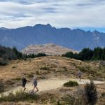
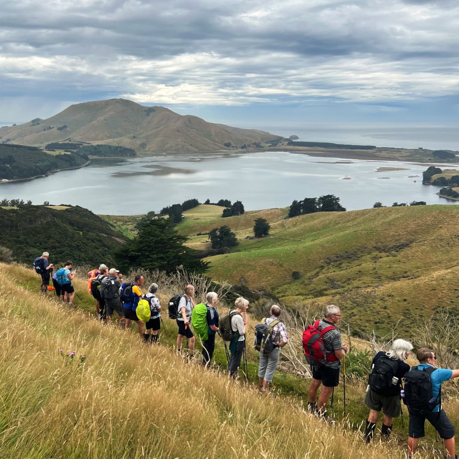
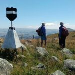
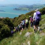
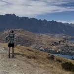 09/03/2025 to 14/03/2025 . Queenstown Camp. Queenstown Hill, Wilsons Bay, Bobs Cove. Trampers, and Hikers. Leaders: Anne and Rod Ward, Di and Chris Bezett.
Continue reading “Queenstown Camp 2025 Day 1: Queenstown Hill, Wilson’s Bay, Bobs Cove”
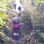
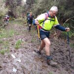
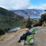 09/03/2025 to 14/03/2025 . Queenstown Camp – Mt Crichton Loop, Sawpit Gully, German Hill, Bush Creek. Trampers & Hikers. Leaders: Anne and Rod Ward, Di and Chris Bezett.
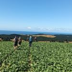
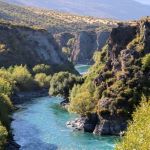 09/03/2025 to 14/03/2025 . Queenstown Camp. – Wye Creek, Kawarau Bike Trail, Gibbston Tavern. Trampers, and Hikers. Leaders: Anne and Rod Ward, Di and Chris Bezett.
Continue reading “Queenstown Camp 2025 Day 4: Wye Creek, Kawarau Bike Trail, Gibbston Tavern.”
 26/02/2025 Stonehurst Track. Grade 4. Trampers. Leaders: Jill Reid, Sylvie Watt.
19 keen trampers left Mosgiel at 8.30am on a lovely Wednesday morning. It did not take long to reach McHardy Gladbrook Rd near Middlemarch then a short drive to the DOC track.
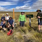
 19/02/2025. Hereweka Road / Portobello . Grade 3.5. Trampers. Leaders: Di Bezett, Lyn Keene.
Twenty three of us set off in lovely sunshine. We had to stop on Hereaweka road for rain jackets but it wasn’t cold, although it was very muggy. Continue reading “Hereweka Road / Portobello”
 12/02/2025. Powder Ridge to Long Ridge (return). Grade 5. Leaders: Pam Cocks, Esther Willis.
Fabulous day – and the writer is officially pooped.
 29/01/2025. Hope Hill. Grade 4. Trampers. Leaders: John Gardiner and Martin Hickley.
The last club tramp here was almost exactly two years ago and Diane and Marijke’s description is quite excellent, so I’ll not repeat that. Undertaken in ever warming conditions and rising afternoon winds, over exposed farmland, twelve trampers were very glad to get down to the cars some five hours after leaving.
 22/01/2025. Mt Royal/Bobby’s Head (Tavora Reserve). Grade 3.5. Trampers. Leaders: Graham Thurlow, Graeme Souter.
Parking at Tavora Reserve in the long grass on a warm summer’s day with a slight breeze we, 15 trampers, made our way up the gravel on Bobby’s Head Rd turning left onto the Goodwood Rd passing a familiar sign, “Adam Sutherland Road”. Continue reading “Mt Royal/Bobby’s Head (Tavora Reserve)”
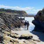 15/01/2025. Akatore Creek to Taieri Mouth. Grade 3. Trampers. Leaders: Spen Walker and Jane Bruce.
We gathered at PJ Park on a fine sunny morning, and Phil welcomed us to the first trip of the year.
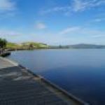 04/12/2024. Waihola – new cycleway/walk. Grade 3. Trampers. Leaders: Heather Kirk and Jenny Wilton. We arrived at the start of the track in Waihola at 9.30 am where there is plenty of parking, toilets and lovely views of the lake.
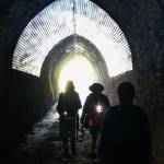 20/11/2024. Frasers Gully / Friends Hill / Wingatui Tunnel & Return. Grade 3.5. Trampers. Leaders: Anne Ward and Lyn Keene.
Our group of 19 met at Ellis Park before beginning our walk up Frasers Gully, beautiful native bush, singing birds and flowing stream.
Continue reading “Frasers Gully/Friends Hill/Wingatui Tunnel and return”
 13/11/2024. Chingford Park, Cleghorn Street, Opoho Circuit. Grade 4. Trampers. Leaders: Ross and Wyn Davies.
20 trampers met up up North Road in North East Valley, on the corner of Crown Street. We headed off at about 9:45am up the valley in sunshine.
Continue reading “Chingford Park, Cleghorn Street, Opoho Circuit”
 30/10/2024. Greengage Track. Grade 5. Trampers. Leaders: Graeme Souter and Graham Thurlow.
Bah humbug how hard can this grade 5 tramp be? Heh heh they were about to find out as those who did the recce already knew what to expect.
 23/10/2024. Tomahawk, Soldiers’ Memorial, Karetai Track. Grade 4. Trampers. Leaders: Di Bezett, Gail Williams and Lyn Keene
24 people set off on a very humid day, straight up the 4wheeldrive track, the views were spectacular. Continue reading “Tomahawk, Soldiers’ Memorial, Karetai Track”