Click on Maps to Enlarge
Taieri Recreational Tramping Club
Mid-week recreational and social walking group based in Mosgiel NZ

Click on Maps to Enlarge
Click on Maps to Enlarge
(1) Post Office Creek from power station
(2) Post Office Creek / Vertaburn (Reid – Beattie Farms)
Click on Map to Enlarge
Click on Map to Enlarge
Click on map to enlarge
Click on map to enlarge

Click on map to enlarge
Click on Map to Enlarge

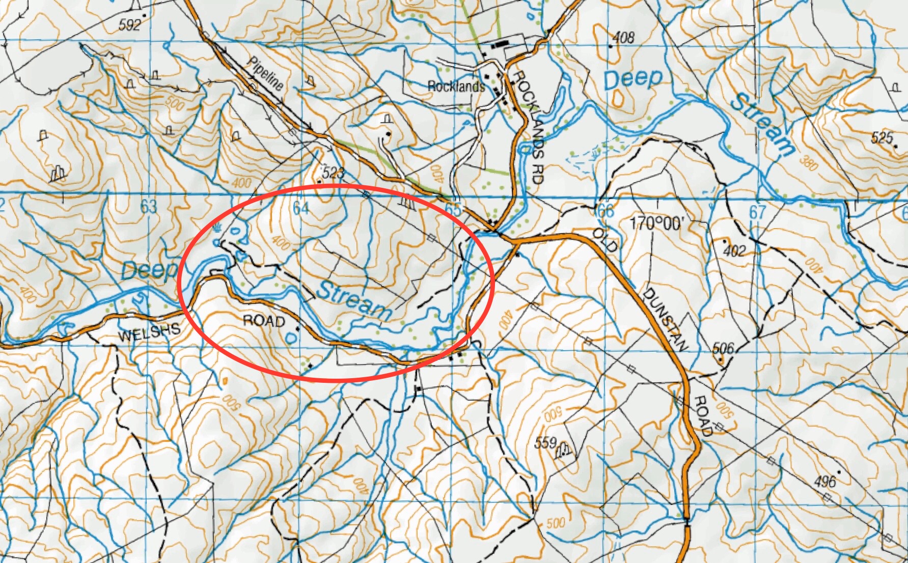
This page of club tramps and hikes in the area West via SH87 (inland on the south side of SH87) groups together trips to Deep Creek. (map)
Road distances from Mosgiel carpark.
TRTC Grading Information – trips incorporating these tracks are generally given a TRTC grading of 4. This is indicative only, as trips can be allocated a higher or lesser grading depending on the route taken. For more detailed analysis refer to Grading Information.
Access Permissions are required for trips to Deep Creek – refer guidelines
Deep Creek Water Scheme Pipeline history.
Further background information behind Deep Stream project
How To Get There:
Follow State Highway 87 from Outram to the Clarks Junctions turn off. Turn left onto the Old Dunstan Road which will take you past Rocklands Station and continue to the gate of the Te Papanui Conservation Park (managed by DOC).
06/11/2024. Deep Creek Weir. Grade 3. Combined. Leaders: Barbara Shackell, Wendy Langley, Carolyn Pridham, Sue Johnstone.
Deep Creek Weir from Old Dunstan Road past Rocklands. 2023 – 1989 (19 trips, 8 with reports and photos, 9 with no reports, 2 with photos only)
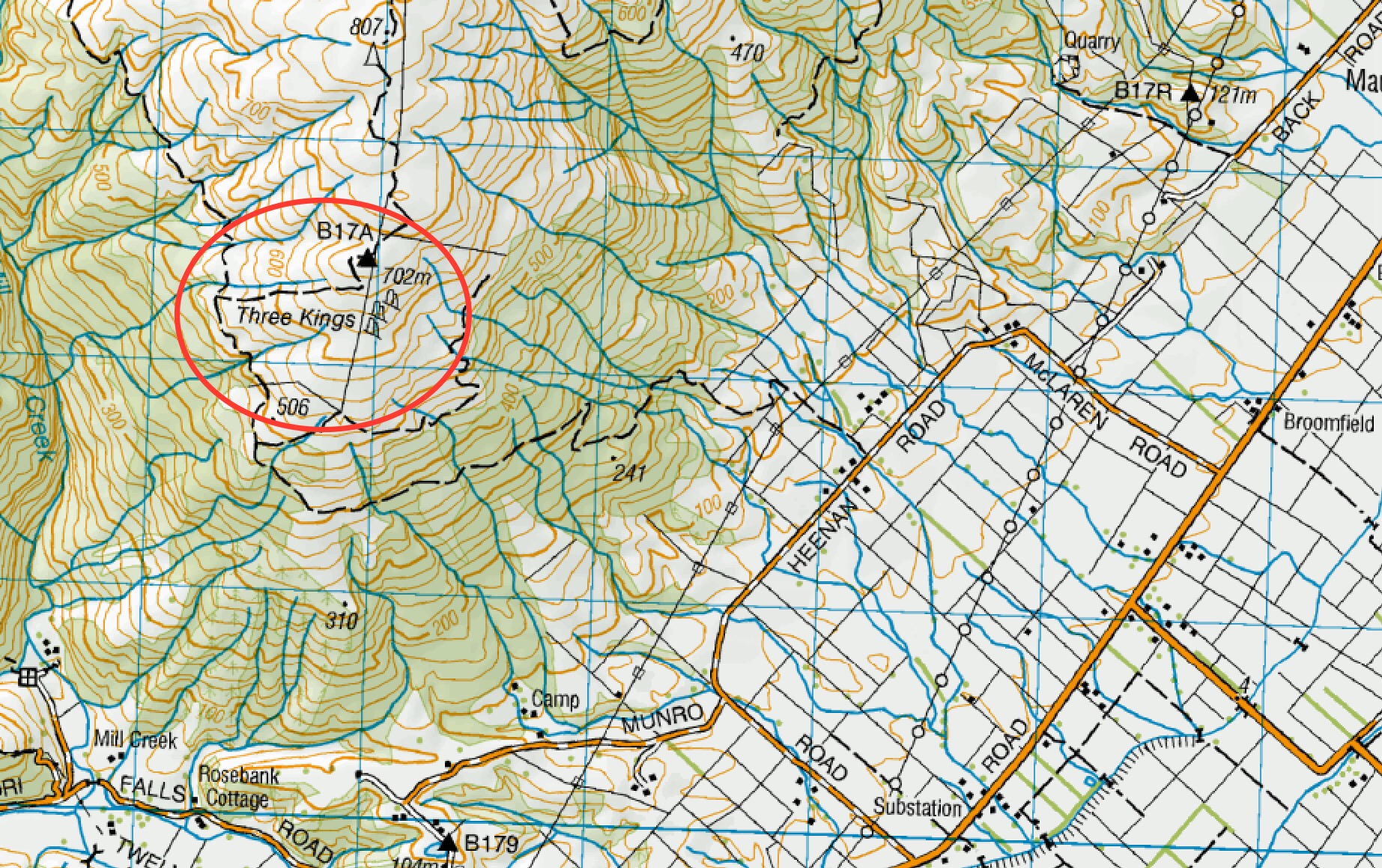
This page of club tramps and hikes covers trips West via SH87 which includes trips from Heenan Road to the Maungatuas and the Three Kings. (map)
Road distances from Mosgiel carpark.
Access Permissions maybe required as this trip (Heenan Road) ventures over a working farm – refer guidelines
TRTC Grading Information – trips incorporating these tracks are generally given a TRTC grading of 3. This is indicative only, as trips can be allocated a higher or lesser grading depending on the route taken. For more detailed analysis refer to Grading Information.
From Outram turn left onto Allanton Road then right onto Huntly Road – this runs into Maungatua Road. Proceed to McLaren Road on the right, this in turn runs into Heenan Road.
30/10/2024. 3 Kings from Heenan Road. Grade 3. Hikers. Leaders Dave Roberts Neville Griffiths.
Tramps Incorporating Three Kings. 2021 – 1989 (26 trips, 6 with reports, 1 with photos only, 19 with no reports)
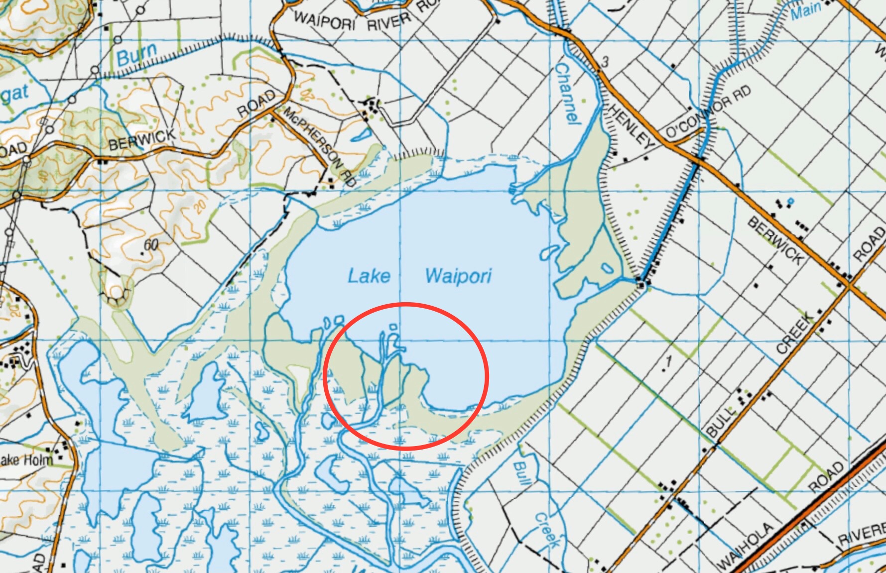
This page of club tramps and hikes in the area West via SH87 (Maungatua, Waipori River, Berwick) groups together trips to the Sinclair Wetlands (map)
Road distances from Mosgiel carpark.
Official Sinclair Wetlands website.
Hori Sinclair and his wetlands’origin(1st paragraph only, of treatise linking its surrounds prehistorically with Kai Point Coal Mine)
Sinclair Wetlands. 2024 – 1990 (5 trips with 4 reports)
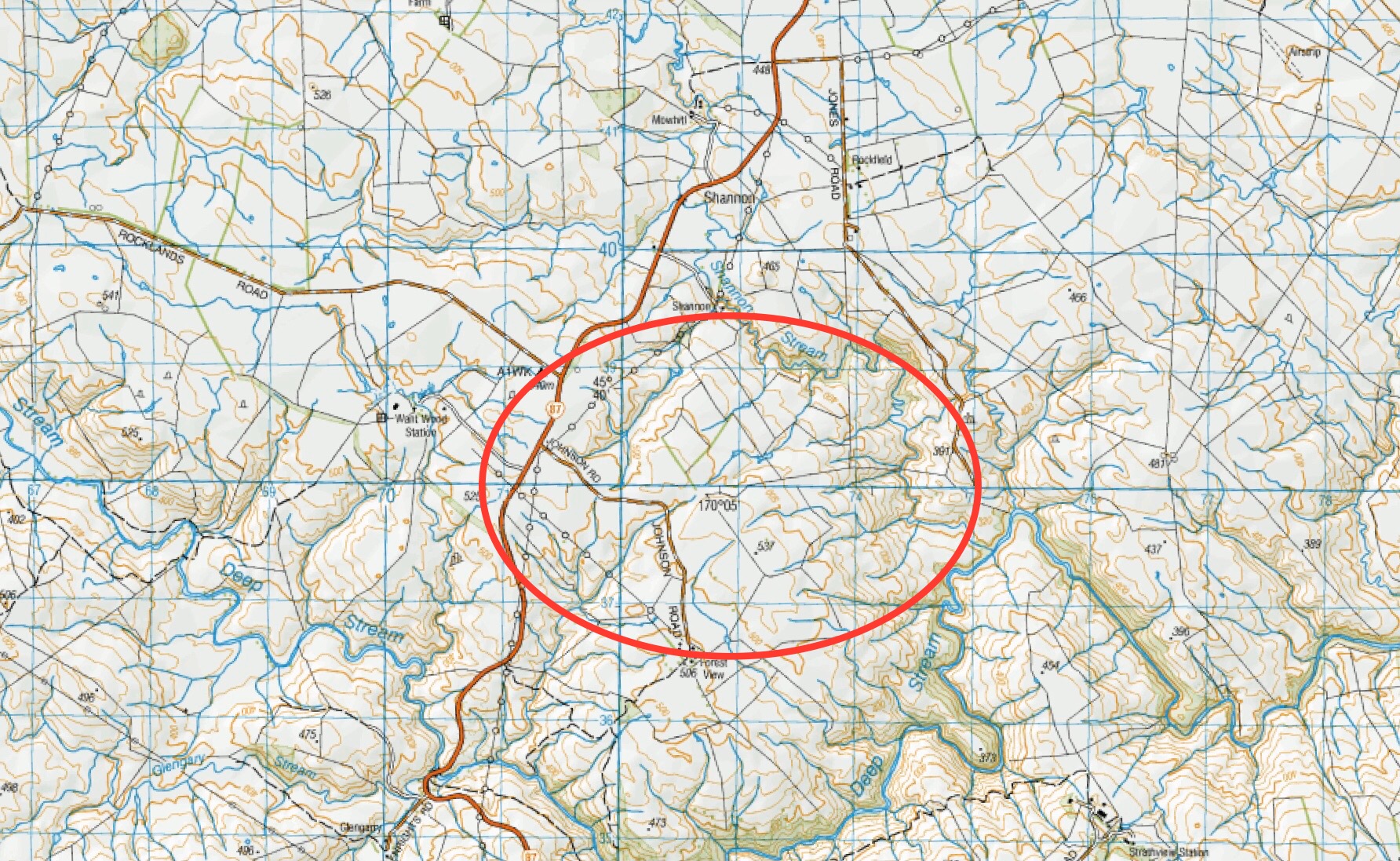
This page of club tramps and hikes in the area West SH87 groups together trips to the Middlemarch area including Shannon and Sutton. (map)
Road distances from Mosgiel carpark.
Rock and Pillar via Six Mile Creek This climbs 1,005 m. (3300 feet) up the eastern face from Glencreag Station up a leading ridge south of Six Mile Creek. This is the most direct approach.
Rock and Pillar via spur south of Lug Creek. Information: Climbs 910 m. (3000 feet) up the eastern face of a well-graded vehicle track up a leading spur south of Lug Creek. Average time to Leaning Lodge is 3 hours on foot.
DoC access. 9.5km north of the Middlemarch store on SH87, just before Lug Creek, is a farm entrance (RAPID 7219 – no DoC sign). A short way up the driveway is a DoC car park. There is public access up the vehicle track to the conservation area boundary. The track is now a recreation reserve administered by DoC.
Easiest route to Big Hut from Leaning Lodge (foot only – unmarked – good visibility essential) is another 45+ minutes climbing gently southwards to cross a steep gully and then climb a gentle shelf to above the eastern basins. Sidle several hundred metres past the lower prominent rock tors before gently descending to Big Hut once it becomes visible. Route very wind and cloud-prone. Ice axe and crampons may be necessary to traverse steep snow slopes near Leaning Lodge.
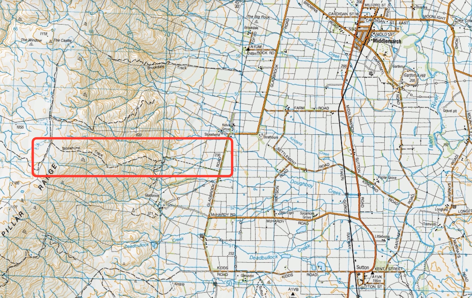
64 km to Middlemarch. 66 km to Stonehurst Track.
Redan Crater- contact for access Ken Rennick.
Stonehurst Track – take SH87 to Sutton / Middlemarch. Just over the rail line at Sutton turn left onto McHardy Road then right onto Gladbrook Road. Start of track is about 1 km on left on Gladbrook Road – see DOC sign post.
Sutton Salt Lake – take SH87 to Suttom / Middlemarch. Turn left onto Kidds Road (before rail crossing). Sutton Salt Lake Reserve is approx 2.5km from turn off on the left.
26/02/2025 Stonehurst Track. Grade 4. Trampers. Leaders: Jill Reid, Sylvie Watt.
Middlemarch Area Tramps. 2023 – 1988 (16 trips with 13 reports, 1 with photos only, 2 no reports)
Jones Property, Matarae. 2022 (1 trip with 1 report)
Shannons Farm Walk. 2023 – 2020 (3 trips with 3 reports)
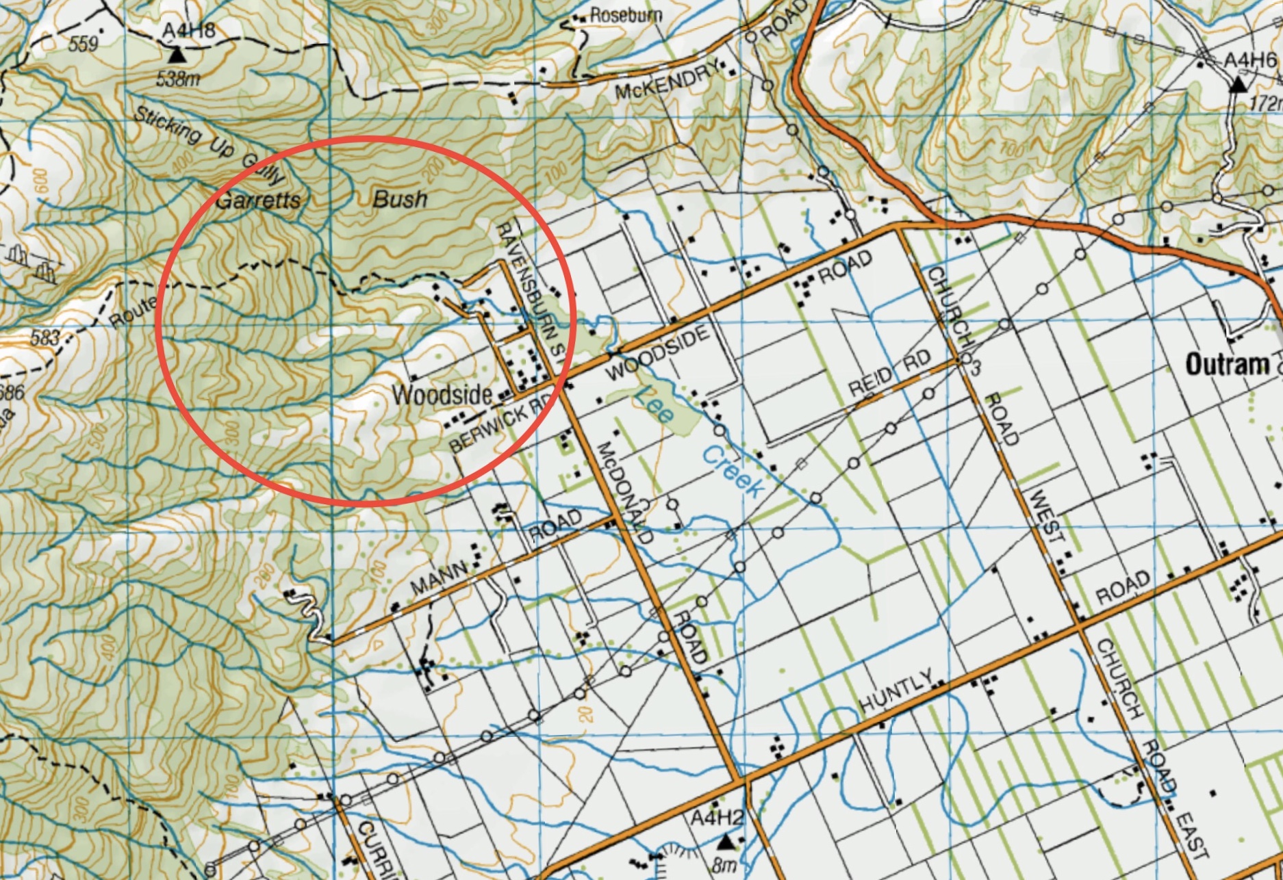
This page of club tramps and hikes in the area West via SH87 (inland on the south side of SH87) groups together trips on farms in the Lake Mahinerangi area.
Road distances from Mosgiel carpark.
Lake Mahinerangi and Waipori (General Information)
Mahinerangi Farm Tramps. 2024 – 2011 (6 trips with 6 reports – 1 with photos only)
Mahinerangi Wind Farm. 2019 – 2011 (2 reports – photos only)
Lake Mahinerangi, Verterburn Road, Picnic Place. (6 trips, no reports)
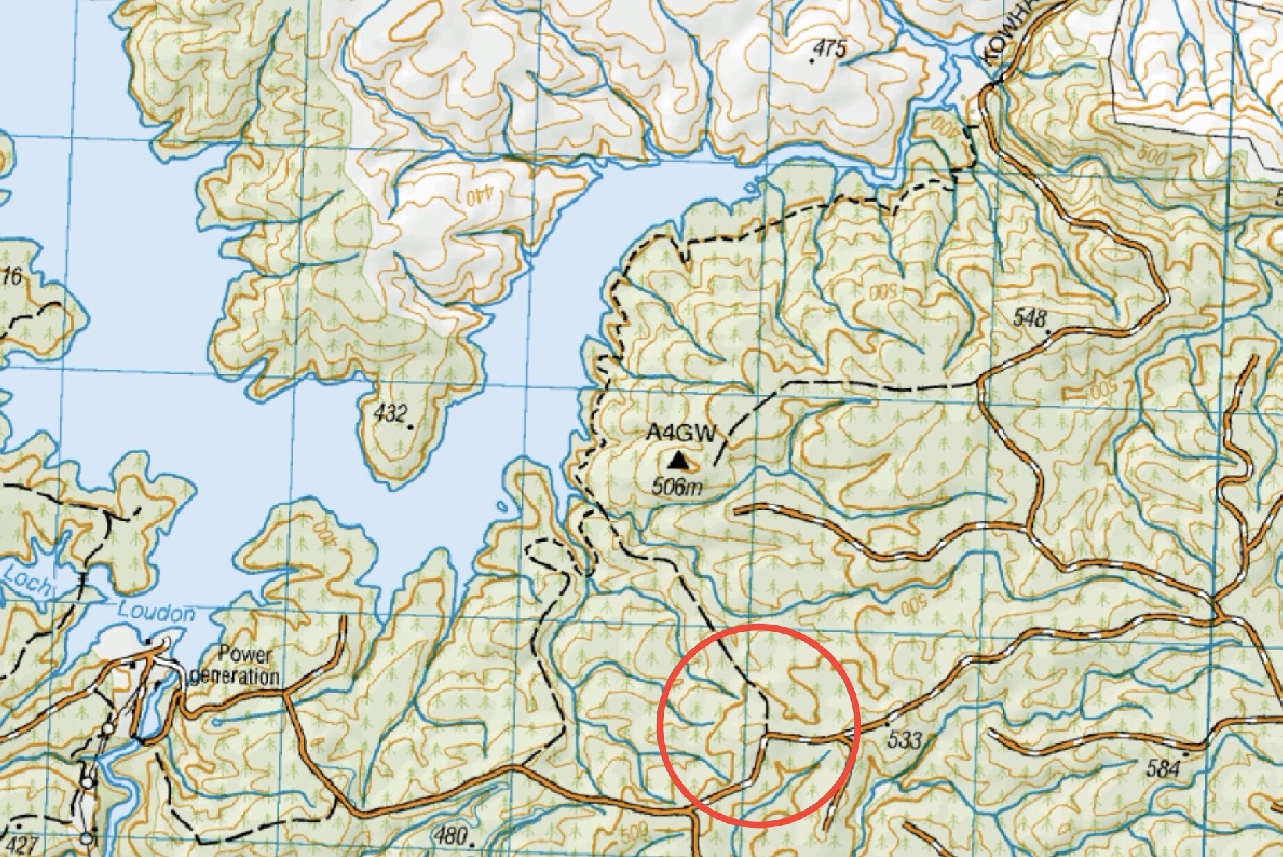
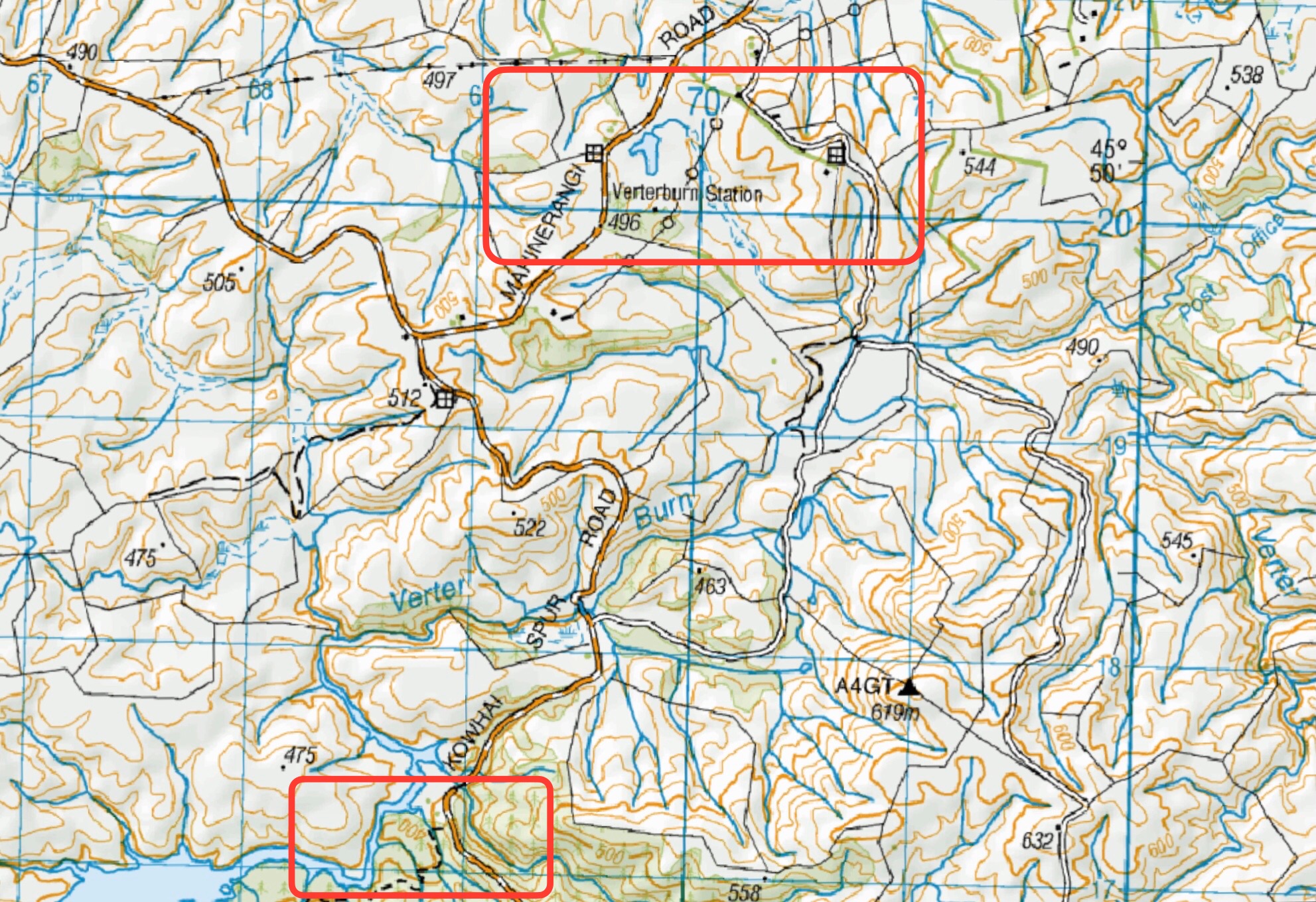
This page of club tramps and hikes in the area West via SH87 (inland on the south side of SH87) groups together trips to Post Office Creek, Reid’s and Beatties Farms (Verterburn). (maps)
Road distances from Mosgiel carpark.
Access Permissions may be required depending on how Post Office Creek track is accessed. Permissions must be obtained for those trips venturing onto either Reid and/or Beattie farms – refer guidelines
(1) Access via Reid’s / Beatties Farms (Verterburn)
Turn left of Lee Steam Outram Road (SH87) onto Mahinerangi Road. Follow this to the junction and turn right onto Kowhai Spur Road. This brings you to Verterburn and access to Post Office Creek at Lake Mahinerangi.
(2) Access via forestry walk – Lake Mahinerangi
Take the Waiporai Falls Road (off Maungatua Road) to the power station at Lake Mahinerangi. Cross over bridge below the power station and follow the unnamed road to the forest access and Post Office Creek track.
19/03/2025. Post Office Creek via Reid Farm. Grade 3.5. Hikers. Leaders: Bruce Spittle and Dave Roberts.
Post Office Creek, Reid’s Station. 2022 -1992 (18 trips with 7 reports including 1 with photos only)
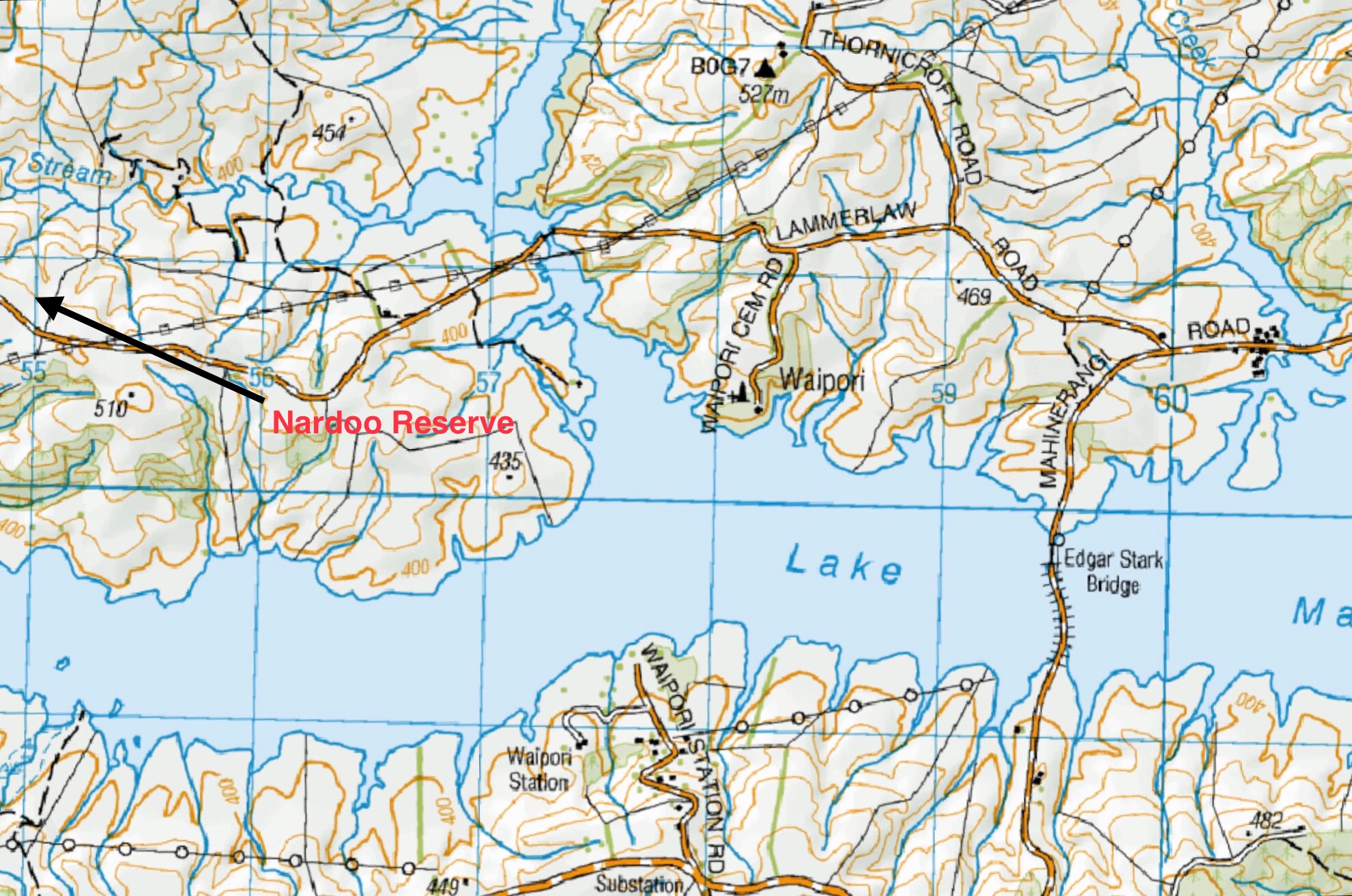
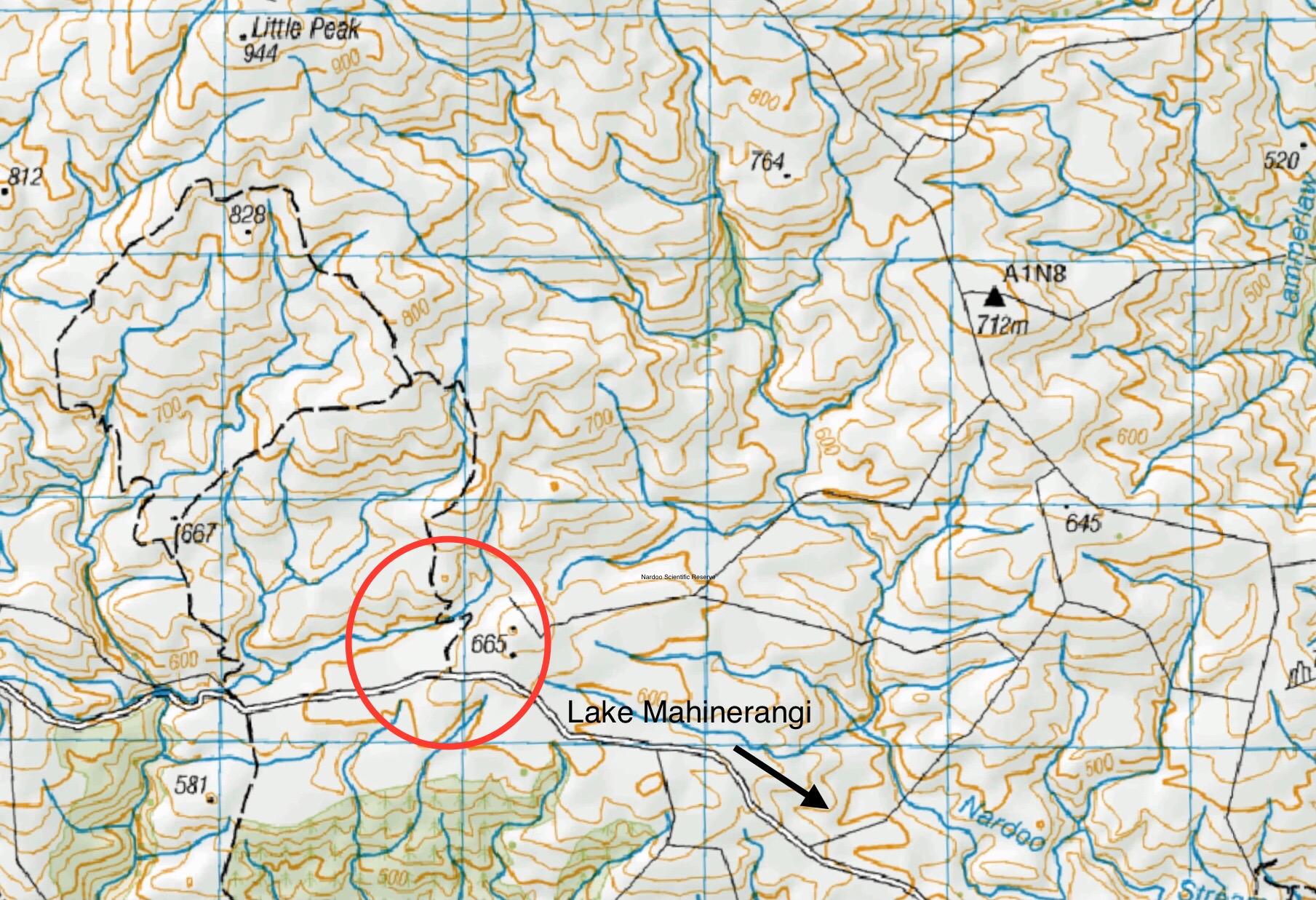
This page of club tramps and hikes in the area West via SH87 (inland on the south side of SH87) groups together trips to the Nardoo Scientific Reserve. (maps)
Road distances from Mosgiel carpark.
Suggest leave Mosgiel 8.30am to get to ‘Little Peak about 1km above ‘Walrus rock’.
TRTC Grading Information – trips incorporating these tracks are generally given a TRTC grading of 4. This is indicative only, as trips can be allocated a higher or lesser grading depending on the route taken. For more detailed analysis refer to Grading Information.
Take Lee Stream Outram Road and turn left onto Mahinerangi Road. Follow this road to the lake past the fisherman’s huts etc and turn right onto Lammerlaw Road. Stay on this road until you reach a small parking area near the Reserve.
Walrus Bridge. Nardoo Scientific Reserve. Little Peak.
2022 – 1993 (10 trips with 6 reports)