Click on Map to Enlarge
Taieri Recreational Tramping Club
Mid-week recreational and social walking group based in Mosgiel NZ

Click on Map to Enlarge
Click on map to enlarge
Click on map to enlarge
Click on Map to Enlarge
Click on Map to Enlarge
Click on Map to Enlarge
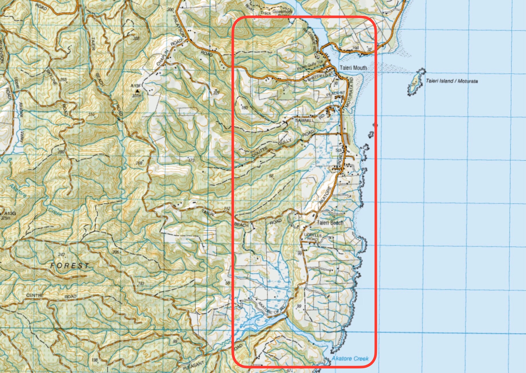
This page of club tramps and hikes in the South Coast area groups together trips to the Akatore Area including Coutts Farm / Gully, Sawmill Road and Taieri Mouth. (map)
Road distances from Mosgiel carpark.
Access Permissions are required for trips to Akatore and Coutts Farms – refer guidelines
TRTC Grading Information – trips incorporating these tracks are generally given a TRTC grading of 2. This is indicative only, as trips can be allocated a higher or lesser grading depending on the route taken. For more detailed analysis refer to Grading Information.
To reach Akatore Creek take the Taieri Mouth Road from Brighton, across the bridge at Taieri Mouth. Continue on Moturata Road and onto Akatore Road to Akatore Creek carpark on the left, just before crossing Akatore Creek bridge.
15/01/2025. Akatore Creek to Taieri Mouth. Grade 3. Trampers. Leaders: Spen Walker and Jane Bruce.
Coutts Gully / Farm, Sawmill Road. 2024 – 1988 (23 trips, 10 with reports and photos, 1 with photos only, 1 with report only, 11 with not report or photos).
Akatore Farm Walk or Beach Walk. 2019 – 1991 (15 trips, 8 with reports and photos, 2 with photos only, 5 with no report or photos)
Akatore Forest: Narrowdale Rd, Gorge Hill, Stewarts Farm. 2023 – 1989 (11 trips, 2 with reports and photos, 1 with photo only, 8 with no report or photos)
Akatore Forest. 2016 – 1991 (8 trips, 4 with reports and photos, 4 with no reports or photos)
This page of club tramps and hikes in the South Coast area groups together trips to the Takitakitoa Wetlands Reserve. (map)
Road distances from Mosgiel carpark.
TRTC Grading Information – trips incorporating these tracks are generally given a TRTC grading of 2. This is indicative only, as trips can be allocated a higher or lesser grading depending on the route taken. For more detailed analysis refer to Grading Information.
https://www.southroads.co.nz/projects/takitakitoa-wetland-restoration-project
The Takitakitoa Wetlands is located about 40 minutes drive south of Dunedin and is at the end of Takitakitoa Road off Otokia-Kuri Bush Road. Take SH1 south and turn off at the Henley turn off just before the bridge that crosses the Taieri River. Turn right onto Otokia-Kuri Bush Road West which will intersect with Otakia-Kuri Bush Raod.
11/12/2024. Takitakitoa, Wetland, Waihola Hall. Grade 2. Combined hike and Christmas Lunch. Leaders: Jan Butcher, Wendy Langley, John Gardiner, Graeme Souter.
7/4/2021. Takitakitoa Wetland/Lester Harveys 90th Birthday. All. Leaders. Raewyn, Phil and Jill D
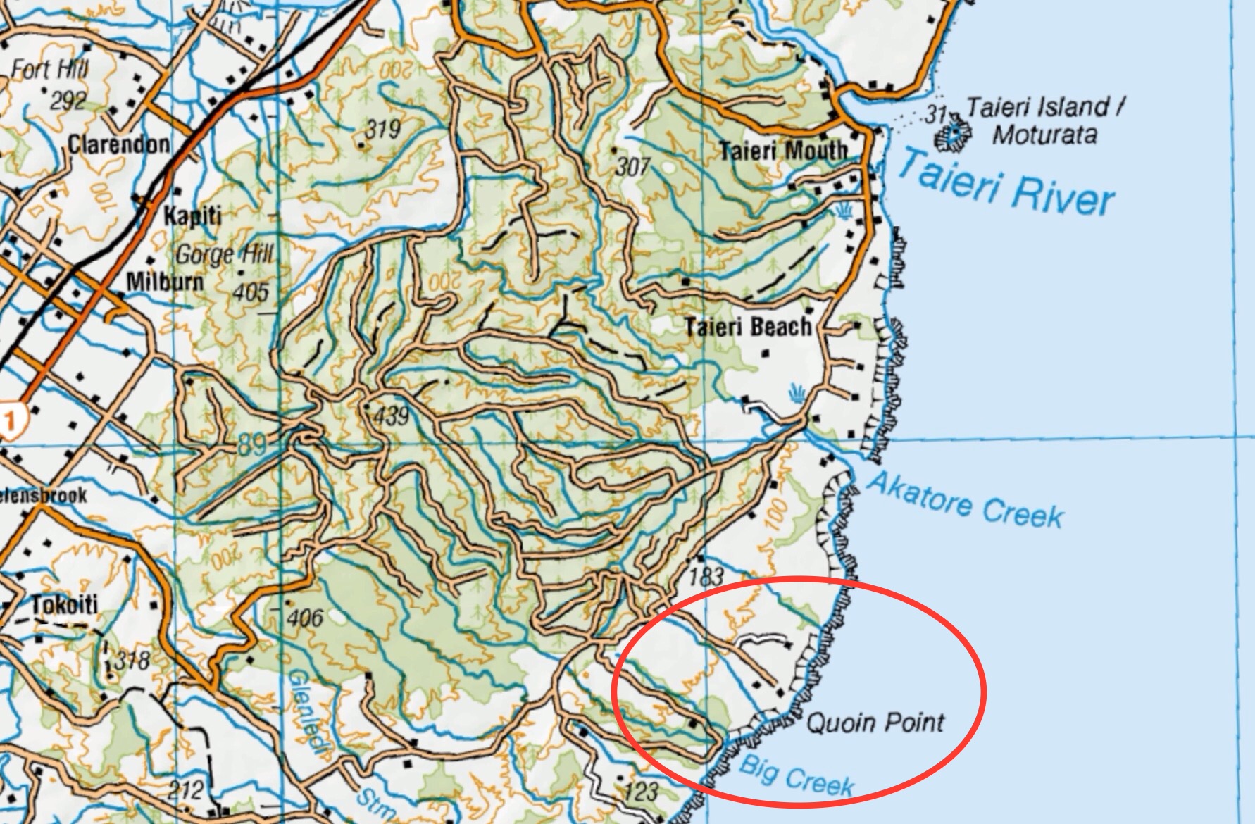
This page of club tramps and hikes in the South Coast area groups together trips to Bull Creek and Quion Point. (map)
Road distances from Mosgiel carpark.
Access Permissions are required as trips to Quion Point / Bulls Creek venture over a working farm – refer guidelines.
TRTC Grading Information – trips incorporating these tracks are generally given a TRTC grading of 2. This is indicative only, as trips can be allocated a higher or lesser grading depending on the route taken. For more detailed analysis refer to Grading Information.
To reach Quion Point take the Taieri Mouth Road from Brighton, across the bridge at Taieri Mouth. Continue on Moturata Road and onto Akatore Road, past Akatore Creek and turn left onto Quoin Point Road.
Quoin Point Bull Creek. 2023 – 1996. (16 trips, 7 with reports, 1 with photos only, 8 with no reports or photos)
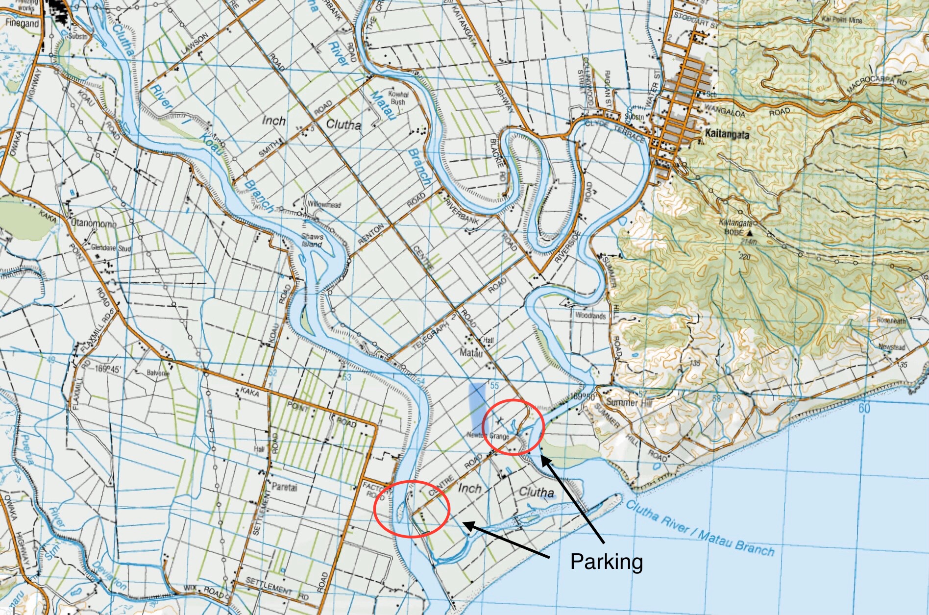
This page of club tramps and hikes in the South Coast area groups together trips to Kaitangata and Inch Clutha (map)
Road distances from Mosgiel carpark.
TRTC Grading Information – trips incorporating these tracks are generally given a TRTC grading of about 2. This is indicative only, as trips can be allocated a higher or lesser grading depending on the route taken. For more detailed analysis refer to Grading Information.
Take SH1 south to the Kaitangata turn off (well sign posted) and turn left onto the road taking your to Kaitangata township. Take Clyde Terrace along side the river and cross the bridge onto Riverside Road. Continue on this road and turn left onto Telegraph Road. Turn left onto Centre Road and continue to small car park by boat ramp to the Clutha River.
02/04/2025. Inch Clutha. Grade 2.5. Combined. Leaders: Phil Keene, Graeme Souter, Bruce & Jenny Wright.
Kaitangata. 2003 – 1992 (3 trips. 1 trip (14/9/2023) as guests of Trixie Trampers (Blaclutha) with report and photos)
Click on Map to Enlarge
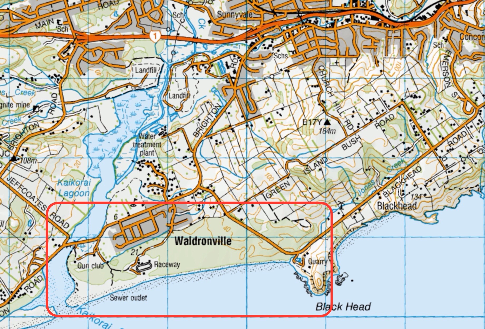
This page of club tramps and hikes in the South Coast area groups together trips to Waldronville and incorporates Blackhead, Kaikorai Estuary, Ocean View and Brighton. (map)
Road distances from Mosgiel carpark.
TRTC Grading Information – trips incorporating these tracks are generally given a TRTC grading of 2. This is indicative only, as trips can be allocated a higher or lesser grading depending on the route taken. For more detailed analysis refer to Grading Information.
Take Brighton Road from Green Island through Waldronville Township. Parking is available past the township on the left just before crossing the bridge over the Kaikorai Lagoon.
Waldronville 2024 – 2003 (14 trips, 10 with reports, 4 no reports or photos)
Beach Walk, Blackhead, Kaikorai Estuary, Ocean View, Brighton Tramps. 2009 – 2004 (6 trips, 2 with reports, 1 with photos only)
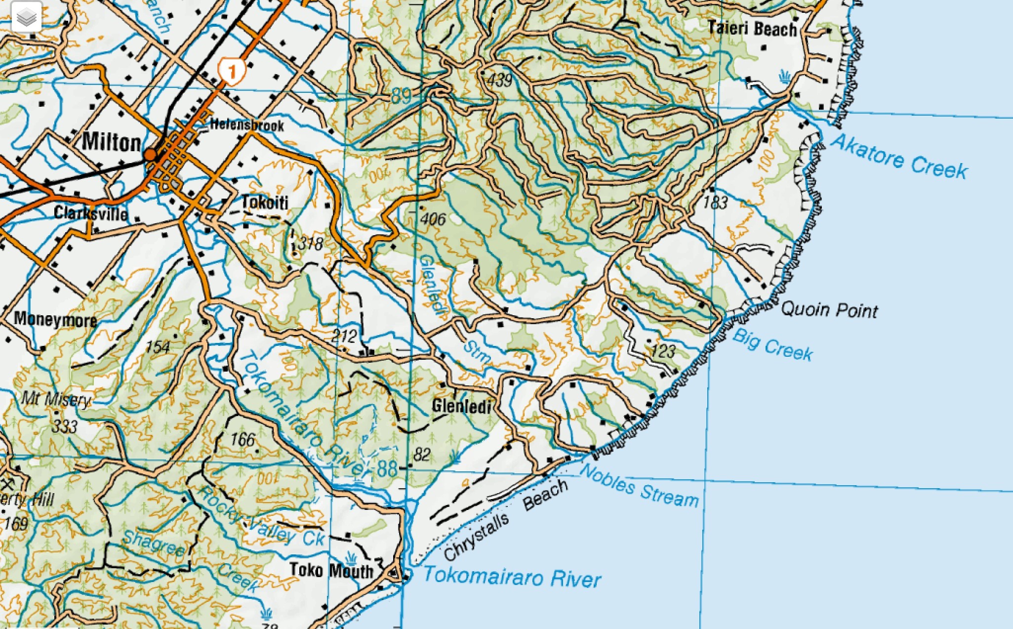
This page of club tramps and hikes covers trips on the South Coast and includes trips to Chrystalls Beach, Toko Mouth and Cooks Head. (map)
Road distances from Mosgiel carpark.
TRTC Grading Information – trips incorporating these tracks are generally given a TRTC grading of 2. This is indicative only, as trips can be allocated a higher or lesser grading depending on the route taken. For more detailed analysis refer to Grading Information.
Take SH1 south and turn left onto Forsyth Road (just before Milton). At the end of this road turn right onto Back Raod then left onto Glenledi Road. Follow this road some distance to reach Chrystalls Beach.
Chrystalls Beach, Toko Mouth. 2023 – 1989 (22 trips with 10 reports)
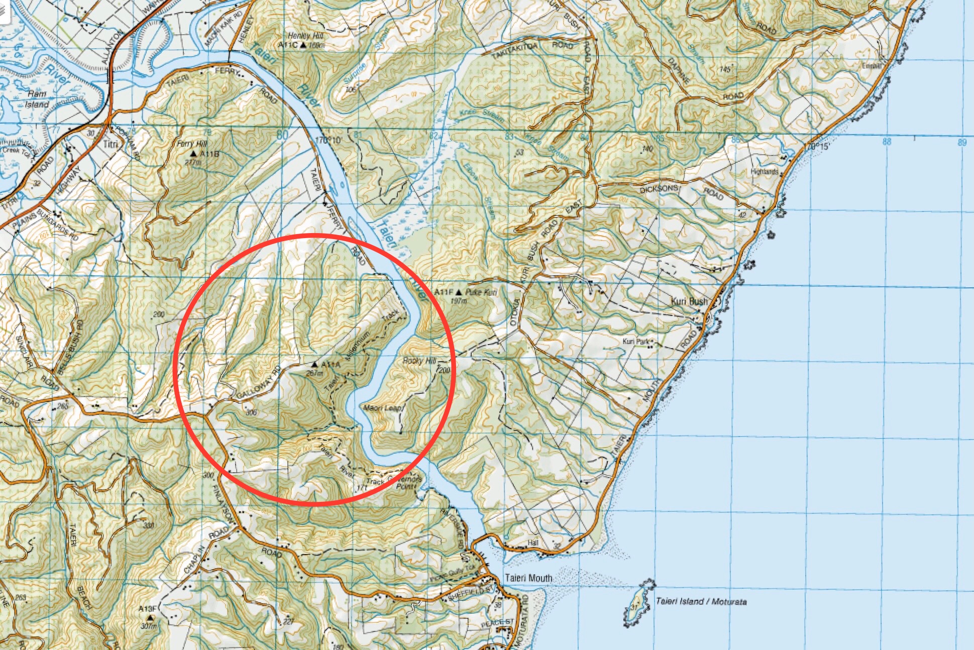
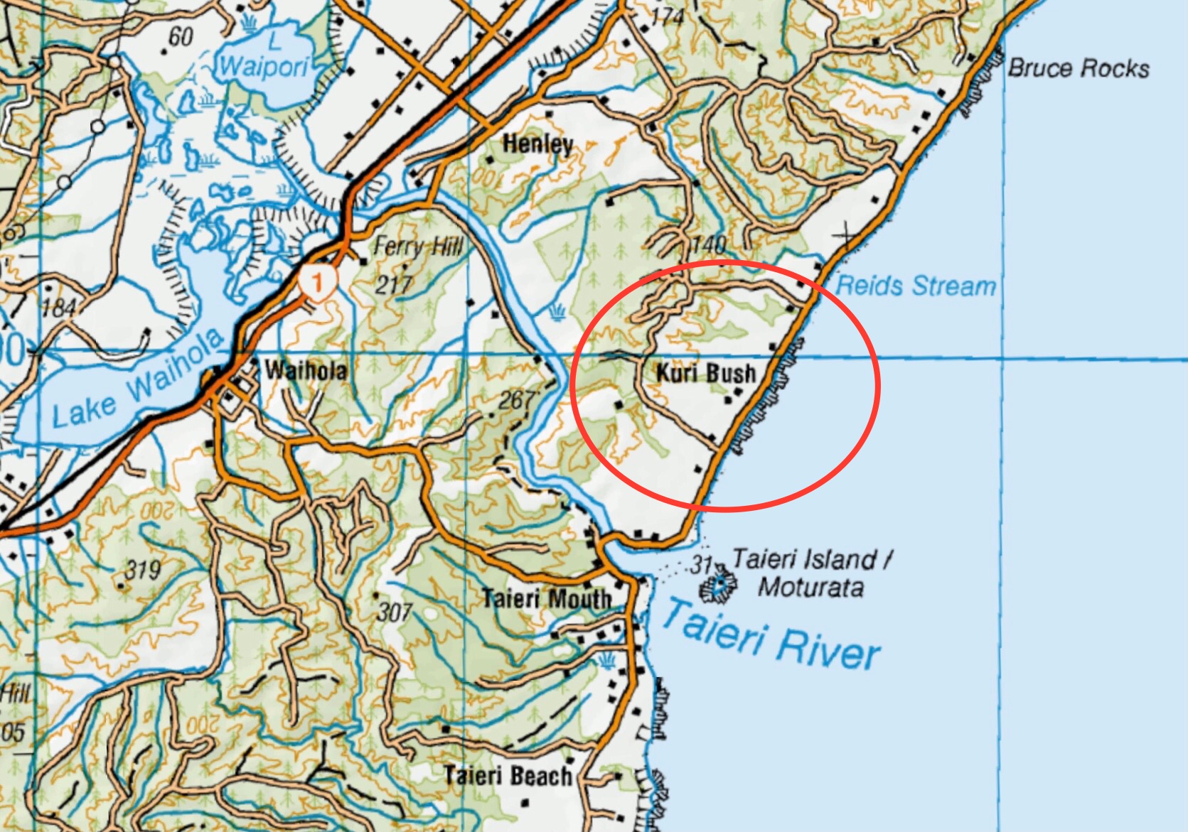
This grouping of Club tramps and hikes covers trips involving Kuri Bush (Big Stone) area located on Taieri Mouth Road between Brighton township and Taieri Mouth beach. It includes Big Stone Road, Daphne Road, Margaret Road and Kathleeen Road. (map)
Background Information:
Road distances from Mosgiel carpark.
11/09/2024.Big Stone Road. Grade 3. Hikers. Leaders: Bill Cubitt & Adrienne Ensor.
Kuri Bush Forestry, Daphne/Margaret Road, Kathleen Road, Big Stone. 2021 – 1988 (19 trips with 5 reports)
This grouping of Club tramps and hikes covers trips from Kuri Bush to Taieri Mouth beach. Kuri Bush is located on Taieri Mouth Road between Brighton township and Taieri Mouth. (map)
Background Information:
Road distances from Mosgiel carpark.
Kuri Bush – Taieri Mouth Beach. 2022 – 2012 (6 trips with 4 reports)