Click on Map to Enlarge
Taieri Recreational Tramping Club
Mid-week recreational and social walking group based in Mosgiel NZ

Click on Map to Enlarge
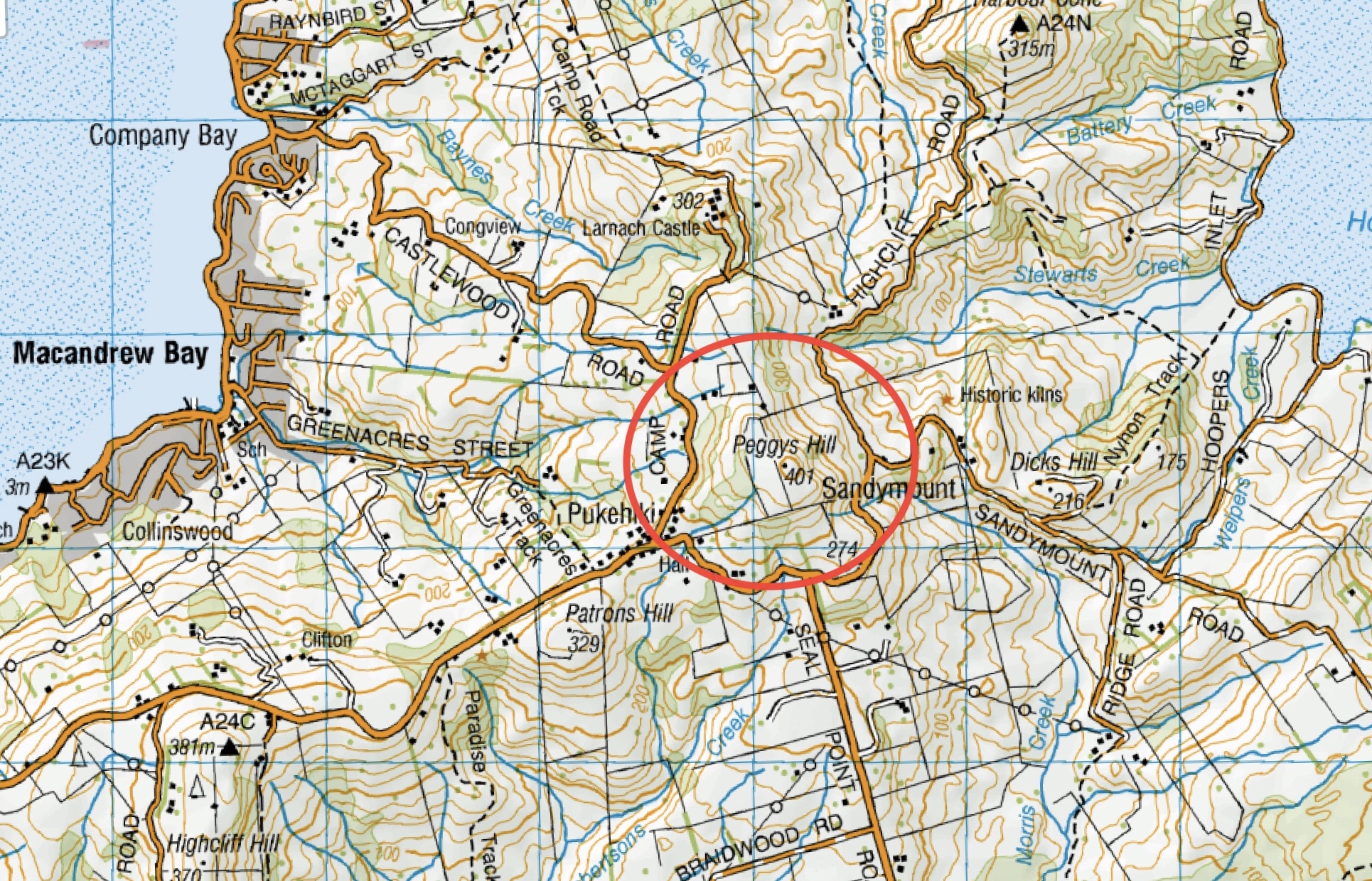
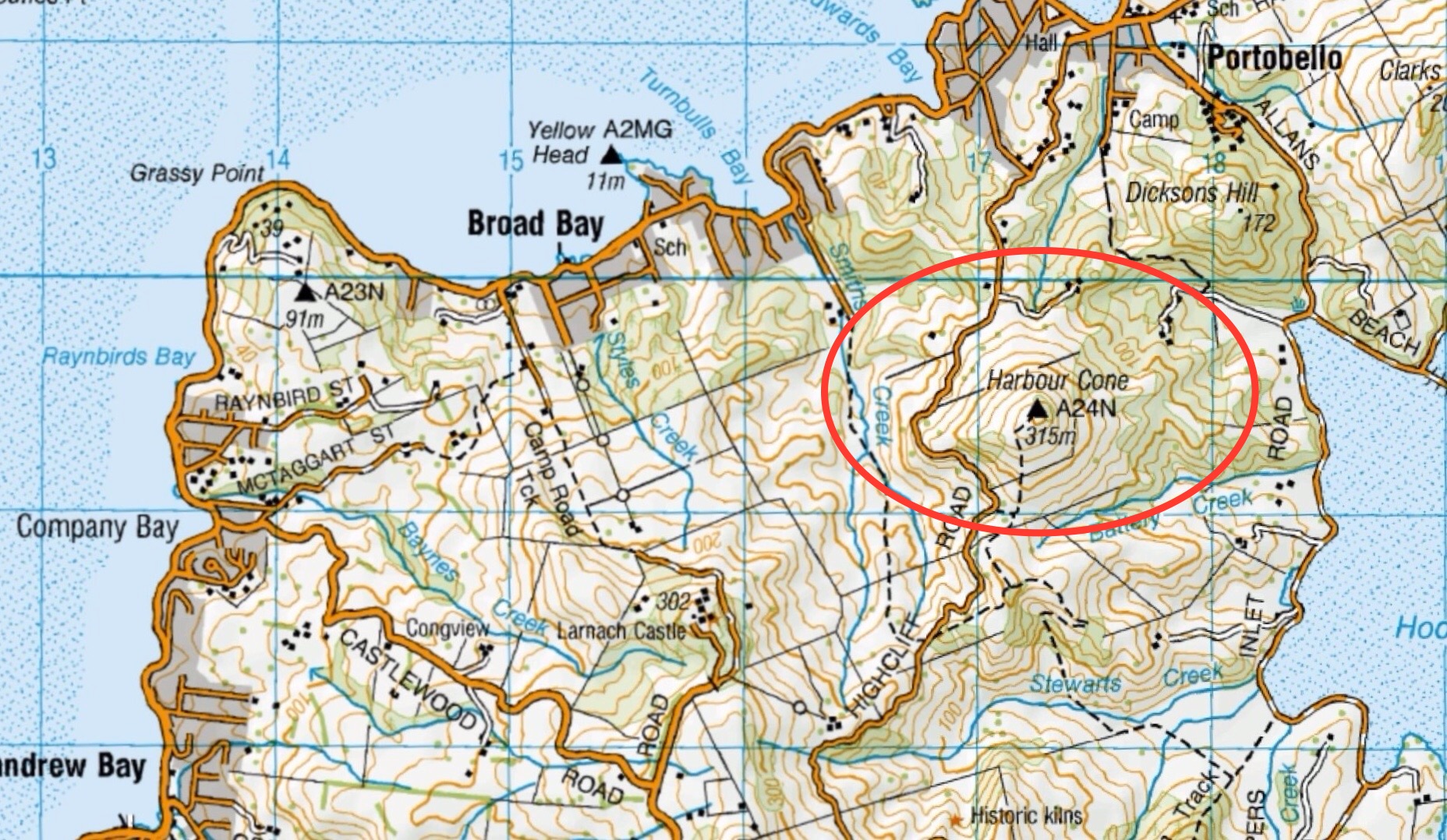
This page of club tramps and hikes on the Otago Peninsula groups together trips to Peggy’s Hill (map) commencing from Macandrew Bay (Greenacres St).
Background Information:
Road distances from Mosgiel carpark.
TRTC Grading Information – trips to Peggy’s Hill are generally given a TRTC grading of 3. This is indicative only, as depending on the route taken, allocation of gradings can differ from this. For more detailed analysis refer to Grading Information.
Access Permissions are required as this trip ventures over a working farm – refer guidelines
List new posts (as per format on each post ie: dd/mm/yyyy, name of trip, grade and leaders)
List and link previous trips relating to this page here (delete when complete)
Click on map to enlarge
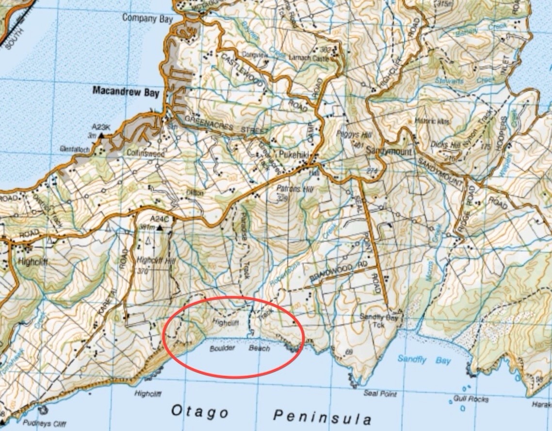
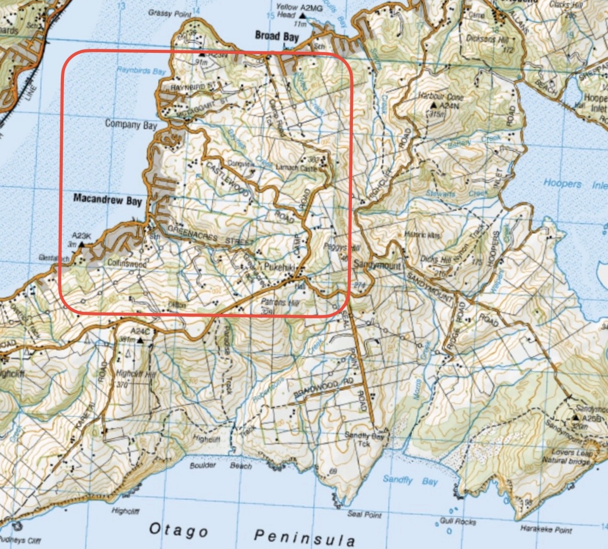
This page of club tramps and hikes on the Otago Peninsula groups together trips to Boulder Beach from Macandrew Bay (Greenacres St), Braidwood Road. These trips will often include the Paradise, Highcliff Tracks.
Background Information:
Road distances from Mosgiel carpark.
(1) From Macandrew Bay proceed up Greenacres St / Track which exits onto Highcliff Road. Turn right onto Highcliff Road and proceed to the start of Paradise Track. This track will take you to Boulder Beach.
(2) Proceed along Highcliff Road and turn left (past Pukehiki) onto Seal Point Road. Follow this road and turn right onto Braidwood Road. At the end of this road is Highcliff Track. Follow this track through the dunes to the junction with Paradise Track then right to Boulder Beach.
Boulder Beach (2024 – 1991) 18 trips – 6 with reports and photos, 2 with photos only, 11 with no reports or photos.
Click on map to enlarge
Click to enlarge map
Click on Map to Enlarge
Click on Map to Enlarge
Click on Map to Enlarge
Click on Map to Enlarge

Click on Map to Enlarge

Click on Map to Enlarge

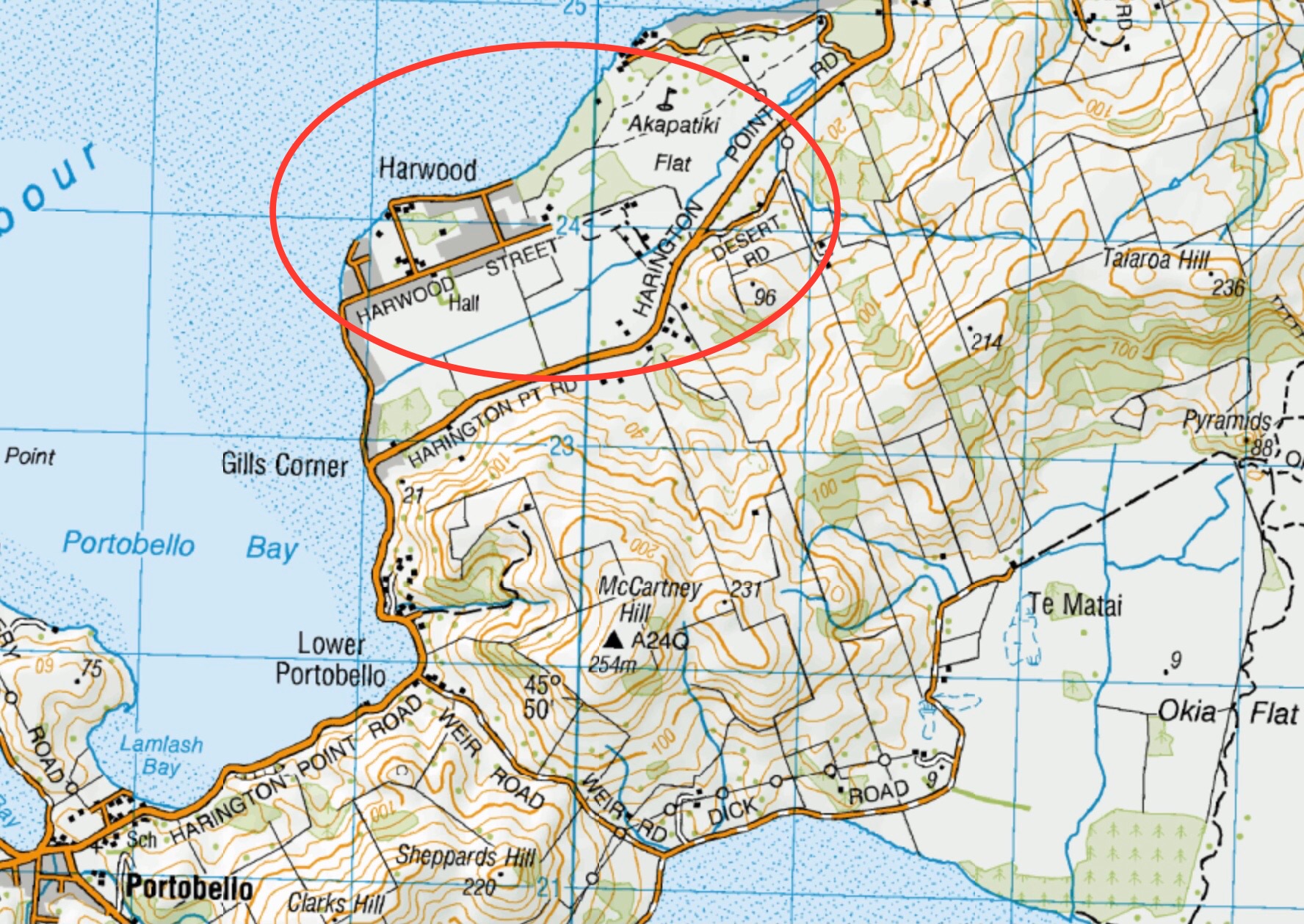
This page of club tramps and hikes covers trips to the Otago Peninsula and involves trips to Harwood. (map)
Road distances from Mosgiel carpark.
29/01/2025. Harwood Area. Grade 2. Hikers. Leaders: Raewyn Keene and Helen Morris.
Harwood – End of year picnic. 2017 – 1998 (6 trips, 1 with reports and photos, 3 with photos only, 2 with no report or photos)
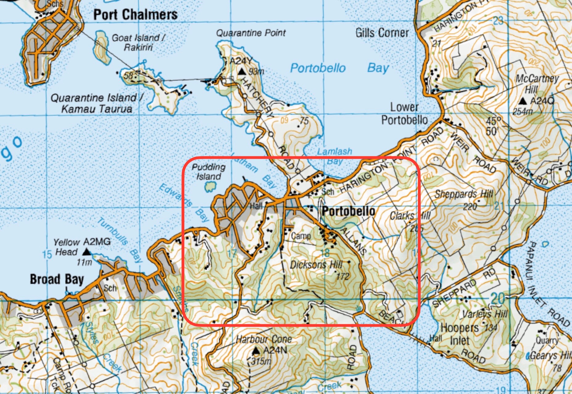
This page of club tramps and hikes on the Otago Peninsula groups together trips to Portobello. (map)
Road distances from Mosgiel carpark.
19/02/2025. Hereweka Road / Portobello . Grade 3.5. Trampers. Leaders: Di Bezett, Lyn Keene.
Portobello, Clarks, Sheppards, McArthny, Varleys Hills. 2023 – 2008 (13 trips with 10 reports, plus 2 with photos only)
Portobello, Hatchery Road, Quarantine Point. 2022 – 2005 (10 trips with 2 reports plus 3 with photos only)
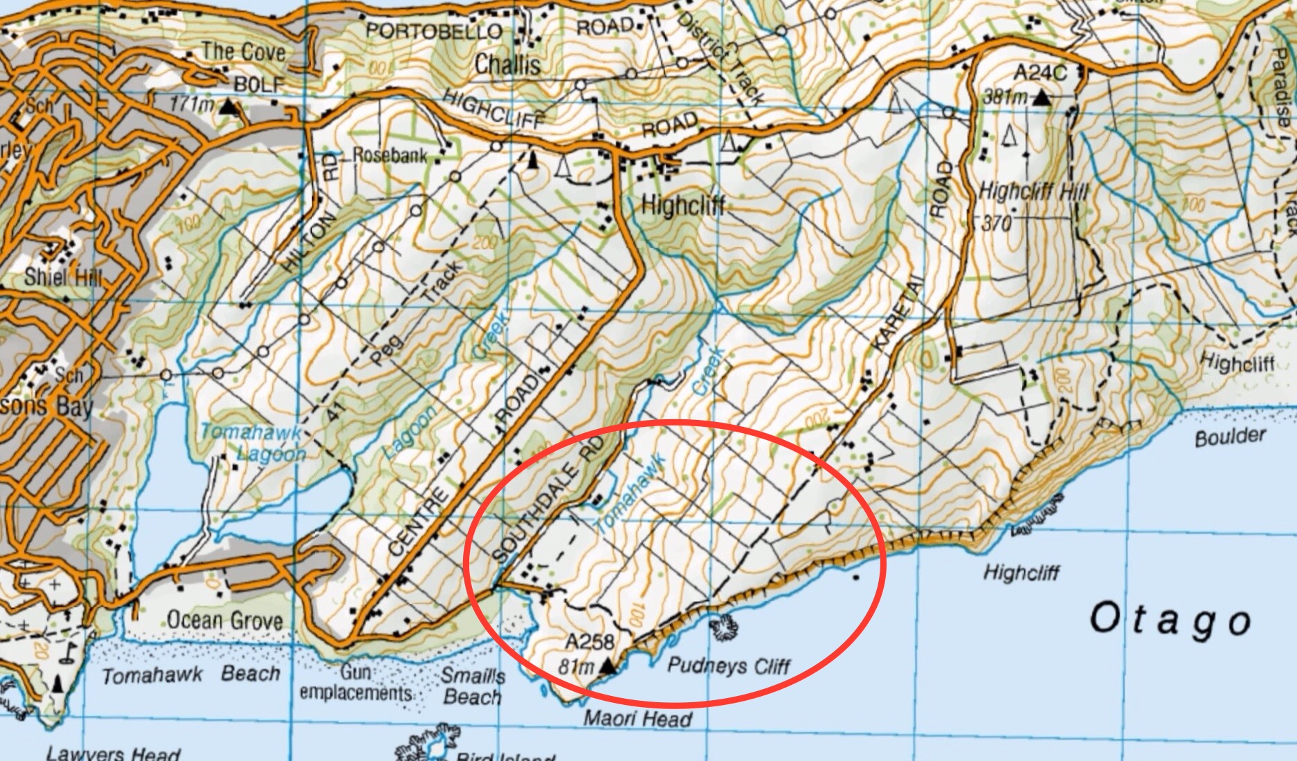
This pages of club tramps and hikes covers trips to the Otago Peninsula and involves trips to the Karetai Track & Road, Tomahawk Lagoon, the Soldiers Monument commemorating those from the Peninsula who died in WW1. Also included are trips incorporating the Highcliff and Buskins Tracks.(map)
Road distances from Mosgiel carpark.
TRTC Grading Information – trips incorporating these tracks are generally given a TRTC grading of 4. This is indicative only, as trips can be allocated a higher or lesser grading depending on the route taken. For more detailed analysis refer to Grading Information.
(1) Karetai Track commences at Smaills Beach. Take Tomahawk Road past the lagoon, bunkers and lookout and down to Smaills Beach where parking is available. Take Southdale Road (on the right by Tautuku Fishing Club) to the start of the track.
(2) Tomahawk Lagoon – Take Tomahawk Road and turn left onto Oregon Street before the hill. The reserve entrance is on the left with ample parking. Access track to Soldiers Monument commences here.
(3) Soldiers Monument – access to monument is off Highcliff Road. A layby for parking and track access is well sign posted.
(4) Buskins Track – can be access from Karetai Track. Follow road at the end of the track to McMeeking Road which will take you to Buskin Track. Access is also from Highcliff Road on the right heading to Pukehiki.
23/10/2024. Tomahawk, Soldiers’ Memorial, Karetai Track. Grade 4. Trampers. Leaders: Di Bezett, Gail Williams and Lyn Keene
Tomahawk Lagoon and Nearby Tracks and Areas. 2023 – 1989 (43 trips with 21 reports)
Buskin Track from Bottom Tramps. 2022 – 1994 (4 trips with 3 reports)
Buskin Track from Top Tramps. 2022 – 1994 (14 trips with 6 reports)