
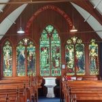
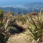
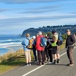
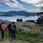
 16/10/2024. Warrington, Seacliff. Grade 2. Hikers. Leaders: Maria MacNee, Julie MacKenzie..
23 hikers, travelling in 7 vehicles, converged in the car park at the picturesque St Barnabas church on the Coast Rd Warrington Continue reading “Warrington, Seacliff”
Category: Links Completed
Post linked to Info Post
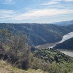
Graham’s Bush, Organ Pipes, Buttar’s Peak, Mt Cargill
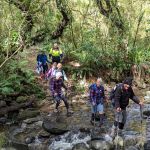
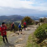 09/10/2024. Graham’s Bush to Mt Cargill. Grade 4. Trampers. Leaders: Karen McInnes and Gail Williams
Eleven hardy trampers met at the end of Hall Road in Sawyer’s Bay on Wednesday morning, very aware that the weather was dodgy to say the least.
Continue reading “Graham’s Bush, Organ Pipes, Buttar’s Peak, Mt Cargill”
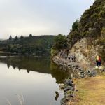
Fraser’s Gully
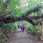 09/10/2024. Fraser’s Gully. Grade 2.5. Hikers. Leaders Helen Morris and Heather Reid.
18 hardy souls left the PJ carpark for Frasers Gully car park on a damp morning. No rain in town. Walked up so far and stopped for our morning tea on a corner. Then carried on up to the top at Dalziels Road. Continue reading “Fraser’s Gully”
Wakari / Kaikorai Loop
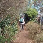 25/09/2024. Wakari / Kaikorai Loop. Grade 1.5. Hikers Leaders: Jenny Finnerty and Ady Whitson
Eventually 16 of us gathered at the meeting place and walked several metres along Wakari Road to the Bain Reserve
Rustlers Ridge, Burns Track
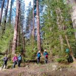
 25/09/2024. Rustlers Ridge, Burns Track. Grade 4 Trampers. Leaders: Phil Morris and Sarah McCormack.
On a sunny Wednesday we headed to the Leith Saddle car park, to tramp the above hike.
Raingauge Ridge – Steve Amies
18/09/2024 Raingauge Ridge – Steve Amies Grade 4.5. Trampers. Leaders: Neil Hodgkin and Sarah McCormack.
 As I write this, I can’t help thinking that yesterday we were so lucky with the weather.
Three Mile Hill Forest
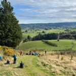
 18/09/2024. Three Mile Hill Forest. Grade 3. Hikers. Leaders: Bruce Spittle & Bill Cubitt.
Thirty-two outdoor enthusiasts, including Dave and Peter coming for their first hikes, assembled on the Taieri Lookout carpark a day or so after snow had covered nearby hills. Continue reading “Three Mile Hill Forest”
McNally Walkway
 11/09/2024. McNally Walkway. Grade 3. Trampers. Leaders: Graeme Souter & Theresa White.
A lovely morning greeted us at the car park where 20 keen trampers departed for Milton and the McNally (yes, its McNally not McNally’s as I was advised) Walkway.
Botanic Garden, Chingford Park
 28/08/2024. Botanic Garden, Chingford Park Grade 3. Hikers. Leaders :Dave Roberts, Vivienne Manning
On a brilliant sunny Dunedin Morning 19 hikers met at the Dunedin Botanic Garden top carpark.
Taieri Mouth Excursion
 14/08/2024. Taieri Mouth Excursion. Grade 3. Hikers. Leaders: Bill Cubitt & Alex Griffin.
26 hikers gathered at Knarston Park on a beautiful late winter’s morning.
Continue reading “Taieri Mouth Excursion”
City to Surf
 07/08/2024. City to Surf. Grade 2. Combined. Leaders: Gail Williams, Karen McInnes, Jenni and Bruce Wright.
Was it a record? Forty six keen members, including one visitor, met at the Otago Yacht Club carpark in Magnet Street for the City to Surf Combined Trip. Continue reading “City to Surf”
Delights of St Clair
 24/07/2024. Delights of St Clair. Grade 1.5. Hikers. Leaders: Neville Griffiths, Wyn Davies.
After parking our cars and meeting up with the Taieri Hikers in Moana Rua Road, 20 Hikers headed off just after 10am and walked across the Kettle Park Sports field towards Marlow Park.
Continue reading “Delights of St Clair”
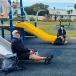
Macandrew Bay, Company Bay, McTaggart St, Camp Road, Pukehiki, Greenacres Street
24/07/2024. Macandrew Bay, Company Bay, McTaggart St, Camp Road, Pukehiki, Greenacres Street. Grade 3. Trampers, Leaders: Yan Campbell, Jenny Flack.
It was a spectacular Dunedin morning, bright, sunny and calm. 26 of us set off from the playground in Macandrew Bay. We began by walking through the streets above the main road towards Company Bay and ended up on a path that drops down through Jenny’s pleasant, terraced property Continue reading “Macandrew Bay, Company Bay, McTaggart St, Camp Road, Pukehiki, Greenacres Street”
Concord Creations
 17/07/2024. Hikers. Concord Creations Grade 2. Leaders: Jan Butcher. & Jenny Finnerty.
Just 6 hikers met up at PJ Park & travelled to Emerson Street, Concord to meet up with 7 town folk.
Continue reading “Concord Creations”
Millennium Track Return (from Henley)
 24/07/2024. Millennium Track return, Henley Start. Trampers. Grade 4 Leaders: Gwenda Farqharson. & Alison K.
Millennium – a strange name for a track? By definition. A period of one thousand years, especially one which begins and ends in “000”. Continue reading “Millennium Track Return (from Henley)”