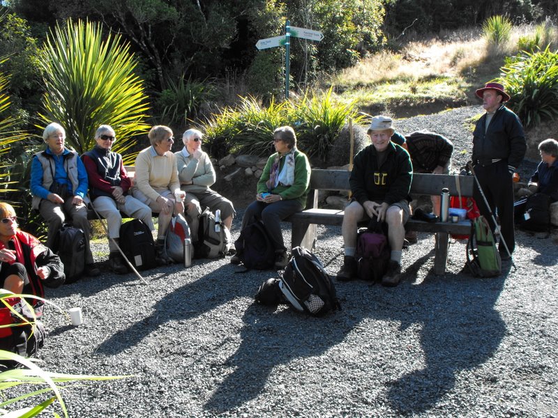
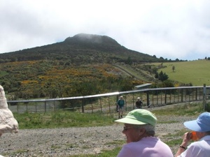
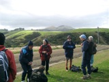
Lunch at top of Orokonui Ecosanctuary. Mopanui beyond.
Well, the Sanctuary is BIG. Much bigger than the writer had imagined.
13km we went, with 9 of them around the perimeter, starting from the
bottom carpark, going around the estuary and clockwise thereafter
ascending from sea level
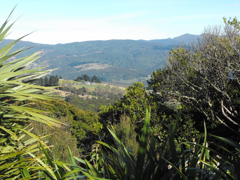
Climbing Orokonui
to near the top of Mopanui (400m+), then down
to the main top gate where the visitor centre will later be built,
near the junction of Blueskin and Mopanui Roads. We lunched there, couldn’t find the sleeve to Joyce’s thermos though we looked hard (and that was because it was back on her kitchen bench) and then it was all downhill
Orokonui descent
back to the cars, but in calm, warm conditions. A really
pleasant walk.
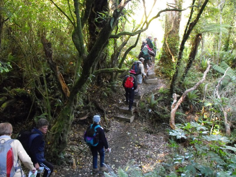
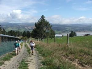
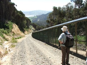
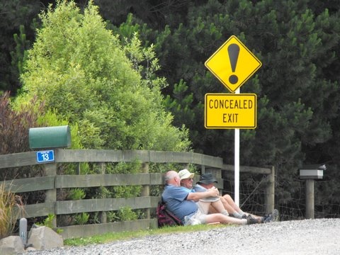
The fence that encloses the Orokonui Ecosanctuary ( the old Orokonui
DoC reserve which includes NZ’s tallest tree, plus all the additional
land) was closed off in July 2007. Almost all pests have been
eradicated, even down to the last goat. An employee behind the fence
explained that they were currently on a spraying programme around the
fenceline as even a bit of gorse widening a gap in the wire mesh will
create a ‘mouse breach’! While it is not yet open to the public, it
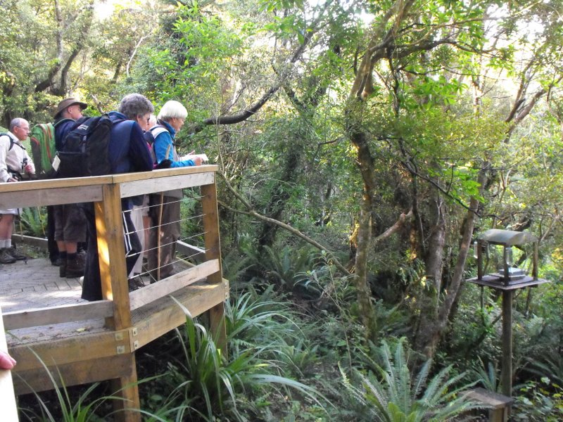
is possible to walk around the fence and marvel at what is being
planned. There are steep sections, especially at the northern end of
the fence but in general the 3 to 4 hour walk was very
straightforward, following the wide, gravelled perimeter track. There
was plenty to see: great views, named fence posts (we spotted No.10
Fleming Street where the PM is in residence) (well, actually it was
Prime Mover Ian and Shirley Fleming’s plaque on fence post No.10) and
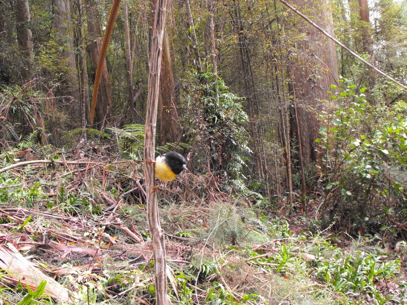
varying vegetation. We could hear rosellas and a rifleman, but we
didn’t catch a glimpse of the 6 Kaka that have been released, although
Leslie Gowans, who visits regularly to detail sightings of birds, says
that they have not strayed much further than 100m from their release
site so far. The Orokonui website if you want to know more, can be
found at: www.orokonui.org.nz – Bob M
7. 7/7/2004 Leaders: Ian, Bill, Pat Before fenced in. Right around through entire gully. 6. 1/3/2000. Orokonui, Big Tree. Leaders; Shirley McN, Val.
5 .28/7/1999. Orokonui, Big Tree. Leaders: Shirley McN, Judy C, Val. 4. 30/9/1998. Orokonui, Big Tree. Leaders: Shirley McN, Judy C. 3. 7/5/1997. Orokanui – Big Tree round trip. 2. 6/11/1996. Orokonui – Big Tree Round Trip. Leaders: Shirley McN, Judy C, Wendy. 1. 22/5/1996. Orokonui – Big Tree round trip. Medium+ Leaders: Shirley McN, Judy C, Wendy
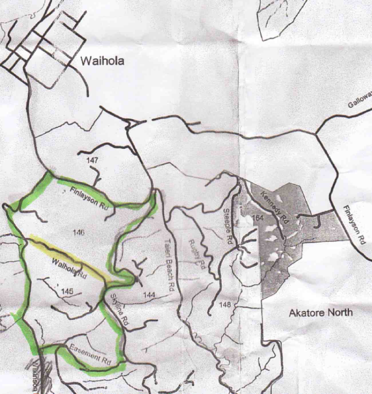
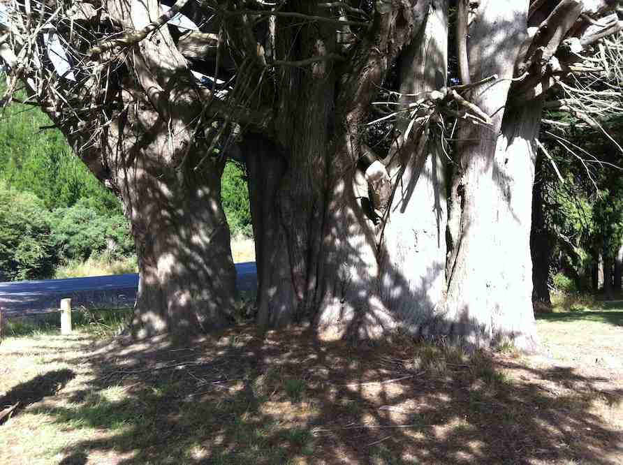
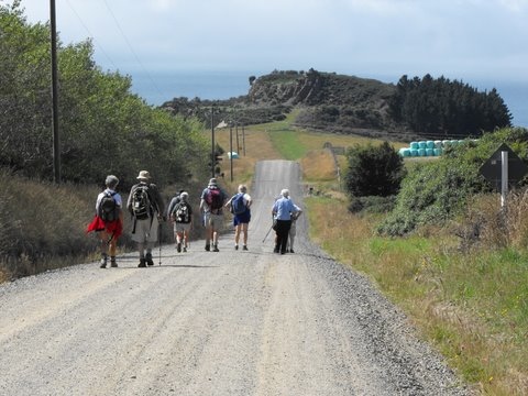
16. 18/1/2012. Hikers. Finlayson Road picnic area. Wilkinson, Easement, Skyline and Waihola Roads, round trip. Leaders: Marjorie and Bruce.
We parked our cars at a rest stop on Finlayson Rd, near Wilkinson Rd turn-off. Bruce led us round the area, planted with a variety of interesting trees, not the least being this large macrocarpa.
3. 20/1/2010. Hikers. Overbridge, Coalstage Road, McMasters Road, Old Brighton Road, Fairfield Park, Morris Road, Overbridge. Leaders: Bev and Chris.
The Rudd Road walk you do when you are not actually doing the Rudd Road walk!!
Our esteemed leaders Bev and Chris decided that views from Rudd Road were unlikely in the misty conditions set to prevail, and that the 12 of us should walk from Saddle Hill to Fairfield and back instead. The intention was to go from Coal Stage Rd up Chain Hills Rd and do a loop, but the general wisdom was to follow Coal Stage. When we got to Saddle Hill Rd, the Left-leaning leaders wanted to turn that way while the majority of Tories voted to turn Right (which was actually less conservative), and so proceed up Saddle Hill Rd to McMasters Rd, where in fact we had a morning tea stop with a view.
It was a warm, still morning here and there was a calming feel about the quiet gravel
road with views out onto the Kaikorai Estuary and Stony Hill, etc.
McMasters Rd towards Stony. (Bob pic and caption)
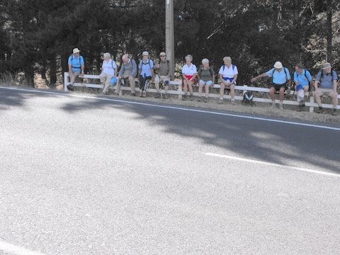
A bunch of fence sitters – Old Brighton Rd. (Bob pic and caption)
Lunch was at the Fairfield park ( Chris led a long detour in order to use a pedestrian crossing), in the sun. Delicious – especially Fred’s shared chocolates.
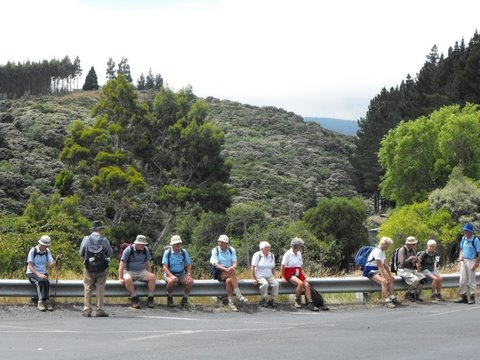
Another bunch of fence sitters – Main Rd, Fairfield. (Bob pic and caption)
And so back to the cars at the overbridge via Main Rd and Morris Rd. A very pleasant 10km on a nice day. We even passed a display of hand milking near the ostriches on Morris Rd. And the clouds were still hanging around Flagstaff, so we felt it had been a good choice. – Bob.
Very surprised and delighted to yet again have another fine Wed. after having 2-3 days of mist and rain. A bit cloudy but fine and not too cold. Ten keen hikers parked their cars in Lees St. and set off on a very convoluted walk to get to their final destination which was the Southern Cemetery. It was up hill all the way to our morning tea stop which was the play area in the Mornington Park. After a refreshing cuppa it was off again on the ups and downs of the streets in the Maryhill/ Mornington area till we eventually got to Eglington Rd and the very top gate of the Southern Cemetery. We walked down through the area of very old graves and found a spot on a grave in the sun to sit and eat our lunch. Very peaceful and quiet. No people or traffic to disturb the peace! After lunching we strolled around among the graves, reading inscriptions where they were still legible and finding many of well known early citizens of Dunedin. Also the area where the early Chinese were buried in place that was supposed to be separate for the rest of the community.
All in all an interesting place to visit and the first time for most of the hikers there on Wed. From there it was a fairly short walk back to the cars. Everyone said how much they’d enjoyed the day. Bev.
What a beautiful day and absolutely perfect for our Street Walk round the Wakari area. The 13 Hikers who met to make the most of the warm sunny day parked their cars at the southern end of Helensburgh Rd, by the back entrance of Wakari Hospital, and set off down Hood St. Only a short walk before getting to our morning tea spot which was Dean St. Reserve. As the Reserve had no seats and was rather muddy and wet we sat on the footpath! Very pleasant in the sun. Then we set off, and with my co-leader, I took everyone on a real tour of discovery round streets and areas that most had never been. Lovely views.
Snow on the hills
Out to sea, over Kaikora Valley, Roslyn and Mornington and then after lunch, over the other way to Flagstaff and Three Mile Hill. We eventually arrived at Mayfield Reserve, a lovely childrens play ground at the back of Wakari School, which proved a very suitable & agreeable place to enjoy our lunch break. We soaked up the warmth the sun and made the most of the ‘amenities’!
Making use of the amenities
From there it was another zigzag through a few more streets and walkways, back to the cars. Everyone agreed they had had an enjoyable and enlightening day, especially in such perfect weather. – Bev
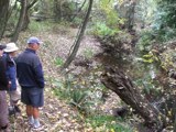
16/4/2008. Traquair/Whare Creek Track & Woodside Glen.
Viewing Traquair Creek
With inclement weather threatening the joy of a beach walk (Purakanui and Canoe beaches) and only 2 hikers along with 2 leaders, a decision was made to seek dry bush cover instead, and so we headed for the recently-upgraded Outram Glen walk. Neil diverted us however to a nearby track he had lately helped to clear