No. 99 on old hardcopy list of 113 club tramps. “Mt Charles Mr Neil Farm”.
27 km from car-park.
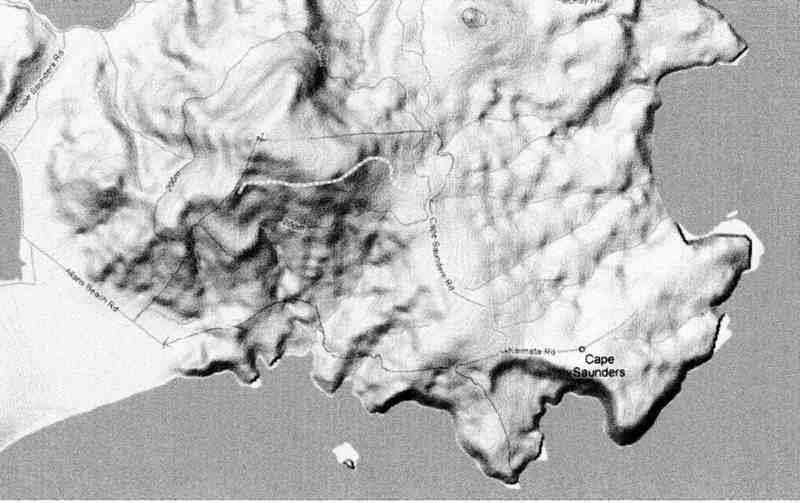
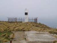
Click here to read about Cape Saunders Lighthouse and the two graves
Mt Charles, Cape Saunders – Information and Trips Library
 12. 10/4/2024 Mt Charles Grade 4 Leaders: Graham and Carol Thurlow
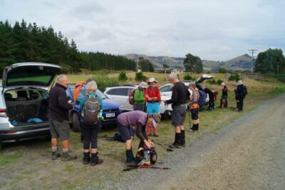
28 trampers gathered at Allan’s Beach.
Because of the possibility of cloud soon coming on top of Mount Charles it was decided that we should immediately ascend the hills to get to the top as soon as possible.
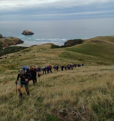
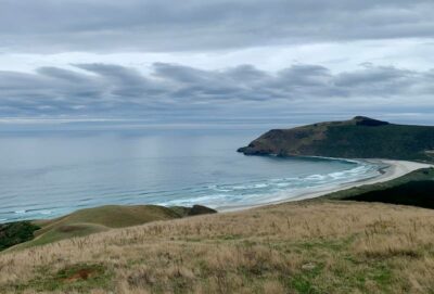
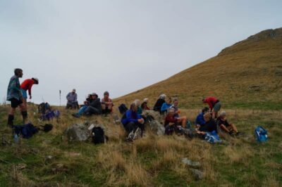
Two thirds of the way up we squeezed through our first fence from Des Neil’s property to Clearwater’s Farm and Carol decided that we should quickly have a cuppa before carrying on to the top of Mount Charles.
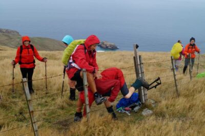
At the top another fence to squeeze through with a very hot electric fence going above our heads. In the middle of all this we heard a crack go off and Gwenda fell back and we thought she had been zapped by the hot wire but she didn’t feel anything.
The weather held off and we were able to sit on the summit and enjoy spectacular views over to Otago Harbour, Hoopers Inlet, Papanui Inlet, Victory Beach, Okia yellow eyed penguin Reserve and the site of Pyramids.
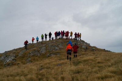

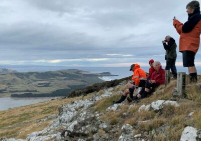
Squeezing back through the fence we gently descended across the top of Mount Charles through a Taranaki Gate back into Des Neils property again.
Then briefly descending a steep farm track we followed sheep tracks in the paddocks to Cape Saunders Road before entering the road to the lighthouse.
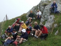
Sitting on tussocks we had our lunch while able to see down the coast toward (Wharekakahu) pigeon Island.
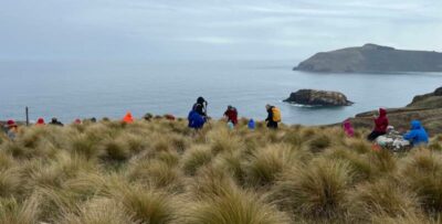
Des Neil arrived on his motorbike and Graham enjoyed chatting with him about farming.
Then the grave sites of two infant children were of interest.
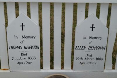
Here is the information source below.
Tragedy was to plague the lighthouse in its first few years. In December 1882 Mr. Nelson’s wife died suddenly. As the youngest child of the family was only 20 months old, the Marine Department granted the keepers request to transfer out of the Department into the Customs Department. But before he was transferred on March 19, 1883, the two-year-old daughter of the Assistant Keeper (Patrick Henaghan) and the youngest child of the Mr. Nelson died when the cow shed they were playing in caught fire. Later another child died of illness and six months later, the son of the new Head Keeper fell over the cliff and broke his wrist.
Extracted from NEW ZEALAND LIGHTHOUSES, Cape Saunders (1880) NZ Lighthouses Text and photographs. Copyright © 1999-2009 Mark Phillips. All rights reserved.
With no wind and Autumn warmth we went on to the (Kaimata) Cape Saunders lighthouse.
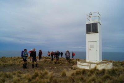
Graham gave a summary of Captain Cook’s naming of this area.
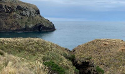
Following the contour tracks above the cliffs we walked back towards where we had started.
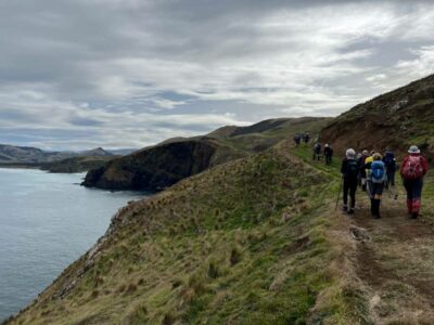
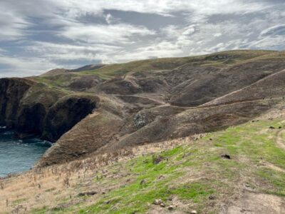
On the way home a stop at Nicol’s Garden centre for delicious coffee and cake was a welcome finish to a great days tramping.
We appreciate farmers Des Neil and John Clearwater for giving us their permission to tramp on their land enabling us to take in the spectacular views that this area offers.
11. 21/6/2023 Mt Charles Grade 3.5 Leaders: Graham and Carol Thurlow
A group of 21 enthusiastically ventured out on a very mild winter morning with some light wind and sun. After short trek up the first hill we were greeted at the gate by a herd of quiet Angus Hereford Cross and South Devon cows who were not fazed by trampers coming through their territory. Next we enjoyed great views of Wharekakahu (Pidgeon Island), the cliffs, Allans Beach and small bays. One beach was given a name Nudist Bay as it was a very lonely place and any living thing there is likely to be naturally nude anyway. Whoever saw a dressed sea lion?
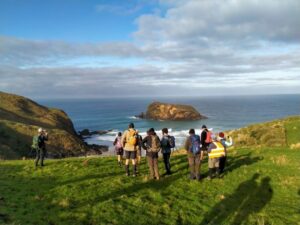
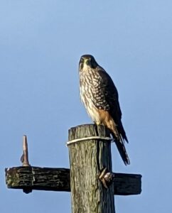
A falcon perched on a pole attracted some photo shots but Carol’s enthusiasm to see it in flight meant it left the perch before John got his camera out. Sorry John.
Some were surprised the Matakitaki lighthouse was small and commented, “I didn’t expect a light on top of a toilet.”
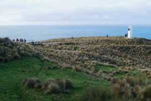
Then the grave sites of two infant children were of interest. Graham shared some details with the group and here is the information source below.
Tragedy was to plague the lighthouse in it’s first few years. In December 1882 Mr. Nelson’s wife died suddenly. As the youngest child of the family was only 20 months old, the Marine Department granted the keepers request to transfer out of the Department into the Customs Department. But before he was transferred on March 19, 1883, the two year old daughter of the Assistant Keeper (Patrick Henaghan) and the youngest child of the Mr. Nelson died when the cow shed they were playing in caught fire. Later another child died of illness and six months later, the son of the new Head Keeper fell over the cliff and broke his wrist.
Extracted from NEW ZEALAND LIGHTHOUSES, Cape Saunders (1880) NZ Lighthouses Text and photographs. Copyright © 1999-2009 Mark Phillips. All rights reserved.
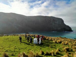
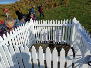
After this we walked to a good viewing spot looking mostly to the south-west and enjoyed our lunch.
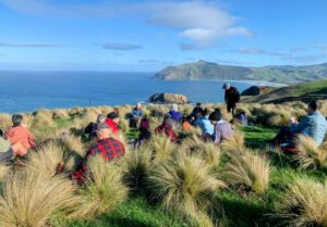
Then it was onwards and upwards to the Cape Saunders road before returning to farm land and climbing up towards the Mt Charles.
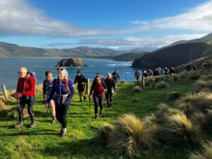
The highest point of Mount Charles is 25m beyond a tightly strained fence with a hot wire on top. A variety of personalised techniques were put into practice to squeeze between the tight wires.
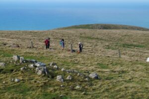
Standing on the summit, with the cool blast of air we were rewarded with outstanding views of Hooper’s Inlet, Papanui Inlet and over to Otago Harbour. We tried spotting the hikers at Victory Beach but none were in sight.

Descending down we were well spread out due to once again squeezing through fences. Those through first got a head start. An awesome day enjoyed by all.
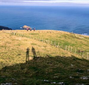
We arrived back at Allans Beach 2:30pm which left enough time to get to Nichols Café for a well-earned afternoon beverage and sweet treat.
Thank you to Des Neill and John Clearwater for allowing us through their properties.
10. 26/2/2020 Allans Beach, Mount Charles and Cape Saunders. M-H Leaders Helen and Phil
Mount Charles (408 metres high)
On a nice 20 plus deg morning, 21 trampers headed towards Allens Beach, this took slightly longer due to road works on the peninsula, but as per quote of Thomas Bracken (1879): “When a visitor arrives at Portobello he will naturally wonder why Australian’s and NZders rush to Europe and America for sightseeing when they can find such beautiful scenes within their own doors”
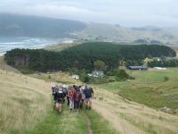
We were greeted by Mr Neil one of the land owners at the start 10am as we headed off on a couple of good climbs with great views back of Allens Beach and Belmont House, and to the side Wharekakahu (pidgeon island).
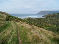
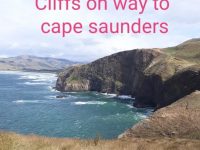
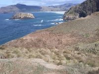
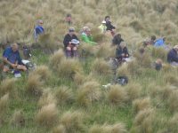
Morning tea was taken 10.30 ish above one of the nice small beaches.
As we found another good nudge we worked around toward (Kaimata) Cape Saunders Lighthouse. A dangerous place to fish as many have been washed off rocks over the years by freak waves. Captain Cook sighted this landmark 25/02/1770 and was named in honour of Admiral Sir Charles Saunders who he had served under in Canada 1759.
Above the lighthouse old founds of one of two old house sites, below a restored picket fenced grave of two children, Ellen(2yrs). Report has it she died from a fire after the two had been playing with matches and Thomas (1yr) who died 3mths later of meningitis they were the children of assistant light keeper Patrick Heneghan. A good spot on a no windy day, very infrequent, as one notes all trees point to the north, like old stooped men.
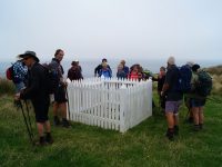
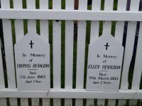
After a stop to take in the cliffs and views we continued a further climb to the junction of Cape Saunders Road and Kaimata Road, where we had lunch out of the strong southerly and mist.

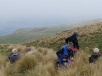
The view of Hoopers Inlet, Palmerston on a good day can be seen from spot but not today. Lunch taken, this built up the energy to take on last climb, through misty farm fields on east to make our way to the summit of Mt Charles, Whoo hoo! The views to all parts of Otago can be seen, but not today, in deep mist, group kept in close proximity trusting our leaders, as one could easily get lost. But out of the gloom the peak of Mt Charles appeared. Disappointing that the trig station is damaged and has not been repaired, most sad we could not see a thing further than 3 or so metres in front of us.
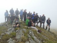
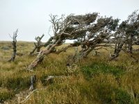
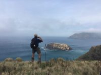
The decent although difficult was made in short time, avoiding the two brown bulls,just another neat tramp in Otago, I hope your time at top was well worthwhile, for first timers it means we have to do it again to take in views.
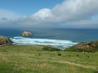
Thanks to our friendly farmers Clearwaters, McKays and Neils for their access.
Cheers Helen and Phil
9. 22/11/2017. Trampers. Mount Charles. M. Leader: Phil.
Mt Charles – 22 November 2017 – Leader: Phil.
Following a quick rendezvous of 4 vehicles at Macandrew Bay it was follow the leader via Allans Beach Road, with the leader doing a feint turn the wrong way at Hoopers Inlet, just to test the following car drivers, before arriving and parking under the pine and macrocarpa at the end of the road. There was then a few recounts on the numbers of intrepid trampers as I was reliably informed we had 16 when we left Mosgiel, but now we had 18! Wow Mt Charles must have a reputation!
So off we set at 10 to 10 back down the road to the gate with ‘closed’ on it; there was a promise of the most well earned morning tea for the year at the stile at the top of the first paddock….this was achieved comfortably by all but clearly the steep start had an affect,
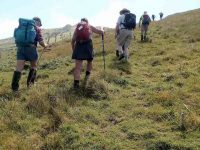
with everyone sitting for a good 20 minutes…maybe it was the views? This was said to be about ‘halfway up- yeah right!’
We then set off up a variety of knobs and farm tracks, and following the fence lines to ridges and little saddles and then via a track – commented to be the stairway to heaven – that dissected some remnant native bush (and where the level of craic was very low), before we emerged on a little plateau, and veering left and with the help of some gentlemanly fence lifters to get under the barbed wire arrived and ‘summited’ Mt Charles at 11.30.
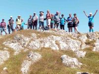
On the last part of the ascent we had been accompanied by a herd of inquisitive and very well conditioned cattle, that set about corralling and dividing us before realising we had no barley sugars to give them so off they bashed through the forest. At the summit we were greeted by the mist clearing and revealing 360 degree views, only to be tested by a swarm of bush flies and other flying objects, so after admiring the views and taking the obligatory photos
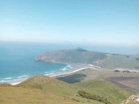
we headed off through the fences and along the ridge to start the descent down the sea side (East) of the mountain. Around half way down the lumpy and steep hillside we found a spot for lunch, where someone had nicely placed boulders and logs for us all to be comfortably seated and take in the surroundings,
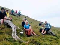
including a top dressing plane, piloted by Snoopy. The plane made numerous and continuous sorties along the coast
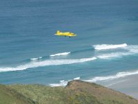
and around the mountain for the duration of the rest of the walk. At about this time the sea mist moved back and the summit was shrouded in….
Gradually we descended and returned along the ‘flat’, parallel with the coast, and then over a small saddle and down to the road end and carparks, where we were warmly met at 1.15 by Jill D and Clive, who having completed 90% of the ascent, returned and undertook a walk along the beach. Well done folks for the inspiring effort.
We then had sometime at the beach, walking to the headland, dipping toes in the sparkling seas, or just lounging and taking in the peace and tranquillity, but for Snoopy! Then onto the Mac Café, where as a sign of the season, and in very Mediterranean like conditions, there were probably more ice creams, and cold drinks consumed than coffees and tea.
Although the walk was ‘only’ 5.7km it was 403 m up a mountain, and of course 403m down!
This was NZ walking at it’s best; a mountain, 360 degree views of land and sea scapes, and lovely weather followed by a walk on the beach and admiring wildlife, with great company. – Phil
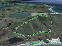
Having met up with the others at the meeting place in Andy Bay, 6 of us travelled to the end of Allans Beach Rd. where we parked under the pines, & geared up for the climb up Mt. Charles. We walked back along the road for the 3-400m to the stile over the fence at the start of the climb, then it was up, up, & more up!
We stopped just after 10am for morning tea break, then resumed the climb. An hour later we reached the trig on top of Mt. Charles,…
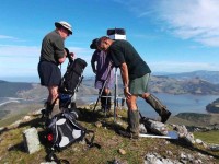
…where we spent some time admiring the view, which was fantastic.
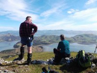
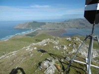
We also found the trig station was falling to bits, with all of the bolts securing the stays to the legs missing.
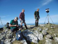
As there was a bit of a breeze blowing up there, we decided to go down the seaward side, & walk back around that area to the cars. So we set off following sheep trails through the bracken, & Onga Onga, down a steep slope until we were approx halfway down, where we had lunch in a pleasant spot with a great view.
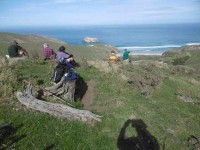
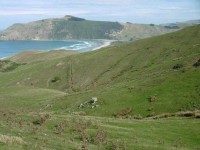
We then finished the descent,…
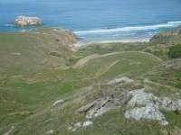
…& made our way back past Belmont House out to the cars.
As it was still quite early in the day, we then went out to the beach, where we had to detour around a sleeping sea lion on the track. There were others on the beach also, ignoring the presence of humans.
The trip up Mt. Charles is a serious climb to get to the top, but I think we all enjoyed the experience. And we stopped off at Mac Bay for a coffee & chat before driving back to town. – Ken.
7. 10/8/2011. Trampers. Allans Beach, Belmont, Cape Saunders, Kaimata Road, Puddingstone Rock, return. Medium.
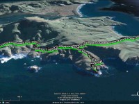
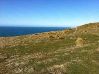
6. 11/2/2009. Trampers. Allans Beach, Belmont, Cape Saunders, Kaimata Road, Puddingstone Rock Cape Saunders Road, Mt Charles, round trip. Medium. Leader: Bill
45 minutes’ drive to Alans Beach by Hoopers Inlet. 37.5 km from car-park.
(Click to enlarge thumbnail pics)
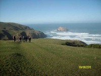
The trip this time was enhanced by a group from the Christchurch Over Forties Tramping Club joining us for the day. The day was pleasant as we made our way from the Belmont homestead over a ridge or two to our tea break spot with a fine view of a small beach and the Wharekakahu Rock islet.


A bit of a climb from there brought us to the experience of an abrupt cliff face

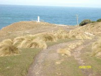
before climbing a fence line to make our way across to the Cape Saunders road and down to the Matakitaki Point lighthouse.
While there we showed our visitors the ancient grave site of two young children (see information at bottom of this post)

before climbing back up to the Kaimata Road and down to our lunch stop.
click to enlarge

Then it was down a paddock or two to view the seals on the Puddingstone Rock ledge,


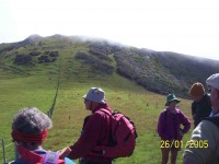
before climbing the road back out to the Cape Saunders Road and along to the NE of Mount Charles to climb through paddock and bush to the trig.


After that it was down the conventional ascent route, much steeper than the one we had climbed, and along to the cars.
5. 23/5/2007 Trampers. Allans Beach, Belmont, Cape Saunders, Kaimata Road, Puddingstone Rock Cape Saunders Road, Mt Charles, round trip. Medium. Leaders: Bill, Pat


4. 29/11/2006. Trampers. Allans Beach, Mount Charles, Cape Saunders. Medium. Leaders: Bill, Pat
click to enlarge
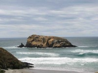
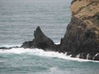
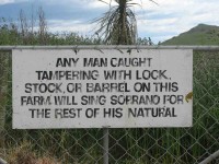
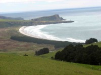
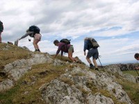
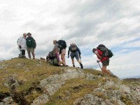
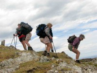
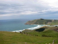
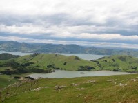
3. 7/12/2005. All. Cape Saunders from Allans Beach. Leaders: Bill, Pat, Bob, Nadia
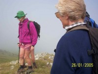
2. 26/1/2005 Mount Charles Hoopers Inlet, Allans Beach. Leaders: Dorothy S, Shirley
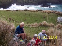
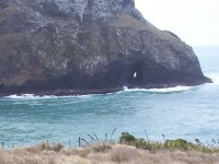
1. 31/3/2004. Trampers. Cape Saunders, Puddingstone Rock. Easy+. Leaders: Bill, Pat




I noticed that you have an article about a tramp that included Cape Saunders. I lived at the lighthouse keeper’s house for several months in 1984 and recently wished to show my children around on a brief visit to Dunedin. However, I could not work out how to organise access – I drove past but observed signs indicating private land. I would be pleased if anyone could let me know how I could go about visiting Cape Saunders in future.
Hi, Carolyn.
Thank you for your enquiry.
As you get down to end of the Cape Saunders road, there is indeed a locked gate.
Phone Sam (and Christine) Neill 478 0878 (house over on Allans Beach Road – his farm comes around the coast from there) to get permission to climb the gate. Their farm is on the market. (Just in case you get someone else answering!)
However, I think I recollect an ODT report (some 9 months or thereabouts ago, ?) of it being destroyed by fire.
However,
Best wishes.
Ian Fleming
I would be interested to have this email passed onto Carolyn. I am Secretary of the Otago Peninsula Museum and Historical Soc, based in Portobello. The Cape Saunders Lighthouse was not returned to Kaipara as indicated above. It is on the Museum grounds. in Portobello. In December 2009 it was discovered that over time the lighthouse was being vandalised – bolts/screws etc being removed – probably hoping to get the roof eventually. The Museum organised to collect the lighthouse and has spent many hours taking off layers of white paint and repainting it. Soon we hope to have displays inside the Lighthouse. If Carolyn has any photos etc – present day ones are fine then we’d love to hear from her.
Thanks. Laurel
Done, Laurel. Thanks.
Hi there,
I have a family member from a North Island tramping club coming to visit and they were hoping to visit the site of the Cape Saunders lighthouse. I noticed there were several landowners mentioned in the most recent post about this but was just wondering which ones would be the best to contact about just accessing the lighthouse site from the road end. Thanks for your time.
Hi Jane,
I’ve replied to your email with contact details. I hope it works out for you.
Cheers
Ross for TRTC Webteam
Hello,
I would absolutely love to try fishing off the rocks at Puddingstone and near the old lighthouse, but I believe these days access is restricted through private property, as mentioned above. Does anyone have the current owners contact details, so that I may request to access the beautiful property and fish from the coastal side? It would be great to take my old man to a spot like that.
Thanks, Oliver.
Hello Oliver, I’m sorry but we don’t have consent for sharing any owners contact details. Maybe ask around in the fishing shops? Otherwise you might have to knock on a few doors out that way? I’m sure you’re aware of the dangers of that location. I was involved in an unsuccessful search for someone I knew who was washed off there a couple of decades ago, so I’ve not got good memories of the place. Anyway, I hope you can get access for you and your Dad. Cheers, Ross