
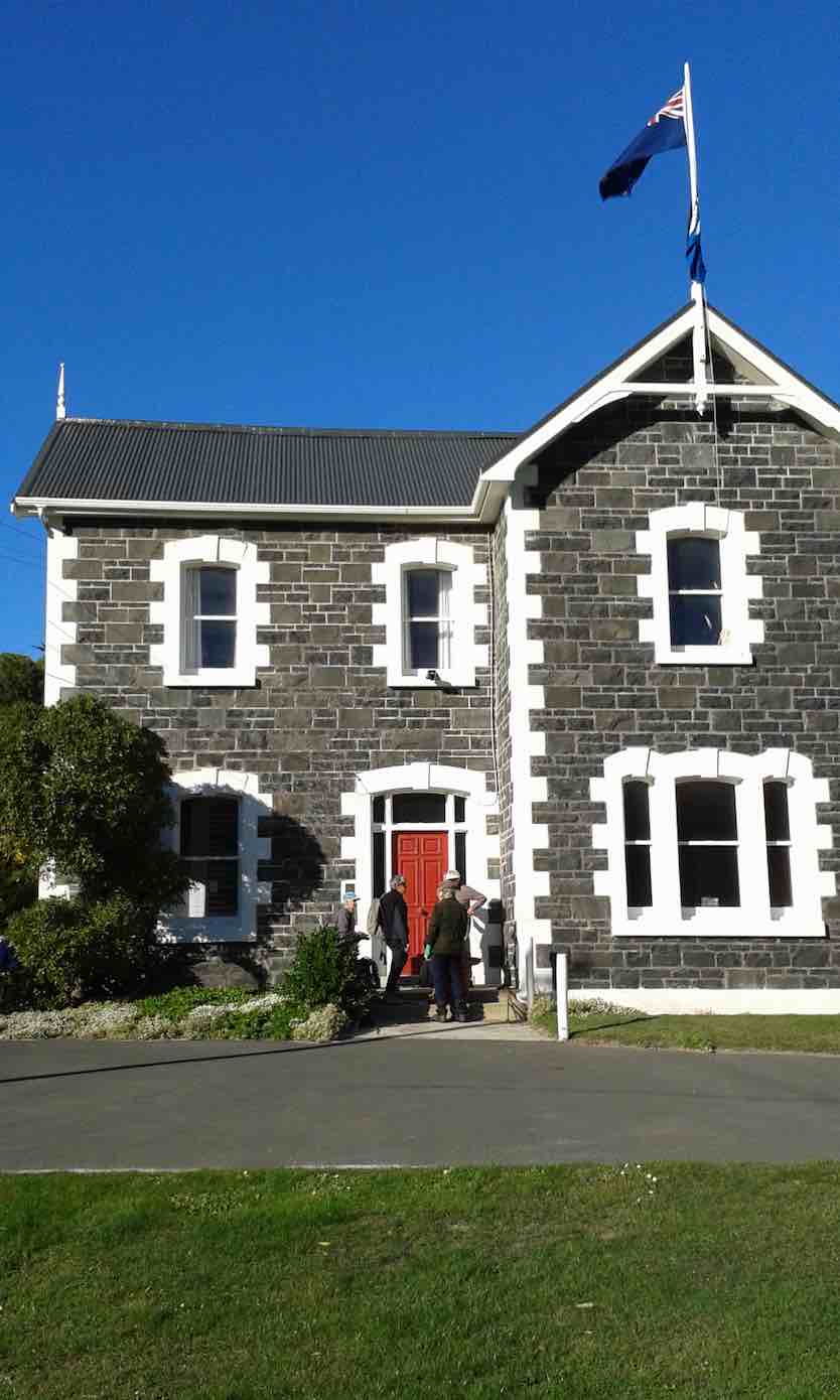
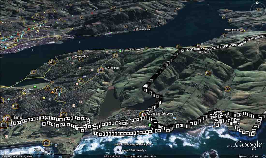
Ocean Grove, also known as Tomahawk, is a suburb in the southeast of the New Zealand city of Dunedin. … The suburb was known as Tomahawk until the 1930s, the name not being a reference to the weapon, but rather possibly an anglicised form of the Māori words tomo haka, meaning “dance by a gravesite”.
No. 23 on old hardcopy list of 113 club tramps. “Karetai Rd via Monument from Lagoon. Year round.”
Distance from car-park: Tomahawk: 19 km; Smaills Beach: 22 km; Paradise Road: 26 km.’
DCC List: 41 Peg Track. Otago Peninsula
Accessed from Oregon St. 3.5 hrs ret. Tramping track – unbenched. Managed: DCC CAM, private land.
Description – This track provides a link between Ocean Grove and Highcliff Road. Access to the track in Ocean Grove is off Oregon Street. An attractive walk around Tomahawk Lagoon then climbs through gorse and native bush. Turn right towards Soldiers Memorial through paddocks with gorse sometimes obscuring the rock walls.
- Classification – Hard
- Time – Approximately 45 minutes.
- Parking – Limited at Highcliff Road. No dogs.
- Dogs – No
St Clair, St Kilda, Kew, Corstorphine, Ocean Grove, Tomahawk – Information and Trips Library
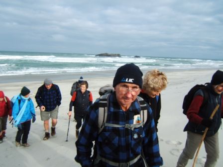
 43. 06/12/2023. Trampers. North of Tomahawk. Grade 3. $7. 22km. Leaders: Esther Willis and Julie McKenzie

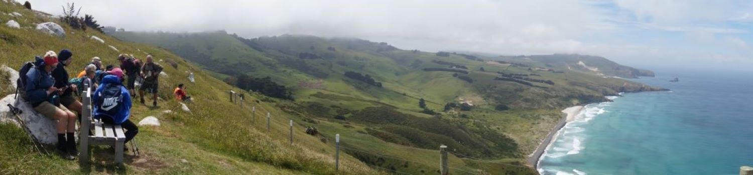
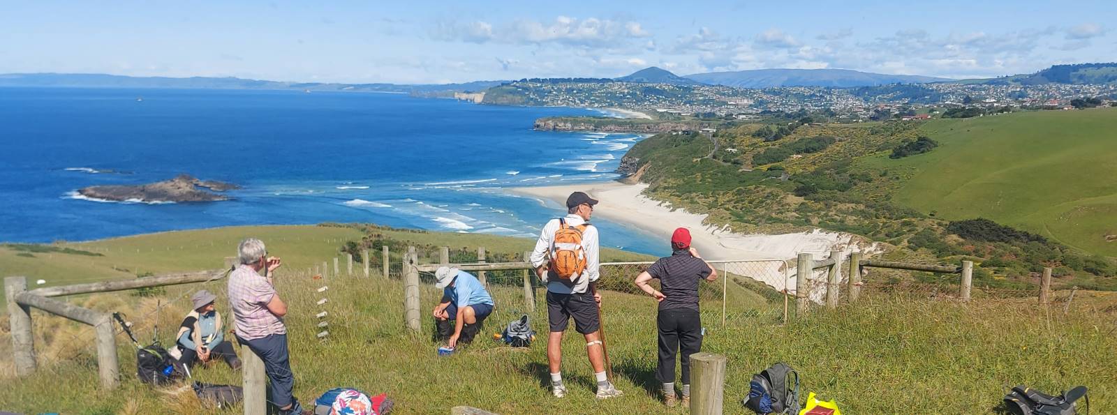
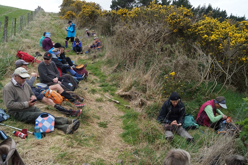
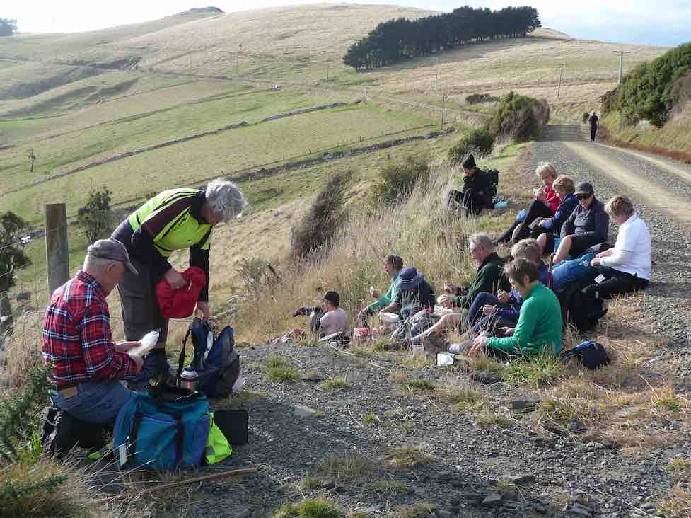
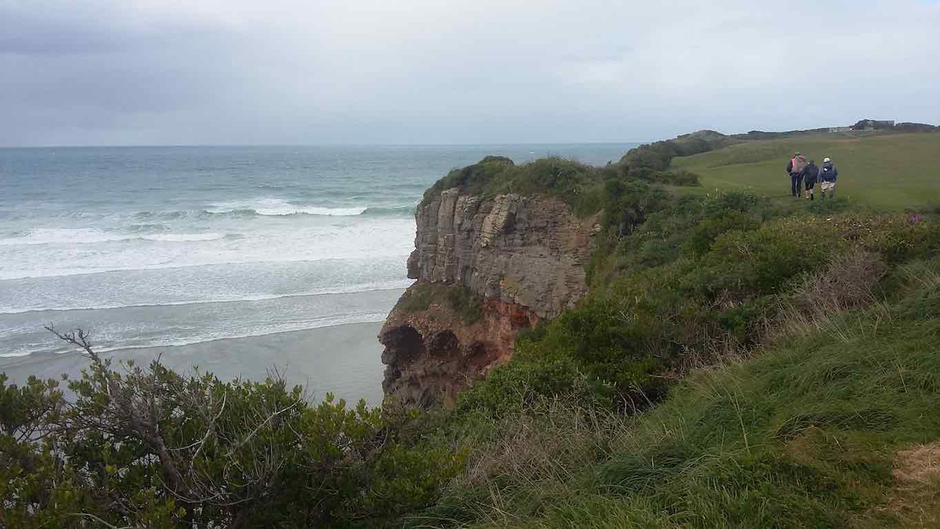
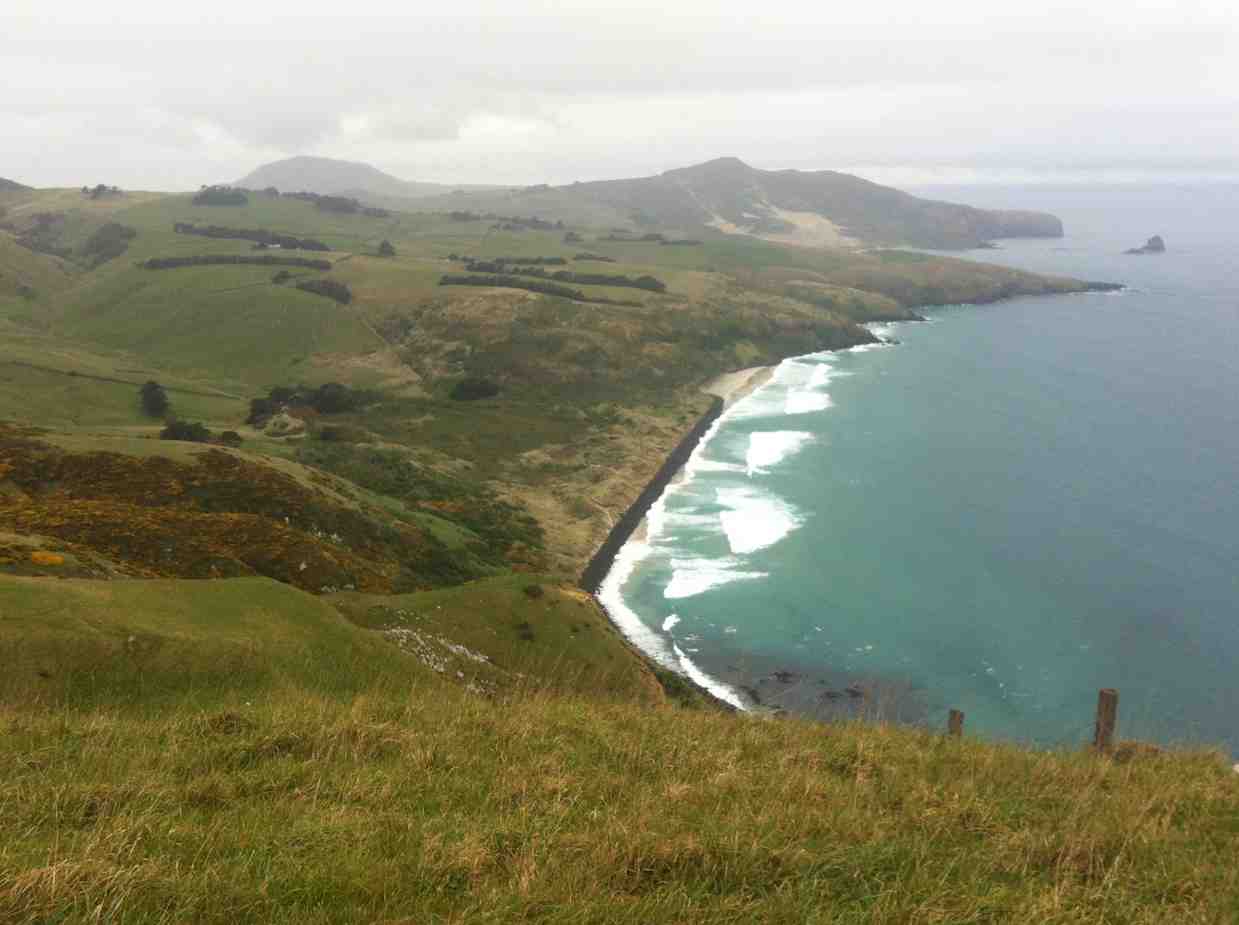
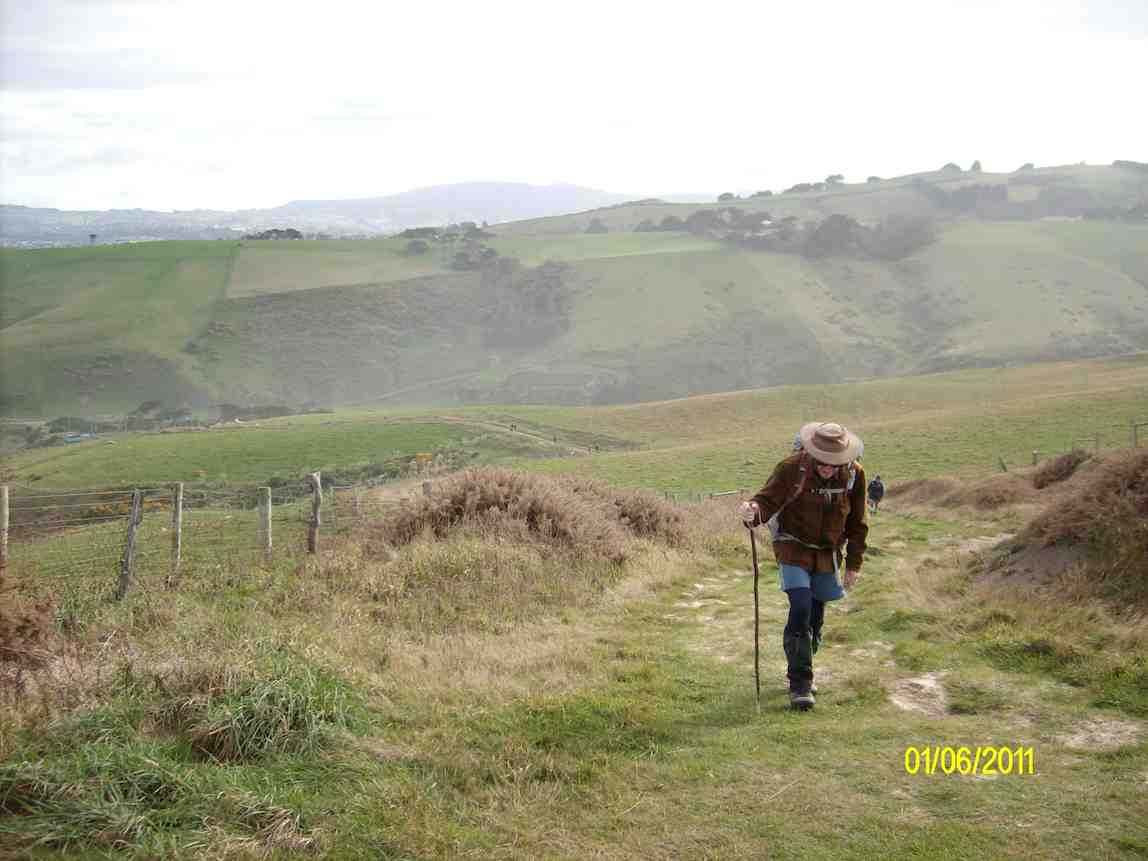
Boulder Beach is off limits until the end of February due to penguins nesting so we turned right from Highcliff Track up Paradise, walking just far enough up to get a view of the sea, while still retaining shelter from the wind , before stopping for the mandatory cuppa.
Shortly after there was a rather broad macrocarpa which had fallen over the track… made navigation tricky for those of us of shorter stature.
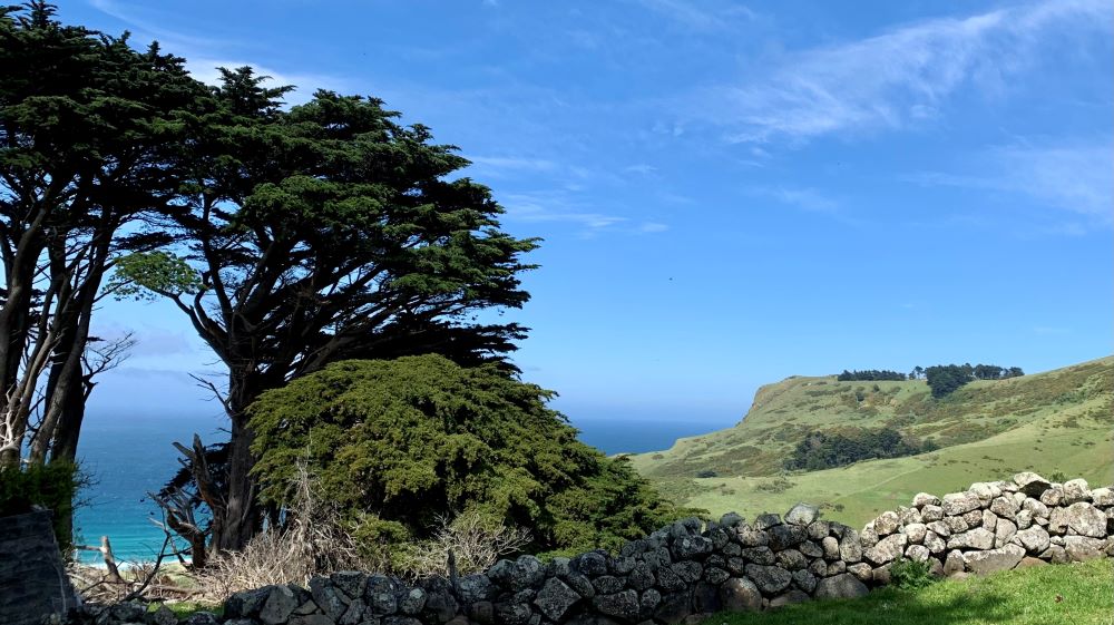
One can’t help but admire the skill, and labour involved in the construction of the many stone walls we encountered as we made our way to Highcliff Road.
After walking a relatively short stretch along the Road we joined the top of Buskin Track which took us back down towards the beach. Lunch was taken halfway down.

Near the bottom we set off on adventure through enormous macrocarpa trees – before joining Highcliff Track again.

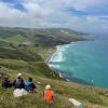
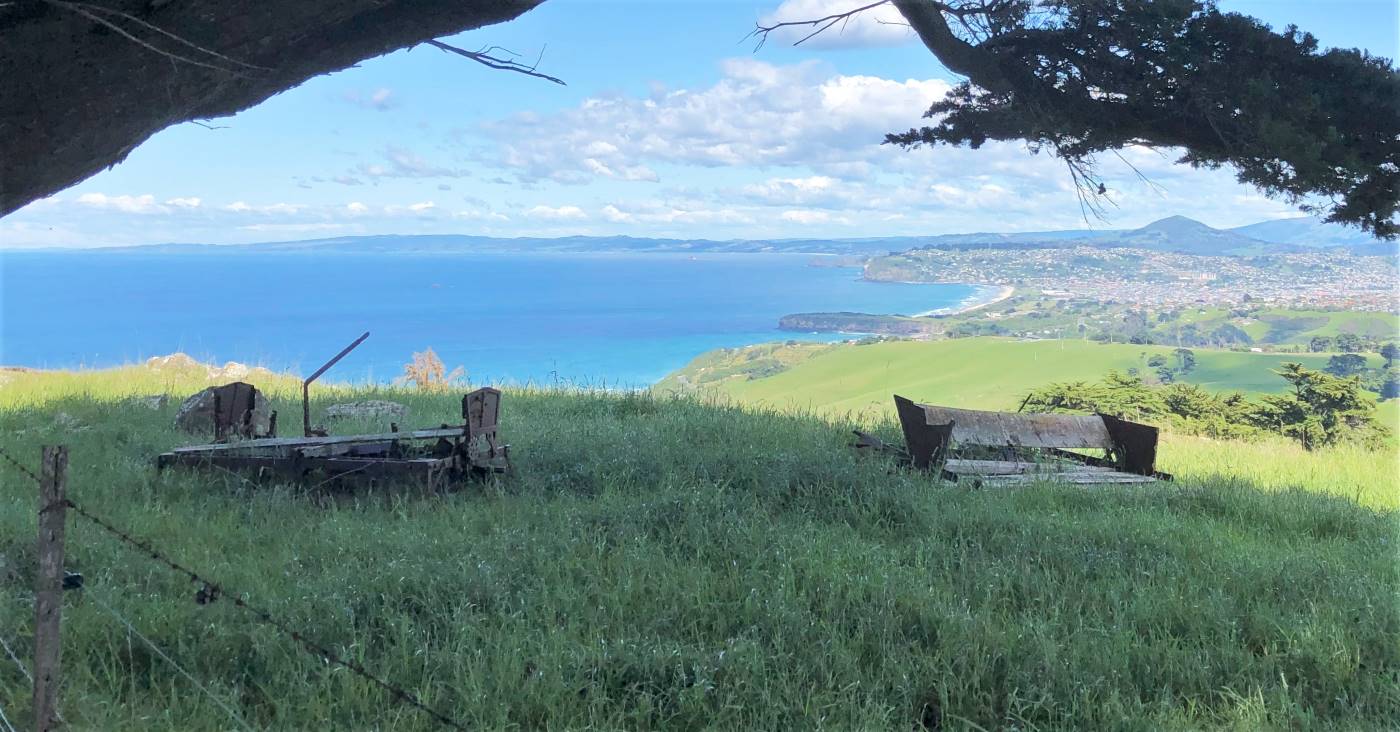
From there we turned right, and walked up a fairly steep, but short, and thankfully zig zagged section of the track, to reach a high point which gave simply stunning views – Sandymount in one direction and Saddle Hill and Dunedin in the other.


After we headed back along Highcliff Track, back to our cars and coffee at Nicholls
Distance travelled around 10 kms. Another enjoyable day out.
Julie and Esther
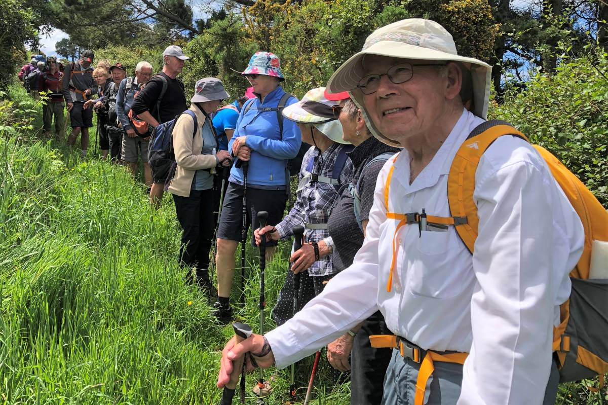
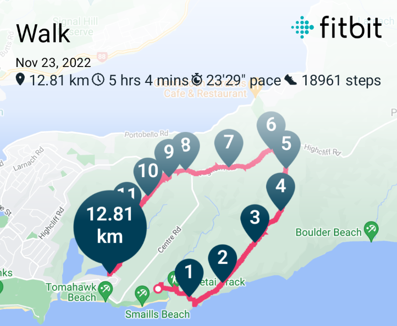
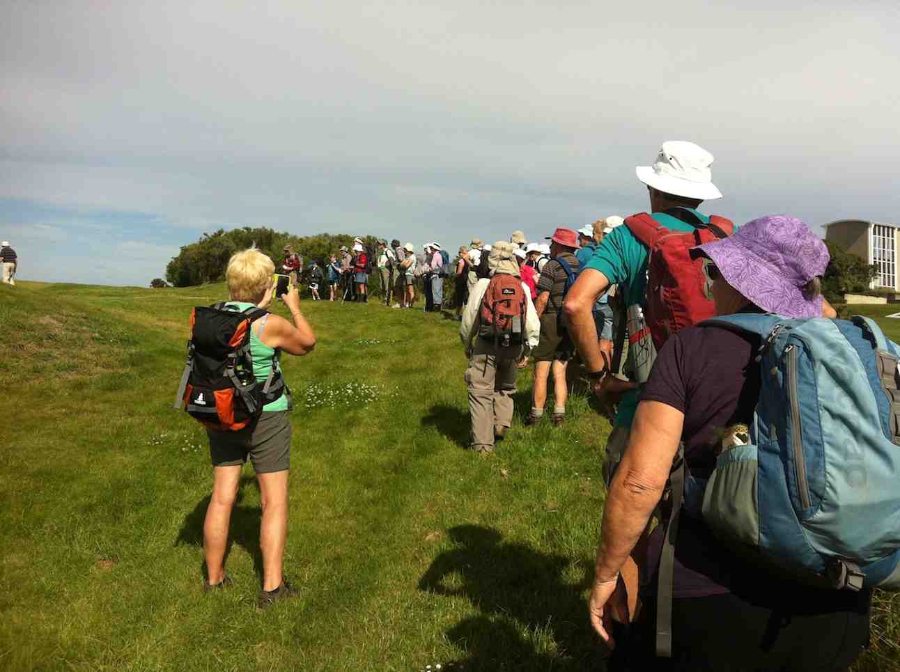
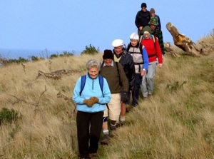
42. 23/11/2022. Hikers. Karetai Track. Grade 3. 22km. Leaders: Jenni and Bruce Wright.
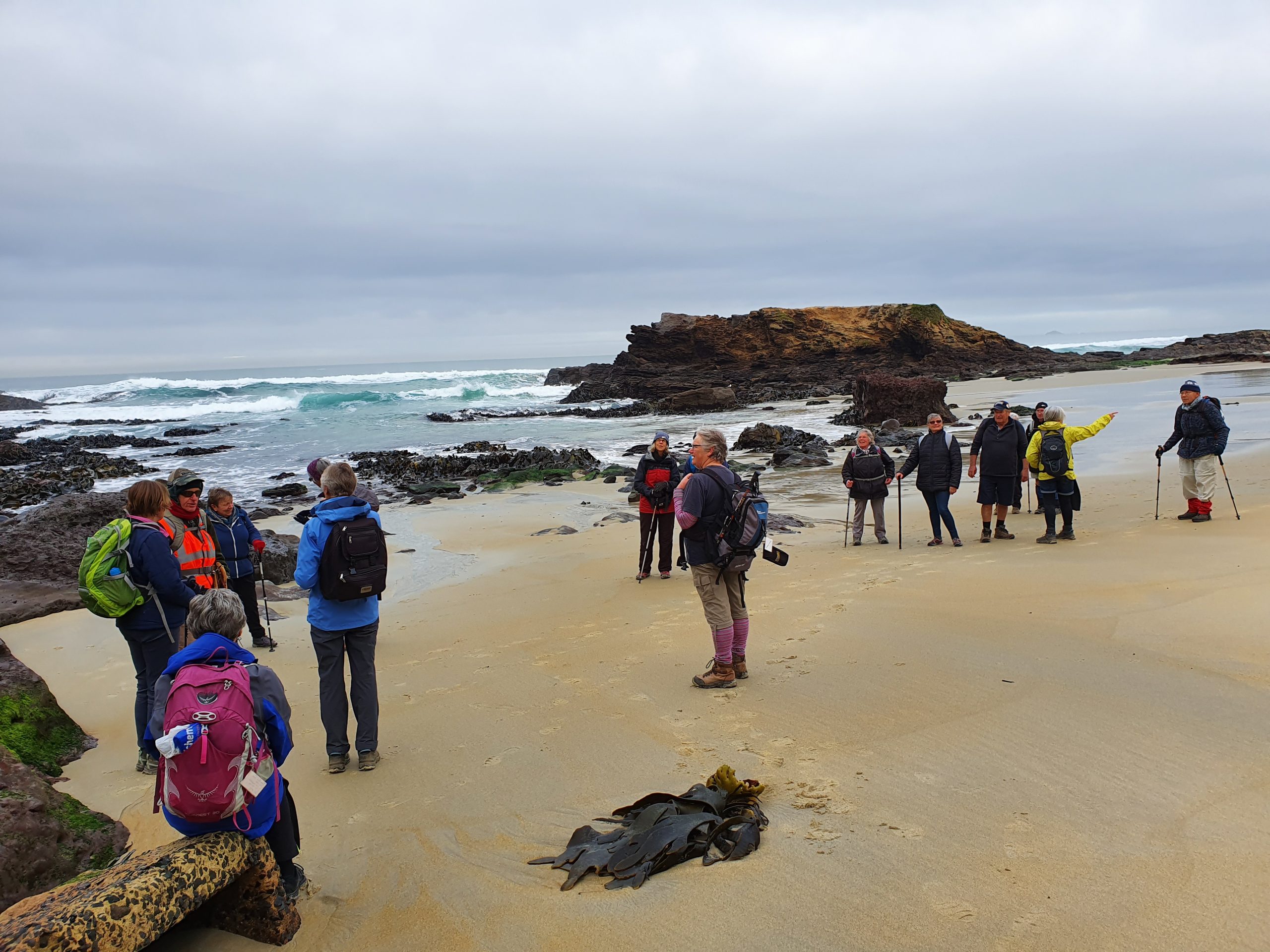
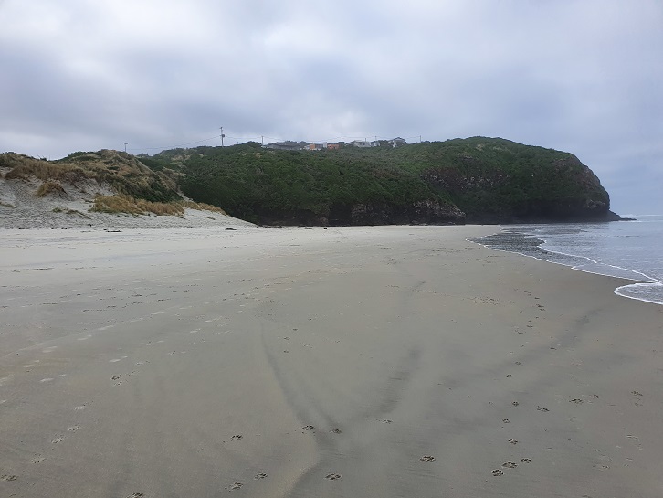
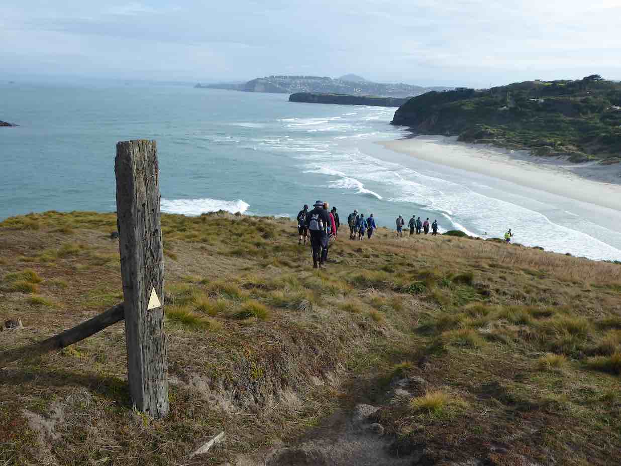
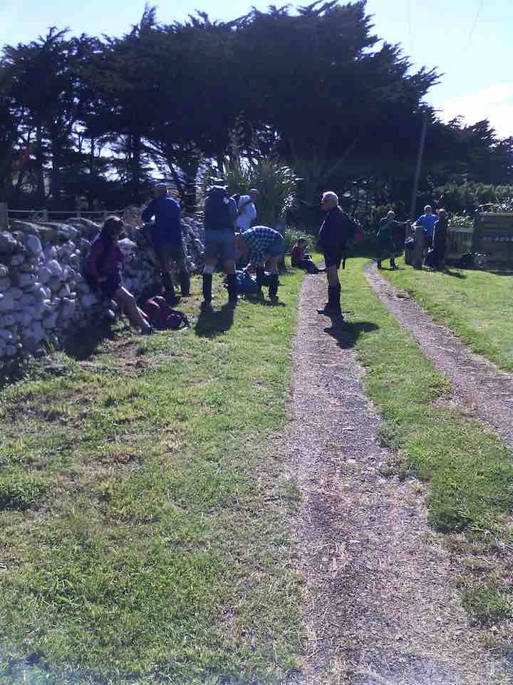
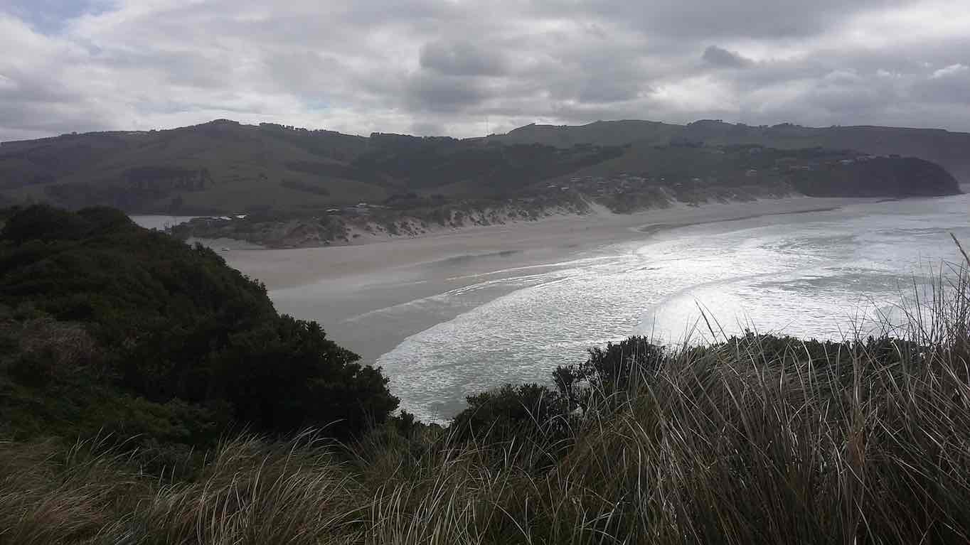
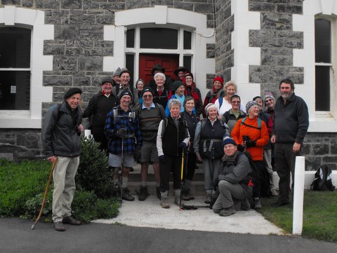
Despite a dismal forecast leading up, our group of 21 started our trek with perfect conditions. We arrived at Smaills Beach car park around 9.25 and four cars were taken to Tomahawk Lagoon carpark with one ferrying the drivers back. In the meantime, the remainder of us took a short walk in front of the Smaills Beach homestead which was built for the Smaill family somewhere between 1870 and 1880. The group were briefed about town supply dairy farm life from Jenni, as her family farmed there from 1955 to 1969. Latterly, it has been beautifully renovated and added to and used as a function centre for the Tautuku Fishing Club.

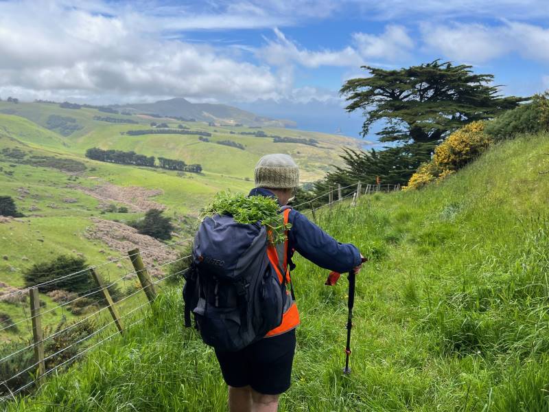
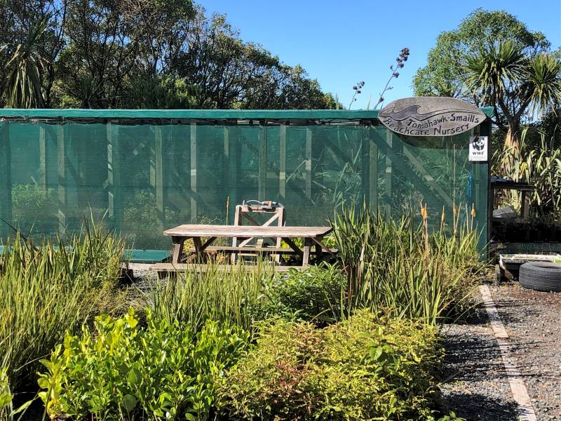
Around 9.35 we commenced our hike up Karetai Track, and admired the work of the Tomahawk Smaills Beachcare Trust. This is a native plant nursery that produces around 4,000 plants a year to help stabilise the dune system throughout the reserve which is constantly battered by Southerlies. There has been substantial plantings undertaken in recent years, so great to see this conservation effort.
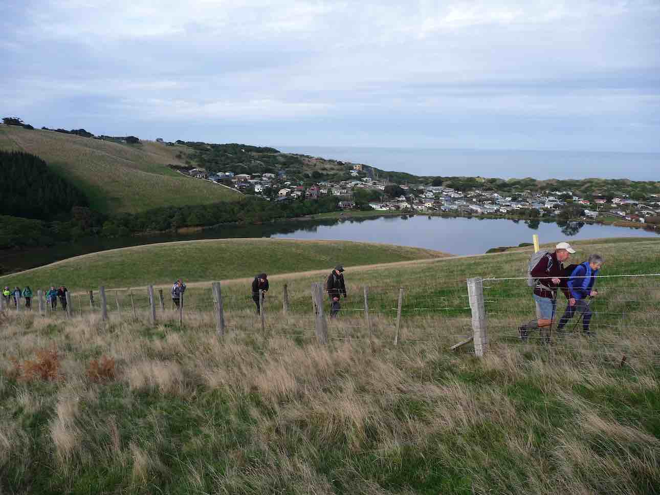
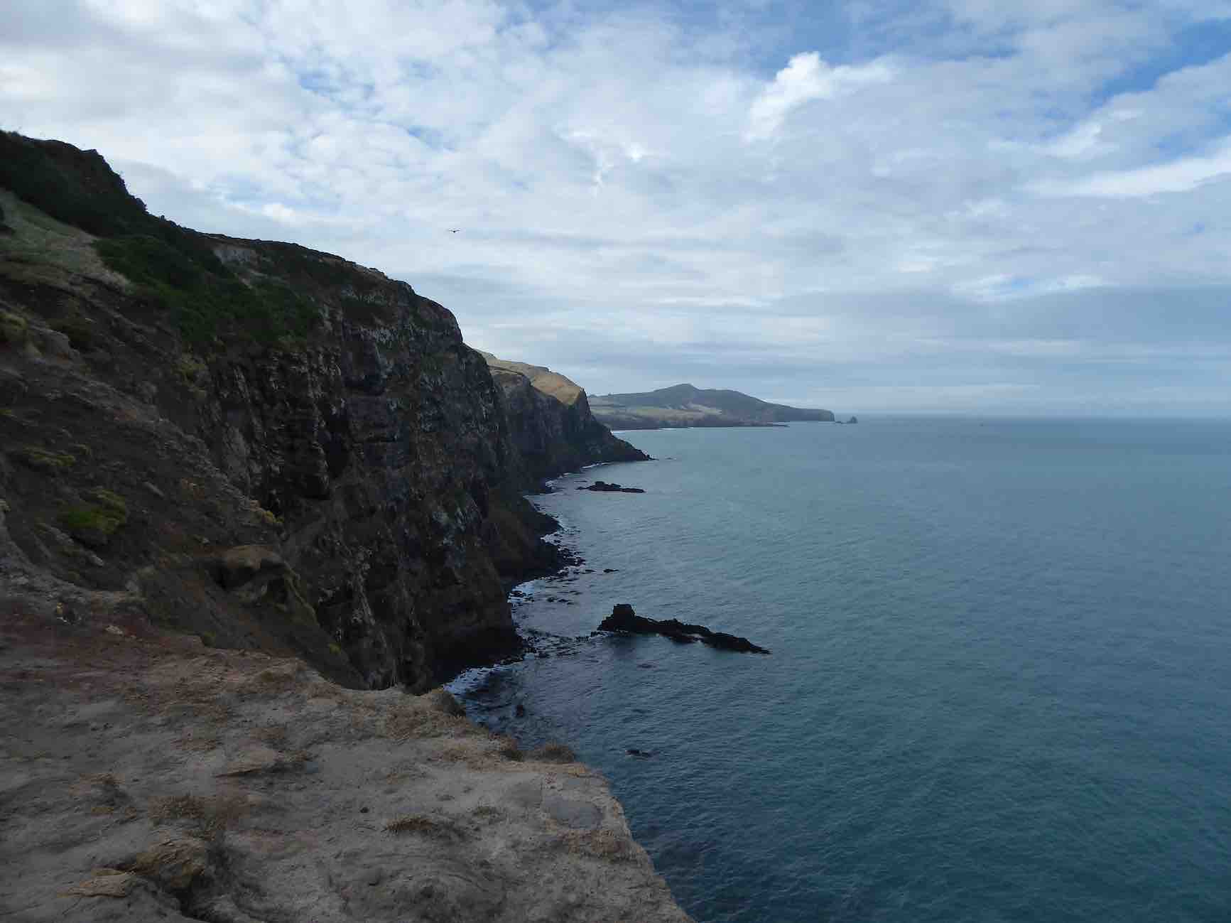
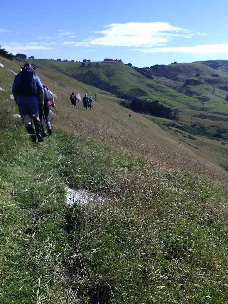
Conscious that it was a steepish climb up to Pudneys Cliff, we stopped often to admire the impressive views of Smaills Beach, Bird and White islands, Tomahawk, St Kilda, St Clair beaches and further beyond. Sadly, there was also much more gorse in the paddocks that Bruce and my Dad, had fought to eradicate in the 1970’s. However, the stock looked in great condition and were welcoming and curious. Hard to imagine that this track was once a paper road that enabled transporting bales of hay on our trusty Landrover, with purpose-built trailer behind. The road in the 50s and 60s used to connect with Highcliff Road at the top.
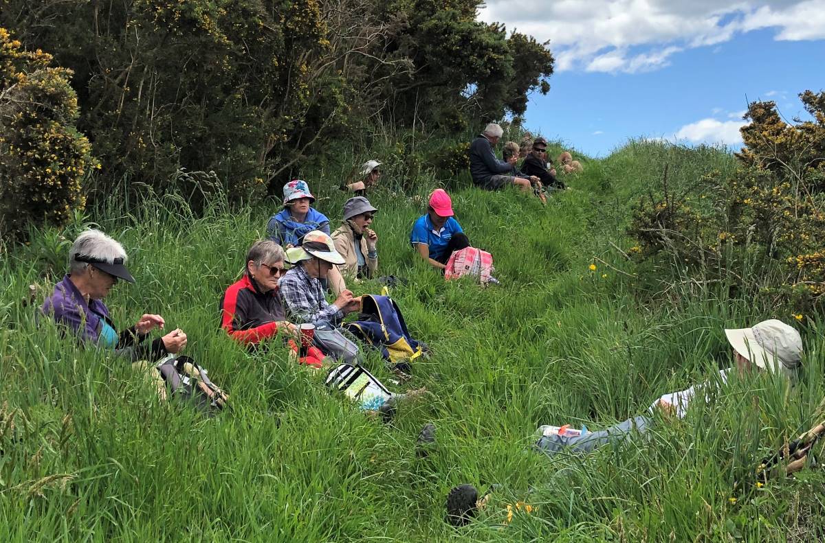
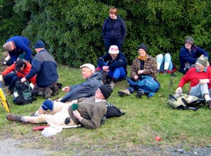
A well-earned morning tea at the top of Pudneys Cliff and treats were enjoyed from both Dave Mellish and Dave Roberts birthdays. Thank you Daves!
It was a gentle climb further up the Karetai Track, with stone walls, historic farming implements, various cattle and lovely chatter amongst the group.
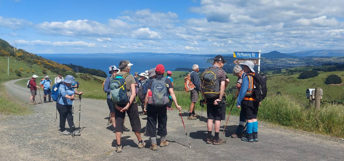
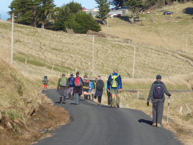
About now, we could see across to the Soldiers Memorial off Highcliff Road. This was our lunch destination and whilst the leaders knew this was totally manageable, those who had not done this hike, and there were quite a few, were sceptical. We walked in single file along Highcliff Road, and enjoyed walking in slightly cloudy conditions with a gentle breeze. There was still, however, the odour from Bloem’s poultry farm. We were warned though.
Luckily the traffic was sparse and accommodating and we in return acknowledged their reduced speed. There were stunning 180 degree views, which compensated for walking on sealed roads and still the chatter continued.
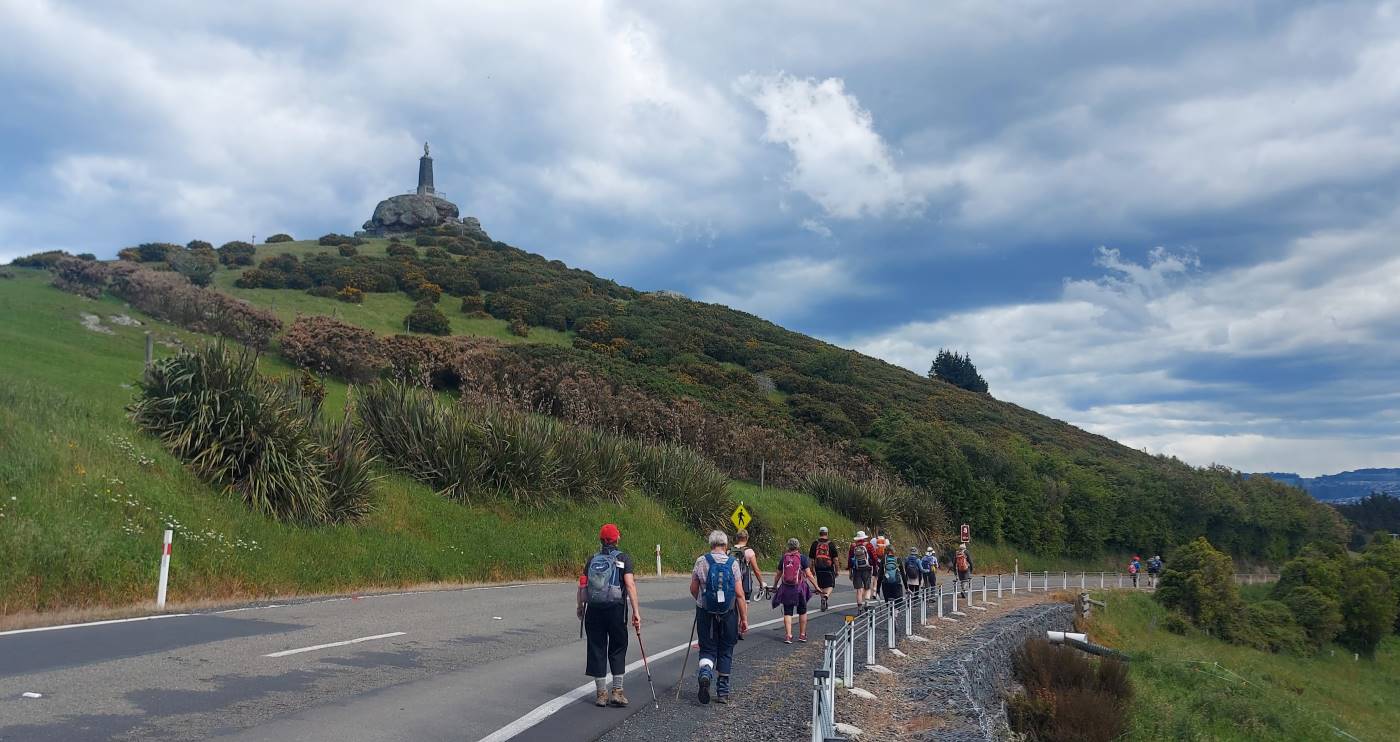
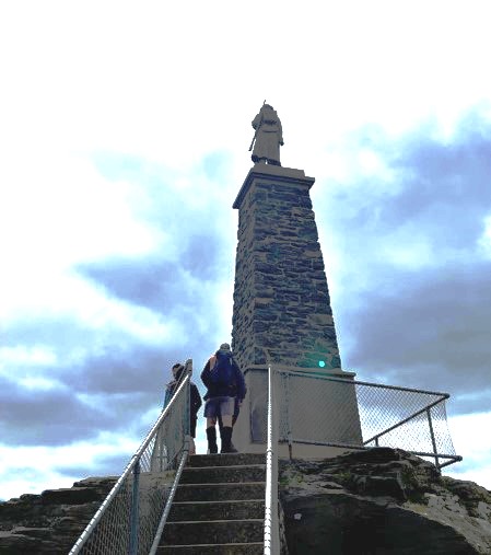
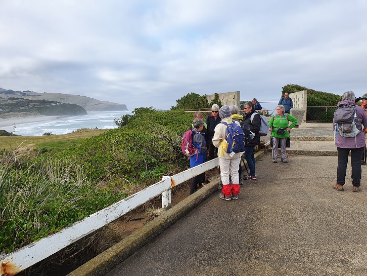
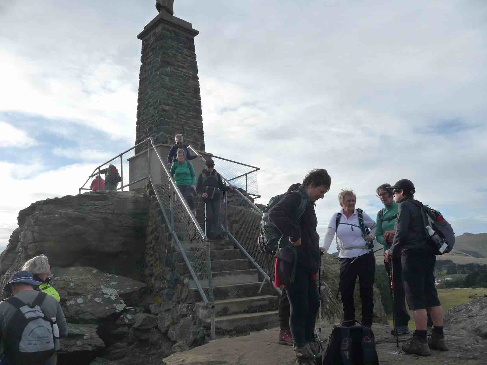
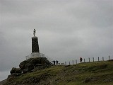
Finally, we saw the Soldiers’ Memorial in view and happily crossed to the track leading up. With tummies rumbling, most took the extension to view the memorial. Built in 1923, it is around 3m tall and on a bluestone column around 10m. It is to commemorate soldiers who had died in World War 1 with a connection to the peninsula. Sadly, there are multiple family members. The plaque itself was more recently updated because of incorrect information recorded. For more info check out: https://www.odt.co.nz/lifestyle/magazine/names-fallen
To satisfy the grumbling tummies, we found a pleasant spot for lunch. Always interesting conversations!
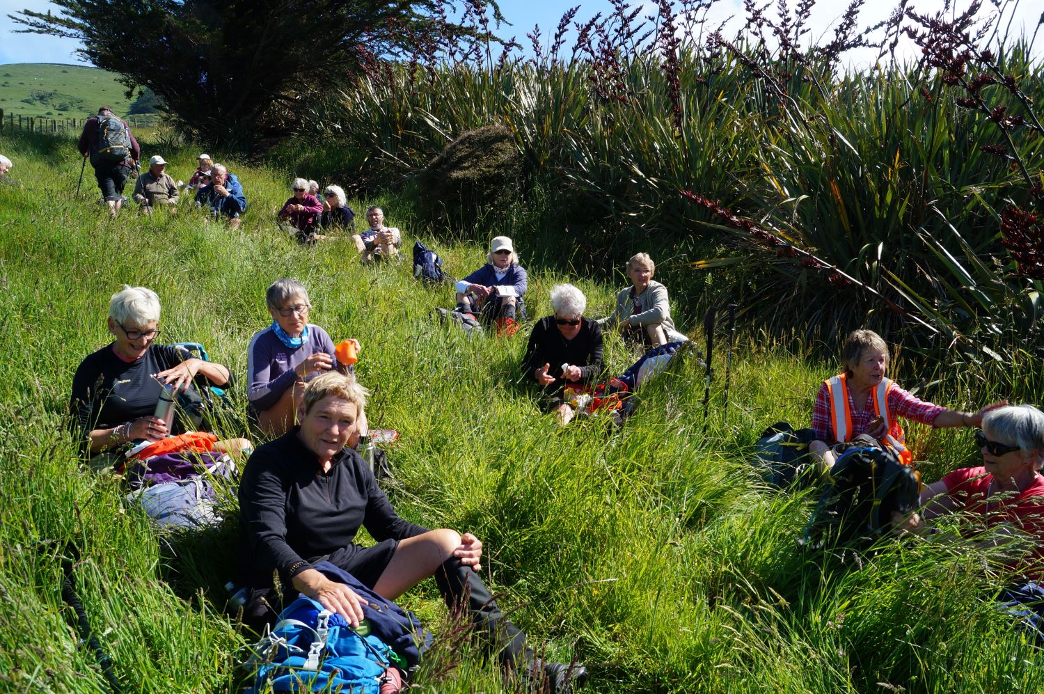
After a leisurely lunch and with the rain clouds looming, we set off down 41 Peg Track through farmland which was overgrown. We will report to the DCC that the grasses here were chest high and difficult to find your feet.
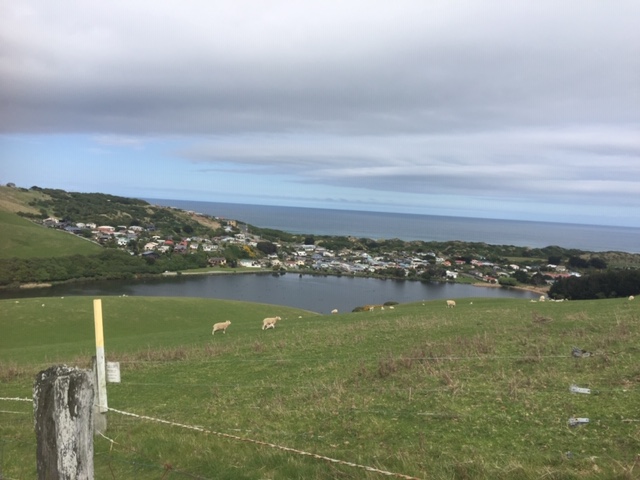
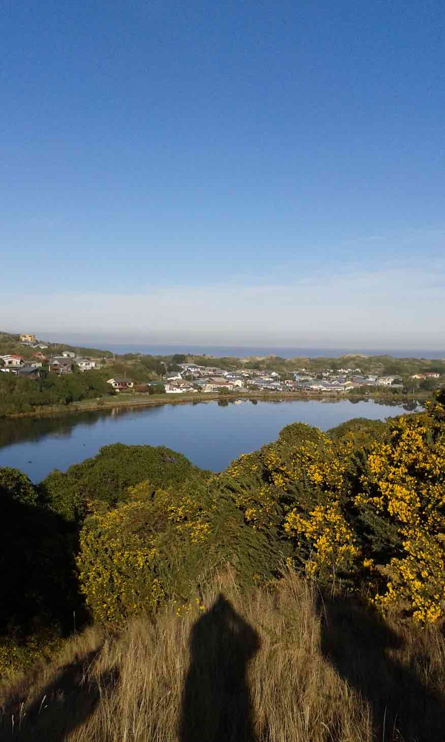
Luckily, everyone took their time and we proceeded without incident. We overlooked the sleepy Tomahawk township and property developments in Ocean Grove. We could also see the cars in the Lagoon carpark so not far to go now.

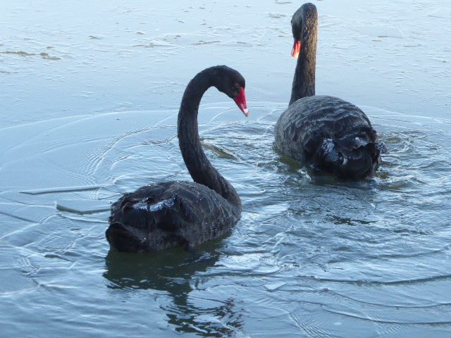
Down through the native bush, managed by DoC as a Wildlife Management Reserve. The native bush is protected by a QEII National Trust. When does it change to a KCIII National Trust? The Lagoon houses many swans, ducks and their babies, oystercatchers etc. This is a real haven particularly during duck shooting season.
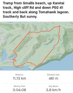
We ended up at the Tomahawk Lagoon car park around 2.30 ish, while the drivers were ferried back to the cars at Smaills Beach. While a few spots fell as we waited for our transport, it was not even enough to put on a jacket. How lucky were we. The day finished with coffee and more chat at Nicholls. Thanks to everyone who contributed to an interesting and enjoyable day. Walked around 11. 5Kms.
Jenni and Bruce
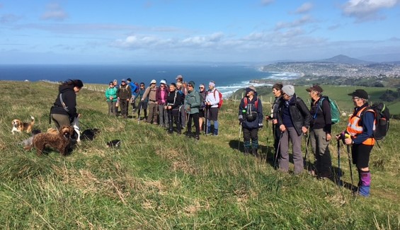
Nineteen trampers and two visitors met at the Smaills Beach carpark and set off at the beginning of Karetai Road in cool conditions. It was great to have some amongst us who had not undertaken this circuit before. We headed up what used to be an access road but is now considerably overgrown. This road was the main thoroughfare for farmers, including my father, carting hay bales piled high on trailers from the freshly mowed fields. Latterly, mountain bikers have enjoyed the challenges presented.
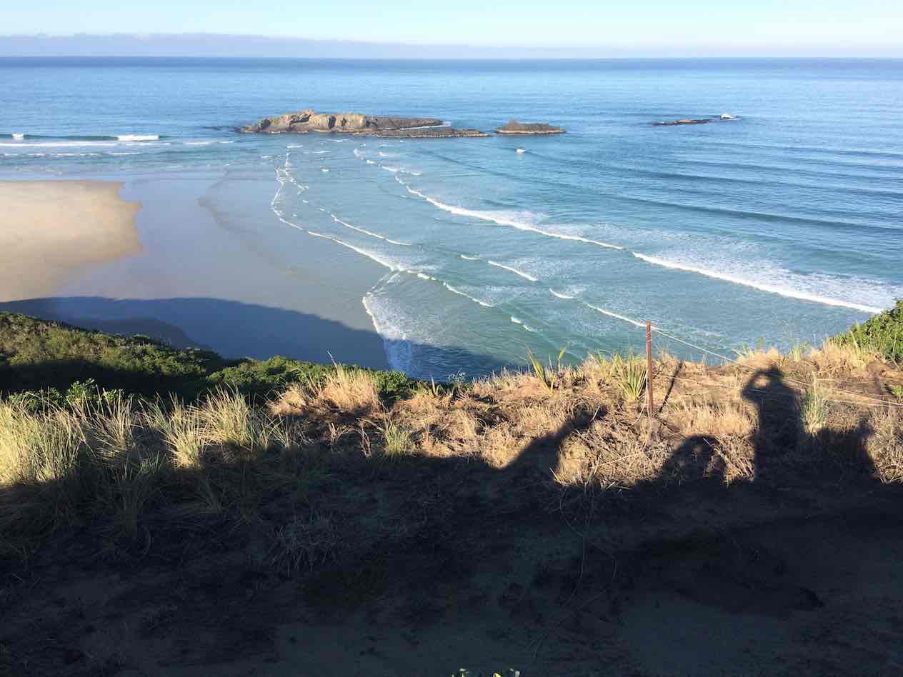
Warming up, we enjoyed the views from Pudneys Cliff, with spectacular views along Smaills Beach and the substantial coast beyond. The ocean forms a V in front of Bird Island, and in low tide it is possible to walk out before the change of tide.

Further along the top, we admired the skills of a young woman and her dog adventure business in action.
A suitable morning tea spot was found, sheltering from the Southerly. Along this part of the track were evidence of stone walls, trees battered by the unrelenting Southerlies, happily grazing stock and sadly, quite a lot of gorse and broom. The chatter continued after morning tea as the walk is not arduous.
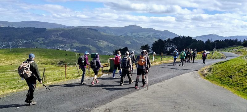
At the intersection of Karetai and Highcliff Roads we marvelled at the expansive vistas down the harbour, across to the suburbs of West Harbour and Signal Hill and Mt Cargill in the distance. The sparse traffic along Highcliff Road was considerate, as were we. Along this stretch, we were distracted by the views of the city and interesting properties being developed.
There is a well maintained track leading to the hugely impressive Soldiers Monument built in 1923 to commemorate soldiers fallen in World War 1. What a perfect spot for this memorial, with amazing views of the city, the harbour and peninsula. It was a poignant reminder of those affected, many from the same families. If interested, check this article https://www.odt.co.nz/lifestyle/magazine/names-fallen.
Not yet 12 noon we headed down the Tomahawk track to find a sheltered spot for lunch.
Jackets and warm gear was evident, the ways of the world sorted, lunchboxes emptied and we then off on the 41 Peg Track with renewed energy.

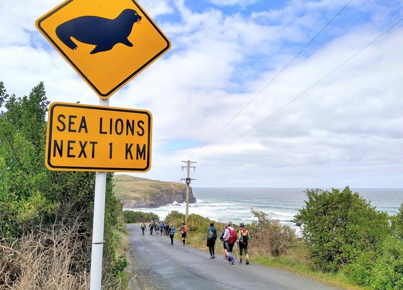
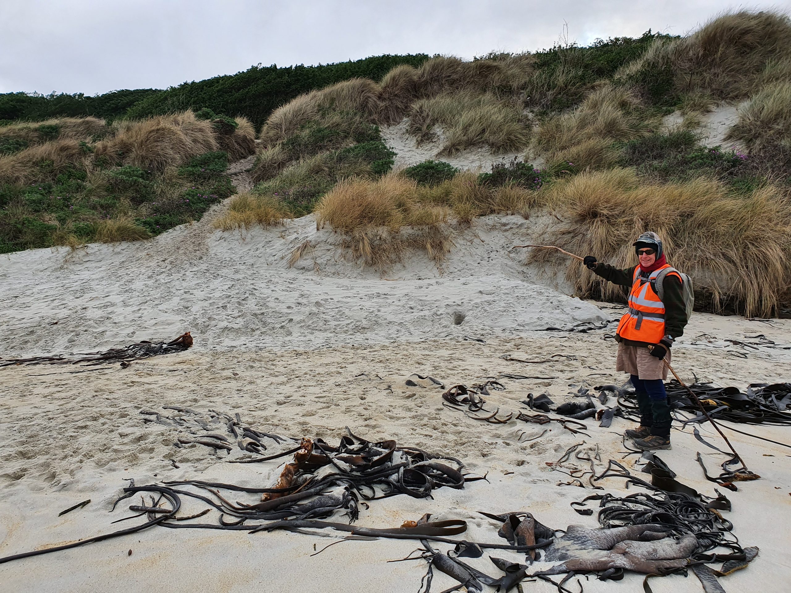
The views this time were over Tomahawk Lagoon and beach, the sleepy neighbourhood of Ocean Grove and new property developments around Centre Road. The track down to Tomahawk Lagoon was reasonably slippery after recent rain. Poles were the order of the day for those of us who sometimes end up slipping and sliding. What a treat heading into the bush. Although only a short distance, the native birds and sun filtered bush was calming with lots of birdsong. We stopped to view the black swans tipping over 180 degrees to retrieve their food from the bottom of the lagoon. Onwards and upwards, stopping at the bunkers for a history lesson and some cool graffiti. We were reminded to watch out for sea lions for the next 1km on the final descent, but didn’t encounter any.
We arrived back at the cars at just after 2 p.m. before heading off to coffee and cake at Nichols. A 12km loop walk rewarded with stunning views in all directions.
A very enjoyable leisurely day out with great people. Jenni and Bruce.
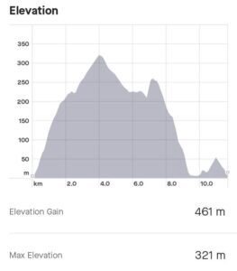
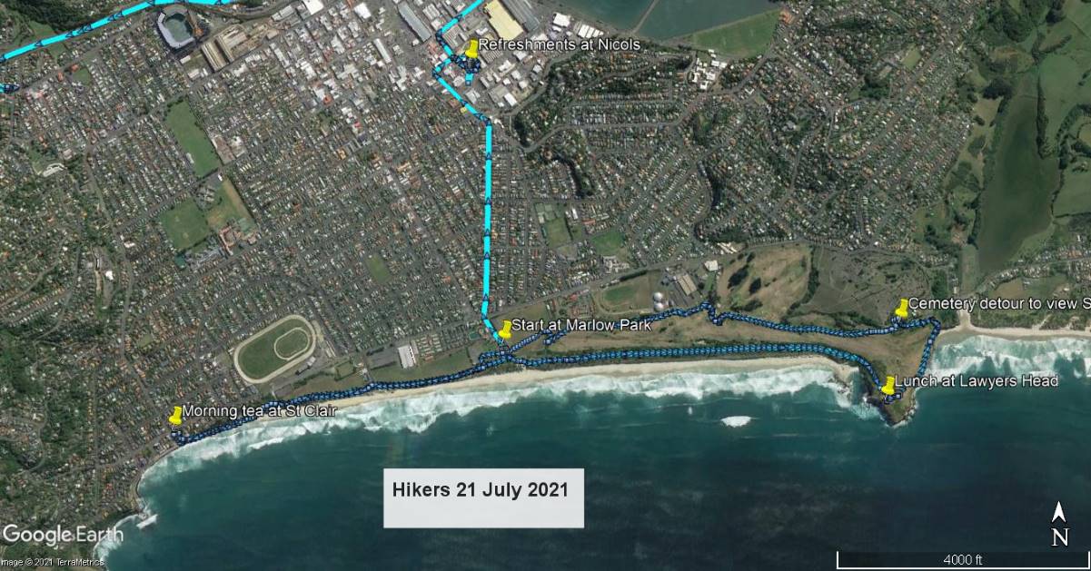
40. 21 July 2021. Hikers. St Kilda, Tomahawk M. Leaders Bruce and Alex
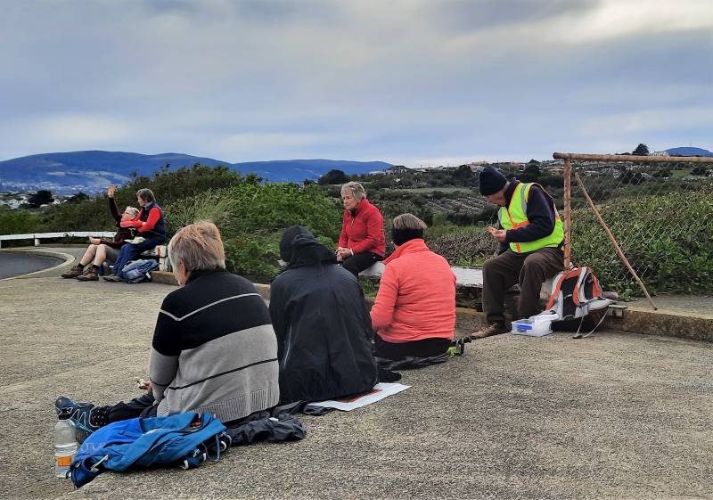
After lunch, at 12.20 pm we dodged the last of the Golden Oldies golfers and crossed the fairway to walk on the Ocean Grove side of the course to the track leading to Tomahawk Road. Rather than proceeding down Tomahawk Road and doing a circuit of the Ocean Grove beach and playing fields, we turned left to proceed along the track by the fence behind the crematorium.
We made a brief diversion into the cemetery and looked at the relatively new memorial to the 37 women who died in a fire at Seacliff hospital. A query was raised about whether any staff died in the fire. I did not know but the information on the internet indicated no staff died, there being no nurse on duty in the ward at night. The single rooms, dormitory and the windows were all locked. No cause for the fire was found, the design of the hospital was considered to be less than ideal and a new hospital was opened at Cherry Farm in 1954.
Thanks are due to Alex Griffin who stepped in, at short notice, as a very able co-leader. Distance covered 9.5 km.
It was a trip down memory lane as we formed part of a 24 strong group at the Smaills Beach car park. A quick briefing for those who had not heard the Downey family farm story and we headed up Karetai Road. Back in the 50’s this road was accessible by car and the trusty Land Rover and trailer carted many bales of hay from the paddocks. The views from the top of this climb over Southern beaches are outstanding.
Further on there’s a perfect spot for morning tea while still overlooking the coastline. The weather gods were on our side, and we carried on in near perfect conditions.

The terrain was reasonably flat, and this enabled lots of chatter.

To our left we could see the Soldiers’ Monument and that was our lunch destination. Finally out on Highcliff Road and a 3km walk to the turn off. Bloem’s farm’s odour was blowing our way and was pretty intense, still we needed to be reminded of their existence.

Not far now though to the Soldiers’ Monument (erected in the memory of those from the Peninsula who died in World War 1). It was a relief to get off Highcliff Road and the traffic and a steep climb up to the monument. Someone had done a clever weaving on the flax which was pretty cool.

Some watches reported 11.58 but others were 12.01 so it was deemed lunchtime. There were two destinations for lunch, one a sheltered spot in front of the monument with spectacular views down to the heads and the second group, overlooking the beaches and Karetai track in the distance. We were spoilt for choices!

After regrouping we headed off down the Lagoon Track which is well maintained and a very pleasant walk through farmland. The little lambs were delightful frolicking in the paddocks.
We enjoyed walking through beautifully formed trees, such an unexpected surprise.

The track from the monument to Tomahawk Lagoon takes 45 minutes and here we watched huge swans and their signets, ducks and their ducklings enjoying the sheltered waters, perfect for youngsters to learn their skills.

Didn’t look that inviting for us to paddle though.
There was a moment of exhilaration as we saw a Nichols’ vehicle in the park, thinking the coffee and scones had come to us, but sadly this was not to be. For the final part of our tramp, we headed up Tomahawk Road and stopped at the bunkers built to protect our coastline. Refer
https://www.odt.co.nz/news/dunedin/repairs-planned-tomahawk-gun-emplacements

Back to the car park at Smaills Beach, and we could be thinking we were at Slope Point.

Since it wasn’t delivered onsite, coffee and debrief was at Nichols Garden Centre. The tramp with a leisurely morning tea and lunch break commenced at 9.40 a.m. and we were back in the cars around 2.00 p.m. 12.6 km according to a reliable source, and a great day spent with brilliant company.
Thanks, Jenni and Bruce.
38. 24/6/2020 Hikers Ocean Grove/Tomahawk
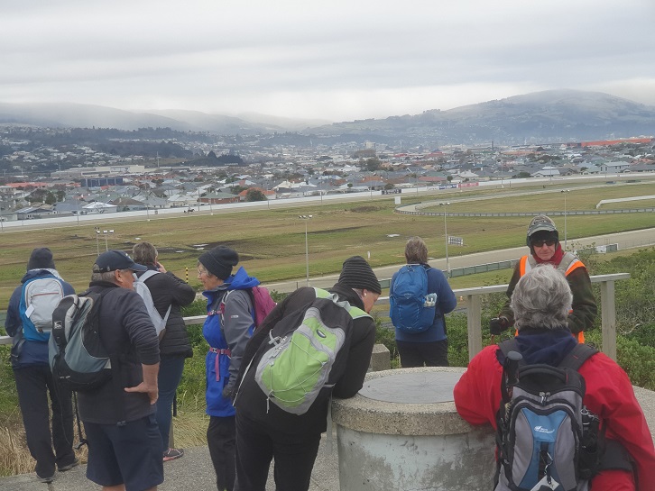
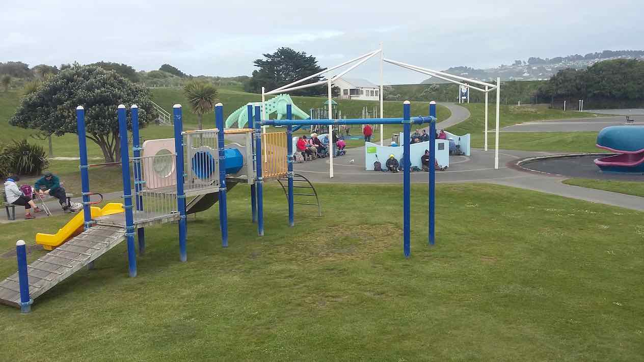
Twenty-four hikers departed from the Marlow Park entrance near the toilet block at approximately 1000 heading up path behind the dinosaur slide, through the car park and continuing along the grassy sports fields to reach the metal gate at the end. We turned left at the road behind the St Clair scout building and at the crest of the sandhill took a track to the right which led to the Sir James Barnes prospect which looked out over the Forbury Park trotting facility.
We then headed towards St Clair down the concrete steps on left and along the crest of the sandhill for about 50 m to where the track branches to the right.

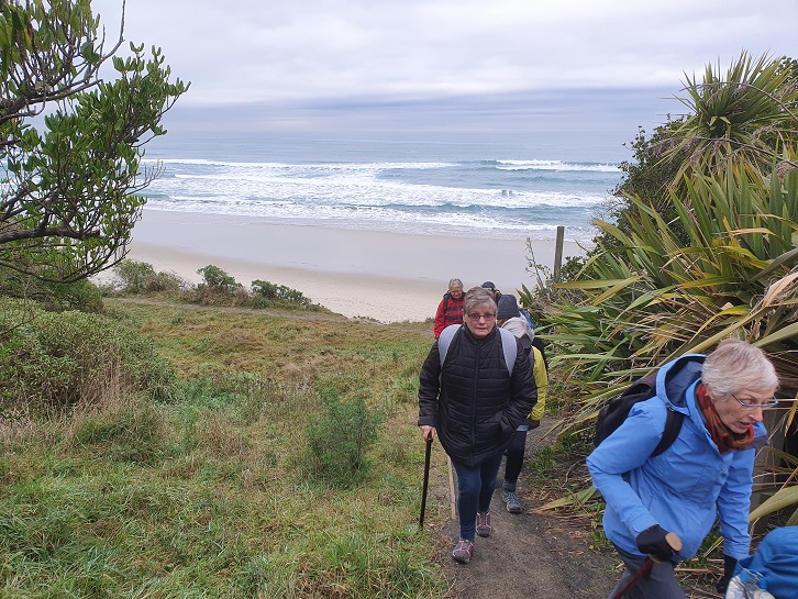
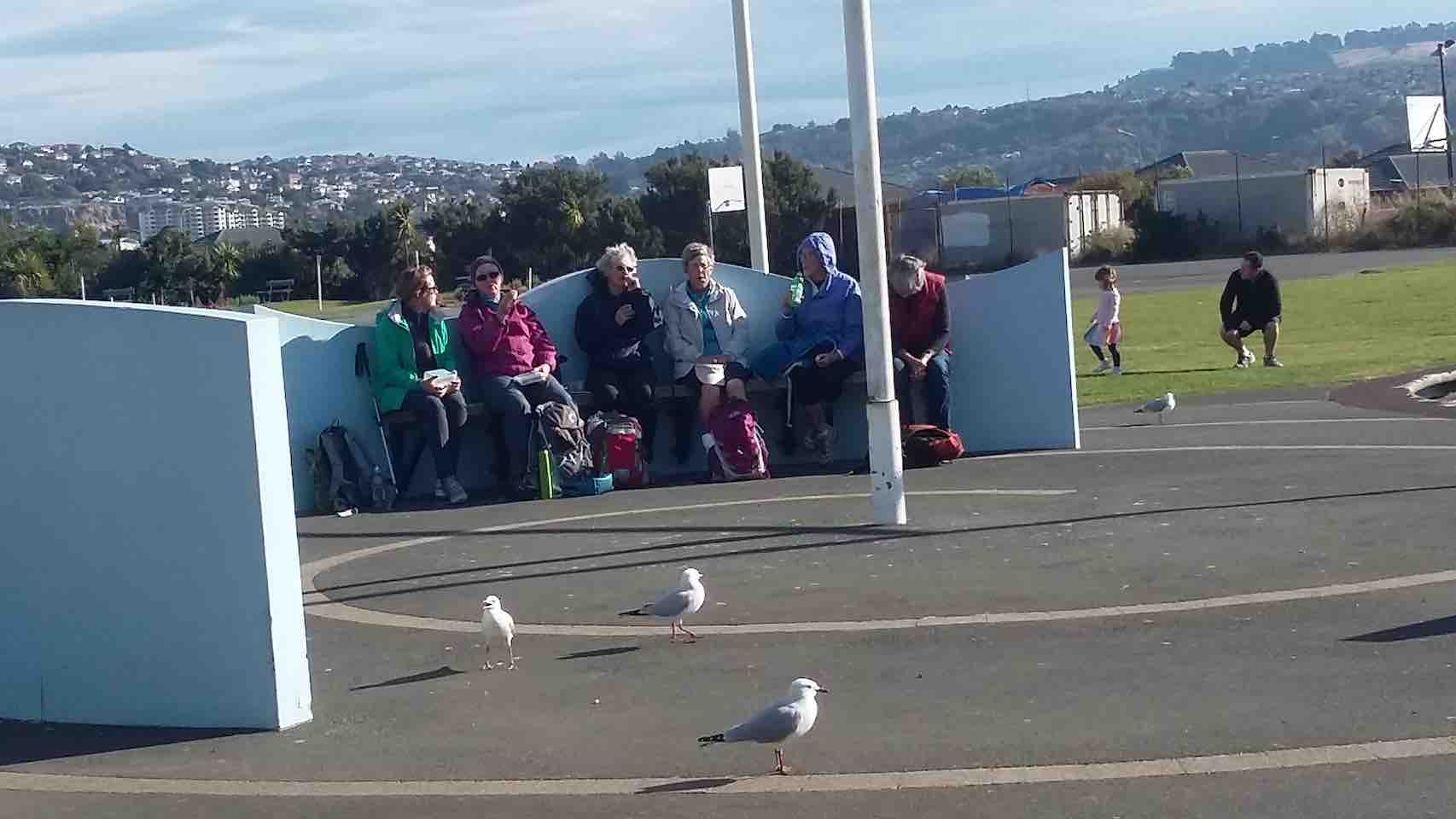
We left the track at that point and went down a sandy track towards the beach and then continued along above the sand retaining sausage, up a sandy slope, and then up some concrete steps to the St Clair Surf Club building. We had morning tea at 1030 in the playground behind the building.

After lunch we walked around the perimeter of the course marked by red posts and avoided walking on the greens. At the far side of the course we went down a short path, near an entrance to the crematorium and cemetery, and down a foot path to the right to reach a green transformer and Tomahawk road which led down the hill to the bridge over the outlet of Tomahawk lagoon. We took the sandy path to the beach just before the bridge and followed the dry stream bed to the beach.
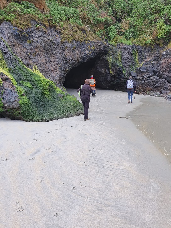
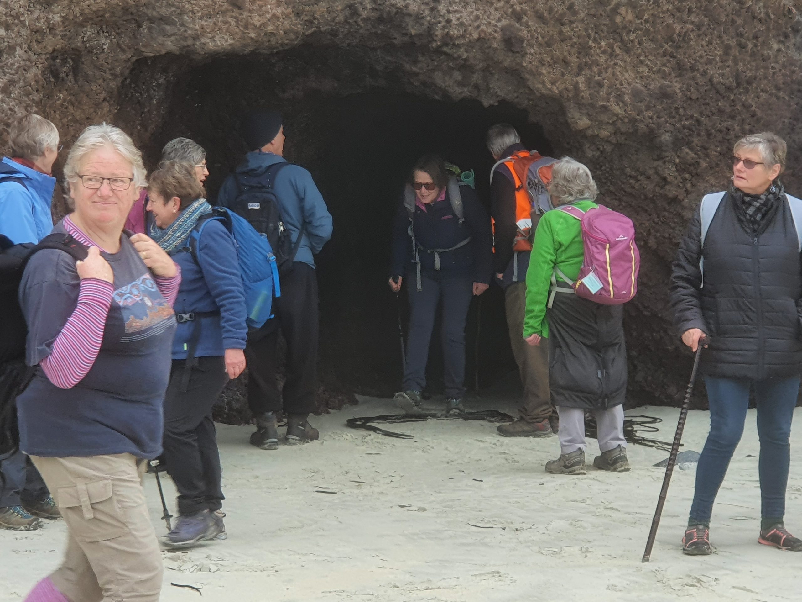
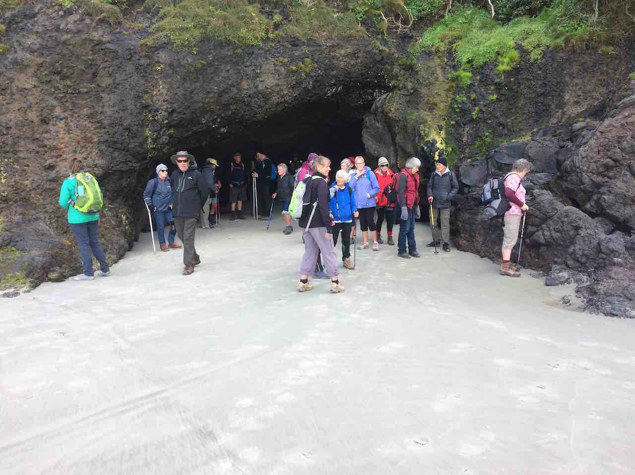
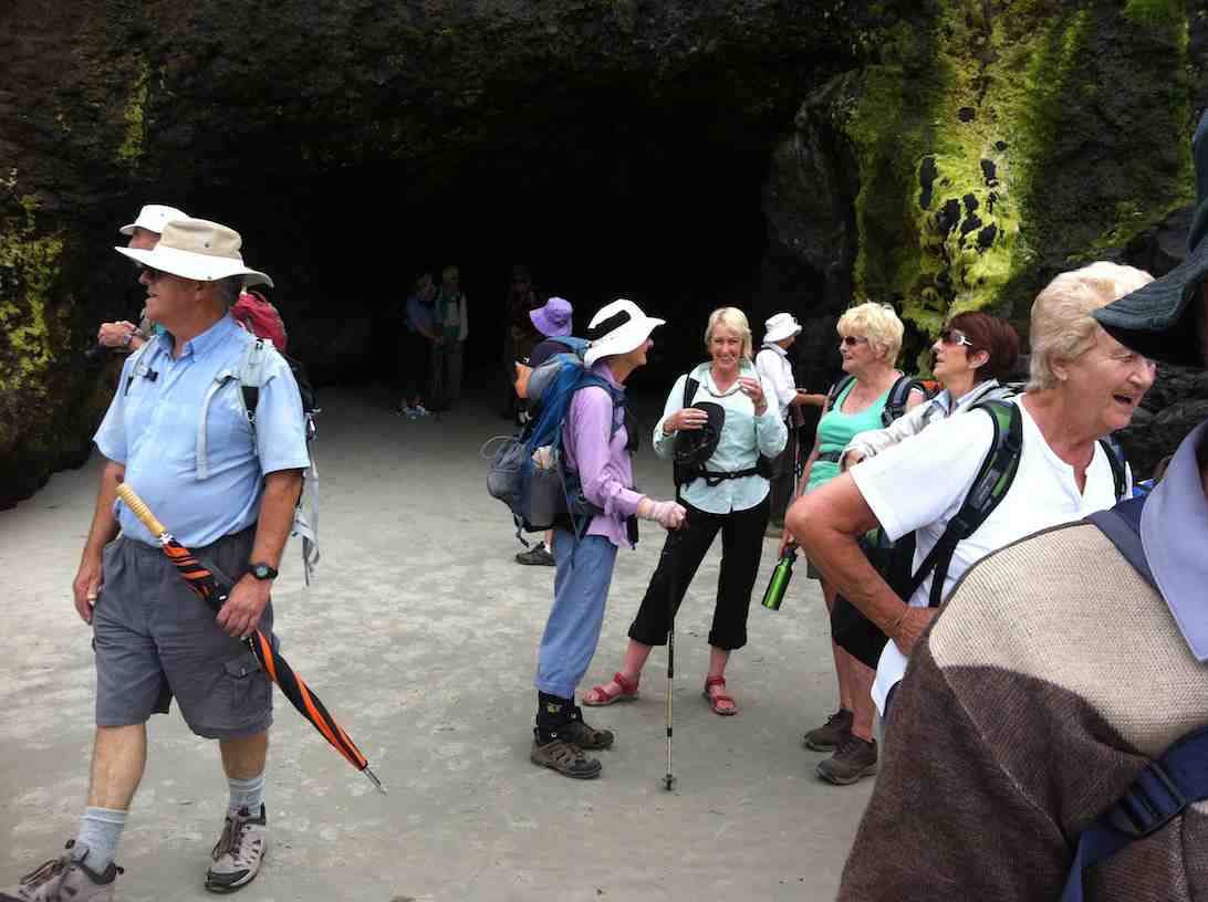
We initially looked at the cliff face and caves by the golf course and then walked to the cave atthe far end of the beach.


We then walked down the hill and turned left into Luke Street going past the Otago Anglers Association Club rooms on the corner. We ascended the rise at the end of the street, walked past the site of the demolished Tomahawk School and swimming pool and noted that the dental clinic had been removed in the past week. We followed a path towards the car park, sporting facilities building and the playing fields to emerge at the far end at the outlet bridge.
We retraced our steps up the path to the left at the green transformer and took the path to the right between the golf links and the crematorium gate. After briefly detouring to the right into the cemetery at a rose bush near the memorial to the women who died in the Seacliff hospital fire in 1942, we went to the left to rejoin the track through the golf course.

The weather was better than it might have been with a bearable temperature and overcast, 100% cloudy conditions, but no wind. This gave the Ocean Grove beach a slightly misty appearance.
The distance covered was 14 km. We extend our thanks to Alex Griffin who stepped in to assist as leader after Marjorie had to leave early for another commitment.
Marjorie and Bruce
37. 12/6/2019 Tomahawk Lagoon – Soldiers Monument – Karetai Road. M. $5.00 Arthur and Eleanor.

Trampers last walked this circuit 24/6/15. Report quoting “A record number of 11). Was a very frosty morning and we were somewhat amused at the ducks flying onto their frozen runway—-parts of lagoon were solid ice.This time we had a group of 17 and only 5 had previously walked this circuit with the club, shows the increase in members! Weather was much warmer too. We parked at Lagoon and set off at 10am, climbing up through bush, paddock and corridors of gorse for 20 mins.
to enjoy a breather and smoko on remains of a stone fence. Onwards and upwards to the Monument with the lone Soldier and a magnificent 360 degree vista of our very own piece of paradise.
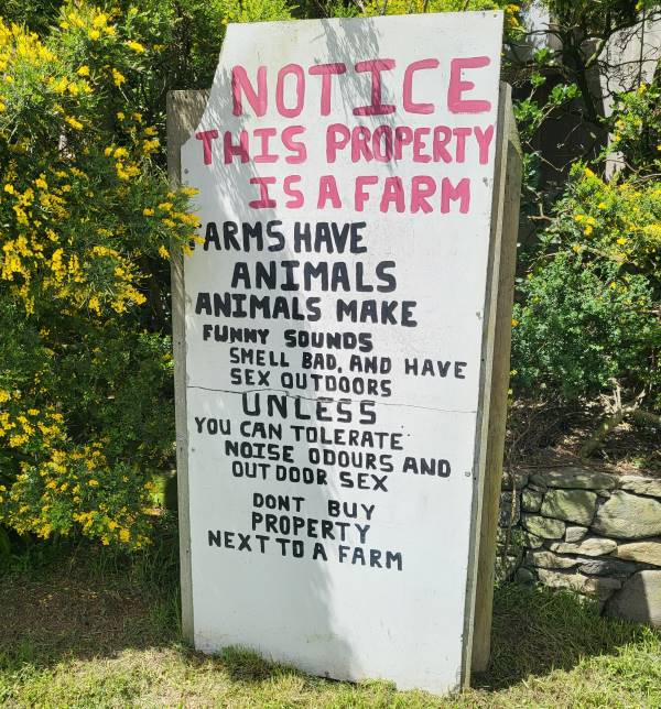
Next we walked down the well used track to High Cliff road. Crossing to left, we walked about 2km single file along this rather busy stretch of road. We knew when we were approaching the pig farm by the smell, also being a little amused at reading the sign installed when neighbouring property went on the market. Shortly after we turned right into Karetai Road.
We continued downhill on the no exit sealed road, then down the gravel road, stopping for lunch at 12.15pm, enjoying the sunshine, chatting and scenery all around us.
(Even offered water from a passing home owner) Then it’s down past the trees and onto the track. At the cliff edge, some ventured to the left for a look towards Boulder beach. On regrouping, we decided to walk along the cliff side of the fence (no place to bring 12 year old triplet grand children) towards Smail’s beach, was a bit of a scramble through the last few metres before we hit the road.
We stopped at the Tautuku fishing club building and took a picture to forward to Jenni Wright— was her family home many years ago. On the road and uphill past Smail’s beach to the cars, arriving at 2.10pm.We found our way to Tuppence cafe in Waverley where we enjoyed coffee, cake and tea for 1. This ended another most enjoyable 12km tramp.
Good friends, good weather and good walks——what more do we need out of life! – Eleanore.
36. 8/5/2019. Hikers. Tomahawk – Marlow Park ret. E. Leaders: Bruce and Marjorie.

Thirty-four hikers assembled on a cloudy morning with a chilly NE breeze at the carpark near the Tomahawk Lagoon outlet on Tomahawk Road, just over the bridge on the right down the hill from the crematorium entrance, before setting off, at 0929, past the white gate on to the Ocean Grove sports fields. At the top left corner of the sports grounds we went up the mown path and turned to the right along a cut path in the grass and emerged near the site of the now demolished Ocean Grove school and swimming pool. The rotunda and dental clinic building have been retained. We then walked down the track on the left and along Lock St before turning left into Tomahawk Road at the Otago Anglers Association building on the corner, then right into Oregon St, and then left into the right of way leading to the Tomahawk Lagoon.
We walked along the path on the right bank of the lagoon, at which were mallard and paradise ducks together with black swans, to the style at the fence at the end and then turned back and retraced our steps to Tomahawk Road where we turned left and went up the hill to the Ocean Grove playground on the right where we had morning tea.
After morning tea we followed the track leading to the beach …

… and then turned left to explore the cave at the north east end of the beach.
We then proceeded back along the beach to the south west end, turned right towards the bridge and took the track up the bank on the right, crossed the bridge and went up the hill to the green transformer where we took the track up to the golf course
We followed behind a group of golden oldie golfers to the green ahead keeping to the perimeter of the course and avoiding walking on the greens. We took the track up to the Leonard Wright memorial which starts near the tee off area.
We inspected the view from Lawyers Head,

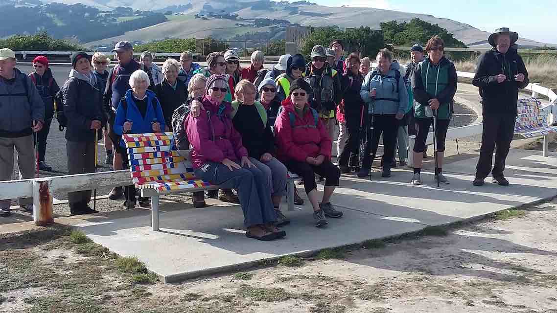
noticed the colourfully painted seats with their message of hope for those contemplating suicide, had a group photo taken …
… and walked the length of the John Wilson drive to the Marlow Park playground for lunch
arriving from 1155 to 1210.
After lunch, we passed the right side of the Pirates Rugby Club building and crossed the rugby ground to enter the golf course at the entrance sign situated in about the middle of the field. We proceeded through the course keeping to the left hand side, eventually passing to the right of the club house, climbed the small hill behind the club house and went down to the left to the start of the path that leads through the golf course to the north east end where we went on to the path.
Most of us then deviated to the left to meander through the cemetery while a group of 4 kept on straight ahead to head back to the cars. On the cemetery walk we passed the plaques acknowledging those who donated their bodies for use in medical education and the 37 women who died in the Seacliff mental hospital fire on 8 December 1942. Further on was the grave William Edgar Adams. Professor William Edgar Adams (1908–1973) was a distinguished University of Otago student, graduating MB ChB in 1935. In 1944 he became Professor of Anatomy and was appointed Dean of the Medical School in 1968. He was elected a Fellow of the Academy of Zoologists (India) in 1955, Fellow of the Royal Society of New Zealand in 1959 and Honorary Fellow of the Royal Australasian College of Surgeons in 1962. He died in office on 18 May 1973.
After following a semicircular route through the cemetery we emerged by crossing the fence at the bottom of the hill on the path where we had entered the golf course earlier in the day and arrived back at the cars at approximately 1343. Coffee was enjoyed at Nichols. Distance travelled 12.25 km.
Bruce and Marjorie
35. 18/10/2017. Hikers. Tomahawk. E. Leaders: Marjorie and Bruce.
Twenty-three hikers parked at the Tomahawk Beach Reserve carpark on Tomahawk Road, at the bottom of the hill at the end of Tahuna Road, just past the bridge over the Tomahawk Lagoons outlet. We proceeded back across the bridge up Tomahawk Road for approximately 100 m and turned up the path to the left at the green transformer. At the top of the path we continued straight ahead on to the golf course and turned to the left following the perimeter
of the golf course until we came to the back of the Sir Leonard Wright lookout on John Wilson drive. We got to the lookout by walking across the tee off area and taking a narrow path up to the road.
After looking at the view,


we proceeded west along John Wilson drive to the St Kilda playground where we had morning tea.
A chilly wind was blowing from the sea necessitating, for many, the use of a wind proof jacket. After morning tea we crossed the Pirate Rugby Club grounds and entered the golf course near by a tree approximately midway between Victoria Road and John Wilson Drive. We walked around the left hand margin of the golf course observing a rabbit and noting the greens had been top-dressed with sand and fertilizer for maintenance. At the end of the left hand margin of the course, rather than going straight ahead onto the road leading the golf club car parks, we turned to the right and went up the course margin and around the club house to link up with the public walkway through the course. We noted a sign indicating the course was closed.
At the end of the path through the golf course we continued on through the cemetery grounds and passed several large gas cylinders behind the crematorium. At the end of the path we were back where we had originally entered the golf course and went down the path to our left, turned right into Tomahawk Road, crossed the bridge, took the 4-wheel drive track to the right immediately over the bridge and then, at the sign, the track down to the outlet creek and beach.
We walked along the beach until we came to the correct place on the sand dunes to enter the path leading back to a playground on Tomahawk Road. It was marked by a short tantalized post. We turned left down the hill and then right into Oregon Street until we reached the Walking Track sign on the left and met Margaret and Les at the Tomahawk Lagoon picnic area at 1208 for lunch. After lunch, most of us walked around the track leading to the end of the lagoon and some climbed over the style and went through the bush up the hill, over another style and across a grassy hillside track with a dip to the right angled turn on the path. We observed the view back over the lagoon but then turned back rather than carrying on up the 41 Peg Track to the Soldiers Memorial.
When we rejoined the group waiting at the Lagoon at approximately 1335 most of us took a slightly longer but grassier route than that available on Tomahawk Road and walked past the Otago Anglers Club Rooms in Luke Street to the end of this street before continuing straight ahead to the closed and apparently still for sale Tomahawk School. The old swimming pool with a black plastic heating system was no longer visible. We continued to the right up the hill path and ambled past the yellow and black sports pavilion, down the concrete steps, and then along the playing field to the end of the grassy field adjacent to the car park. We got back to the cars at approximately 1.48 pm.
Refreshments were shared by 21 slightly weary hikers at Nichols. The weather had been fine and breezy with it being cold when exposed to the ocean winds and warm in the shelter of the golf course. The distance covered was approximately 10 km. – Bruce
34. 15/2/2017. Trampers. Highciff Road, Karetai Road, Highcliff Track, Paradise ‘Road’, Highcliff Road.
Our tramp started on Highcliff road. 11 of us today. Lovely to see Judy out again, also Bruce after his holiday. Also back again was Neil number 3 after an outing with us last
week. Along Karatei Road to McMeeking Road and past farmhouse. Got onto Highcliff track after our morning tea.
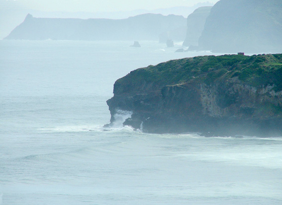
Some stunning views of Boulder beach,

farmland and the coastline. Along the side of the hill
and down to not quite the beach. It was closed for the penguins.
Passed the old houses and onto Paradise track up to the road having lunch on the way.
Up the road then and back to our cars. Decided to go to the pool cafe at St Clair for our coffee debrief. A lovely tramp all up. – Helen.
33. 8/6/2016. Hikers: Tomahawk/Smaills Beach. E. Leaders: Judy and Jay.

A fine frosty morning found 30 hikers heading for the crematorium carpark. We wandered down the track from the carpark corner out onto Tomahawk Road, and along to the Tomahawk School (now closed) for morning tea.
Unfortunately the planned walk up between the two lagoons could not be followed due to a last minute refusal from the land-owner. So instead of a round trip, we turned into Oregon St and followed the track around the north lagoon, a pleasant walk in the bush. The swans on the lagoon made a great sight (and noise) as they lumbered across the still waters and took flight from our invasion.
Across the style, and then a short climb up though the bush to a second style. 18 keen types carried on up the fence line for another 10 minutes, enjoying the views on such a marvellous morning. (This track continues on up to the Soldiers’ Monument on Highcliff Rd.)
The rest wandered back down the track to wait at the picnic tables for the others to return.
Then it was back out to Tomahawk Rd, and a long pull up the hill past the gun emplacements, …
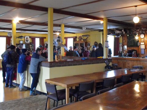
… across the Centre Rd junction and down to the Tautuku Fisherman’s Lodge …
… for lunch. With no-one in residence there we had to crawl under the barrier arm and across the cattle stop, a good exercise in balance!
After a leisurely lunch,
it was back up the hill to the bus terminus, then through the track to the sand-hills and down to the beach. A good low tide allowed some to explore the cave …

… at the end of the beach before proceeding to the far end, then out to the road and back up to the cars.
Coffee at Nicholls was enjoyed before it got too cold to hang around!
– Judy and Jay.
Twenty-three hikers parked at the Tomahawk Beach Reserve carpark on Tomahawk Road, at the bottom of the hill at the end of Tahuna Road, just past the bridge over the Tomahawk Lagoons outlet. We proceeded back across the bridge up Tomahawk Road for approximately 100 m and turned up the path to the left at the green transformer. At the top of the path we continued straight ahead on to the golf course and turned to the left following the perimeter

of the golf course until we came to the back of the Sir Leonard Wright lookout on John Wilson drive. We got to the lookout by walking across the tee off area and taking a narrow path up to the road.
After looking at the view,

we proceeded west along John Wilson drive to the St Kilda playground where we had morning tea.

A chilly wind was blowing from the sea necessitating, for many, the use of a wind proof jacket. After morning tea we crossed the Pirate Rugby Club grounds and entered the golf course near by a tree approximately midway between Victoria Road and John Wilson Drive. We walked around the left hand margin of the golf course observing a rabbit and noting the greens had been top-dressed with sand and fertilizer for maintenance. At the end of the left hand margin of the course, rather than going straight ahead onto the road leading the golf club car parks, we turned to the right and went up the course margin and around the club house to link up with the public walkway through the course. We noted a sign indicating the course was closed.
At the end of the path through the golf course we continued on through the cemetery grounds and passed several large gas cylinders behind the crematorium. At the end of the path we were back where we had originally entered the golf course and went down the path to our left, turned right into Tomahawk Road, crossed the bridge, took the 4-wheel drive track to the right immediately over the bridge and then, at the sign, the track down to the outlet creek and beach.
We walked along the beach until we came to the correct place on the sand dunes to enter the path leading back to a playground on Tomahawk Road. It was marked by a short tantalized post. We turned left down the hill and then right into Oregon Street until we reached the Walking Track sign on the left and met Margaret and Les at the Tomahawk Lagoon picnic area at 1208 for lunch. After lunch, most of us walked around the track leading to the end of the lagoon and some climbed over the style and went through the bush up the hill, over another style and across a grassy hillside track with a dip to the right angled turn on the path. We observed the view back over the lagoon but then turned back rather than carrying on up the 41 Peg Track to the Soldiers Memorial.
When we rejoined the group waiting at the Lagoon at approximately 1335 most of us took a slightly longer but grassier route than that available on Tomahawk Road and walked past the Otago Anglers Club Rooms in Luke Street to the end of this street before continuing straight ahead to the closed and apparently still for sale Tomahawk School. The old swimming pool with a black plastic heating system was no longer visible. We continued to the right up the hill path and ambled past the yellow and black sports pavilion, down the concrete steps, and then along the playing field to the end of the grassy field adjacent to the car park. We got back to the cars at approximately 1.48 pm.
Refreshments were shared by 21 slightly weary hikers at Nichols. The weather had been fine and breezy with it being cold when exposed to the ocean winds and warm in the shelter of the golf course. The distance covered was approximately 10 km. – Bruce
Bruce
32. 13/1/2016. Trampers. Tomahawk – Peg Track – Memorial – Karetai Road.
Eight trampers turned up for today’s tramp. Due to weather conditions, we decided to change from Hermits Cave in the Silverpeaks, to the peninsula circuit from Tomahawk Lagoon up to the monument, then up Highcliff RD, along Karati Rd. & back down to Tomahawk via the old part of Karati Rd.
We had morning tea in the paddock 1/2 way up the gorse lined track, lunch in the shelter of the NZBC buildings along Karati Rd. as the wind was quite strong, & cold. We then hurried down to the end of Karati Rd. where we regrouped before heading off down the track towards the coastal cliffs. As the wind was strong, we decided that it would be prudent to just walk down the 4WD track, instead of going around the outside of the fence next to the cliff edge, where we have previously gone.
Then it was a long road walk back to the cars, where it was decided to meet at Nichols coffee shop for an after event catchup!! Just to keep up tradition you know !
walked 11.7km
4.3 km/h
climbed 511mtrs – Ken.
3
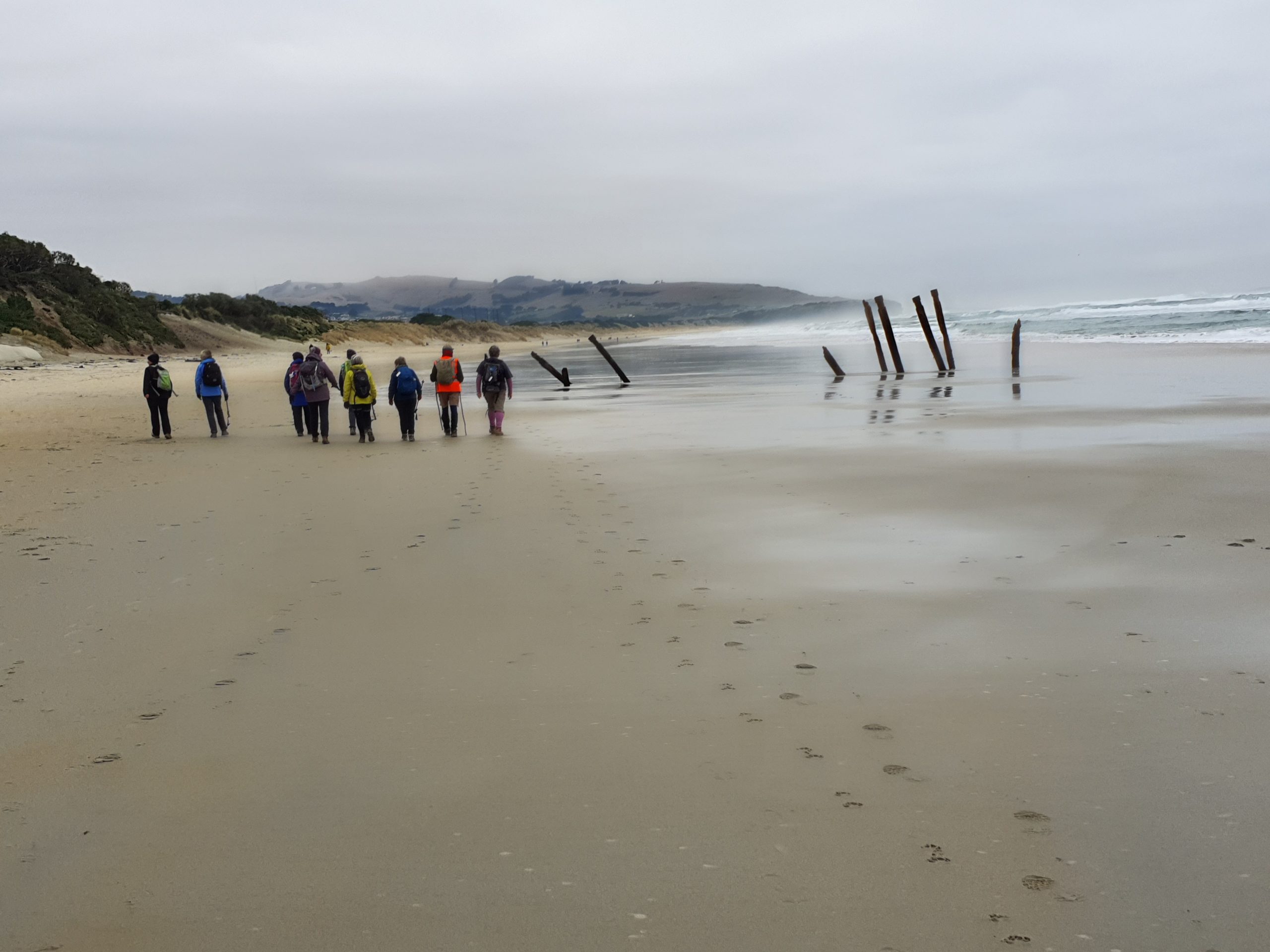
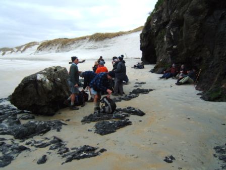
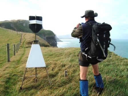
1. 15/7/2015. Trampers. Buskin Track, Boulder Beach, Paradise Track. After a bit of a mix up over pickup points, we parked up beside Penzance Kennels, where we had a discussion on which way we would tackle the days walk. We settled on going down Buskin Track & worrying about the return journey later.
The track was mostly dry apart from a few areas where it has been damaged by water scouring it out quite badly. As two of the party of three, had never been there before we took some time to check out the cribs [baches] at the bottom of the track.We also came across an employee of Otago Pest Destruction [I think that’s what they are called] who was happily banging a possum on the head, after it got caught in one of his traps. He said he got 27 the day before, so much for a possum free peninsula !!!
We then made our way out to the beach for some boulder hopping practice, before gaining the sand at the northern end. As we passed by the log shelter I noticed an intruder lying inside, looking very cosy indeed.
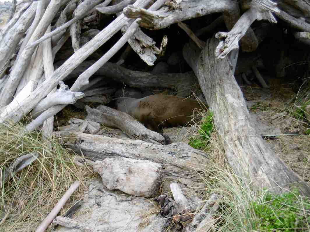
2 Intruder in the log shelter on beach
It lifted its head to survey me for about two seconds, then just went back to sleep ! What a life !!
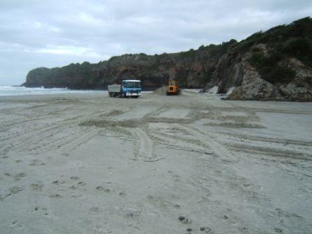
We wandered along the beach wondering where all the sand had gone, the bank holding the tussock is badly eroded, & about 1 meter high. So now, there is no way for the Yellow Eyed Penguins to climb up & get to their nests further up the hill.
We walked back past the intruder in it’s cosy shelter,
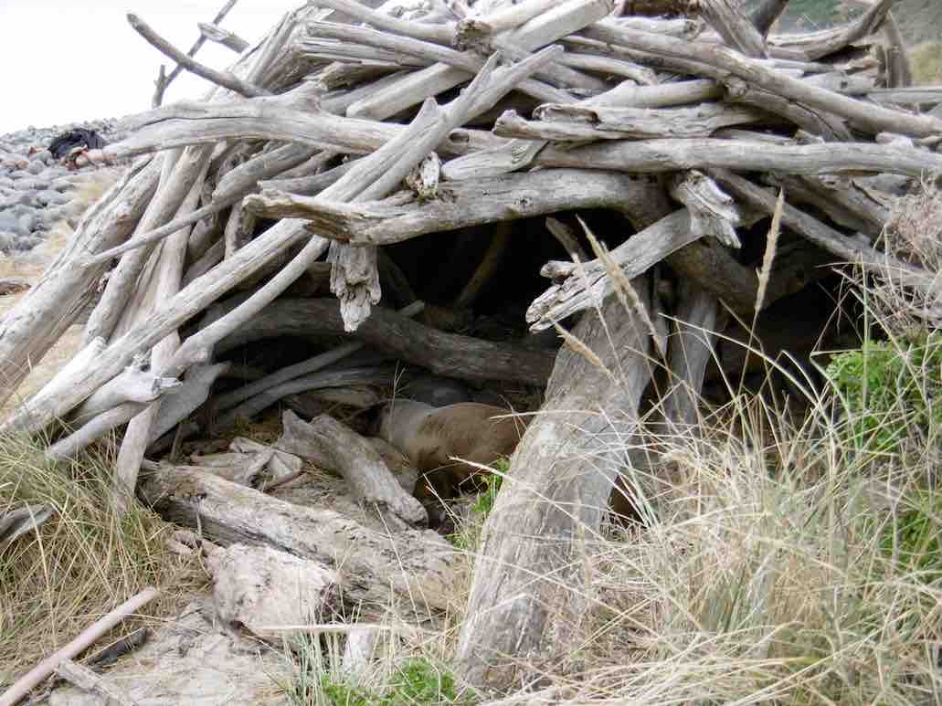
3 Another shot of the intruder.
& had lunch sitting on a large bit of driftwood,
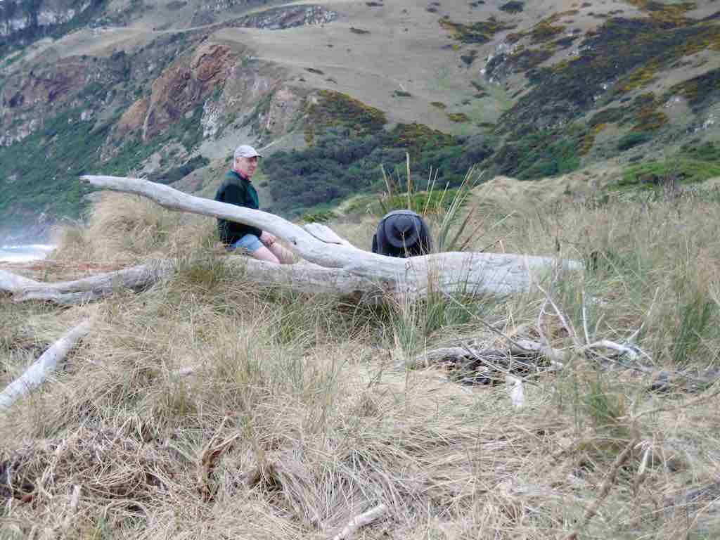
1 Lunch spot at Boulder Beach
before walking up Braidwood Rd. to the gate into the paddocks leading along to the Double Bay area, where I had an unsuccessful look for the viewing hide I had seen at an earlier date, but the vegetation had me beat, so we retraced our steps around to the bottom of Paradise Track, made our way up there, & back along Highcliff Rd. to the car.
We walked 10km
ave 3.3km/h
climbed 475m – Ken
30. 24/6/2015. Trampers. Tomahawk – Memorial – Karetai Road.
2h 56min
4.1km/h
climbed 442m.
max height 392m – Ken.
9 am rolls around and lo and behold there is a record number of 11 intrepid trampers ready to set out for the day’s tramp. Arriving at the Tomahawk lagoon and on our way by 9.45 am, after some who did a few extra circuits to find the starting place. Past the lagoon partly frozen over: ever seen ducks trying to land on frozen water …
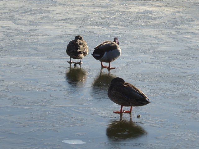
… or swans trying to get out of frozen water?
It was a steady climb along the marked walkway (often a corridor of gorse), with views over the pig farm and across to the east. It was here we had morning tea and shed the first layer of clothes as the day was warming up and no wind. On and up to the 10 metre high monument of the Soldiers’ Memorial – the lone soldier figure standing on blocks of bluestone.

The 360 degree view right around the Peninsula, over the city and across to the west is spectacular. After the oohs and ahhs, and photos taken we wend our way down to Highcliff Road. The tarseal walk…
… along Highcliff road and Karetai road leads us to a pleasant stopping place for lunch at the end of Karetai Road. Lunch over, up over the stile, through the paddocks and to the cliff edge track …
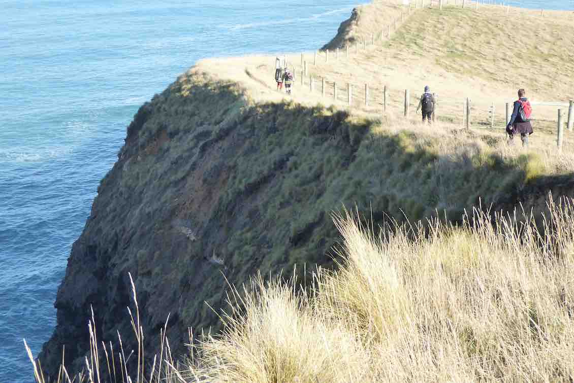
… where the dramatic sheer cliffs get a second or third look before we head down beside Smailles Beach.
29. 29/1/2014. Hikers. John Wilson Drive, Golf Course, Beach, Cave, Tomahawk Lagoon, return Lawyers Head Paper Road. E. Leaders: Bruce and Marjorie.
… so we supped our cuppas around the Leonard Wright memorial at the Head.

Silently viewing an about-to-be missed, nevertheless ironically applauded tee shot at the end of our links perimeter stroll.
Now down and away from the links along another narrow, but lengthier track out and across to the Tomahawk Road.

Looking back upon another strung-out sight.
We emerged upon a playground on Tomahawk Road.
Up a small but energetic sand-hill and we were on another track out to the road again, down it a bit, and into a side road leading to yet another side route and out onto a recreation area alongside Tomahawk Lagoon’s inner lobe, this one a wildlife reserve, although both lobes are noted for their bird life.
Here was to be the lunch stop, but prior to that there was a short walk up alongside the lakelet to where our local club members knew of a Trampers’ track leading up to a soldiers’ memorial on by the Peninsula high road. But this was to just to wander the level part of track and enjoy (??) at one spot a strong pong from the the slightly stagnant waters and mud verge. (Roll on a storm flush!)
So we lunched leisurely, variously at tables and on ledges until our leaders judged it time for the return journey.
Out on the road, a motor cyclist stopped to talk and admire our impressive size. He was glad to hear we were returning by the Lawyers Head paper road and invited us to notice the “use it or lose it” graffiti posted in a couple of places before its entrance. (Apparently the City Council proposed closing it.) We were going to be a wonderful “use it” example.
The ‘road’ led us through a corner of the Andersons Bay Cemetery, close by the towering Crematorium and out through the Chisholm Park Golf links. Then across the Pirates Football Club pitch and we were at our cars again and adjacent to a useful new toilet block by the playground.
Now came farewells and dispersal time. There were many appreciative remarks from the Christchurch Club members about the unique difference of such a walk, with its wonderful unexpected variations. ‘The best of their week so far’ was one comment.
I know our club felt quite proud to hear such unstinted praise, and of course are so indebted to Marjorie and Bruce for their careful planning, taking into account the meal stops, the permissions sought, and the trip duration. Bravo. Of course the day’s excellent weather didn’t hurt either. – Ian.
28. 28/11/2012. Trampers. Tomahawk, Soldiers Monument, Buskin Track, Highcliff, Karatai Rd

GPS Tomahawk Soldiers Monument Buskin Track Karatai Rd, courtesy Ken.
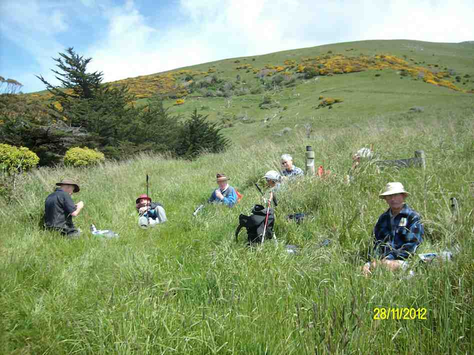
Lunch at junction of Boulder Beach tracks. (Ken caption and pic)
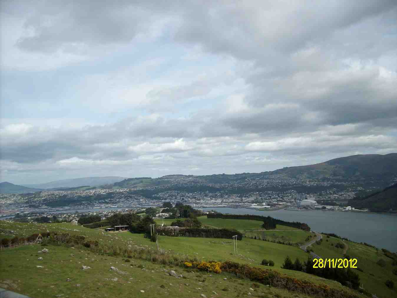
View of city from Soldiers Memorial. (Lester pic)
27. 26/9/2012. Trampers. Smaills Beach, Karetai Road, Highcliff Track, Boulder Beach, Paradise Track, Highcliff Road, Karetai Road.

Karetai
Six of us parked at Smaills Beach car-park. We had dropped the idea of Silver Peaks because of the forecast rain with its fog. As we went up Karetai ‘Road’, we reached the rain level at our tea break and had to ‘parka-up’. We turned off further up onto the Highcliff Track …
Boulder Beach from Highcliff Track
and round to Beatties Cottage where we lunched. We didn’t bother going down to the beach but lazed in the sunshine (temporary but happily well-timed) in the shelter of the cottage’s large hedge from the wind.
The climb up Paradise Track gets no shorter but by and large, with its couple of zig-zags, provides a good gradient.
Along Highcliff Road, we forewent turning down the Buskin Track, with its promised steep climb back up the Highcliff Track, and carried on to the Karetai Road turnoff, returning down it to the cars.
Surprisingly Ken’s GPS recorded we had done 14.5 kms! A useful day’s walk. – Ian
26. 1/6/2011. Both. Bowls Stadium, Cemetery, beach, Fishing Club, Karetai Rd, Smaills Beach, return. Leaders: Bruce and Marjorie.
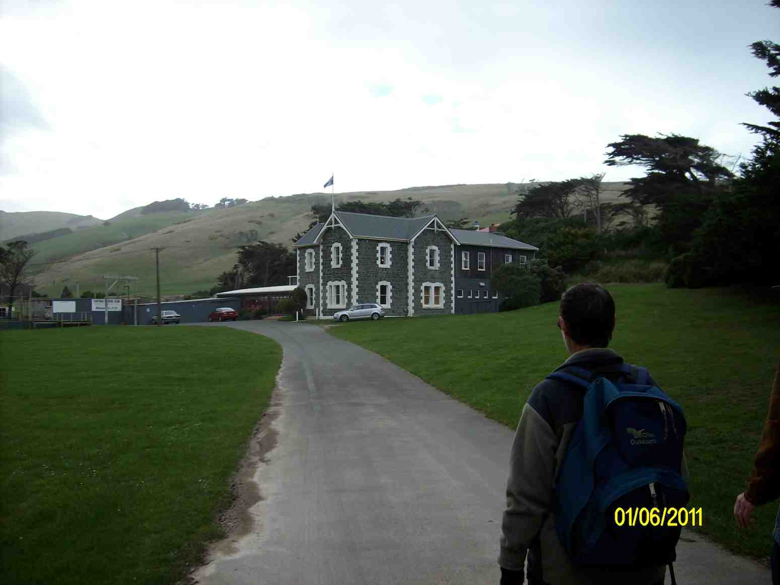
About nine of the group, following a route pioneered by Ken, went down to the trig …
… and then contoured around on a track

25. 23/9/2009. Hikers. Tomahawk, Centre Road. Medium. Leaders Arthur and Barbara.
24. 4/6/2008 Both. Tomahawk Lagoon, Soldiers Memorial, Centre Road. Leaders: Joyce, Ian, Lesley G
23. 26/9/2007 Tomahawk Lagoon – Soldiers Memorial. Leaders: Joyce, Eleanor.
22. 25/7/2007. Trampers. Tomahawk Lagoon, Soldiers Memorial. Moderate. Leaders: Bruce and Marjorie.
21. 14/2/2007. Trampers. Boulder Beach, Karetai, Tomahawk Lagoon. Medium. Leaders; Bruce and Marjorie.
20. 31/1/2007. Hikers. Tomahawk Lagoon. Easy. Leaders: Jean, Mary M.
19. 13/4/2005. Hikers. Tomahawk Lagoon. Leaders: Rosemary and Jack.
18. 3/12/2003. Hikers: Tomahawk Lagoon. Medium. Leaders: Colleen, Dot T
17. 29/10/2003. Hikers. Tomahawk Lagoon. Easy. Leaders: Joan H, Chris.
16. 14/5/2003 Hikers. Karetai Road, Boulder Beach. Medium.Leaders: Colleen, Betty
15. 11/4/2002 Tomahawk Lagoon. Leaders: Ray, Les W
14. 20/3/2002. Alt. Tomahawk Lagoon, Karetai Road, Smaills Beach. Medium. Leaders: Lance and Lois.
13. 15/8/2001. Alt. Tomahawk, Karetai. Leaders: Nancy, Val, Peg C.
12. 11/4/2001. Tomahawk Lagoon. Leaders: Diana and Ray, Les W.
11. 19/7/2000. Boulder Beach, Karetai Road. Leaders: Jean, Chris, Joan H.
10. 23/2/2000. Tomahawk Lagoon, Centre Road. Leaders: Arthur and Barbara, Ria H.
9. 30/6/1999 Tomahawk Lagoon. Centre Road. Leaders: Jean Y, Denise, Eleanor W
8. 12/8/1998. Highcliff Centre Road from Lagoon. Leaders: Molly, Frank.
7. 18/3/1998. Tomahawk Lagoon, Centre Road round trip. Leaders: Jean, Ria H.
6. 9/7/1997. Tomahawk Lagoon, Monument, Highcliff Road, Karetai Road Leaders: Chris, Ria H, Jean
5. 18/9/1996. Tomahawk Lagoon. Leaders: Chris, Joan H, Ngaire.
4. 13/4/1994 Tomahawk Lagoon, Smaills Beach, Karetai Road, Buskin Road, Soldiers Track and return. Medium. Leaders: Ria H, Jean A, June G, Betty H
3. 8/7/1992. Tomahawk Lagoon, Karetai Road, Centre Road. Average. Leaders: Ria H, Jean A, Bev H, Merle
2. 7/3/1991. Cars park Karetai Road Car Park. Karetai Road from car park. A good peninsula walk. Leaders: Daphne, Margaret S, Les W, Jack M.
1. 12/7/1989 Centre Road, Highcliff. Average +. Leaders: Kees & Ria, Diana
B, Ria H