Mid-week recreational and social walking group based in Mosgiel NZ
Chrystalls Beach, Toko Mouth
No. 47 on old hardcopy list of 113 club tramps. “Toko Beach. M Young”; also No. 65 on old hardcopy list of 113 club tramps. “Chrystalls Beach Farm”. Location: 59 km from the car park. Best in Summer. The stock winter over.
Directions: On SH1, before Milton, at Helensbrook intersection, left onto Forsyth Road, right onto Back Road, left onto Glenledi Road.
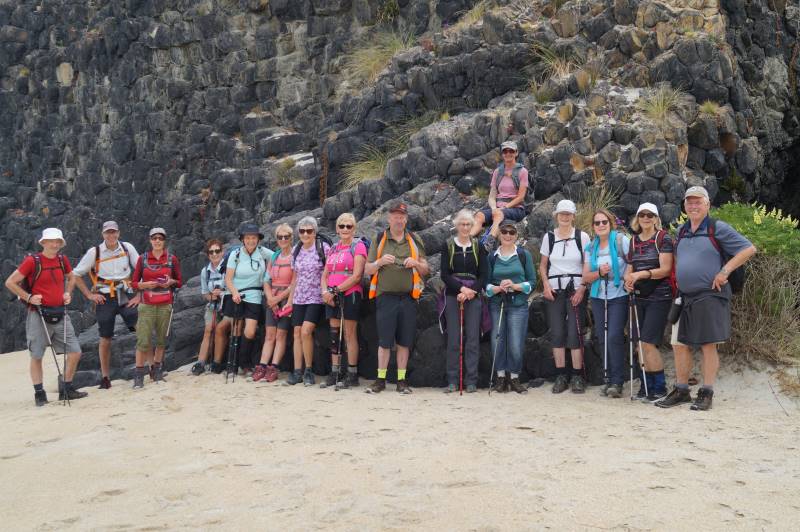
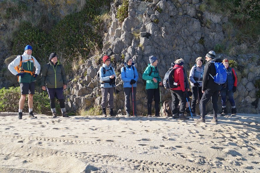
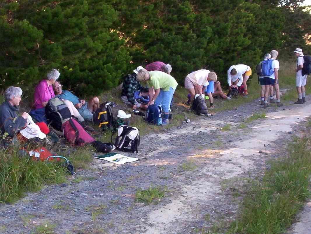
A fine overcast morning greeted us at Peter Johnstone Park with 19 trampers in 5 cars beginning our tramp at 10am.
The start of a great day (Photo & Caption Helen)
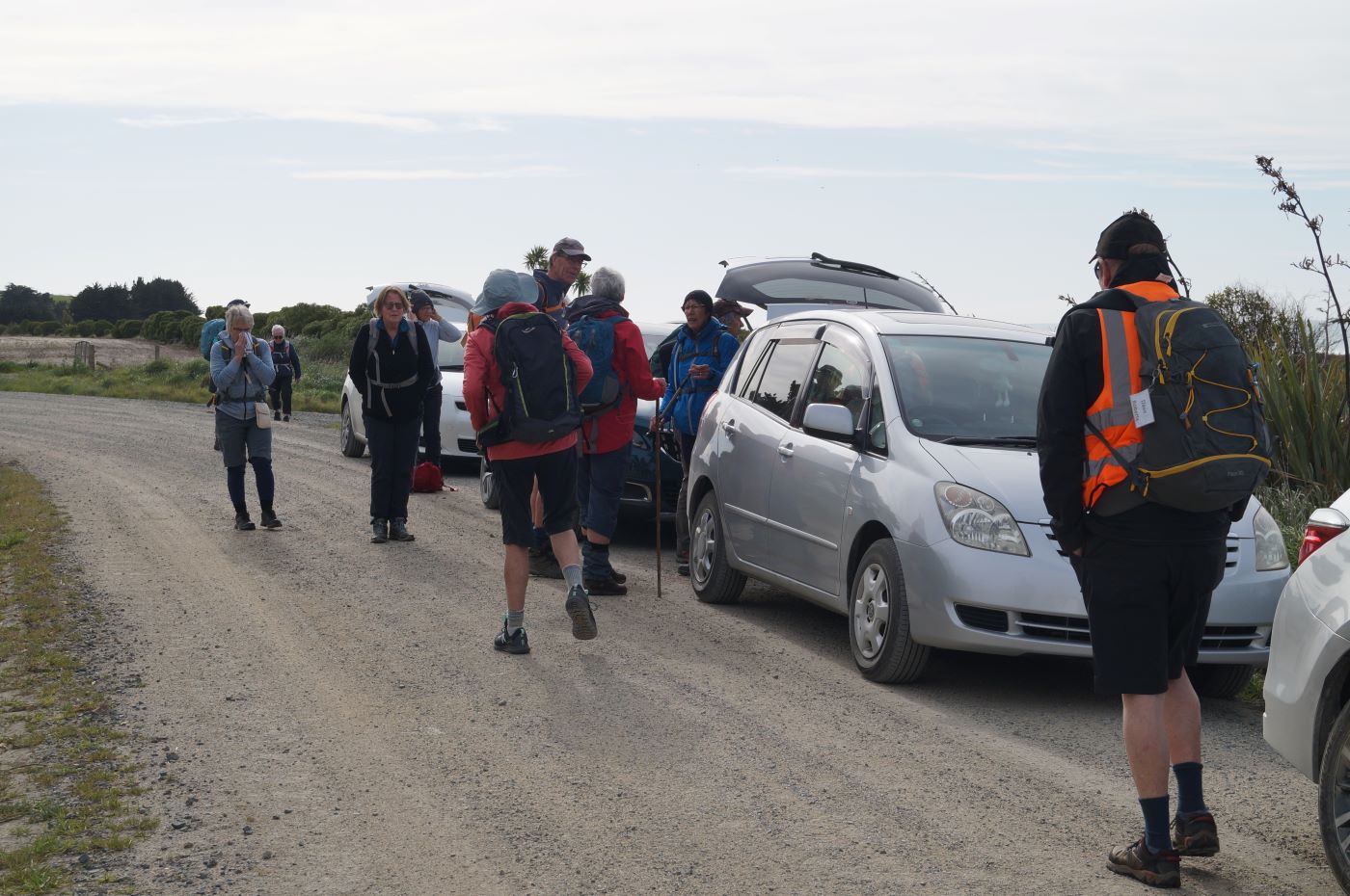
Getting ready to leave the cars (Photo & Caption John)
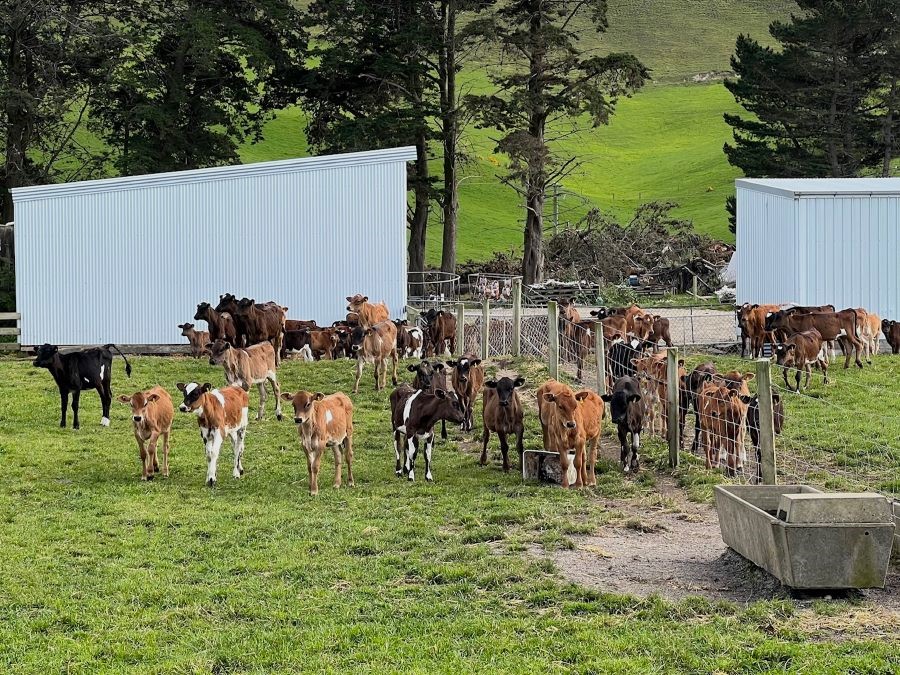
We saw a dairy farm then passed the implement sheds before reaching the main milking shed.
Springtime in the rural setting (Phote & Caption Pam)
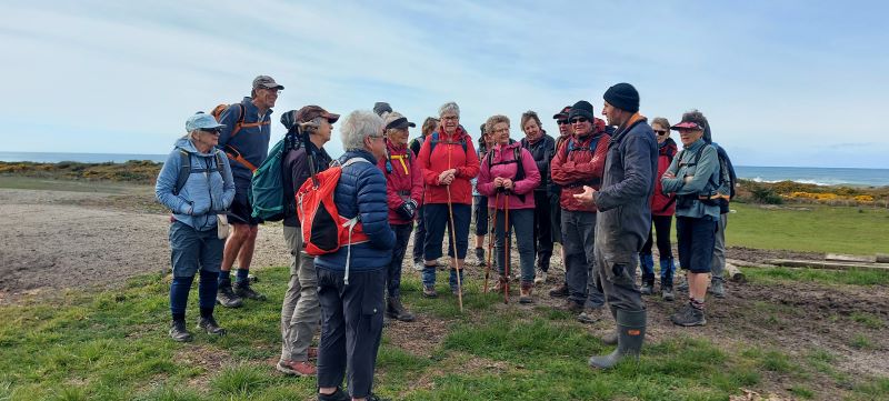
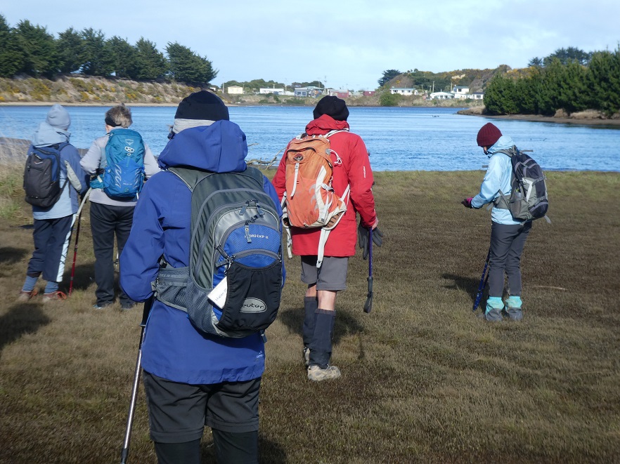
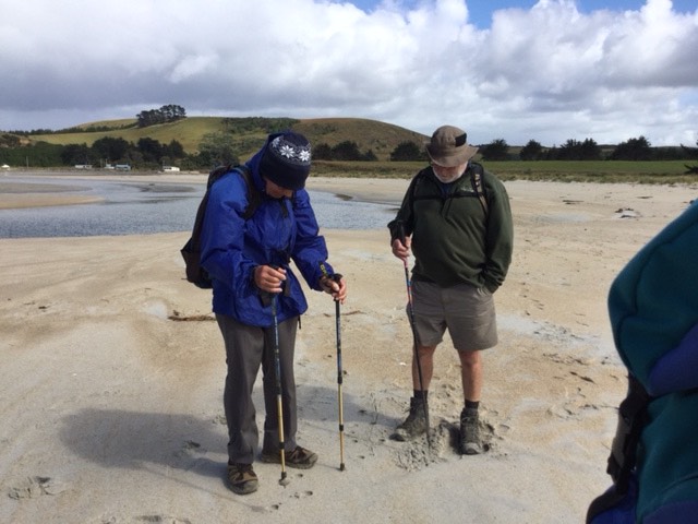
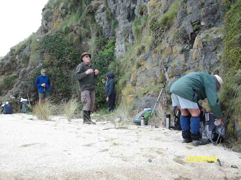
Listening to Tony explaining the new neck apparatus (Photo & Caption Helen)
Then we meet the Farm owner Tony MacDonell who spoke to us about his 800 dairy cows. All of the cows had collars around their necks and this is known as Virtual Fencing and it gives beeps growing louder as a cow strays over and away from the virtual fences. No need for electric fences. Tracking on Tonys cellphone means each cow represents a dot on his farm maps. He can tell if an animal has strayed or hasn’t moved for some time. The app on his cell phone also allows him to send a signal to the collars tells the cows it is milking time.
Tony also spoke of Pest Control on his property he has recently had a plaque of possums and shot over 1000 of them.
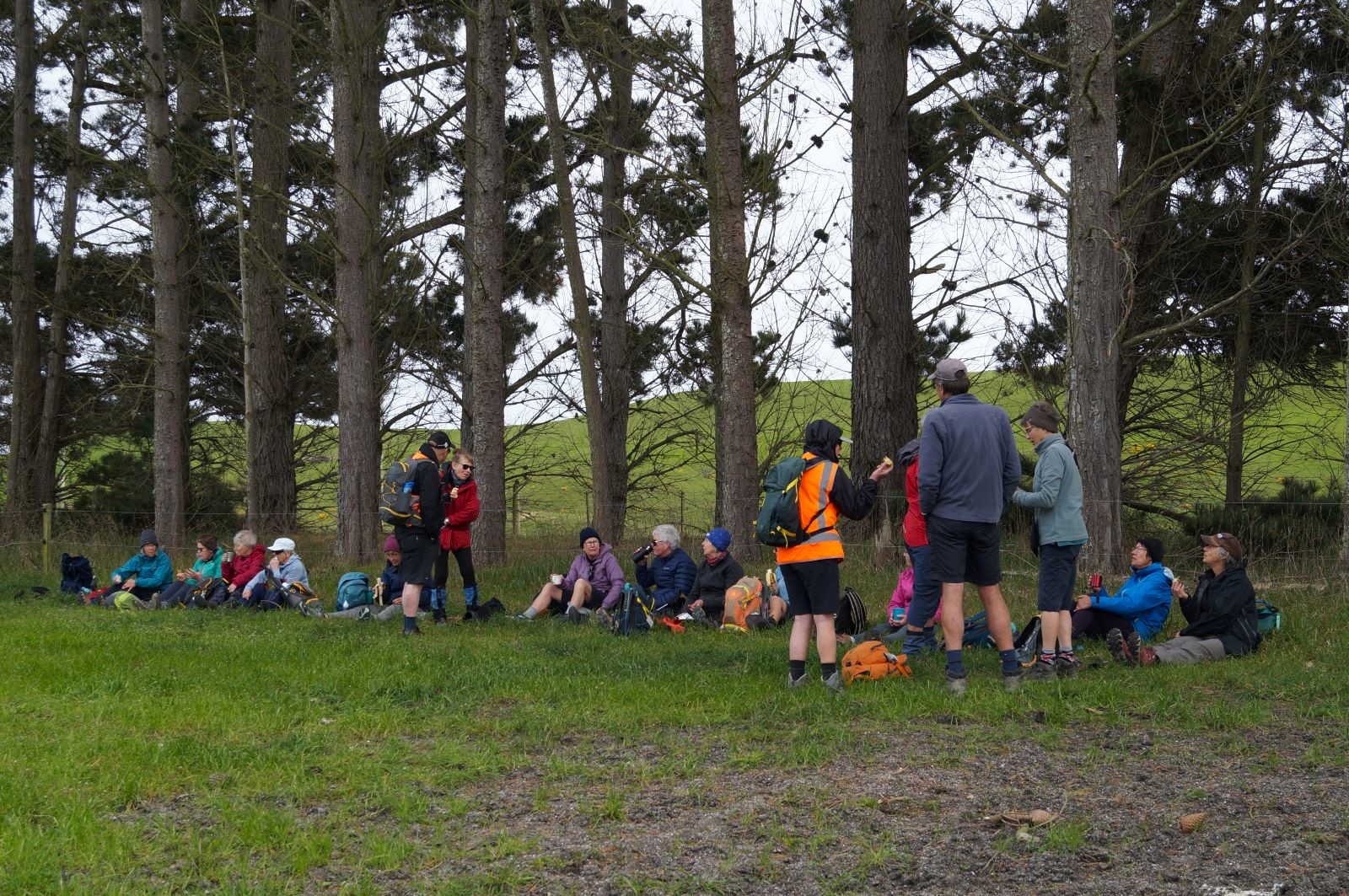
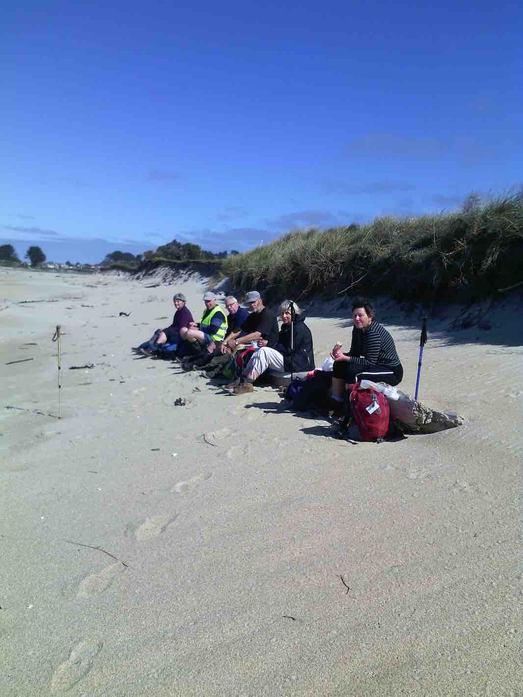
Morning tea catchup (Photo & Caption John)
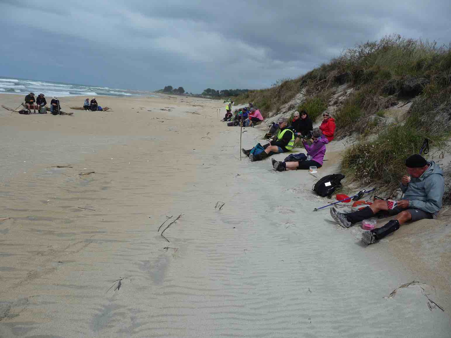
Morning tea was enjoyed at 10.45am in a field shared with old cow-pads .
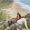
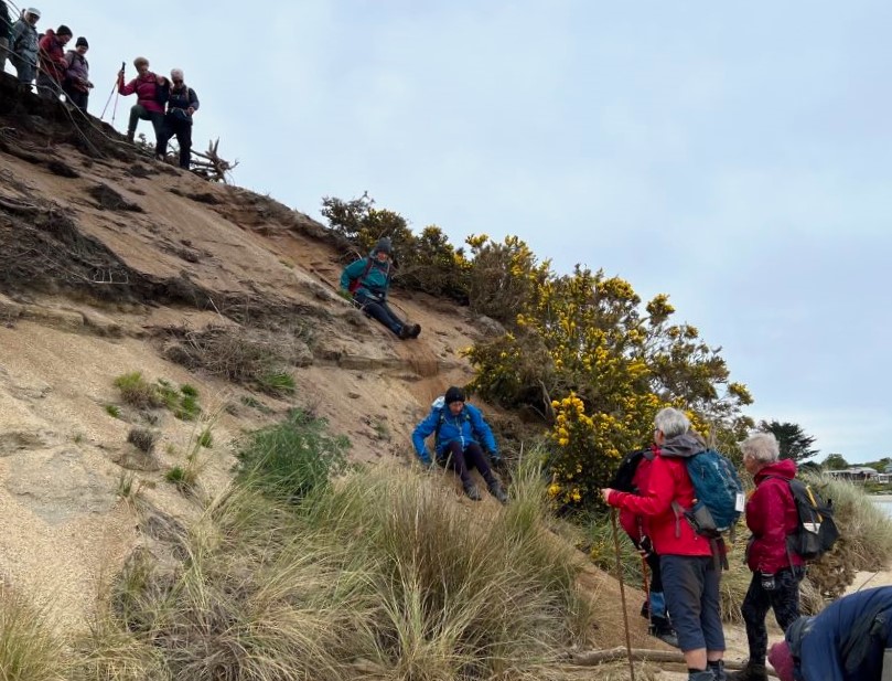
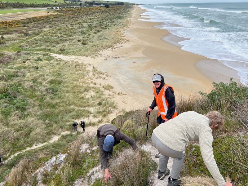
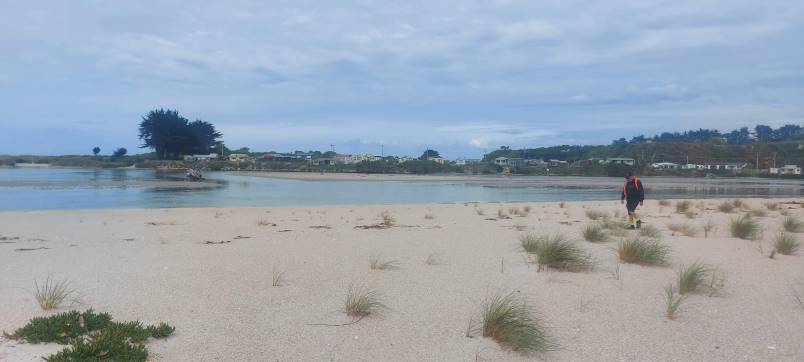
By11.05am we were on our way again continuing our walk through the dairy farm. We descended down a steep bank of about 10metres to Chrystalls Beach and found a sheltered bank for lunch at 12noon.
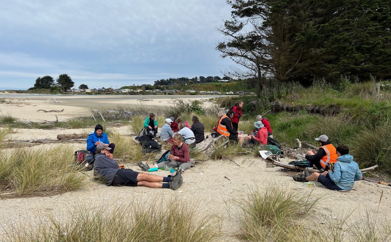
Only way down !! (Photo & Caption Pam)Lunch on the beach with Toko cribs in the background (Photo & Caption Pam)
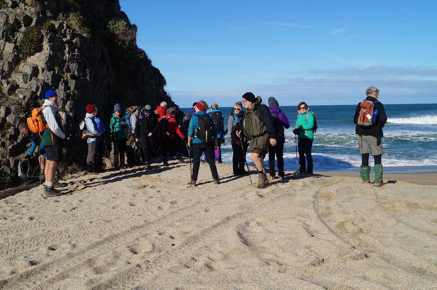
The Toko Mouth is a beautiful spot with it own natural beauty. A group of some 20 plus cribs nestle on the rivers southern bank.
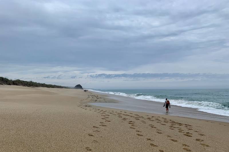
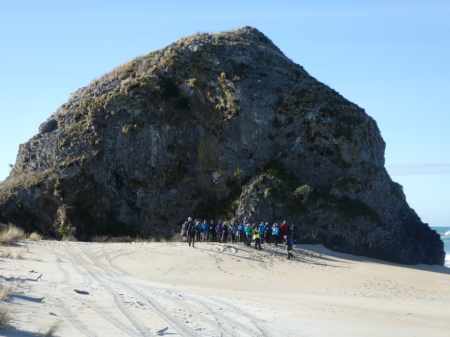
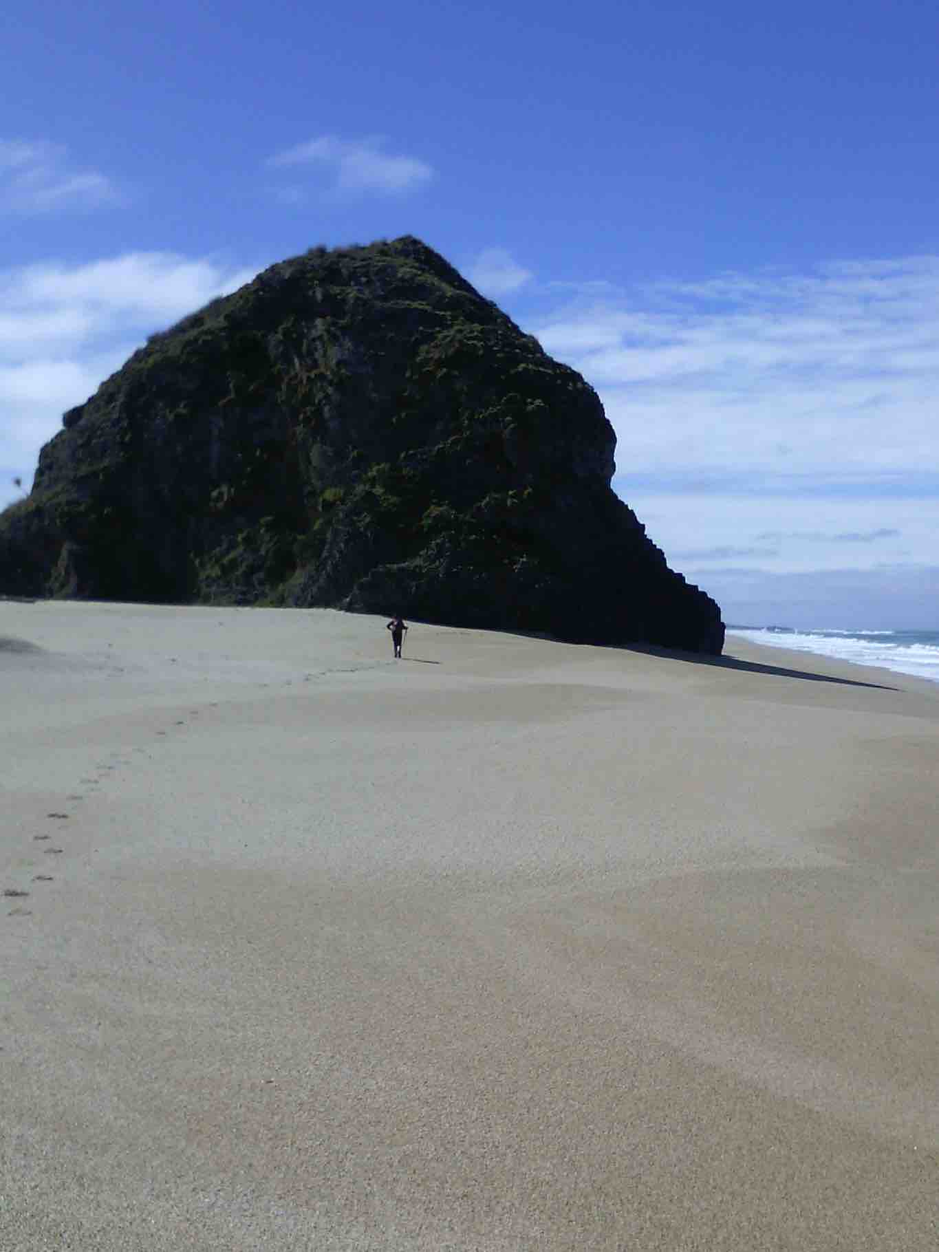
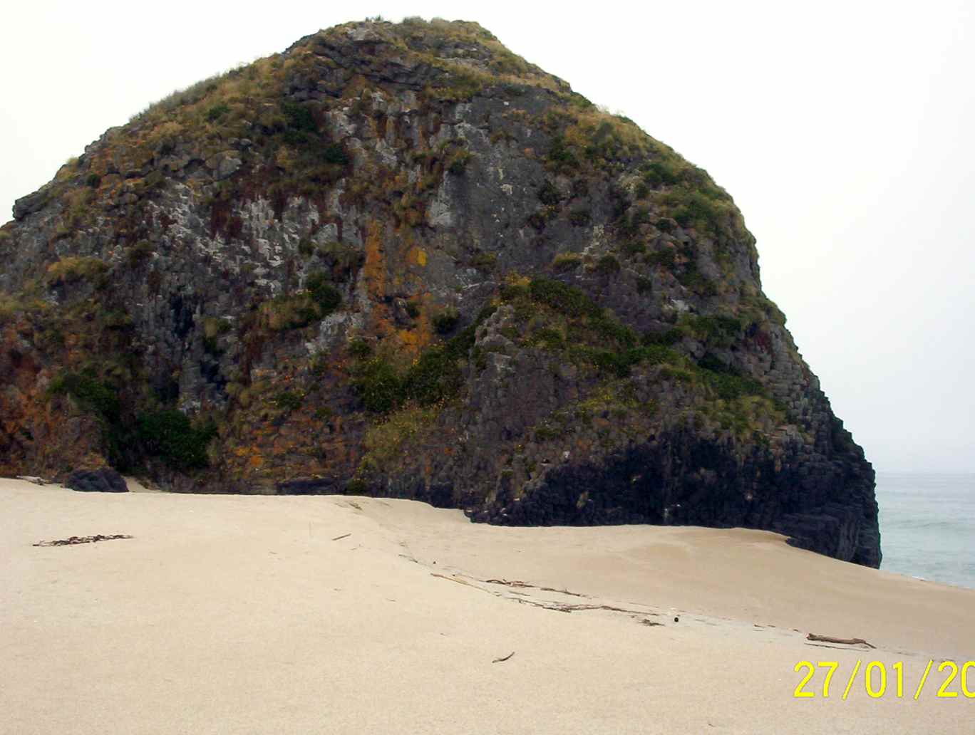
The trek to Cook’s Head (Photo & Caption John)
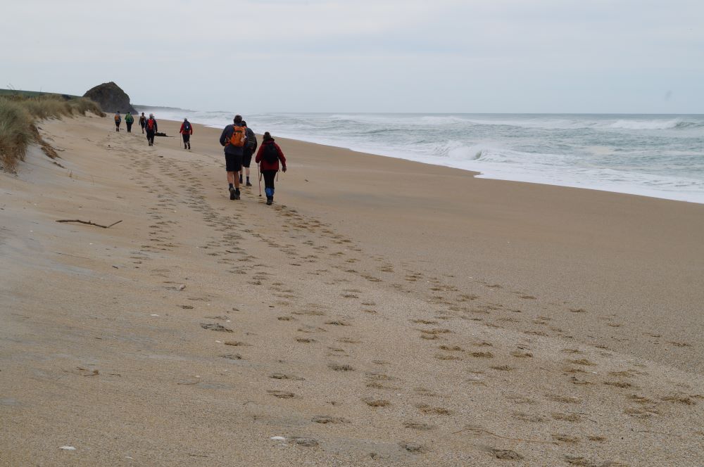
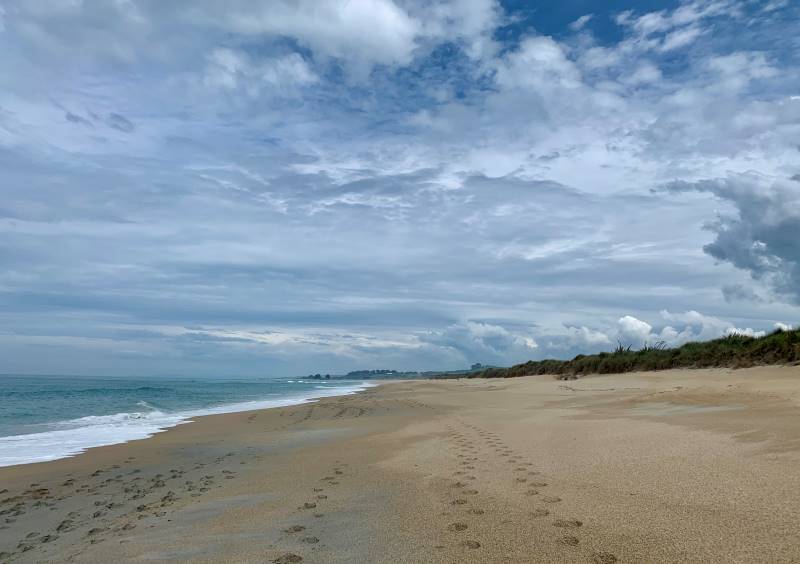
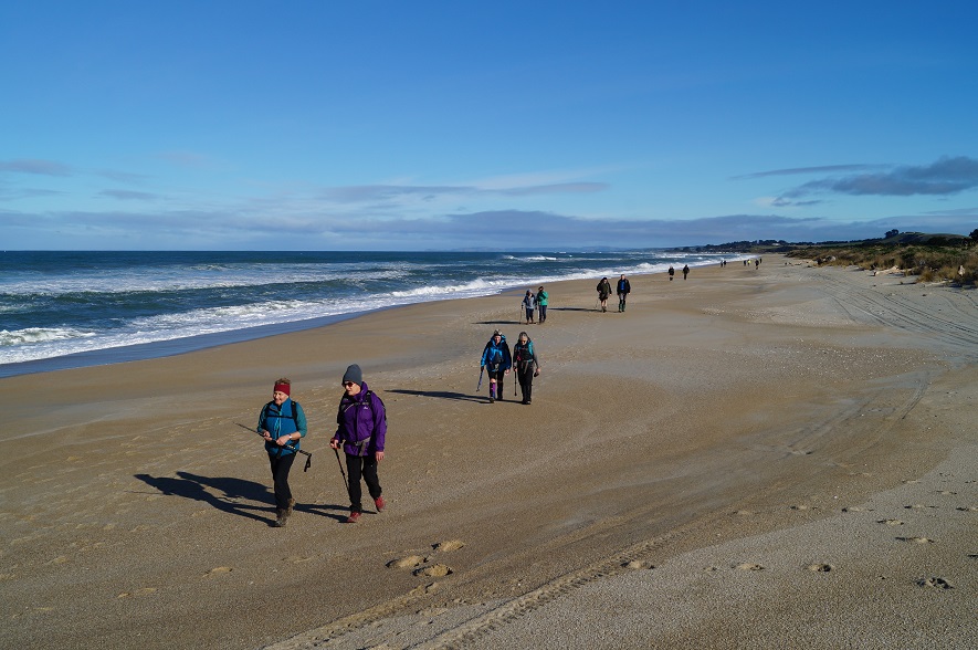
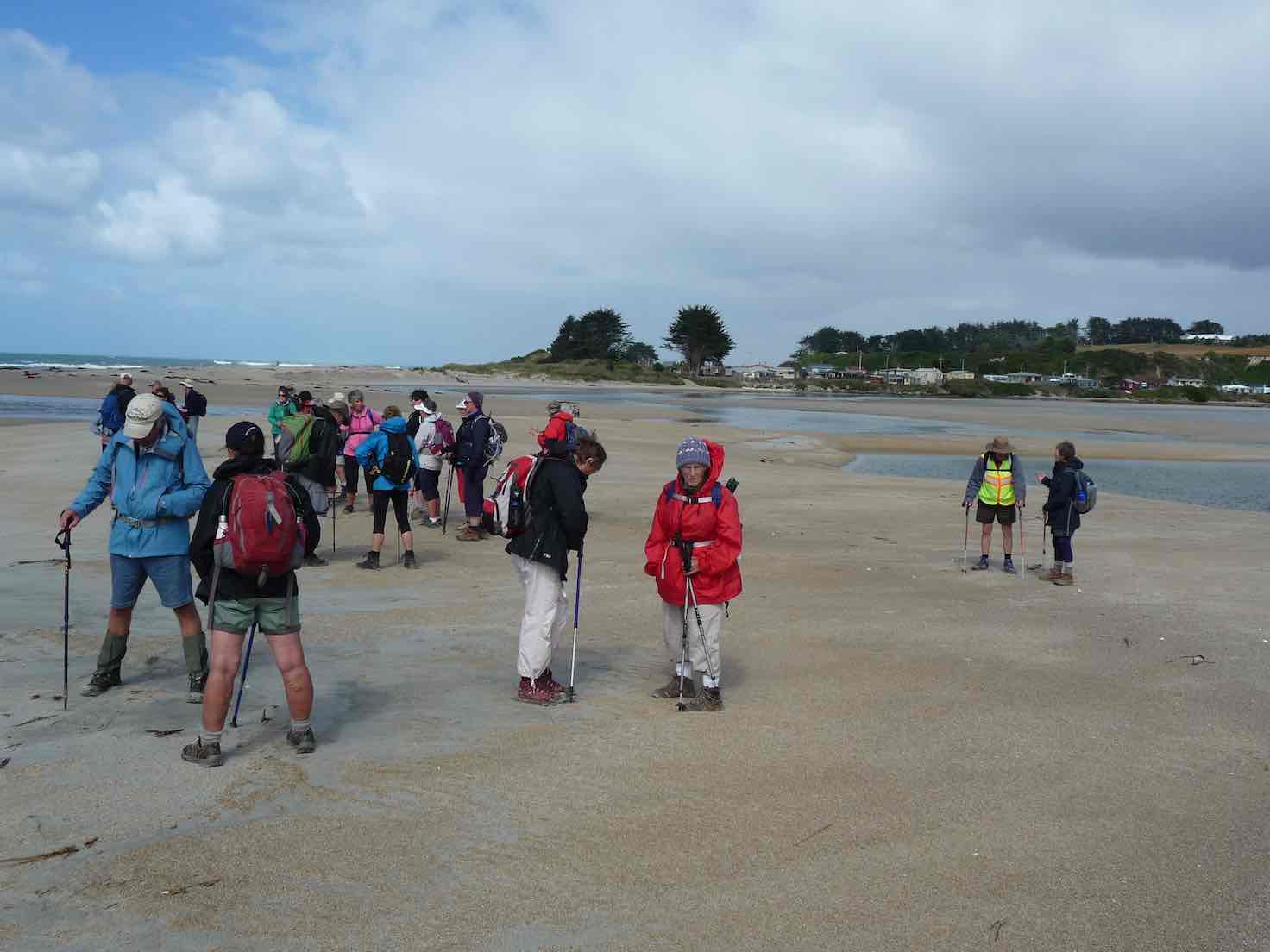
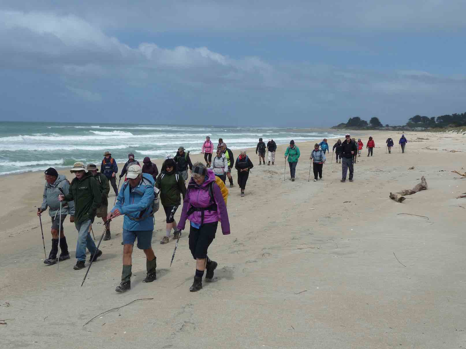
By 12.30pm we were on our way again walking along Chrystalls Beach towards Cooks Head. We had to scramble away from every large wave.
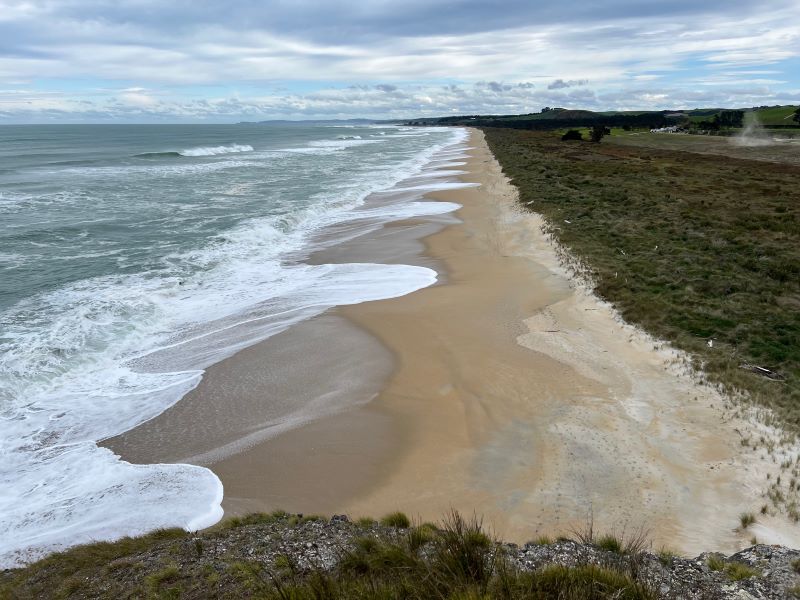
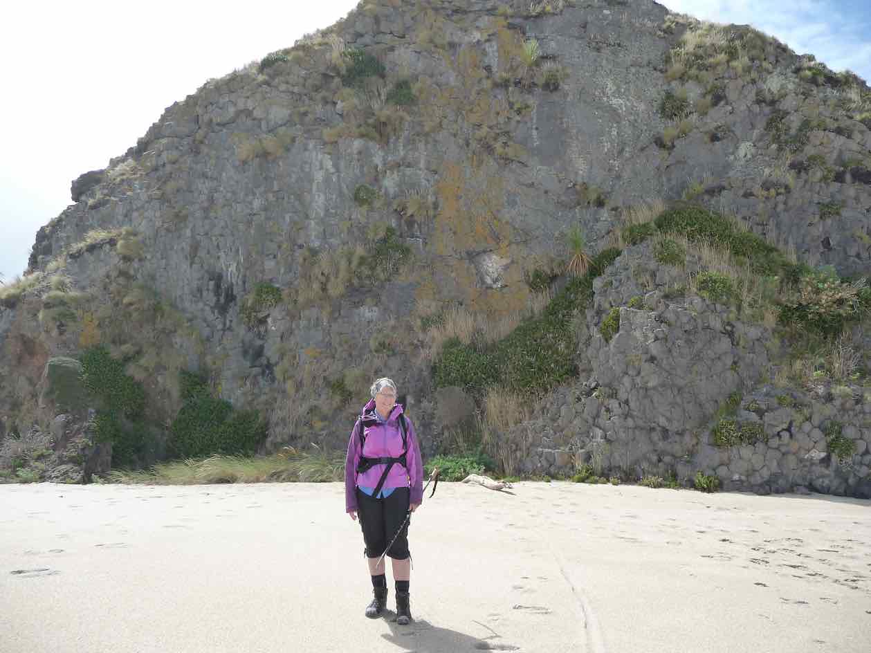
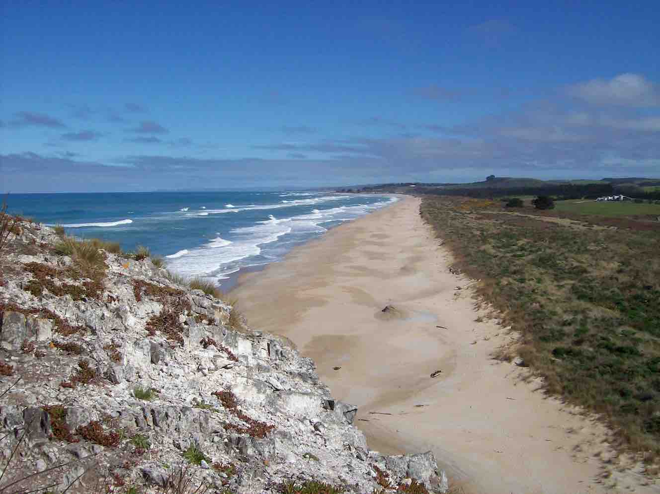
Secluded Chrystalls Beach with its golden sand (Photo & Caption Pam)
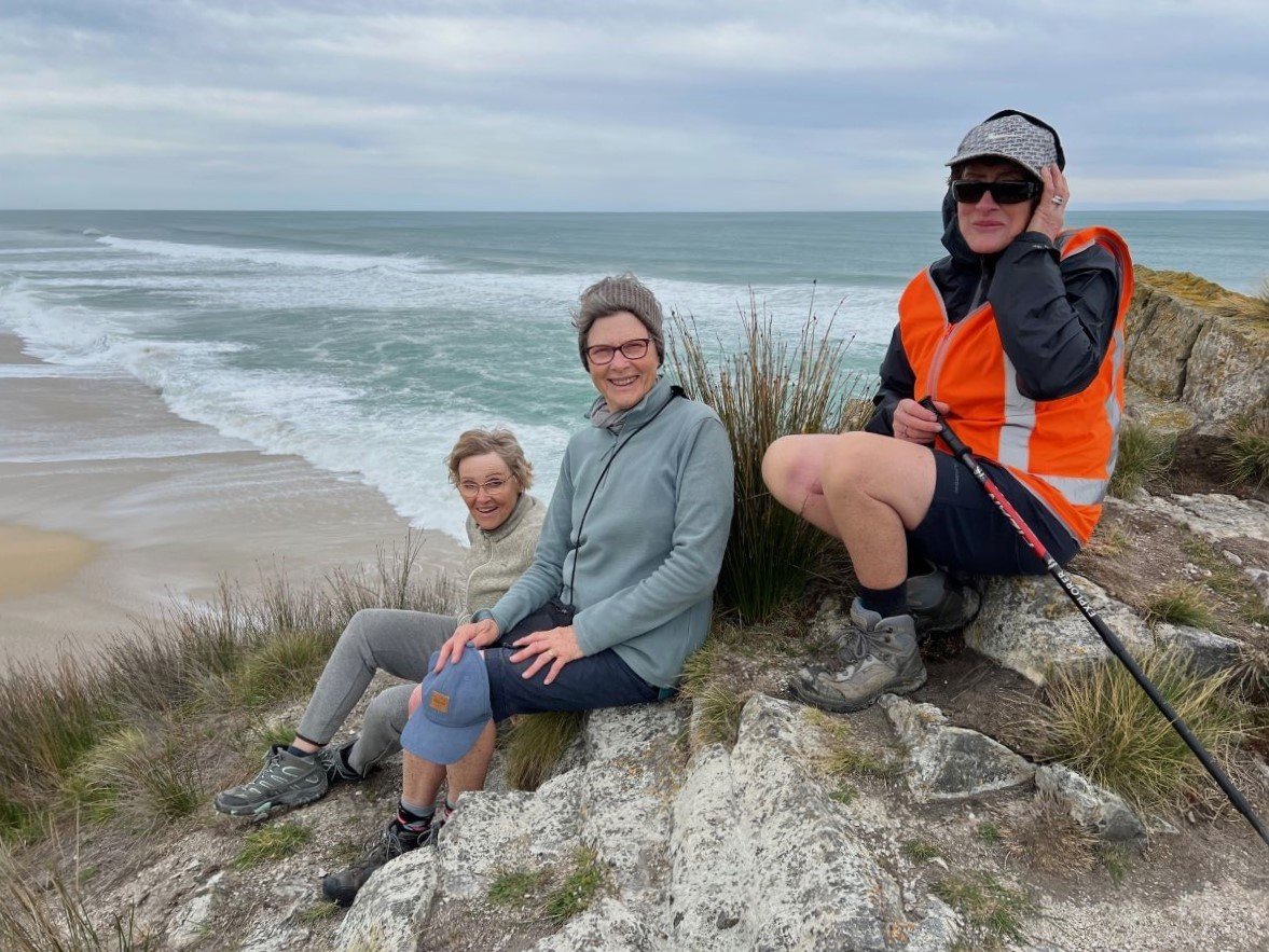
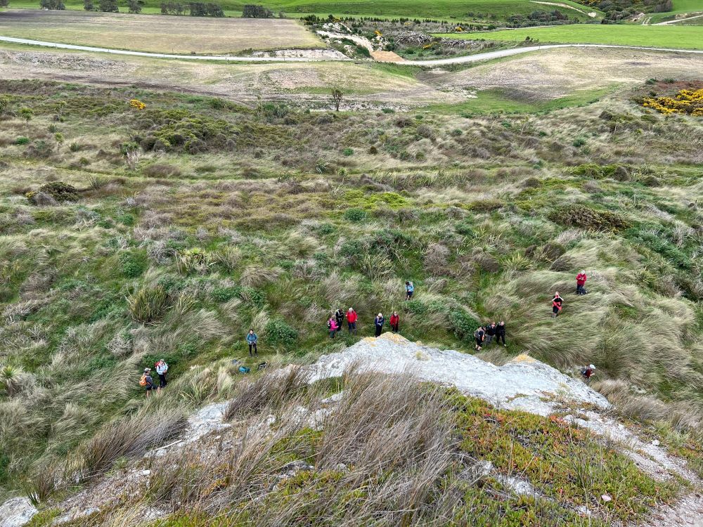
Pam, Jill, Maria and John climbed to the top of Cooks Head . Fearless Pam reaching out close to the slippery edge to take stunning photos. Well done Pam.
A little windy on top of Cooks Head rock (Photo & Caption Pam)Trampers dwarfed below (photo from top of Cooks Head rock (Photo & Caption Pam)Careful descending down Cooks Head (Photo & Caption Pam)Coffee in Mosgiel (Photo & Caption Helen)
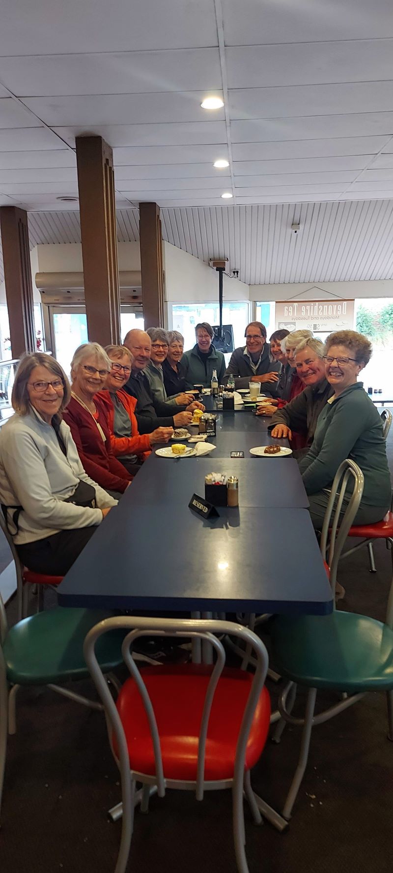
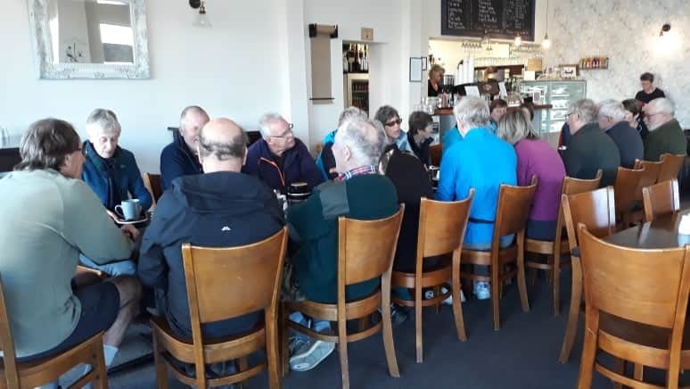
We were back at the cars by 2pm having completed just over 9.5kms of nearly flat tramping . Afternoon tea was enjoyed at the Aurora Café in Mosgiel.
Thank you Jill Reid for acting Tail End Charlie
Regards
Dave Roberts
21. 10/11/2021. Trampers. Chrystalls Beach. Leaders: Dave Roberts and John Gardiner
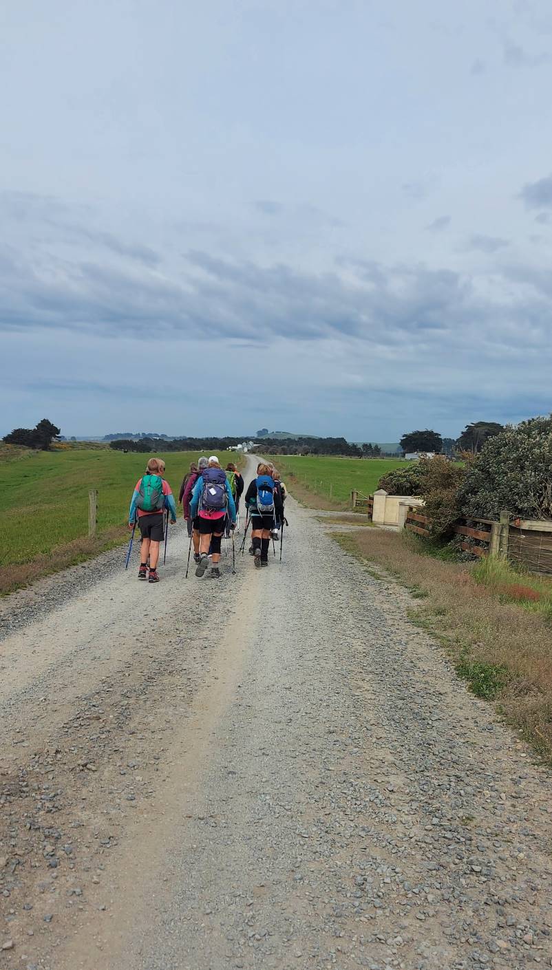
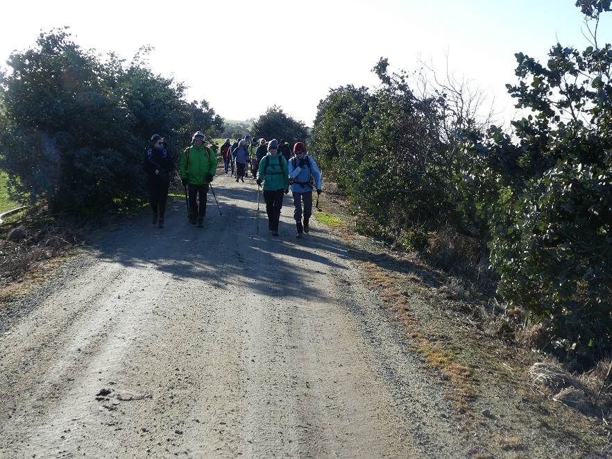
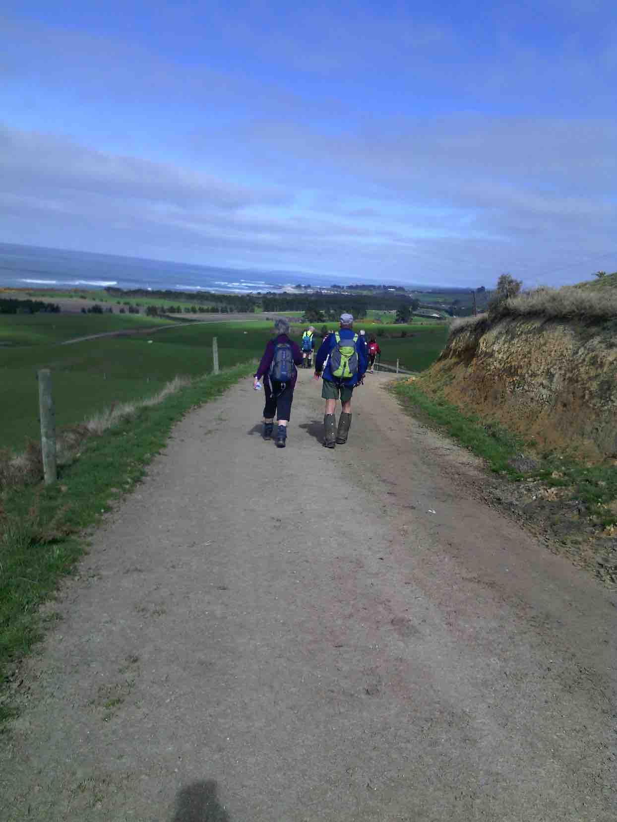
A fine and overcast morning greeted us at Peter Johnston Park, where each driver was issued with a set of instructions on how to find the Chrystalls Beach tramp starting point. On our way we met up with one other car in Waihola, with 17 trampers in 5 cars beginning our tramp at 10.05am.
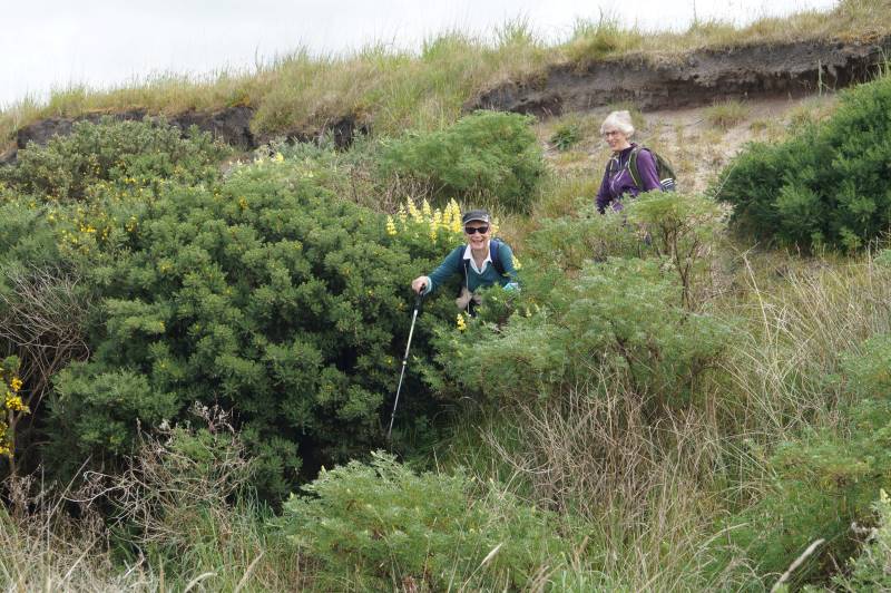
The first few hundred yards had us quickly entering “private property” on Irishman Road.
At the start on the farm road Photo and caption Helen
Here we met a Fonterra Truck entering the dairy farm, our group tightly bunched at this stage ensuring safety for all. This first section of the tramp saw us on a flat straight gravel road, heading south, following a map supplied by Arthur Heenan. Typical sights of a dairy farm, the farmhouse, implement sheds, followed before we reached the main milking shed. A bit of a detour around this had us meet the property owner, on his farm bike, who reassured us that the electric fence by the river would be turned off!!
Morning tea was enjoyed at 10.45am in a field with older cow-pads and lush long grass. By 11.05am we were on our way again, continuing our walk through the dairy farm.
Morning tea in a field Photo and caption John
A variation from Arthur’s map route had us descend onto Chrystalls Beach directly, down a steep bank of about 10 metres. A number of trampers made their own way down, following slightly different routes to each other. Being of short duration, with open visibility, and not too technical, all made it safely. However in these situations the attentiveness and experience of a good “tail end Charlie” certainly comes into it’s own.
Judy and Diane blazing a trail Photo and caption John
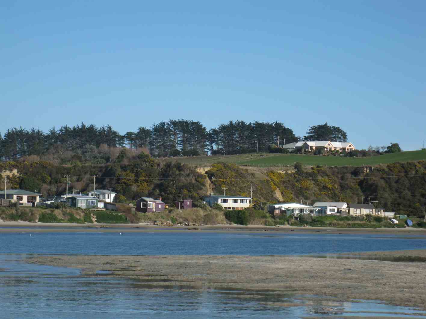
The Toko River Mouth area is a beautiful spot, because of both it’s natural beauty, and man’s sympathetic footprint. A group of some 20 plus quirky Cribs nestle on the river’s southern bank.
The lovely beach and Toko Mouth Photo and caption Helen
With this view we enjoyed lunch, from 11.50am,sheltered from what little wind there was. I used this opportunity to let trampers handle and familiarize themselves with the club’s rescue beacon.
Lunch stop Photo and caption John
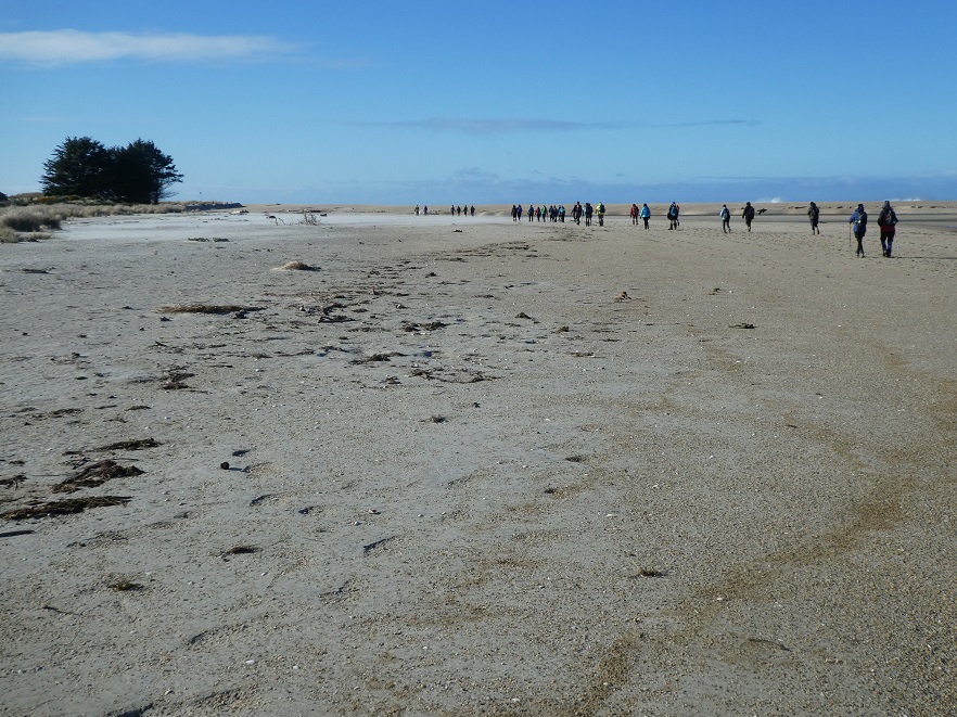
By 12.30pm we were on our way again walking along Chrystalls Beach towards Cooks Head. With lots of coarse “river sand” on the beach and under a slightly overcast sky the crystals weren’t shining for us much on this occasion. The tide being reasonably well out meant a few trampers, searching for firmer sand to walk on, had to scramble away from every 7th larger wave.
Looking back towards Toko Mouth – the cloud formations were stunning Photo and caption MarijkePhil enjoying the joy and feel of seawater on bare feet Photo and caption Marijke
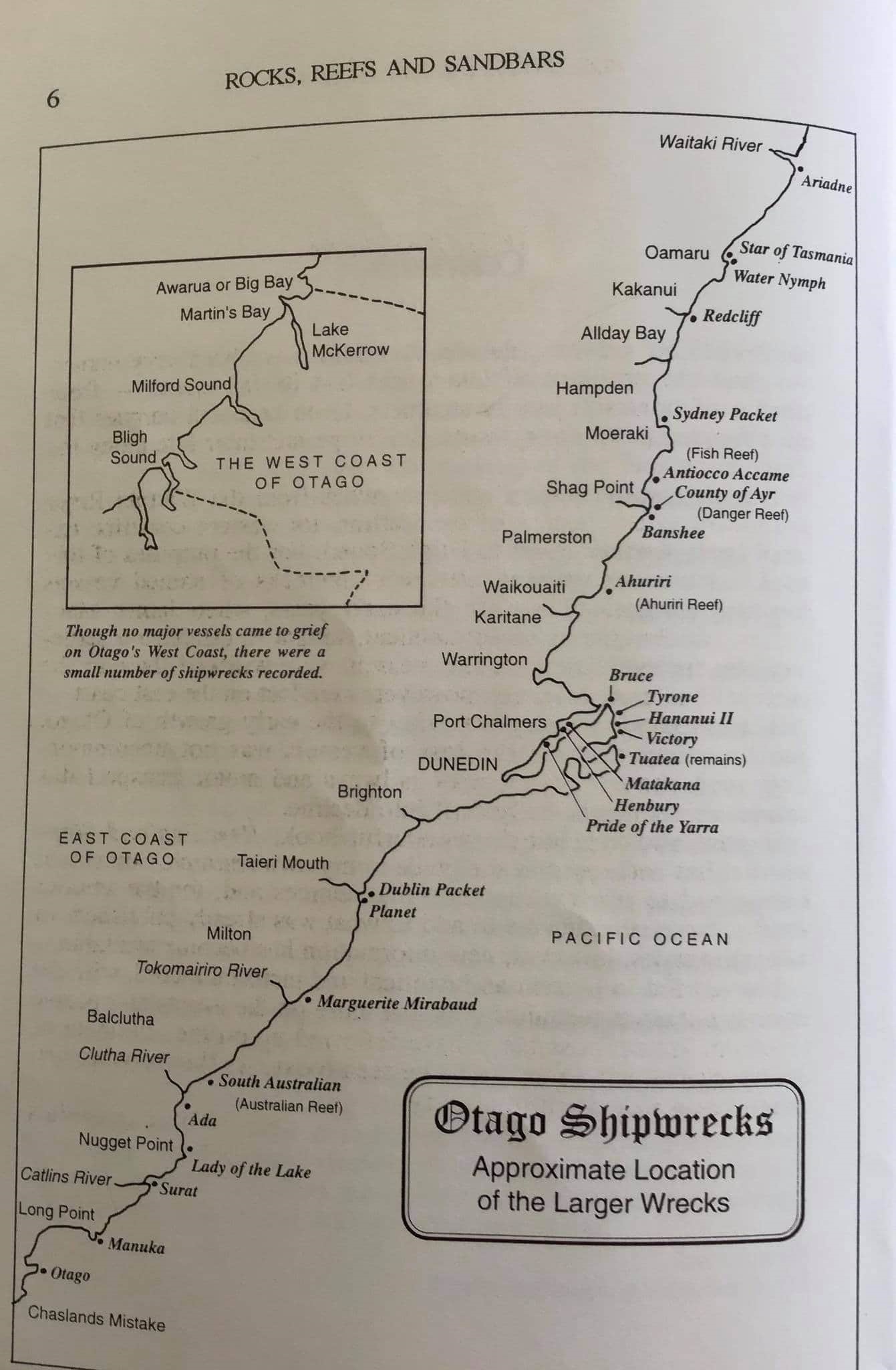
Not always as friendly, this beach was the scene of the wreck of the French sailing vessel Marguerite Mirabaud in February 1907. As “tail end Charlie” for this section it was interesting to see how quickly a group of trampers can get spread out. Not so critical on an open beach perhaps, but the safety benefits of frequent regrouping stops can’t be over emphasized.
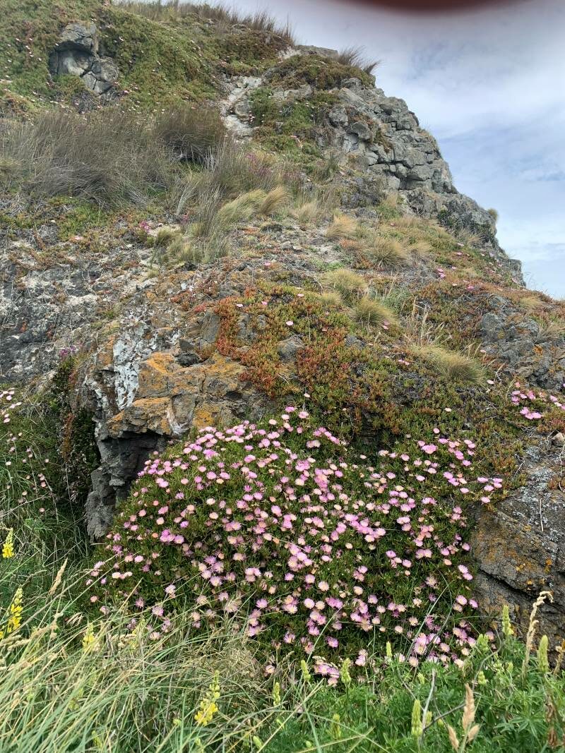
Stunning flowers on the lee side of Cook Head Photo and caption MarijkeGroup photo at Cooks Head Photo and caption John
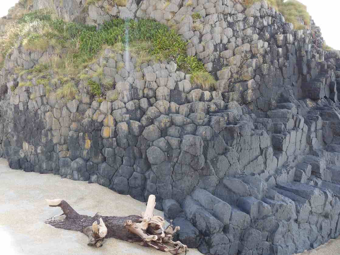
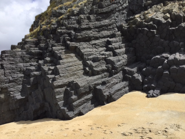
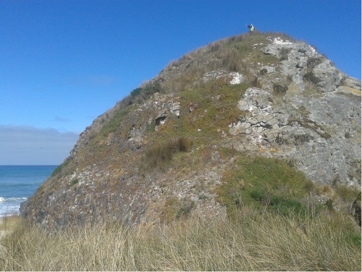
Cooks Head was reached by 1.20pm where a group photo was taken. This is a large rocky outcrop about halfway along Chrystalls Beach, comprised of phonolite basalt rock, with numerous hexagonal basalt columns, suggesting it was a former volcanic vent. The origin of it’s name still alludes me, (you let me down google!).
We were back at the cars by 1.45pm,having completed just over 7km of nearly all flat tramping. Afternoon tea was enjoyed at the Blend in Mosgiel.
The highlights:-
-As a city kid, just being on the land in a Rural setting, has a kind of romantic vibe to it. The dairy farm with its assaults on the senses and the energy of springtime.
-The serenity and beauty of the Toko River Mouth on a calm still day.
-Seeing the “back country” east of Milton from the car. Farmland, forest and hidden upmarket homes.
-The friendly camaraderie and socializing that accompanies every club activity. Something we tend to take for granted but shouldn’t.
Thank you to Arthur Heenan in providing travel instructions and maps for the tramp and to property owner Tony Macdonell for allowing us to tramp through his farm.
John Gardiner.
20. 22/7/2020. Trampers. Chrystalls Beach. Leaders : John Gardiner and Dave Roberts.
Ever been to Chrystalls Beach? Do you know where it is?
Whenever I ask these questions, the answer is always :-
“Never heard of it”.
Well now myself and 30 other trampers can answer these questions.
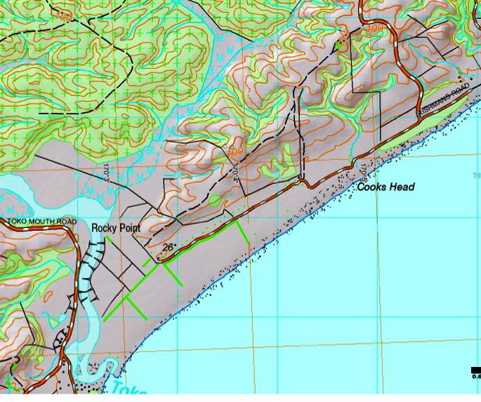
Chrystalls Beach is just east of Milton, north of the Tokomairiro River Mouth.
On Wednesday 22nd July, seven cars transported our group of 31 to the starting point for our tramp, parking on the side of Irishman’s Road.
The journey took us about an hour, and included four different gravel roads from S.H.1. just before Milton.
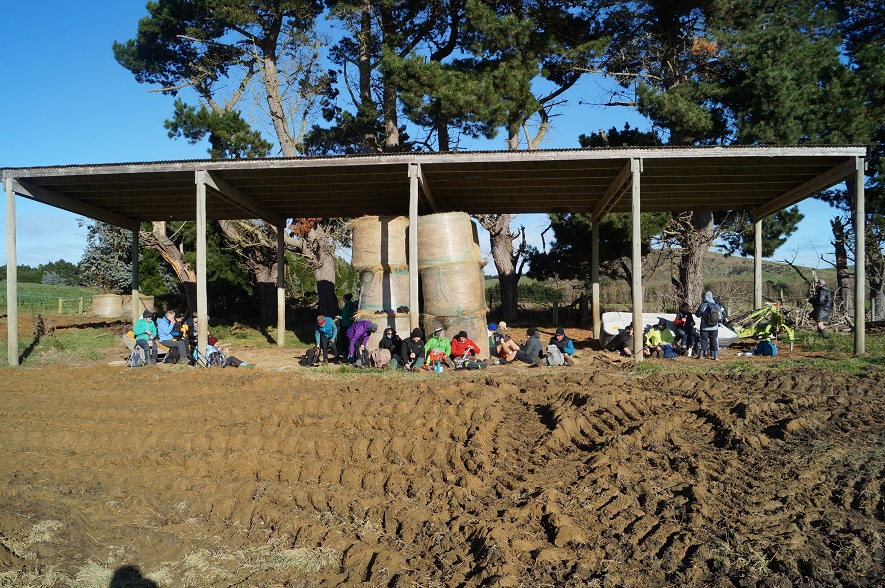
Our usual “strict” timetable for morning tea and lunch was somewhat disrupted by our late arrival(approx. 10.45 am) and the lack of suitable shelter from an icy cold blustery South Westerly wind.
Photo and Caption Gordon – “And we’re off”.
Setting out “into the teeth” of this wind, we had brunch (really morning tea and lunch combined) in the shelter of a hayshed at 11.25am.
Photo and Caption John – “Brunch in the hayshed – note the mud in foreground”.
This early part of the tramp was over a Dairy farm, with all Dairy farm’s usual trappings on offer i.e. cow pads and mud.
As expected the mud was particularly deep around gates, and on the farm tracks. A number of electric fences traversed these tracks the “ gates” comprising plastic insulators and hooks.
A special shout out to Margreet Simpson who grabbed one of these fences, wearing woollen gloves, exclaiming “It’s not on” only for the next person to come near it exclaiming “it’s hot!”.
Photo and Caption Gordon – “Through the live electric fence to the river”.
Not surprisingly we all treated this bit of fence with the respect it deserved!
A special thanks to the farm manager, Gareth Ferguson, for allowing us to tramp through the property.
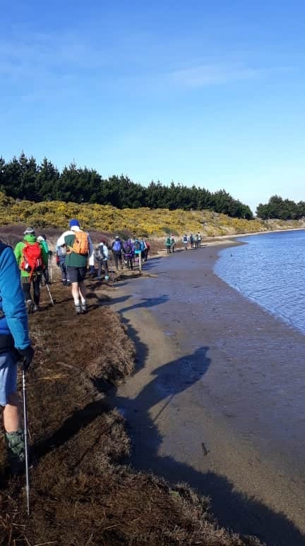
We left the property to tramp along the side of the Tokomairiro River towards the river mouth.
Photo and Caption Helen – “Low tide essential for this pleasant estuary walk”.
Here we scrambled through some marshy terrain for a short spell before a sandy river edge made the going much easier. This is definitely a tramp best attempted at, or near, low tide.
Photo and Caption Gordon – “Toko mouth village”.Photo and Caption John – “Well spread out trampers.”
At the river mouth, on the far side, lies Toko Mouth Township. A quaint little town of at least 21 very eclectic cribs – delightful.
The river mouth included a huge area of accumulated coarse river sand , as Bruce Wright exclaimed, “ideal for lining the Budgey Cage!” At this point a large row of sand hills separated us from the beach, but we were obviously below sea level as breakers could be seen, not far out, over the top of these sand hills. Apparently Chrystalls Beach got it’s name from the sparkles (like crystals) in it’s sand.
Photo and Caption Gordon – “On the windy beach”.
The walk along the beach with a tail wind now decreasing in intensity and sharpness, gave the leg muscles a good workout, but was very pleasant. This is obviously a rugged piece of coastline with the wave pattern erratic, indications being that these are very dangerous waters. Indeed this beach is the site of the February 1907 wreck of the French sailing ship Marguerite Mirabaud.
Photo and Caption Eleanore – “Shipwrecks along the Otago coast – in particular Toko mouth/Chrystalls beach”.
Interestingly an auction was held on the beach to dispose of the ship’s cargo. By 1.00 pm, with our group being a bit spread out, we regrouped at Cooks Head .
Photo and Caption John – “Reaching a milestone – Cooks rock”.
This is a large rock that stands proud alone on the beach. It looked airily alien, like it had just been dropped there, and somehow didn’t belong!
Photo and Caption Gordon – “Cook’s Head Rock”.
Arthur Heenan climbed to the top, while the rest of us investigated it.
Phot and Caption Gordon – “Arthur at the top”.
Photo and Caption John – “Ready to go again”.
Not sure where the Cook’s name comes from, no doubt there’s an interesting story as to how this rock got its’ name.
A short walk from Cook’s Head saw us back to the cars at approx. 1.00 pm , having tramped 7.3km.
By 2.15pm we were at the Blackstone Cafe’ for post tramp analysis, the usual banter, and socialising.
Photo and Caption Helen – “Enjoying everyone’s company after a satisfying tramp”.
A special thanks to Arthur Heenan for providing Dave Roberts and myself with directions, an aerial photo of the area, and advice along the way during the tramp.
John
19. 5/2/2019. Both. Cooks Head. Farm walk. Toko Mouth. Return beach. M. Leaders: Arthur H. and Lester.
It was a 50 minute drive for the 7 cars transporting our group of 31 Trampers and Hikers (combined), to reach Chrystalls Beach which is out at the coast from Milton.
A rather chilly wind coming up the coast greeted us, so it was jackets or windbreakers on. A semi-sheltered pine plantation was our morning tea stop – in the sunshine.
Morning tea in sun out of the wind. (Gordon pic and caption.)
A little later, as we passed the cowshed on the dairy farm, a light shower arrived necessitating sheltering in the lee of some trees for 5 minutes.
A shelter-belt of trees on our left gave good shelter as we walked down the farm lane in a southwest direction.
Eventually we crossed the last paddock and negotiated the two-wire electric fence (turned off, thankfully) to arrive on the bank of the Tokomairiro River, and followed it to the sea.
Part of Toko township. (Gordon pic and caption.)Jim and Keith comparing sticks or contemplating the distance to China. (Kevin pic and caption.)
The wind had eased somewhat by now, and it wasn’t quite as cold. After a rest stop we began the Beachwalk on the return part of our circuit, but now with the wind coming from behind it was much more pleasant.
Heading off along the beach. (Gordon pic and caption.)
After about half a kilometre we stopped to eat our lunch at the top the beach. It was low tide, and the surf was endlessly roaring.
Lunch on the beach. (Gordon pic and caption.)
No lingering over lunch, and then onward again. Chrystalls Beach is not a particularly pleasant beach to walk on because the coarse sand does not pack down hard. Nevertheless the group made good time up the beach, with the only thing of note being, sadly, the dead body of a very young Little Blue Penguin.
Heading off to Captain Cooks Head Rock. (Gordon pic and caption.)
All were very glad to reach Cooks Head, to have a breather in its shelter …
The Rock. (Gordon pic and caption.)
… while admiring its volcanic origin.
The rock makeup. (Gordon pic and caption.)(Kevin pic.)
Strangely no one wished to climb to the top today.
Will we climb it or not? (Gordon pic and caption.)
A short walk through the sand dunes, and on the road soon had us back at the cars, having covered just over 9 km for the day.
We had had only the one shower during our tramp, but there had been rain inland, and it was raining at Milton as we travelled homeward.
A refreshment stop was made at Waihola, before arriving back in Mosgiel at 3 p.m. – Art.
18. 21/9/2016. Trampers. Cooks Head. Farm walk. Took Mouth. Return beach. M. Leader: Arthur H.
We had a day at the beach.
Seven trampers left Mosgiel at 9.00 a.m. and travelled for 50 minutes to reach Chrystalls Beach, which is out at the coast from Milton.
After parking behind the beach, we walked back up the road we had just descended, – “Irishmans Road”. The overcast sky was beginning to show some blue patches now, the day becoming quite sunny.
An easterly breeze was coming in from the sea, and was noticeably cool. We had dropped Helen off at the top of the hill to find us a sheltered morning tea spot. The rest of us were nicely warmed up by now, and morning tea in the sunshine was most welcome.
Onward we walked, and were soon on one of the lanes of the daily farm. Downhill towards the cowshed …
Towards Toko Mouth. (Helen pic and caption.)
… and then followed the main farm lane heading south.
The lanes were dry, and perhaps not too interesting themselves, but it was a pleasure to walk through the farm and enjoy the colour of the fresh spring grass. We had passed the large mob of dairy cows soon after leaving the cars, grazing in their paddock beside the road.
Eventually we came to the end of the lane, and crossing one paddock, arrived at the bank of the Tokomairiro River. Under the electric fence and along the specially cleared track through the gorse and we were at the water’s edge.
We could look across at the Toko Mouth houses as we followed the river for half a kilometre or more to the mouth.
It was getting close to low tide, but just a little early for lunch, so we began the beach walk, coming to our dining seat before too long. A nice smooth log was perfect, plenty of room for all of us to sit side by side while munching away happily – like a row of birds on a wire.
H-114941Lunch on beach. (Helen pic and caption.)
We could watch the endless waves breaking on the beach and listen to the surf. Sea birds were noticeably absent, however.
Lunch over, we resumed our northward beach walk. The sand conditions were rather trying (and tiring), being a bit soft to walk on. It is about 3.5 km along the beach, and all were glad to eventually reach “Cooks Head” rock.
Rock and then close up. (Helen pic and caption.)
Time was taken to inspect the volcanic formations, similar to the “organ pipes” near Mt Cargill, which form the rock. Two were keen enough to climb to the summit …
Arthur and Eleanor on top of Cooks Rock. (Janine pic and caption.)
… and admire the view.
The view. (Arthur pic.)
The others were content just to watch.
Ten minutes more and we were back to the cars soon after 1.00 p.m. Not a long tramp, at around 10.5 km overall.
An historical note – In 1907 a French sailing ship, the Marguerite Mirabaud ran aground in fog on Chrystalls Beach. No lives were lost and the cargo was auctioned off behind the beach after being recovered. The sea broke up the ship though.
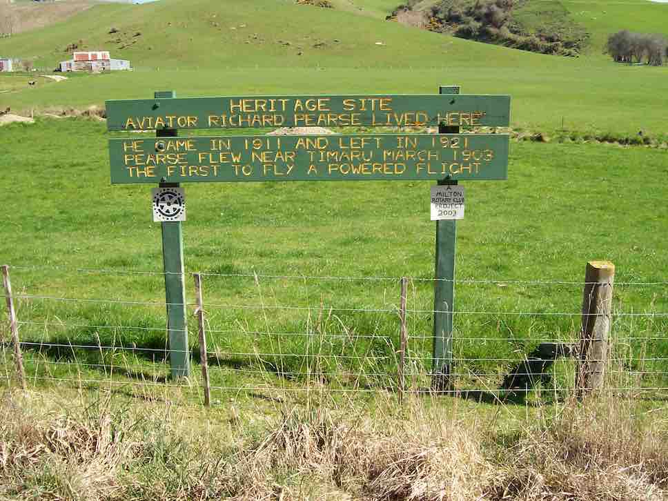
On the way back to Milton we stopped to inspect the sign erected by the Milton Rotary Club on the roadside, to mark where Richard Pearse had lived for 10 years from 1911.
Richard Pearse Sign. (Arthur pic.)
He is credited by some as flying a powered aircraft in 1902 or 1903, before the Wright Brothers.
The cars then made an essential stop at Waihola on the homeward journey. All seemed to have enjoyed their day at the beach. – Arthur.
17. 19/3/2014. Trampers. Cooks Head, Chrystalls Beach, Toko Mouth, farm walk return. Easy.
Chrystalls Beach to Toko Mouth & farm walk was the destination for our outing this week. Quite a few of the six who turned up had not done this before, so it was especially enjoyed by them. This time, to make it a bit different, I decided that we would do the trip in reverse, so walked back up the road to the farm house, where we were met by a overfriendly young dog that wanted to follow us, so we tried tying it up, but it went absolutly berserk, so we had to untie it, & really growl at it to make it stay at the house.
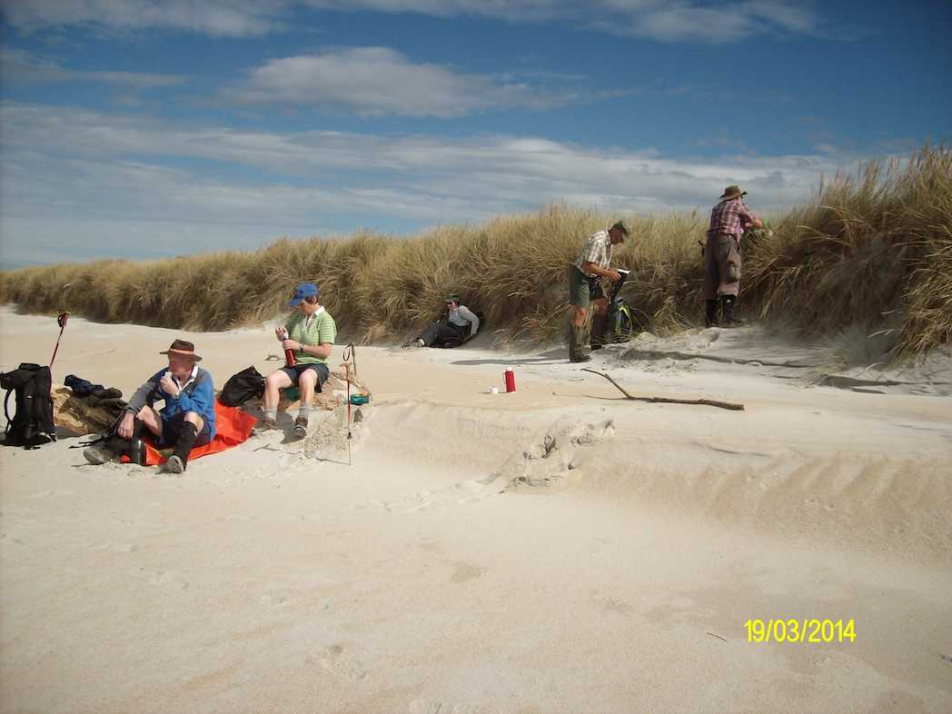
There has been quite a change to the look of the farm, with new roads, & the top paddocks bare of vegetation, but the lower paddocks are still the same. We had a lunch break …
Lunch break (Ken pic and caption)
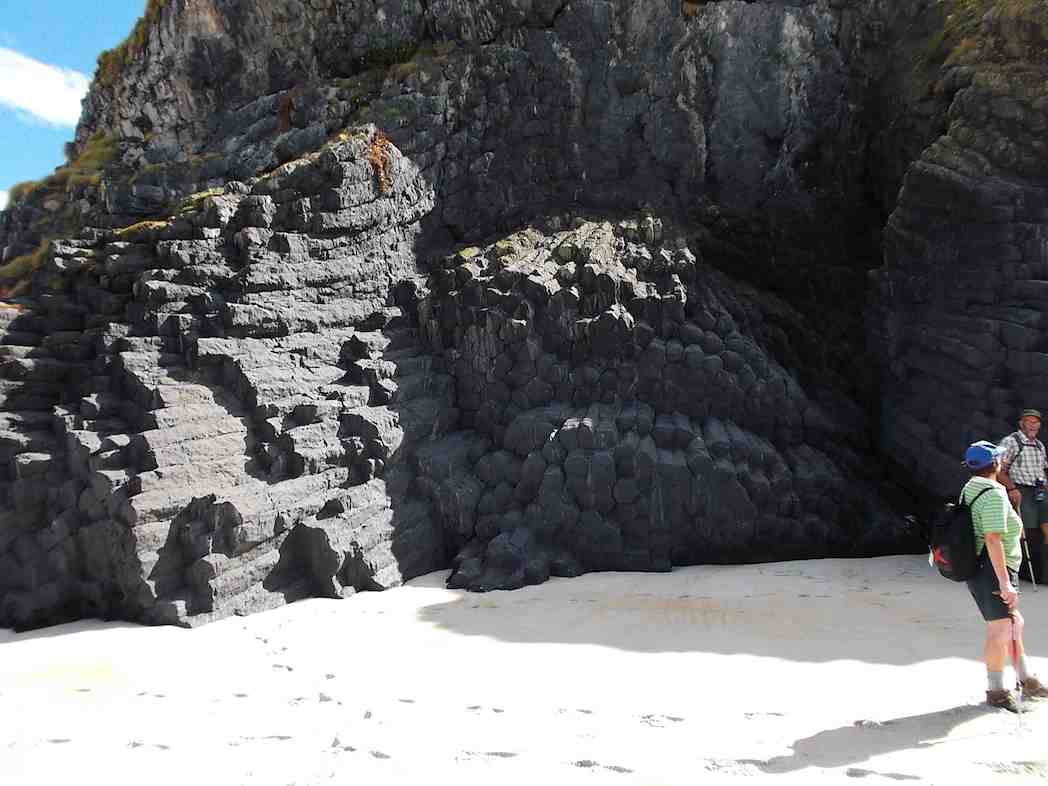
… along the beach a bit from Toko Mouth, then walked along to Cooks Head & inspected …
Cooks Head rock formation. (Heb pic and caption [Ed note: on the seaward side of the ‘Head’])
… the rock formations, before walking back to the cars.
The weather was very nice all day, with bright sunshine, & mostly calm conditions, which was enjoyed by all. – Ken.
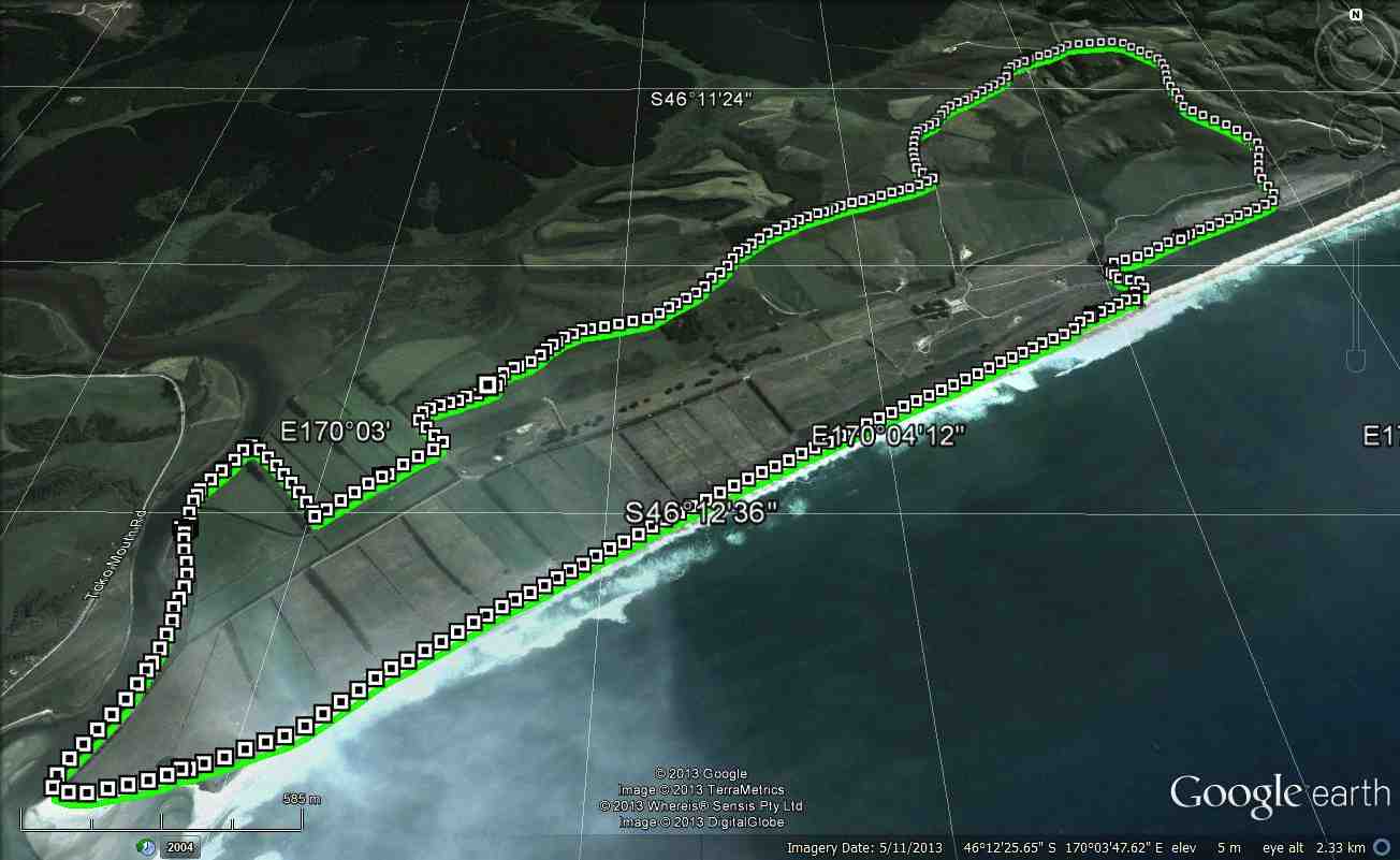
16. 25/9/2013. Trampers. Cooks Head, Chrystalls Beach, Toko Mouth, farm walk return. Easy.
GPS of route, courtesy Ken. Chrystalls Beach, Toko Mouth, farm, circuit.
On a day that looked threatening weather wise, 5 of us travelled to Chrystalls Beach, & after parking the cars away from some loose wandering cattle, we made out way across to Cooks Head where we had morning tea.
Morning tea stop in the shelter of Cooks Head.
Then we rugged up for the very windy walk along the beach to Toko Mouth. The sand was just as soft & hard to walk on as I remembered it from last time I was there.
We had a regroup around the corner of the Toko estuary out of the wind, then made our way along there to the point where it is possible to climb through the gorse, & up onto the farm paddocks. It was then a case of deciding which way to go to find the big hay shed where we had lunch the last time. After locating this we walked along the muddy track to where our route turned off into the paddocks, to head back up to the top road again. We had lunch out of the wind, hunkered down behind a large stack of trees that the farmer had torn out of the ground, & stacked up in piles along the new fence line. After lunch, it was just a matter of walking back up the slope that leads past the house on the property, & then along the roads back to the cars.
We all agreed that it was a good walk, despite the wind, & the very occasional light spot of moisture.
15. 14/7/2010. Cooks Head, Chrystalls Beach, Toko Mouth, farm walk return. Easy. Leaders: Ian, Ken.
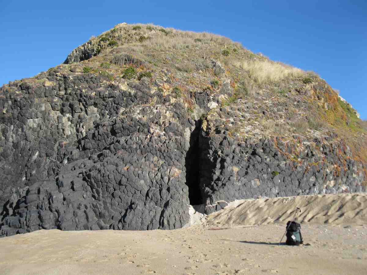
Because of low tide at 11.00 a.m., we walked the beach first for the first tiime instead of doing the tramp the more usual other way round. So it happened that we came upon Cooks Head from the north instead of the south and discovered a cave we had never noticed before.
And with the tide at a glorious low, it was no trouble inspecting the seaward side of the ‘Head’.
After morning tea at Cooks Head, it was the long beach walk to Toko mouth, some of the sand a strong orange colour, and other parts a firmer white. As you can see, it was a lovely sunny day.
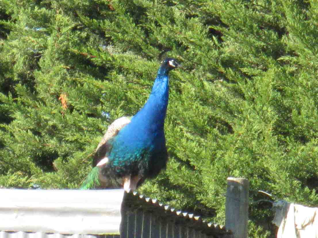
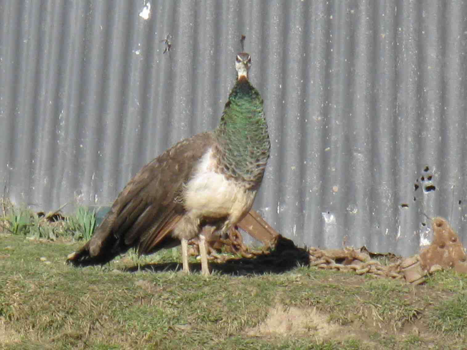
We returned back up the farm, following its ridge until we reached the house just below the high point of the tramp on Irishman Road. Here Bill stopped to patiently get the following two birds in their best pose.
Then it was just down the road to join the cars at the bottom. A great day and a great turn-out. – Ian.

 A fine overcast morning greeted us at Peter Johnstone Park with 19 trampers in 5 cars beginning our tramp at 10am.
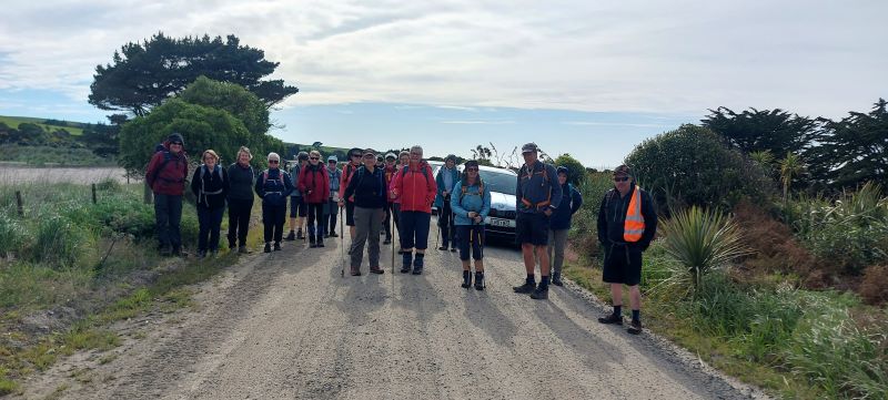


One thought on “Chrystalls Beach, Toko Mouth”