Brinns Point to Seacliff

Brinns Point to Seacliff.
The North Otago coast is lined with old Maori settlements, and Brinns Point is no exception. The bay south of the historic urupa (cemetery) on the headland was occupied by Moa-hunters, and much later was an out-post whaling station. A channel has been cleared through the boulder beach to enable boats to reach the shore especially at high tides. This is thought to be the work of the whalers but the channel clearance may date from much earlier, for all we know. This bay was investigated in the 1950s by the Blake-Palmers of Seacliff. This was published in the Journal Polynesian Society by Blake-Palmer senior who was superintendent of Seacliff Mental Hospital at the time. This was the first ‘proven’ association of man with the largest species of moa: Dinornis Maximus, thought by some scientists to be extinct before arrival of man. Later studies showed Dinornis had been found on archaeological sites beforehand however. There was an old Maori settlement on the flat at Ross’ Rocks. The next known settlement south is at Omimi, where moa bones have been excavated on what was largely a fishing site.
The cliffs after which Seacliff township gets its name are lined intermittently with Maori umu, most being umu ti. Parts of the coast road from Warrington to Karitane followed original Maori tracks according to early survey plans in LINZ archives. The hills along this coast were heavily forested and only cleared  when the land was subdivided for framing. The original route of Coast Road has been modified in places since the 1960s but many portions of the old routed can be seen with associated stonework on both sides of the present road. Coast Road remains an active connection with the distant past.
– Taken from Karitane … Split Rock … Seacliff Coastal Walk. Notes by Brian Allingham, Archaeologist, January 2010.

Split Rock

Split Rock.
This large outcrop probably had significance to Maori given its dominant presence. It would make an ideal lookout of the coast over the treetops. The hills east and south of Maori Peak were rich resource zones where forest resources such as timber, foliage, berries and birds, especially Kereru (pigeon) and tui were taken. Young stems from mature cabbage trees were steamed for up to 48 hours in large earth ovens (umu ti) to obtain the sucrose from the fibrous centre of the stems. Several umu ti are known to survive in the Seacliff bush today and some may remain unidentified in the field. Keep your eyes open for a generally circular pit of 4-5 metres across and with a raised rim around the edges. Some are up to a metre deep.
–  Notes by Brian Allingham. Archaeologist. January 2010.

Maori Peak background information

Maori Peak.
This general area has high spiritual values and is reputed to be the abode of ancestral beings, some of whom have been seen in modern times by local Maori; thus perpetuating historical references from the 1800s and earlier. Little is known or understood of these beings, other than the perception that they are regarded as Kaitiaki or guardians. It would be wise to respect the area by not eating or drinking on Maori Peak or around the immediate base.
– Notes by Brian Allingham. Archaeologist. January, 2010.

Puketeraki Beach

Puketeraki Beach.
Erosion has removed much of the evidence of former habitations along the beach. These were probably unfortified settlements that could rely on the defended ground at the pa if need be and would keep such a place on standby. One such place is Te Pa Hawea the “Yellow Bluff” about which little is known. It is attributed to the Hawea people who were connected to and gave name to Lake Hawea. This ancient connection lives on today through whanau who whakapapa back to these people.
The smaller settlements along the beach date from a relatively early period, and probably supported one or several whanau thriving off relatively local resources. It is know from later records that coastal groups of people would gather at a locality on the coast before heading inland on seasonal hunting expeditions, when large amounts of eel and weka flesh were taken and preserved. Connections were also maintained with related inland populations, thereby sharing resources.
– Taken from Karitane … Split Rock … Seacliff Coastal Walk. Notes by Brian Allingham, Archaeologist, January 2010.

Suddaby Farm.

Contacts: Seek permissions.
17/2/2010. Suddaby Farm, from Wallace Ford Road. (At the end of Mount Gowrie Road). Leaders: Ria, Hazel.

Well, although the tramp was called ‘Deep Stream Pipeline from George King Memorial Drive’, we never went near the George King Drive at all, except to pass by both ends of it on the way to our destination.

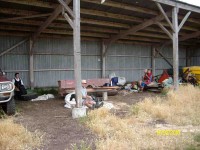
We [all 5 of us] parked the car on Wallace Ford Rd. outside Carters farmhouse, & made our way across some very dry & parched land to Withers farm, after having morning tea in a large farm shed.

Morning tea. Angela, Doug, Hazel, Ria. (Ken pic).