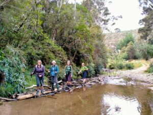
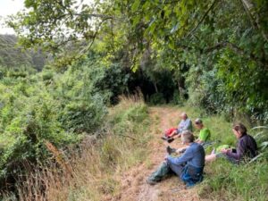
Sep 21 2022

Ross Creek and environs

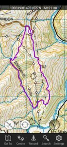
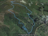
No. 94 on old hardcopy list of 113 club tramps. “Ross Creek – McGlashan College Year Round” 17 km from car park.


33. 21/09/2022. Ross Creek. Hikers Grade 3 Leaders: Pam Clough and Jay Devlin.

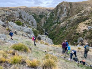
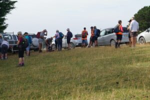
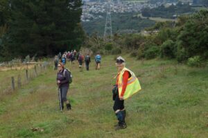
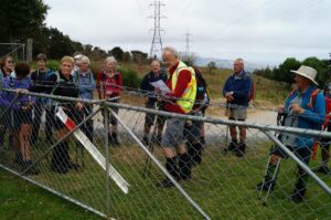
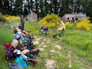
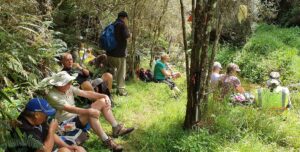
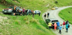
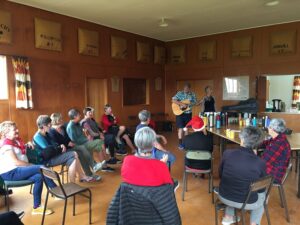
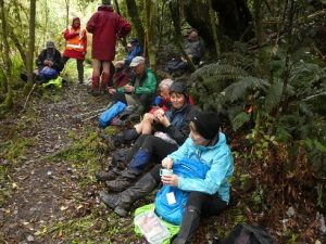
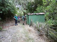
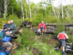
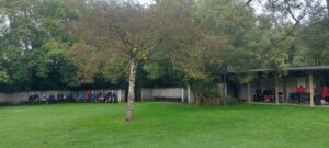
24 Hikers and trampers parked in Rockside Road close to the Leith Valley Holiday Park.  The day was pleasantly fine with no wind.   We started our Ross Creek walk on Rockside road which took us on to a lovely meandering bushy track. We came out opposite Woodhaugh Gardens where we stopped for morning tea.

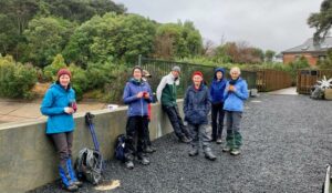
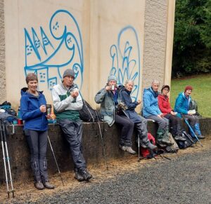
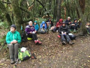
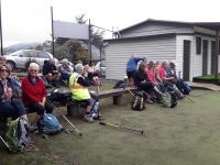
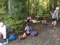
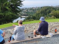
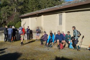
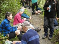
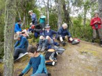
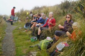
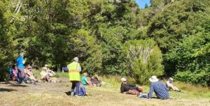
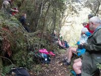
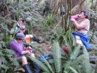
Morning tea

Morning tea Caption and photo Helen

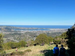
After that we left the Gardens and crossed the road over to the Queens St Track which gave us lovely views over Dunedin and the Stadium.  We crossed over Warrender St and kept on Queens Drive. We then turned right into Cosy Dell Road, which is very narrow, so care was taken.  We headed on to Cannington Road and did a loop through Brayside Cres and Cairnhill St where we were treated to fabulous gardens with spring flowers and beautiful magnolia trees not to mention the lovely homes.

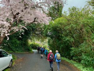
We were treated to lovely cherry blossom along the way

We were treated to lovely cherry blossom along the way Caption and photo Marijke

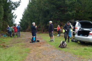
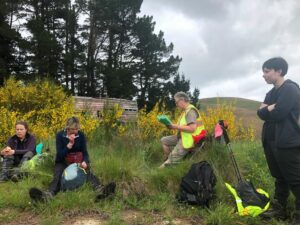
We then ended up at John McGlashan College where we had a leisurely lunch break.

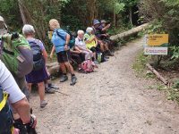
Lunch

Lunch Caption and photo Helen

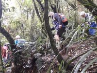
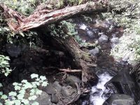
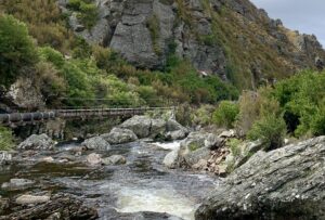
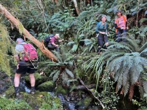
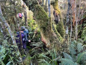
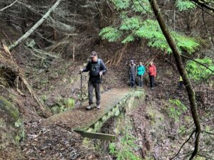
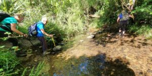
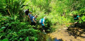
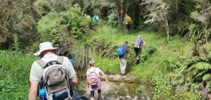
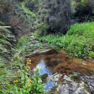
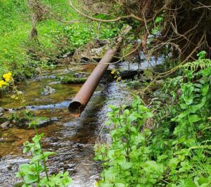
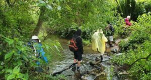
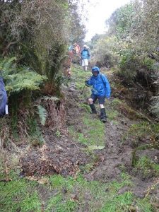
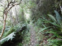
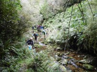
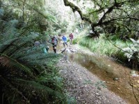
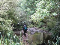
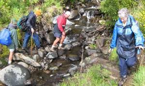
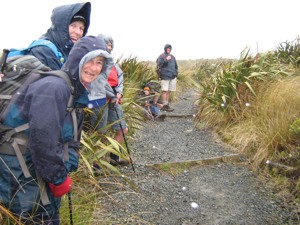
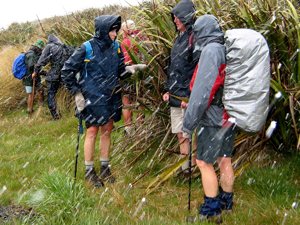
After lunch we then went on to the Ross Creek track where we had to negotiate some very steep steps and a small creek crossing where luckily no one fell in. This track is most attractive with lovely bush, creek and birdlife.
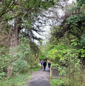
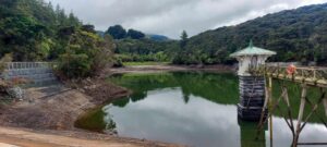
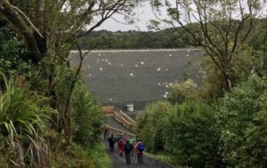
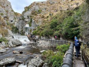
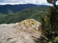
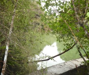
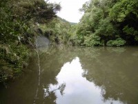
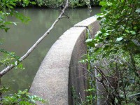
Reservoir

Reservoir Caption and photo Helen


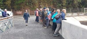
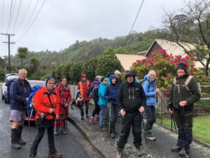
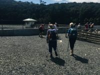
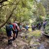
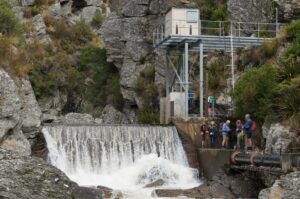
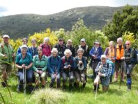
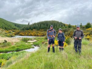
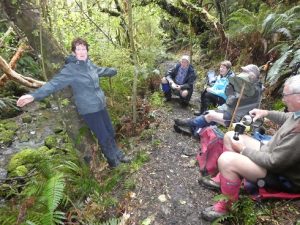
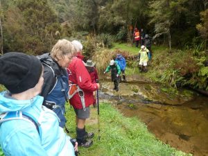
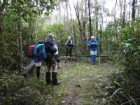
Group at reservoir

Group at reservoir Caption and photo Helen

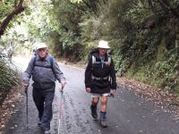
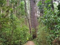
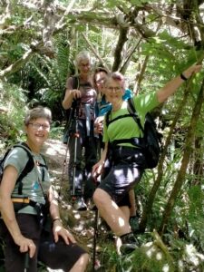
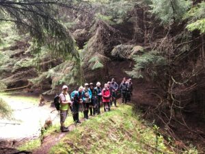
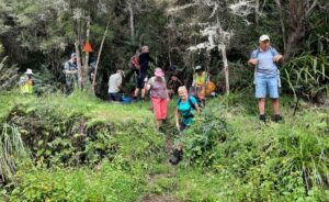
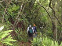
The last mile, nearly back at the cars! The lush greenery is so nice at springtime.

The last mile, nearly back at the cars! The lush greenery is so nice at springtime. Caption and photo Marijke

Back to the cars.  Coffee at Sunnyvale.


32. 20/07/2022. Ross Creek Leaders: Phil and Helen Morris

Wakari Bike car park/Polwarth, Burma Roads Ross Creek/Leith Valley/ Rockside, Tanner
Road/McGouns, Pineapple/ Wakari cycle track 10km amblers.

In a misty start we left Peter Johnstone Park and arrived at the Wakari bike car park at 9.50am. 8 trampers headed off down Polwarth Road, taking in some new houses in Redwood Lane. We then turned right into Burma track and then left into the track to the reservoir. As we had some hills in the tramp refuelling at the reservoir was required (morning tea).

20 July Ross Creek trampers morning tea

Morning tea break (Photo & caption Marijke)

20 July Ross creek trampers reservoir

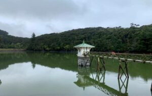
Ross Creek Reservoir and Valve Tower (Photo & caption Marijke)

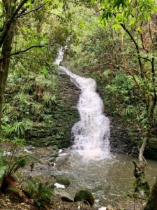
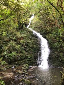
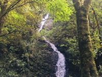
Cloudy but dry we returned to Burma Road down the hill and over the bridge we headed left down to School Creek track. Three quarters of the way down from the reservoir we took in a fantastic waterfall.

20 July Ross Creek trampers waterfall

Waterfall after the rain (Photo & caption Marijke)

We then headed right up Zig Zag track to Cannington Road (some a little breathless). Across the road onto Golf Course then Podocarp tracks we walked back to the reservoir past our morning tea spot. We then headed out onto Rockside Road for orientation. We continued to Tanner Road then left across the road and up some paths taking us past some nice homes hidden from the road.

20 July Ross Creek trampers Dogwalker

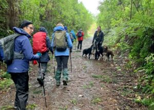
Meeting up with a local dog walker (Photo & caption Marijke)

20 July Ross Creek misty hills

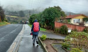
Mist on the hills (Photo & caption Helen)

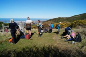
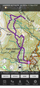
We got to the entrance of the Pineapple track (now around an hour forty-five minutes into our tramp) so we had time to do the McGoun’s track – taking the left entrance up to McGoun’s Creek. A good workout, the track joined the Pineapple track and we turned back down the hill to our lunch spot at the water tower.


20 July Ross creek trampers lunch

Lunch spot (Photo & caption Helen)

With a light sprinkling of drizzle at the end of lunch we continued down the Pineapple track and then turned into the McGoun’s extension. Then a 20-minute tour of the Wakari bike tracks and then WALLA we came out at the cars. A good walk in a sheltered area as a replacement for the Pipeline, Burns, Rustlers tramp that was cancelled. Thanks Arthur and Helen for helping me do a recce of the cancelled tramp.

Writer Phil Morris

Stats say 9.95km 315 elevation 2hrs 30mins actual walking time

References for tracks:-
Dunedin walks Dept of Conservation, and Dunedin Amenities Society.


October 6: Ross Creek Tramp (replacing Glenfalloch & Beyond)

31. 06/10/2021. Ross Creek Leaders: Ross Davies, John Gardiner and Pam Cocks

While Mosgiel was in sunshine, the Otago Peninsula was covered in mist with a strong north-easterly. 16 eager trampers sat in cars up in the thick mist on Highcliff Road debating their next move. The planned ‘Glenfalloch and Beyond ‘ tramp was quickly abandoned and a decision was made to go to Ross Creek. (A big thank you to Ross and John for taking charge and leading us!) By 10:15hrs we were parked up on Rockside Road and heading into Ross Creek where conditions were much more pleasant.

IMG_3439 Ready to go resize

All geared up for whatever comes our way. (Photo & caption Jenni)

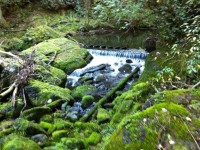
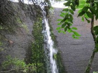
After about 15 mins walking up the main track, we crossed over Ross Creek onto a narrower track which took us to a waterfall, 20m in height (This must be one of Dunedin’s best kept secrets!). This waterfall was created when the ‘Waters of Ross Creek’ were diverted during construction of the Reservoir.

IMG_3443 waterfall resize

Stunning waterfall (photo & caption Jenni)

Further on we made a diversion into the Otago Golf Course to view a pully which is used to assist the golfers and their carts up this steep bank. Back down on the track we had a stand-up morning tea and some of Jenni’s yummy baking!

Carrying on through native bush for 30 minutes we came out into the open just below the dam to a view of the Star Constellations on the dam face. There are 77 steel coated stars across the dam face representing the Southern Constellations found in the sky above the city. They were installed in 2020 after the strengthening and when the dam face was rebuilt (2017 – 2019).

IMG_0047 Stars resized

Star constellations on dam face (photo & caption Pam)

Onward and upward on a short steep shingle path to the dam’s top. We continued clockwise passing the smaller dam and into the bush again, passing by what they call ‘The Grotto” and onto Craigieburn track. This was a steep track up boxed steps through Rimu trees to arrive near the top at ‘The Little Ruin’, which is associated with the arrival of The Rankins in the late 1860’s. It was used as a farm shed for storage and was built relatively quickly by novices.
Carrying on we turned into “Tanners View’ overlooking the Northern end of the Leith Valley. A short walk took us to a stone fence, climbing over and into an open grassed area which was part of the Craigieburn Farm and was purchased by the DCC with the Amenities Society in 1949. The remains of the Byre complex were probably started in the late 1880’s consisting of a narrow milking shed and larger stables for horses.

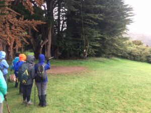
We moved on quickly from here due to the drizzle and cold wind but not before John had a childhood flashback enjoying a swing from a rope hanging from the macrocarpa tree!

IMG_0065 John swing resize

John enjoying a swing (Photo & caption Pam)

From here we walked down Tanner Road to the start of the Pineapple Track and after walking 30 mins up to the Water Treatment Plant and just through the style we stopped for a quick lunch under the dripping trees!

IMG_0068 Lunch resized

Lunch under the dripping trees (photo & caption Pam)

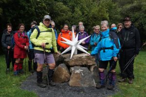
Onwards and upwards again to McGouns Creek Track through its pretty native bush, ferns and board walks with views of the Redwood Forest. This loop track brought us back to the start of the Pineapple Track. We then crossed back into Craigieburn Track, which took us above the Reservoir and then across the top of the dam and down to a big “star” for a group photo.

DSC05201 Star photo resize

Trampers to the stars!!! (Photo & caption John)

It was a gentle downhill walk back on the starting track. We took a right turn near the bottom of the track over the foot bridge passing an old concrete ammunition store and further on past the disused Woodhaugh Quarry.

We continued on crossing over another foot bridge which brought us out to the Motor Association camp and back up to our cars at 2.15pm, after an enjoyable tramp of 11kms of historic and more recent interest.

Coffee, cake and continuous chatter was then enjoyed at Nichols Cafe 😀


30. 19/2/2020. Hikers. Ross Creek. Leaders Barbara and Noi

19Feb20 Photograph at your peril!res

Photo and Caption Noi – “Photograph at your peril”


19Feb20 Ross Creek bridgeres

Photo and Caption Barbara – “Ross Creek Bridge”


19Feb20 Negotiating Ross creek tracksres

Photo and Caption Noi – ” Negotiating Ross Creek tracks.”

19Feb20 Morning tea Cosy Dell Tennis Clubres

Photo and Caption Noi – “Morning tea – Cosy Dell”

19Feb20 Ross Creek - pretty as a pictureres

Photo and Caption Noi – “Ross Creek pretty as a picture.”

19Feb20 Town Beltres

Photo and Caption Noi – “Town Belt”


image1 (1)

Photo and Caption Barbara – “Relaxing lunch in the bush.”

image5 (1)

Photo and Caption Barbara – “Who knew Dunedin had a waterfall”

image10

Photo and Caption Barbara – “Ross Creek enjoyed”


29. 22/1/2020. Hikers. Ross Creek. Leader Clive
20200122_093654res

Photo and Caption Clive – “Start at entrance to Pineapple track”


20200122_095327res

Photo and Caption Clive – “Morning tea at the Byre”


20200122_111303res

Photo and Caption Clive – “The Redwood Loop”


20200122_112252res

Photo and Caption Clive – “Some tall trees in the redwood forest”

Continue Reading »

No responses yet

Mar 16 2024

Evansdale, Careys Creek, Honeycomb, Rongomai

Published by under Trampers

Location: 37 km.
From Evansdale Glen. Route. DOC. Stream crossings. Preferably February when water most likely to be low.
Track up Careys Creek alone: an easy walk.

Click information on the Seacliff Dam, historical creek track and pipeline.


Img 8974 Thumbnail17. 13/03/2024. Trampers. Carey’s Creek, Rongomai, Honeycomb Tracks. Grade 3.5. $11. 39km. Leaders: Pam Cocks, Graeme Souter.
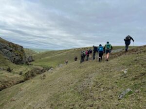
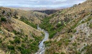
After a few concerns about the weather earlier in the week we were greeted with a cracker of a day. The Dunedin crew met at Woodhaugh Gardens as usual with our team leader deciding she simply must put on a pair of leggings to protect her legs whislt she “crushed” the overgrown grass that greeted us on our recce the previous week.

Continue Reading »

One response so far

Sep 30 2023

Deep Creek Weir from Old Dunstan Road past Rocklands

No. 2 on old hardcopy list of 113 club tramps. “Deep Stream [Stream crossed out and replaced by Creek] (Rocklands). R Lippers. Cattle.”
No. 56 on old hardcopy list of 113 club tramps. “Deep Creek from Old Dunstan Road. (Rocklands. Year Round”
Est, 50 km from car park.
See Deep Creek Water Scheme Pipeline history.
See further background information behind Deep Stream project

19. Welsh’s Road, Old Farm, Deep Stream Weir. Grade 3 Leaders: Lyn and Di

13 of us set off for the Pipeline, which is just off the old Dunstan trail on Rocklands Station.

We had morning tea under the pine trees where we parked the vehicles. It was a tad cold but we soon warmed up with the walk over the farmland to the pipeline.

Up and up over farmland. Caption and photo Pam

Up and up over farmland. Caption and photo Pam

The countryside is getting more rugged Caption and photo Marjke

The countryside is getting more rugged Caption and photo Marijke

Tramping nirvana, easy level dry track, marvelous views Caption and photo John

Tramping nirvana, easy level dry track, marvellous views Caption and photo John

It was stunning scenery walking to the Weir and back.

Happy Trampers. Caption and photo John

Happy Trampers. Caption and photo John

Pump house and Weir. Caption and photo Pam

Pump house and Weir. Caption and photo Pam

Exploring the engineering feat, the Deep Stream Weir. Caption and photo John

Exploring the engineering feat, the Deep Stream Weir. Caption and photo John

Can you spot the hut Caption and photo Marijke

Can you spot the hut? Caption and photo Marijke

We had lunch in the sun out of the gorge with more room to spread out.

Refuelling. (Pipeline track to the weir in the background). Caption and photo Pam

Refuelling. (Pipeline track to the weir in the background). Caption and photo Pam

Then took the road back to the cars. It was 8.84ks according to my phone.

Some finished the day with a cuppa at the Wobbly Goat. Another great day out.


Continue Reading »

One response so far

Sep 02 2023

Nicols Creek, Swampy, Pineapple Track, Moon Track, Booth Road

Published by under Trampers,Year round

(David Nicol was an early settler and dairy farmer. He reputedly bought land here in the hope that the railway line would be routed north through Leith Valley.)

Click here for Antony Hamel’s YouTube video showing his exploration of the 5 falls of Nicols Creek.

Click here for an EXCELLENT MAP of Nicols Creek showing the location of The Basins (called the Cup and Saucer on the map), and the 5 waterfalls. (It also shows the Pepper Tree track location.)
Neighbours at War Click here for background and photos to the Finnerty Family and their house site on the Moon Track by Nicols Creek.
Click Swampy ridge track for background information.
Click Pineapple Track for background information.
Click Pineapple and Flagstaff walk for background information.
No. 17 on old hardcopy list of 113 club tramps. “Nicols Creek. D McCabe. Year Round”
Nicols Creek circuit Maintained by Green Hut Track Group.
DCC land.

Booth Road 16.1 km from car park.


27. 30/08/2023. Trampers. Pineapple Track-Nicols Creek Grade 3.5-4 Leaders: Sarah and John
An Interview with Pineapple Track/Nicols Creek Tramp Leader Sarah by Tail End Charlie, John

Hi Sarah. You were a late incumbent to the leadership of this tramp?

– Yes, Ross was originally down to lead it, but back problems meant he asked me to lead it instead. (Best wishes for a speedy recovery Ross.)

Did you do a recce the Saturday prior?

– That’s right, Craig went mountain biking, and I went exploring on foot, in the area, to finalize the tramp format.

Were the group lucky with the weather on the day?

-The weather was brilliant. Sunshine, little or no wind and temperatures towards the mid-teens. The tracks were reasonably dry.

And did we have a good attendance?

– There were 18 of us – arriving at Tanner Rd/Fulton Rd corner in 7 cars.

What was the tramp route?

-We started on the Pineapple Track, walking up to the Pump House for morning tea.

Getting ready for morning tea in the sun Caption and photo John

Getting ready for morning tea in the sun Caption and photo John

Then we carried on up the Pineapple Track, turning off at McGouns Track onto the Old Pineapple Track. This led us to the “new” Pineapple Track by Pineapple Point.

crossing Nicol’s stream Caption and photo Pam

crossing Nicol’s stream Caption and photo Pam

From here we followed the lower track, traversing Nicols Creek before arriving at the Mountain Bike picnic table at 11.55am for lunch.

Lunch with a view worth taking in Caption and photo John

Lunch with a view worth taking in Caption and photo John

Panorama - View from lunch spot. Caption and photo John

Panorama – View from lunch spot. Caption and photo John

After lunch it was onto the upper track, traversing Nicols Creek.

somewhere in the bush! Caption and photo Pam

somewhere in the bush! Caption and photo Pam

Then onto the “new” Pineapple Track, and back to the cars via McGouns Track.

Heading down the pineapple track Caption and photo Pam

Heading down the pineapple track Caption and photo Pam

Wahl!! I think you lost me somewhere there! Did the tramp take long Sarah?

– The recce only took me 3 hours. On the day the tramp took us much longer at 5 hours. Some technical terrain reduced the tramp down to a crawl pace in parts.

Did you manage to squeeze in coffee afterwards?

–        Only just. We were back at the cars by 3.00pm, then headed straight to the Fire Station Cafe’ in Roslyn.

How would you describe the shape of the tramp?

– Roughly a double figure 8.

Sounds lucky, I think? Thanks for the interview, Sarah.

Screenshot Sarah

Screenshot Sarah

Continue Reading »

No responses yet

Feb 17 2023

Racemans, North and Little Coal Creeks, Steve Amies

Published by under Both Hikers & Trampers

14. 15/02/2023. Trampers. Silverstream (Raceman’s – Little Coal Creek – Steve Amies- Raceman’s Loop). Grade 4. $5 Leader: Phil Keene

The residue of Cyclone Gabbie hovering off the coast and threatening some rain seemed to have an effect on today’s turnout – only one car, one car, headed for the hills, but it’s hard to hold back quality! So we were parked up at the Powder Ridge car-park and on the track by 9.20am and shambled off up the road and we crossed the surging Silverstream with trepidation a couple of times, before hitting our straps on Racemans.

The famous 5 minus 1 cross the surging Silverstream (Phil)

The famous 5 minus 1 cross the surging Silverstream (photo & caption Phil)

Birdsong was prevalent, nearly drowning out the chat, with the whoosh of a pigeon or two over the stream. As on the day of the recce we were overtaken by a surging team of 5 collies out for their daily run with their Goddess mistress fast coming up behind.

Enjoying a cuppa on Racemans Track (Pam)

Enjoying a cuppa on Racemans Track (photo & caption Pam)

We morning tea’d after 45 minutes, looking out through a clearing across the valley, why is it ‘the other side’ always seems so more interesting. 1.5 hours from the car-park we took a deep breath to prepare for the ascent up Little Coal Creek and off up up and up we went.

A steady climb up Little Coal Creek (Pam)

A steady climb up Little Coal Creek (photo & caption Pam)

It was nice to have some of natures hand holds as we pulled ourselves up, being dry, very dry underfoot, just like walking on powdered cement.The going was slow though, to such an extent that these modern devices that people wear were sending out warnings that they were not recording any movement! Are you alright?

That was a good joke Phil (Pam)

That was a good joke Phil (photo & caption Pam)

After 50 minutes of huffing and puffing I’ll blow your house down, I swear I could have, we were at the junction of Little Coal and North Coal Creek tracks.

This way ladies (Pam)

This way ladies (photo & caption Pam)

From here the climb was more steady, drifting into plateaus, before the next bit of up. Time was taken to enjoy the views out through the bush to Pulpit Rock and Raingauge Spur plus poke our noses out over the rock ledges.

Time to rest and admire the view

Enjoying the views to Pulpit Rock and Raingauge Spur from Little Coal Creek (photo & caption Pam)

Towards Pulpit Rock (Phil)

Towards Pulpit Rock (photo & caption Phil)

3 hours from the car park we stopped at the Steve Amies/ Little Coal Creek junction and decided to have lunch here, with both sun and shade to help dry out the perspiration. Bees were prevalent and seemed to take a liking to the creams on our skins, some coming back for more, but no harm was done.

Lunch at the junction (photo & caption Pam)

Lunch at the junction (photo & caption Pam)

At 12.45pm we were up and off down what was a lovely Steve Amies track and the gradient was such that there was more time to take in the impressive Kanuka trees, some as big as the mature Pinus Radiata that have also made their home here. As to be expected, the track had to get steep again, and care was required as we ‘dropped’ back down onto Racemans, to be followed by a 40 minute stroll back to the car- park arriving back 5 hours and not a minute more from when we left.

the famous 5 minus 1 'dropping' down to Racemans off Steve Amies Track (Phil)

the famous 5 minus 1 ‘dropping’ down to Racemans off Steve Amies Track (photo & caption Phil)

Altitude gained was 509m and a little over 11kms completed. Grade 4 seemed about right. Consensus was a great day out and just 10minutes from home.
Phil K


13. 18/11/2020. Trampers. Racemans, North and Little Coal Creeks, Steve Amies.  Leaders: Ross and Wyn Davies. M.

18 trampers set out from the car park just off the Whare Flat Road, towards the pumphouse at 9.25am. It was a nice morning. We arrived at the Tunnels Track junction after half an hour; time for morning tea.

P1020426res

Photo and Caption Gordon – “Morning tea.”

DSC04414res

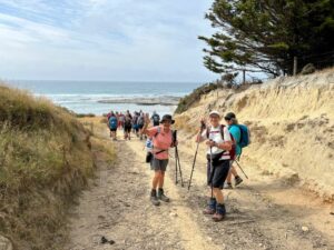
Photo and Caption John – View from morning tea spot.”We made steady progress up the Racemans Track and reached the North Coal Creek junction and hour and a quarter later. After a brief pause for some energy food, we headed up the North Coal Creek Track. The track – such as it is – was in good condition. It is an unrelenting climb and we had a few stops to regroup on the way up.
P1020433res

Photo and Caption Gordon – “Climbing rock wall on North Coal creek track.”

We reached the junction with the Little Coal Creek Track after about an hour. We carried on up the Little Coal Creek Track for another 15 minutes to a lunch spot with a view to the north.

P1020442res

Photo and Caption Gordon – “Lunch.”


DSC04417res

Photo and Caption John – “View over the cliff edge at lunch stop.”

We had a good panorama of Powder Ridge and Long Ridge, Mt Allan behind, Pulpit Rock and Green Hill in the centre of the Silver Peaks.

The weather started to look more threatening after lunch, as we continued up the Little Coal Creek Track for another 20 minutes to the junction with the Steve Amies Track.

P1020444res

Photo and Caption Gordon – “Happy campers at Steve Amies junction.”

By this stage there were a few showers; enough to make the track down the Steve Amies Track increasingly slippery. Everyone took the descent carefully and we made it safely without any proper falls. It took us about an hour and three quarters all the way down to Racemans Track, by which time the rain was getting more frequent.

Getting progressively wetter we retraced our steps along Racemans Track and back to the car park in about 40 minutes, arriving back at 3:50pm. Distance was variously measured at more than 15 kms, with an average of about 15.5 kms. It was a relatively longer day in terms of distance, time walking and ups and down, which everyone coped with OK. Some decided home was the best direction but 8 of us diverted to Blend Café for hot drinks and varying amounts of food.


Continue Reading »

No responses yet

Feb 03 2023

Quoin Point Bull Creek

Published by under Beach,Both Hikers & Trampers,Farm

No. 79 on old hardcopy list of 113 club tramps. “Quoin Pt – Bull Creek – Farmland (see George) Farm”

45 km from car park.
“quoin” definition: 1. An exterior angle of a wall or other piece of masonry.
2. Any of the stones used in forming such an angle, often being of large size and dressed or arranged so as to form a decorative contrast with the adjoining walls. Seek permissions. 03 –
Coast and farm walk. Bull Creek nature walk to waterfall (tiny!) recommended.

16. 1/2/2023. Quoin Point to Bull Creek. Combined. Leaders Bruce, Alex, Helen and Phil.

Thirty-one keen walkers headed south and after regrouping at the turnoff to Quoin Point road parked in a paddock opposite the wool shed at the end of the road where lambs were being drafted.
1 Feb Bulls Creek Keen to get started John

Keen to get started. Photo & caption John

We followed the farm road leading down the hill towards Quoin Point and then turning right opening closing gates where appropriate before stopping after 15 minutes near an inlet with a choice of sun or shade. Shade was more popular.
1 Feb Bulls Creek Morning tea near Quoins Point Phil

Morning tea near Quoins Point. Photo & caption Phil

We continued across the paddocks and paused for a time near a caravan and new home above it on the hillside with natives planted in two paddocks while Bruce chatted to the land owner Peter O’Connor of Riversdale. Peter said he was happy for trampers to traverse his property and did not need to ask his permission in the future. The two paddocks are linked by a pipe gate and the best exit to the beach and Bull Creek was at the far corner nearest the sea of the second paddock. The path goes down the hill over some grey rocks and then along the coast to Bull Creek. He plans to mow a track across the lower part of his property in about two years to make access easier.
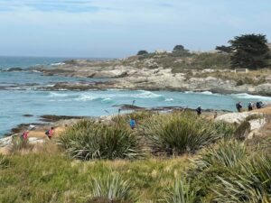
1 Feb Bulls Creek Neil on gate duty again John

Neil on gate duty again. Photo & caption John

1 Feb Bulls Creek An example of the beautiful farm gullies, planted in natives John

An example of the beautiful farm gullies, planted in natives. Photo & caption John

1 Feb Bulls Creek Local's dog, keen to come with us John

Local’s dog, keen to come with us. Photo & caption John

1 Feb Bulls Creek Going to visit the house on the hill Phil

Going to visit the ‘house on the hill?’ Photo & caption Phil

1 Feb Bulls Creek Happy trampers Pam

Happy trampers. Photo & caption Pam

1 Feb Bulls Creek Around the corner to Bulls Creek Pam

Around the corner to Bulls Creek. Photo & caption Pam

1 Feb Bulls Creek Watching over Bulls Creek Pam

Watching over Bulls Creek. Photo & caption Pam

We had lunch on the North side of Bull Creek in case the rising tide cut us off. A seal was spotted in the water at Bull Creek and another mammal seen in the distance on the rocks on the way back. Clare’s family had built a dam across the creek so that the seaweed in the creek could be flushed out once the dam broke.
1 Feb Bulls Creek Time for lunch John

Time for lunch. Photo & caption John

1 Feb Bulls Creek Bus iconic tree and three T.R.T.C. icons John

Bulls Creek iconic tree and three T.R.T.C. icons. Photo & caption John

Clare kindly arranged for 3 of the party to travel back by car; a 25 minute journey going near Milton.
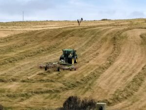
The weather remained fine. Distance 13.56 km, Climb 384 m. We started walking at about 10 am and were back to the cars at 3 pm. There were many views of the coastal rocks. Hay tedding was in progress on one paddock and for the others the hay had been cut and baled since the recce.
1 Feb Bulls Creek Very precise windrowing Phil

Very precise windrowing. Photo & caption Phil

Future walks on the property might be considered for mid-February or after when the sheep are likely to have been shorn, the lambs drafted and the hay cut which makes walking easier. Thanks to the co-leaders Alex Griffin, Helen Morris and Phil Morris for their valuable leadership. Also to Neil for his opening the gates, waiting for the last person to go through and then, remarkably, being in position to open the next gate. He was also better at spotting where the next gate in paddock was, possibly due to his eyes operating at a higher elevation. Thank you again Neil. Our thanks are also due the land owners Alan Shaw, Gwen Lane and Peter O’Connor for their kind permission to be on their properties and to Clare for her local knowledge of the area and assistance with offering transport back to the cars for three persons.
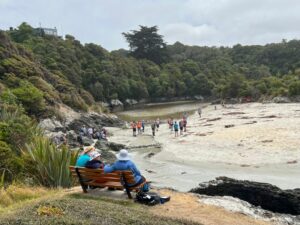
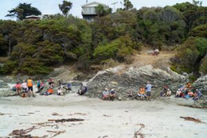
Because the Brighton Café closes at 4 pm the group was given the opportunity to make their own choice for coffee, such as at Waihola or Mosgiel, or an ice cream at Brighton.
Bruce Spittle

Continue Reading »

No responses yet

Jan 21 2023

Spiers Road, Davies, McGouns Creek Extension

Published by under Trampers

Click Ben Rudd Article for background information.
Click Pineapple and Flagstaff walk for background information.
Antony Hamel in his Dunedin Tracks and Trails book has interesting information on the “Snowy Mountain Track” under his Spiers Road entry.
4. Eastern Flagstaff. Trampers. Grade 4.5. $5. 15km. Leaders Ross Davies and Gwenda Farquharson
(Redwoods bike tracks – Old Pineapple Track – No track – Davies Track – Flagstaff Walkway – Spiers Road Track – street walk)
Keen to start the tramp - John

Keen to start the tramp (photo & caption John)

17 of us met up in Wakari Road at the carpark for the Redwoods bike tracks on a cloudy morning and headed off into the maze at 9.20am. It’s a lovely meander through the very tall trees. We emerged at the Booth Road end of the Pineapple track and took the track up to the water treatment plant.

Morning Tea at the pumping station - John

Morning Tea at the pumping station (photo & caption John)

We had morning tea there a little after 10am on the uphill side before heading into the bush behind the plant. This was the entrance to the original Pineapple Track which was replaced by the current one in the late 1970s. Within a few minutes on a faint unmarked trail we crossed the McGouns Track  and kept on straight up. The track is reasonably obvious. It was a bit greasy in places but is a nice contrast with the new track.

Mind your step - Phil

Mind your step (photo & caption Phil)

We emerged into the open area beside the new Pineapple Track but didn’t head over to Pineapple Point viewpoint as we’d been enveloped in cloud by then.

Regroup in the bush - John

Regroup in the bush (photo & caption John)

Instead we retreated a little way back down the way we’d come before heading south through the bush, contouring around to the middle part of the Davies Track. There’s a slight ground trail, and some markers, probably noting trapping lines. Plus lovely big Totara trees and impressive cabbage trees. Towards the Davies Track there are blue triangle markers for another trap line and this leads on to the Davies Track about halfway up. We had a look at the alligator swamp but they were all hiding.

Feels like the jungle in Borneo - Phil

Feels like the jungle in Borneo (photo & caption Phil)

The upper part of the track was fairly muddy and slippery. Eventually we emerged from the bush, just below the cloud. After the fire a few years ago, the flax and gorse and grass are growing back, and it was saturated. With nowhere dry to stop, we carried on up to the Flagstaff Walkway and then a few more minutes towards the top where we found a sheltered dry spot beside the track for lunch, at about 12.45pm.

Lunch on a handy bank - John

Lunch on a handy bank (photo & caption John)

After lunch we zoomed across the summit, then down a little way towards the Bullring. You have to keep your eyes out for the Spiers Road track branching off to the left, over the ridge and then plunging down towards Halfway Bush.

Within sight of civilization - John

Within sight of civilization (photo & caption John)

After the light rain of the night before the track needing a bit of care.

Ross explains the site of the original road out of Dunedin - John

Ross explains the site of the original road out of Dunedin (photo & caption John)

This was the route of the Snowy Mountain Road, the first overland route out of the new Dunedin to the north, over Flagstaff, over Swampy, over Hightop, and on north to Johnny Jones’ Cherry Farm at Waikouaiti via what is now the Mountain Road forestry road.

Ben Rudd's stonewall - Phil

Ben Rudd’s stonewal (photo & caption Phil)

Further down we passed Ben Rudd’s stone wall, and then the site of a plane crash in 1943 which everyone survived, including the plane! From the bottom of Spiers Road it was a 30-minute street walk back to the cars, checking out the houses and gardens along the way. Most repaired to Coffee Culture in the olde Roslyn fire station for the de-brief.

Thanks Gwenda for helping out, and to everyone for sharing in another happy adventure.

Ross

Tramp details: Distance – 13 kms; height gain – 730 m; moving time – 3.75-4 hrs; elapsed time – 6.25 hrs.
Discussion afterwards agreed 4 or 4.5 for grade and I’m comfortable with 4.5 because of the extra height gain and the proportion of rough track involved.

Continue Reading »

One response so far

Dec 04 2022

Post Office Creek, Reid’s Station

Published by under Trampers,Year round

 No. 27 on old hardcopy list of 113 club tramps. “Mahinerangi – Post Office Creek. J Shaw. Year round.”
Impassable gorse-infestation beyond old Waipori School building (aft 2008).
33 km from car park.
18. 30/11/2022. Trampers. Post Office Creek track from the Waipori Village side. Grade 3. $14. 60km. Leaders: Barbara and Leah.
Despite ominous weather predictions for several days prior to the 30th, and heavy rain early that morning, the visual was more promising.Three vehicles and 14 trampers left the Peter Johnstone carpark heading towards Berwick and up the Waipori Falls Road, through the Village and continuing towards Lawrence. The big, locked orange gate, although on a side road, can’t be missed! Through the locked gate, past the new picnic area, following the road below the Mahinerangi Dam to cross the bridge and climb up into the Wenita section of Dunstan Road. The potholes aren’t for the fainthearted.
About to leave the cars - John

About to leave the cars (photo & caption John)

The walking track is off Patearoa Road which itself is off Moonlight Road and we parked at the junction of the two. The permit was left visible through the windscreen.

Excited to be ready to go - John

Excited to be ready to go (photo & caption John)

A quick morning tea, and the party set off on the 1km down-hill (remember what goes down at the beginning of the day must go up at the end!!) to the rustic signpost indicating Post Office Creek track. There was a brief delay while one driver (nameless) went back and spent a frenetic 5 minutes searching for car keys in order to lock the vehicle. Having found the keys in the backpack, they were left on the ground while the pack was rezipped. The person (also nameless) who had ferreted them away while the rezipping was underway should be afraid; very afraid! A brief detour a few minutes down the track proper took us to the now dilapidated fishing huts.

Fishermen’s Hut hidden in the trees above lake Mahinerangi - Pam

Fishermen’s Hut hidden in the trees above lake Mahinerangi (photo & caption Pam)

“Watch your head John” as the track winds under the overhanging rock - Pam

“Watch your head John” as the track winds under the overhanging rock (photo & caption Pam)

A scramble back up the track and we were crossing the first of the creeks and negotiating the rock bivvy.

PO Creek rock bivvy2 - Barbara

Post Office Creek rock bivvy (photo & caption Barbara)

The entire track follows the contour of the slope with very little up or down. Many of the guts had bridges in varying degrees of disrepair but which, it’s understood, are likely to be removed entirely in the near future, after the maintenance work in the forestry has been completed. The tracks will be realigned to navigate the guts minus bridges.

One at a time crossing the old wooden bridge - Pam

One at a time crossing the old wooden bridge (photo & caption Pam)

Pigs had been digging up the track which left it nice and soft underfoot and there were a few fallen branches we cleared as we went.

escaped from the forest (Jenni)

Escaped from the forest (photo & caption Jenni)

We left the canopy cover of the trees as we neared the re-sited Waipori School buildings where we sat and had our lunch. Half the group elected to follow Jill to the actual Post Office Creek while the remainder sat and chatted, walked down to the lake edge and poked around the buildings.
Disappointingly there was no fishing or poetry recitation.

Lunch beside the relocated school house once used by musterers - Pam

Lunch beside the relocated school house once used by musterers (photo & caption Pam)

Our industrious leader with historical info - Jenni

Our industrious leader with historical info (photo & caption Jenni)

On the return of the wanderers, we set out again, retracing our steps, looking out for litter to take back to our vehicles. The last uphill kilometer was unwelcome but all 14 made it. A change of footwear, a little shenanigans with someone’s pack and sticks, and we headed back to the locked gate, this time heading to the right, over the Lake Mahinerangi causeway, through the fishing village and back to the Middlemarch Road at Lee Stream, enjoying a commentary from Jill who, for several decades, had farmed the property on both sides of the road.

End of track at Post Office Creek - Pam

End of track at Post Office Creek (photo & caption Pam)

One carload stopped for an icecream at Outram ($2 for 2 scoops being excellent value!), but weren’t joined by the other two, who must have thought 4.30pm too late for such extravagance!

An enjoyable day on an easy track which could well be considered for a combined day.
It would be possible to leave a 4WD vehicle at the bottom of the hill, at the signpost for the track, as we did on the recce, shortening the distance by 2 km.

Barbara

Continue Reading »

No responses yet

Jan 29 2022

Careys Creek from Evansdale.

Published by under Both Hikers & Trampers

Location: 37 km.
No. 29 on old hardcopy list of 113 club tramps. “Careys Creek (Evansdale). M Vaughan. Year round.”
Click https://trtc.blogtown.co.nz/1980/12/14/seacliff-dam-historical-track/ for information on the Creek and pipeline.

13. 26 January 2022. Hikers. Evansdale Glen. M. Leaders: Jim and Betty Finnie

It was a pleasant sunny morning that 16 hikers assembled at the Evansdale Glen car park. The morning tea stop was in pleasant sunshine at the end of the short bush circuit that returned us to the grassy domain.

20220126_101527 Clive res1200

Morning tea (caption and photo Clive)

From the domain the main track took us up valley in pleasant conditions, crossing the stream 3 times…

20220126_102944 Clive res1000

The 1st stream crossing (caption and photo Clive)

20220126_103009 Clive Res 1200

How to tackle the 2nd stream (caption and photo Clive)

20220126_114945 Clive Res 1200

The 3rd stream crossed with dry feet (caption and photo Clive)

… to where a pleasant lunch break was had.

20220126_115944 Clive res 1200

Lunch by a babbling brook (caption and photo Clive)

20220126_115054 Ady res 800

Looking downstream at lunchtime (caption and photo Adie)

20220126_115527 Clive res 1000

The water race for the old Seacliff asylum (caption and photo Clive)

20220126_122326 Ady res 1200

Lunch stop Evansdale Glen (caption and photo Adie)

On the way back down valley conditions deteriorated and required wet gear to be donned. My wet gear consisted of a 35 gram $1.99 plastic poncho that had remained unused for six months. The donning of this unused item for the first time presented challenges that were resolved with the assistance of fellow hikers to remove my head from an arm hole and get my head installed in its correct position.

20220126_134125 Clive res 1200

Wet from above and below (caption and photo Clive)

We arrived at the Blueskin Cafe on the dot of 2:00 followed by an uneventful return to Mosgiel.
Betty & Jim Continue Reading »

No responses yet

Dec 19 2021

Hindon, Machine Creek Penno farm

3. 15/12/2021. Hindon. Blacksmiths Gully. Leaders Jill Reid, Sarah McCormack, Linda Partridge, Jan Butcher.
A reasonable day dawned for our combined Christmas visit to Hindon, and about 40 people headed up George King Memorial Drive to the hall.  We deposited our “plates”, wrapped up warmly, and drove to Don Graham’s gravesite on Ardachy Station.

15 Dec 1200 Ross Hindon-getting ready

Getting sorted (caption and photo Ross)

Don loved this challenging country & he overlooks the hills and Taieri River.
15 Dec John tribute stone resize

Lovely spot for a tribute stone (caption and photo John)

The hikers walked a gentle track & enjoyed the spectacular scenery.

15 Dec Phil hikers group resize

Nice view of the hill (caption and photo Helen)

15 Dec Phil nice view from the hill resize

The group of 19 hikers (caption and photo Helen)

The trampers headed down the hill to Blacksmiths Gully, then looped back up to the cars – about 6 km.

15 Dec John going down the ridge line resize

First impression of the vastness of the countryside (caption and photo John)

15 Dec John landscape view resize

Panaroma – open country dwarfs everyone (caption and photo John)

15 Dec John Phil and Peter in their happy place resize

Phil and Peter in their happy place (caption and photo John)

15 Dec John are we going the right way Jill resize

Are we going the right way Jill? (caption and photo John)

15 Dec Pam trampers in the foxgloves resize

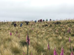
Trampers among the Foxgloves (caption and photo Pam)

Kevin Burke said Ian Fleming’s grace and we then enjoyed the generous pot luck lunch.

Chris Wither told us some Hindon Hall history & her various associations with it during her 38 years living at Hindon.  She mentioned how mice often visited during yoga classes……and yes, one brave mouse came under the door soon after!

15 Dec 1200 Ross Hindon-eating lunch

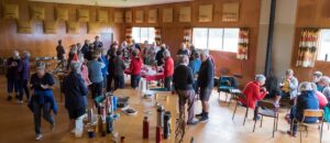
Lunch in the Hindon Hall (caption and photo Ross)

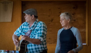
We greatly enjoyed Grant Shackell playing his guitar and singing along with his “blind date” Claire Currie.

15 Dec 1200 Ross Hindon - Claire and Grant

The entertainers – Grant and Claire

15 Dec Pam sing along Hindon Hall resize

Entertainment from Grant and Claire. Interesting woolsacks on the wall from past and present farms in the district (caption and photo Pam)

Thank you both for the wonderful entertainment, and to Jill Dodds and her helpers for organising the food etc.  A very pleasant way to wrap up our tramping year!

Jill Reid

15 Dec screen shot of tramp route

Tramper’s route


2/4/2014 Both. Hindon. Machine Creek. Recently Bathgate, now Cowley Farm. Easy+ Leaders: Ian, Ken

Continue Reading »

One response so far

Oct 12 2019

Black Gully Dam/Careys Creek

Published by under Both Hikers & Trampers

12 clean and dry trampers arrived  with poles and putties at Double Hill carpark(after leaving a car at Evansdale) at 10am ready for this downhill track to Evansdale Glen.  Due to a shower we swapped a layer for a jacket.

We headed off descending through the manuka with views over the gully down to the dam.  (This dark dam along with remaining pipeline was the water supply to the Seacliff Mental Hospital).

P1000335aaresized

Black Gully Dam – Photo Gordon

After the visit to the dam, creek crossings started along this rather rugged, muddy slippery track to a sheltered spot for smoko at 10:30am.

P1000340-resized

Jill doing balancing act at morning tea – Photo – Gordon


By memory the muddy patches  were worse than previous trips, which caused the odd member to slip and have a closer look at the mud!

P1000347 (1)resized

However, it was great to be amongst such lovely healthy native bush, particularly the fushia and ferns.

We continued crossing Carey’s creek  and walking up the creek bed a couple of times for about 50 metres, often negotiating slippery rocks and mud glorious mud!  Our leader managed to find an umbrella of branches at 12:30 for a  half hour lunch break.

P1000350- resized

With the majority of crossings over, the track levelled out and soon we were walking through a grass verged track admiring the lime green willow leaves to the glen.  Careys Creek crossings were counted by 2 members, both arriving at 22.

P1000353-resized

Could have been 23, but we walked over the foot bridge at the end.

After arriving at the glen, drivers raced off ahead to pick up cars and drive us to Blue Skin Nursery cafe for our coffee and cake fix.

As always, we all enjoyed the day.  For 8 of the group it was their 1st time on this track with our club.  We needed jackets on, lucky though, no wind and little rain, mainly drips from the trees.  Must admit the putties, pack and jacket were very muddy and took some scrubbing.  However, the boots were clean.

In Anthony Hamel’s book, he quoted—“This is a rugged and remote area and the track can fall into disrepair.  In 2006 The  Green Hut Track Group did many hours of work on this track”.  Once again it is very pleasing to see they have been back on the job and apart from muddy patches today, the track is in very good condition(with new steps dug in a couple of places).  Thanks for your great effort.

Eleanore and Arthur

No responses yet

Oct 25 2017

Careys Creek track, Black Gully Dam to Evansdale.

Published by under Trampers

Distance from car-park: 40 km

Black Gully Dam. Accessed from Semple Road. Black Gully Dam/Seacliff Dam. Av Time 1 hr; Route. Manager: DOC.
Click https://trtc.blogtown.co.nz/1980/12/14/seacliff-dam-historical-track/ for information on the Creek and pipeline.
Extension of Route to Black Gully Dam/Seacliff Dam. to Honeycomb track  junction. return. 4 hours return. Managed by DOC.
Best done in summer when Careys Creek is low, as there are many crossings. Attractive bush surrounds, which give good shelter from a hot sun.

8. 25/10/2017. Trampers. Black Gully Dam, Careys Creek, Evansdale. M. Leader: Keith.

Nine trampers left the car park and after delivering one vehicle to the tramp end,we left the car park at Semple road at 9.50am.

We made good progress on an times slippery and steepish track and stopped for smoko at 10:15.
As we followed the old pipe line down, the creek crossings became more frequent…

River crossing. (Helen pic and caption.)

 …and the track more muddy.
Lunch was had at 12:15…

Lunch. (Helen pic and caption.)

…and soon after the rain began, so it was on with the coats.

The hairy goat and his kids. (Helen pic and caption.)

Every one was quite wet by the time we got to Evansdale Glen but it was a good tramp and a great coffee at Blueskin cafe.
Distance Semple Rd car park to Evansdale walk bridge 11.6 km – Keith
7. 16/3/2016. Trampers. Black Gully Dam, Careys Creek, Evansdale. Leader: ?
On a day that didn’t promise much weather wise, we had 9 trampers on the Careys Creek tramp. For a change, the women outnumbered the men as well !!!
After doing the car shuttle thing, & having morning tea,

1 Packing up after morning tea (Ken pic and caption)

1 Packing up after morning tea (Ken pic and caption)

we all met up not far down valley from the Black Gully Dam,

2 Black Gully dam (Ken pic and caption)

2 Black Gully dam (Ken pic and caption)

3 Black Gully dam (Ken pic and caption)

3 Black Gully dam (Ken pic and caption)

& continued on at a leisurely pace,

4 track (Ken pic and caption)

4 track (Ken pic and caption)

being careful  of the quite slippery conditions.
The many creek crossings …

5 Crossing the creek (Ken pic and caption)

5 Crossing the creek (Ken pic and caption)

6 An easy crossing (Ken pic and caption)

6 An easy crossing (Ken pic and caption)

… were also treated with great care, as the boulders were mostly treacherous to stand on. It was pleasing to see the new much larger orange triangle track signs that have been installed along the places where it is necessary to walk the riverbed.
We had lunch alongside the creek at a suitable place, & then continued on downstream, where we met up with a quite a large group of Kings High School boys with two supervisors. They were making a lot of noise, & could be heard from some distance away. We spent the rest of the trip mixing with these boys, as they would race ahead, then stop to pick Blackberries, which they were going to make into a Blackberry Pie later that night.
We had some of our group who had not done this tramp before, & all agreed that it was a good day, which most of us finished off with a coffee & chat at Waitati.Walked 11.7km
3.6km/h
3h 13mins
climbed 173m – Ken.

6. 1/10/2014. Trampers. Black Gully Dam, Careys Creek, Evansdale.
Careys Creek track was the destination for this tramp, & 6 trampers turned up for the day out. We drove to Evansdale, & left one car there, & then drove up to the top of the track at Black Gully Dam track. Morning tea was taken at the wooden seat part way down this track just before the steep steps leading down to the creek. The dam was inspected, along with the old hut that is situated there, & then we made our way downstream over the many slippery creek crossings to a late lunch spot, not far from the signposted junction of Rongomai track. We then made our way back out to Evansdale Glen via the ‘new’ track, where two of us left the others to have a spell, & a look around the area, while we went & retrieved the two cars, so we could ferry everybody back to town. Once again, this tramp had not been done by some, & for others it had been a long time [many years] since they had been there, so even although most got wet, or damp feet, it was enjoyed by all, & the weather was brilliant !
We walked 10.8km
2h 45m moving time
ave 3.9km/h
climbed 163m – Ken.
5. 18/9/2013. Trampers. Black Gully Dam, Careys Creek, Evansdale.
Seven trampers gathered at the top of the Careys Creek track after leaving a vehicle at the Evansdale end.  The descent through the bush was pleasant easy going, with a stop to view the Black Gully dam and then another in a patch of sunlight for morning tea, where George shared his birthday goodies.

The creek was low so the numerous crossings were made with dry feet, except for one member who measured her length over slippery rocks and now sports a bruised cheek and knee, not to mention scratched specs.

The party then split, with three opting for an early lunch and the rest pressing on to the Rongomai junction.  Here the others caught up again, for an easy ramble out to the road.  – Judy

4. 26/1/2011. Trampers. Black Gully Dam, Careys Creek, Evansdale. Ken, Ian, Sabina.

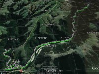
GPS of Careys Creek track route, Semple Road to Evansdale, courtesy Ken.

With two cars between only three of us we nevertheless decided to do a car shuttle between Semple Road and Evansdale and to do the entire Careys Creek track. Ground conditions were wet and slippery, which would have ruled out the steep Honeycomb track anyway.
We were reminded again of just how many and how steep the steps down to the dam were. But they are well benched-in, so not too bad.

One of the more level parts of the track down to the Dam.

We took Sabina up to see the Dam and the slightly greater overflow didn’t auger well for the many creek-crossings and creek-wadings ahead, where the track is just the actual creek-bed. But again, things weren’t too bad.

The Dam waterfall was slightly heavier than usual.

Along the way we met up with several small groups of the Green Hut Track Group. They have almost completed clearing the entire track. Bravo! We were delighted to find several areas modified. These were where difficult parts of the track had, where occasion warranted, been either better benched, stepped or even completely re-routed. Again, bravo!
And then, just past the foot of the Rongomai, behold, a track now mown where  at all possible, all the way down to Evansdale Glen.

An example of the mown track nearer Evansdale.

This had been the first time the club has done the entire 10 km of creek in a long time. And it felt good. – Ian
3. 31/12/2009. Holiday tramp. Black Gully Dam, down Careys Creek some distance and back. 4 hours. Ian, Ken, George.
The weather forecast had promised a fine day but it turned out overcast. Rain on the previous wet day had left the track muddy and slippery necessitating great care not to slip. Exposed parts of the track produced lush rank grass and buttercups, and rain during the day left steep grassy slopes extremely slippery. The track is well-cleared for a considerable distance but from near its highest point and onwards, it was much more heavily overgrown than when we did the recce. First of all, of course, we climbed the track to the old Seacliff dam.
Looking across dam. Ken, George.

Looking across dam. Ken, George.

Dam and overflow.

Dam and overflow.

Peering through foliage to see extent of dam pond.

Peering through foliage to determine extent of dam pond.

Then it was down the Careys Creek old pipe-maintenance track. As mentioned above, this part was well cleared.
Track down Careys Creek. George, Ken.

Track down Careys Creek. George, Ken.

Of course there were very many stream crossings, some entailing a walk quite a distance down the creek before entering the track again. These were well-marked with indicators suspended from branches overhanging the stream-bed.
One of many stream crossings. George, Ken

One of many stream crossings. George, Ken

There was a restriction on time as George had belatedly discovered he had to be back home mid-afternoon, so although we managed a short-notice early 8.15 a.m. setting out, we were unable to make the full distance down to the Honeycomb Track turn-off before having to turn back. A memorable part of the tramp was a (unnoticed at the time but decidedly stinging later on and into the night) brush with some concealed onga-onga, Ken on his left wrist, George on a finger and Ian on his right knee. But all in all, a very enjoyable way to finish the old year off. – Ian
2. 5/12/2009. Recce of Black Gully Dam, Careys Creek, Honeycomb, returned Mountain Road, Semple Road. 5.5 hours. Ian, Keith, Glenis.
Track is well-cleared for most of its length.
The road-walk back is about 8 km.
1. 19/10/1994 Evansdale, Black Gully Dam/Seacliff Dam, Double Hill. Medium. Leaders: Ria L, Marie F, Jack R, Bob H

2 responses so far

Mar 23 2016

Nicols Creek Bridge, Morrisons Burn, Poleline Road, Swampy, Nicols or Pineapple.

Published by under Trampers,Year round

Click Dunedin’s Hills’ History for background information.
Click Swampy ridge track for background information.
Click Pineapple Track for background information.
Click Pineapple and Flagstaff walk for background information.
6. 23/3/2016. Morrisons/Poleline/Swampy/Moon circuit. Leader?
Morrisons Poleline track Swampy Moon track. (Caption/route map courtesy Ken)

Morrisons Poleline track Swampy Moon track. (Caption/route map courtesy Ken)

After cancelling our trip to Leaning Lodge, 7 trampers turned up at the carpark to do the Morrisons/Poleline/Swampy/Moon circuit.
We parked on the Leith Valley Rd. by the entrance to the Glow worm track, then walked up the road to the bridge over the Morrison Burn.
The day started off cool, but fine, & the track condition was quite good. We climbed under the barrier at the locked gate on the bridge at the start, & made our way up to the weir,

1 Curiosity (Ken pic and caption)

1 Curiosity (Ken pic and caption)

then backtracked to where the track went uphill through the bush. After morning tea break,

2 Morning tea (Ken pic and caption)

2 Morning tea (Ken pic and caption)

we carried on until we came across a gravelled road, where we took the wrong way!! We soon discovered our mistake, & walked along the road to where the track started again up through the bush. This eventually led us onto the Poleline track that goes up to the top of Swampy. We had lunch sheltered from the wind by the building at the top of the Leith Saddle track, then retraced our steps back …

3 Fog over Mosgiel from Swampy (Ken pic and caption)

3 Fog over Mosgiel from Swampy (Ken pic and caption)

… to the junction of the Poleline track & the Swampy Ridge track, where we turned off, & made our way along to the top of Moon track. We had a short stop here before heading off down this very badly rutted [damaged by mountain bikes] & rough track into the bush again where there is a multitude of mountain biking tracks, winding back & forward making it hard to know which track to take. So we just kept looking for tracks that went downhill, & eventually we ended up on the Leith Valley Rd. about 150mtrs from the cars.

An interesting day, & a tramp that a few had not done before, & all agreed that it was a good walk.
Walked 12.8km
Ave speed 3.9km/h
Moving time 3h 18min.
Climbed 658mtrs. – Ken.

5. 19/8/2009. Medium.  Morrisons Burn, Morrisons Track, Poleline Road, Swampy, Pineapple, Nicols Creek. Medium. Leaders: Keith and Glenice

Morrisons Burn waterfall
Upper of three water supply weirs

Upper of three water supply weirs

Looking down from weir. Keith, Hazel, Bruce

Looking down from weir. Keith, Hazel, Bruce, Ria

Swampy track south towards Flagstaff

Swampy track south towards Flagstaff

4. 23/1/2008 Morrisons Track, Swampy, Pineapple, Nicols Creek. Leaders: Lex
Greenery on Morrisons Track

Greenery on Morrisons Burn Track


Parking the cars at the Nicols Creek bridge, we walked up the Leith Valley Road to Morrisons at the foot of Stoney Ford slope. We scrambled past the large slip immediately across the footbridge and enjoyed the beautiful bush and moss-clad track up to reach the waterfall. Then the steep scramble up the bank to morning tea on the 4WD at the slope’s top. Along that a bit, and then it was further up, up, up through bush to join the Pole Track 4WD to enjoy lunch where it meets the Swampy Ridge track. Instead of turning down the Nicols Creek track junction when we reached it,


Junction of Swampy with Nicols Creek Tracks. Hazel, Ria, Pat, Ken, Doug M, Lex

Junction of Swampy with Nicols Creek Tracks. Hazel, Ria, Pat, Ken, Doug M, Lex

by common consent Lex took the 10 of us on to the Pineapple Track


Junction Swampy, Pineapple Track. Lex, Ken, Pat, Doug M, Hazel, Wendy

Junction Swampy, Pineapple Track. Lex, Ken, Pat, Doug M, Hazel, Wendy

descent to break away from it further down at a stone cairn to cut across the cocksfoot on the left to the bush edge. This provided heightened interest as it had not been reconnoitred but Lex cleverly located the track that led down through the bush and across back to Nicols Creek track. The day had begun overcast and actually rained a few drops after lunch, but got really hot during our concluding descent to the cars. A good way for it to happen. – Ian

3. 16/1/2008. Trampers. Nicols Creek, Swampy, Morrisons. Medium. Leaders: Lex, Tash.

2. 16/5/2007. Trampers. Morrison Falls. Return Nicols Creek. Moderate. Leaders: Lex, Tash.

1. 15/11/2006. Trampers. MOrrison Track, Pole Track, Swampy. Medium. Leaders: George, Doug J.

One response so far

Sep 10 2014

Outram Glen and Traquair/Whare Creek. Cartwright Track

Published by under Trampers

15/9/2014.
Just been reading some of your website on this short track. You may like to know that when we were talking to the gentleman at the museum last week, he told us that the track was put in to take supplies of piping etc up the burn for the Outram water supply. Also, if you go to the end of that track, & then cross the burn, there is a track up the other side, & up there is a valve, & some old piping. So it seems that the track has nothing to do with the old mill that was there, as it got it’s water from the race that you & I found in the paddocks above the road.
He has some old photos of the area as well, but they are not very good ones. There is also a water wheel [working] at the museum, which I think he said was the old mill wheel. – Ken
10/9/2014. Trampers. Outram Glen & Traquair/Whare Creek.
After a cool start to the day, the weather warmed up, & we had a good walk along the Outram Glen track to Lee stream, [where we discussed the possibilities of crossing the stream without getting very wet] & back. We had a couple of stops along the way, one was with the owner of one of the houses up the Chalkies track road. He tells us that the grumpy one has now gone, & the new owners are quite ok with groups like ours going down [or up] the track through their properties, then down [or up] their driveway. I think permission should still be sought first though, especially for the first time at least.We arrived back at the car for lunch, & then proceeded along to the short track that runs in from the one way bridge at the start of the George King Memorial Drive. this was a new walk for some in the group, & started up a discussion on the old mill that used to be there.
On the way back out, we decided to go up into the museum grounds, as this was also new for some in the party. We struck up a good conversation with one of the gentlemen working on the site, & he was most helpful with info on the old mill, it’s whereabouts, & where to find some old relics.
We arrived back at the carpark, just before the hikers returned.We walked approx 12.5km  [didn’t take the GPS on the short track.]
ave. 4.2km/hr. – Ken.
5/5/2012. Whare Creek Outram Council weir. Ken and Ian.
On a fine Monday afternoon and with permission and advice from the landowners, we explored down the bush track below the power lines to arrive at the water race that supplied the water that drove the old Outram Glen Flour Mill back in the early 20th Century.

The Outram Glen Flour Mill water race.

Following the pink markers brought us to the point leading steeply down below the race to the creek and a weir. From Jim Sime’s later information, this was the Outram Council’s weir and pipe line to supply water for the Outram Water Supply tank, located above the Taieri Museum, now no longer in use. The weir was designed so that flood debris would wash right over it.

Old Outram Council Weir and piping, no longer in use.

Mr Sime said that the Flour Mill water race, higher up the bank, which he explored on an earlier occasion, leads on for a considerable distance to disappear at the face of a rock bluff, with no indication evident of how the fluming would have had to have been attached to the sheer rock. Mr Sime thinks that a pool yet further upstream at a streams’ confluence may well have been where the race might have begun.

Ken at the weir.

Ken pic. Upstream from the weir, the creek winds round to the left.


18/4/2012. Trampers. Outram Glen & Traquair/Whare Creek.

GPS of two routes taken, courtesy Ken.

Seven of us took to the Outram Glen – Lee Stream track on an overcast & cool morning. We decided to have morning tea at Lee Stream, so we set off at a good pace, & we soon warmed up. The sun was out at Lee Stream, so a leisurely break was in order. We made our way back to the glen where we had lunch, & then we moved the cars down to the Traquair Burn bridge.
We made the short walk to the start of the Traquair Burn track & along this to the end, where we did a bit of exploring up the small tributary stream on the left. This quickly ran out of easily negotiated terrain, so we went back to the track end, & Ken went exploring up the Burn a bit further to see if it was possible to go upstream.
We returned to the cars via the Outram machinery museum grounds, where we had a good look around. – Ken
23/4/2008. Trampers. Outram Glen & Traquair/Whare Creek.
Arrived at Lee Stream

Arrived at Lee Stream

Six trampers turned up at the car-park following a very stormy night to learn that the leaders, Ria and Hazel had, happily as it turned out, decided on Outram Glen instead of Whare Flat. They had carried out three Whare Flat recces only to find on each occasion tracks too overgrown to clear. We were delighted to find the reported upgrade of the initial flat (mostly) part of the Outram Glen track had been widened and metalled making for two-abreast walking. The remaining steeper bit however was literally, according to a DoC notice, “maintained to only route standard”. It was! But we made good progress arriving at the Lee Stream terminus at 11. It was there that Doug and Hazel discovered wild potatoes

Gathering potatoes

Gathering potatoes near Lee Stream outlet.

Bush by Traquair Creek

Bush by Traquair Creek

of a very good size which Doug lugged back down the track for his meal table.
We lunched below the Taieri Historical Museum area prior to exploring a newly-cleared track up alongside the Traquair (or Whare) Stream – a new discovery for most of the group. Ian recounted how his Grandfather and family had owned the Flour Mill in a small area across the stream from 1911-1913 (the original Outram Glen), now buried under the present road corner alignment: a place once renowned for its gardens and picnic area for locals. Two houses, a mill, a fountain and an electric generator (which had earlier powered Outram’s street lights) as well as gardens had occupied the area. The buildings were destroyed by fire in 1918.

Fallen coloured deciduous leaves on an open area of the track would have kindled a painter’s imagination. We returned from where the track finally petered out, left wondering where it might have continued to in the past. Another satisfying day. – Ian

23/4/2008 Leaders: Ria L, Hazel

No responses yet

Nov 09 2011

Nicols Creek, Swampy Saddle, Davies Track

Published by under Trampers,Year round

Click Dunedin’s Hills’ History for background information.
Click Swampy ridge track for background information.
Click Pineapple Track for background information.
Click Pineapple and Flagstaff walk for background information.
No. 17 on old hardcopy list of 113 club tramps. “Nicols Creek. D McCabe. Year Round”
 Year round.
Nicols Creek circuit Maintained by Green Hut Track Group.
DCC  land.


9/11/2011. Trampers. Booth Road, Davies (formerly Warburton), Swampy Saddle, Nicols Creek.
Nine of us met at Booth Road. We entered Davies Track via McGoun this time, exiting it on the left a short way up past the cairn. A light shower came on during the bush section, sounding quite pleasant as it struck the leaves overhead. Out in the tussock at the top, the weather was clear again. Ria and Hazel had discovered a new track had been made above the bush, this time striking to the left instead of the one to the left, the one that got several of us lost last time where overgrowth had rendered a crucial turn invisible.
We emerged on the Flagstaff walkway above a rock outcrop and headed down to the top of the Pineapple. Here Gay, a visitor, left us and we continued along Swampy Ridge to the top of the Nicols/Moonlight track. A little way in and we found the track has been ruined by mountain bike wheels cutting a narrow deep groove down the track middle, making keeping our footing on the restricted track-sides difficult and dangerous. Further down, we kept to the Moonlight side of Nicols Creek and traced, where we could, the original track, bisected however by the zigzags of the mountain bike route. Rain now really set in and we sheltered in nearby bush for lunch. We then continued down the old track, through the macrocarpas, the stone outcrop and yet further carefully down to emerge at the creek crossing below the waterfall – to Ian’s delight but Ria’s chagrin who had hoped to emerge onto the Leith Valley road on the north side instead of now forced across to the other side. So it was down and out and up Islay St back to the cars. All felt it had been another good day out. Too dull and showery for photo opportunities however. – Ian.
14/11/2007. Trampers. Woodhaugh, Ross Creek, Davies, Pineapple, Ross Creek return. Moderate. Leaders: Ria, Hazel.
Stream crossing. Doug, George, Peter, Wendy

Stream crossing. Doug, George, Peter, Wendy

The route Ria and Hazel took ten of us on provided plenty of variety both in scenery and weather. We approached Davies track by way of Ross Creek Reservoir from Woodhaugh. After Ross Creek it was through cleared forest before climbing through secondary growth …

Tea break. Wendy, Keith, George, Doug, Peter, Glenice

Tea break. Wendy, Keith, George, Doug, Peter, Glenice

… on the foothill slopes of Flagstaff before entering beautiful native forest and and hour later emerging on Flagstaff’s tussock and flax with overcast views of the harbour and Dunedin both north and south. We had encountered occasional showers to this point and now out on the tussock it was turning really cold. We were still not prepared upon reaching the upper Pineapple-Flagstaff track …

Made it onto Pineapple. Ria, Sabina, Glenice, George, Keith

Made it onto Pineapple. Ria, Sabina, Glenice, George, Keith

… to be pelted by a fierce but fortunately brief hail storm. We quickly made our way down to the junction with the Swampy Ridge track where now the hail had now been …

Snow. Doug, George, Sabina, Keith, Glenice

Snow. Doug, George, Sabina, Keith, Glenice

… replaced with snow. So it was down, down the Pineapple to the sheltered edge of the bush where we lunched in the now fitful sunshine. Then the bush, Booth Road, back through Ross Creek tracks and down past the reservoir until the last scenic bush gave way to Woodhaugh St and back to the cars. An interesting day. – Ian

In Leith Valley, where Otago’s first industry – sawmilling – is reputed to have started about the 1860s, is the start of the old Pineapple Track.
Originally, it was named Ross Track, after Archibald Hilson Ross, who owned most of the land in the vicinity. In the early 1920s, Mr Oscar Balk, first president of the Otago Tramping Club, led parties of trampers up this route. At the top of a rather steep section, the parties would stop to rest and often refresh themselves with a tin of pineapple. This tin was sometimes left hanging on a tree or fence, and the track came to be called the Pineapple Track.
The line of the Pineapple Walkway has deviated from the original track in places to provide more scenic variation.
The original vegetation of the area has been modified as a result of early milling, burning and stock grazing, but remnants of the milled species (podocarps) still remain. Rimu, miro, totara and matai are found in isolated pockets, mainly in damp gullies. Even so, the overall distribution of plant species retains some semblance of natural order with the larger forest trees growing at lower altitudes. Podocarp broad-leaved forest type occurs with shrub species which grade out into Dracophyllum shrub land and ultimately tussock grassland communities on the summit area.
Some common plants: fuchsia, pepper tree, lemonwood, broadleaf, totara, five’finger, wineberry, lancewood, Muehlenbeckia, Dracophyllum, Coprosma, Hebe, and wild spaniard tussock.
There are many varieties of birds in the bush areas where there is an ample food supply to sustain many nectar-, berry-, and insect-eating native birds.
Some of these are: New Zealand pigeon, bellbird, fantail, tomtit, brown creeper, tui, silvereye, rifleman and pipit.

17/10/2001. Trampers. Nicols Creek – Swampy Saddle – Warburton Track. Leaders: Lex, Mary L, Irene.

No responses yet

Next »