Cape Saunders Lighthouse

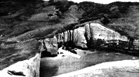
Cape Saunders Lighthouse and the grave of the two children.

“Cape Saunders on the Otago Peninsula, was named by Captain James Cook after Sir Charles Saunders, the First Lord of the Admiralty, the commander of the fleet which captured Quebec in 1759.

Early shipping into the town of Dunedin via Port Chalmers was hindered because of the lack of lighthouses marking the harbour on the peninsula so often ships arriving from England sailed past the harbour entrance and headed further north. It was not uncommon during the 1850s for ships to spend days searching for the harbour entrance and the Otago Provincial Council recognized the importance of lights so in 1863 appointed James Balfour as Provincial Marine Engineer. It was not before time as in 1860 only 60 vessels had arrived at the port but by 1863 this had increased to 983.

Balfour arrived from Scotland later in 1863 with both the lantern forTaiaroa Head and Cape Saunders (the lanterns from Scotland and lens from France respectably). He immediately set to work designing his first lighthouse for the council at Taiaroa Head and this light was lit on 2 January, 1865. The original light was red to distinguish itself from the proposed light at Cape Saunders.

Meanwhile the Otago Provincial Council had begun planning the lighthouse at Cape Saunders, buying land off the local Maori at a place called Kaimata in 1862 but a lack of funds halted the project.

So the Provincial Government erected a 12 foot white stone beacon on the Cape in 1868. But this proved to be totally inadequate for the job as ships often steamed pass the harbour entrance not having seen the beacon.

The Otago Daily Times was to report on January 13 1865, that the Cape Saunders Light apparatus was displayed at the first New Zealand Exhibition in Dunedin.

After the Marine Board was formed in 1862, James Balfour was appointed Colonial Marine Engineer in 1866 when this board was changed to the Marine Department.

By now the light equipment for Cape Saunders was still idle so it was used at Nugget Point which was lit in 1870.

In 1875, the Marine Department led by John Blackett and Captain Johnson, decided to build a new light at nearby Matakitaki Point which had easier access and was not so exposed to fog. This 28 foot wooden tower similar in design to Akaroa was constructed in 1878 and the light was first lit on 1 January, 1880.

The first Head Keeper was James Nelson, who was transferred from The Brothers lighthouse.

Tragedy was to plague the lighthouse in it’s first few years. In December 1882 Mr. Nelson’s wife died suddenly. As the youngest child of the family was only 20 months old, the Marine Department granted the keepers request to transfer out of the Department into the Customs Department. But before he was transferred on March 19, 1883, the two year old daughter of the Assistant Keeper (Patrick Henaghan) and the youngest child of the Mr. Nelson died when the cow shed they were playing in caught fire. Later another child died of illness and six months later, the son of the new Head Keeper fell over the cliff and broke his wrist.

The wooden tower was replaced in 1954 by a steel latticework tower and a new mains powered electric beacon. However, this tower didn’t  last due to salt water corrosion and was replaced again in 1967 with the old lantern room from Kaipara Lighthouse.

The light was fully automated in April 1980.

In June of 2006, the lighthouse was again replaced, this time with a modern aluminum tower. The backup diesel generator was removed and new battery pack was installed to supply backup power if the mains power fails.

The old Kaipara Head lantern room has been sent back to Kaipara where it will be restored.

The lens and lighting equipment is displayed at the Port Chalmers Museum.

DIRECTIONS:

Situated on the Otago Peninsula. Currently a restricted area on private land.

A modern aluminum tower is now in use.

– Extracted from NEW ZEALAND LIGHTHOUSES, Cape Saunders (1880)  NZ Lighthouses Text and photographs. Copyright © 1999-2009  Mark Phillips. All rights reserved.

Ben Rudd

Ben Rudd Property and the Otago Tramping Club Inc

Ben, a gardener of repute in Dunedin at the turn of the century, owned and farmed land at the top of Rudds Road, from 1890 to 1919. In 1919 he sold his farm and retired for a short period to Dunedin city. Finding urban life unbearable, in 1921 he purchased a 45 ha block of land on the northern flank of Flagstaff and lived on this property until he died in 1930 at the age of 76. Ben was intolerant of trespassers, claiming at onetime that up to 100 trespassers a week were causing him considerable annoyance and damaging the property.

In 1923 a party from the newly formed Otago Tramping Club was “warned off” by Ben Rudd. One of those in the party descried “the feelings of alarm as they encountered the stocky bearded little man with the shot-gun.” Despite the initial antipathy, Ben Rudd eventually established very good relations with the club. To help prevent further trespassing the Club paid him £5.00 to cut a track round his property.

Ben Rudd died in 1930 and his property was bought by the club in 1946. The club’s committee learned only by chance that the Rudd property was available, significantly, as it was probably the only property in the area not already owned or spoken for by the Dunedin City Corporation.

The transaction, although undertaken by the committee without reference to the general membership was enthusiastically endorsed at the next AGM. The money for the purchase was loaned by Mr W Stevenson, who later refused to accept repayment; a generous gesture that has long been appreciated.

– From the clubs Friend of Ben Rudd’s Certificate.

Where tussock begins …

Mt Flagstaff keeps vigil on our city. In time of rain it hides away. Settlers knew the area, one more so than most: Rudd by surname and solitude an aim.

Before exile, the English-born migrant learned his craft well – from all accounts. Dunedin Town had no better gardener.

After first urban years Ben Rudd settled 40 acres at Flagstaff where a byway signifies his title. Any dwelling has gone, though relics are visible. Picture a wee man living rough up yonder, wild pig as meat for the pot, with a rabbit or two when empty; like hermits of old, contented alone.

Farm development kept Mr Rudd busy in mid-life. Stock were grazed instead of tillage, for nature could zap the best of crops. Snow lay early on Flagstaff and often stayed late. While horse and foot were modus operandi people riled him less, but as Dunedin grew and travel improved bother came along.

Legends tell of youth driven off by an ancient scattergun fired at random; also of a rare journey from Kaikorai Valley to the “smoke” by cable car. Pint-sized Ben fell out with a mammoth Edwardian dandy; temper ablaze he swung on the man’s watch chain, kicking shins like a demented elf!

Photographs reveal Ben’s Place lay near the summit route, which could often bring intruders. An assault and trespassing lawsuit of 1907 confirms the trend. On finding a picnic circle with billy aglow Ben took offence – combat with a younger bloke left him second best. Later court action yielded a shilling and costs were allowed.

This highlighted years of hostility on access matters.

Much dirty linen was aired in court of prior violence. While oft provoked Ben had an obsession about his rights worthy of King Canute.

Increasingly unwell he battled on for another 12 years, selling in 1919. Life in Dunedin had less appeal, however, and 18 months saw him back at Flagstaff camped near his late abode.

Illness finally overtook him at the public hospital. He died in February 1930, aged 76 years.

Tramping Club members are said to have tended his old patch for some time after.

Footnote: Eighty-odd years ago much of Flagstaff and Whare Flat comprised small farms. These have since been purchased by the city. You can wander safely now, apart from trail bikes! – Dunedin Star Midweek,24/5/1995. Community News. Peter McLauchlan’s Sketchbook. With Bill Brosnan.

Installation and Dedication of the Linda Mercier Memorial Seat.

The crowd met on Saturday 20 April 2002 at the Bullring and made light work of carrying the materials pre-built by Peter Mason to Ben Rudd’s hut site. A contingent from the Merciers arrived at lung time to catch the last of the installation process for the large durable seat. Everyone, including the children, helped, and a track was put in to the site, which will command a spendid view from the beech trees.

1930s

Old Ben eased back to rest on the slope beside his home and wipes away the sweat from his face. Funny how snowgrass seedheads are always tickling your face no matter where you sit, he thinks, as he watches the sunset glow extending right over Silver Peak. Crunching the last of this year’s gooseberries from his garden, he thinks of the stupid boys from school a few decades ago who taunted him about his size, who made him just want to spend his life alone. No pests up here in his little piece of heaven. Time to turn in. More track cutting tomorrow for those trampers, he thinks, then I’ll put on my best jacket and go into that blasted Dunedin for supplies. He hangs his rough old coat on the three-prong coat hook screwed into the rafter by the door, gets his fire going from the lunch-time embers and begins to cook up his tea. This lis life, he thinks. Day to day peace.

Early 1950s

Old Ben has gone, but his home remains, lovingly maintained by his old friends in the OTC. They never ever got to really know the old chap, but they all admired him. There’s a bit of broom climbing the hill into the tussock. SOmething Ben would have see off. “All in a day’s work” as he would have muttered to himself. It’s a pleasant day and the place is peaceful as usual until two stupid boys from school show up among the tussock from the Flagstaff summit. “Hey, nobody around. Let’s have a look inside to see if ther’s any gold. The old hermit was probably a miner.” “Don’t be stupid. No gold here.” “Hey, look at the old coat hook up on the rafter. Bet I can swing on it.” There’s a groan of timber, and the old rafter begins to shift.  The old man’s home can’t stand too much of this treatment. Luckily for the rafter, the screws in the three-prong coat hook let go and the kid falls, laughing, on the floor, although he’s hurt himself. The other one, having fnished carving his hame, is really amused. Great to see someone else hurt, eh? The boy gets to his feet and yells at the coat hook in his hand as if his fall was all its fault. He steps outside. Flings the offending article up the hill into the flax.

2000s

Just another work day by those trampers and mountaineers from the OTMC. It’s still a peaceful spot, although the stupid boys from school still cannot leave Ben alone. They have tried toburn down the shelter that replaces his home, and continue to leave their names and obscenities as only stupid boys can. It’s a working party today, though, in a group that bears his name with pride: “The Friends of Ben Rudds”, installing a seat at the point where you can still see that treasured view of Ben’s. It’s misty, but the folk caatch a glimpse of Silver Peak every so often. One of the workers, digging out a hole for one of the four seat legs, uncovers a three-prong coat hook from among the broom roots … and, wiping away the sweat from his face, wonders about its history.

– From Ben Rudd’s Management Trust Friends of Ben Rudd’s Newsletter, No. 9

The shelter site with Linda’s seat, Ben Rudd’s house site, the Bruce Campbell beech trees and the remains of Ben’s garden is of interest …. The majority of the beech trees were planted and more pig damage to former plantings was undone. The ground in fromt of the Linda Mercier seat was raised and secured and the Shelter’s fireplace with its concrete slab was demolished and/or buried under soil and turf. The shelter was cleaned out. Some of the worst snow damage on the track was tidied up. A permit is required for every fire on the property, including any billy-boiling at the shelter.

– From Ben Rudd’s Management Trust Friends of Ben Rudd’s Newsletter, No.11

Nicols Creek Glow-worms

Glow-worm display spectacular

One evening recently a group of boy scouts visiting Nicols Creek was privileged to see the 17m high waterfall illuminated misty white by the light of myriads of glow-worms occupying the surrounding walls.

Nicols Creek is a shady bush streamlet that formerly entered the water of Leith just above Woodhaugh, Dunedin.

The water is very pure and is piped at the lower end and connected to the Dunedin water supply.

A short way into the valley the streamlet drops over four large waterfalls. The first is pretty and quite spectacular – a sheer drop over a high moss-green wall of rock surrounded by native forest.

After dark there is a spectacular and beautiful display of glow-worms on the walls of the first gorge. Glow-worms also occur in fewer numbers within sight of the falls. (The large numbers present during our recent visit was unusual).

Last century, this waterfall was one of New Zealand’s better-known scenic attractions. Today it is virtually forgotten. This is a good thing in some ways because it has enabled the native vegetation to revert to almost its former condition.

The light in the glow-worm Arachnocampa luminosa, is produced in the tail of a legless fly larva. The larva lives inside a flexible tube to which are suspended 20 to 40 threads strung with sticky globules that resemble a string of beads. These are “fishing lines”. Small flying insects such as gnats, attracted to the glow-worm’s light, bump into the hanging threads and get caught.

When it feels the tug, the glow-worm glides along its tube to the relevant line and quickly draws it in. It eats the insect rapidly.

Glow-worm eggs are small and spherical. The larva emits a bright light immediately after it hatches from the egg. It finds a place to build a tubular nest, then lets down sticky fishing lines. After about nine months when it is 30mm long, it changes into a pupa. The pupal period lasts from 12 to 13 days. All stages except the egg can glow.

– Nature file, Otago Museum, Anthony Harris, 16/5/1994. Newspaper cutting.

Leith Saddle Boardwalk – Jack Merrilees

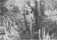
Jack carrying timber

Left: Taieri Recreational Tramping Club member Jack Merrilees with some material for the track.

The Ministry of Youth Affairs Conservation Corps based with the DOC filed Centre in Dunedin has been making steady progress on the boardwalk to the Leith Saddle. When completed this boardwalk will be about 1.6km in length and pass through unique forest featuring miro, rimu and the mountain cedar.

The logistics of carrying the timber up the ridge to the work site is a major obstacle to speedy progress. Recently however this task has been made lighter through the voluntary efforts of some local tramping clubs.

The corps is especially indebted to the WEA over 50s tramping club and the Taieri Recreational Tramping Group members who carried tonnes of timber up the boardwalk to the work site over two work days recently.

Thanks also to the generous contributions of two major Dunedin businesses, training funding  from the Ministry of Youth Affairs and expert help and materials from Department of Conservation Field Centre. Soon interpretation plaques will be in place, a contribution from a major sponsor. Some sponsorship is still needed to complete the boardwalk. Please contact David Blair, Department of Conservation, Dunedin. – Dunedin Star Midweek, Wed 7/4/1993

Walk down Lake Roxburgh

A walk containing the largest number and best preserved examples of Chinese rock shelters in Otago
runs between Alexandra and Roxburgh.
Depending on how far you want to travel along the walk and how much time you want to spend exploring the gold workings, the route can take anything from half a day to an overnight trip.
The walk is a round trip down Lake Roxburgh and returns via Shanty Creek and the original Knobbie Range road from Roxburgh to Alexandra.
No special equipment is needed apart from good walking shoes, a day pack with food and drink and a parka. The walk is unsuitable for young children and the not-so-able.
To get to the start of the walk, cross the road-rail bridge from Alexandra and walk south to Sanders’ Orchard. Walk around the orchard’s top outside fence to the old Graveyard Gully pioneer cemetery where you will see the walk.
The track follows an old bridle track for the first few kilometres, and there is a similar bridle track with reveted rock walls on the opposite bank. These paths were constructed in the 1880s to supply coal to gold dredges working the river.
In the first 4km to Butcher’s Point there are only a few rock shelters and huts, most in a ruined state.
The vegetation is mainly thyme covering the rocky slopes, and also some sweet brier and matagouri. Poplars mark the locations of early habitation sites.
COLEMAN’S CREEK
Just before Coleman’s Creek, the track comes to two huts, “leaky Lodge” and “Mary Ann’s”. Downstream of the creek is a complex of tailings, water races and rammed earth and stone dam.
The Coleman’s Creek workings make a good turning-back point for walkers with limited time and energy. About 1km below Butcher’s Point is the Narrows, which used to be the site of a big rapid in the river. Beyond this the river widens out to the Island Basin.
There are numerous rock shelters and stone huts in this section of the walk. One of the more notable is “Jimmy Richardson’s” at the end of the Island Basin.
A puzzling feature in this area is the large concrete posts set at regular intervals down the gorge. These mark the location of profiles of the lake bed, used to measure the amount of silting of the lake.
Next a bluff falls into the lake, and the route traverses a series of ledges and aimal tracks through this bluff. The “Maltese Cross” cottage is the next hut, located in a grove of tall poplars. Behid this is a rock shelter known as “Blackman’s Cave”.
GRUBSTAKE
At least two hours are needed to explore the Doctor’s Point workings. The area was originally worked in the 1880s and again in the 1930s when the Government introduced a subsidised relief scheme to grubstake gold mining.
Many of the original huts and rock shelters were upgraded by the 80 minders who worked the gorge during the Depression.
The lower workings consist of a formation of parallel stacked tailings. Water for the sluicing was conveyed to the site by two stone races from Shanty Creek. Above the workings is a rammed earth holding dam with stone buttresses that looks like a fort viewed from the lake-shore.
Near the lake are three stone huts, still in good condition. Upstream is an eel-smoking chimney.
The upper workings consist of tunnels (now collapsed) with their spoil dumps and tip heads. A cable-way, steel  rails and a wooden slide remain. There is also a blacksmith’s forge site.
Past Doctor’s Point at Shanty Creek is a hut that sleeps four.
From the hut is a four-wheel-drive track that meets the old Knobbie Range wago road. This was the original road between Roxburgh and Alexandra before the present west bank route was constructed in the 1870s. It is impossible for ordinary cars.
From the Shanty Creek ford the track climbs up to a plateau of rock-strewn landscape. This is the dry heart of Central Otago, stark and barren to some, but with its own beauty. It is certainly a unique landscape.
Over the top, the track drops 400m on a gentle grade back down to the graveyard. There are extensive views of the Clyde-Alexandra basin from the track. It is easy to imagine the excitement of the “diggers” in 1862 when, after an arduous journey from the Tuapeka, they came across the same view of the Dunstan goldfield.
Lower down, the track passes through a belt of rabbit-devastated country with bare eroded ground between circular mats of scrubweed.
– Part cut-out. Page 10 – Section 4, Otago Daily Times, Friday December 1. (No year noted! – would have been after 1990.)
Headed:
Alexandra – Millers Flat.
Recreate historic past.

Racemans Track, Weir, Origins

In 1876 a report was written for the Dunedin City Council outlining the various options available for the supply of water to the low-lying areas in the city. The two options available were the Leith Valley supply which was to be very expensive, or the Silverstream supply which would be cheap and effective but would supply water to only the low levels.

In December 1877, during the on-going debate over the two systems there came a dry spell and Ross Creek Reservoir was so low that a fire in the city drained the reservoir. This incident served to motivate a decision and in December 1877 the Silverstream project was decided on.

By 1880 13 miles of water race was constructed out of a total of 18 miles and in 1881 it consisted of 29 km of winding open earth ditch 3 to 4 feet across, timber sluices, tunnels, weirs and steel pipes. It began at the top weir on Silver Stream and wound around the western slopes of Swampy Summit, Flagstaff and Three Mile Hill to the Southern Reservoir in Kaikorai Valley. It was opened on 15th December, 1881. All eastern tributaries of Silver Stream from the top weir to the Three Mile Hill Road were diverted into the open race by small masonry inlets.

Water shortages still recurred from time to time and it was soon found that the Silverstream scheme was not as wonderful as previously thought. In times of heavy rain the open water-race could not cope with the volume of water while there was not enough storage at the Southern Reservoir for a long period of heavy draw-off.

In 1895 it was decided that additional pumping and storage was required. The final location for a pumping station was at Powder Creek. In 1920 an electric pump was installed at the bottom weir, pumping water up a pipeline and into the water-race when needed. Apart from in 1890, it was not used again until 1928. By 1933 the population growth and the increase in water use made it practical to appoint a full-time attendant at the pumping station.

Since the early 1940s, land subsidence and the need for constant maintenance resulted in much of the open water-race being replaced with pipeline. The water-race in this area of tracks was the only major part that was not piped. Following a severe flood in 1957, the water-race above the pumping station was closed. After this, water for the race was pumped from the pumping station directly up the hill into the open water race.

The Silver Stream Water-Race was abandoned in the late 1960s. The current pumping station moves water along a buried pipeline following a new route to the Southern Reservoir.

In the late 1980s the Track Clearing Group began to re-open and develop the Silver Stream Water-Race Tracks. This group, with the assistance from the WEA over 50s Tramping Club continues to do great work in maintaining these tracks. The late Steve Amies was the founder of both groups and instrumental in re-opening the tracks.

Other matters receiving attention during this time were the afforestation of the water reserves and the detection and prevention of pollution. Considerable planting was done around the Leith and Silverstream catchments. The aim of this policy was commercial as well as functional. It was claimed that afforestation kept down noxious weeds, kept the area free from stock and rabbits, and increased the efficiency of the area as a water catchment as well as increasing the beauty of the country.

Since 1948 the open water race has been progressively replaced with a pipeline. The catchment lies to the West of the Flagstaff-Silverpeak divide, and comprises 4275 hectares which is largely council owned with much of it in native bush, some in tussock and some in exotic plantation.

– Adapted From City Forests Ltd hard copy information sheet and DoC Silver Stream Water-Race Tracks.

Pineapple Track: Information

In Leith Valley, where Otago’s first industry – sawmilling – is reputed to have started about the 1860s, is the start of the old Pineapple Track.
Originally, it was named Ross Track, after Archibald Hilson Ross, who owned most of the land in the vicinity. In the early 1920s, Mr Oscar Balk, first president of the Otago Tramping Club, led parties of trampers up this route. At the top of a rather steep section, the parties would stop to rest and often refresh themselves with a tin of pineapple. This tin was sometimes left hanging on a tree or fence, and the track came to be called the Pineapple Track.
The line of the Pineapple Walkway has deviated from the original track in places to provide more scenic variation.
The original vegetation of the area has been modified as a result of early milling, burning and stock grazing, but remnants of the milled species (podocarps) still remain. Rimu, miro, totara and matai are found in isolated pockets, mainly in damp gullies. Even so, the overall distribution of plant species retains some semblance of natural order with the larger forest trees growing at lower altitudes. Podocarp broad-leaved forest type occurs with shrub species which grade out into Dracophyllum shrub land and ultimately tussock grassland communities on the summit area.
Some common plants: fuchsia, pepper tree, lemonwood, broadleaf, totara, five’finger, wineberry, lancewood, Muehlenbeckia, Dracophyllum, Coprosma, Hebe, and wild spaniard tussock.
THere are many varieties of birds in the bush areas where there is an ample food supply to sustain many nectar-, berry-, and insect-eating native birds.
Some of these are: New Zealand pigeon, bellbird, fantail, tomtit, brown creeper, tui, silvereye, rifleman and pipit.

Grahams Bush Botanical Information (1988)

A top-down description:
From across the Old Mount Cargill Road from the Organ Pipes track entrance, the top section of the walk is very steep, but now relieved by an excellent set of steps. For much of the descent into the gully the walk passes through dense stands of manuka and kanuka. Both have small pointed leaves. Most of the trees are of even size and height. This implies they are even aged and grew up at about the same time. Equally important is the fact that no young kanuka is growing beneath the adult trees. In places many other species of native trees and fauna are growing. This is because kanuka seed needs light to germinate and not enough filters through the canopy. Other seed such as lemonwood is not so light-demanding. These young plants will eventually grow up through the kanuka to become a new forest canopy.
The widespread dominance of the blotchy-leaved pepperwood tells us more of the forest’s history. It is very unpalatable to stock and generally thrives when stock eats out the other plant species. Until recently stock have been common in this bush.

It is also interesting to note how dry this slope is. This stands in sharp contrast to the cooler gully at the bottom of the hill. A bridge spans the creek here, about 20-30 minutes from the carpark. Beyond this are more mature patches of forest.

Fuchsia (with orange bark) predominates in this valley, while little kanuka can been seen. A good variety of ferns thrive here in the moist conditions, the most distinctive of which are the tall tree ferns. The one with milky-coloured frond stalks is the silver tree fern.

Just 2-3 minutes beyond the bridge is a clearing. From it the hill just descended is apparent. More of the story becomes obvious. The whole hillside is of an even aged kanuka. Above nearer the road one sees old macrocarpas.

Kanuka and manuka often thrive after fire or in areas cleared either by humans or nature. Could it be that this hillside was once cleared, and that maybe the macrocarpas indicate an old homestead site – a base for a farm now abandoned and reverting to native forest?

In such a role kanuka is a successional species; i.e. it thrives after disturbance allows light into the forest floor. In time it gets over-topped by other forest species and becomes replaced with more mature forest.

An example of this mature forest that once covered this hill and what will once again be seen is 10 minutes further down the track.

One cannot fail to be impressed by the huge boles in the rimus (with hammer bark) and miros (with soft green leaves and dark mossy trunks). These giants are survivors of a once extensive podocarp forest that covered most of the Dunedin district. Fortunately their poor shape precluded their being logged for timber and consequently they now serve as a seed source to re-vegetate the reserve in podocarps. The dominant trees forming the forest canopy in this area are kanuka.

A second small patch of these trees occurs a little below the second bridge. Beyond them further evidence of the impact of humans on the area is seen – hawthorns growing in the forest! These exotic trees from Europe add a new shade of green to the forest each spring. Being deciduous, like so many continental trees, they lose their leaves in summer and grow a new set in spring. In New Zealand the only common tree with this habit is the fuchsia – the orange shaggy-bark trees. Like kanuka, fuchsia is one of those successional species. Their roles are very similar but they fill them in different locations – fuchsia preferring damper cooler sites.

– Adapted from DoC hard-copy information sheet

Town Belt Article

The Town Belt is a green belt which surrounds the centre of the New Zealand city of Dunedin. Covering a total of over 200 hectares (490 acres), it extends around three sides of the city’s centre at a distance from it of some 1-3 km (1-2 mi) in a broad 7 km (4 mi) crescent from the Oval at Kensington in the south through the suburbs of Mornington, City Rise, Belleknowes, Roslyn, Maori Hill, Prospect Park, Glenleith, Woodhaugh, The Gardens and Dunedin North and the slopes of Signal Hill. The fourth side of the central city is bounded by the Otago Harbour.

One of the world’s oldest green belts, the Town Belt was planned in Scotland at the time of the advent of the Otago settlement in 1848.[1] Residential areas outside the belt became separate boroughs, and were not amalgamated with Dunedin until much later. The town belt now forms a break between the city’s inner and outer suburbs. The belt was originally a combination of native bush and scrubland, but is now largely replanted forest and open parkland. Many species of plant can be found in the belt, including tree fuchsia, lemonwood, lancewood, manuka, and broadleaf, and the forested area is home to many species of birds, including some uncommon and endangered species such as the kereru, eastern rosella, bellbird, tomtit, tui, rifleman, morepork, and shining cuckoo, and kotare.

A long, narrow road, Queens Drive, winds along much of the length of the belt and provides easy access to it for Dunedinites. Queens Drive is linked to many of the city’s main streets, including Stuart Street and High Street. Numerous walkways lead through the bush and parks, and the belt is a popular recreation area for Dunedinites.

The Town Belt includes many open areas and parks, including the Kensington Oval, Dunedin Southern Cemetery, Montecillo Ground, Unity Park, Mornington Ground, Jubilee Park, Belleknowes Golf Course, Robin Hood Park, Littlebourne Ground, Prospect Park, Woodhaugh Gardens, the North Ground, Dunedin Botanic Gardens, Dunedin Northern Cemetery, Logan Park, and the University Oval.

Notable buildings and structures in the belt include Moana Pool, Olveston, Otago Boys’ High School, and the Beverly-Begg Observatory.

– From Wikipedia.

Quarantine Island: Botanical Report

P N Johnson, Botany Division, DSIR, Dunedin March 1987

Quarantine Island has a fenced 1.4 ha of low Halls totara – broadleaved forest in excellent condition, plus other native scrub and coastal communities. …

Quarantine and Goat Islands owe their origin to former spurs drowned with the sinking of valleys now occupied by Otago Harbour. Both were used for quarantine purposes in early days of European settlement, and are Crown Land, formerly managed by Health Department. Goat Island has now largely reverted to native low forest and scrub. … Quarantine Island is leased to the St Martins Island community, who maintain a house and other buildings on the eastern headland, and graze sheep over most of the island, except in a fenced-off portion of bush, facing south at the western end. Historical remnants persist in the form of one of the old quarantine buildings, a small graveyard, chimney and flagpole remnants and old wrecks at the boat landing. The island is c. 17 ha in area, and reaches 58 m at its summit. There are two pylons on the crest, carrying electricity from Port Chalmers to Portobello.

Broadleaved – totara forest. This comprises most of the c. 1.4 ha fenced-off area to which sheep do not have access. The canopy, mostly about 4m tall, comprises Halls totara, broadleaf, ngaio, kohuhu, lancewood, peppertree and divaricating shrubs. These last two become more common in the understorey, especially Melicope simplex and Coprosma areolata. Traces remain of shrubs which would previously have been more common: Corokia cotoneaster and Helichrysum aggregatum, while the abundance of mahoe saplings 1m tall indicates that this species will become more common in future. Ground cover is dense, despite the dry stony soil, with Asplenium lyallii, shield fern, Carex forsteri and Libertia ixioides. Creepers are also abundant below and upon the shrubs, especially Scandia, Calystegia, climbing rata, Parsonsia and Clematis paniculata. Condition of this forest is very much better than adjacent grazed forest, or any similar forest remnants on mainland sites on Otago Peninsula.

Cabbage tree – coprosma – totara forest. An eastern portion of the fenced-off bush, probably more open at the time stock were excluded, has cabbage trees above a mixture of windswept totara and Coprosma propinqua scrub. Former grassy openings illustrate the process of regrowth of scrub and forest.  The grasses browntop and cocksfoot of the former pasture are being invaded by bidibid, Coprosma propinqua shrubs, and the tall palatable grass Hierochloe redolens.

Flax, some of it possibly planted, is establishing vigorously from seedlings, even among long rank grass, and there are healthy saplings 1m tall of Olearia avicenniaefolia, lancewood, kohuhu and Hebe elliptica.

Coprosma – mixed scrub. Shady faces of the southernmost headland have dense 2-3m scrub of Coprosma propinqua, Halls totara, Melicope, kowhai, ngaio and creepers (mostly Muehlenbeckia australis).

Flax – Hebe scrub. Above the sea shore, in a zone below forest or in patches below pasture, flax grows densely with Hebe elliptica shrubs, and scattered ngaio trees. Patches of bracken are present on some small spurs.

Pasture. On the island crest the main components are browntop, crested dogstail and white clover. Patches of rushes (Juncus gregiflorus, J distegus) occur on moist gentle slopes. Dry crests encourage infestations of barley grass and Scotch thistle (especially common at the south-east end). On sunny faces, Rytidosperma unarede and sweet vernal are common grasses and there are a few patches of silver tussock on upper parts of northern faces. Western faces hold thin, dry, erodible soils between rock outcrops and ledges. Grazing here is heavy, so that the native coastal tussock Poa astonii is reduced to a stubble.

Carex sedgeland. A few small seeps have tussocks of Carex appressa and in one place the tall blue coastal sedge Carex trifida which is of very local occurrence on Otago coasts.

Coastal rocky banks. Some of these are draped with native ice plant, though trampling and grazing prevent this moving up-slope onto ground accessible to sheep. Poa astonii tussock and Linum monogynum are characteristic of rocky outcrops, with other native herbs such as Wahlenbergia gracilis. Easter orchid (Earina autumnalis) surives as a clump atop one northern coastal detached boulder. Crumbling loess banks near the houses have become covered with garde escapes – wallflower, shrubby stonecrop, marguerite daisies and periwinkle.

Coastal herb field in wave-splashed zones. There are small areas of turfy coastal herbs such as Toula dioica, Puccinellia stricta, Crassula moschata, native celery and glsswort. Beach heads become colonised by Atriplex hastata growing among drift and flotsam.

Island at NW corner. Being inaccessible to sheep, this little island illustrates the density and diversity of native plants which would otherwise occupy all opens sites close to the coast. Above a fringe of coastal herb-field is a terrace sward of knobby club-rush, holy-grass, Elymus, Dichelachne and Linum. The rocky sides have dense low Hebe elliptica, tussocks of Poa astonii, mats of native ice plant and the coastal fern Asplenium obtusatum. On the crest, compact shrubs of Coprosma propinqua shelter an infestation of ivy and periwinkle.

Planted trees. As well as the usual macrocarpas typically planted for shelter, there are groups of pines (Scots pine round the graveyard, bishop pine and radiata on the SW grassy promontory). There is a line of Arizona cypress here too. Along the north side are a few trees of Lawsons Cupress, at least two trees of brush wattle on one spur, and a few kowhais which have survived despite the crude netting fences which one protected them. One red beech has been planted near the summit. None of these tree species appear to be spreading naturally.

Tunnel Beach Walkway


Tunnel exit on beach

The Tunnel Beach Walkway, one of the most popular scenic walks around Dunedin will be officially opened by the Minister of Lands, Mr Elworthy, on March 16. (1983).

Access to Tunnel Beach has been negotiated by the Lands and Survey Department with the farmer who owns the land the walkway crosses.

The advantage to the farmer of the walkway is that under the Walkways Act he can be compensated if there is damage done and the access can be controlled. For example, the Tunnel Beach Walkway will be closed during lambing.

The steps down the tunnel are worn and water seeps through it so concrete steps will be poured before the official opening.

The Tunnel Beach Walkway is a coastal walk, descending a line of seacliffs south of St Clair where the wild Pacific breakers have carved sheer headlands, sea stacks and arches, and the wind has sculptured extraordinary shapes.

From the road end the track descends across green pasture and within a few minutes reaches the clifftops above Tunnel Beach.

The rock underfoot is the soft Caversham sandstone, an extensive thick sediment laid down during the sea’s encroachment of the Dunedin area 20 million years ago. The sandstone was generally overlain by other sediments, but near here lava from the Dunedin volcano flowed over the sandstone itself. This occurred about a dozen million years ago. The soft nature of the almost uniform sandstone makes walking too close to the cliff-edge a dangerous practice, but has also allowed the magnificent carving both by humans and by nature that is in evidence here.

At Tunnel Beach the rock is seen in detail. Careful examination will reveal shell fragments and with luck a fossil such as a brachiopod shell or echinoderm (sea urchin) or even bones of an extinct whale could be found.

At the top of the tunnel and on the promontories, the rock supports a community of salt-resistant species including Austral spleenwort, Selliera sp and Samolus sp. Species that occur further up the slope do not grow here as they cannot cope with the sea water that splashes up during the high seas that can batter this stretch of coastline.

The tunnel was dug in the 1870s by workmen employed by John Cargill, a son of Captain William Cargill, and who farmed the area. It’s reputed to have been a birthday present to his daughter.

The Cargill families found seclusion and shelter on the beach at the foot of the tunnel steps.

The swift flowing current, with is load of sand and erosive potential, heads up the coast just beyond the extremities of this little bay. It must have deterred all but the strongest swimmer from entering the water. At low tide the sandy beach makes an attractive setting for picnics, with the deeply cleft sandstone buttresses towering above. Some are intricately carved, some lie scattered as blocks already tumbled to the beach. Needless to say, common sense dictates where to sit in safety.

Some of the smaller boulders beneath the cliff are derived from the lava floors above, or from Blackhead, a headland of down-thrown volcanic rock being quarried to the south-east.

Vertical rusty streaks of iron-staining make a cross-cross pattern with the near horizontal traces of each successively deposited layer, called “bedding planes”, visible on the cliff faces.

Caves and sea-arches are eroded into the cliffs and an arch at the southern edge of Tunnel Beach, when seen from the walkway above is an excellent example showing the formation of a “stack”.

When the arch has finally eroded and collapsed, the leg on the right will stand free of the mainland just as the stacks off the northern edge of the beach do. Horizontal bedding visible on these stacks suggests that these are still in situ and are not blocks that have fallen from elsewhere.

Amongst a group of trees atop the cliffs, Cargills Castle awaits further depredation by time, vandalism and weather. It was built in 1876 for Edward Cargill, another son of the founder of the Province, Captain William Cargill; and a Mayor of Dunedin 1879-98. Originally called “The Cliffs” it was not long before the Italian-designed building was given its present name by locals. It was one of the first concrete buildings in Otago.

The “castle” was of 21 rooms and cost £14,000 to erect. It was nearly completely destroyed by fire in 1892 and although rebuilt by 1923 – “the biggest white elephant in Dunedin” according to one building contractor – was unfit for habitation.

In more recent years there have been several attempts to instill new life into the building, including an opera venture and plans for a tavern, but all to no avail.

– Dunedin Midweek, Wednesday, Feb 23, 1983.

Seacliff Dam Historical Track

Point of access; Double Hill Road – 500m on right beyond gate below Forest HQ. 45 minutes return. Moderate.

The Seacliff Mental Hospital was competed in 1884 and at the time was the largest public building in New Zealand. Water for the complex was originally supplied from a spring behind Warrington. However, as the hospital developed, this supply became inadequate. An alternative supply was sought and it was decided that a dam and pipeline at Double Hill would be suitable.

As a consequence, this dam and an associated pipeline were built around 1912 for the purposes of supplying water to the Seacliff Hospital. The dam is some 6m high and approximately 1.5m thick at the base. It is estimated that 80 cu m of concrete were necessary to build the structure. In addition, the construction required 17,000m of 150mm pipe to link the dam with the storage tanks at Seacliff. The flow was gravity fed, the dam being at a greater elevation than the hospital.

All equipment to build the dam and pipeline was packed into the upper reaches of the Whaitiripaka Stream on horseback or horse-drawn sled. The pipeline was laid along the stream-bed to Evansdale Glen and thence over Porteous Hill to Omimi and Seacliff.

Problems were associated with the scheme however, primarily due to silting up of the dam and a subsequent loss of capacity. The tragic fire at the Seacliff Hospital in 1942, which resulted in the loss of 37 lives prompted greater concern over the reliability of the Double Hill water supply. Corrosion of the pipeline and unstable ground over Porteous Hill compounded the problems.

An auxiliary water supply was installed at Evansdale in 1944 to augment the supply during the summer period. However the condition of the pipeline continued to deteriorate. Major repairs to the pipeline were considered too expensive and in 1952 it was replaced by a new line from Cherry Farm. Thus ended the useful life of the Double Hill dam and water supply.

Since 1981 the N.Z. Forest Service staff have improved access to the damaged sections  of Whaitiripaka Stream where remnants of the water supply scheme remain. The walk to the dam is quite short and well worth a visit in light of its historical background.

Mapoutahi Pa

Mapoutahi Pa occupies a small predipitous headland with a commanding view of the entraces to Blueskin Bay and Purakanui Inlet. Remains of the home terraces and defensive earthworks can still be seen.

The date that the pa was built and the details of its earliest inhabitants have been lost from Maori myth. However its role in the 18th century Kai Tahu quarrels and feudings is well known.

Te Wera, the Chief of the Kai Tahu, had a pa at Huriawa. After an unsuccessful siege of Huriawa by his feuding uncle Taoka, from Pukekura (or Taiaroa Head), an ally of Te Wera’s, Te Pakihaukea, shifted to Purakanui and relocated Mapoutahi Pa. Taoka then turned his attention to this new settlement.

Tradition says that when Taoka arrived in mid-winter to besiege Mapoutahi Pa he found the pa well defended and impenetrable. However, on one particularly wild night Te Pakihaukea’s guards put dummies in their places so that they could retreat to the warmth of a fire. Taoka discovered the ploy and the pa was stormed and most of the inhabitants massacred.

Afterwards it appears that the pa fell into disuse. Today many of the terraces, made to accommodate houses and storage structures, can still be seen although the edges have become less distinct through time. In addition to the imposing natural defences of high cliffs, Mapoutahi Pa was also protected from attack by ditches and banks surmounted by rows of stout palisades. Parts of the ditches are now filled in and the palisading has long since disappeared.

The name for the peninsula on which the pa was built of “Mata-awhe-awhe”, meaning “Dead gathered in a heap”. This may result from the incident recounted above.

Several archaeological excavations have been carried out on the headland.

The excavations brought to light evidence of double-row palisade defences in the form of postholes. Scattered oven-stones and charcoal as well as shell and bone midden material were found around the post-holes.

Analysis of the midden remains showed that in common with most other pre-European coastal sites, the inhabitants of Mapoutahi Pa fished mainy for barracouta ad red cod.

Birds found nesting in colonies nearby, such as shags, albatross and penguins were caught frequently.

Local shellfish were gathered from rocks, beaches and estuaries to either side of the pa. Mussels and cockles were the most common shells found in middens. Seals, as well as the Polynesian dog and rat were also used for food.

The artifacts found were mostly of types concerned with fishing and domestic activities such as sewing, food preparation and so on. Fish hooks, a number of bone needles and fragments and flake tools were included in these finds. A large number of flake tools were made of obsidian or volcanic glass, which had to be obtained from the North Island.

The results of the excavation are generally consistent with an occupation of the site in the 18th century. Traditions indicate that the site may have been occupied earlier than this, however.