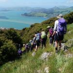
 13/11/2024. Chingford Park, Cleghorn Street, Opoho Circuit. Grade 4. Trampers. Leaders: Ross and Wyn Davies.
20 trampers met up up North Road in North East Valley, on the corner of Crown Street. We headed off at about 9:45am up the valley in sunshine.
We entered Chingford Park from the side, via Afton Terrace, and crossed the archery field. We admired the huge Macrocarpa tree, and the stables, and took a clockwise circuit of the loop track above the stables. Morning tea was at the pavilion.
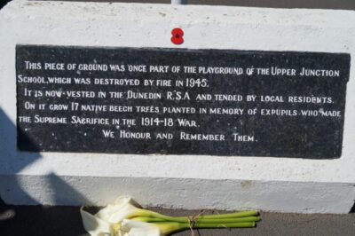
We left the park via Dryden Street and then on up-valley up Norwood Street. The steep climb started after the entrance to Bethunes Gully and it was soon time for removing layers as we warmed up. Once we reached North Road, we took time to reflect at the World War 1 memorial site on what was the Upper Junction School property. It is a sobering place, well restored in recent years.
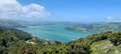
From here it was a short walk down North Road to Cleghorn Street, and then up Cleghorn Street to reach the track up the ridge towards Signal Hill. The views over the West Harbour settlements to the Otago Peninsula and down to the harbour entrance are extraordinary; maybe the best of many around the city?


We followed the ridgeline up to our lunch location at 12:15pm just below the pine trees near the top of Signal Hill.
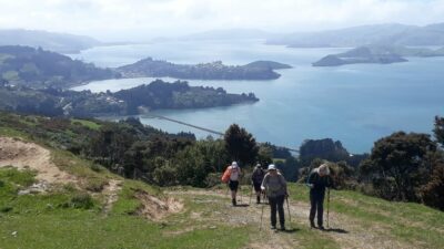
After lunch we were soon over the top of Signal Hill and beginning the steep descent. Part way down, we made a left turn back up towards the ridgeline with the harbour above Burkes. From there we followed the fenceline on private property down to the Burns Park Scenic Reserve, probably Dunedin’s least known and least visited scenic reserves.
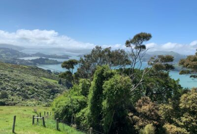
We descended into some lovely forest, with remnant trees including rimus, totoras and fuscias.
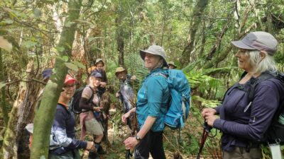
We then sidled around to a track junction, then sidled a little more and finally climbed up to emerge on Gerry’s Rock.
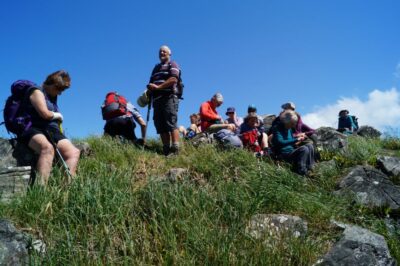
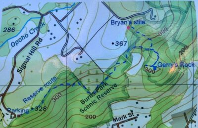
(Background information on Burns Park Reserve and Gerry’s Rock.)
The track was lightly marked and very lightly constructed, not so much a track as a route. There were lots of tree roots and obstacles to negotiate. It was slow going, a bit slower than we’d estimated. But negotiate it we did, safely and steadily. Returning back up seemed almost easier and quicker.
We returned to the road down to Signal Hill Road, and then down the steep streets of Opoho back to where we started, by 3:15pm.
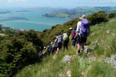
Most didn’t stay for afternoon refreshments but for the remainder the debrief over coffee and real fruit ice-creams was a welcome end to an interesting and testing day with a bit of everything.
Trip details:
Distance 13.3km, Elevation gain 570m, Moving time 3hr 45 min. (These are averages of Strava and TopoMap details from Marijke, Wyn and Graeme S. Typically, Strava reports longer distance and greater elevation gain.)
Grading:
I’d suggested a grading of 3.5 prior to adding the excursion to Gerry’s Rock. The diversion with the extra distance and height gain and loss, plus the very uneven ground, all made this a clear Grade 4. Everyone coped well, but I apologise for the lack of warning and I think I’ll need to report to the Grading Committee.
Ross
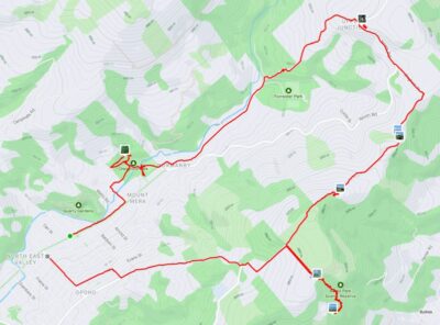
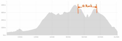
Link to background information and earlier tramps and hikes in the same area.

Interesting reading on Burns Park Reserve and Gerry’s rock ( a hidden gem)