
 18/09/2024. Three Mile Hill Forest. Grade 3. Hikers. Leaders: Bruce Spittle & Bill Cubitt.
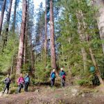
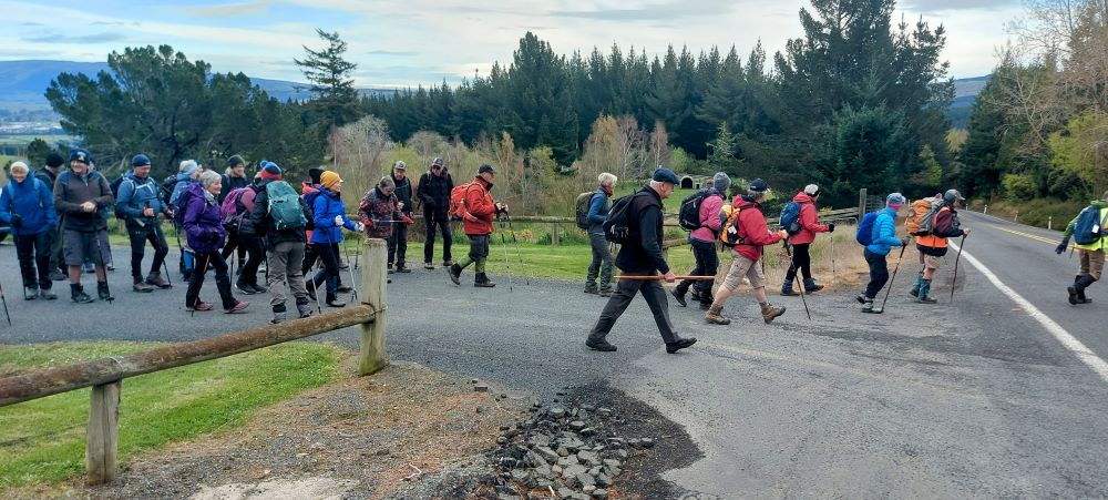
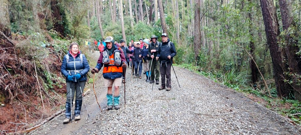
Thirty-two outdoor enthusiasts, including Dave and Peter coming for their first hikes, assembled on the Taieri Lookout carpark a day or so after snow had covered nearby hills. We set off at 09:15 by crossing the busy Three Mile Hill road and entering the narrow passage leading to the Flagstaff Creek walk to the left of the wide gateway of the road leading to the firewood processing plant.
The bush lined track led to a notice with a map of the one-hour Flagstaff Creek Walk in red and the shorter Douglas Fir Walk in blue. On the recce we found the Douglas Fir Walk was blocked in one area by a fallen rimu tree that would be impossible to go under and not suitable for a group of mature trampers to go over or around. Later, in the final stages of the tramp we would be able to go under it in a different place.
The notice also noted that the bridge on the Flagstaff Creek Walk was permanently closed.
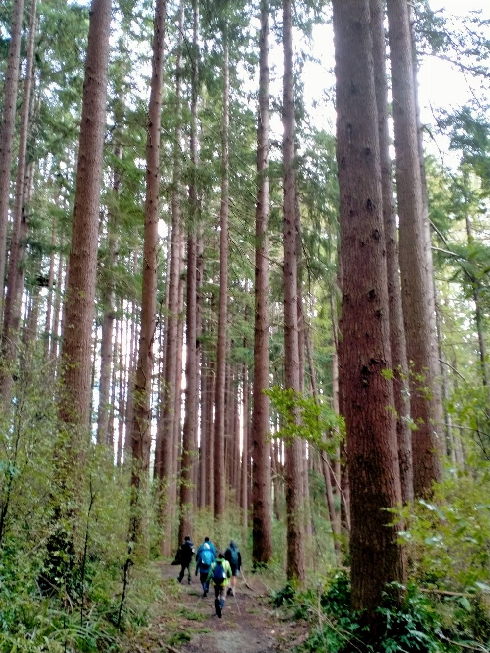
The bush lined track appeared to have been widened by a Bobcat and after 15 minutes we stopped for morning tea where it met South Road.
After morning tea, we went along South Road to the left to its origin at a locked gate and car park on Three Mile Hill.
The car park is well used by dog lovers at weekends.
We met two groups of five or six dogs taking some exercise on the hike.
We then retraced our steps back to the morning tea site and followed the signpost pointing downhill on the left with a narrow bush track to Flagstaff Creek.
At the track junction, near the creek, we turned to the right and inspected the permanently closed track that previously the club used to cross.
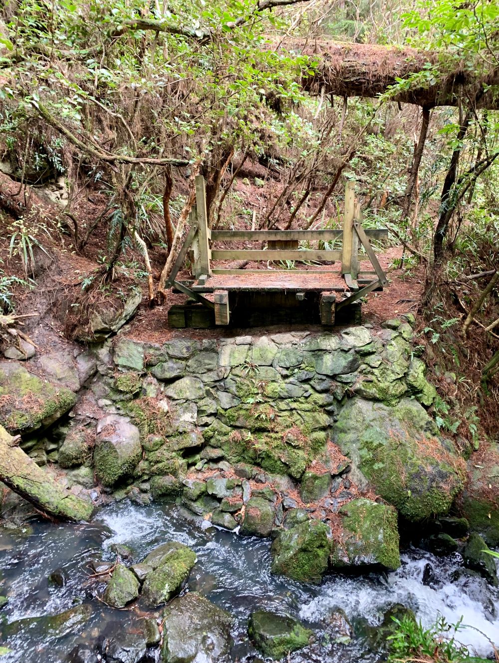
We then went back along the track following it to the 10m high weir which had white water flowing below like a waterfall.
Above the weir was a concrete inlet for the water race system opened in 1881 which used to take water to the Southern Reservoir until it closed in about 1957 after a flood.
We inspected the water wheel in the race which appears to have been a water flow meter.

We the retraced our steps back up to South Road, turned left and went down South Road to the concrete ford.
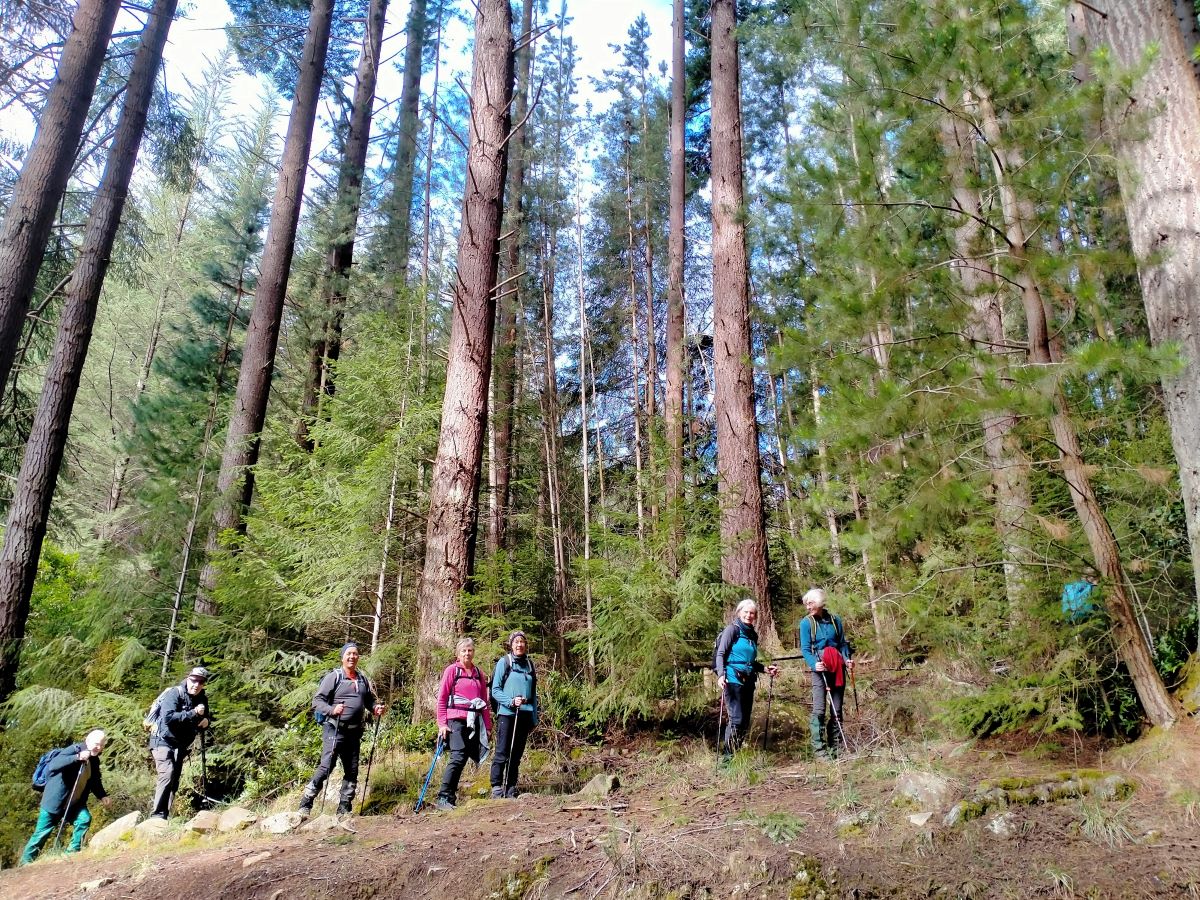
We crossed the ford and turned left onto the track leading through a grove of Japanese Cedars trees planted about 1914.
The track passed some ferns and pungas before arriving at the damaged bridge missing a central span.
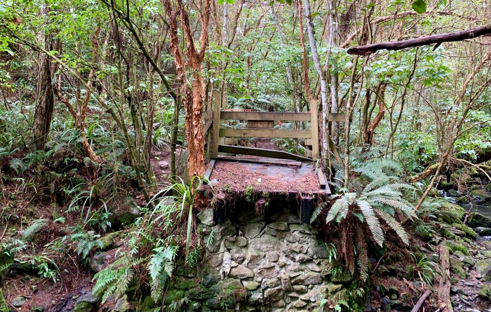
No one volunteered to try jumping over the missing section (thankfully).
We then went back to South Road, turned left, went past the entrance on the right to first Burma Road and Durham St and then High Street.
After a while we came to Clarke St on the right and proceeded down to arrive at the end at 12:00 for lunch under the pine trees with a view of Three Mile Hill.
After lunch, at 12:30, we went back to the start of Clarke Street and turned left again and walked to the sign pointing to Stuart St on the right. (South Road changed to, I think, Rumble or Gamble Street at that point).
We walked up Stuart St for some hill work to help maintain our fitness to the junction with High Street and then turned into High Street to the right and came down to South Road.
Both Stuart and High Streets were lined with mature trees and were not noted for being very level. They differed from their city namesakes in having less traffic.
At South Road we met up with a subgroup who had preferred to omit the extra hill loop and returned to the concrete ford at the bend in South Road by the bridge and the Japanese Cedar track.
The majority of the group then started up the Douglas Fir track immediately over the ford on the left.
Meanwhile a small group proceeded more directly to the car park on Three Mile Hill at start of South Road. There they were kindly met by Phil who shuttled them back to the Taieri Lookout carpark.
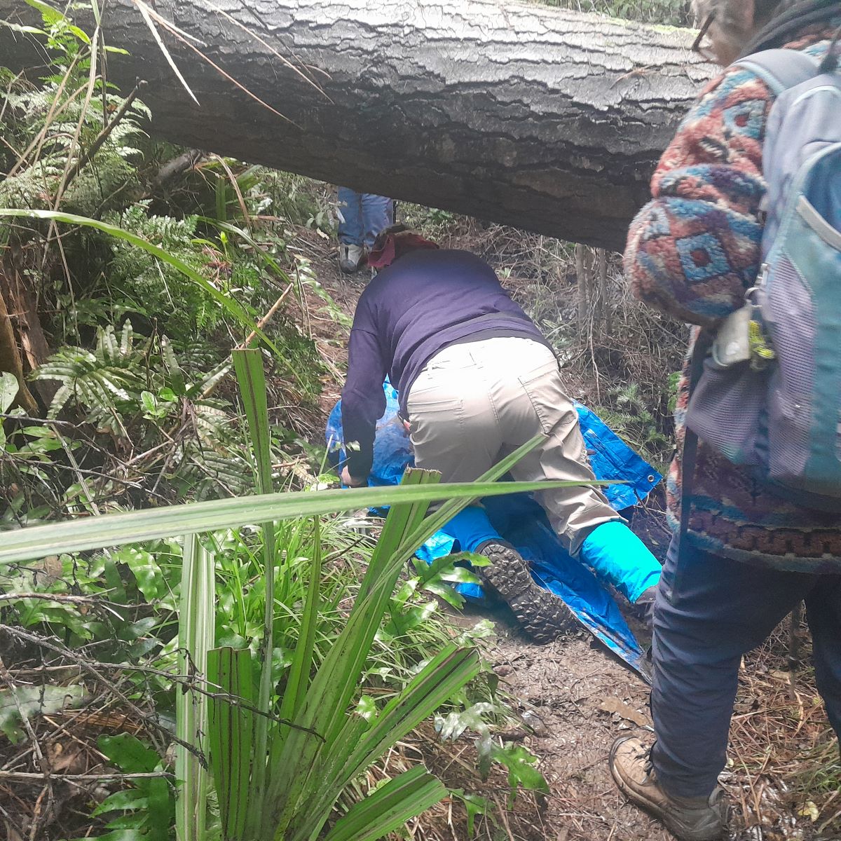
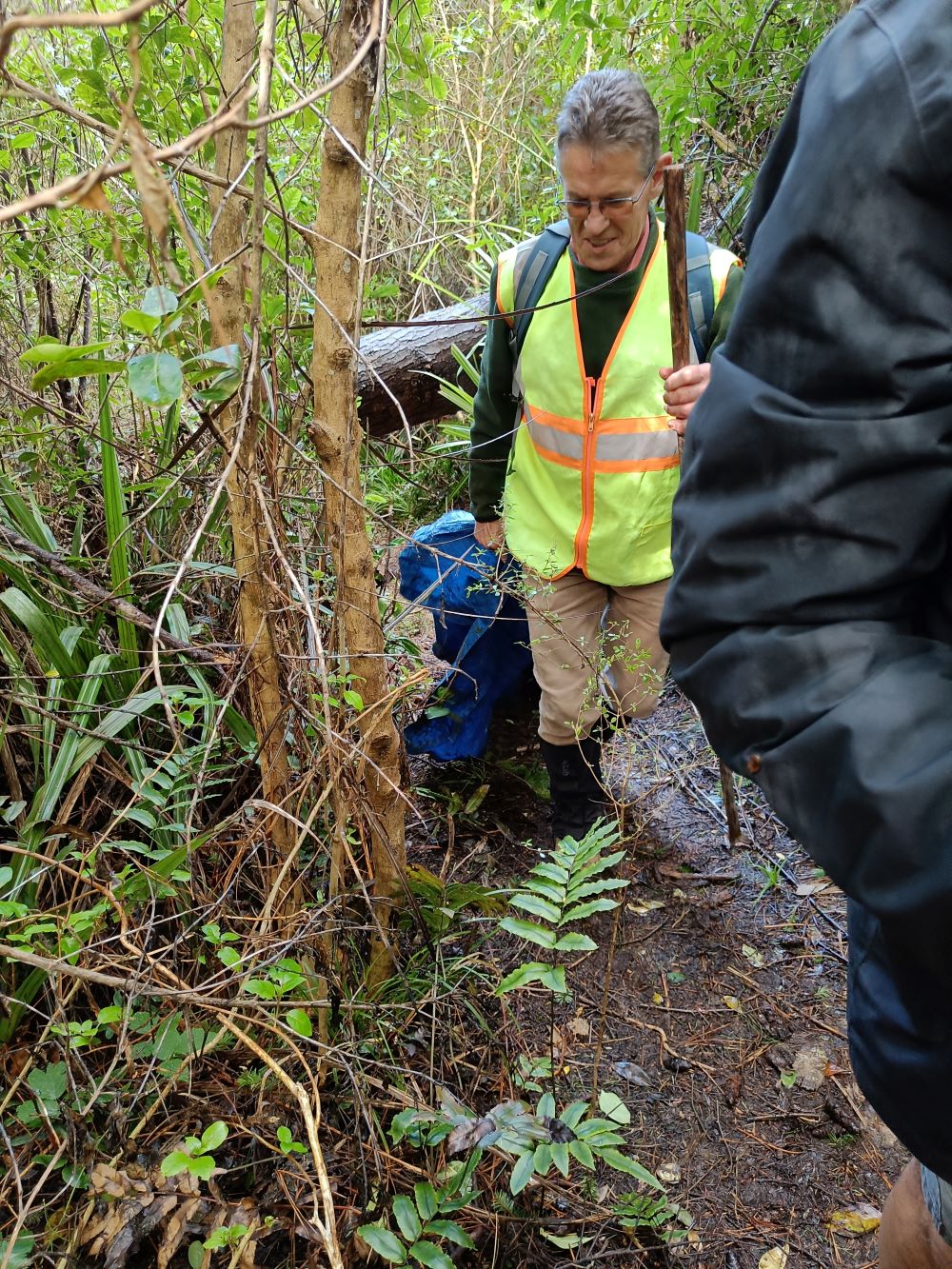
For the majority group, about halfway up the Douglas Fir track, we met the fallen Douglas Fir tree across part of the track and turned sharp left to continue on the track where further up the same tree offered the opportunity for limbo dancing.
We then continued back to the notice board and turned left to arrive back at the Taieri Lookout at 1430.
Distance measured by Marijke’s screen shot 11.88 km.
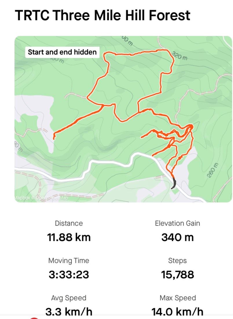
Distance on Garmin 11.5 km.
Climb 418 m.
Refreshments were had at the Aurora Cafe.

Thanks to City Forests for permission to do the walk, to Bill Cubitt for his very able leadership and route planning, to Phil Keene for his helpful guidance and assistance with providing the transport alternative and to everyone who came out with a degree of uncertainty about the weather and who kept so well together as a group.
Bruce Spittle
Link to background information and earlier tramps and hikes in the same area.