Road distances from Mosgiel carpark.
Access permission required for Pigeon Flat walk.
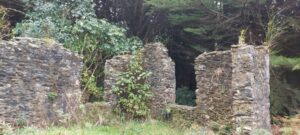
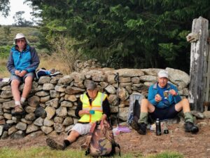
The stone-walled ruins on Mckessar Track
Doctors Point, Mopanui, McKessar, Purakanui, Osborne – Information and Trips Library
 16. 19/06/2024 Trampers – Purakanui, Mopanui and return. Grade 4. Leaders: Graeme Souter and Heather Kirk
Sometimes It can be a bit bleak walking this time of the year. Yet there we were, 18 trampers keen to head out for a tramp from Purakanui and up Mopanui.
Two car loads from Mosgiel and three from Dunedin met at Borlases Road, just before Port Chalmers on the earlier summer timetable for an early start. It’s a twisty scenic drive up to the car park at Purakanui and by the time we arrived it was 10 am.
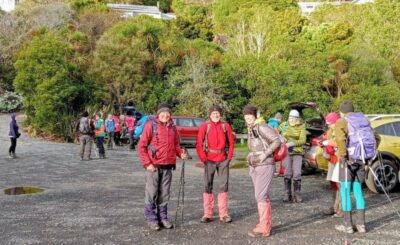
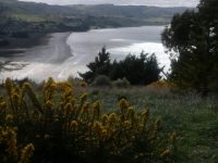
The tide was out as we walked well wrapped up against the cold, on the bushy, southward track around the inlet.
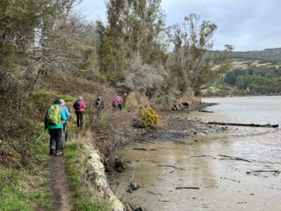
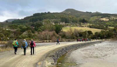
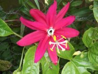
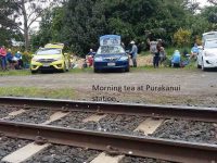
Then up to the Osborne/Purakaunui railway siding. We noticed Tui, fantail, and even beautiful kingfishers during our walk. We enjoyed morning tea at the rail siding at 10.40 am. Some bravely taste testing the banana passionfruit growing wild there.
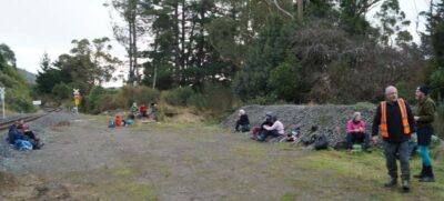
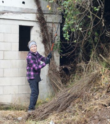
So far, the weather had delivered as promised, cloudy and cooler. Refreshed we continued climbing up the well-formed track for about 20 minutes to where the track splits. Here we took the left branch and walked through a pine forest with old forestry equipment noticeable. The track splits again and we kept veering left and continued up the zig zagging track. We turned left where the bush is quite dense and pink ribbons marked the track up. It steepens and is a narrow rocky climb to get to the top and the Mopanui trig.
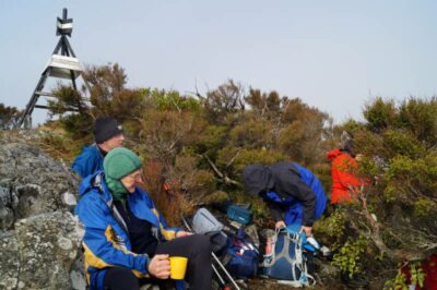
It was chilly and quite breezy with no views to be had, as we each found a spot out of the newly arrived drizzle to eat lunch. Then as if to feel sorry for us, the clouds lifted long enough to catch some views across Port Chalmers and Waititi .
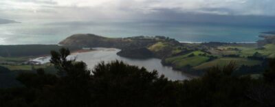
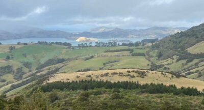
We descended on the south side of the trig. It was a shorter steepish, slow decent in these damp slippery conditions. We then turned right and followed the Orokanui pest proof fence road back and out on Mckessars track, around the inlet again and back to our cars.
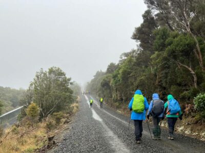
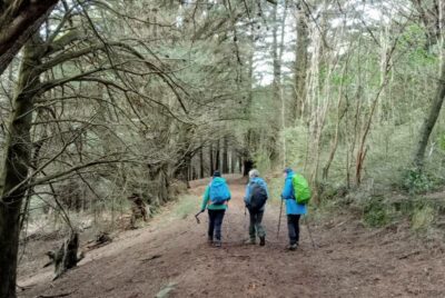
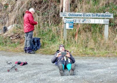
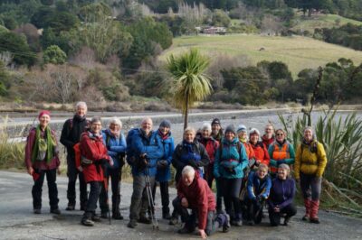
All in over 12kms was walked and we were back at our cars just before 3 pm. Some of us greatly enjoyed a hot drink at the Careys Bay pub by the fire to warm up. Another wonderful winter walk.
Heather
15. 23/08/2023. Hikers. Mopanui, McKessars Track. Grade 3. Leaders: Margreet and Neil Simpson
On a perfect hiking day, 18 adventurers in 5 cars grouped up at Borlases Rd on the Southern outskirts of Pt.Chalmers. From there we convoyed towards Long Beach turning off to Osborne, before crossing the “under repair” causeway. The next left turn put us on a steep gravel road past the iconic Mopanui homestead before parking at the Purakanui/Osborne railway siding.
The team set off up the hill with great gusto. Smoko was had on a sun-drenched glade at the intersection of the Mopanui/McKessar tracks.
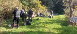
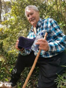
We zig-zagged to the top of the track where we turned off to enter the well ribboned bush track towards the summit. The track got steeper, and the rocks got rockier, but did the chatter get quieter? Not one decibel!
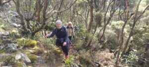
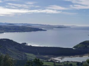
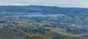
After a catch-up rest just before the summit; we broke clear to take in the fantastic vista from the trig station. There being no wind. A long lunch was enjoyed, before we tackled the short steep descent to Mopanui Rd.
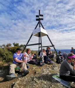
It was a pleasant jaunt back to the cars via McKessar track looking in at the old farm homestead enroute.
Emersons was an excellent venue to cap the day off with refreshments.
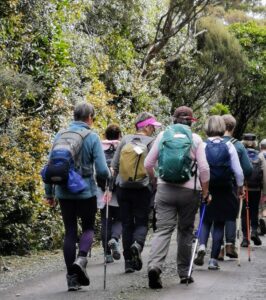
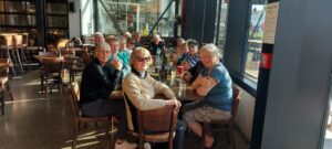
Vertical distance climbed was 407 metres and walking distance was about 8km.
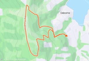
14. 28/03/22. Trampers. Doctors Point/ McKessar Track. Grade 3.5. Leaders: Theresa White & Chris Wither
32 hikers and trampers left their vehicles at Doctors Point car park at 10.00am on an overcast, but mild and pleasant morning. Being low tide, everyone walked along an extensive sandy beach to walk through Taoka’s Arches (the caves). The day had become sunny and warm.
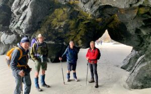
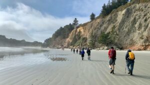
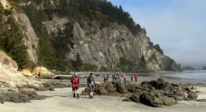
A combined hikers’ and trampers’ morning tea was enjoyed at Mapoutahi, where John gave everyone a bit of a rundown on the area’s history, and particularly, the background story of Mapoutahi Pa’s tragic, gruesome sacking in the 1750’s.
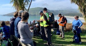
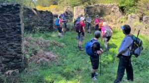
After morning tea 17 trampers said goodbye to the hikers and headed through the trees towards Osborne on the shore of the Purakanui Inlet. The day was, by then, sunny and warm. After climbing up Purakanui Station Road the group headed up the McKesser Track and enjoyed lunch along the way. The McKessar Track, which traverses both DCC and private land, is named for a family who farmed in the area and the group enjoyed a short side trip to view the remaining ruins of the McKessar’s house and farm buildings.
The Mopanui Ridgeline Track then took the trampers onto more private land through lovely David’s Bush.
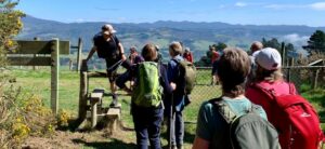
From there it was just a quick walk down Whites Road and back to the cars. Sea mist had come in when the trampers reached Whites Road but lifted to allow some great views of Blueskin Bay on the downhill stretch.

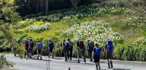
A total of 14.5 km was tramped and the climb went from sea-level to 319m. with total elevation gain of 472m.
Chris Wither
13. 16/3/22. Hikers. White Road and Beyond. Leaders Jenny Finnerty and Bob Mitchell
Eighteen hikers met at the Orokonui Ecosanctuary car park. While it may have been overcast it was a good day for a walk. We set out along the boundary fence of the sanctuary. Morning tea and comfort stop was about a km along the road.
We squeezed through a small exit to get back onto the road to continue on to the Mopanui Ridgeline Track. We followed the fence line down the hill through a lovely wooded area known as “David’s Track” which is on private property but is made available to the public.
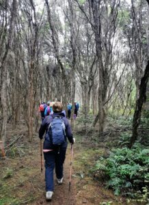
It took us down to the top of White Road where we had lunch and more great views of our coastline.
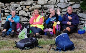
After lunch it was a leisurely walk down White Road on to Doctors Point Road. While the drivers were taken back up the hill to get the cars the passengers walked around towards the Blue Skin Gallery Cafe where we had coffee and cake and a chat about White Road and beyond. The hike was at least 10kms.
Jenny and Bob
12. 11/11/20. Hikers. McKessar Track. Leaders: Betty and Jim Finnie
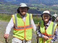
The weather was perfect for the group of 18 hikers which included two veterans plus a new member, assembled at the site of the old Purakaunui railway station. Most of the group took the short but steep stroll down to Osborne Road, then back to the cars for a relaxed morning tea stop.
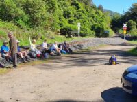
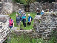
All 18 made it to the lunch stop at the end of Mopanui Road, with a short break to view the remains of the McKessar residence and what had probably been stables.
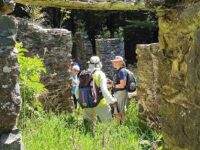
It was only a short distance to blooming Rhododendron bushes which had probably been doing this for well over a 100 years. From here this well preserved track continued to the end of Mopauni Road for a leisurely lunch stop in extremely pleasant conditions. After lunch most of the party took a short walk down the White Road track to where on such a fine day we were rewarded with an amazing vista of Waitati, Blueskin Bay and Warrington beach.
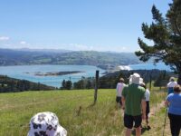
With the tide in, Rabbit Island was in sharp contrast. It’s always good walking down hill and we were back in the cars before 2:00 o’clock for our return to Mosgiel which included a coffee stop at Nichols on the way.
Leaders were Betty & Jim.
11. 20/2/2019. Trampers. McKessar circuit from Doctors Point. Leaders: Jill D and Judy D
Another great day for 12 trampers to head north to Waitati then out to Doctors Point where we parked to do a circuit trip.
We started out along the beach while the tide was low and access to the walk through caves possible .Morning tea was up at the Mapoutahi Pa a near perfect spot – calm sea and generally uninterrupted panorama.
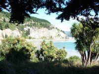
From the pa it was a road walk around the Purakaunui inlet for the hill climb to the Purakaunui (now unused) train station, where we started a long steady climb on a well maintained track to the Mopanui Rd, and the deer fence. Throughout our climb we were walking under a luxuriant canopy of trees – pines and natives.
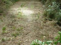
Some visited the derelict stone house en route.
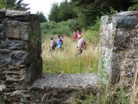
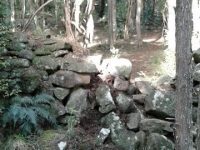
At the top where we had lunch with some great views esp towards the Silver Peaks and Pulpit rock, where we had been the previous week. Below was the Blueskin Bay filling up with the incoming tide and also the Orokonui reserve and predator proof fence line. Quite a feature in the area is the dry stone (locally sourced) walls withstanding the test of time throughout the elements of nature. These craftspeople were very patient and skilled in their workmanship. We followed both the deer fence part way and stonewall down through a Manuka and Kanuka plantation to just above Doctors Point again some spectacular views of the surrounding areas. From here it was on a formed road walk back to the cars. Approx 13 kms. Coffee was at Blueskin Bay nurseries.
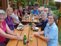
– Jill D
10. 26/9/2018. Hikers. Mopanui Ridgeline Track. Leaders: Bob and Jan.
17 hardy hikers braved the elements & set out to walk the Mopanui Ridgeline Track (also known as White’s Track). 2 cars travelled up Mount Cargill Road into Mopanui Road where we commenced our hike. 2 cars drove around Doctors Point Road and parked up beside the railway line (our destination) then Bob drove the passengers up to Mopanui Road in his 12 seater to join the rest of the party and have our morning tea in a sheltered area before setting off.
It was a gusty wind that followed us down the track but we managed to keep on our feet and soon came to an area with a canopy of tall trees which was a welcome relief.
9. 29/8/2018. Hikers. McKessar Track from Foot. E. Leaders: Jim and Betty.
The sun was not shining when we left the car park and as we approached Port Chalmers it looked like it would be a day destined for coffee only. As we continued our journey, there was a marked improvement in the weather as we reached the Purakaunui Railway Park. From the car park the walk was down hill to Sea level then back up the road to the cars for the morning tea break. All the Twenty Two then walked up to our lunch stop at Mopanui Road where we sat with our heads in the cloud. The up hill climb included a breather to marvel at in the relics of the McKessar Homestead. We descended back down the track & into the cars for our refreshment stop at the Plazza Café. Conditions could be described as a little moist. – Betty & Jim Finnie
8. 15/11/2017. Hikers. Purakaunui Station. McKessar Track, Mopanui Road. E. Leaders: Jim and Betty.
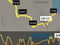
Starting off from the site of the old Purakanui railway station, a party of twenty hikers made the short road walk down hill to the Purakaunui inlet for an then returned, for the morning tea stop at the cars.
An after-lunch
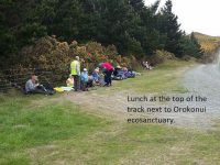
stroll beyond the road end, took us to a point which gave us an excellent view to the north. Little time was required for the pleasant stroll down hill back to the cars, which took us to our refreshment stop at the stadium Plaza cafe. – Betty and Jim
7. 25/5/2016. Trampers. Doctors Point, Canoe Beach, Osborne Rd, Purakanui Station Rd, McKessar Rd, Deer Fence, White Rd, Doctors Point Rd. M. Leaders: Neil and Carole.
Wednesday 25th was the perfect day – light cloud, blue seas, 2kph breeze, when 10 trampers assembled at Orokonui (Waitati) junction and headed over to Doctors Point parking area at 9.45am.
The walk along the beach and through the arches (almost dry-footed) led us to the rocky foreshore. However the tide being an hour off low-tide required boulder-hopping skills on the cliff side of the rocks to ensure dry feet….
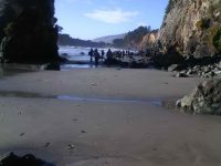
Beyond the rocks we had morning tea under a lone pine tree and then moved on to circuit the Pa site and admire the view.
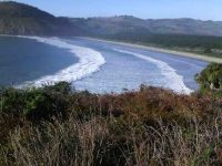
On to the beach, Osborne Road which we branched off to walk through the pines and view the old Maori Cemetery (Purakaunui Urupa) which a couple had not been to before. 35 minutes later we returned to the road following the estuary, turned into Purakanui Station Road and uphill to the railway line.
Lunchtime: 3 minutes on, no gorse, no blackberries in the middle of the walking track so a good place to sit! (Not the railway track.)
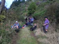
We passed the old stone house relics at the lower end of McKessler track where someone was doing reparation work for the owner, Jill Hamel, an 84 year old archaeologist who lives in Anne Street, Roslyn. (Neil rang and spoke to this lady!)
Continued up McKesslar track which ends at the road by the Orokonui predator fence and the drystone wall.
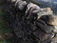
We followed the deer fence down, turned into ‘gorse alley’, bypassed an uncleared section by going through a paddock and then back onto the now excellent lower track. Looking across the slightly misty tidal flats …
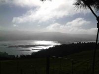
… and down to White Road brought us back to our cars at 3.00 pm after 14.5 kms. Pleasant tramping days tend to end at the local coffee shop and this was no exception.- Carole.
6. 9/3/2016. Hikers. Mopanui Road, McKessar Track, Albert Road. E. Leaders: Bev, Lesley.
5. 9/10/2013. Trampers. Doctors Point, Canoe Beach, Osborne Rd, Purakanui Station Rd, McKessar Rd, Deer Fence, White Rd, Doctors Point Rd. Medium.
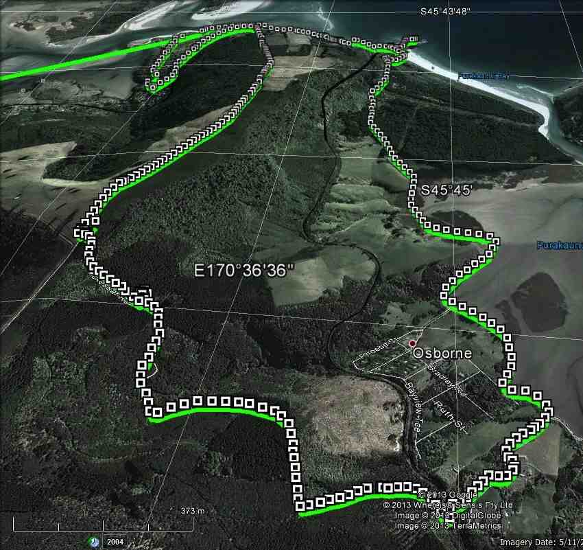
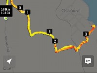
I messed up with the GPS, as I forgot to turn it off when we got back to the car. However, we estimate that we walked approx 13km [as it was 8.? something to the top of McKessar Track, ] We climbed about 350mtrs to the highest point, which was the top of McKessar Track.
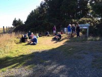
5 of us made our way along Doctor’s Point beach to the Mapoutahi Pa site, where we had morning tea just after 10am in the shelter of a large Macrocarpa tree. We then went & explored the Pa site for a while, before setting off along the Access Rd to Osbourne, where a climb up to the railway line set the blood circulating a bit faster.
The walk up McKessar Track was interesting, as it has been completely cleared, the water tables have been cleaned out, & gravel has been spread on some parts as well. During lunch break,…
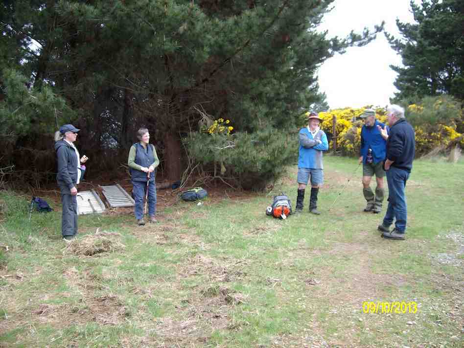
… we had a visit from a man who works for the two women who own the land there, & he filled us in with quite a bit of knowledge on the area etc. We also had a discussion on which way to go down to Doctors Point again, either along the Orokonui fence, or down the deer fence. He was sure that the deer fence route was not available, but as I had rung Ian on his cell phone from our lunch spot, & he had told us to go down the deer fence, that is what we decided to do, & that worked out OK, with just a bit of gorse on the way down the 4WD track below the deer fence to negotiate. It was then just a walk along White Rd, & Doctors Point Rd back to the cars.
All agreed that it was a good day, especially after we stopped off at the Waitati Coffee shop for refreshments on the way home!- Ken
4. 21/3/2013. Ken and Ian found the gorse alongside the deer fence had been sprayed and passage was possible again. But ascent to Mopanui from McKessar Track, although the track is detectable at both ends has still a middle bit where we could not find a way through to the track on the other side! Perhaps two, one coming down from Mopanui and another up from McKessar, equipped with radio contact could find the way through, because that part must not be very extensive.
3. 27/5/2009. Trampers. Doctors Point, Canoe Beach, Osborne Rd, Purakanui Station Rd, McKessar Rd, Mopanui, Mopanui Rd, White Rd, Doctors Point Rd. Medium+. Leader: Ian
The feeling was magical starting out on the beach on such a clear morning.
click to enlarge
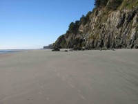
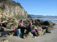
The tide was so far out it was easy to walk even round the outside of the caves, to stop for morning tea at the far end of Canoe Beach.
We were shocked to find the road from the beach under so much flooding. After MUCH thought, there was nothing for it but to charge? through.
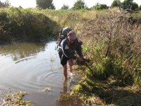
We encountered dip after flooded dip in the road, each of us tackling them in our respective timid or reckless ways.
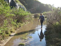
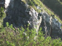
The flooding was not just on the road of course. It went right back to the cliffs, down which a waterfall was coming. A sight we had never witnessed before and hopefully will never again.
Yet another dip. Probably the last one, although the road proper beyond still had rivulets in it.
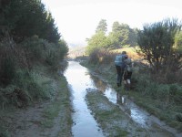
We had news for the hikers whom we surprised on a corner coming the other way. Their walk was due to be rather truncated and hopes of lunching on Canoe Beach to be shattered. (We doubted many of them would appreciate wet feet.)
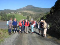
We turned up the Purakanui Station Road (near Osbourne) and crossed the railway into the newly-signed McKessar Track, beautifully cleared. Further across the north flank of Mopanui we turned off up the zig-zag track that eventually took us to the marker indicating the route up to Mopanui. Here we lunched. Sabina and Ian made it to the Mopanui trig, Ria cautiously turning back, to avoid possibly slipping on the large rocks near the top, were they to turn out to be wet.
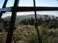
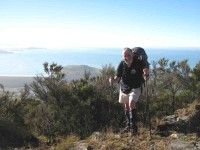
We met Ria back down at the track junction and made our way out to the Mopanui Road, avoiding the worst of the gorse. Down at the end of the road, and adjacent to the other end of the Mckessar Track, the owner of the farmland had taken the trouble to leave the upper and lower gates unlocked, so we could avoid the encroaching gorse on the outside of the deer fence. Earlier delays had lengthened our day so we stopped for afternoon tea mid-way down the paddocks on some convenient rock outcrops. Then it was out through the far gate and on down the long FWD track to the top of White Road, down that and back along the road to Doctors Point and the car. A good day. – Ian
2. 22/11/2006. Doctors Point, Mopanui. (Low tide 11.26am). Moderate. Leaders: Ria L, Hazel.


Hi. I am a member of the North Otago Tramping and Mountaineering Club. I read with interest the report of your Mopanui-McKessars Track trip on 23/8/23. In particular, the report talks of a Mopanui Track branching off McKessars Track. We have searched for such a track in past years but always got bushed and ended up climbing Mopanui from the road. Is the Mopanui Track now clear and signed? Grateful for more info to this address if possible.
Regards, John.