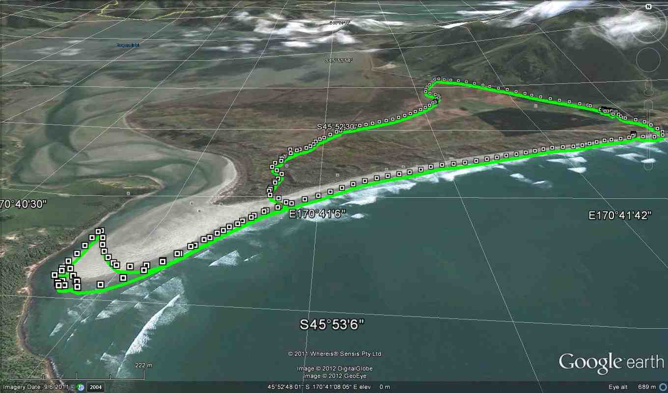
27 km from car-park.


The hikers set off at 10am and made their way across a paddock near Sam Neill’s residence as it was high tide at 10am.
There was little wind with the temperature being 21 degrees and the view around Hoopers Inlet was gorgeous.
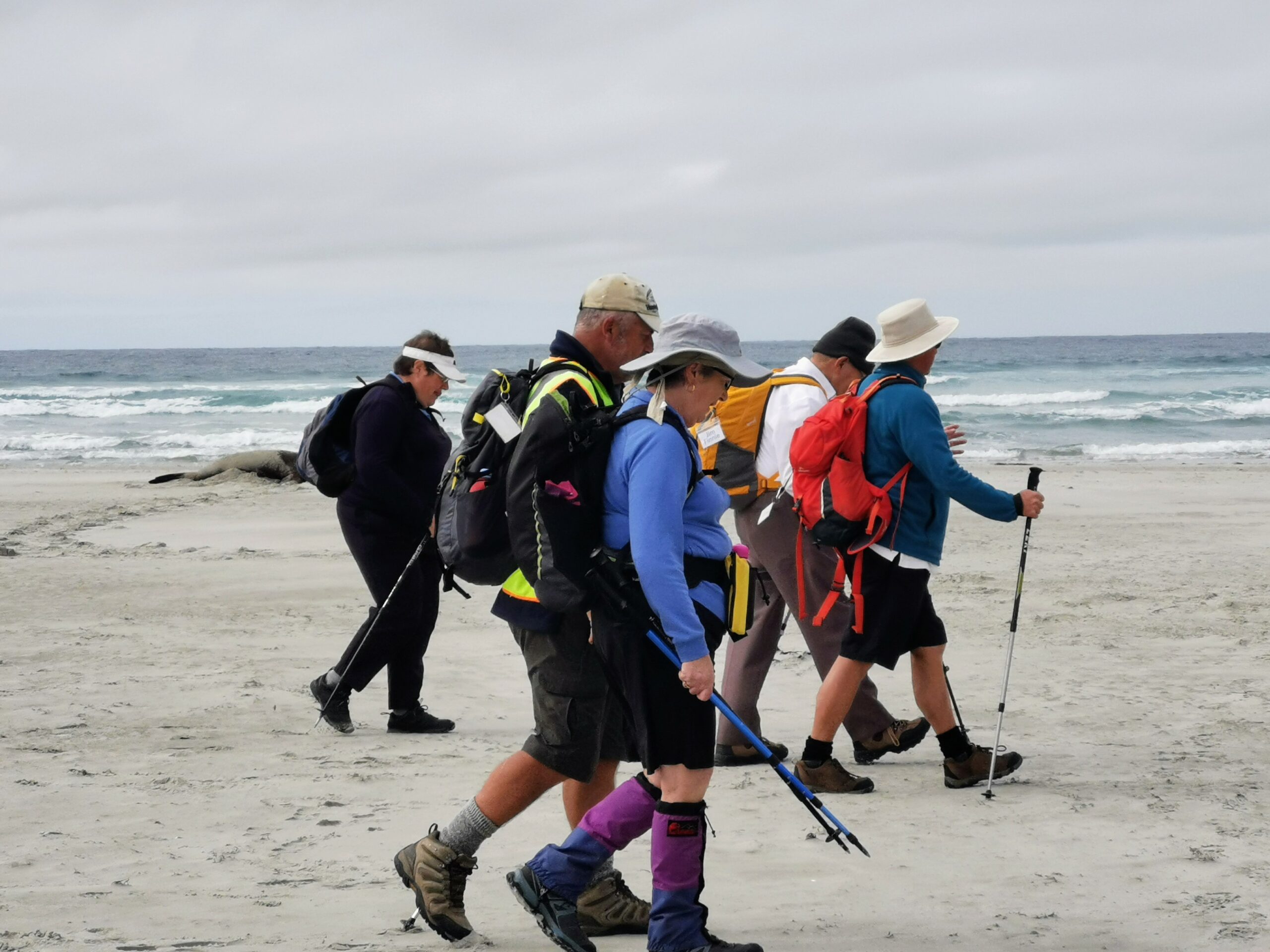
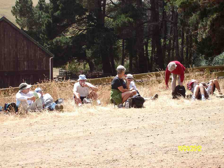
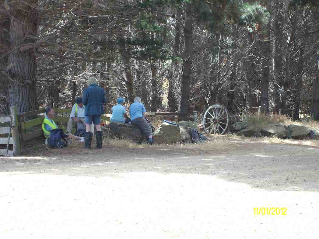
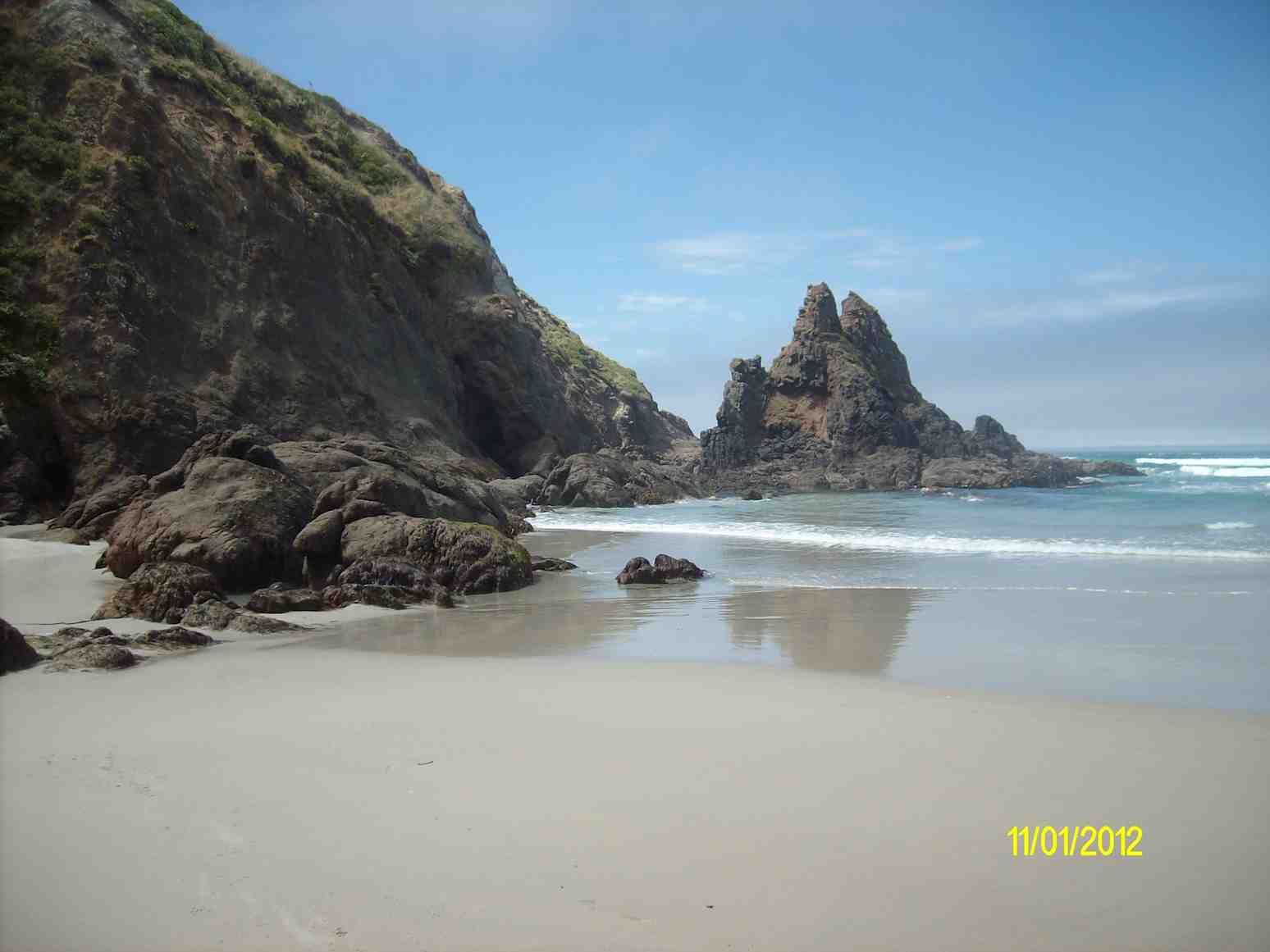
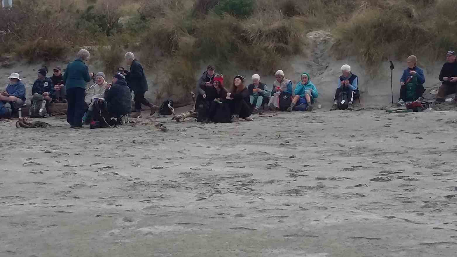
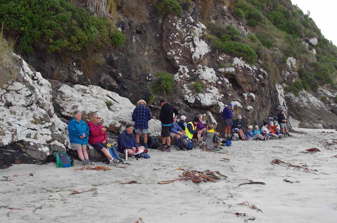
About 10.30am we stopped for morning tea along a sandy terrain track. We walked along beach across salt swamp paddocks close to Hoopers Inlet encountering Sea Lions nesting nearby.
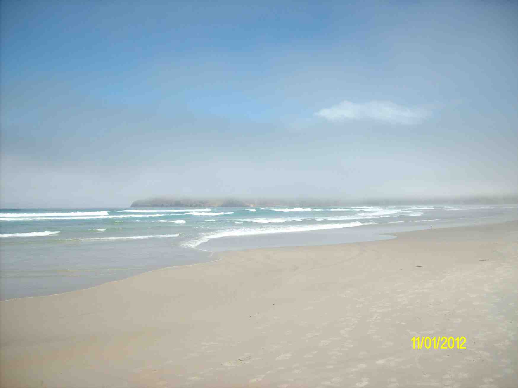
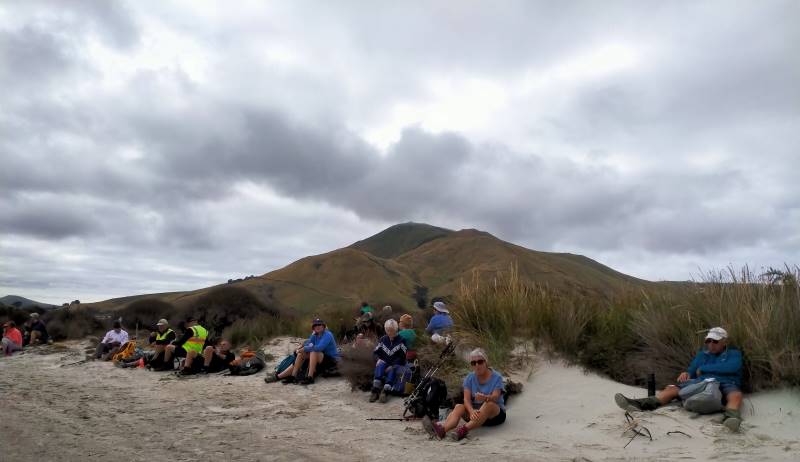
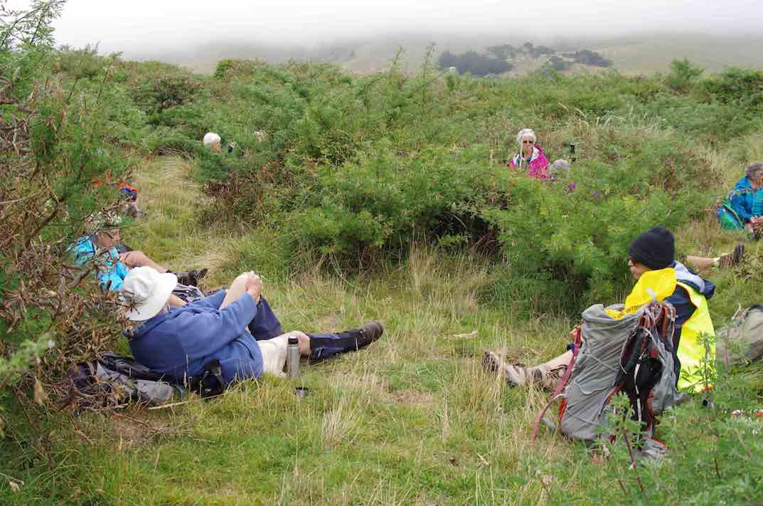
We stopped for lunch 12 noon at the sand dunes end of beach and enjoyed stunning views of Hoopers Inlet Poatiri/ Mt Charles and Harbour Cone.
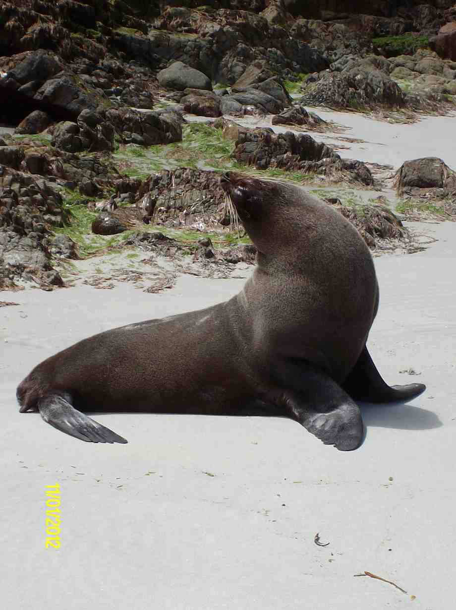
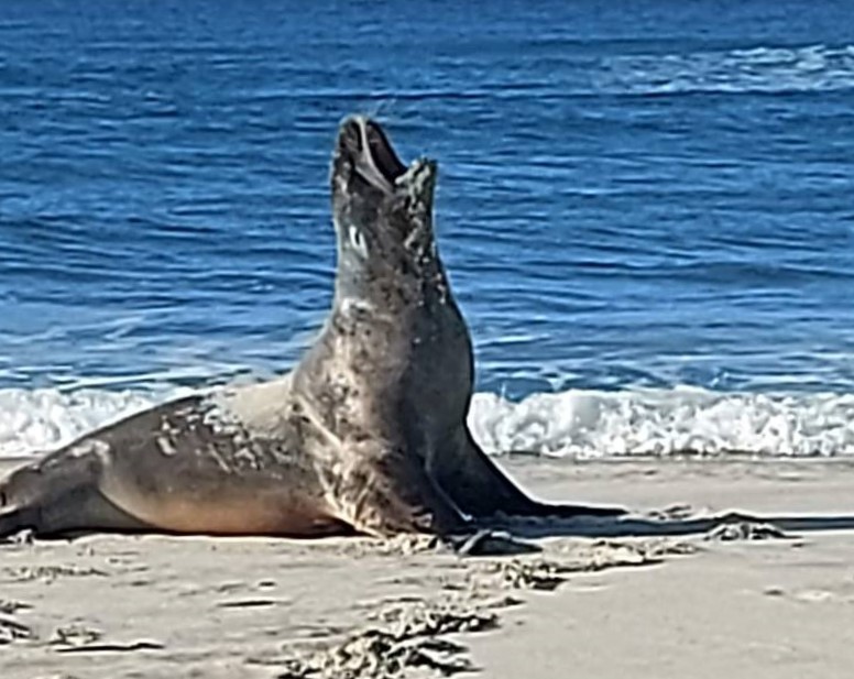
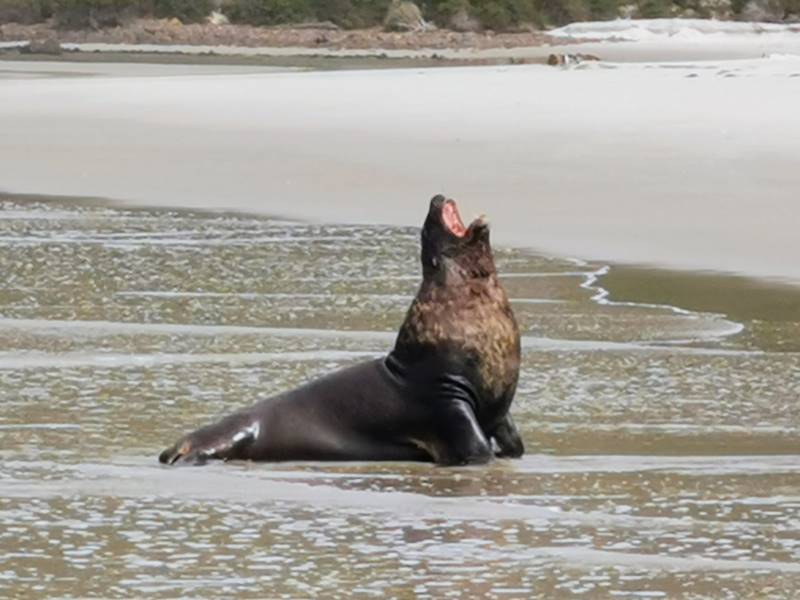
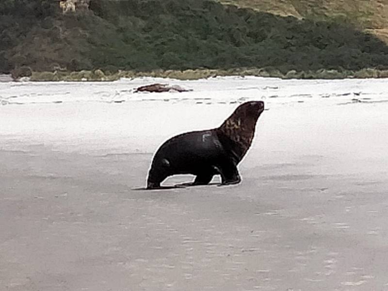
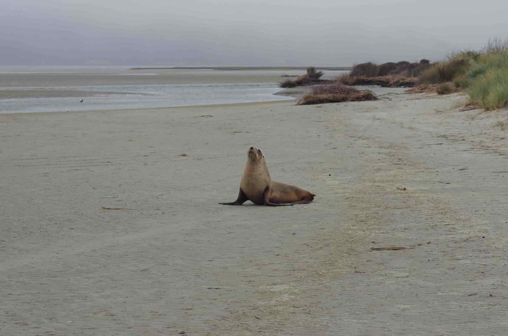
After lunch we travelled along the beach which treated us to magnificent surf clean sand and over 10 sea lions Some sea lions were landing on the beach as we arrived. These majestic somewhat unpredictable animals lay on the beach sometimes singly some times in small groups.
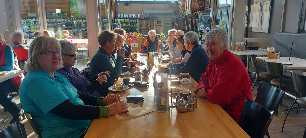
We returned to our cars at 2pm and coffee was enjoyed at Nicols Café where we were pleased to rest our weary legs a chat some more . A great end to an enjoyable tramp having walked 10 kms.
Thank you Bruce and Jim for your guidance and everyone who provided photos.
Dave Roberts Graeme Souter
5. 18 July 2018. Hikers. Allans Beach. E. Bruce and Marjorie
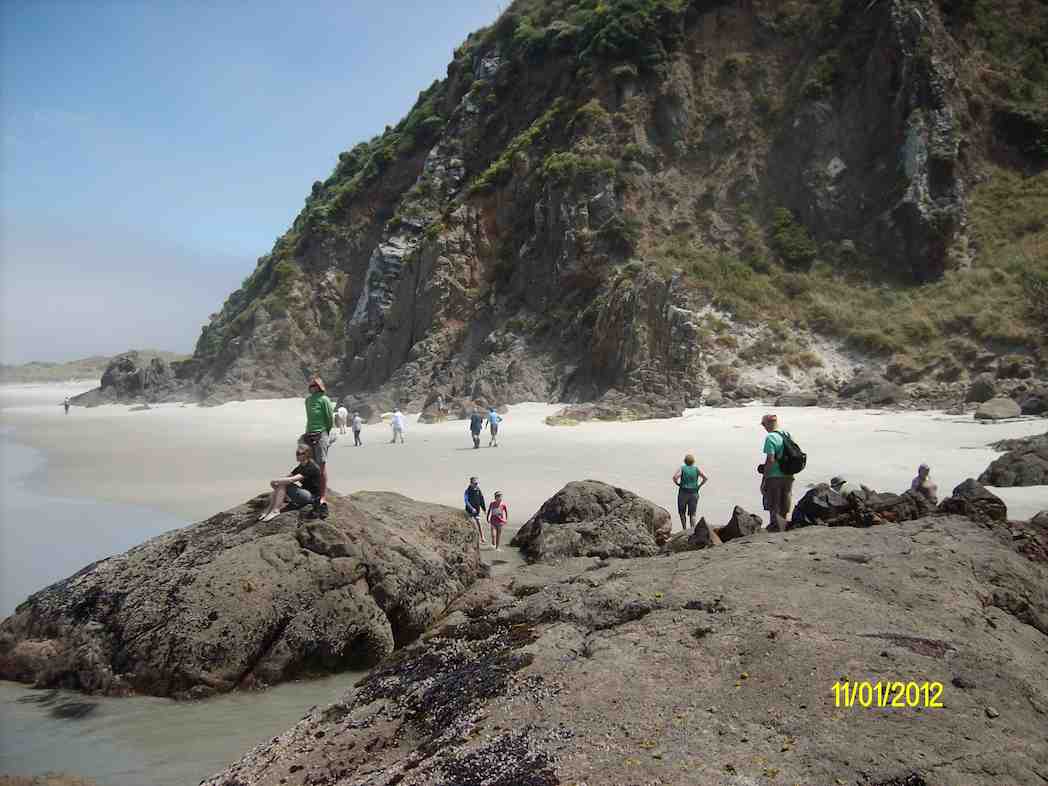
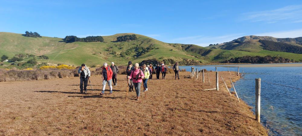
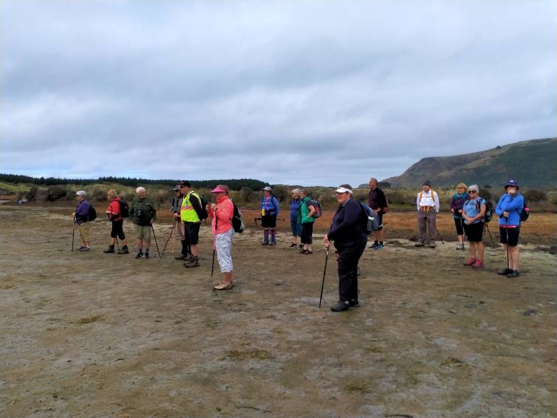
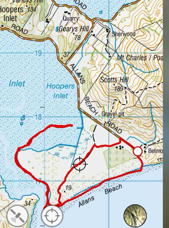
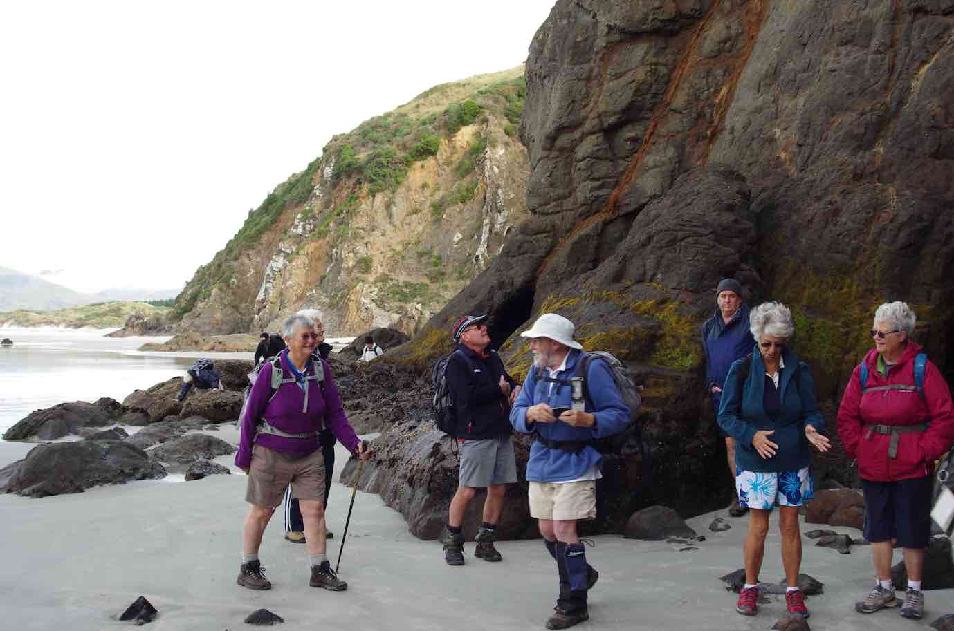
28 hikers set off from the car park at the end of the Allans Beach road by crossing the style at approximately 11 am and had morning tea
near the end of the track to the beach, reached by crossing a second style. Our transit time from 9.30 am at the Bush Road car park was longer than usual because of the work associated with the widening of the road from Broad Bay to Portobello with fill from the Clearwater quarry near the south side of Papanui Inlet. The fill is transported in large truck trailer units and for safety the Allans Beach road is one way during the week at present (apart from for residents) from Allans Beach to Portobello. We were not aware of this when we did the recce on Saturday 7 July. The route that remained open to Allans Beach, which most of us followed, was proceeding through Portobello on the Harrington Point road and turning right, after 1.3 km, into Weir Road, right onto the Papanui Inlet road and then taking the second road on the road that passes between Papanui Inlet and Hooper’s Inlet, and between Gearys Hill and Mount Charles, to join the Allans Beach Road. Most of us also explored Sheppard Road between Papanui Inlet and Hoopers Inlet to find that it was one way and did not allow a left turn into Allans Beach road. The entrance to the Clearwater quarry is on the Papanui Inlet road about 0.8 km past Sheppard road between Varleys Hill and Gearys Hill.
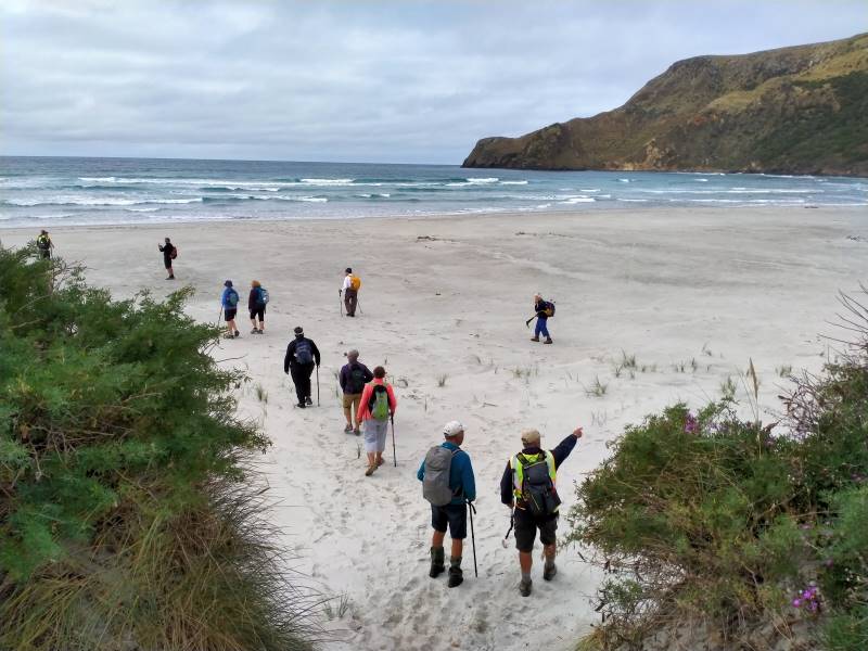
We proceeded to explore the northeast end of the beach until we reached the rocks and then turned to travel southwest along the beach
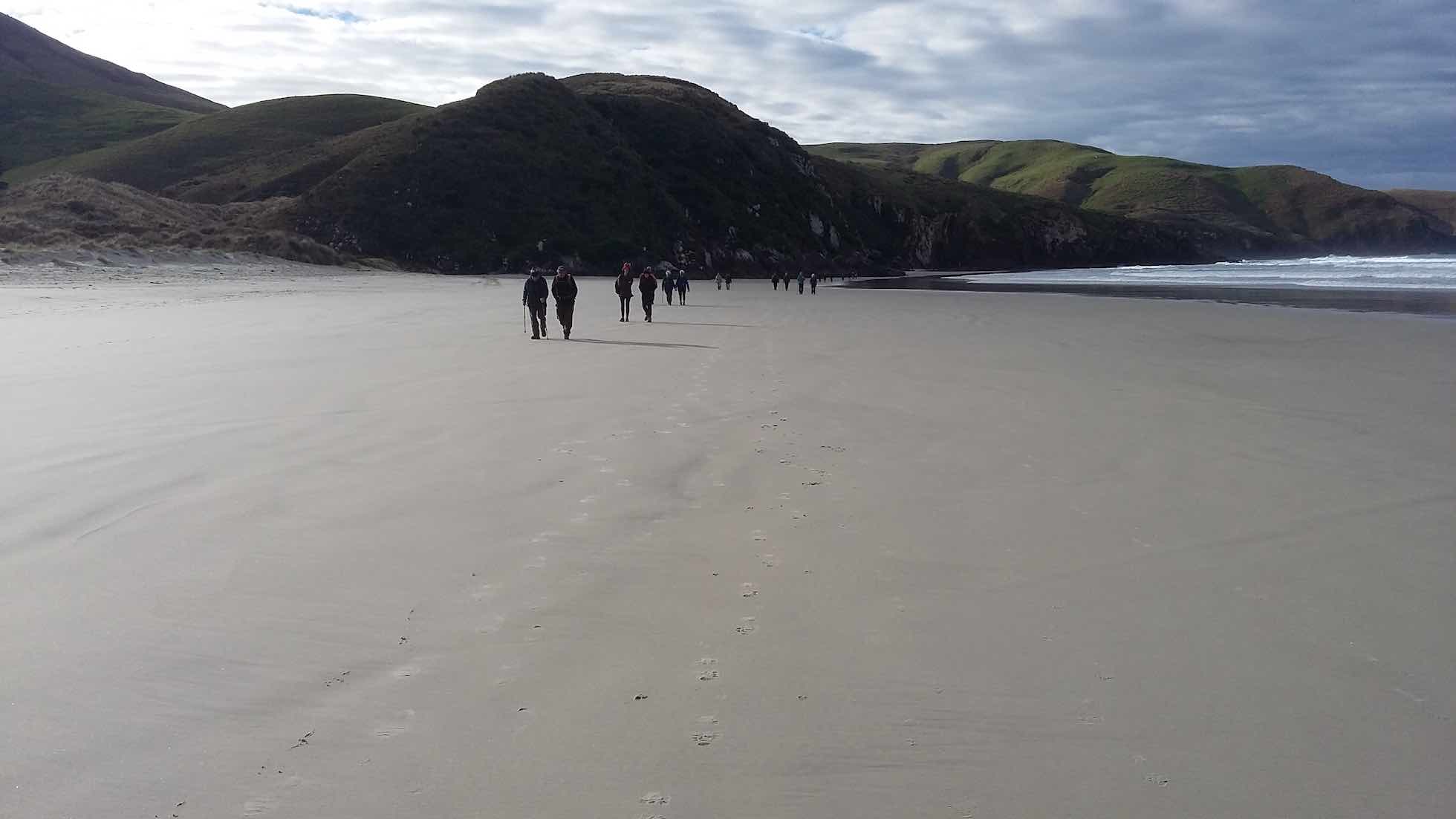
and around the corner to the right to have lunch at 12.15 near the north end of the first bay on the right.
Some of the group made their leisurely way back after lunch while the main group proceeded around the shoreline until 1.10 pm to the fence which comes to within 1 m of the water just around the point where the inlet shoreline turns from north to north east.
A 1-year-old sea lion appeared to observe our arrival at the fence area and flapped its way across a boggy area from about 150 m away to the east, wriggled through a fence and swam down the channel to stop adjacent to our party to observe us.
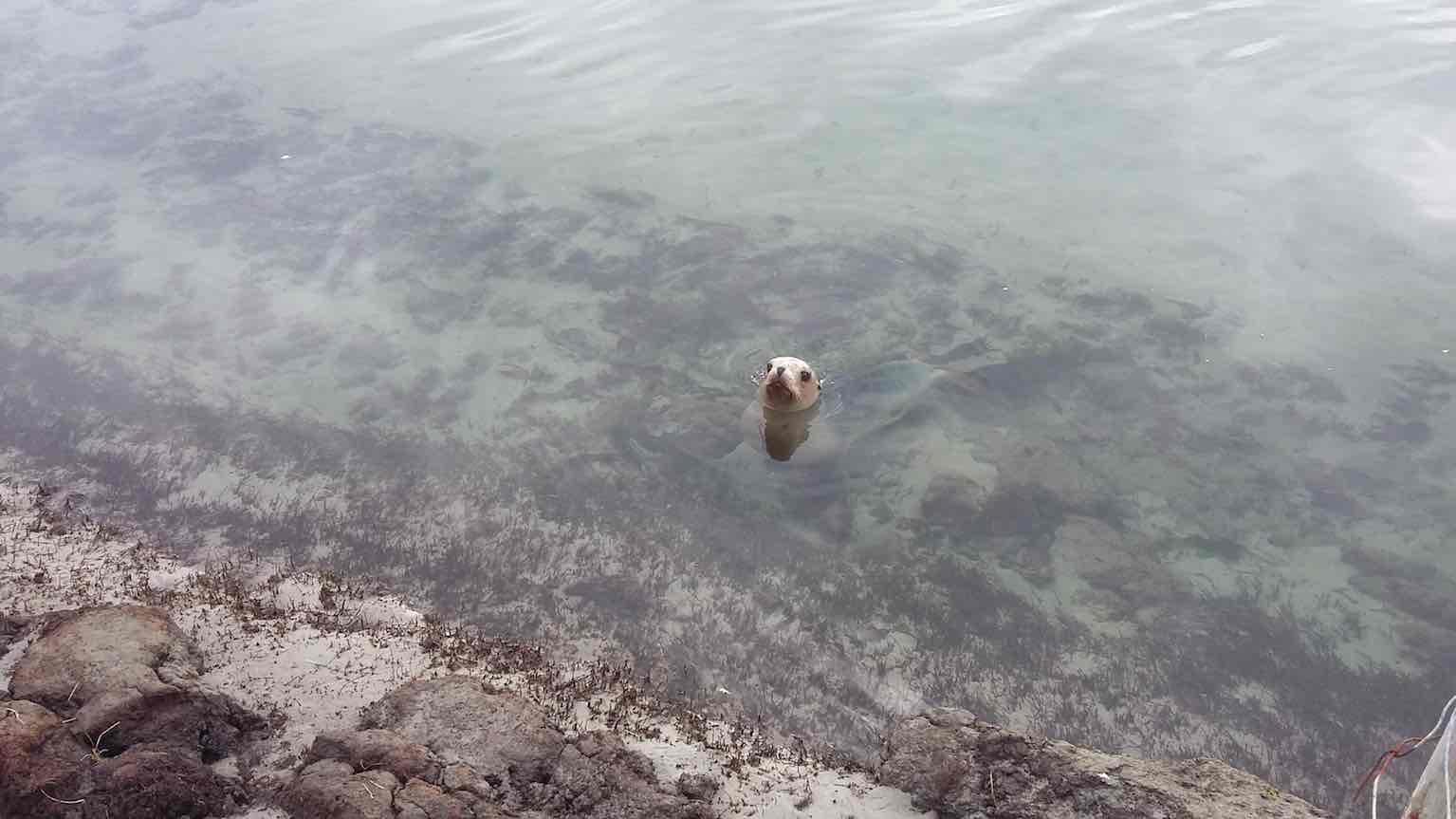
We had endeavoured to remain a safe distance from the wildlife, which a regular observer of the wild life informed us later was 20 m, but this young sea lion proceeded to emerge from the water opposite us a distance of less than 20 m and display some sea lion dentition. We retreated appropriately in the face of this gesture and proceeded to retrace our steps to the end of the beach near the outlet, pausing to watch a mother-child pair
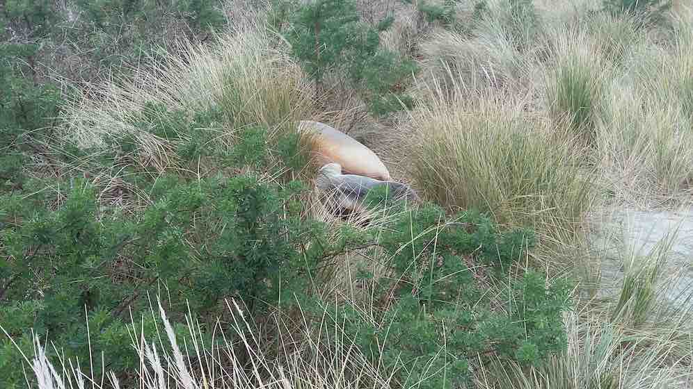
approximately 3 m into the sand dunes from the inlet, about 300 m from the fence. Some other sea lions were observed on the shore on the opposite side of the inlet
We proceeded north east up the beach for about 100 m to approximately 25 m past a pine tree in the dunes to a track whose entrance was marked by an upright post and a surf board shaped portion of boat.
We followed the track through the sand hills, past a grassy clearing, with tree segment seats arranged around the inverted remnants of a copper, and through an open gate into a paddock with approximately 100 cows on the grass whom we passed on the left between the grassy and boggy areas.
When we reached a fence we turned right for about 100 m past a circular water trough to open a gate on the left. We proceeded to follow the track past the farm house of Christine and Sam Neill who had kindly given permission for us to traverse their property. We opened two gates to cross the drive way to the farm house, passed the cattle yards on the left, went through another gate and were reunited with our cars by opening the gate leading to the cars, about 80 from our first style, at 2.15 pm.
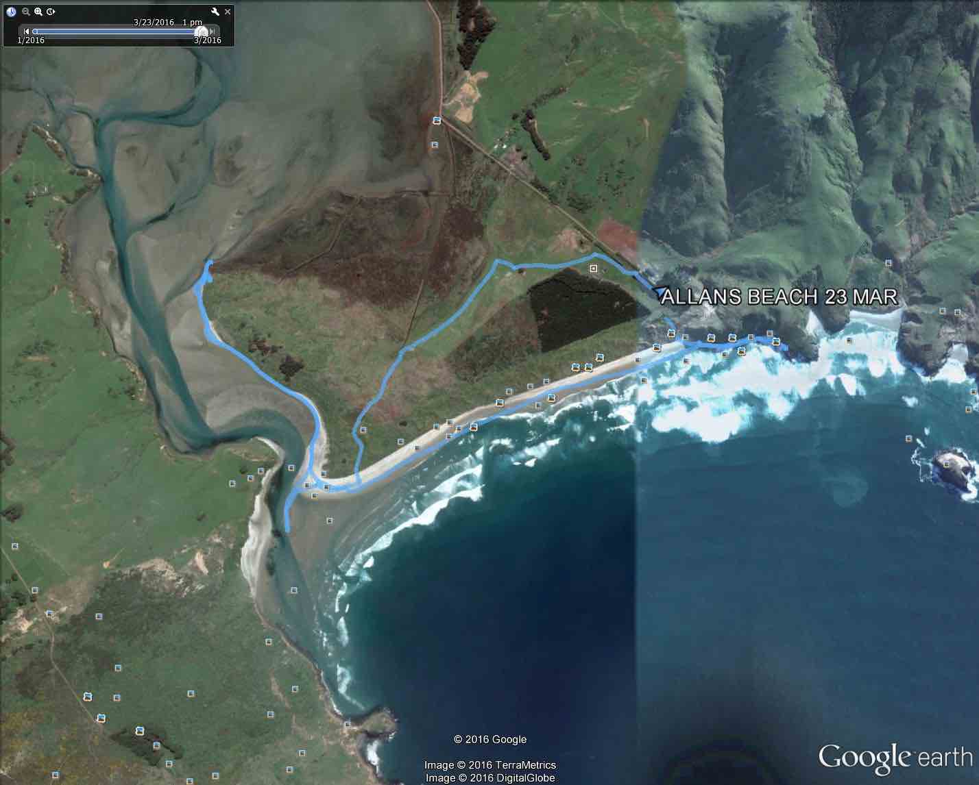
The group that returned earlier arrived shortly before the main group via the beach or past the cattle. The distance travelled was approximately 8 km and the route was similar to that shown in the map for March 2016. The weather was relatively calm, cloudy and reasonably comfortable for walking. Low tide was at approximately 2 pm, about 30 minutes before low tide in Dunedin. (The tide at Taiaroa Head is approximately 13 minutes before Port Chalmers which is approximately 14 minutes before Dunedin).
Afternoon coffee was at Nichols. The Allans Beach has the possible disadvantage of being at some distance from Mosgiel but offers a soft terrain to walk on, some variety between beach and farm walking, flattish terrain and, potentially, glimpses of wild life.
Bruce and Marjorie
4. 23/3/2016. Hikers. Allans Beach. E. Leaders: Bruce, Marjorie.
Allans Beach tramp report 23 March 2016
Twenty-two hikers set off from the car park at the end of Allans Beach road at 9.40 am. Low tide at Dunedin was 11 am and at Allans Beach (between Taiaroa Head and St Clair) approximately 10.30 am. We went over the stile and down the track to the beach before turning left and proceeding to the end of the beach …
… where we observed a couple of sea lions

before returning a little to have morning tea at the base of the rocky cliff, where a sign indicated that no dogs were allowed.
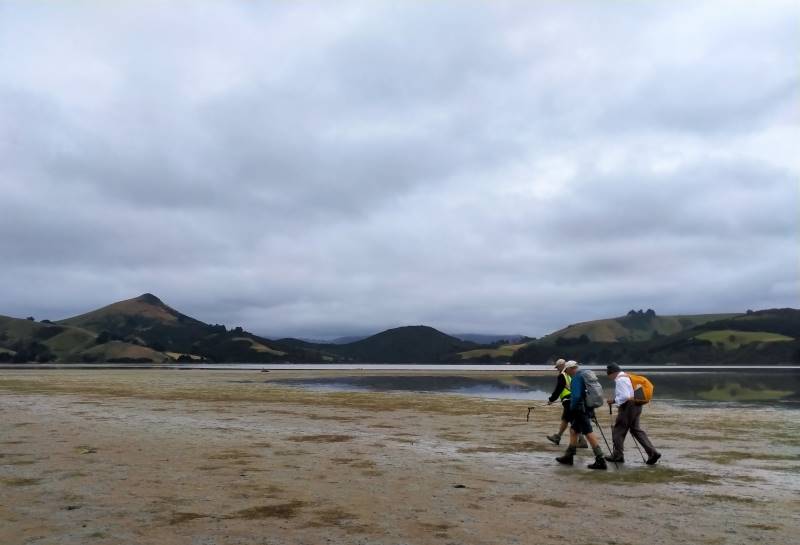
After morning tea we went to the other end of the beach and looked at the channel with the outgoing tide running quite swiftly.
We then went up the left bank of Hoopers Inlet walking on quite firm sand and seeing a few more sea lions.
We stopped at the fence which stretched to within a metre of the water’s edge and then returned to have lunch in the shelter of the lupins.
After lunch we returned to the beach and took a track into the sand dunes about 150 m from the end of the beach. The track came out on the farm of Sam and Christine Neill and we went across the farm, past the house, through two gates on the road leading to the house, and back along the paddock to the stile by the carpark, reaching this at 1.30 pm. Distance covered approximately 8.5 km. Morning tea was designated for the Portobello Café but we ended up at the Penguin Café, Portobello.
It would have been difficult to walk along the edge of the inlet on the sand unless the tide was reasonably low.
– Bruce and Marjorie