Nov 17 2023

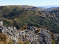
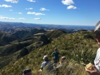
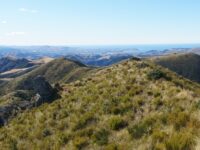
Signal Hill tramps

Published by under Trampers,Year round

Distance Chingford from carpark: 20 km.
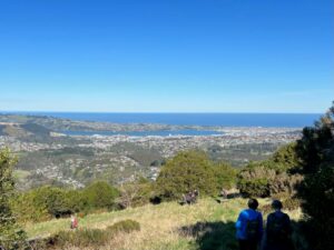
Follow Old Main North Road to Cleghorn Street which has the best view of the harbour. Walkway sign.
Walk starts starts at the gate on right, up McGregors Hill. Beyond stile Pine plantation on 3rd stile at summit.
Gravel road 10 minutes to end. Locked gate. Last stile. Signal Hill road.

15 Nov Signal Hill Harbour View With Hikers. Square Small Janette19. 15/11/2023. Hikers. Cleghorn Street to Signal Hill. Leaders Pam Clough and Jay Devlin

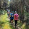
23 keen hikers gathered on a beautiful day at the Bottom of Cleghorn St where we made our way up the gravel road to the beginning of our walk which was firstly over farmland. Continue Reading »

No responses yet

Nov 01 2023

Green Hut, Pulpit Rock

Location: 43 km from car park. Click Silver Peaks Forest for background information. No. 21 on old hardcopy list of 113 club tramps. “Green Hut & Pulpit Rock return or via Possum Hut. Year Round. Long.”

22. 1/10/2023. Combined. Green Hut Site and Pulpit Rock. Tramp Grade 4, Hike Grade 2. 43km. Leaders: Neil Hodgkin/Chris Bezett, Dave Roberts/Jay Devlin.

image (2) Helen square RES100x100Hike to Green Hut (which is now two seats as the hut was deconstructed in 1988 because of ongoing vandalism).
On a foggy morning 18 keen hikers regathered at the On the Spot garage at Waitati where we turned left up a dusty road to the beginning Continue Reading »

No responses yet

Sep 02 2023

Nicols Creek, Swampy, Pineapple Track, Moon Track, Booth Road

Published by under Trampers,Year round

(David Nicol was an early settler and dairy farmer. He reputedly bought land here in the hope that the railway line would be routed north through Leith Valley.)

Click here for Antony Hamel’s YouTube video showing his exploration of the 5 falls of Nicols Creek.

Click here for an EXCELLENT MAP of Nicols Creek showing the location of The Basins (called the Cup and Saucer on the map), and the 5 waterfalls. (It also shows the Pepper Tree track location.)
Neighbours at War Click here for background and photos to the Finnerty Family and their house site on the Moon Track by Nicols Creek.
Click Swampy ridge track for background information.
Click Pineapple Track for background information.
Click Pineapple and Flagstaff walk for background information.
No. 17 on old hardcopy list of 113 club tramps. “Nicols Creek. D McCabe. Year Round”
Nicols Creek circuit Maintained by Green Hut Track Group.
DCC land.

Booth Road 16.1 km from car park.


27. 30/08/2023. Trampers. Pineapple Track-Nicols Creek Grade 3.5-4 Leaders: Sarah and John
An Interview with Pineapple Track/Nicols Creek Tramp Leader Sarah by Tail End Charlie, John

Hi Sarah. You were a late incumbent to the leadership of this tramp?

– Yes, Ross was originally down to lead it, but back problems meant he asked me to lead it instead. (Best wishes for a speedy recovery Ross.)

Did you do a recce the Saturday prior?

– That’s right, Craig went mountain biking, and I went exploring on foot, in the area, to finalize the tramp format.

Were the group lucky with the weather on the day?

-The weather was brilliant. Sunshine, little or no wind and temperatures towards the mid-teens. The tracks were reasonably dry.

And did we have a good attendance?

– There were 18 of us – arriving at Tanner Rd/Fulton Rd corner in 7 cars.

What was the tramp route?

-We started on the Pineapple Track, walking up to the Pump House for morning tea.

Getting ready for morning tea in the sun Caption and photo John

Getting ready for morning tea in the sun Caption and photo John

Then we carried on up the Pineapple Track, turning off at McGouns Track onto the Old Pineapple Track. This led us to the “new” Pineapple Track by Pineapple Point.

crossing Nicol’s stream Caption and photo Pam

crossing Nicol’s stream Caption and photo Pam

From here we followed the lower track, traversing Nicols Creek before arriving at the Mountain Bike picnic table at 11.55am for lunch.

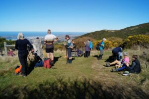
Lunch with a view worth taking in Caption and photo John

Lunch with a view worth taking in Caption and photo John

Panorama - View from lunch spot. Caption and photo John

Panorama – View from lunch spot. Caption and photo John

After lunch it was onto the upper track, traversing Nicols Creek.

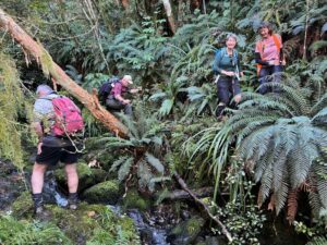
somewhere in the bush! Caption and photo Pam

somewhere in the bush! Caption and photo Pam

Then onto the “new” Pineapple Track, and back to the cars via McGouns Track.

Heading down the pineapple track Caption and photo Pam

Heading down the pineapple track Caption and photo Pam

Wahl!! I think you lost me somewhere there! Did the tramp take long Sarah?

– The recce only took me 3 hours. On the day the tramp took us much longer at 5 hours. Some technical terrain reduced the tramp down to a crawl pace in parts.

Did you manage to squeeze in coffee afterwards?

–        Only just. We were back at the cars by 3.00pm, then headed straight to the Fire Station Cafe’ in Roslyn.

How would you describe the shape of the tramp?

– Roughly a double figure 8.

Sounds lucky, I think? Thanks for the interview, Sarah.

Screenshot Sarah

Screenshot Sarah

Continue Reading »

No responses yet

Sep 15 2022

Street Walk: Town Belt areas.

Published by under Hikers

10. 14/09/2022. Hikers. Street walks of Dunedin – from the Oval. Leaders Jenni and Bruce

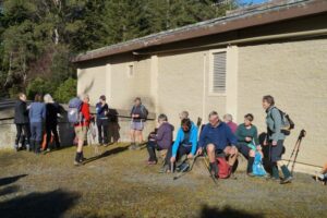
Memorials, buildings and landmarks that we drive past regularly were revisited when 24 hikers ventured out on a clear but cold Wednesday. Wearing many layers of clothing, we set off from the Oval, which as one clever quiz team recalled, covers 22.9 acres.
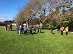
14 Sep Oval Setting off from the Oval Jenni

Oval Setting off from the Oval (Photo & caption Jenni)
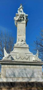
14 Sep Oval Perfect detailing, Boer War memorial, pic Helen

Perfect detailing, Boer War memorial (Photo & caption Helen)

Henry Ely Shacklock, Prince of Wales Hotel, Carnarvon Station, Bell Pepper Blues, the Empire Hotel – the home of the Dunedin Sound, all conjured up memories of time passed.

Further along Princes Street, we admired the beautiful refurbishment of Wains Hotel, now a 5 star boutique hotel and its across the road neighbour, Distinction Hotel, formerly the 1937 Chief Post Office. This building housed a huge number of public servants over the years.
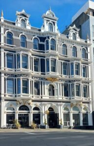
14 Sep Oval Pristine Wains Hotel , Helen

Pristine Wains Hotel (Photo & caption Helen)

Morning tea was taken in the sunshine on the Dunedin Cenotaph.
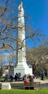
14 Sep Oval Morning tea Helen

Morning tea (Photo & caption Helen)

There was much to observe and discuss in the Exchange. The Cargill Monument, originally erected in the Octagon, but shifted to the Exchange in 1872. A mammoth effort, considering the detail.

14 Sep Oval What a task relocating this in 1872 Helen

What a task relocating this in 1872 (Photo & caption Helen)

It was interesting to visit Queen Elizabeth II’s, great-great-grandmother, Queen Victoria, who reigned for 63 years and seven months. What an amazing length of service from our two stoic royals.

Rattray Street, today a crumbling collection of buildings, has huge memories for many of the team ….. Hong Kong Café, Sunset Strip, Dragon Café, Tai Ping Restaurant, the Rolling Stones party place, Calder Mackay and the Crown Hotel to name a few. Along Manse Street, up Stafford Street. Ross and Glendining Ltd, Kempthorne Prosser, Sew Hoys and the St Mathew’s Anglican Church. The architect for the church was William Mason, MP and Dunedin’s first mayor and yes related to Mason and Wales of today.
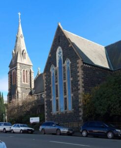
14 Sep Oval St Mathew's Church Helen

St Mathew’s Church (Photo & caption Helen)
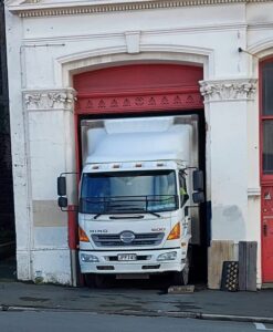
14 Sep Oval Admirable skills here Helen

Admirable skills here (Photo & caption Helen)

Next came the stories from the Rugby Hotel, topless waitresses (from one who knows) and the Bell tea building.

14 Sep Oval NZ's oldest tea producing company Helen

NZ’s oldest tea producing company (Photo & caption Helen)

The Market Reserve was our next destination, and there’s miles of history around what was formerly a tidal inlet, the original shore of Otago Harbour. The Victorian style men’s toilets were discussed, ladies were no where to be found. The Crown Roller Mills building has now been beautifully restored and houses 12 luxury apartments and a restaurant.
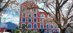
14 Sep The Crown Roller Mills Building Helen

The Crown Roller Mills Building (Photo & caption Helen)

We admired the house Johnny Jones lived in (39 Melville Street) which is still in great shape and then popped our heads into The Dunedin Club which was built for him. Royalty have stayed there. This is used today as a hub for business people, weddings, conferences etc. It also has eight luxurious suites for accommodation. As an aside did you know that Jones donated the land for the building of St Paul’s Church in the Octagon?
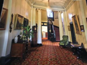
14 Sep Oval The grand hall, photo courtesy of The Dunedin Club

The grand hall, photo courtesy of The Dunedin Club

We zigzagged up the 98 steps (one of the quiz questions), to Maitland Street and some viewed the Bottled Sunshine sign for the Lanes lemonade factory. Some missed that! Carroll Street which was previously known as Walker Street, was the red-light district of Dunedin and associated crime. The top block of Carroll Street was known as the Devil’s half acre. The arrival of the Lebanese community helped improve the area, but the reputation was renowned. Now, we’re informed the red-light district is all around us, with online ordering and home deliveries!
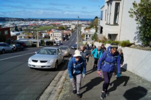
14 Sep Oval Up Maitland St, looking back occasionally for great views John

Up Maitland St, looking back occasionally for great views (Photo & caption John)

The team made good progress up the steep Maitland Street and arrived at our lunch stop at Unity Park. The wind chill factor caused us to depart sooner than we would have liked. We were happy to know the Trampers had reached the top of Mt Cargill for their lunch stop but they couldn’t see us waving!

The only other site worth mentioning was from Walter Street and overlooking where Carisbrook once was and pondering what might be in store for the Forbury Trotting site.

Back through the Southern Cemetery, a rather sad place with many delipidated plots.

At the Oval, we popped into the Kensington for a short quiz on the day’s findings. One of the team’s names was “Time for Ovalteam” – clever! The team though who won the quiz was “Outram Plus 1” and received boxes of Smarties, which seemed appropriate. Drinks and homemade nibbles were enjoyed, service was a bit slow.

Walk was around 9 km.

We would like to thank everyone for their keen participation for an enjoyable day out.
Bruce and Jenni.

Note: Toilets on this walk are few and far between. If you want the Oval toilets open, you need to organise this with the DCC – www.dunedin.govt.nz/do-it-online/book/facility-bookings or phone 477 4000. The ones in the Exchange area where the ACC building is being erected, are no longer available.


9. 16/02/2022. Hikers. Town Belt Circuit. M. Leaders Linda Partridge and Diane Paterson

Thirteen keen hikers met at Woodhaugh Gardens for morning tea before setting off on a circuit of the northern/central part of the town belt.
16 Feb Woodhaugh Gardens morning tea Ady resize

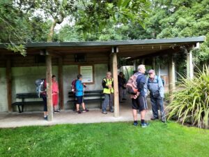
Morning tea at Woodhaugh Gardens (photo & caption Ady)

We began by taking the zigzag path and steps up from Duke Street. When we reached Queen and Warrender streets, after our first ascent, we viewed the university in the distance and saw up close where many of the students lived in their hillside flats. We met some students from Auckland moving into their new abode and friendly banter ensued between the students and the sprightly TRTC hikers. We also marvelled at the parking arrangements in these narrow steep streets.
16 Feb More steps Diane resize

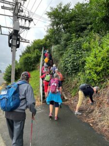
More steps! (photo & caption Diane)

We continued on to Cosy Dell and took time to view the tennis courts and the array of historic homes, many now flats that are located in a small area.
16 Feb Street walkers Raewyn

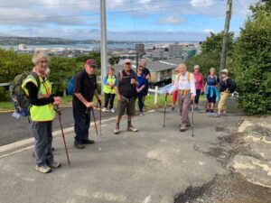
Great views of the city along the way (photo & caption Raewyn)

16 Feb Betty on scooter Linda resize

Betty keen for something different! (photo & caption Linda)

16 Feb Freddy Mercury Raewyn

‘Queen’ Freddie Mercury on Queen Street (photo & caption Raewyn)

More steps (and groans) and we made our way along Park Street to Heriot Row, London Street and then around by Moana Pool to our lunch spot at Olveston.

Unfortunately we felt we were a little early for lunch so low and behold another set of steps were located and we climbed up to Wallace Street and then found a pleasant route back down to Olveston for a well-earned lunch.
16 Feb Olveston lunch Ady resize

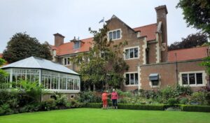
Lunch at Olveston (photo & caption Ady)

After lunch and a brief look at the lovely Olveston gardens our route back took us along streets and tracks through the town belt until we regrouped at Stonelaw Terrace. Given we were making good time we did a detour down Cannington Road and Braeview Crescent before descending on the historic Bullock Track to our cars at Woodhaugh Gardens.
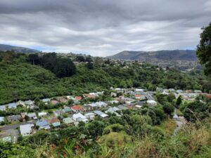
16 Feb Looking to NE Valley Ady resize

View of the Leith Valley (photo & caption Ady)

It was a great day with lots of interest including history, panoramic views, friendly students, the very special Green Belt and a few laughs along the way. The circuit we took was around 9kms.

Afternoon tea was enjoyed at the café in the Botanic Gardens.

Linda and Diane


8. 11/9/2019. Hikers. Town Belt- walk, bus trip. Leaders: Pam and Jenny.
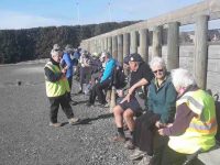
B.1. Morning tea at Dunedin City Petanque. No shorrage of seating, perfectly sheltered from any breezec

B.1. Morning tea at Dunedin City Petanque. No shorrage of seating, perfectly sheltered from any breeze. (Barbara pic and caption.)
B.3. Playtime for a youngster! c

Playtime for a youngster! (Barbara pic and caption.)
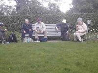
B.4.Lunch time at Olvestonc

Lunch time at Olveston. (Barbara pic and caption.)
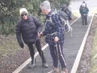
B.64. Lesson on tackling step before teacher heads actoss the ditch!c

Lesson on tackling step before teacher heads actoss the ditch! (Barbara pic and caption.)
Continue Reading »

No responses yet

Apr 23 2021

Tunnels Track, Yellow Hut, The Gap, Gap Ridge

Published by under Trampers

Click Silver Peaks Forest for background information on the area.

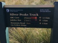
Accessed from Mountain Road from old forest HQ 6 hr ret, Route, DOC and private land.
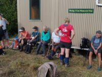
(Green Hut access: 41 km from car park.)

8. 21/04/2021. The Gap. Leaders: Arthur Heenan, Peter Horrell

Eighteen Tampers set off from Mosgiel at 8.00 am and travelled to Waitati and drove up through the forestry  to the start of Yellow Ridge track.  Led by Arthur Heenan and Peter Horrell, we set off in great weather conditions, with a clear sunny day with little wind and the recent dry conditions making the track as good as possible It was a steady walk to the hut for morning tea and then up to Yellow Ridge.

DSC04820res

“Time for a rest – morning tea.” – Photo and Caption John

image_123923953 (3)res

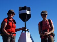
“Which way? – Photo Peter

DSC04829res

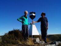
“Destination reached.” – Photo and Caption John

DSC04830res

“No sign of rain.” – Photo and Caption John

image_123923953 (1)

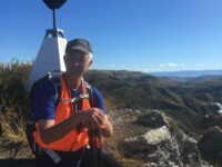
“Me at the top!” – Photo and Caption Peter.

DSC04832res

“The gap rocks.” – Photo and Caption John

At 860 metre above sea level the trig station gave stunning views out to Karitani ,Blue Skin Bay, Mt Cargill and Swampy, as we topped the first ridge we could see through Silverpeaks, Hindon, right through to the Wind Turbines above Lake Mahingarangi,  a spectacular piece of country.
image_123923953 (2)

“Amazing views.” – Photo and Caption Peter

DSC04833res

“Panorama – as far as the eye can see.” – Photo and Caption John

DSC04839res

“Homeward bound stop.” – Photo and Caption John.

The 14.5 km walk was hard due to the elevation, with some steep climbs and some gorse to wade through and the final climb back to the cars  certainly gave us all a good workout.
Peter

  Continue Reading »

No responses yet

Dec 12 1980

Pineapple and Flagstaff Walk

No. 31 on old hardcopy list of 113 club tramps. “Pineapple Track – Swampy Summit. Year Round”

The hills around Dunedin are superb viewpoints to see the city, coastline and ranges of inland Otago. Flagstaff is one such hill and like Mt Cargill to the north allows the walker to pass through several types of vegetation en route to the summit.

Most of the features seen from the walk have strong historic significance. Beyond Signal Hill, the site of Otakou can be seen. When the first European settlers arrived, this Maori settlement was the largest in the region. In 1817 this ‘kaika’ contained 600 very “fine houses, neatly furnished”. From 1833-1841, a whaling station was operating from here. The whalers’ township, known as Musselburgh was nearer the heads. By 1840, 250 Europeans were living around the harbour entrance. It was from Otakou that the earliest immigrants received their first supplies of fresh meat, milk, butter and vegetables. The region south to the Nuggets and inland by the Clutha to as far as the Lammerlaw Range and West Taieri was bought for European settlement of $4,800.

Almost immediately apparent from the walk is the distinctive layout of the centre of the centre of Dunedin. Charles Kettle and a party of surveyors laid out the streets in 1848, using the special features of the Scottish capital, Edinburgh as a guide. The planned settlement took its name in 1845 from the Highlander’s name for Edinburgh. The town belt, the ribbon of bush threading its way through the suburbs, cutting off the inner city from the suburbs also dates from the early surveys. Immigrants were offered land packages on or before their arrival in Otago. Each consisted of a 1/4 acre (1012 sq m) town allotment, a 10 acre 4 hectare) suburban allotment, and a 50 acre (20 hectare) rural allotment, all sold at the rate of £2 an acre ($9.60) a hectare). The town belt separated the town and suburban allotments. Most rural blocks were on the Taieri Plains.

Kettle’s name was given to Flagstaff Hill, but through common usage the term Flagstaff became accepted and superseded Mt Kettle.

As early as 1925 there was skiing on Swampy Hill and Flagstaff. Sixteen years later an exceptionally heavy snowfall convinced many of the return of very cold winters. Many Otago skiers spent several weekends clearing the hillside of stones and boulders but unfortunately for them the snow never came back.

In these early days of settlement the forests all but cut off Dunedin to the north. Long before a road was made around Mt Cargill, the track known as ‘Johnny Jones’ (the Waikouaiti whaler) track linked the Dunedin area with Waitati via Flagstaff and Swampy. In 1859 snow poles were put up along the track to guide travellers caught out in storm or mist.

A road was made between Whare Flat along the inland flank of the hill to near the saddle between Flagstaff and Swampy Hill in 1870. The settlers at Whare Flat used it to draw their supplies of timber from the bush on the other side of Flagstaff. In later years these old roads fell out of use.

The settlers, utilising a number of small sawmills, ‘cut-out’ much of the bush on the eastern flank of Swampy Hill and Flagstaff. The Pineapple Track at the northern end of Flagstaff passes through such ‘cutover’ forest. From here podocarps were milled to provide local building materials. Only an occasional remnant podocarp remains. Mahoe (whitey wood) is plentiful here while on the forest floor and tree trunks, many species of fern abound. The upper part of the track here includes totara saplings and old stunted broadleafs with twisted limbs, growing in a slightly drier soil. Hounds tongue and “hen and chicken” type ferns hang from the dead tree trunks.

The tussock on the part of the walk from the Whare Flat Road car park (known as the ‘Bullring’) is being taken over by native scrub: flax, manuka and the occasional Olearia – although these get knocked back by fires from time to time. Native orchids are common here, especially in early summer. Skylarks can be heard on this hill from sunrise to sunset.

The summit: An unobtrusive plane table helps point out the many interesting places which can be seen from here. To the north you can see the higher hill of Swampy with its buildings from aviation and scientific experiments, and to its east is Mt Cargill, topped by a TV transmitter. Further away is the city and the drowned valley of Otago Harbour with the Peninsula beyond and the sand dune suburbs of St Clair and St Kilda connecting this with the mainland.

Turning northwards, the track crosses the tussock-covered scenic reserve beyond the summit. In spring and summer, orchids and violets can be seen between the snow tussock. Boulders of volcanic rock are scattered over the hill top, some of which are clustered in lines of ‘stone stripes’ down the hillside.

The tussock grassland now largely covering the summit and upper slopes is only 2-300 years old. Before this , forest covered the entire area. Periodic fires have encouraged the tussock grassland. Snow tussock, mountain flax and Astolia are the most common native plants, while manuka is encroaching into the grassland that fire has not recently reached.

Once into the bush, the track drops through regenerating shrub-land from the signpost at the top of the Pineapple Walk. It was near this spot that in the 1920s a well-known grocer and tramper guiding parties to see the views would pause, and pass around a tin of pineapple. It became a tradition that once empty the tin would be left on a tree or fence post – giving the track the name.

From clearings on this track can be seen Ross Creek Reservoir and the city beyond, also the Mt Cargill television transmitter and the northern side of Leith Valley. Many shrubs are invading clearings from the bush edge. Fuchsia and pepperwood are common. Grazing has determined the nature of this vegetation with only the unpalatable species surviving.

The Booth Road water treatment station sits in a clearing of ornamental plants. A small round concrete tank in the pines on the left of the track halfway down  from this station is also part of the water supply scheme built before the 1950s. A tap near the edge of the bush gives cool refreshing water to the walker on his or her return.

At the Booth Road end of the walkway, the track passes through the Dunedin City Council exotic plantation. Spruce, ash, radiata pine and Douglas fir were planted over 30 years ago as part of growth experiments with these species in the area.

– From DoC hard copy information sheet.

One response so far

Jan 09 1980

Dunedin’s Hills’ History

Dunedin’s hills are virtually all of volcanic origin. Several eruptions occurred near Port Chalmers from 10-13MYA. The lava flows from this volcano and its many smaller flank vents extend in a roughly circular pattern, of some 15 km radius, over the sediments.

Continue Reading »

No responses yet

« Prev