Dec 09 2023

Tomahawk Lagoon and nearby tracks/areas

Published by under Beach,Trampers

Ocean Grove, also known as Tomahawk, is a suburb in the southeast of the New Zealand city of Dunedin. … The suburb was known as Tomahawk until the 1930s, the name not being a reference to the weapon, but rather possibly an anglicised form of the Māori words tomo haka, meaning “dance by a gravesite”.

No. 23 on old hardcopy list of 113 club tramps. “Karetai Rd via Monument from Lagoon. Year round.”

Distance from car-park: Tomahawk: 19 km; Smaills Beach: 22 km;  Paradise Road: 26 km.’

DCC List: 41 Peg Track. Otago Peninsula
Accessed from Oregon St. 3.5 hrs ret. Tramping track – unbenched. Managed: DCC CAM, private land.
Description – This track provides a link between Ocean Grove and Highcliff Road. Access to the track in Ocean Grove is off Oregon Street. An attractive walk around Tomahawk Lagoon then climbs through gorse and native bush. Turn right towards Soldiers Memorial through paddocks with gorse sometimes obscuring the rock walls.

  • Classification – Hard
  • Time – Approximately 45 minutes.
  • Parking – Limited at Highcliff Road. No dogs.
  • Dogs – No

Boulder Beach From Top Of Highcliff Track Pam (square) (100x100)43. 06/12/2023. Trampers. North of Tomahawk. Grade 3. $7. 22km. Leaders: Esther Willis and Julie McKenzie
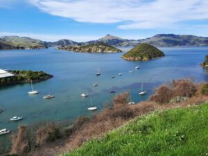
As hoped, the weather was kind to us, as this tramp would be wasted without being able to savour the spectacular views.

Continue Reading »

No responses yet

Sep 06 2022

Port Chalmers and environs

Published by under Hikers

Click Dunedin’s Hills’ History for background Information.
30 km from car park.
24. 31/08/2022 Hikers. Port Chalmers. Leaders: Michael Webb and Bruce Wright M.
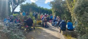
On a typically beautiful Port Chalmers day with no hint of Mosgiel type frost, 32 hikers met at the Back Beach car park for what some thought was going to be a gentle stroll visiting some historical sights in West Harbours hidden gem.
The first hill climb on the track from Back Beach to Island Terrace cut short the usual discussing of sore hips, knees, dieting, prostate problems, midnight trips to the loo, hot flushes, ungrateful children, recalcitrant grandchildren, the Mayor and Jacinda.
Oh what a beautiful day Ady

Oh what a beautiful day Caption and photo Ady

It was during this first ascent of many hills that the first mumblings of mutiny were heard. The leader took this on board, totally ignored it and proceeded to lead the group up to Hotere Hill via Campbell Buchanan lane where we had morning tea.
Morning tea in Ralph Hotere Garden

Morning tea in Ralph Hotere Garden
Caption and photo Helen

We then descended a track to Back Beach for a relaxed stroll alongside the harbour where Faye revealed herself to be a “legend” with her lecture on oven cleaning.
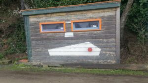
Boat shed on Back Beach Michael

Boat shed on Back Beach Caption and photo Michael

Stone boat 2

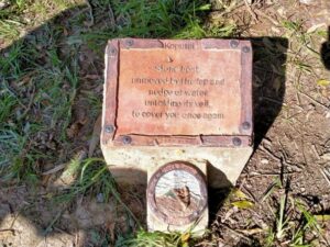
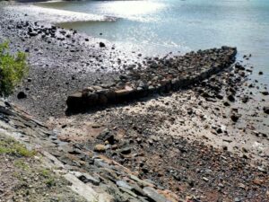
Stone boat – how many just walked by? Caption and photos Phil

Stone boat 1 Phil

A walk up Currie Street to see some historic buildings including the old Buffalo hall was followed by a welcome comfort stop at the Port Chalmers Library. Another steady ascent took us to the Lady Thorn dell for lunch.
Neil will give anything a go - once Phil

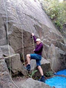
Neil will give anything a go – once. Caption and photo Phil

Yet another climb took us to Scott Memorial before crossing the road for our last uphill leg before descending through some bush and a track past the old cemetery back to Port Chalmers.

The town Helen

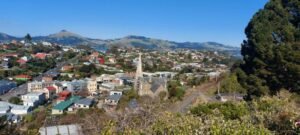
The town Caption and photo Helen

Refreshments were taken at The Galley where one unnamed lady ordered a Bloody Mary. Due to the many steep tracks and hills in Port Chalmers this could possibly be a Grade 3.  The hike was 8km. Michael Webb

Continue Reading »

No responses yet

Sep 20 2017

Portsmouth Drive to Marina

Published by under Uncategorized

17 km from car park.

3, 20/9/2017. Hikers. Portsmouth Drive to Marina. E. Leaders: Judy and Dorothy.

Twelve harbour strollers, went to Andy Bay.
We parked beside the inlet – it was a windy day.
Along the Portsmouth Drive we went, trudging in a row.
We passed the harbour molars, and onward we did go.

A sunny sheltered spot was found, and morning tea was had,
Relaxing in the sunshine, it wasn’t half too bad.
Then on we went, around the wharves, and round the harbour basin –
We found that walking in the wind, was really somewhat bracin’.

We viewed the plaque in memory of “Neptune”, sunk in war.
She hit a minefield in the Med, and then she was no more.
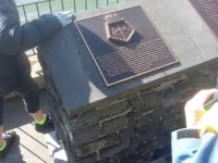
We passed the Neptune memorial at the wharf and some members were able to point to the names of loved ones who were involved in this tragedy. (Clive pic and caption.)

On we went and onwards, across the Leith we strode,
Then Clive led us along the groyne, to where the water flowed.
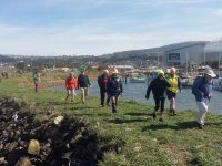
We took a walk out on the groyne at the boat harbour and nearly got blown away in the 20 knot winds. (Clive pic and caption.)

Back around the boat harbour, some picnic tables found,
For lunch and chatter in the sun, then homeward we were bound.

Lunch outside the Yachting Club. (Raewyn pic and caption.)

A cracking pace was soon set up, the wind was at our backs.
Perhaps the increase in our pace, was due to lighter packs?
We viewed a lot of logging trucks, a queue a mile long –
Sending all those logs away, we feel it is quite wrong.

A photo stop was taken, beside the harbour molars –
And so we coined the title, “The Mosgiel Harbour Strollers.”
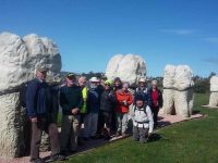
The Molar strollers. (Clive pic and caption.)

The cars in view, we stepped it out and headed fast for home.
A coffee stop at Blackstone – and then I wrote this “pome”….
(Well, try to find a better rhyme!) – Judy.

Stats for the day: 11.7 kms; 3 hours and 4 minutes walking time; 480 calories. – Clive.

2. 14/1/2015. Hikers. Portsmouth Drive to Marina. E. Leaders: Peter and Wendy.
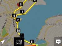
GPS of route

GPS of route

We parked in the carpark by the Bayfield High School. And 21 of us set out.
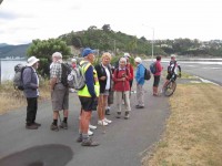
Some of us waited while others investigate the doings of a suspect prowler.

The bulk of us waiting for others investigate the doings of a suspect prowler back a the carpark and to call the police to investigate. Helen found a passing cyclist friend to chat to.

We walked along Portsmouth Drive past the molars, turned down Kitchener St, huggiing the harbour edge and stopped off for morning tea.
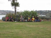
Sheltering from a cold wind for morning tea.

Sheltering from a cold wind for morning tea.

Carrying on, we turned round into Birch St, across the top of the harbour basin then down along Fryatt St almost to its end. Then it was up Wickliffe St, across the railway overbridge, briefly on Anzac Avenue, down Parry …
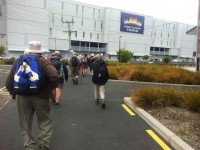
 

Skirting the Statium.

Skirting the Stadium.

…and Minerva Streets to cross the Leith on SH88 bridge, and on the north side to turn under the bridge and out along Magnet St to get to our lunch stop at the Marina.
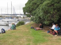
Lunch

Again sheltering from a cool wind, this time for lunch.

On our return, we walked the length of Anzac avenue. Then onto the railway station platform, where Dorothy performed a most believable but all too brief strut down the catwalk. Out at the other side, on past Toitu Settlers Museum and along the grassy verge ahead where we stopped, briefly thwarted by the railway bridge overpass pathless on-ramp ahead. So it was across all four laned SH1 Cumberland St, with the assistance of the lights further back. This safely accomplished, it was Les and Peter led us up Water St, along Vogel St, back down Jetty St and onto the pedestrial spiral ramp to get us onto the bridge. Then via Birch St, Buller St and French St we rejoined Kitchener St which took us back out onto Portsmouth Dr and back to the cars. From talking to one or two others, I must say coming to the end of eleven kilometres on hard pavement had taken its toll of leg muscles, on this the first tramp after the holidays. A good walk, not too hot or windy. Thanks to Peter and Wendy for a good start to the year. – Ian.

1. 20/11/2013. Hikers. Midland St, Portsmouth Drive to Marina. Leaders: Bev and Chris.
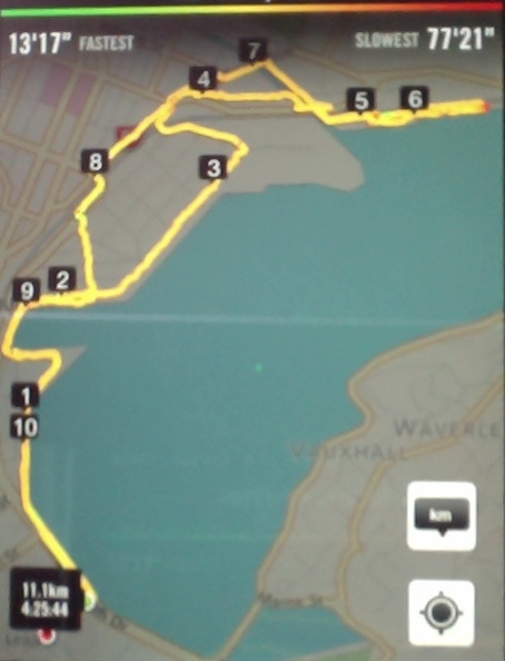
Route

Route

The walk was most inventive and interesting, leading us along back streets few of us had ventured on before. We parked at the bottom of Midland Street where we could cross onto Portsmouth Drive with the safety assistance of traffic lights. The laying of cable along the walkway forced us onto a less inviting traffic-coned path along the road till we returned to the walkway at the molars.
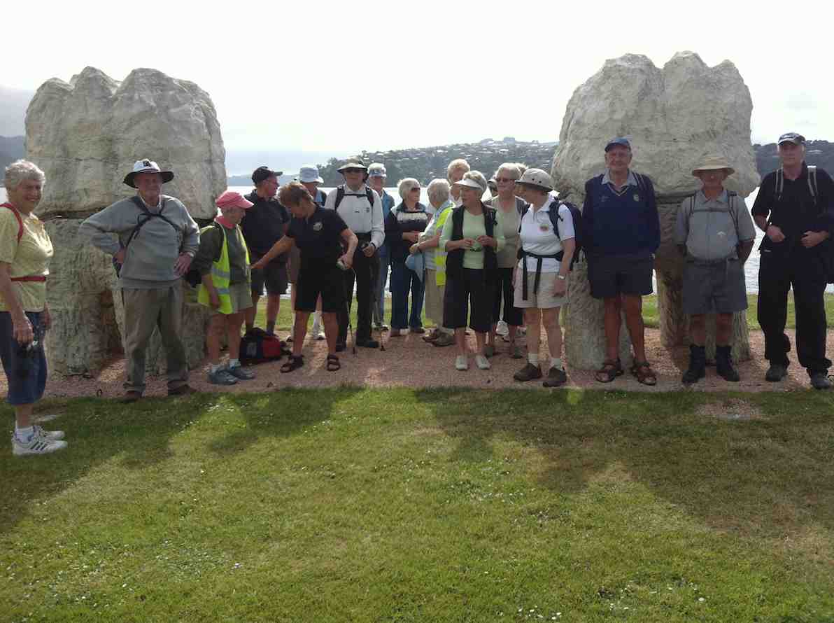
Molars

Molars. The 20 of us are almost all in the pic.

A little further on we turned down to the length of Kitchener St turning left up at its end into Birch St to join Wharf St esplanade and have morning tea on the seats, to admire the inner harbour view as well as a gentleman, lent back on a camp seat, fishing, hat over face, asleep.

A happy surprise was Lex sharing round chocolate marshmellows in anticipation of his 85th birthday the following day.

Then it was up and on again, down virtually the entire length of Fryatt St to turn left up Wickliffe Street and over the elderly railway overhead bridge, down the other side to the right, and to stop and admire (?) the special road-coned entrance/egress of Hall’s work-yard and the still-hooded traffic lights. We gingerly made it across Anzac Ave, across Frederick St, back again across Anzac Ave to join Parry St, make way across the SH88 Leith Bridge very wide pedestrian walkway, down, back, under the bridge and along Magnet St. (4 km)

and the Harbour Walkway (5 and 6 kms) to lunch at the northern end of the map in what shelter we could find from the nor-easterly wind.

We retraced our steps to the SH88 Bridge underpass, this time following the Leith bank up to Anzac Ave (7 and 8 kms)

which we followed right to the St Andrew St lights where we turned down along it to the roundabout, followed Mason St, then into Tewsley St and into Fryatt St to retrace our route alongside Wharf St (9 km), Birch St, Kitchener St and Portsmouth Drive back to the cars.  11 km in all. The harbour wind-blast along Portsmouth Drive almost blew us off our feet. Many thanks to Bev and Chris for a varied and interesting streets exploration around a corner of the harbour. – Ian.
No responses yet

Mar 25 1970

Salisbury Property

Published by under Uncategorized

Donald Reid was ambitious, disciplined, far-sighted and a hard worker. He was born on a farm in Fifeshire, Scotland and it had always been his ambition to own his own farm.
With his two young brothers and his widowed mother, who had just remarried, he arrived at Port Chalmers in 1849. He was fifteen years old. In two years’ time he was grazing his own bullocks at Breadalbane, North Taieri. Before he took up 62,000 acres at ‘Salisbury’ in 1857, he had gained experience at the Valpy Farm at Forbury and had also operated his own farm at Caversham for two years, where he had succeeded in bringing swamp land into cultivation.
By 1857 there were clay-walled thatched roofed cottages sparsely dotted round the foothills of North Taieri well above the swamp of the central plain. Reid built a peesy (or pise [with e acute]) which was his highland name for the Australian named wattle and daub cottage. He brought the water supply right to the cottage with a tap on the verandah. He called his property ‘Salisbury’, as the hills reminded him of Arthur’s Seat and the Salisbury Crags, Edinburgh. Gradually the wilderness of high fern, manuka scrub and flax became a model farm: the flax and fern roots were broken up by ploughing with oxen; bricks were burnt on the property to build accommodation for the men; shelter belts of blue gums, macrocarpus, wattles and pinus insignis, ornamental trees such as poplars, weeping willows and hawthorn hedges were planted, and a plantation of gum trees were started with seed from Australia. ‘Salisbury’ was almost a self-contained community where most of their requirements were produced, including candles and soap. By 1865 the change from grain growing to sheep grazing had been made and it became one of the best grazing estates in Otago, splendidly watered and well sheltered with belts of trees.
When gold was discovered in 1861, Reid made a bargain with his men. They agreed not to abandon their farm duties for the goldfields until their important summer work was over. In return, Reid supplied transport, equipment and supplies for three months whilst they worked a claim together. This claim brought them more than their usual share of luck. Reid also ran a carting business to the diggings taking farm produce and stores, making a trip each way every week with a bullock dray.
… The first Mrs Donald Reid died in 1868 and he married Mrs Price in 1874.
… Donald Reid was one of the outstanding men on the Taieri and in Otago. His interests were wide including farming, transport, Harbour Board, politics and the development of industry and local affairs. He served continuously on road boards and school committees and donated the glebe of 10 acres on which the North Taieri Church and manse stand; he was instrumental in the passing of some early land Acts and in Sir H. Atkinson’s government, after the Abolition of the Provinces in 1876 he was Minister of Lands and Public Works. When he retired from public life in 1878 he commenced the business of auctioneer and stock and station agent which … developed into the … large concern.
His journey of 24 miles to Dunedin and back each day involved three to four hours’ travel in all weathers, part of it in an open buggy. in 1911 Reid made the decision to sell ‘Salisbury’ and the following year it was purchased by Mr L C Hazlett who retained the flat land for grazing his race horses and built the four cottages between ‘Salisbury’ and the North Taieri Church.
From 1945 to 1965 Mr E C S Falconer of Dunedin owned the property… The present owners are Mr and Mrs P O McDonnell. To maintain the ‘Salisbury property in its former condition would be costly and a great deal of work. Young Mr and Mrs J W Penno [who] now live in the house… – “Taieri Buildings” 1970 by Daphne Lemon

No responses yet

« Prev