Click on Map to Enlarge
Taieri Recreational Tramping Club
Mid-week recreational and social walking group based in Mosgiel NZ

Click on Map to Enlarge
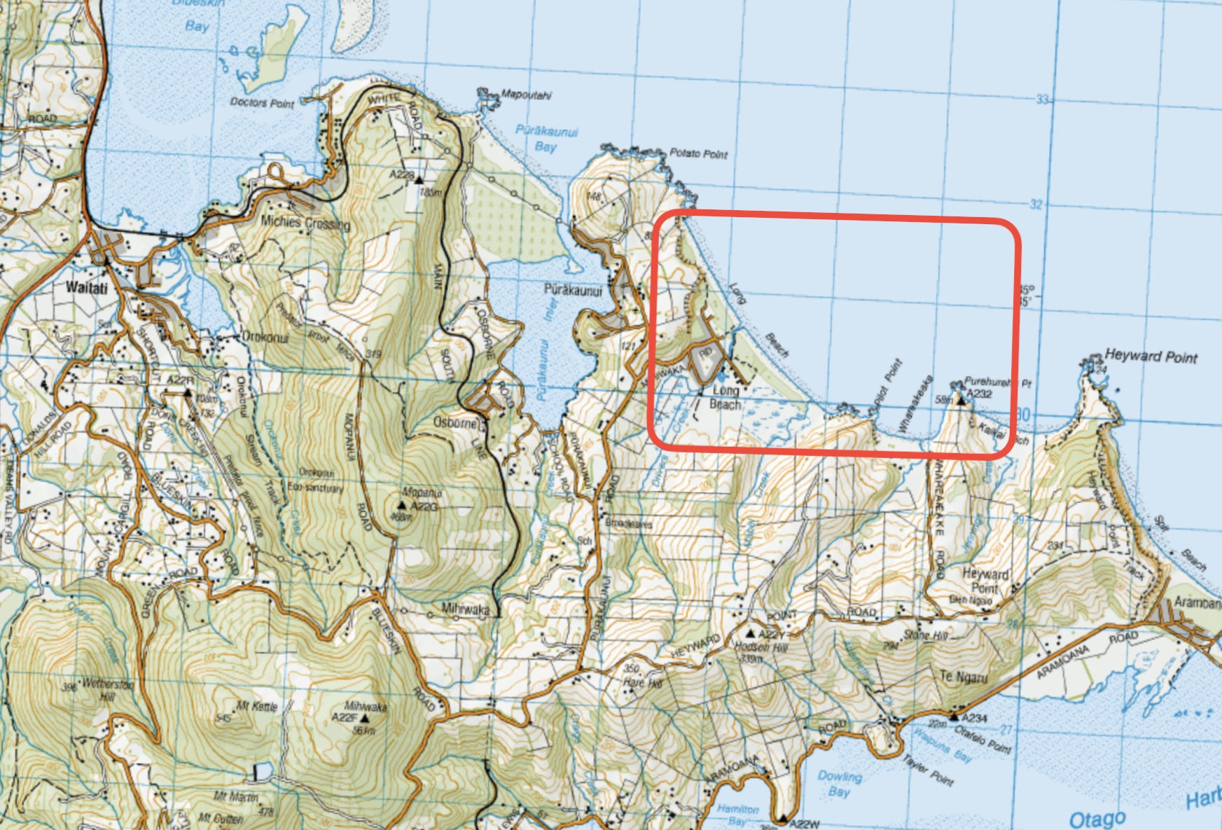
This page of club tramps and hikes in the West Harbour area groups together trips to Long Beach. (map)
Road distances from Mosgiel carpark.
Long Beach. 2019 – 2004 (5 trips, 3 with reports and photos, 2 with no report or photos)
This page of club tramps and hikes to the West Harbour area groups together trips incorporating the Otago Harbour cycle/ walk way via Ravensbourne, Mia, Burkes, St Leonards to Port Chalmers.
Road distances from Mosgiel carpark.
West Harbour Recreation Trail. 2009 – 2022 (8 trips, 6 with reports and photos, 1 with no report, 1 with report and no photos)
Click on map to enlarge
Click on map to enlarge
Click on map to enlarge
Click on map to enlarge
Click on Map to Enlarge
Click on Map to Enlarge
Click on Map to Enlarge

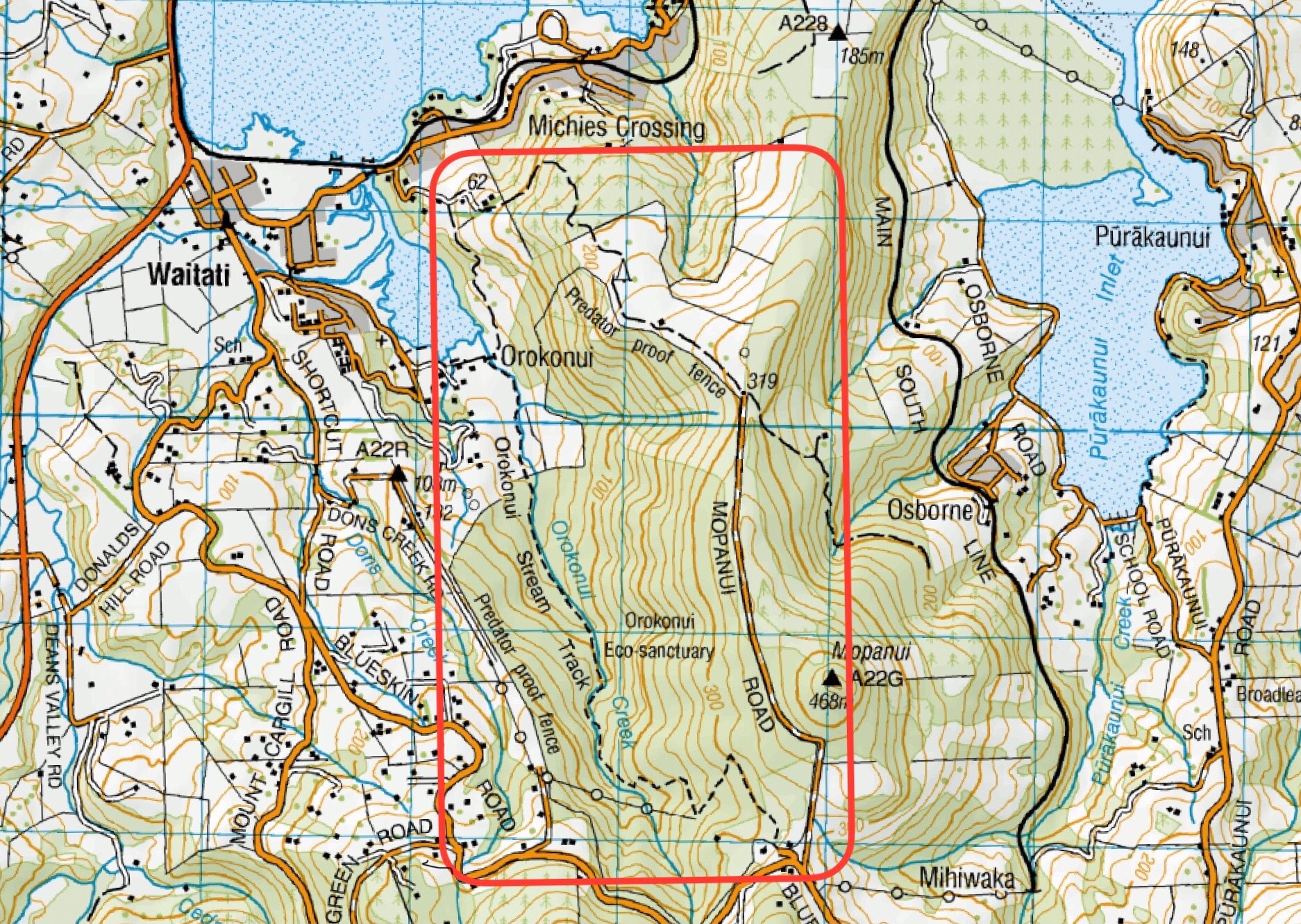
This page of club tramps and hikes to the West Harbour area groups together trips to the Orokanui Ecosanctuary. (map)
Road distances from Mosgiel carpark.
20/11/2024. Orokonui / Wrights Road. Hikers. Leaders: Jay Devlin and Pam Clough.
Orokonui Ecosanctuary. 2012 – 1996 (9 trips, 1 with reports and photos, 1 with photos only, 7 with no reports or photos)
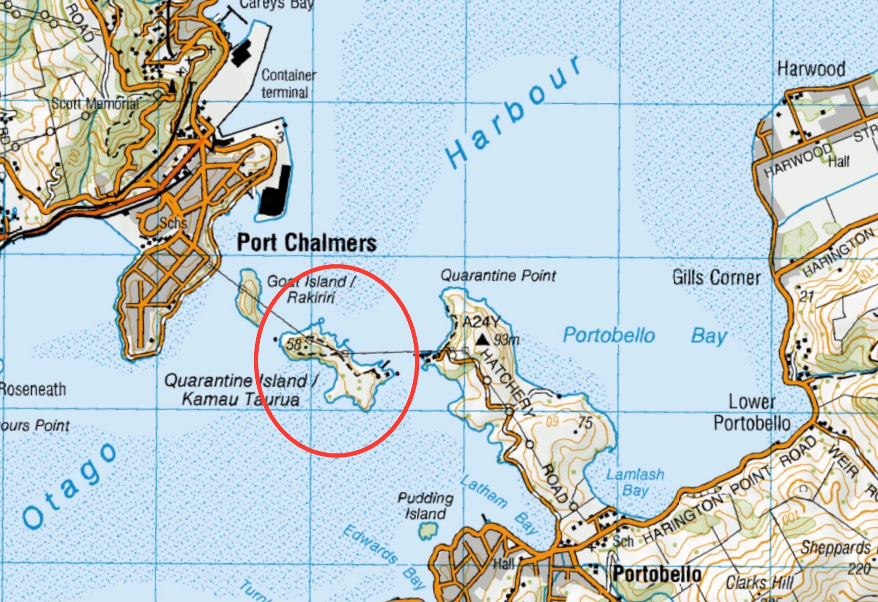
This page of club tramps and hikes to the West Harbour area groups together trips to Quarantine Island. (map)
Road distances from Mosgiel carpark.
General Information:
Wikipedia entry on Quarantine Island
And here is the St Martin Island Community web page. Click the photo at the bottom to see original buildings!
Quarantine Island: Botanical Report
Quarantine/St Martins Island. 2023 – 1997 (5 trips with 3 reports)
This page of club tramps and hikes in the West Harbour area groups together trips for Port Chalmers, Mia, Deborah Bay and Rangi Park walkway.
Road distances from Mosgiel carpark.
Click Dunedin’s Hills’ History for background Information.
TRTC Grading Information – trips to Port Chalmers and surrounds are generally given a TRTC grading of 2 – 2.5. This is indicative only, as depending on the route taken, allocation of gradings can differ from this. For more detailed analysis refer to Grading Information.
16/04/2025. Historic Port Chalmers. Grade 2.5. Hikers. Leaders: Mike Webb. Jenni Wright.
Maia to Port Chalmers. 2024 – 2023 (2 trips with 2 reports)
Port Chalmers and environs. 2022 – 1995 (24 trips with 10 reports)
Port Chalmers, Deborah Bay. 2001 – 1995 (3 trips, no reports or photos)
Port Chalmers Rangi Park. 1997 – 1996 (2 trips, no reports or photos)
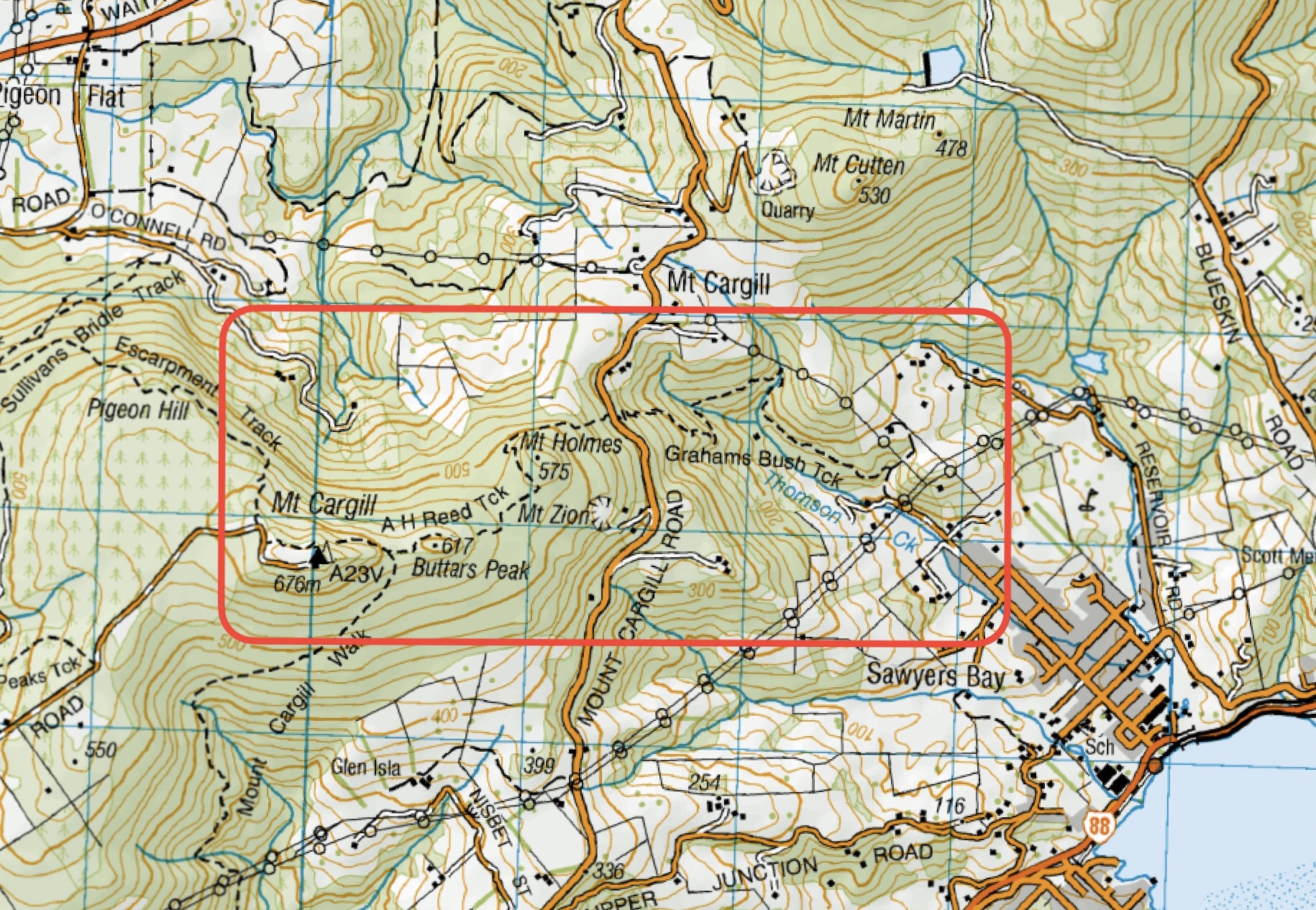
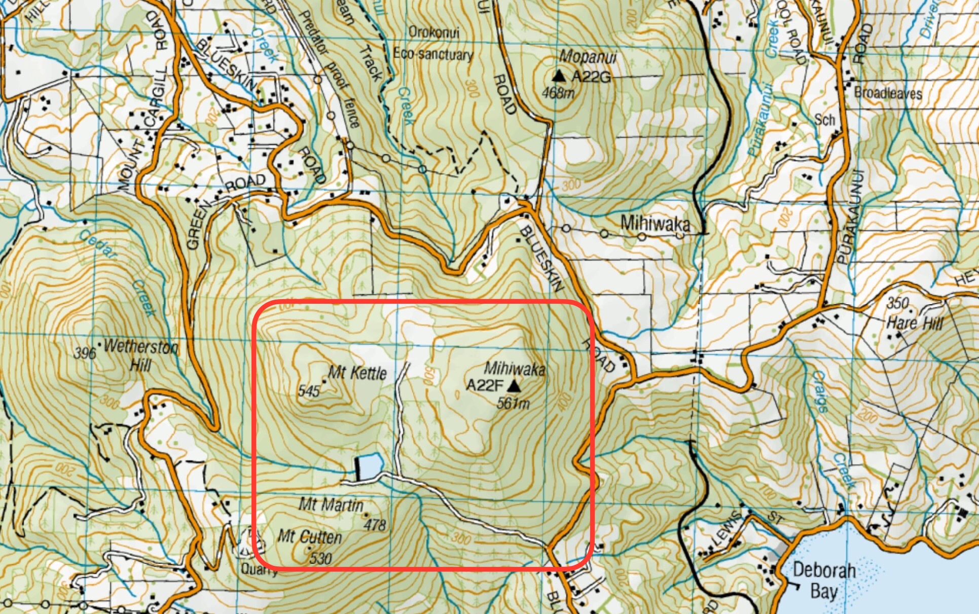
This page of club tramps and hikes in the West Harbour area groups together trips to Mihiwaka, Mt Kettle, Mt Cutten and Cedar Farm. (map)
Road distances from Mosgiel carpark.
No permission needed to reservoir. Cedar Farm: Seek Access Permission DCC Forestry.
22/01/2025. Cedar Farm to Mt Cutten. Grade 3. Hikers. Leaders: Heather Reid, Val Cayford.
Mihiwaka, Mount Kettle, and Cedar Farm. 2024 – 1998 (10 trips with 6 reports, 1 with photos only)
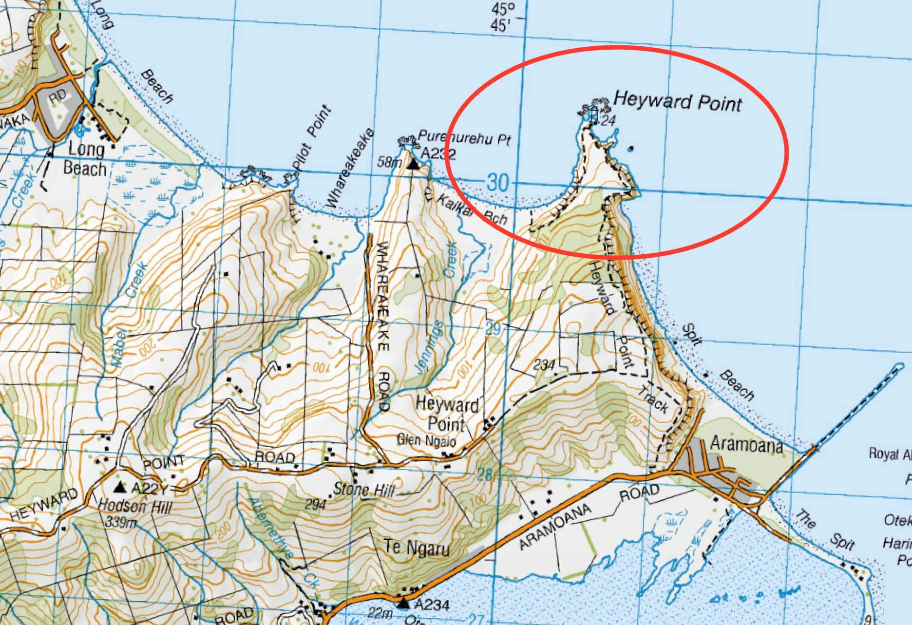
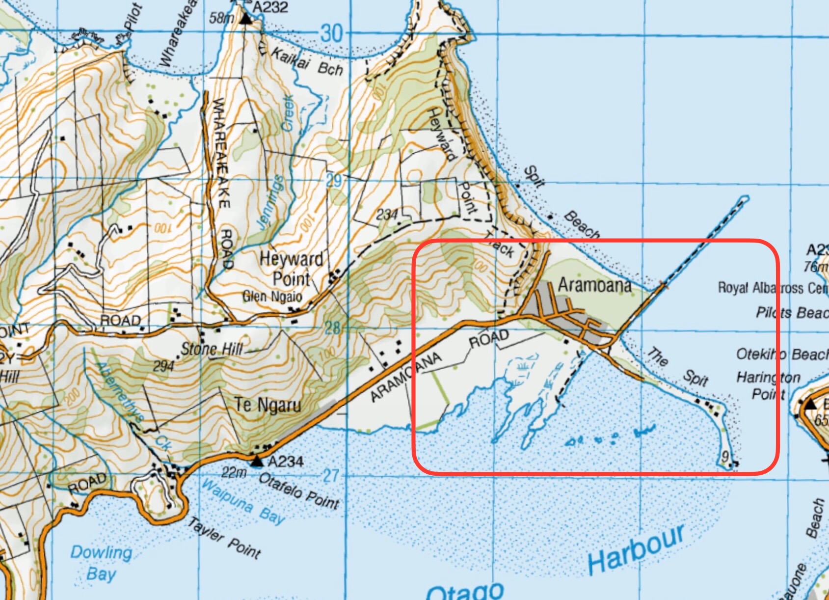
This page of club tramps and hikes in the West Harbour area groups together trips to Heyward Point,(map) from both Heyward Point Road and Aramoana.
Road distances from Mosgiel carpark.
Part: Tramping Track, Managed by DOC.
Rest: Not during lambing Sept-Nov.
Access Permissions are required as this trip ventures over a working farm – refer guidelines
Heyward Point, Kaikai Beach, Whareakeake Road. 2024 – 1989 (20 trips with 13 reports).
Aramoana, Heyward Point, Murdering Beach Road. 2005 – 1997 (10 trips, 1 with photo only)