Click on Map to Enlarge
Taieri Recreational Tramping Club
Mid-week recreational and social walking group based in Mosgiel NZ

Click on Map to Enlarge
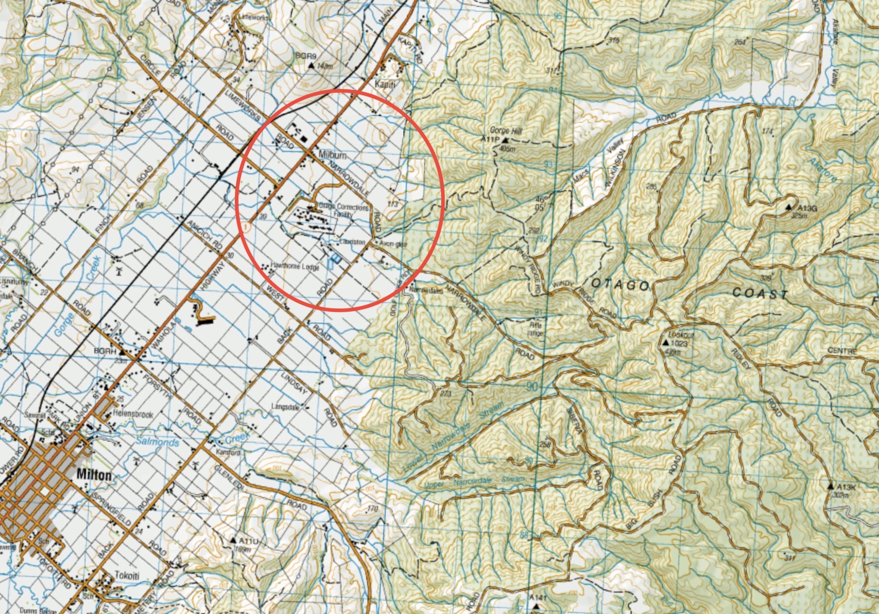
This page of club tramps and hikes in the South Coast via SH1 area groups together trips incorporating Akatore Forest and Narrowdale Road. (map)
Road distances from Mosgiel carpark.
Access Permissions are required for trips to Narrowdale Road / Akatore Forest- refer guidelines
TRTC Grading Information – trips incorporating these tracks are generally given a TRTC grading of about 3. This is indicative only, as trips can be allocated a higher or lesser grading depending on the route taken. For more detailed analysis refer to Grading Information.
Drive south on SH1 to Milburn and turn left onto Narrowdale Road. Continue past the Otago Correction Facilities and veer left at the Golf Course corner and continue on Narrowdale Road.
25/06/2025. Akatore Narrowdale Forest. Grade 3. Hikers. Leaders: Neville Griffiths, Cathy Ferguson.
Akatore Forest: Narrowdale Rd, Gorge Hill, Stewarts Farm. 2023 – 1989 (11 trips, 2 with reports and photos, 1 with photo only, 8 with no report or photos)
Click on Map to Enlarge
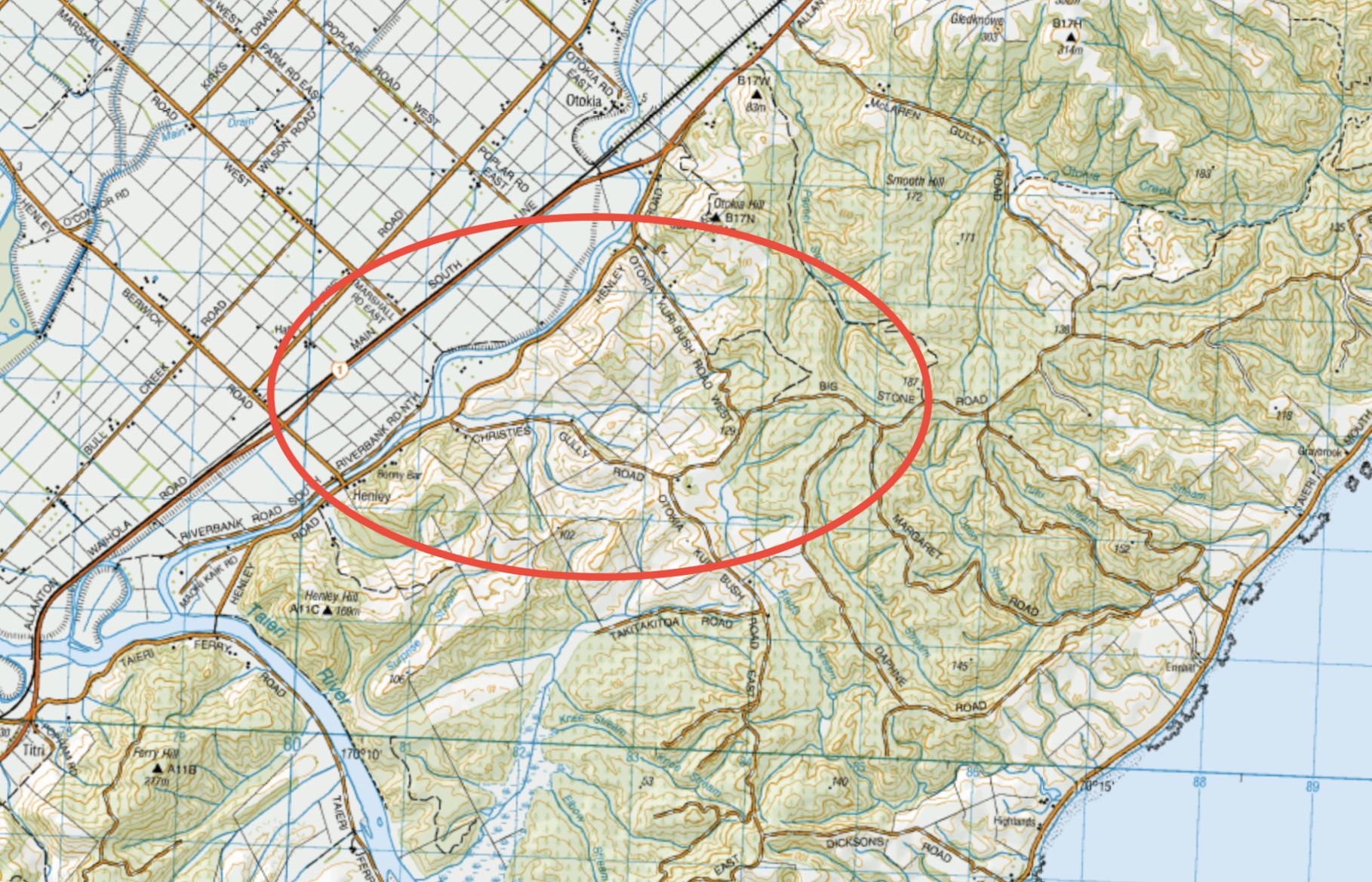
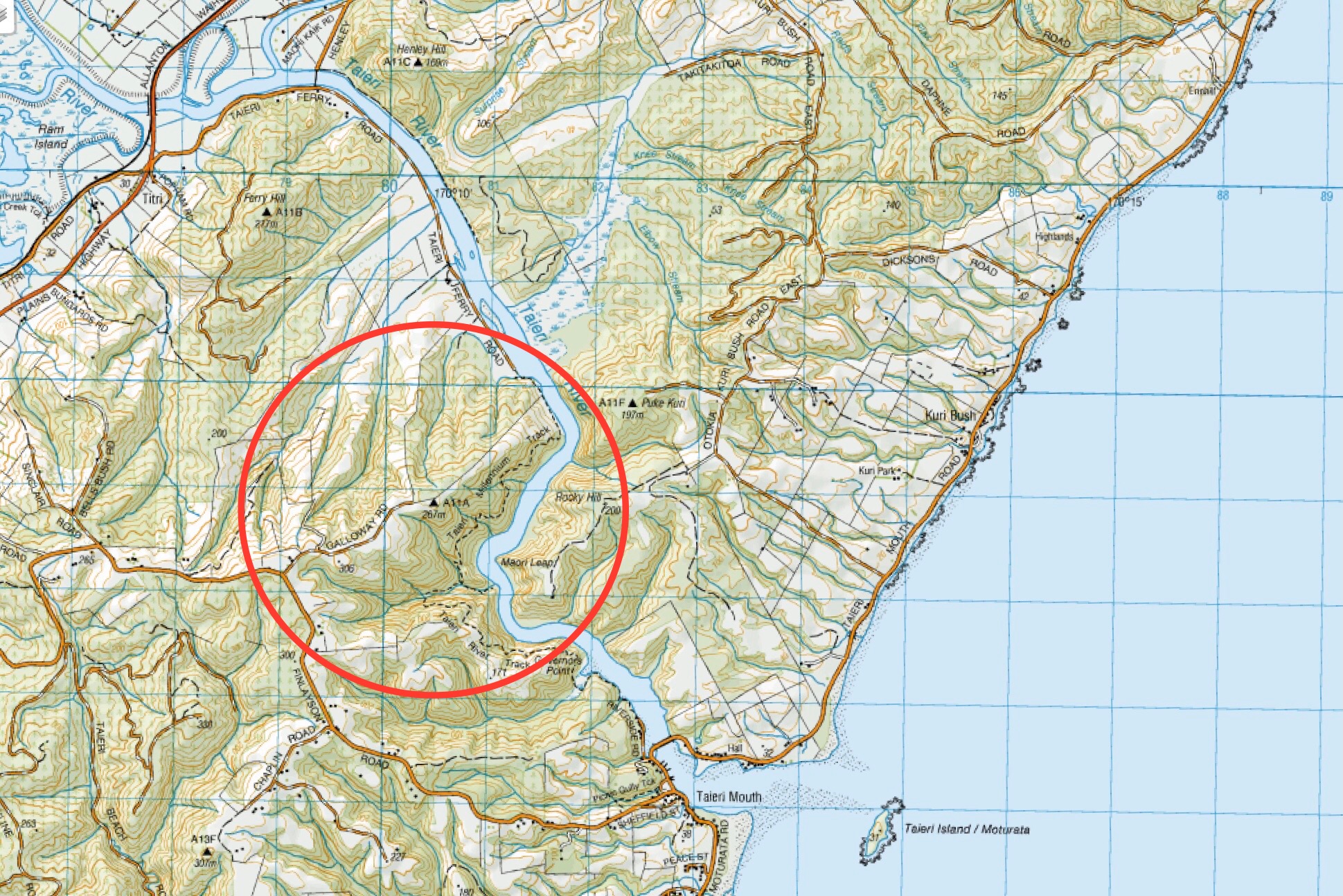
This page of club tramps and hikes in the South Coast via SH1 area groups together trips incorporating Henley Road, Big Stone Road, Otokia Road and Christies Gully. (map)
Road distances from Mosgiel carpark.
TRTC Grading Information – trips incorporating these tracks are generally given a TRTC grading of about 3. This is indicative only, as trips can be allocated a higher or lesser grading depending on the route taken. For more detailed analysis refer to Grading Information.
28/05/2025. Henley Loop. Grade 2.5. Hikers. Leaders: Rhonda Wilson and Jill Dodd.
Christie Gully, Big Stone Road, Otokia, McLaren Gully Rds. 2014 – 1991. (17 trips, 1 with report and photos, 2 with photos only, 14 with no reports or photos)
Palmers Creek Otokia Cemetery Henley. 2002 – 1994. (3 trips, no reports or photos)
Click on map to enlarge
Click on map to enlarge
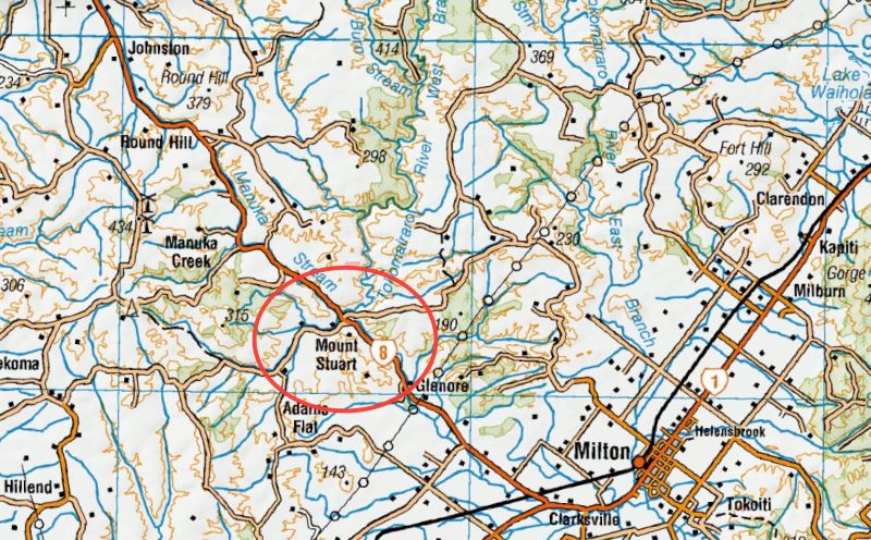
This page of club tramps and hikes in the area South via SH1 and groups together trips to the Mt Stuart Reserve (map) incorporating the Clutha Gold cycle track.
Road distances from Mosgiel carpark.
TRTC Grading Information – trips incorporating these tracks are generally given a TRTC grading of 3. This is indicative only, as trips can be allocated a higher or lesser grading depending on the route taken. For more detailed analysis refer to Grading Information.
Proceed south on SH1 to the turn off onto SH8 to Central Otago just south of Milton. Mt Stuart Reserve is located on the right just before the Manuka Gorge about 10 -15 minutes drive from SH1 turn off. Parking is plentiful at the Reserve.
05/02/2025. Mt Stuart Reserve to Mt Stuart Tunnel (Clutha Gold cycle track). Grade 2.5 and 3 Combined. Leaders: Clare Banks, Barbara Shackell, Sue Beal.
Click on Map to Enlarge
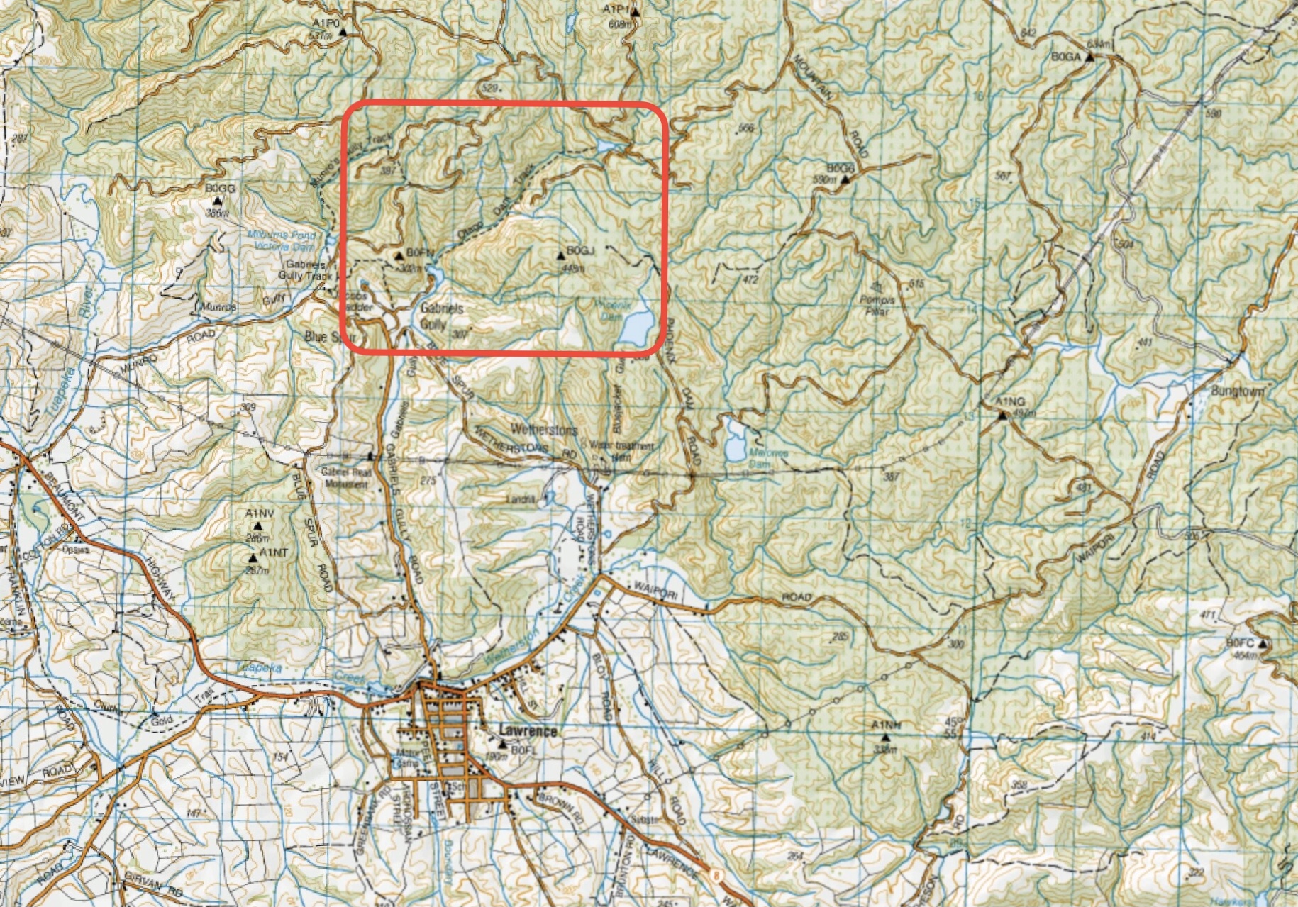
This page of club tramps and hikes in the area South via SH1 and groups together trips to Gabriel’s Gully, the Otago Dam and located in the township of Lawrence. (map)
Road distances from Mosgiel carpark.
TRTC Grading Information – trips incorporating these tracks are generally given a TRTC grading of about 4. This is indicative only, as trips can be allocated a higher or lesser grading depending on the route taken. For more detailed analysis refer to Grading Information.
Gabriel’s Gully is located in the township of Lawrence. Proceed south on SH1 to the turn off to Central Otago just south of Milton. Lawrence is about 30 minutes from the turn off on SH8. The Gabriel’s Gully turn off is about half way along the main street of Lawrence – follow the road to the reserve where there is plenty of parking.
Gabriel’s Gully, Lawrence. Bus Trip. 2024 – 2000 (8 trips – 5 with reports and photos, 2 with photos only, 1 with no report or photos).
Click on Map to Enlarge
Click on Map to Enlarge

Click on Map to Enlarge
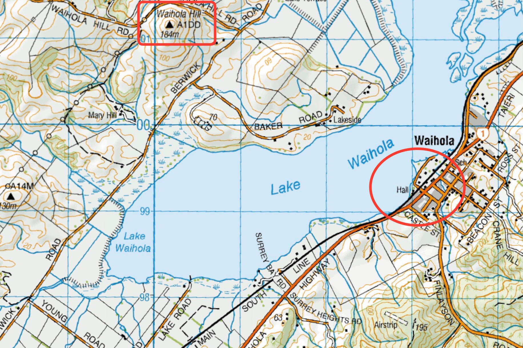
This page of club tramps and hikes in the area South via SH1 and groups together trips to the area around Lake Waihola, including Waihola Hill and Lawlor Farm. (map)
Road distances from Mosgiel carpark.
Access Permissions are required for trips incorporating Lawlor Farm – refer guidelines
04/12/2024. Waihola – new cycleway/walk. Trampers. Leaders: Heather Kirk and Jenny Wilton
Waihola Walk. 2024 – 2010. (4 trips, 3 with reports and photos, 1 with photos only)
Waihola Hill and Lawlor Farm. 2023 – 2022. (2 trips with reports and photos)
Finlayson, Wilkinson, Waihola, Skyline Roads. 2012 – 1988 (16 trips, 1 with report and photo, 1 with photos only, 14 no reports or photos)
This page covers the Club tramps and hikes to Hope Hill located on Wallace’s Farm off SH1 just south of Allanton. (map)
Road distances from Mosgiel carpark.
Access Permissions are required as trips to Hope Hill venture over a working farm – refer guidelines.
TRTC Grading Information – trips incorporating these tracks are generally given a TRTC grading of 4. This is indicative only, as trips can be allocated a higher or lesser grading depending on the route taken. For more detailed analysis refer to Grading Information.
Proceed south on SH1 just past Allanton to a farm gate on the left of the highway. Parking is available through the gate on the farm property.
29/01/2025. Hope Hill. Grade 4. Trampers. Leaders: John Gardiner and Martin Hickley.
Wallaces Farm on Hope Hill. 2023 – 1993 (14 trips with 6 reports)
This page covers the Club tramps and hikes to the McNally’s Walkway located in Milton. (map)
Road distances from Mosgiel carpark.
The McNally Track was developed by the Milton Rotary in 1980 and is still maintained by them today. The track is clearly marked with marker poles and is suitable for a Combined trip.
(1) Milton township turn left opposite Presbyterian Church, turn left at Ossian Street and follow on down Moore and Tokoiti Streets to Cemetery near which is the entrance to the McNally Walkway. Park cars by the side of the road.
(2) Turn left off SH1 at the kink in the road onto Springfield Road. Follow Springfield Road to the sawmill and turn right onto Cemetery Road. Turn right onto Cemetery Road and continue to the Cemetery which is the entrance to the McNally walkway
11/09/2024. McNally Walkway. Grade 3. Trampers. Leaders: Graeme Souter & Theresa White.
McNally Walkway. 2023 – 1992, 20 trips with 10 reports.