
 28/05/2025. Careys Creek / Black Gully. Grade 4.5. Trampers. Leaders: Ross and Wyn Davie.
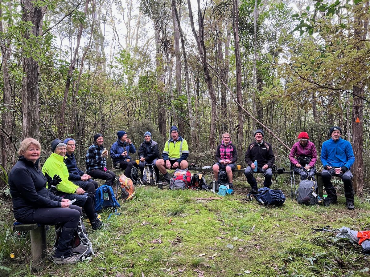
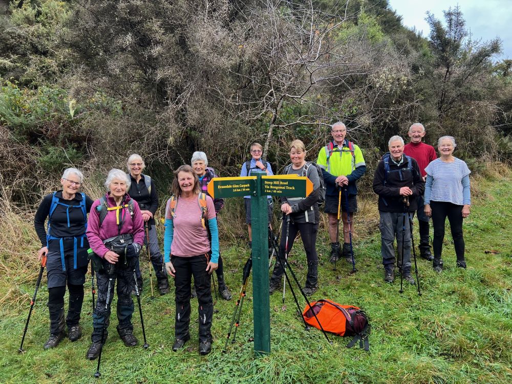
All twelve of us met up in Waitati by the Turdis, after the Townie contingent had stashed a car at Evansdale Glen for shuttling at the end of the trip.
We headed up Double Hill Road, admiring the awesome collection of potholes on the first sealed section. It was a relief to reach the gravel section of the road. It was a cool morning with a black frost at Mosgiel, but not so bad at Blueskin Bay. We parked at the carpark just past Double Hill where the track starts. After a belated birthday shout of baby fish (of the chocolate persuasion) we headed off at 10am into the forest. Or more correctly down. Careys Creek is the little sister of nearby South Waikouaiti valley with the same sort of steep sides and no easy way in.
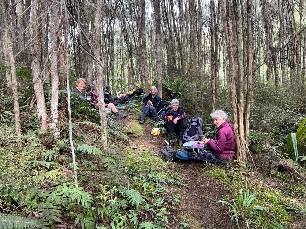
We had morning tea only about 10 minutes down the track, where there was a cleared area with seating created for 12 people. Perfect for us.
Soon enough we continued down what is a steep track but probably also the best maintained of the whole valley. And also, the driest as it probably sees more sun.
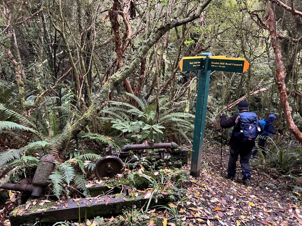
Soon we reached the bottom and the newest and shiniest DoC sign at the three-way crossroads where there is a very short sidetrack to the Black Gully Dam.
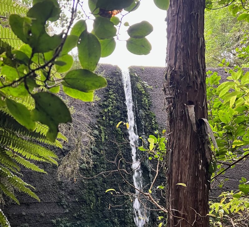
It’s quite an impressive dam, built in 1912 to collect water for the Seacliff Hospital. The water was piped down Careys Creel to Evansdale and pumped to above Seacliff Hospital. The pipeline was a maintenance nightmare; easy to imagine when much of it went straight down the creek. It was finally replaced in 1959 with water from Cherry Farm.
We returned to the crossroads and took the route down the valley.
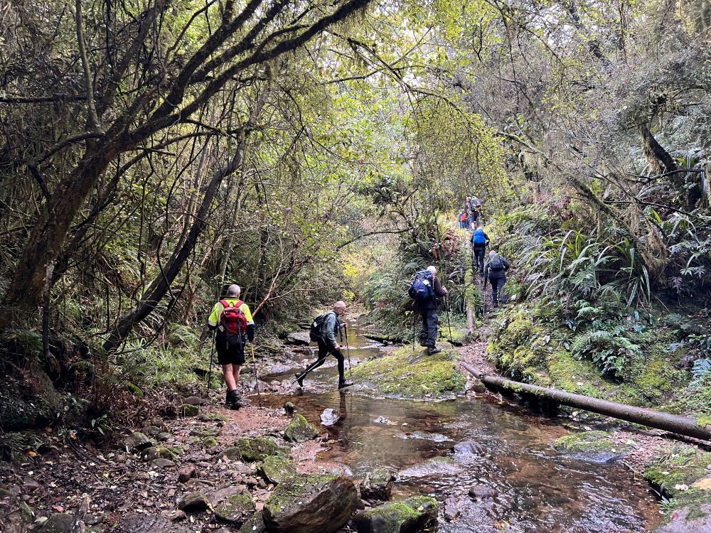
It’s a very scenic route, mostly in native forest which is surprising since it’s mostly wrapped around by pine forest. There are heaps of friendly fantails, and a few shy robins, and maybe tomtits. The track is very varied. Some sections are straight and even, but a lot is twists and turns and little ups and downs, and despite no rain in the last week, frequently slippery.
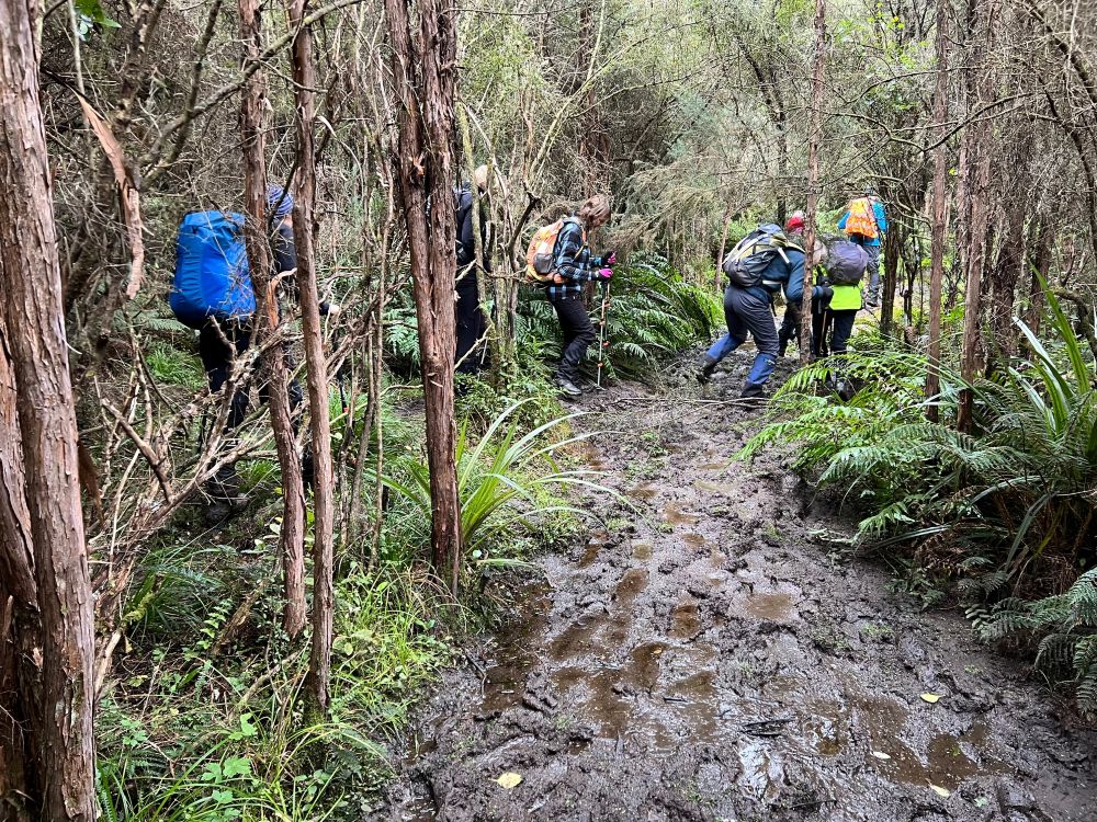
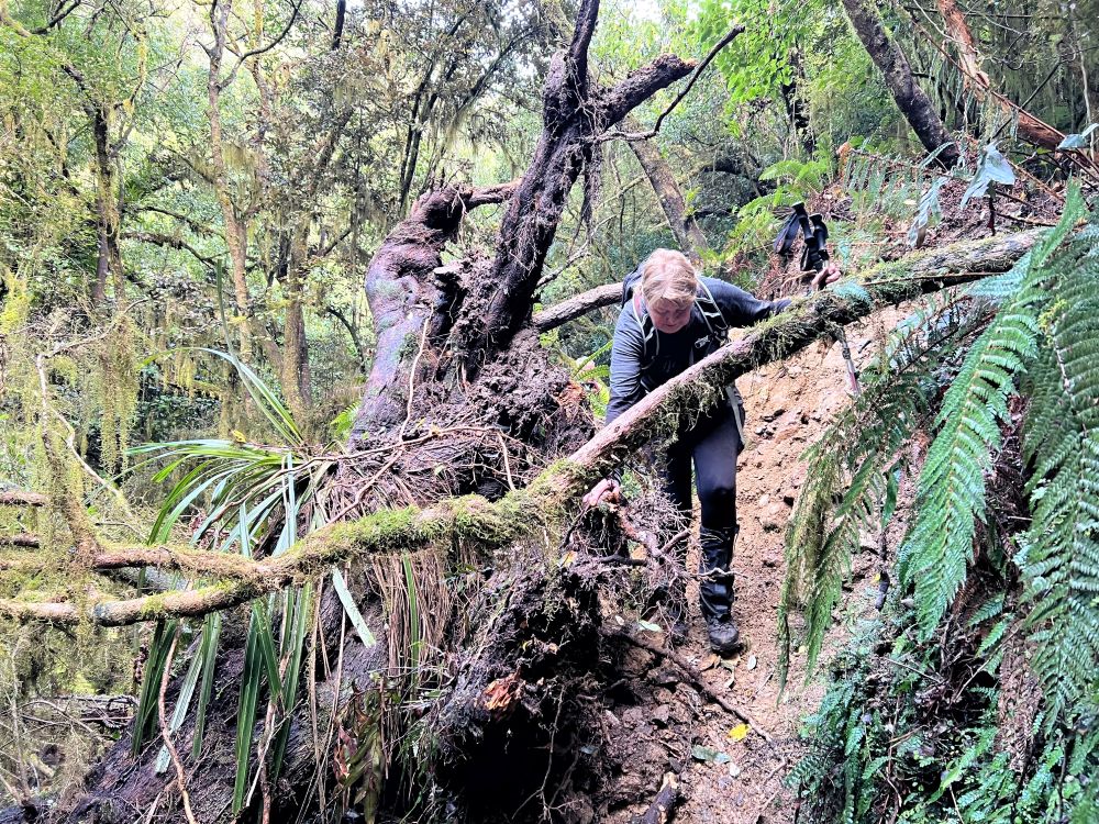
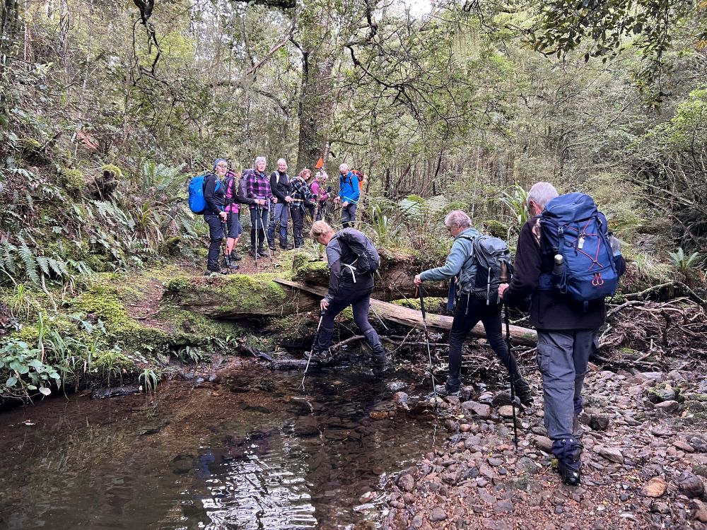
So began the quest to settle the number of creek crossings from below the Black Gully Dam to Evansdale Glen. A previous trip had reliably reported 22 crossings, but then on the recce, I counted 26 and Wyn reckoned 28. We defined a crossing as anything fully from one side to the other and so began the reckoning. Progress down the top half of the creek is not rapid, and we had to be careful on some of the slippery descents into the creek. And all those creek crossings meant care was necessary stepping across rocks to keep dry feet. There were one or two slips, and some chose to wade through the crossings; a lower risk strategy. At about 12:01pm we came to a drier section a little above the creek, and decided it was time for lunch. With a few whistles and coo-ees and sending forward an emissary, we were soon reunited, and lunching.
After sharing some more baby fish, we resumed our journey and our counting. The middle section is a bit of a gorge, and the track more rugged and in places more damaged. And for variety there are muddy sections, albeit much tamer than Swampy muddy sections.
The creek tally climbed to 22, and then 23. We came to the bottom of Honeycomb Ridge, and then the bottom of Rongamai Ridge. By this stage the track relented with all the tricky stuff and was mostly friendly from there on.
The pace picked up, and still the crossing count mounted. We reached the end, at Evensdale Glen, at a little after 3pm, after 30 creek crossings.

It’s quite a challenge, requiring a fair bit of concentration, especially negotiating the many slippery bits. But the valley rewards the effort. It’s a valley with lots of nice little creek scenes, and lots of native forest, and impressive exotic trees, and towering bluffs, and close encounters with native birds, and offering a sense of achievement for safely getting to the end, we reclaimed the cars from the start, and soon enough everyone was off homeward.
The distances are reported with a wide range to choose from. The Doc sign swore it was 9.3km. TopoMaps thought more like 10.5km. And Strava reckoned somewhere between 12km and 14.2km. Total elevation gain was 80m, so very little uphill. And moving time on 3hr 50min. Difficult to pigeonhole for grading but I stick by my 4.5, upgraded because of winter, slippery track even without recent rain, and a lot of uneven ground.
Thanks Neil for stepping up at the back as tail-end-Charlie, and thanks everyone for your good company and spirits on a nice little adventure.
Ross
Link to background information and earlier tramps and hikes in the same area.