4. 26/4/2023 Mt Watkin. Trampers. Grade 4.5. Leaders Graeme Thurlow and Phil Keene.
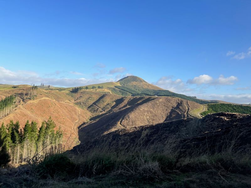
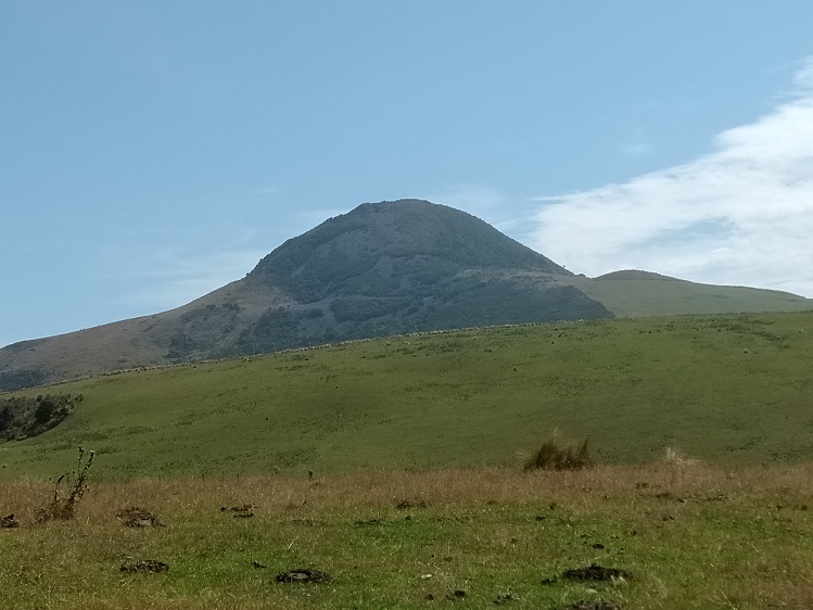
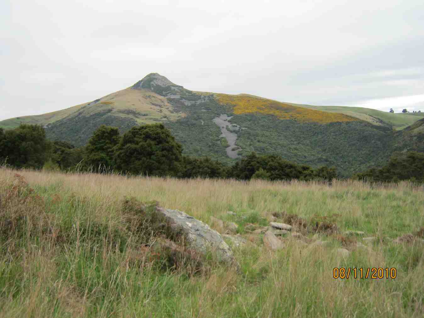
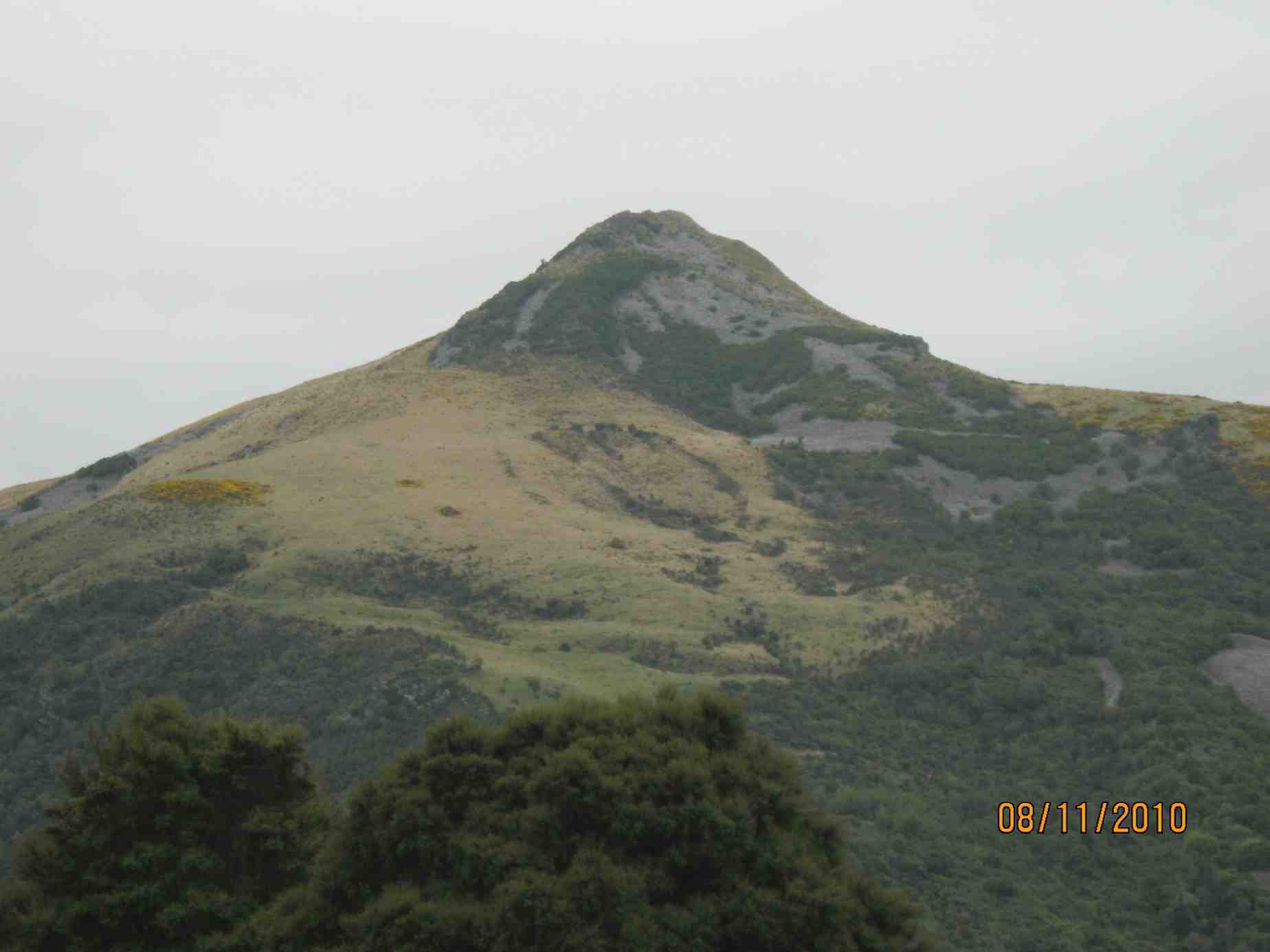
View of Mt Watkin from the car. Photo & caption Pam
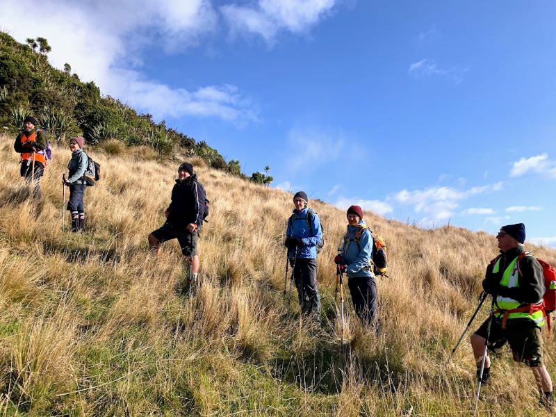
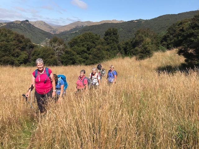
On a cool day 7 trampers came and we headed straight up Mt Watkin first.
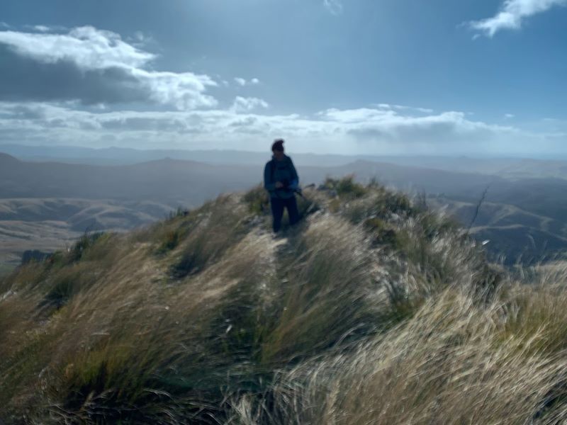
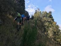
On our way, meaning straight up Mount Watkin! Photo & caption MarijkeAnd it was steep. Photo & caption PamAnd the wind blew… Photo & caption PhilAt the top of Mount Watkin, cold, blustery, lonely! Photo & caption Marijke
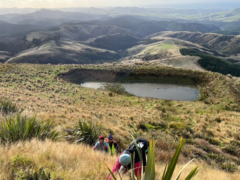
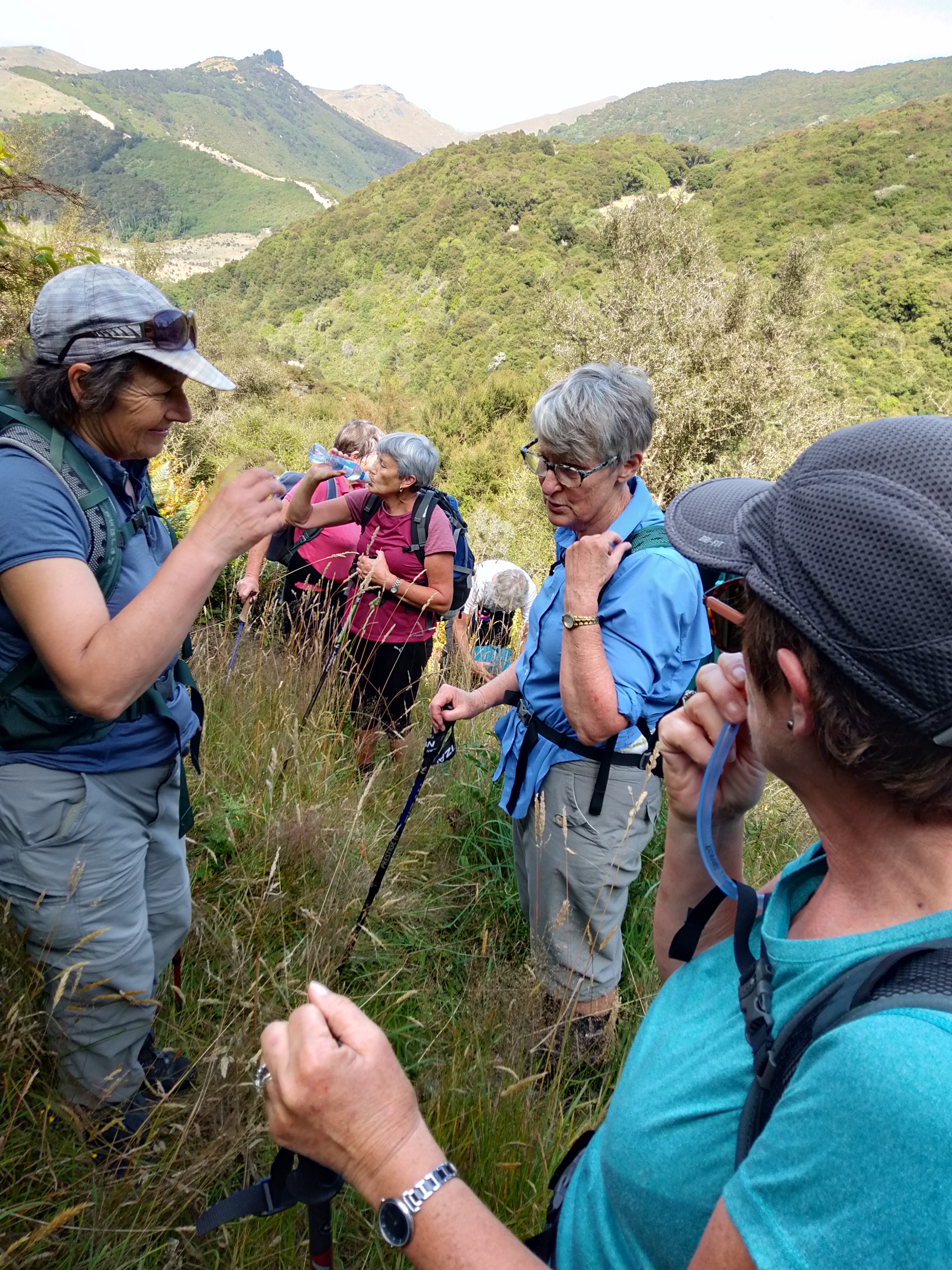
With wind in exposed places especially at the top we all enjoyed a rest and a sit down for a well-earned morning tea. Great views of the snow on the Rocky Pillars but slightly misty in the distance.
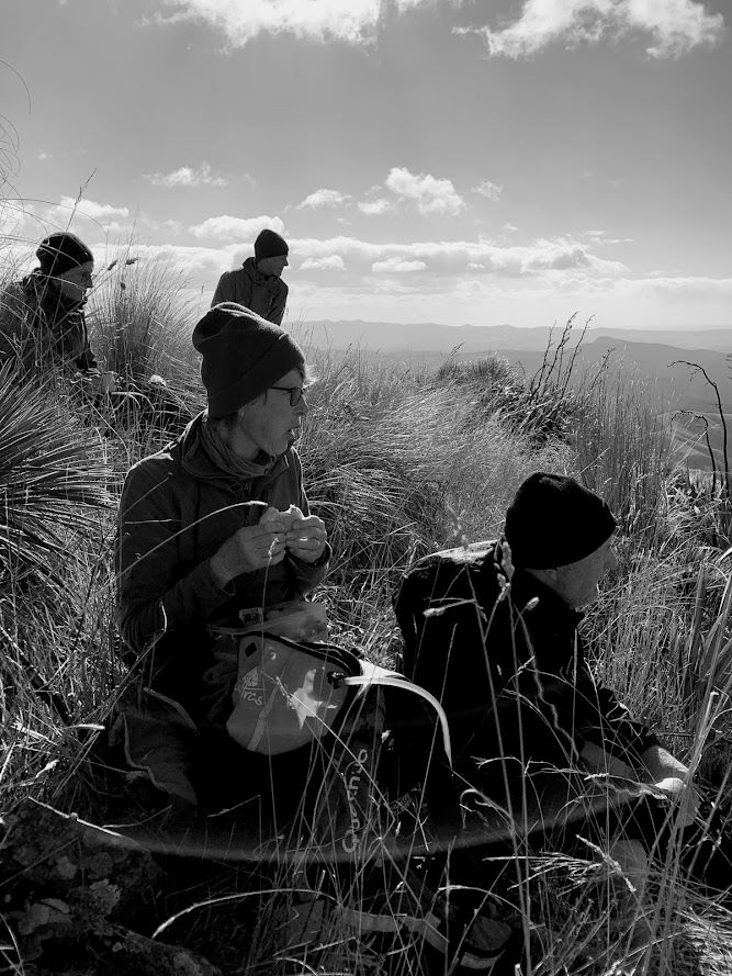
We found some shelter on the lee side of the mountain to have our morning tea. Photo & caption Marijke
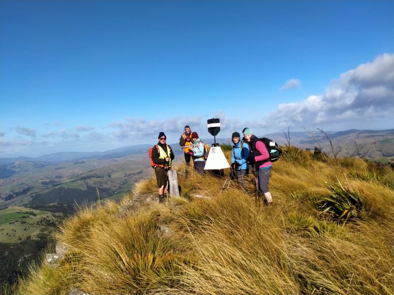
Descending all agreed it was a grade 5.
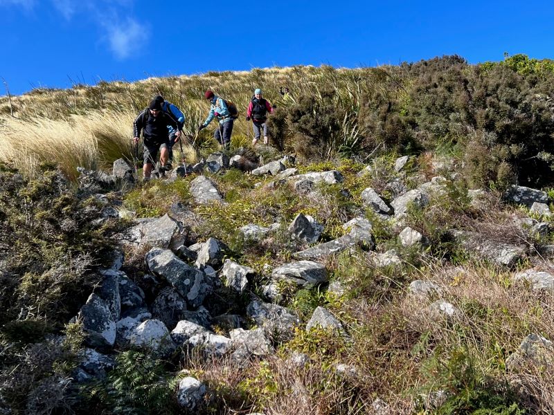
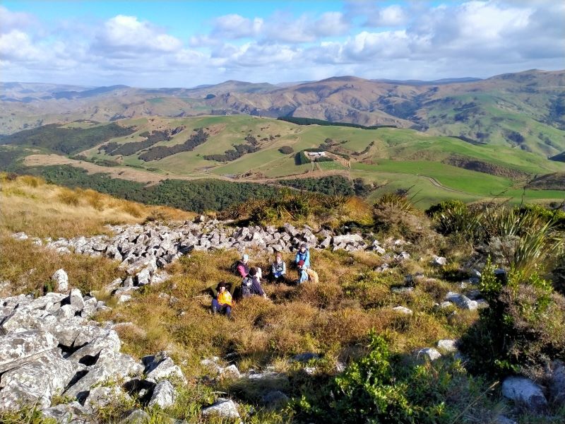
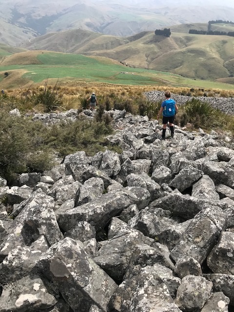
It was rocky! Photo & caption PamLaying down in an ancient Celtic ring? Photo & caption Phil
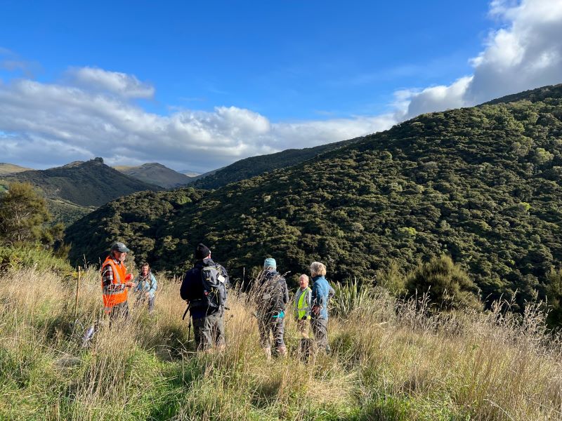
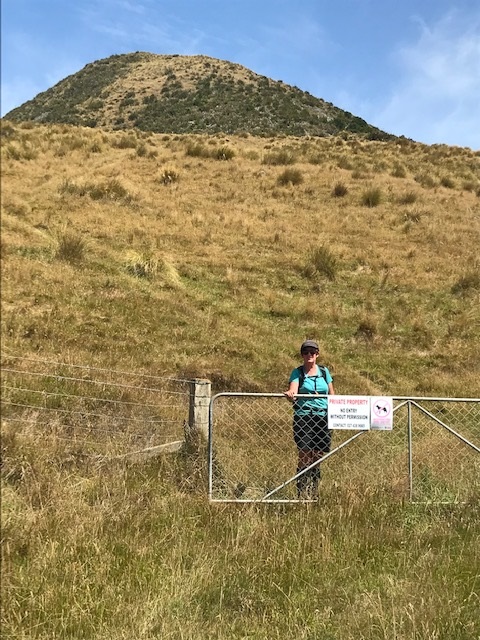
A welcome rest was needed amidst the rocks before continuing to the boundary fence with Smith’s farm. Graham T’s jovial comments “We haven’t got far to go’ received responses like “Yeah, right??”
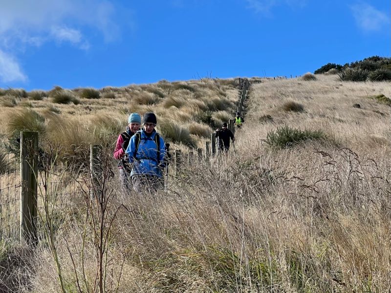
Following down the fence line. Photo & caption Pam
After the descent to Smiths boundary when we looked at distance and time, we were shocked at how little distance we had gone for the time it took.
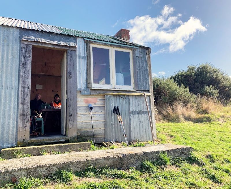
Now easy going to the rewards of the blackberries near the boundary and onto lunch at the DCC hut which was wired and set up for entertainment with LED lights!
It was sheer luxury to have lunch in a hut! Photo & caption Marijke
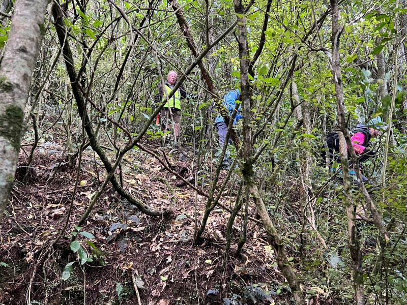
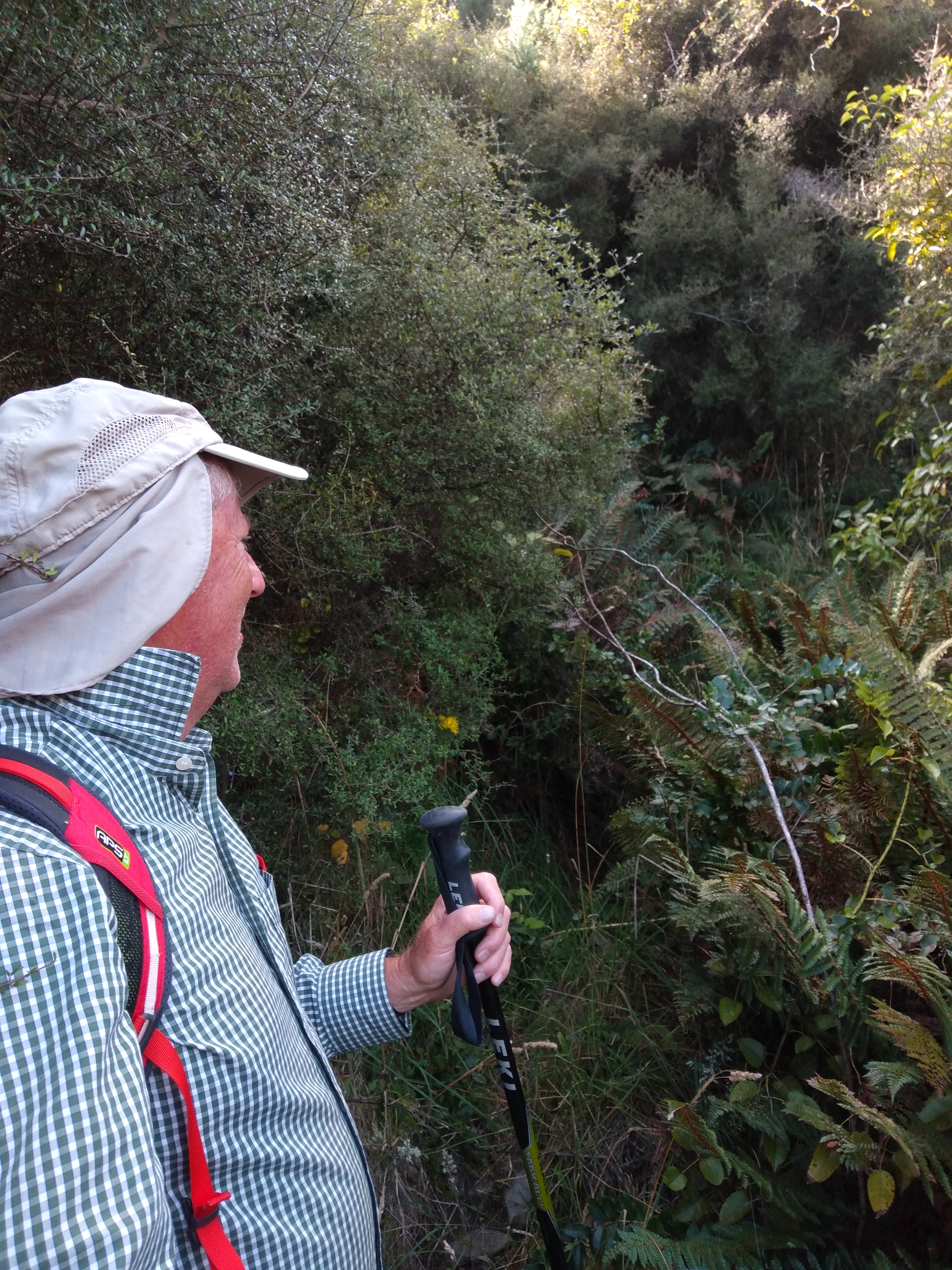
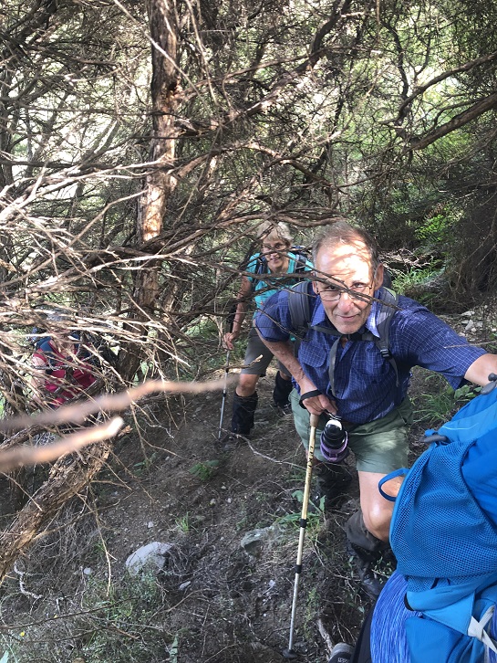
Further on down the western track we exited into long grass circled by forest and then entering the forest we bush bashed.
These vines weren’t here when I did the recce (Graham T). Photo & caption Pam
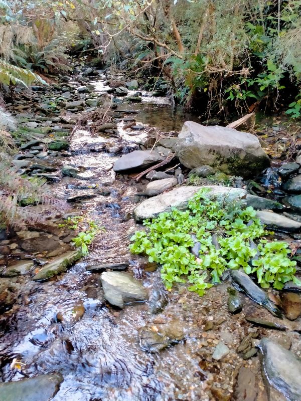
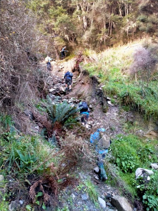
Zig zagging and encountering vines we continued down until finally reaching the creek for our climb up and out finally to a track out through a gate into Noone’s property.
The stream at the bottom. Photo & caption Phil…then up the goat track. Photo & caption PhilRegrouping after the bush bash. Photo & caption Pam
A longish walk back to the car and comments were ‘It’s good we knocked the b…. (Mt Watkin) at the start of the day’ and not had to tackle it at the end of the day.
Good comradeship, jovial comments and laughter eased the challenges of the day.
Thanks to David Smith and Zac Noone for giving permission to tramp on their property.
3. 12//2/2020 Mount Watkins. Leaders Dave and Keith
Mount Watkins (616m) is a volcanic mountain 11km inland from Waikouaiti, surrounded by the Dunedin City Council reserve (650 hectares) and two farms. The goal was to circumnavigate the mountain and climb it.
Photo and Caption Dave – “The goal.”
The morning was rather foggy so it was decided to leave the climb of Mount Watkins to later in the day. The 15 keen trampers set out early from the entrance to the Mount Watkins reserve administered by the Dunedin City council.
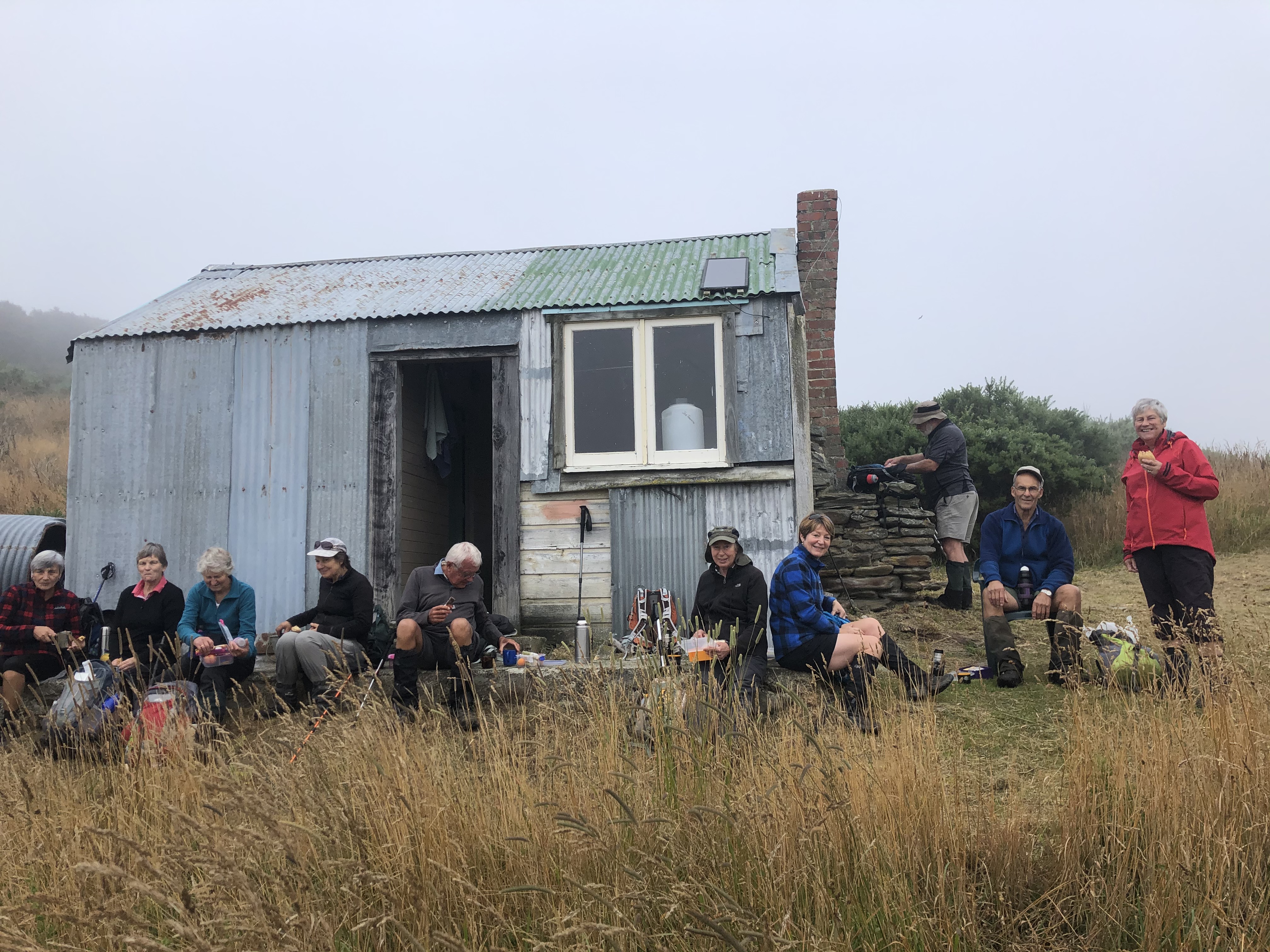
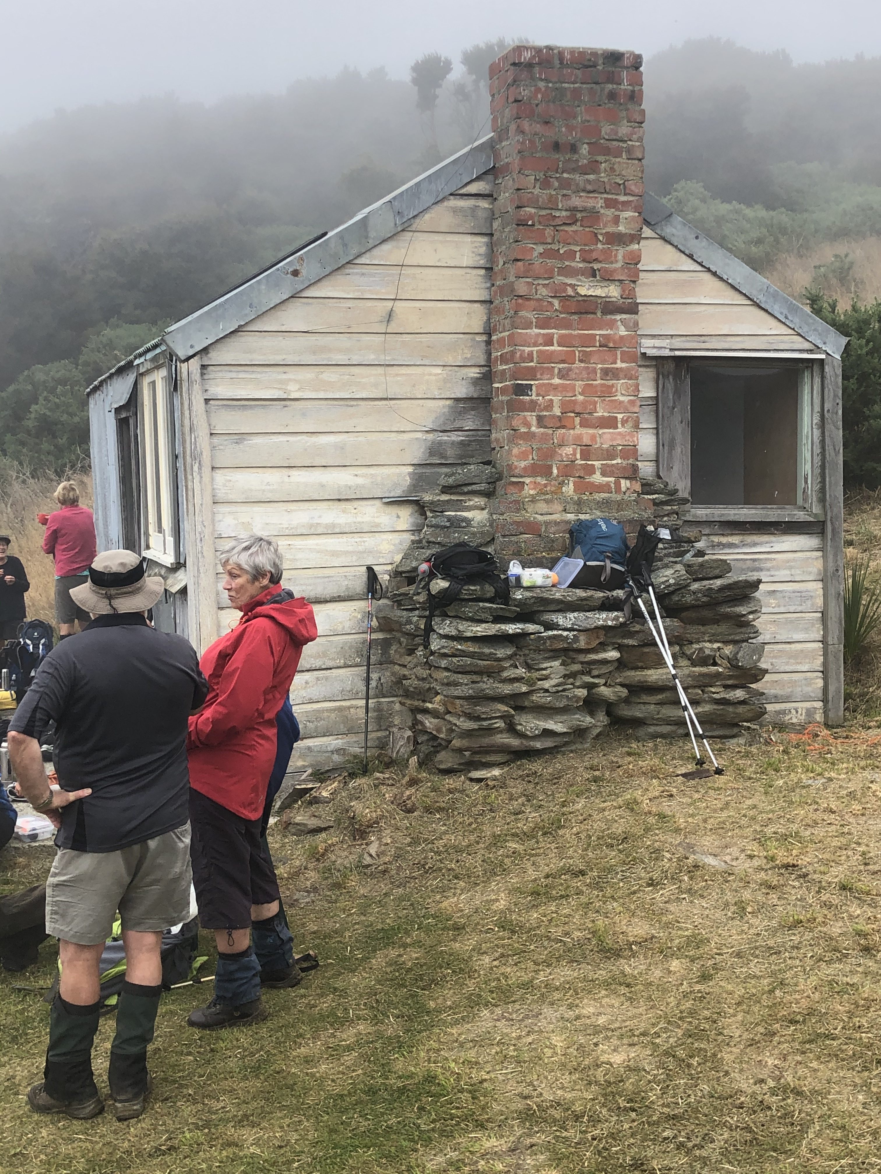
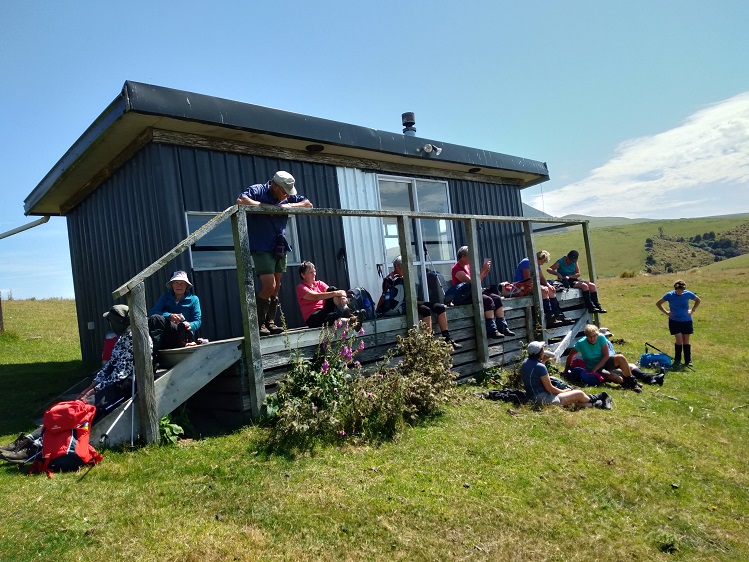
There was a short walk to a hunters hut, where conveniently we had morning tea.
Photo and Caption Shona – “A convenient hut for morning tea.”
We were surprised that someone had mowed the grass especially for us!
Photo and Caption Wendy – “There is always plenty to .discuss.”
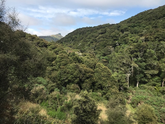
It was then gradually downhill on an old four wheel drive track. The flora changing from kanuka to native bush.
Photo and Caption Dave – “Coloured fungi.”
We reached the bottom of the gully where the four wheel drive track ended and there was a stream to cross.
Then it was a steep climb up the other side.
This was ably lead by Phil.
Photo and Caption Dave – “Our up hill leader Phil”
Photo and Caption Wendy – “Karen you’re doing well!”
Photo and Caption Wendy – “Neil you’re doing well!”
The climb up was steady, unmarked and animal tracks could be followed.
Photo and Caption Dave – “Time for a break.”
Photo and Caption Shona – “At last onto a small grassy plateau.”
Photo and Caption Shona – “The final push to the top”
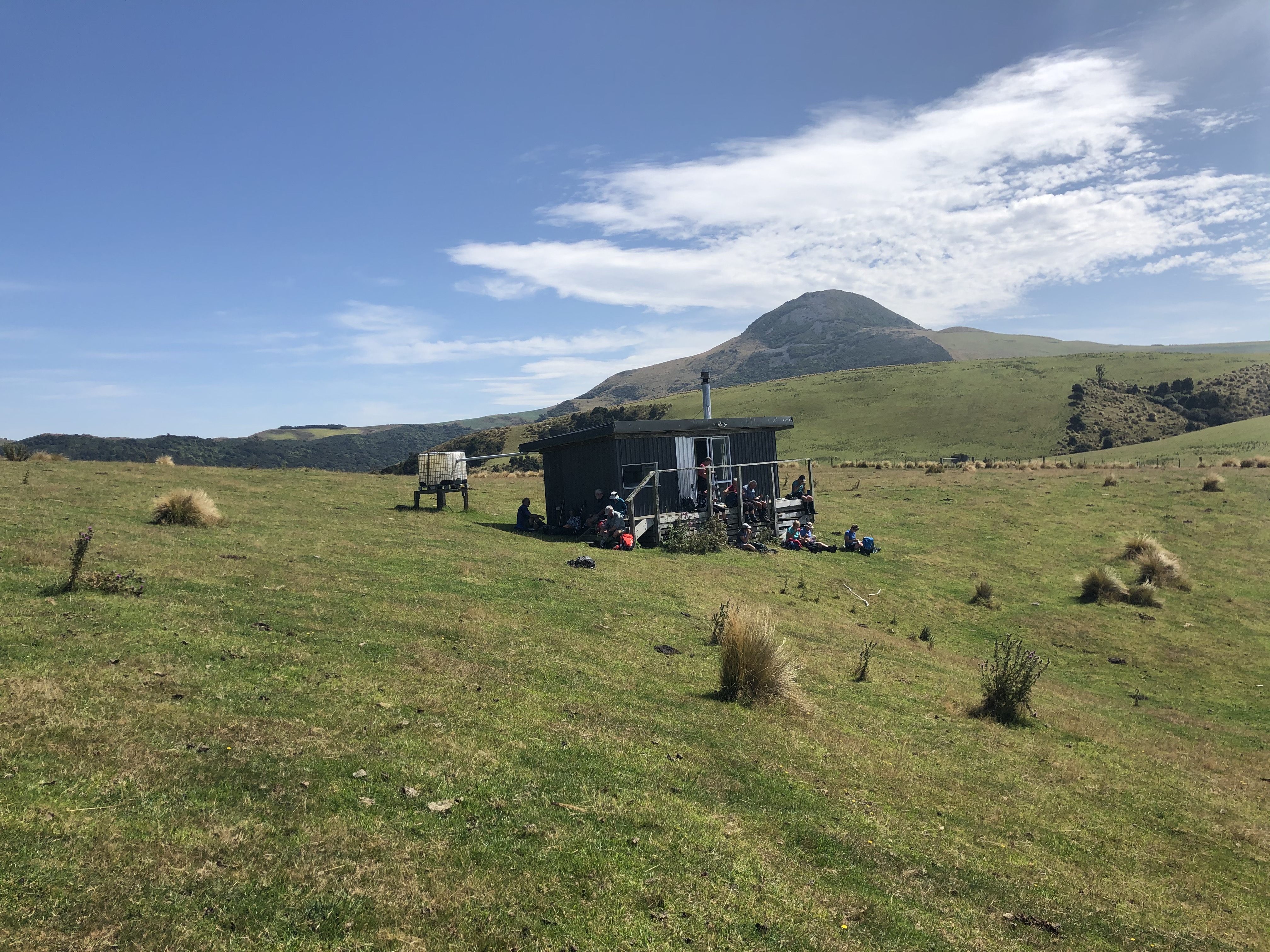
On reaching the farm at the top the weather had cleared to a fine day, lunch was had at a second hut.
Photo and Caption Dave – “Lunch conveniently at the top hut”
Photo and Caption Shona – “the goal Mount Watkins in the background.”
A walk along farm tracks and an airstrip took us back out to the road. It was then a rather hot walk along the road to the start of the climb. Seven started the climb and the rest walked the road and thankfully brought back the cars to where the climbers would finish.
Photo and Caption Shona – “Jill ready for the final assault”
The climb up was solid going with rocks, tussocks, spaniards, occasional bushlawyer and the heat to contend with.
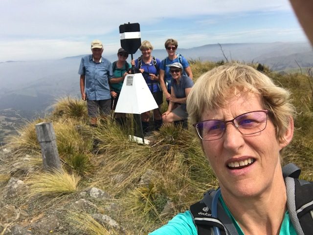
Photo and Caption Shona – “At the trig on the top – we made it!”
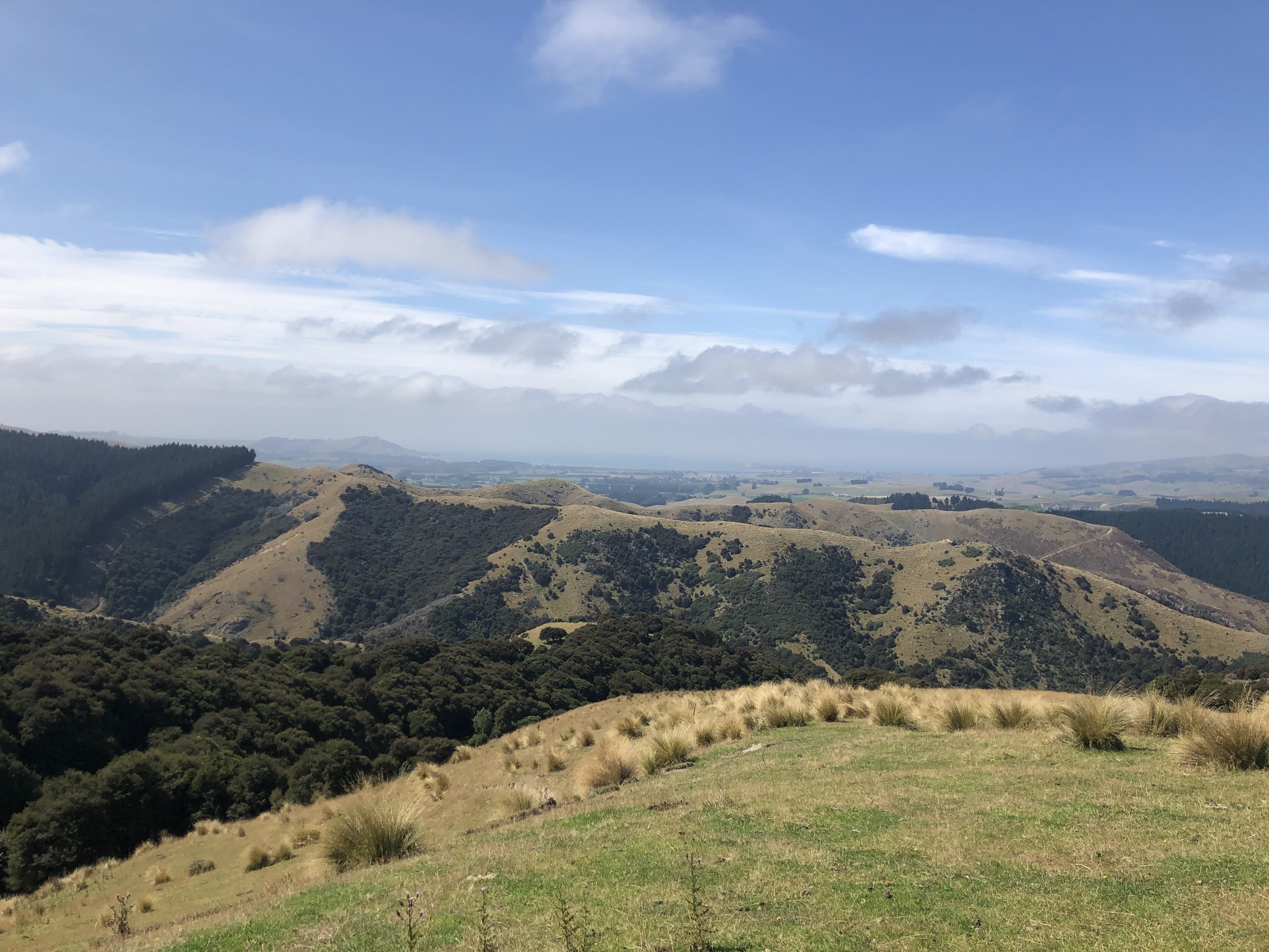
Photo and Caption Wendy – “An amazing view out to the sea in the distance.”
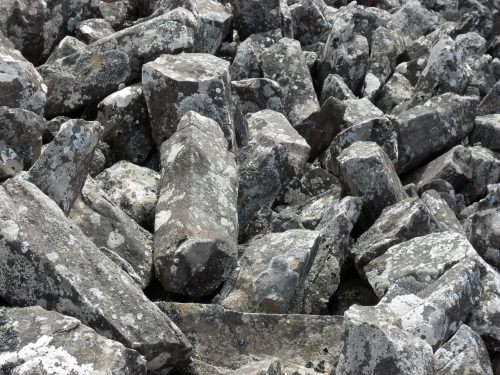
Photo and Caption Shona – “Tracking down through the columnar basalt to the cars below.”
On reaching the cars (after covering approx. 12.2 km) we headed off to Blueskin nurseries, in time, for well deserved refreshments and a chat.
Yes it was a hard tramp, but well worth the effort!
Keith and Dave
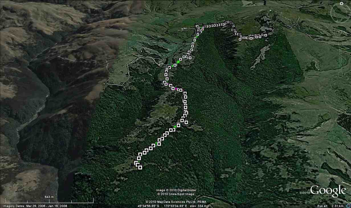
2. 14/11/2010. Mount Watkins / Hikaroroa Open Day.
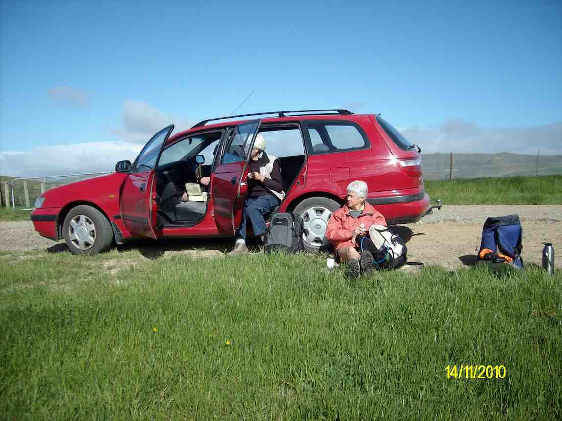
62 km from car parkSix of us, Bev, Glenis, Ian, Keith, Ken, and Lesley were at the DCC Mt Watkin/Hikaroroa Scenic Reserve on the day – a Reserve noted for its preserved coastal forest in the gully and basalt boulder fields on the mountain slopes. Four of us had arrived early. You wouldn’t know it from the pic, but the wind was ferocious, and we sheltered in various places around the car while waiting for others to turn up.
Morning tea (Ken pic)
The GPS shows Ken’s route to the bottom of the track. A side route shown leads down to a Knoll in the valley side that Glenis, Ian, Keith and Ken explored later in the day. A little further up the main track, Bev and Lesley spent the day ‘personing’ the track entrance to the Boulder Fields (route not shown – see it on GPS pic for 8/11 below), to direct people where to go.
Mt Watkin. Full Track. Courtesy Ken’s GPS.
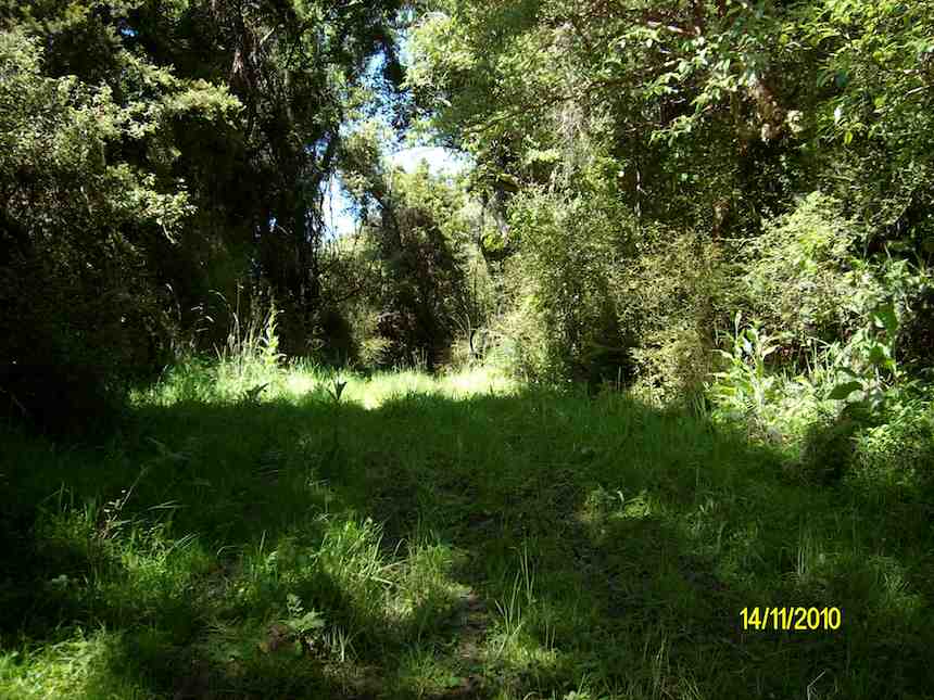
Down the main track, it was warm and sheltered from the wind. The following pic shows the vegetation preserved in the gully bottom, out of reach of the loggers of earlier days.
Looking up the track down by the stream. (Ken pic)
A good day. 88 turned up in all. Blustery in exposed areas, but not too cold. We felt lucky with the weather, considering the rather bleak forecast. Thanks to the DCC for purchasing and opening up the reserve for us today.- Ian
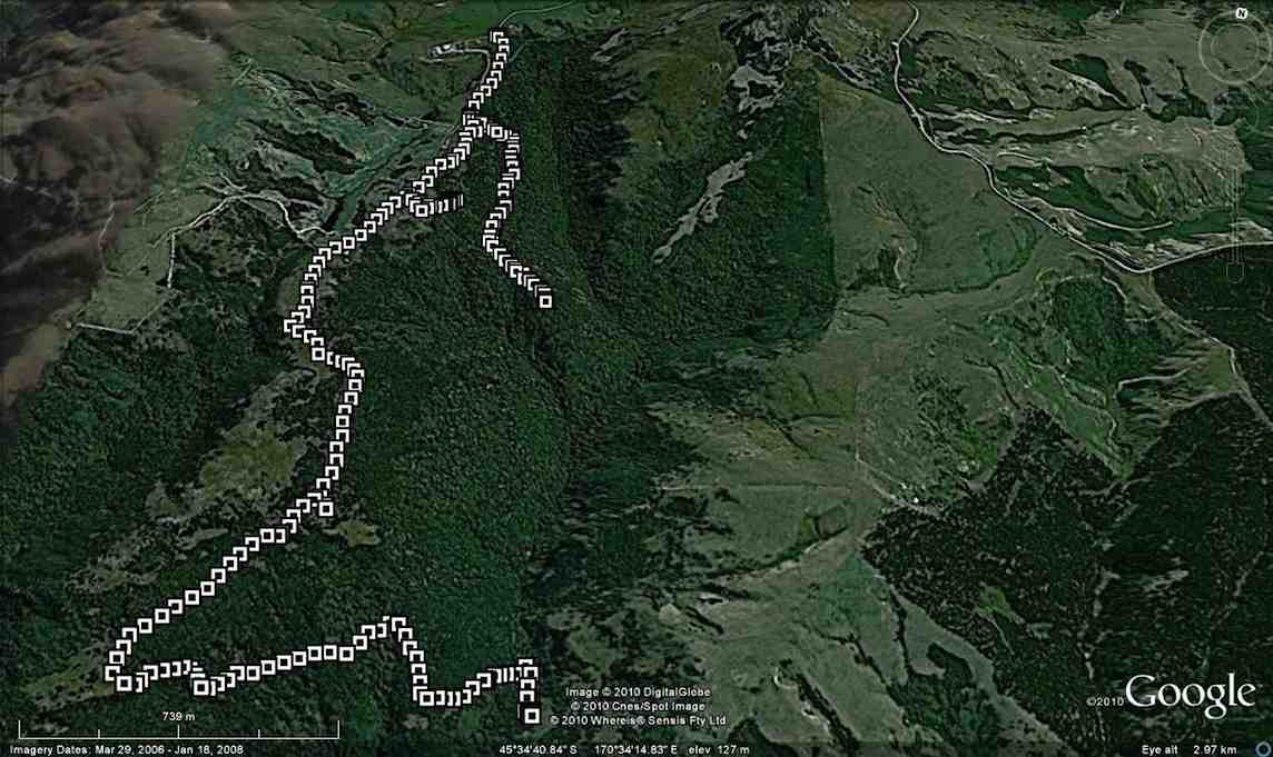
1. 8/11/2010. Mount Watkin. Ken, Ian.
GPS of most of route, courtesy Ken.
Ken’s GPS map shows the gully south of Mount Watkin very clearly. It was from the bottom of the route than the following pics were taken.
Boulder Fields
As you can see from the next pic, there is the track we came along showing at the bottom. We climbed quite a bit up from it and bush-bashed into part of the boulder field. However, there is a bush-free clear entrance showing quite high up.
You need to be fit if you are walking down into the reserve and return. Extra fitness required if you climb Mount Watkins as well, however the farmers’ permission is required. David Mellish Webmaster.
Until I was 9, we lived in the house on the road to Bucklands Crossing with a full view of Mt Watkins. Our property overlooked Bucklands Crossing. There was also a wonderful view out to the Matanaka
headland near Waikouaiti with the sweep of the beach towards Karitane – but we could not see the latter from our house.
Albeit belatedly, thanks for your comment Anitra. It’s always nice to trigger some memories. That must have been an interesting place to live, with an extraordinary view. Cheers, Ross
Sorry Jeremy, we’re in no position to comment on hunting rights. You’ll need to contact the landowner(s) and talk to them.
Cheers
Ross for TRTC Webteam


What is the required tramping fitness required and what would be the average time to walk this.
Vivian
You need to be fit if you are walking down into the reserve and return. Extra fitness required if you climb Mount Watkins as well, however the farmers’ permission is required. David Mellish Webmaster.
Until I was 9, we lived in the house on the road to Bucklands Crossing with a full view of Mt Watkins. Our property overlooked Bucklands Crossing. There was also a wonderful view out to the Matanaka
headland near Waikouaiti with the sweep of the beach towards Karitane – but we could not see the latter from our house.
Albeit belatedly, thanks for your comment Anitra. It’s always nice to trigger some memories. That must have been an interesting place to live, with an extraordinary view. Cheers, Ross
Are people allowed to hunt pests there (goat’s and pigs)
Sorry Jeremy, we’re in no position to comment on hunting rights. You’ll need to contact the landowner(s) and talk to them.
Cheers
Ross for TRTC Webteam