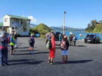
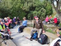
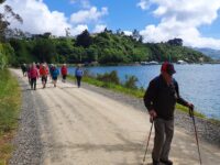
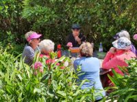
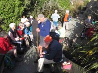
24. 31/08/2022 Hikers. Port Chalmers. Leaders: Michael Webb and Bruce Wright M.
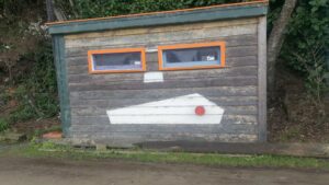
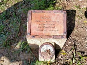
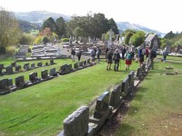
Yet another climb took us to Scott Memorial before crossing the road for our last uphill leg before descending through some bush and a track past the old cemetery back to Port Chalmers.
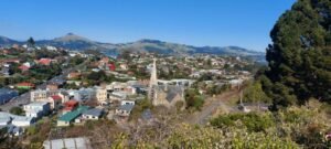
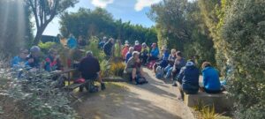
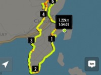
Refreshments were taken at The Galley where one unnamed lady ordered a Bloody Mary. Due to the many steep tracks and hills in Port Chalmers this could possibly be a Grade 3. The hike was 8km. Michael Webb
23. 25/11/2020 Hikers. Port Chalmers. Leaders Mike Webb and Jay Devlin. E-M.
22. 19/9/2018. Port Chalmers walkabout. E. Judy.
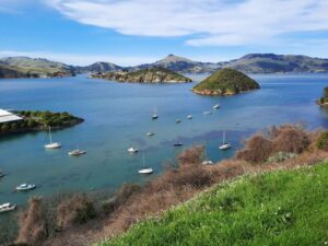
Establishment on a beautiful spring day. We walked up to the lookout with stunning views of the harbour and had morning play-lunch at the
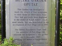
Ralph Hotere Garden. From there we made our way down to Back Beach
where we did a short walk out to the point where there were people
fishing for their evening meal. We then walked round the point
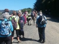
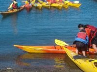
and made our way to the Lady Thorn Rhododendron Dell for lunch. After lunch we walked up to the cemetery where some walked back down the hill and the others carried on another steep track which then took us down to the town and back to Careys Bay Hotel

where we all enjoyed a beverage of various delights. – Leaders Elaine and Jay.
21. 22/11/2017. Hikers. Port Chalmers. Leader: Judy.
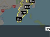
22nd November saw two members celebrating the same birth date (Dave Mellish and the writer). Are there any other shared birthdays in the Club?
Anyway, after some rather off-key singing, 18 hikers set off for Port Chalmers and the Careys Bay car park on a beautiful warm sunny morning. The planned morning tea stop on Boiler Point didn’t happen, as the track was closed for new wharf development, so it was a bit of a slog up to the lookout (with a look inside the church on the way) and the Hotere garden for a well-earned break.
With a cruise ship in, there was plenty to see, and it took a while to gather the troops for the walk down to Back Beach, then around the point past the school …
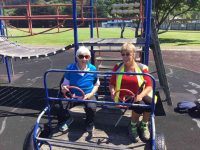
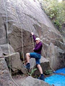
… and rugby grounds, across the railway line and so up to the rhododendron dell for lunch. Everyone sought whatever shade could be had, and we were entertained by rock climbers on the cliffs behind.
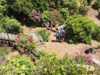
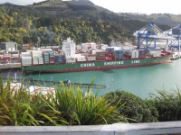
The excitement of watching a container ship berthing delayed some after lunch, and the group split at this point, eight continuing up the hill to the Scott Memorial, …
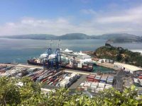
… then up and around the track beyond the car park on the far side (sorry, the leader forgot it went up some steepish bits for a while) and down in leaps and bounds to the Blueskin Road, across it to the track again, and so down to the Iona Church and a look inside here too. There were quite a few cruise ship visitors about, and it was a good excuse for a rest as we stopped and chatted…. The choice then for these eight was either up and through the cemetery, or straight down to the road – guess which way we went? Well, we were pretty hot and tired by then.
The remainder of the group were well installed in the hotel by the time we arrived, having taking an easier route through the cemetery and straight down to the Bay. After some liquid refreshment and a leisurely chat, it was quite a late return home! – Judy.
20. 3/8/2016. Both. Port Chalmers. Leaders: Judy and Peter D.
However our trip was very pleasant. Leaving the carpark at the back beach …
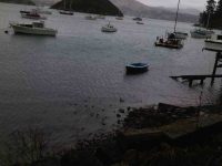
… of Port Chalmers following the road round the harbour with views of the Peninsula and further down the harbour towards Dunedin in the haze to the Harbour side rugby pavilion where we had shelter from the northerly driving rain, to enjoy our morning tea break.
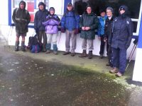
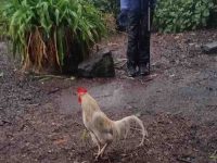
We didnt dilly dally for too long as it didn’t take long to start chilling off. From here we proceeded along the railway line to the main road into Port Chalmers up to Ajax St and along Church St over the main trunk line to the junction of the road to Lady Thorn Dell and up the short steep gravel track to the Blueskin Bay Rd. Over the road and into the bushes following the Rangi track till we came out to a clearing greeted by a colourful array of noisy roosters at the Scott Memorial.
In this area we were very sheltered by the canopy of bushes . At the lookout we had panoramic views …
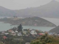
… of the container port at work and into the haze we could see right down to Tiaroa Heads. Quite surreal. Still no snow. From the monument we followed the Brailley Track to the Port Chalmers Cemetery where we found a shelter for lunch.
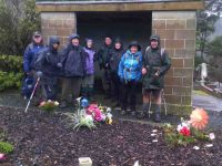
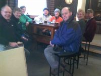
Careys Bay was beneath us so a quick zig zag through the cemetery to the famous Hotel where they allowed us to hang our wet gear in their front foyer while we enjoyed the warmth of the environment and the open fires.
Two of our men did the gentlemanly act by fetching their cars and brought them round to Careys Bay to save the rest of us from further exposure from the elements !!
19. 22/4/2015 Hikers. Port Chalmers. Leaders: Judy and Jennifer.
18. 8/5/2013 Hikers. Sawyers Bay, Old Road, Lady Thorn Dell, Lookout, Back Road, return. Leaders: Mollie and Pat.

25 of us parked in Stevenson Road in Sawyers Bay, walked
from its end around Borlases Road, turned up Ajax Rd above the steepled Presbyterian Church, onto Church Rd, crossing the railway line to reach Lady Thorn Dell for morning tea amongst the Rhododendrons, small groups disported between the seats and tables there. The day was fine and the view from the viewing platform down to the container wharves excellent.
It was then back down Church Rd, Ajax Rd, onto Mount St, to cross State Highway 88 to climb steeply up Grey St, Scotia St and Constution St to the Lookout at its top. We spent some time there watching bundles of logs being slowly craned into the bowels of a rather rusty looking ship. A passing ship towed a tug on up the channel heading presumably to the fertilizer or the petroleum wharves nearer Dunedin. We then crossed the point, steeply down this time to reach Peninsula Beach Road at the back, and to have an early lunch there. Happily the group supporting blind trampers passing by noticed us and came across for a chat, with a number in each group recognizing friends in the other.
After lunch, we completed the circumnavigation of the peninsula, detoured off across a rugby paddock to walk alongside the railway to the railway crossing, and back along State Highway 88 to Sawyers Bay Station Rd and up to the cars.
A point to note is that Hiker numbers are growing larger, making group control by the leaders more of a task, as our wide range of individual fitness led to us becoming a rather straggled out band at times. However, the weather was pretty ideal, if a little windy at lunch time and draughty when walking alongside logging trucks, and the social chatting side was well attended to. Thanks to Pat and Mollie for a most satisfactory day. – Ian.
17. 10/8/2011 Hikers. Port Chalmers, Scott Memorial, Lady Thorn Dell. Leaders: Bob and Evelyn
16. 16/9/2009 Hikers. Aramoana, and Port Chalmers. Leaders: Lex, Marjorie.
15(?) of us set out on a fine, mild day with only light breezes – an ideal hiking day – led by Lex and Marjorie, to walk at Aramoana. As that was deemed to be too short, we called in first at Port Chalmers, where, from Mount St, we ascended Grey St, passing the grand old Presbyterian Manse whose 14 rooms, recalled Lex from his courting days, were occupied by bachelor minister George Jeffries and several student ‘tenants’ – hence its nickname “Holy Fryers (Friar’s?) Abbey”. Lex’s reminiscences of his courting days continued as we passed his wife’s old family home and pictured him sunbathing on the lawn. We discovered, again from the Learned Lex, why Meridian and Magnetic streets are so named. (Answers are at the end (1) if you need them). Morning tea was enjoyed at the top on a grassy knoll looking at the splendid view towards Portobello.
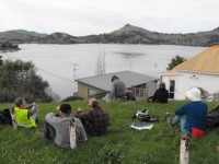
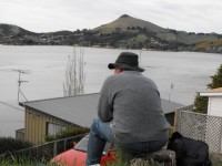
The descent was by Fox St to Peninsula Beach Rd and back to the cars by Beach St past the stacks of logs and chips. On to Aramoana. We parked at entrance to the township, puzzled over three signs of a crossed-out “H” in a circle alongside an arrow head, (a prize for the one who answers 1st as the answer is NOT at the end (2) if you need it) and walked to the north end of the beach, and along the beach to the Mole and a self-satisfied sea lion basking on the sand. Lunch at the start of the Mole looking out across sparkling waters
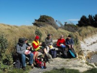
and asking how far we could see was most enjoyable. (We didn’t know the answer but see the end (3) for an informed guess). Of course we walked along the Mole and stood by the new “lighthouse”
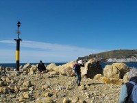
(What was the date inscribed in the concrete base – see the answer (4) at the end), and noted albatrossesses whitely plumped on Taiaroa Head and also saw one or more flying. The dredge entertained us as we tried to determine its movements (See (5) at the end for a guess), and one of the divers was pleased to chat.
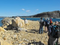
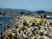
Lesley reckoned she had found a clump of Capt Cook’s scurvey grass, but noted that there seemed to be much less of the rare plant than there used to be around there. (See (6) at the end for some more information). And so to the memorial to the Aramoana Massacre where we sat briefly and talked of the events and the film “Out of the Blue”. Chris had played a part in its production and recalled the actor playing the role of David Gray (See (7) at the end for the name)) being very empathetic in the role. Consensus was that it was a good film in being even-handed in its treatment of Gray. But did the police need to be stalking in white shirts? Perhaps they were taken by real surprise at such an event.
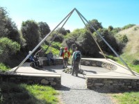
To the park and out along the boardwalks
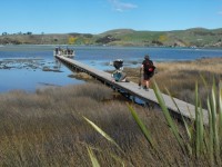
and gravelled paths among flax to the salt marshes, where Joyce delighted in betting on the crab races.
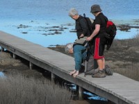
And back to the cars. A view near Deborah Bay of a wee house wedged between road and water where the Lewis family lived with 17 children!!!!!!!!!!!!!!!! A pleasant walk. One learns new things every time one comes out with the TRTC. Thanks to all who share their knowledge and entertainment. Bob Answers 1 Magnetic Street points to the magnetic North, while nearby Meridian Street points to the geographical North 2 a prize for the 1st correct answer 3 on looking at a map, probably Shag Point or perhaps the more distant Katiki Point where the Moeraki lighthouse is situated. 4 March 2009 5 It appeared to dump its load, acquired from out by the buoys, near the Spit Beach as it returned to the sea so much higher in the water 6 on the following website you can see a picture of the plant Lesley found which looks very like Cook’s Scurvey Grass http://www.nzpcn.org.nz/documents/NZ%20Favourite%20Plant%202005.pdf 7 Matthew Sunderland
16. 27/8/2009. Hikers. Port Chalmers: Iona Church, Rangi Park, Cemetery, Scott Memorial, Lady Thorn Dell, Observation Point, Hotere Garden, Back Beach, Stinking Point, Walton Park, return.Leaders: Fred, Bob.
Eighteen keen hikers set off from around Iona Church (Peter claimed that we were moving in religious circles, and when Bob said “Iona Church” he wondered how he had come to be the “owner” ), and climbed up the Rangi Park track. We were diverted past the old cemetery
where we were regaled by stories of Lex’s youth, drinking there before the annual ball and being “late”. The steep track is well formed, though some of the steps are high, and passes through a most extensive grove of Brachyglottis Rangiora (or Rangiora )
that large-leafed, white-backed foliage you can write on with a ballpoint. Several lookout points were good for stops to admire the views across the port, harbour, islands and peninsula.
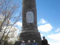
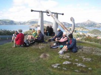
We descended from the Scott Memorial and Nineteen Fathom Foul anchor along Brailleys track to the new cemetery and thence into Church St and the Lady Thorn Rhododendron Dell
for a welcome morning tea – a warm and picturesque spot with early shrubs coming into blossom, and seats for all.
Round the church again (2 churches really with 2 spires – 1872 and 1883), down to the town centre,
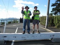
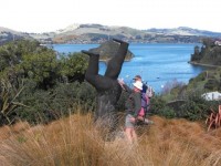
up Grey, Scotia and Aurora streets to great views at Observation Point. Neil was so engrossed there in pointedly chatting up a young lady that he made no observation that the rest of us had moved off. A few moments were spent in the Hotere sculpture garden where Les and Peter tested the smacking law with some choice whacks of the inverted male’s bottom,
and there was a photo opportunity for some old hulks to pose by the old hulk, “Black Phoenix II”.
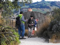
Down the hill to the Yacht Club and the public toilet,
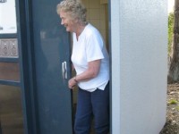
where there was much toilet humour, and then along the Back Beach walkway to a sheltered, planted picnic spot for lunch.
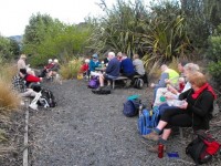
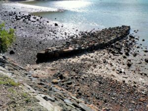
Now rested, we could complete the journey along the gravelled Peninsula Beach Road, past Russell Moses’ “Koputai” – the boat-shaped groyne sculpture,
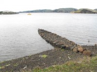
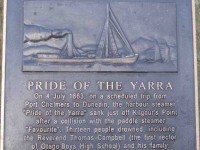
round Stinking Point (where there was no smell but a useful seat) and the Pride of the Yarra Plaque (where there was a
plaque and another seat.) Along Victory Place and Wickliffe Terrace to the track above the school we strode, descending to Walton Park at Mussel Bay and along the grassy waterfront track to the railway line. A stack of uplifted tracks provided tiered seating for a wee rest out of the breeze,
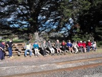
and a garden filled with ornaments of all kinds offered a wee feast for the eyes.
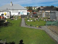
The last stretch of the journey was along the George St shops and up Mount St to the cars. Less than 10km walking, but 4 hours of good exercise, and a route with some new ingredients for most. Fred and Bob led luminously in the club’s fluorescent jerkins. – Bob.
15. 26/11/2008 Hikers.Port Chalmers. Leaders: C. Hughes, G. Baxter
14. 16/1/2008. Port Chalmers. Leaders: Tash, Lex.
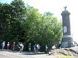
Scott Memorial
On a lovely calm and warm summer morning 15 hikers parked their cars at Sawyers Bay and set out for Port Chalmers. We went round the back road and then up the hill to the Scott Memorial and Centenary Lookout. Perfect place for morning tea break. Lovely views, shade or sun to sit in and the colourful company of the resident ‘free-range’ roosters and hens who are always very interested to check out the visitors! Then it was down the hill and through the Port Chalmers cemetery to the port itself. No cruise ships that day but two left recently and another due in that night. Up the hill then to the Conservation Point Flagstaff Lookout. Perfect day for great views all round. We sat in the recently developed little reserve that has a sculpture by Ralph Hotere as well as a couple of other rather intriguing and interesting ones, and enjoyed a restful and relaxing lunch break. Then, down the hill again to the back beach road. About half way along we went up a track that took us up to the top of the hill again. From there it was down the road, across the railway line and back along main road to Sawyers Bay and the cars. A happy and convivial day out. – Bev.
13. 16/1/2008. Hikers. Port Chalmers. Park cars at Sawyers Bay. Easy.Leaders: Lesley S, Eleanor B
12. 7/2/2007. All. Port Chalmers from Sawyers Bay – Cruise Ship. Easy.Leaders: Peter and Wendy, Molly, Lois.
11. 28/6/2006 Hikers. Sawyers Bay, Back Beach. Leaders: Jean A, Chris
10. 13/8/2003. Hikers. Port Chalmers, Careys Bay. Easy. Leaders: Lesley W, Denise.
9. 21/8/2002. Alt. Port Chalmers Careys Bay Back Beach. Leaders: Dot B, Joan H, Anne R
8. 17/10/2001. Alt. Port Chalmers, Back Beach. Leaders: Nelson and Dot, Mavis.
7. 6/6/2001.All weather. Overgrown. Port Chalmers, Deborah Bay. Easy+. Leaders: Bill H, Lesley S, Winnifred
6. 8/11/2000. Port Chalmers. Leaders: Mavis, Peggy M, Catherine.
5. 7/6/2000. Deborah Bay. Leaders: Bev H, Les & Margaret
4. 8/1/2000 Port Chalmers Careys Bay Back Beach, Rangi Park walkway. Leaders: Mary M, Catherine T
3. 21/5/1997. Port Chalmers, Back Beach, Rangi Walkway. Leaders: Daphne, Les and Mavis.
2. 13/11/1996. Port Chalmers Back Beach – Rangi Park Walkway. Return trip. LeadersL Les and Mavis, Daphne.
1. 12/7/1995. Port Chalmers. Deborah Bay. Easy+. Leaders: Shirley, Bev H, Ria H, Jean A

