29/6/2016. Kaikorai Stream Walk. E. Leaders: Jan and Lesley.
Taieri Recreational Tramping Club
Mid-week recreational and social walking group based in Mosgiel NZ

29/6/2016. Kaikorai Stream Walk. E. Leaders: Jan and Lesley.
21/5/2014. Street Walk: Maori Hill. E. Leaders: Lance and Lois.
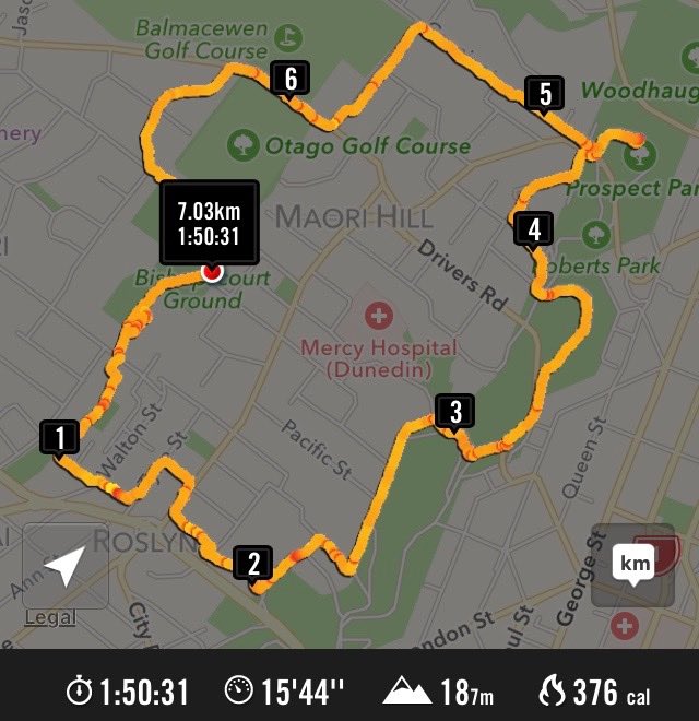
(An inadequate report. Only a summary. Anyone care to improve on/add to/alter it? Please notify.) Cars parked on Queens Drive encircling Prospect Park. Across Lachlan Avenue to Stonelaw Terrace, down a steep track at its end, first seal, then small crushed metal, to emerge on Queens Drive, then up Chamberlain Street for a short distance, along Como Street and up View Park Lane. This was a revelation to the reporter, who had known nothing about this (unique to Dunedin?) lane of letter boxes sited at the end of back sections to properties fronting otherwise onto Como (our left) and Chamberlain (our right) Streets. A gift for posties! Then along Falkland Street, down Drivers Road, to climb Tolcarne Avenue and stop just below Tolcarne Collegiate School Hostel to enjoy morning tea at a view point.
Then up Grendon Street, finding a lane taking in the back properties of houses on left and right with their frontages out on adjacent roads. (Unsure though where this was.) Out onto Highgate, through the village onto Balmacewan Road and up Prestwick Street to its terminus and return. Along Pilkington Road, to take Cannington Road to spot where it ends at the bush, return and follow Cairnhill Street into Braeview Crescent to explore it to each of its terminuses (or termini if you must be linguistically correct) to their ends. Back along Cannington Road to find our way into Brownville Crescent, another new find for the reporter. Here was a road necessarily one-way due to its narrowness. Lance thought it likely than a developer had enforced his wishes on some early Maori Hill Borough Council, narrowing its width to increase adjacent property areas as much as possible. It exited onto Highgate. Then it was back down to the cars at Prospect Park. Early lunch, scheduled to be finished before a forecast storm. However this came only later when driving back home, so lunch was enjoyed in the sun on a bank sheltering us from the wind. Thanks to Lance and Lois for a well reconnoitred, imaginative and most enlightening route. – Ian.