Aug 08 2019
Protected: Committee Minutes, 8/8/2019.
Enter your password to view comments.
Jul 24 2019
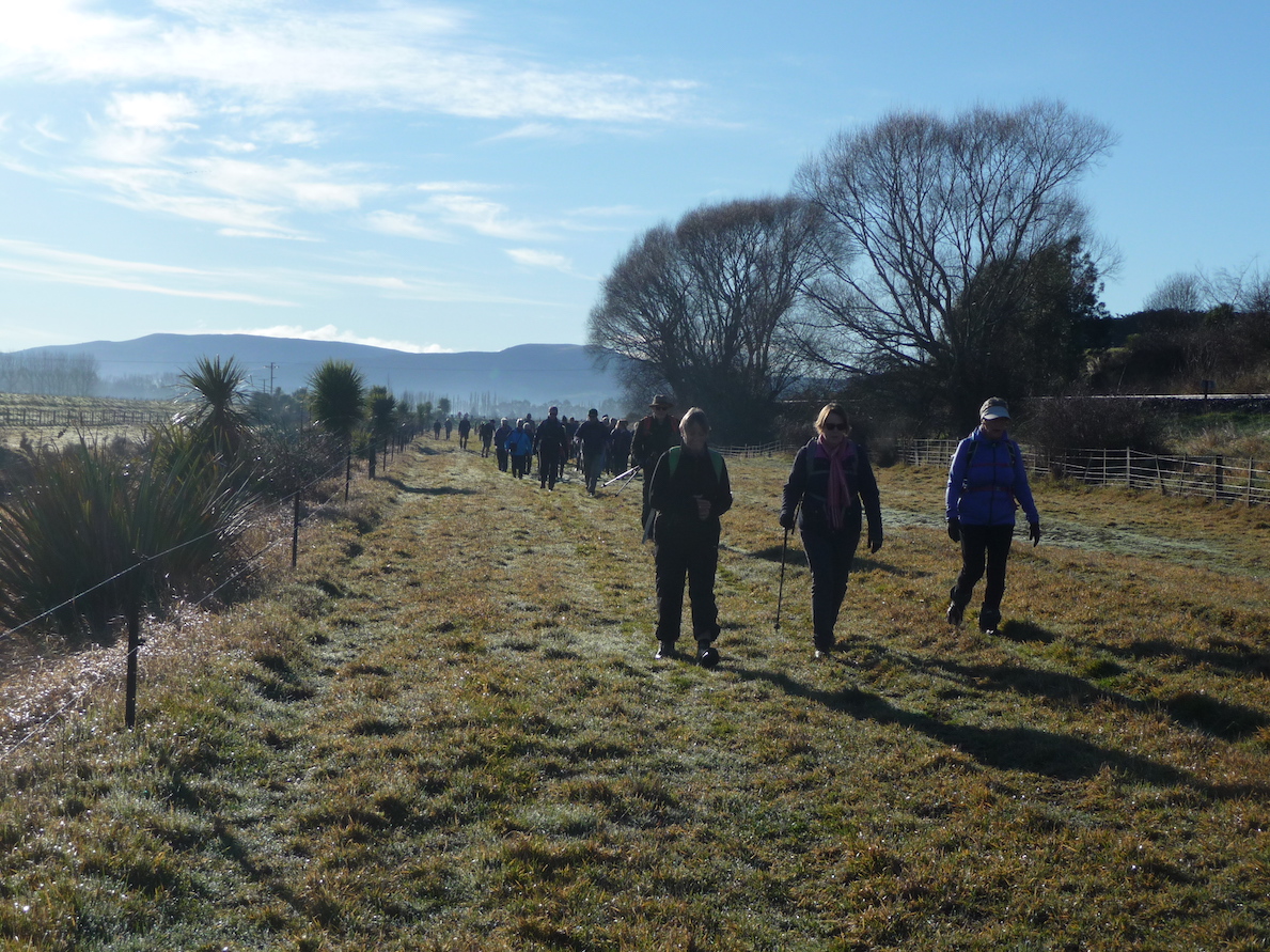
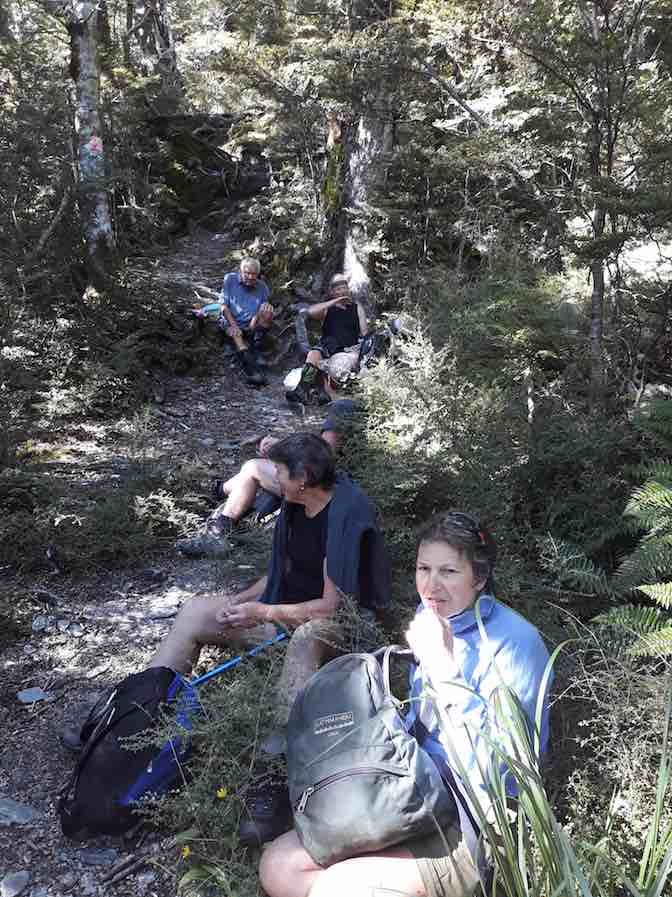
On the way down Owhiro Stream. (Gordon pic and caption.)
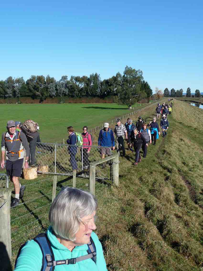
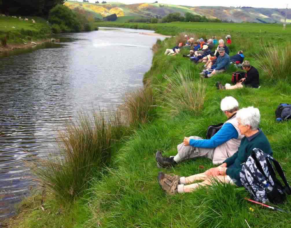
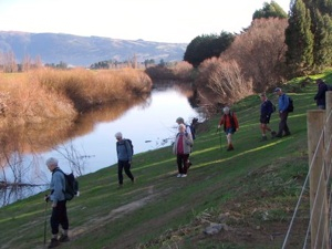
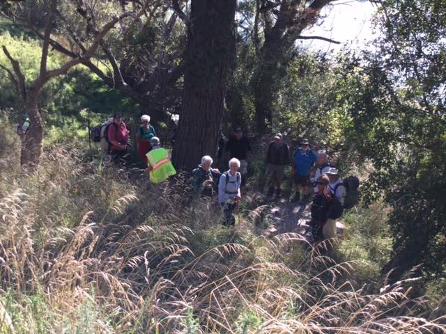
We followed some of the Taieri waterways onto the floodbanks which have over the years saved farmlands from being completely destroyed/submerged in floods. Alan had some photos of the extensiveness of the flooding over the years.
A catchup were the Owhiro Stream enters the Taieri River. (Gordon pic and caption.)
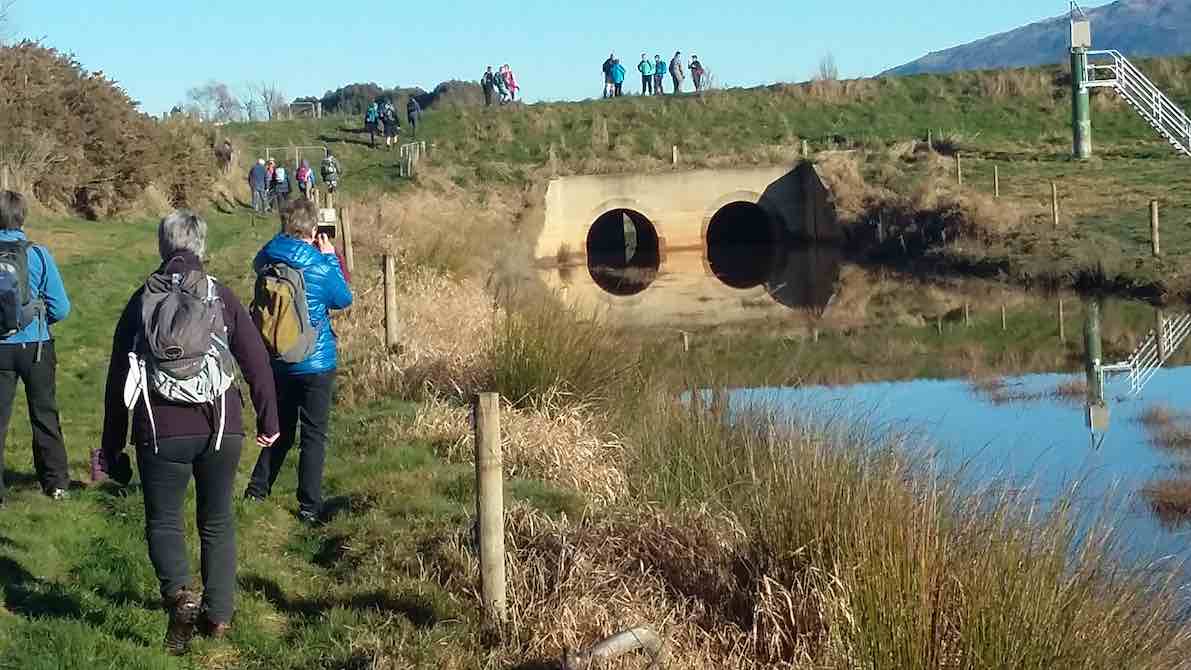
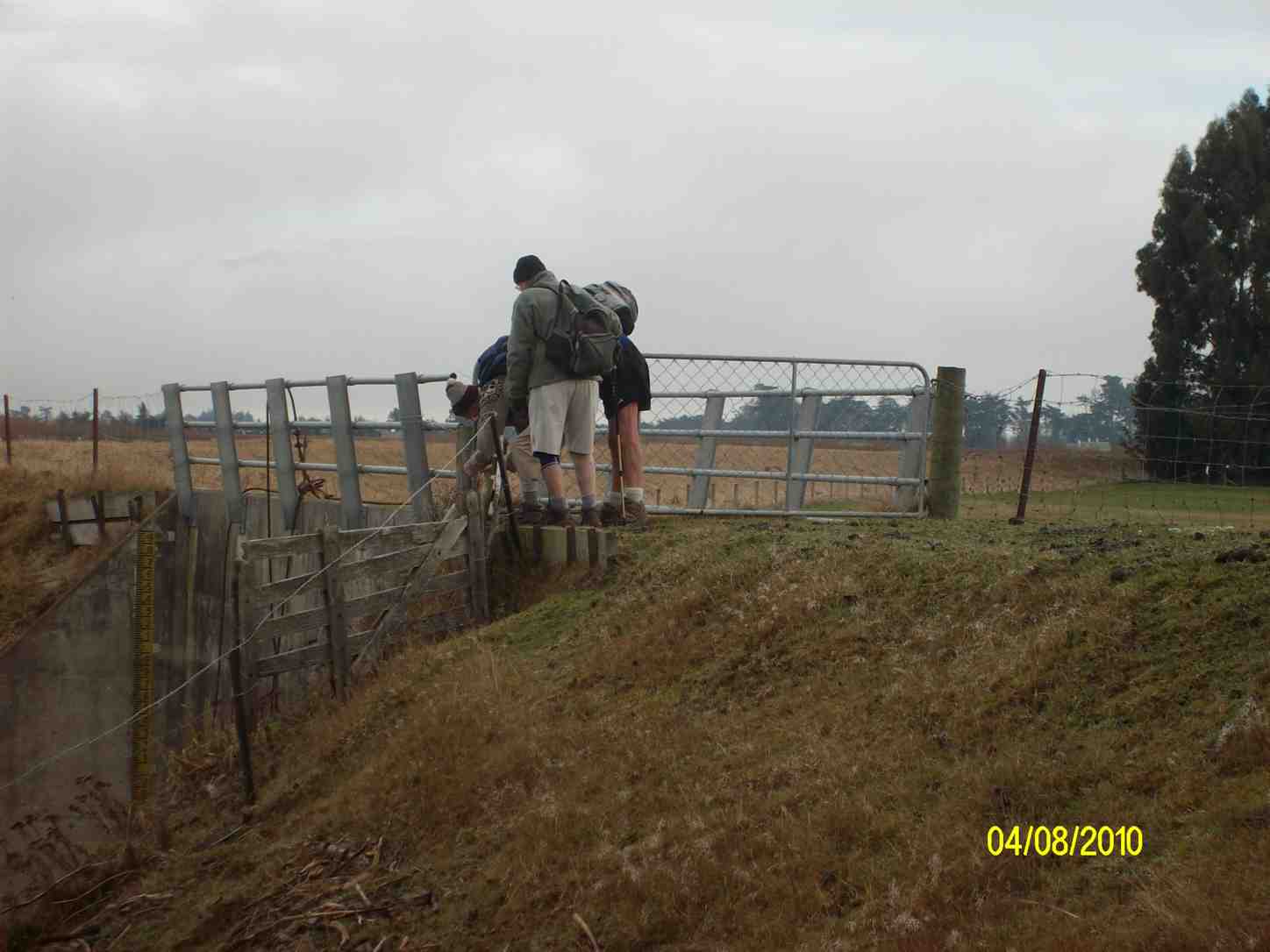
the control gate into the ponding area. (Clive pic and caption.)
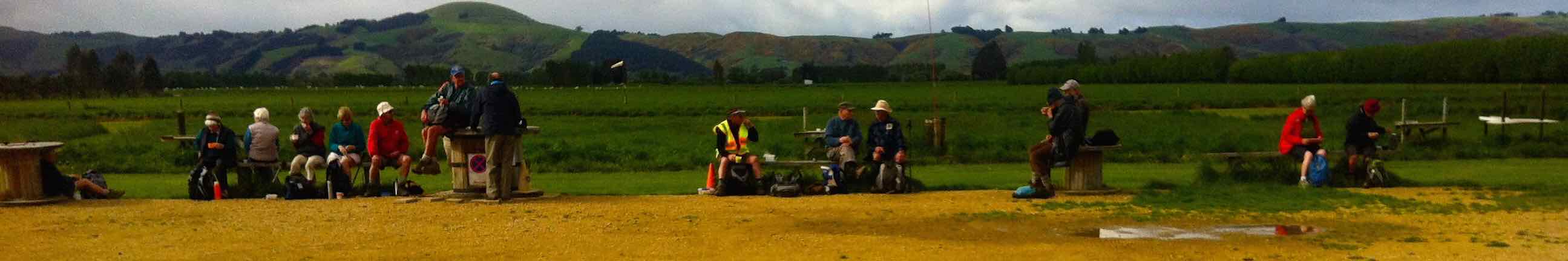
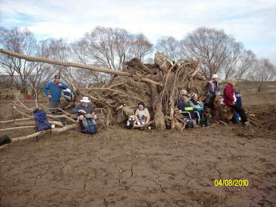
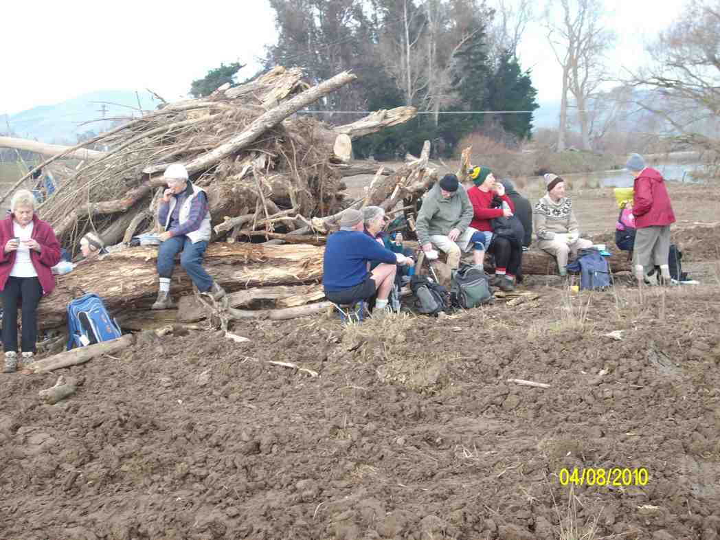
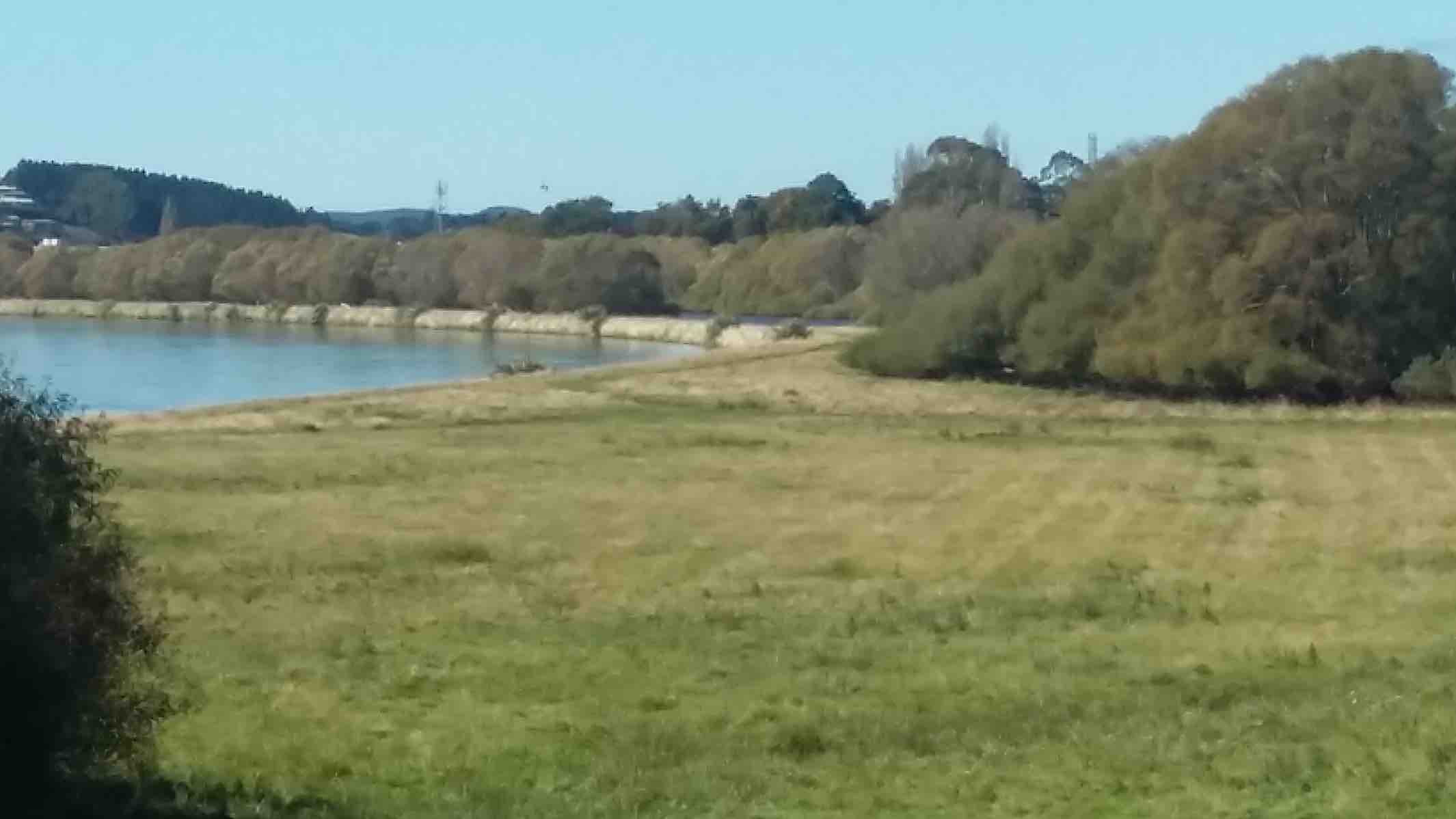
Morning tea was held beside the Mill stream pump house. The stream flows into the Taieri river. The river was full and very discoloured.
Morning tea Mill Creek. (Clive pic and caption.)
From here we split into smaller groups depending how far people wanted to walk back to the party house.
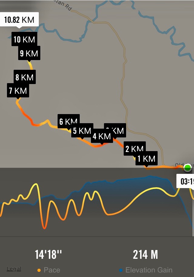
Overall walking distances ranged from the Ramblers’ ramble to the longest distance approx 10 kms and then a ride home for them.
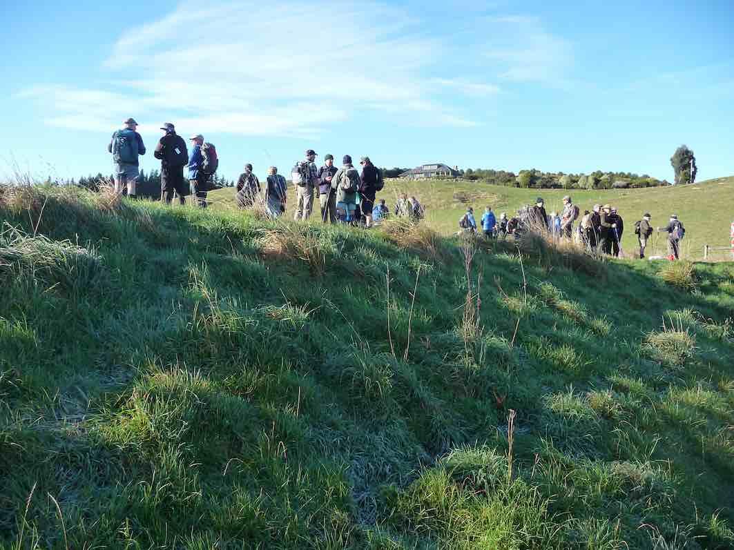
Heading towards South Fork farm. (Gordon pic and caption.)
Alan suppyling information on slipway at flood gates. (Gordon pic and caption.)
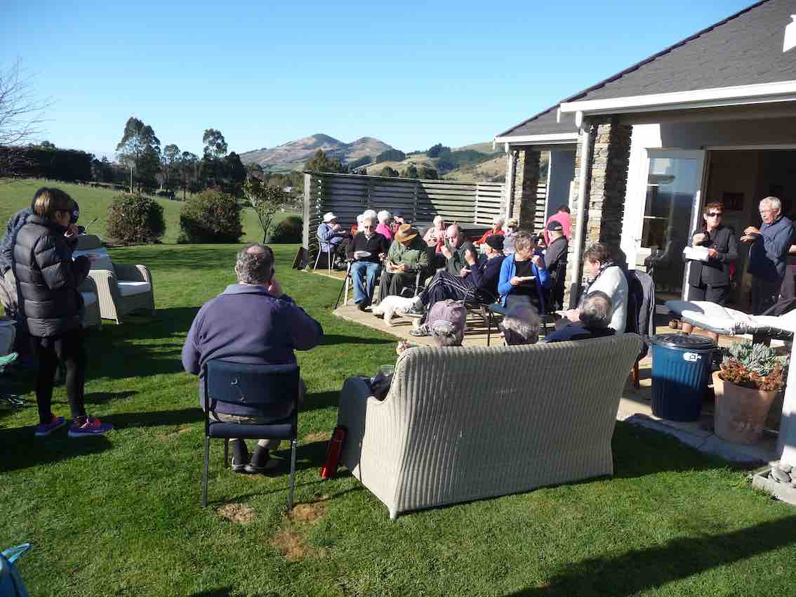
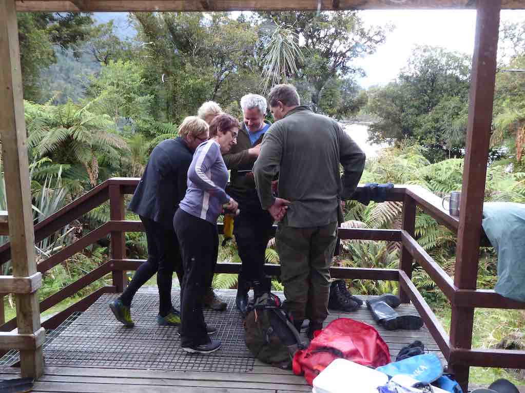
Alan had vehicles placed along the way to get all home by about 1 pm to be together to share Doug’s 90th birthday lunch. A real party lunch shared by all including some of our members who like to be involved with activities but not always able to join us on some of our weekly outings.
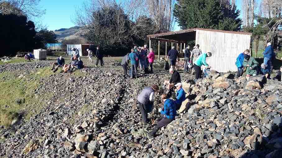
Lunch back at homestead. (Gordon pic and caption.)
Helen Morris spoke about Doug
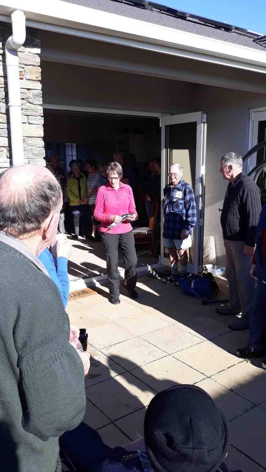
Helen speaks about Doug.
– out most Wednesdays a very busy man with an immaculate house and garden, a perfect gentleman, and a great bagpiper and ball room dancer. Always wearing shorts!
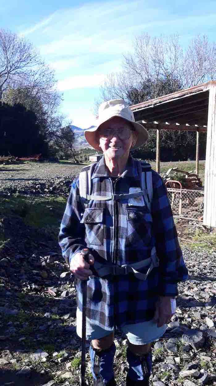
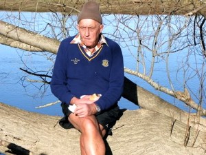
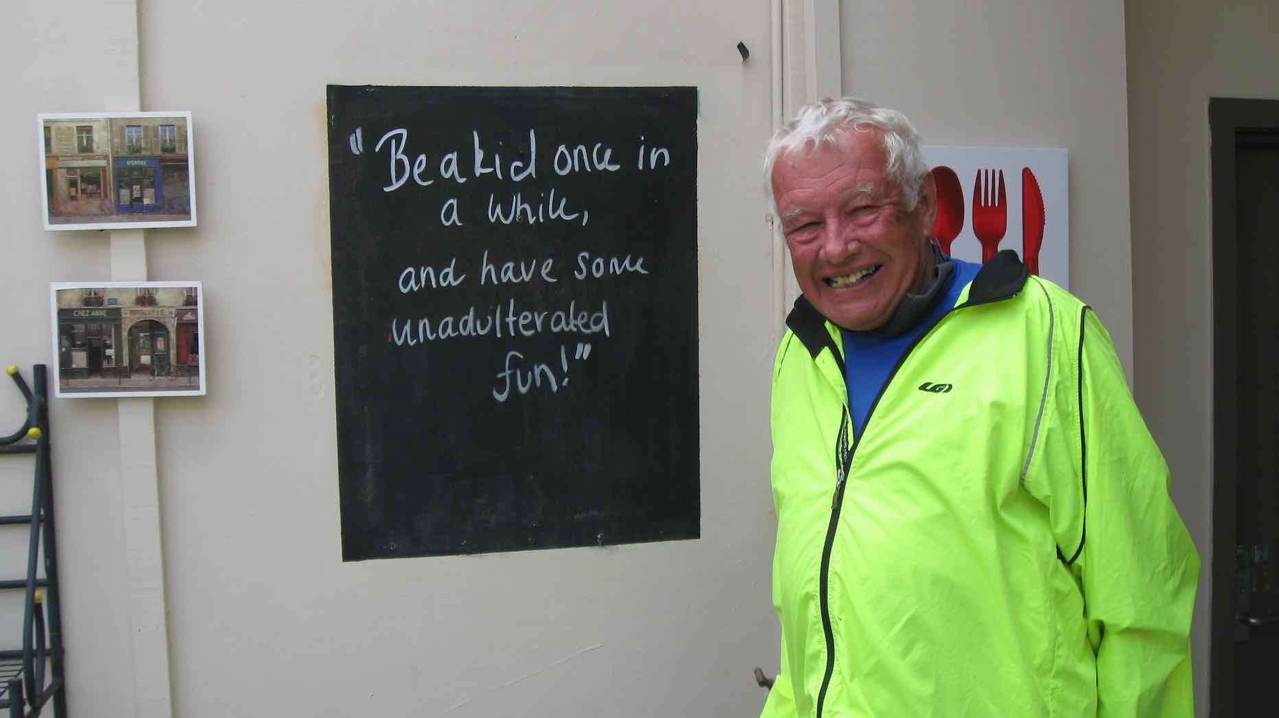
Doug. (Helen pic and caption.)
A big Thankyou to Alan and Kerry hosts extraordinare for providing an idyllic location and perfect weather (hardly a breathe of wind ). We wish them well for their overseas trip next week and look forward to hearing of their experiences.
Jill on behalf of the club.
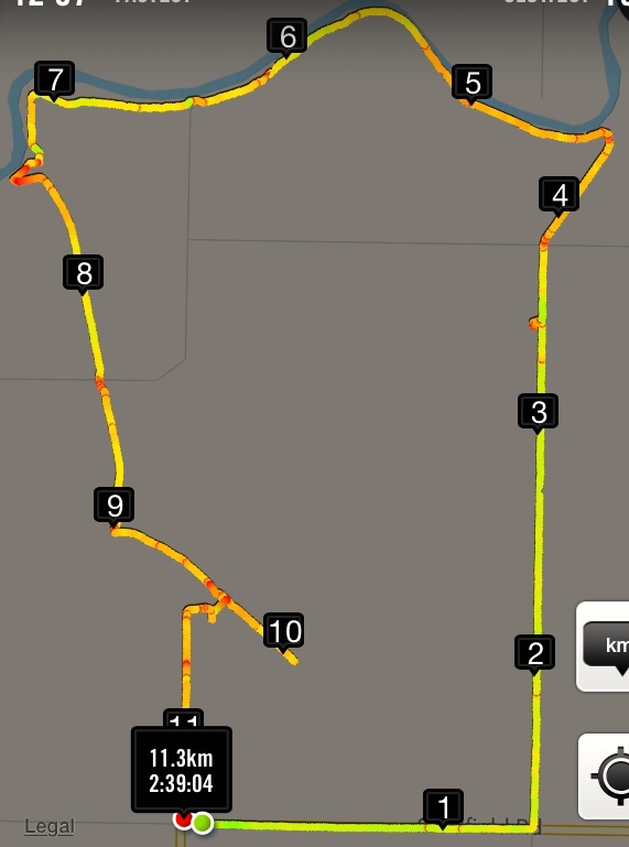
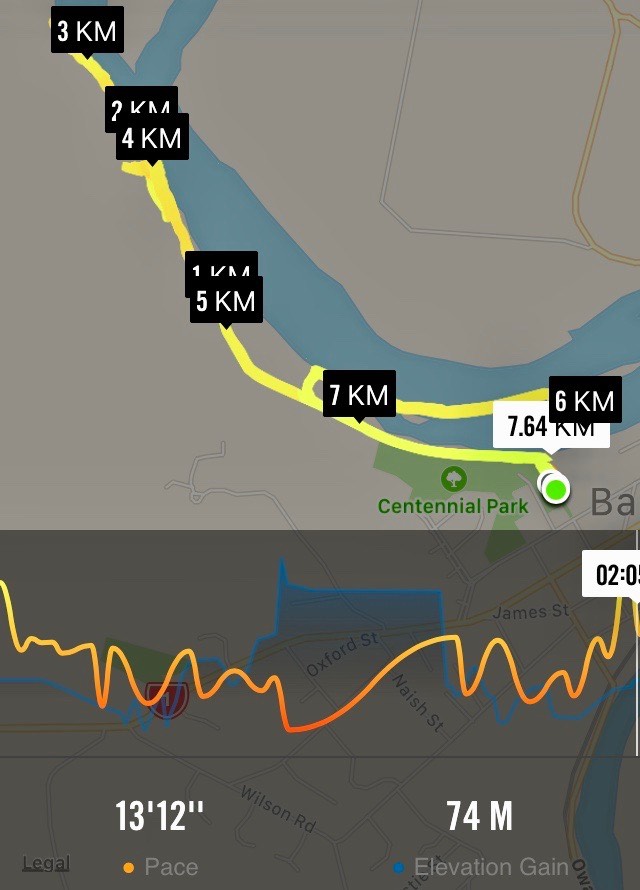
(Add 100m to kms, as turned GPS on late!) Route: Riverside Rd, School Rd, Taieri Flood bank, Siverstream Flood bank, McKay reserve, paper road.
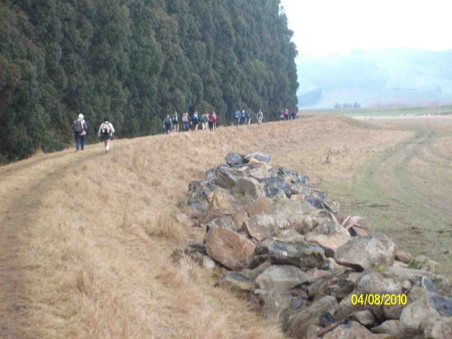
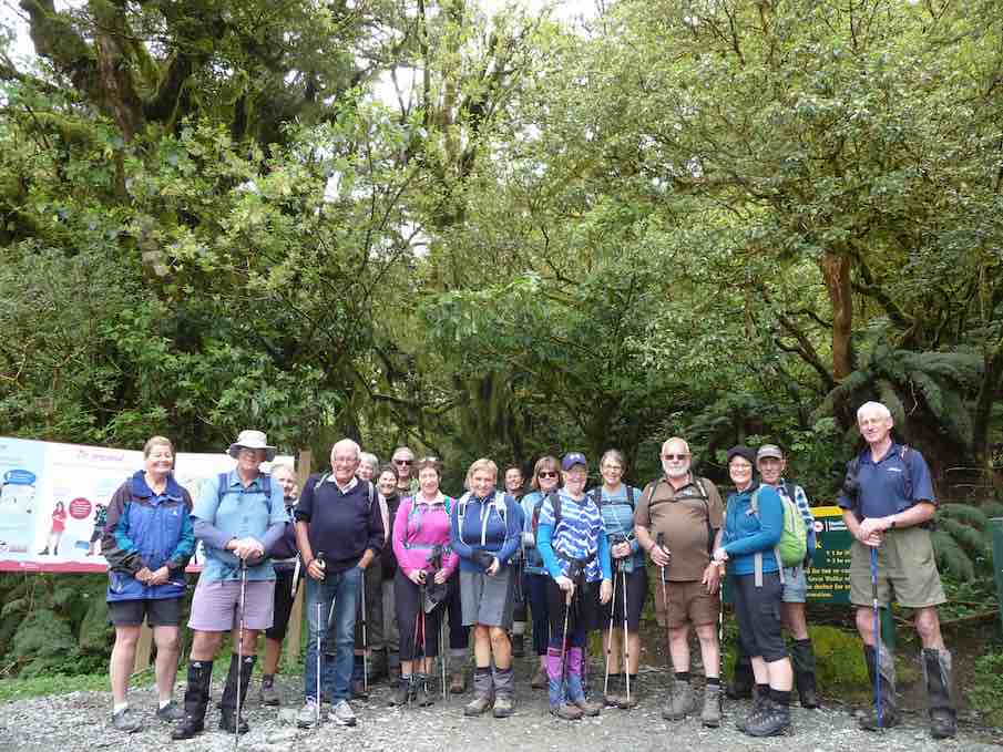
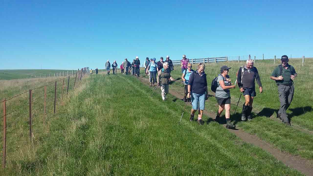
Twenty-five of us started along Riverside Rd from cars parked at the end of Dukes Rd. Turned left into School Rd. At about the 3.3km mark (a tiny swiggle on the map) Peter let us in through a combination-locked gate to the Dunedin Model Aero Club site and welcome bench seats …
Cuppa at Dunedin Model Aero Club site on School Road.
… upon which to enjoy morning tea. One of us preferred …
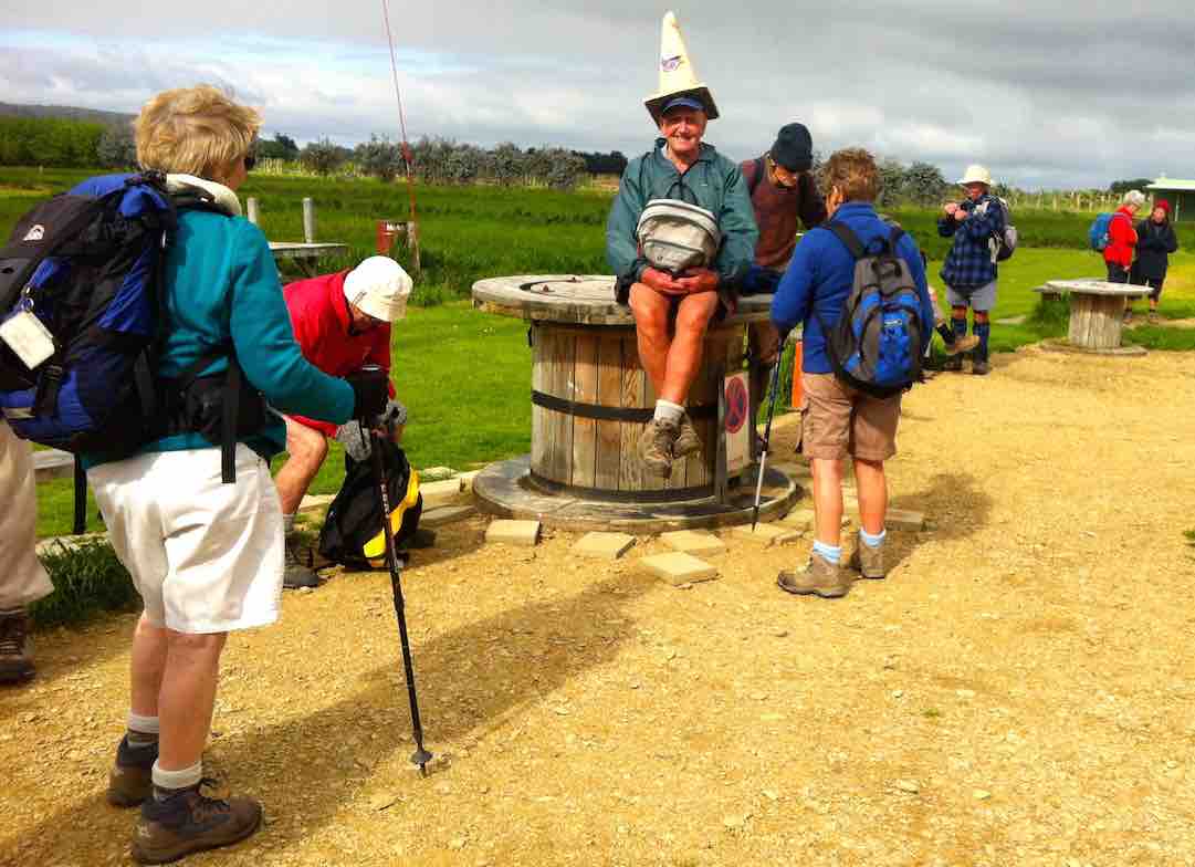
An alternative hat
… sitting on a table, rather fancying himself in his newly acquired piece of headgear.
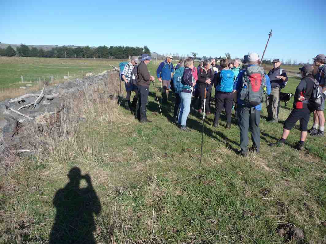
As we were walking back out onto School Road, Leader Peter told us in interesting detail the history of the road, originally the Mosgiel-Outram railway route. The raised bridge over the Taieri River necessitated a fully-laden passenger train locomotive stopping and waiting for twenty minutes to get up enough steam to get its load up and over. School Road was the most difficult part of the line to construct. Hector told us of the need of a foundation of flaxes to first undergird the permanent way over the Taieri swamp. At road’s end, we followed the old rail bed as it veered right and led us to the Taieri River flood bank, alongside an interesting flood gate structure, designed to release flood waters into the flood plain alongside when needed to alleviate flooding elsewhere.
Making our way alongside the river, we had to negotiate a tricky fence, armed with live electric (fortunately the stretchy kind) wires on either side. Eventually, we were able to carry on. Arriving near the river’s confluence with the Silverstream, we perched ourselves alongside the latter …
Lunch
… for a leisurely lunch. Fortunately the wind abated for the while we were there.
Up and along the Silverstream’s true right floodbank, under the Riverside Road bridge and on to a heavy flood gates structure protecting a large drainage ditch at the lower corner of the McKay’s Triangle Wildlife Management Reserve from flooding back.
We walked along the ditch’s true left through luxuriant spring grass freshly tracked by some vehicle’s wheels, a boon denied the leaders who had to brave the reserve completely lacking track indicators to keep them free of boggy underground. Along the way we passed by
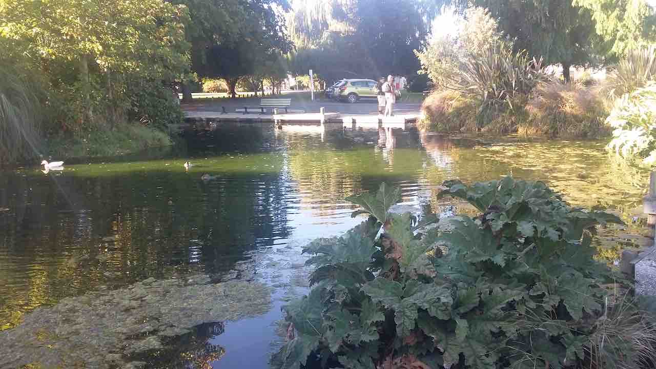
Lake Kate
a lake, adding to the scenic variety of the reserve. We persisted up along the aforesaid ditch, seeking yet another lake that unfortunately failed to materialize. So back down to enter in via a mai-mai to circumvent the beautiful Lake Kate, …
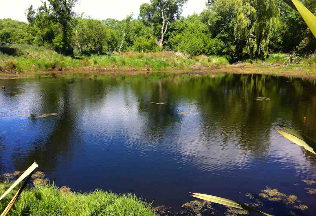
Lake Kate
… unseeable from the track. Thank you leaders, for finding the way into this hidden jewel for us.
We were then cleverly led by twisting track and footbridge out to the other major track, this one bordering yet another drainage ditch set at right angles to the other. This led us in straight alignment with Duke Road, virtually its paper road extension, back up to the cars again.
Thanks to Peter and Lesley for a carefully planned trip with the McKay’s Reserve as a surprising cherry at the end. – Ian.

GPS of route (Courtesy, Ken)
Shutting the stock gate on the flood gate. (Ken pic)
Lunch1 (Ken pic)
Lunch2 (Ken pic)

Bridge (Ken pic)
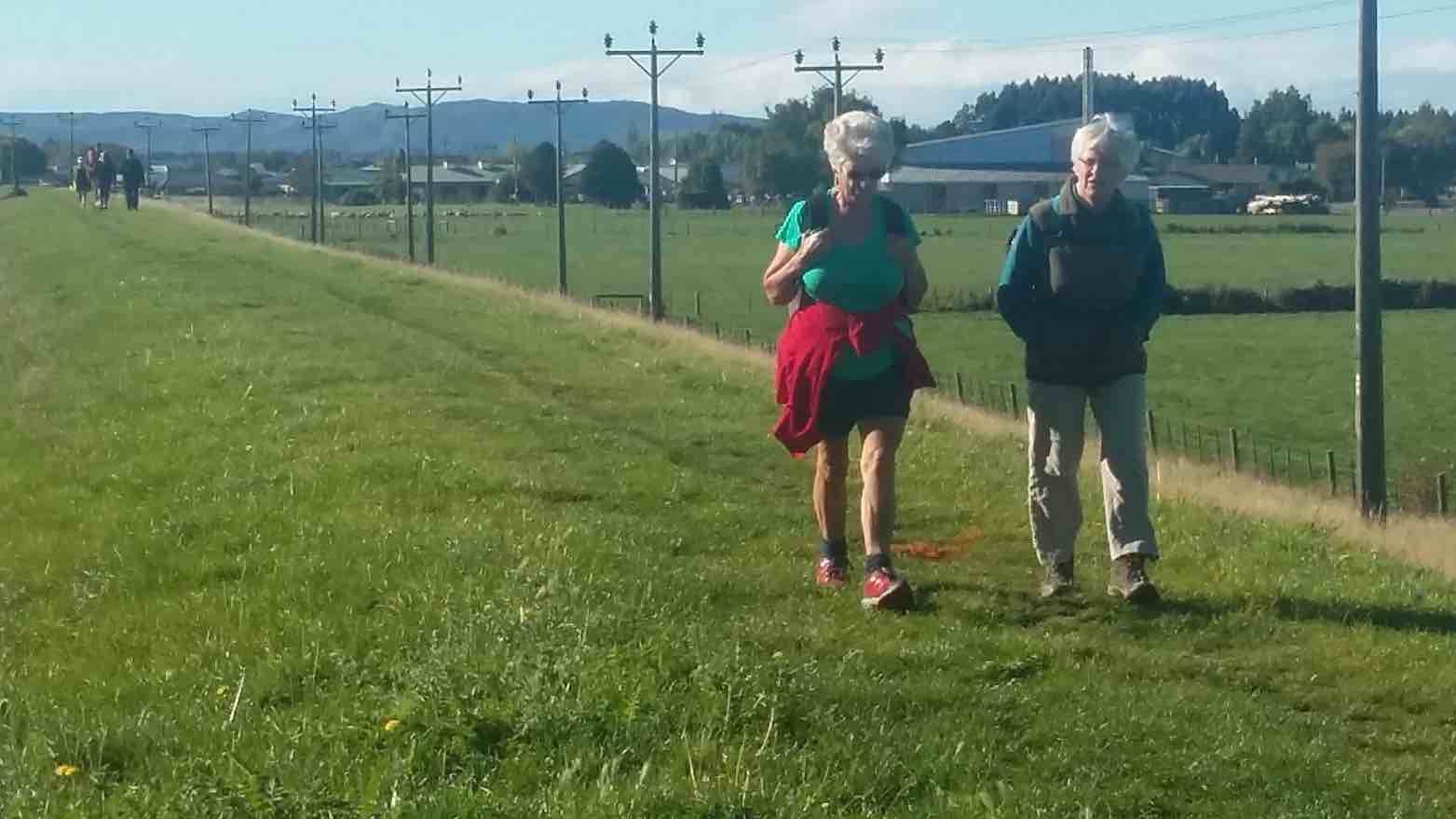
Taieri in the winter. Who? Dot, Who? Margaret, Joyce, Lex, Arthur, Who?
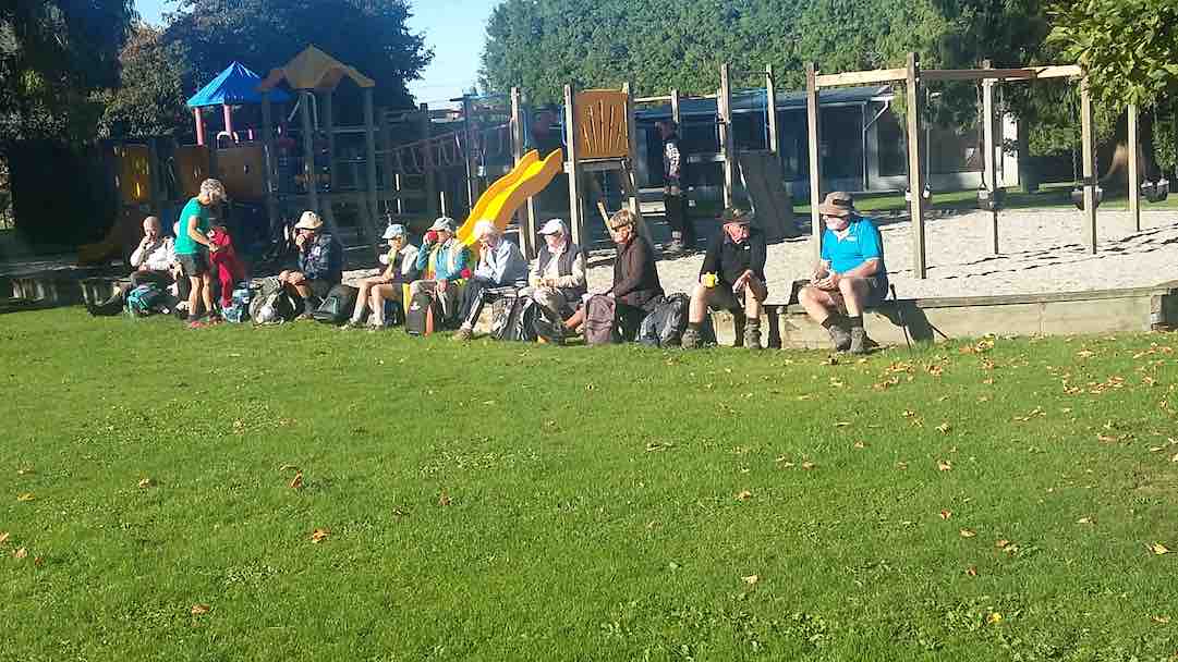
A perfect winters day for the 20 hikers who parked their cars at the end of Dukes Rd to enjoy awalk on the roads and farmland on the Taieri Plains. We went along Gladfield Rd to School Rd where we found a spot to sit and have our welcome morning tea break. Off down School Rd for a short distance then on to farm land. Across paddocks, along stop banks, making the most of the beautiful sun and scenery which made this an especially enjoyable day out. Sat and had our lunch in a very pleasant spot amongst trees and near the Silverstream.
A Presidential munch. Peter

The ‘swing’ bridge
Then it was across more paddocks, over a ‘swing’ bridge and back to the cars. Not a hard hike but one everyone enjoyed very much. – Bev
Park end Dukes Rd. Straight ahead SE to McKays Triangle Wildlife Management Reserve. (Seek permission for this part, although paper road.)

McKay’s Triangle Wildlife Management Reserve Sign

Small Lake, McKays Triangle Reserve, Mid-Taieri Plain

Taieri River

Taieri River flood-gates, Mid-Taieri, designed to release flood waters onto flood plain.

Drainage Ditch Gate by track as trampers return to cars
Apr 17 2019
2. 17/4/2019. Hikers. Edgar Centre to Rotary Park, return. E. Shona and Jill D.
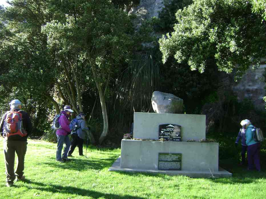
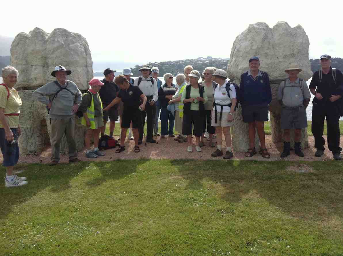
28 hikers assembled at the Edgar Centre, before walking along Portsmouth Drive to Bayfield Park stopping en route to admire the memorial stone “RONGO”.
1. 16/8/2017. Hikers. Edgar Centre to Rotary Park, return. E. Leaders: Judy and Adrienne.
(Adrienne pic.)
(Adrienne pic)
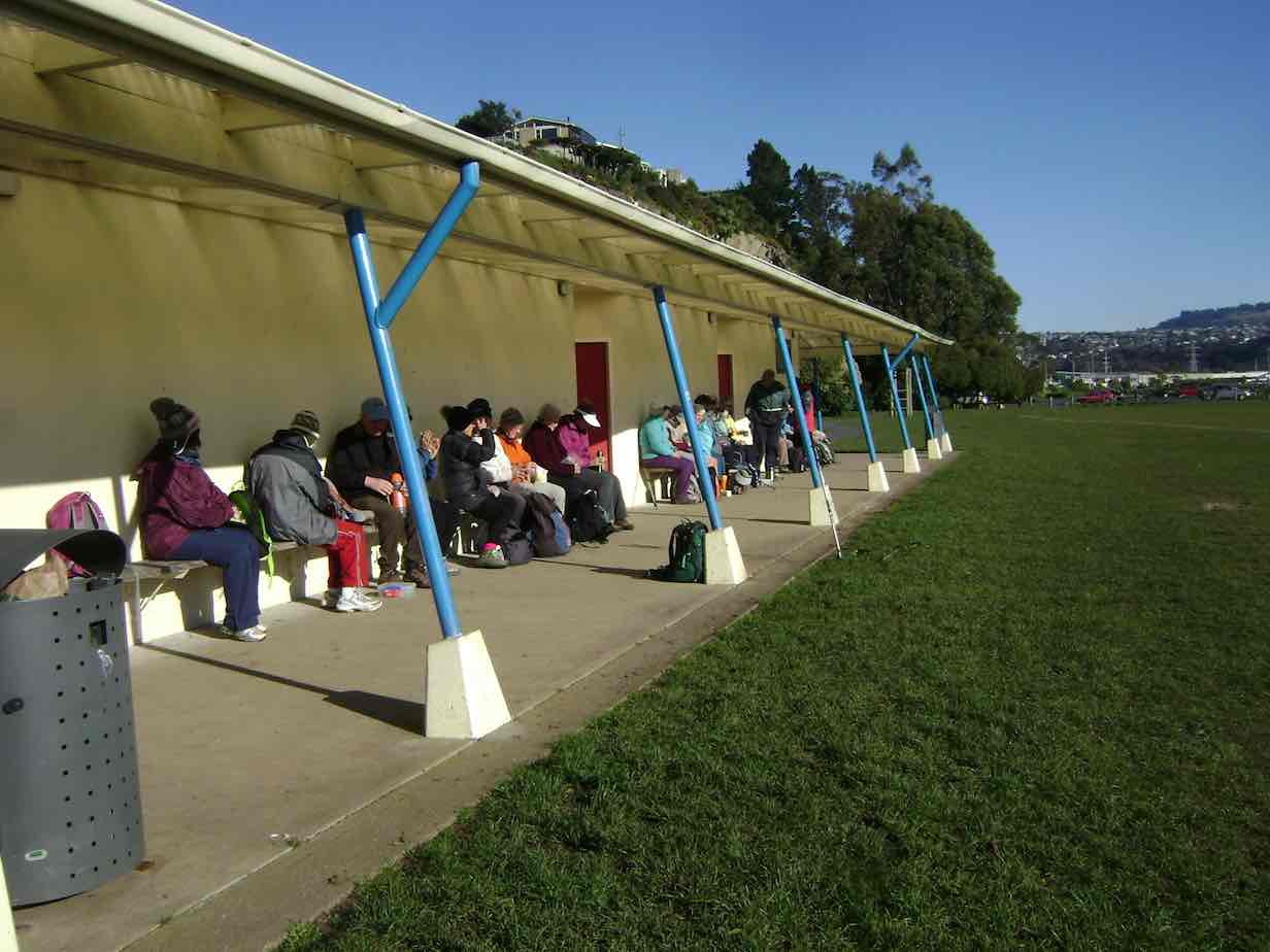
26 hikers met at the Edgar Centre carpark in clear sunshine after a frosty start to the morning. We walked along Portsmouth Drive a short way to the Bayfield sports fields for a leisurely morning tea on the comfortable seats in front of the pavilion.
From there it was another short leg to the bus stop at the bottom of Silverton Street, where we boarded the bus for the ride up to the Shiel Hill terminal. Another short walk took us further up the hill and across the road into Rotary Park for an early lunch. A lazy breeze found us well spread out, seeking sunshine and shelter – hard to find both. The views of the city and harbour are magnificent from this park.
Soon we were joined by Les and Margaret, with welcome birthday chocolates – thankyou! It was good to see Les up and about again after a bout of pneumonia.
Unfortunately it was a bit too cool for the proposed lengthy lunch and sunbathe, so by midday we were off again for the walk down the hill, via McKerrow St, Larnach Rd and Shandon Rd to the top of Arthurs Walk. With knees creaking a bit we descended the many steps down to Portobello Rd, and so back to the cars, and coffee at Nichols. – Judy and Adrienne.
Nov 14 2018
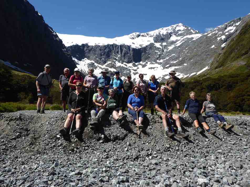
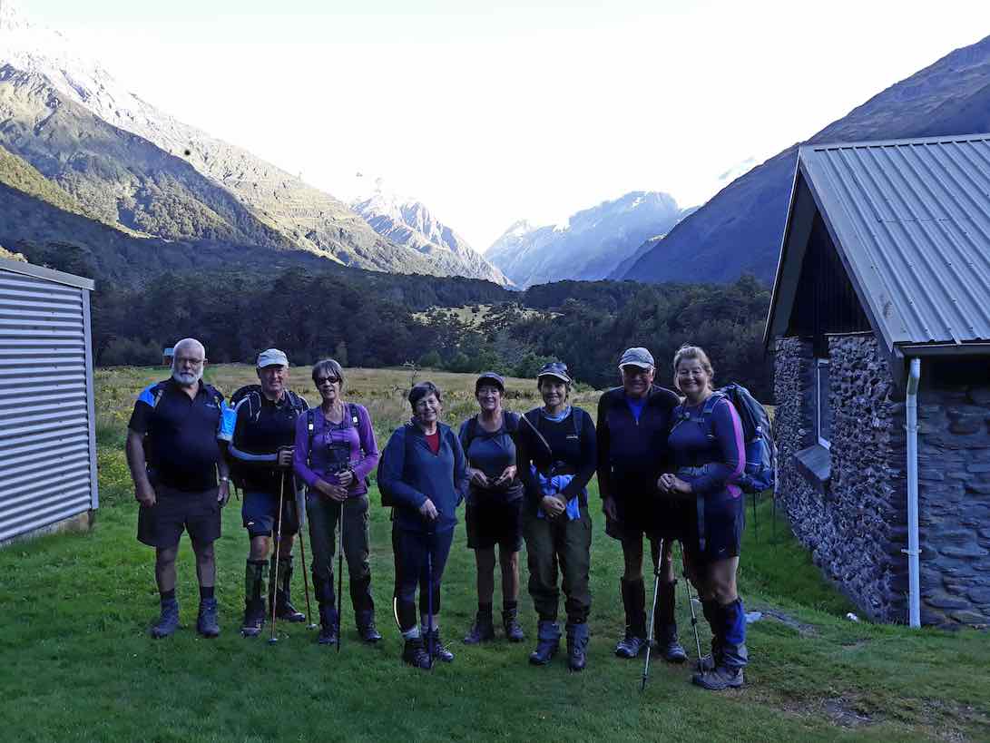
12/11/2018. Hollyford Camp. M. Phil.
Trampers: 12-16 Nov: Hollyford Camp. M. Phil.
Hollyford Escapades: 12-16 November 2018
Planning to execution seemed to go very well as everyone was at Waihola early….. this being a trait that continued for every start during the week.
18 intrepid walkers in 6 cars set off and bang on time arrived at Cocoa’s Café at Mandeville airport for a necessary kick start to getting to Te Anau reasonably refreshed. First stop was at the DOC I-site to get hut tickets and check the weather, then it was food and petrol top-ups plus a visit to the best public loos in the world for most – albeit some of us had to go back to the car to get the entry gold coin!
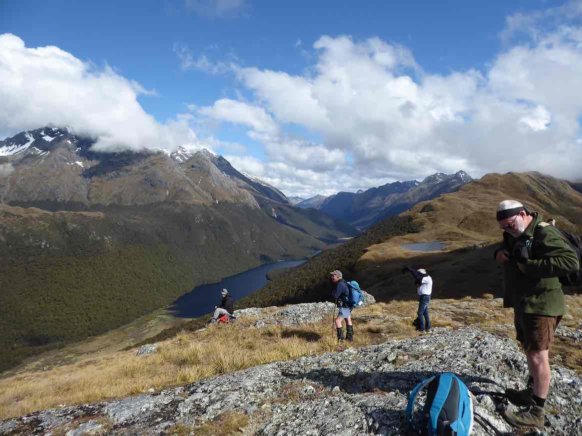
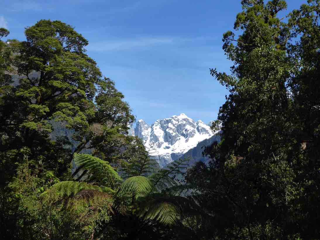
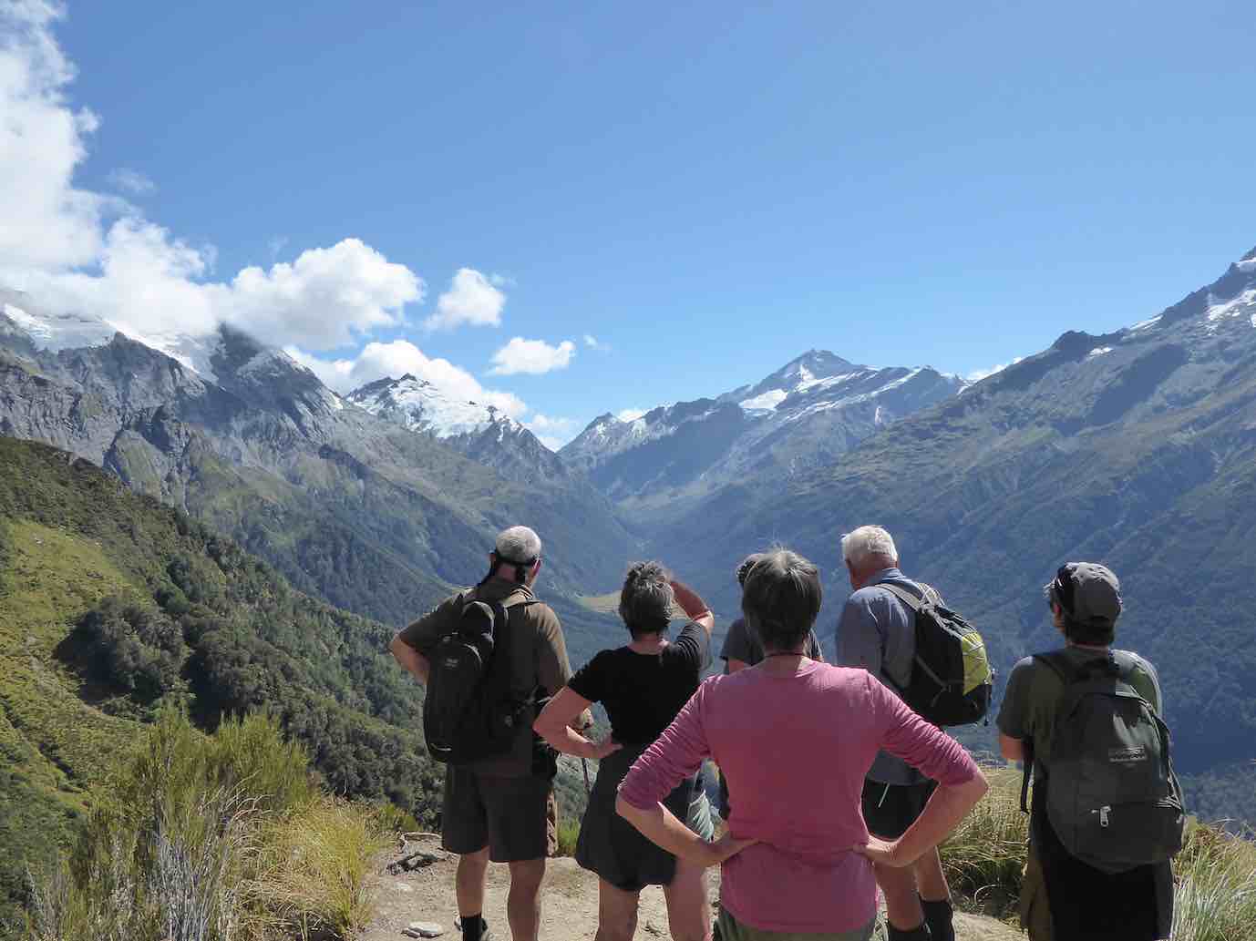
The clearing weather meant the drive up through Te Anau Downs and the Eglinton Valley was pretty well up to the Mercedes car advert standard, then after a brief stop at Knobs Flat we arrived at The Divide. With clear tops on the Livingstone Range, it was decided to attack Key Summit,
At the Divide about to head up Key Summit . (Gordon pic and caption.)
initially via the Routeburn/Greenstone track, before branching off on the zig zags to the Summit and, for some, beyond the well known tourist look out. The group split into 3 as each limit was reached; lovely views of Lake Marian, the Darrans, the Hollyford and also the Greenstone Caples were in view and appreciated.
On Key Summit looking to the Greenstone: McKellar Saddle ( and Caples). (Phil pic and caption.)
We finally descended in good time and once back in the cars, moved into the Hollyford proper. Turning right into the Lower Hollyford Rd we stopped, read and discussed the memorial to Davey Gunn that celebrated his 56 mile journey over bush tracks from Big Bay to the Milford Rd in 23 hours to raise support for the injured in a plane crash there. What the books don’t say is Davey had a cuppa then returned to Big Bay to carry on his guided trip… he had also cracked some ribs getting plane passengers from the crash in the surf….
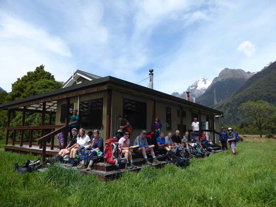
Finally we arrived at Gunn’s Camp and settled in to our ‘little huts on the Prairie’…… followed by good craic and a variety of well cooked dinners.
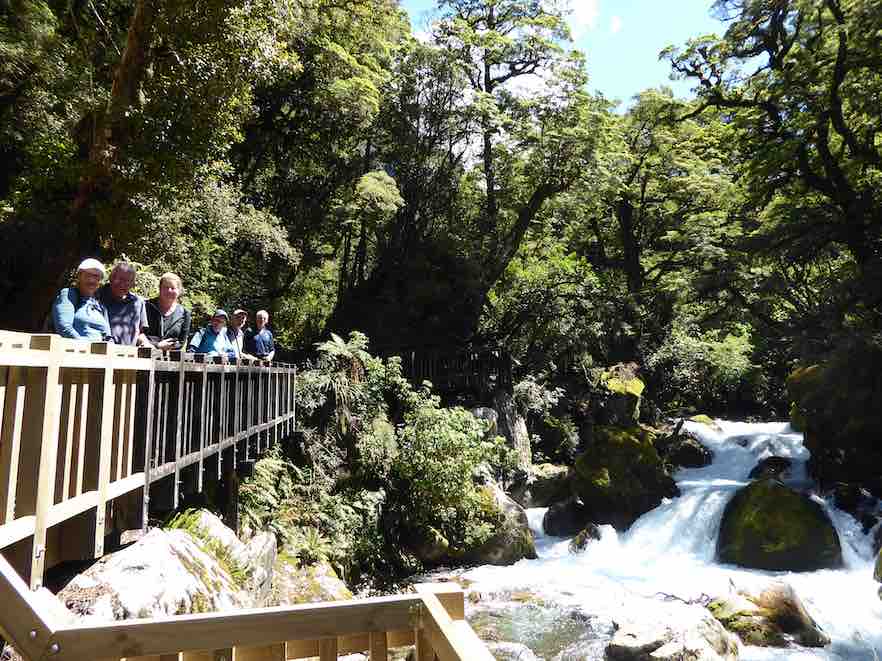
We were at the Lake Marian track ahead of time on the Tuesday morning, everyone keen to get going. Crossing the Hollyford River involved the first swing bridge for the week, then some time was taken on the Gantries overlooking the tumbling waters of Marian Creek;
Marian Creek cascading. (Phil pic and caption.)
from there it was a steady 2 hour walk up to the Lake, to be greeted by emerald clear water and towering peaks,
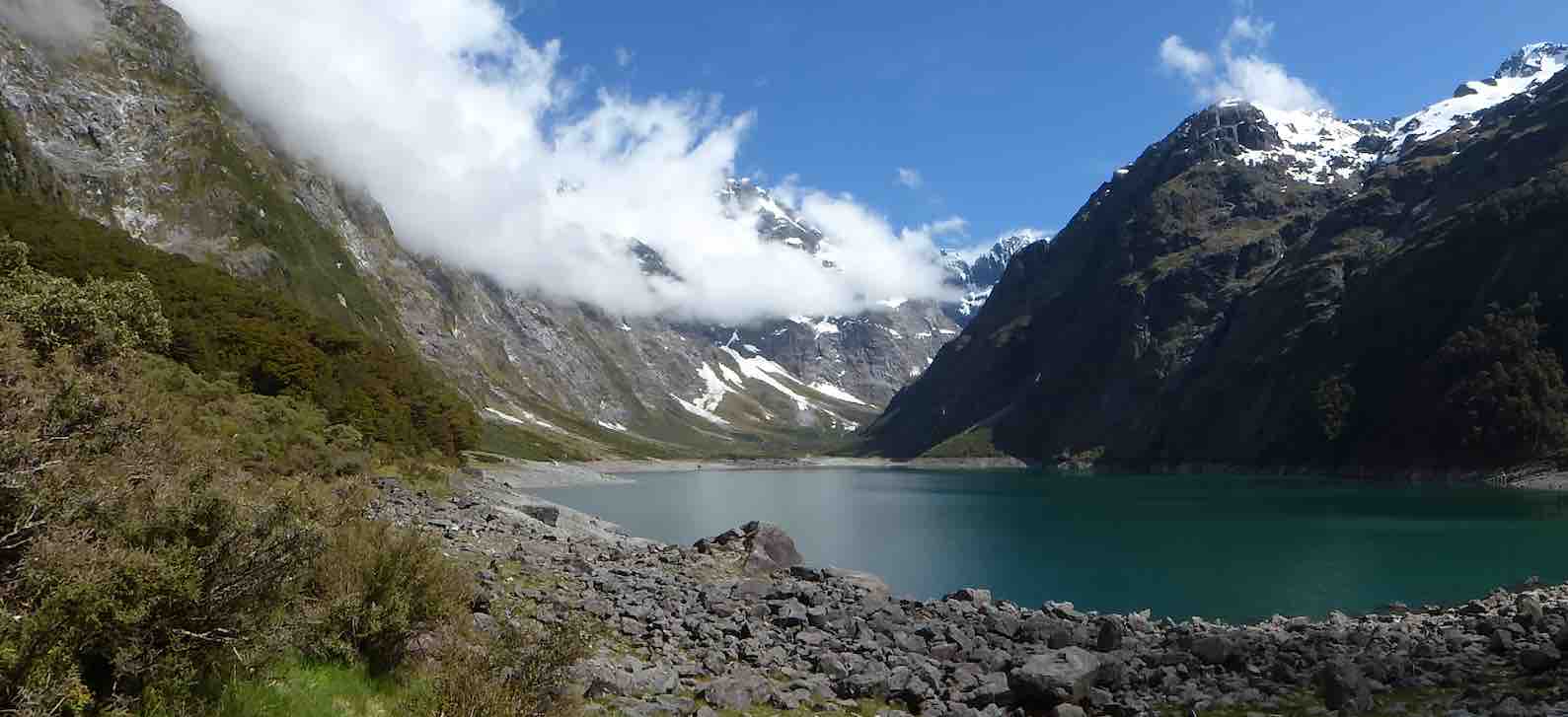
Lake Marian in all her glory. ( Phil pic and caption.)
capped off by some loud avalanches at the top of the valley (they resembled large waterfalls). We stayed here for a good 40 minutes enjoying a very special environment, before returning.
It was a sign of the nature of the track that the return time was also 2 hours……
After lunch, having ensured that no-one laid down on their bunk, we travelled up the Upper Hollyford and just before the Homer Tunnel, veered off to park in the Gertrude Valley carpark. We then rambled a while to the base of the Saddle, enjoying the amphitheatre of surrounding peaks as well as the early celmisias, ourisias and Mt Cook lilies that were smiling back at us.
Gertrude Valley with Saddle behind. (Phil pic and caption.)
Once back at the cars we returned to Camp, allowing for a short stop at Falls Creek where new carparks and Gantries have ensured another great stop on the Milford Rd.
The Camp was busier on the second night with the Stray Bus arrival, plus some trampers who had arrived from the Demon Trail, telling of tall stories and lots of trees over the track, and loads of hunters and jet boaters in the huts…
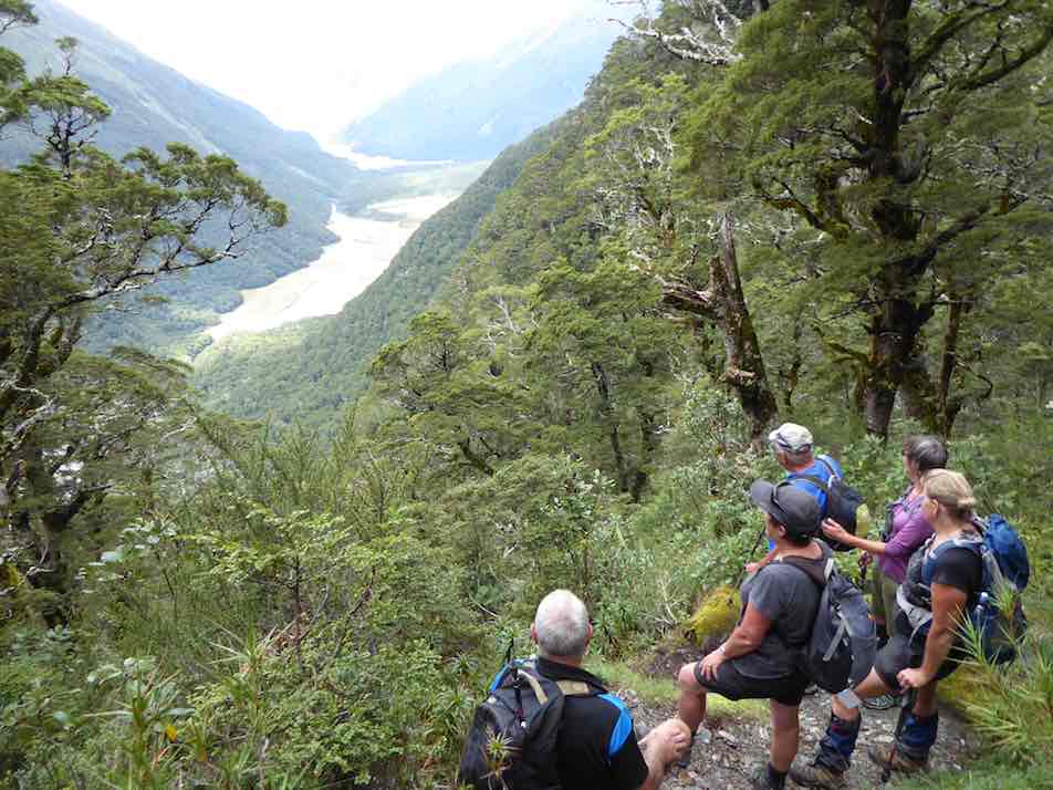
Wednesday dawned fine and we travelled to the road end, where we set off to enjoy the Hollyford Walk;

Heading off down the Hollyford Track. (Gordon pic and caption.)
guarded over by towering mountains named mostly after Ngatimamoe and Ngai Tahu chiefs intersprinkled with mountains named after bureaucrats, nieces and mothers;
Mt Karetai. (Phil pic and caption.)
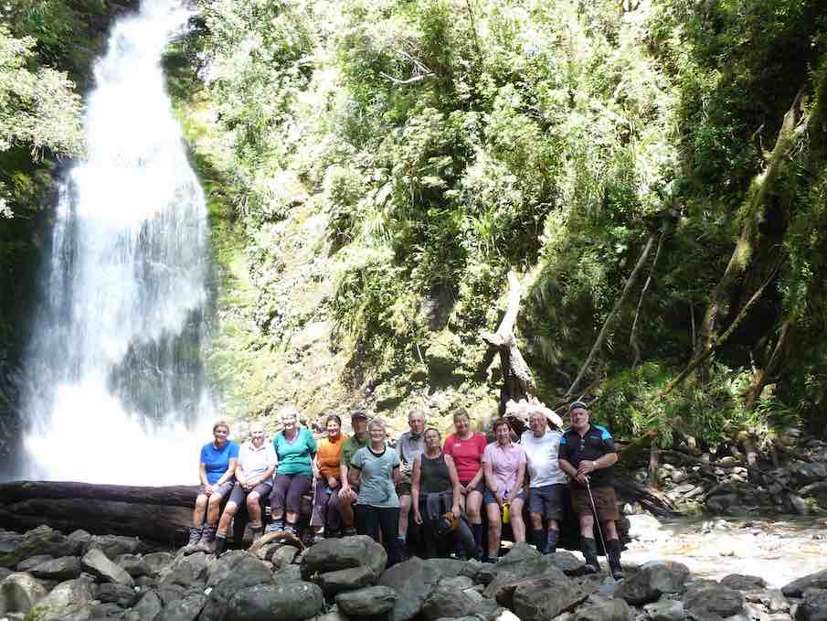
we rambled through forest of Beech, Miro, Matai, Totara, Kamahi and Rimu, finally arriving at Hidden Falls Hut for lunch (having already stopped off at the Hidden Falls to get showered upon).
Lunch at Hidden Falls. (Phil pic and caption.)
A few green hooded orchids spread throughout the moss and liverwort track edges.
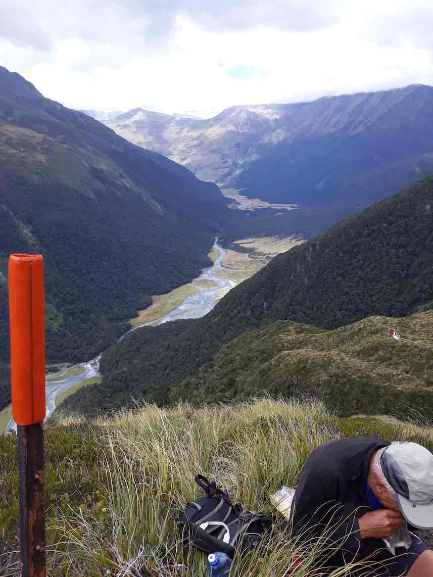
Following lunch, 5 hikers turned right and returned to the road end by 4pm, whilst 13 trampers turned left and after 40 minutes begun the ascent of Little Homer Saddle; through the forest gaps great views of Mts Madeline and Tutoko were enjoyed and after another 30 minutes we were at the top of the saddle; whilst not high, the effort was considerable in the heat of the day…… a drop off to the Little Homer Falls
Little Homer Falls. (Gordon pic and caption.)
followed with tree falls along the way becoming a little harder to limbo under….. the Falls drew everyone to them and then after a well earned break we set off for Lake Alabaster through self pruning beech forest. As we veered in to the Pyke Valley, we were greeted by tall straight Kahikatea.
Finally we emerged into a clearing where the Pyke Lodge of the Guided walk stood and gazed upon the majestic view of Mt. Madeline dominating the Hollyford skyline.
A further 20 minutes of tired tramping followed before we arrived at Lake Alabaster

First views of Lake Alabaster. (Gordon pic and caption.)
– 7.5 hours after we started, and according to GPS estimations some 2 kilometres longer than official publications credit, at just on 23 kilometres for the day!
Progressively the breezes dropped and shadows and mountain and forest reflections dominated the Lake,
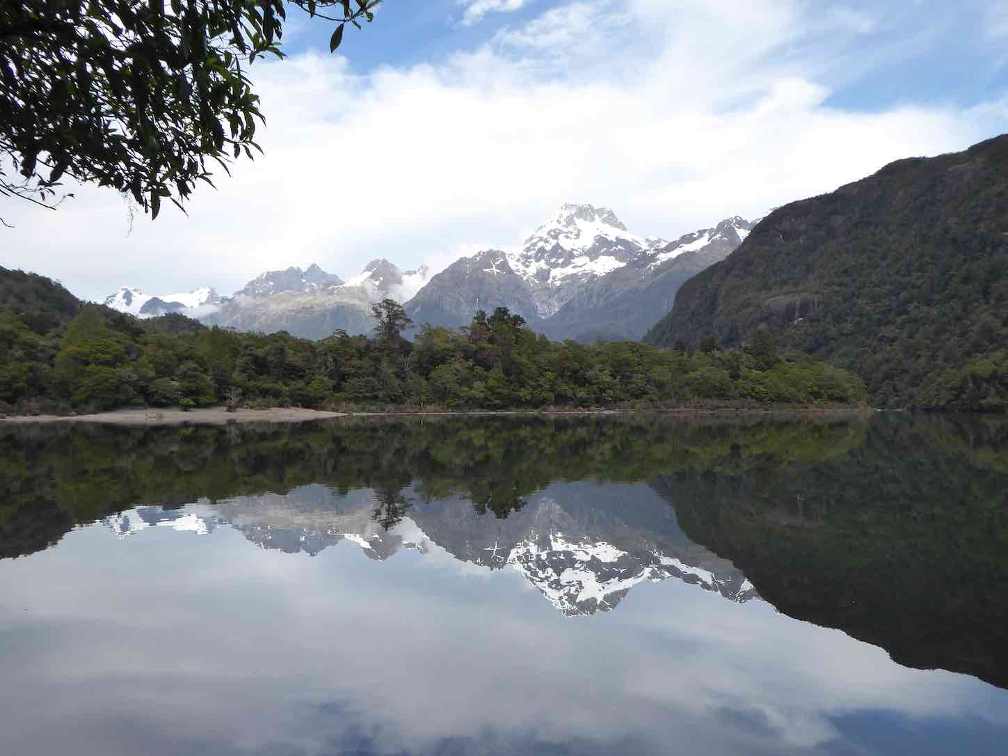
The Darran Mountains and Mt Madeline reflections in Alabaster. (Phil pic and caption.)
interspersed with splashes of delight as keen trampers (some) had a ‘swim’ and dried off before the sand-flies could do damage.
A good spread of birdlife was enjoyed along the walks including tui, bellbird, grey warbler, (bush robin at Marian),shining cookoo, ruru (at night!), chaffinch and the melodious Kaka. Masses of perching orchids (the bamboo – Earina mucronata) adorned tree branches around the shoreline.
We had the company of a small number of other trampers for the first night at Alabaster.
On the Thursday morning, helped by feedback from trampers off the ‘Demon Trail’, 10 decided to follow the dotted lines on the map along side the Lake up the Pyke Valley; this in effect being a bush bash with the lapping levels of the Lake the easier going. About half way along we stopped at a large flowing creek…. fishing and fossicking were undertaken, with not a lot of luck, though style was fine.
Returning through thick bush we stumbled upon a small ‘grave site’ and then returning to the hut we had a cuppa and lunch, before crossing the largest swing bridge in Fiordland over the Pyke River, to touch upon the Demon Trail. A hundred metres of this was enough to convince us that we should save this for another time…..!
Our second night at Alabaster was a very social affair, with jet boaters …
What do jet boat drivers have that fellow walkers don’t? (Phil pic and caption.)
… and pack rafters arriving along with a range of trampers heading up or down the valleys from or to the Coast. Deer had been shot, trout caught, a jet boat sunk and being expensively recovered with helicopters ….so much to catch up on….. and best of all, no news from the outside world! Mattresses were spread throughout the common areas to accommodate all.
Notwithstanding the week of walking everyone was up and away at 6.50 am on the last morning, well before the official start time, as a slight rain began to fall…and fall….and fall. At last we were experiencing a Fiordland shower… becoming so consistent and insistent that when the time came we made a detour to Hidden Falls Hut for an early brunch to recharge, before the last 2 hours trudge to the road end. We took 1.5 hours off the incoming time, very commendable as we were going uphill all the way! (but then apparently the GPS said the distance was shorter…) ah we are better off without these new contraptions!
After 6 hours tramping we quickly reorganised before driving to Gunn’s Camp where we checked for final messages from the Hikers, picked up belongings, then drove back to Te Anau and civilisation. We caught up with the Hikers at a local Café which was being inundated by bus loads of tourists, they were swarming and biting better than sand-flies!
The Hikers meantime, had an enjoyable day trip to Milford Sound on the Thursday. First stop was the well known Chasm, and then they made a call into the Milford Sound Lodge. What used to be a backpackers hostel now has several new cabins and areas for motorhomes, all well laid out with the Cleddau River nearby.
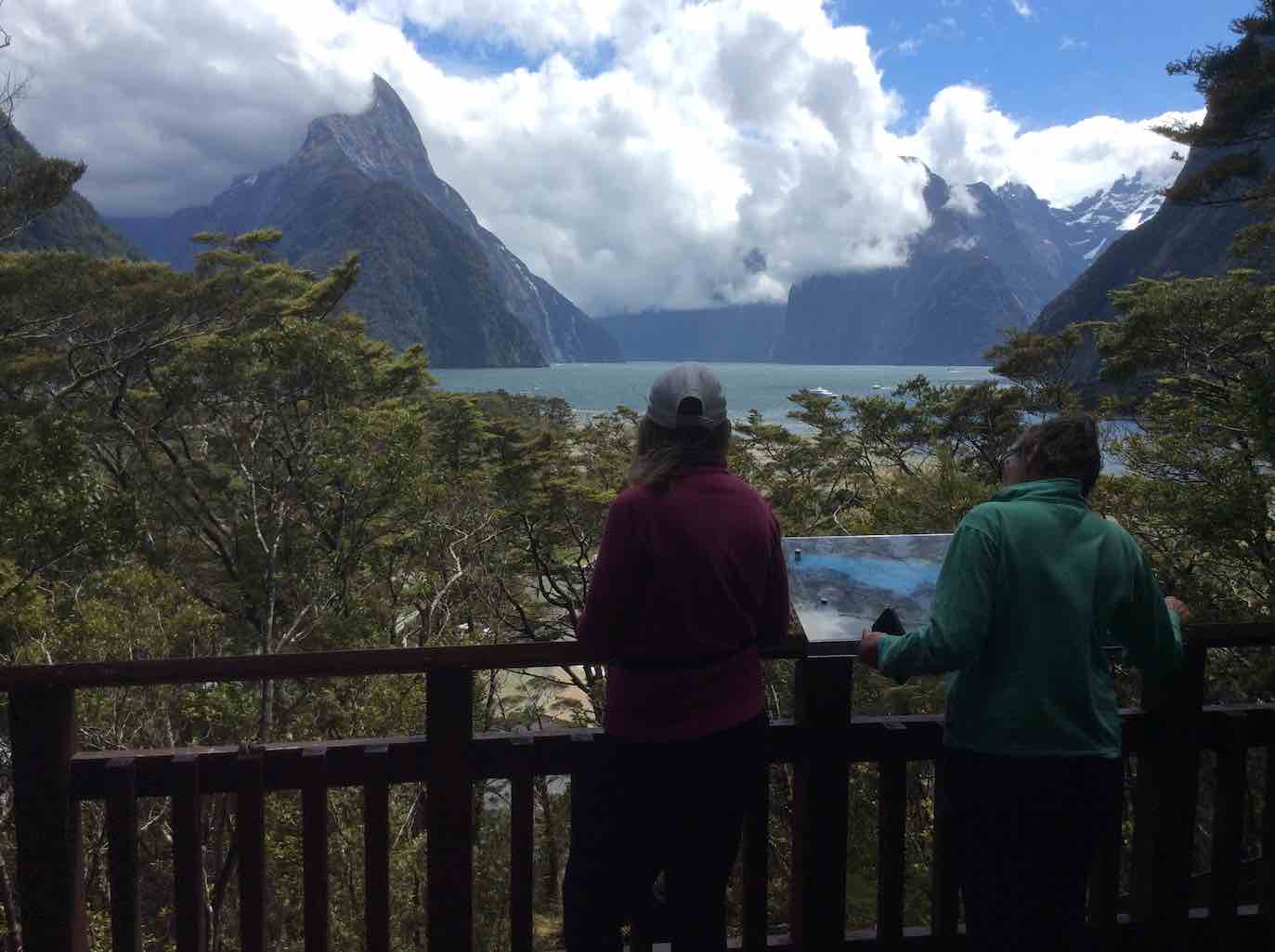
Enjoying Milford Sound. (Raewyn pic and caption.)
The coffee wasn’t bad either apparently! On the way out they made a stop at the historic bridge over the Tutoko River and a lookout near the tunnel entrance. Friday for them dawned with heavy rain so the decision was made to stay put, light the fire and relax in the common room awaiting the trampers return. By 1pm they decided to head for Te Anau for lunch and rendezvous there as originally planned.
Overall
A most enjoyable 5 days of great company, tracks and views to click the camera at. Four days of sunshine out of five is not a bad record in Fiordland terms. Next stop Martins and Big Bays?
Gunn’s Camp
Everyone felt at home here and the accommodation and facilities most appropriate for a stay. It is a very good base for exploring northern Fiordland, whether sightseeing, fishing, hunting or walking and would save multiple trips to and from Te Anau – or to just step back in pace or in time.
Aug 29 2018
37 km from car park to Mopanui Road end, and 40 km to
foot of McKessar Road.
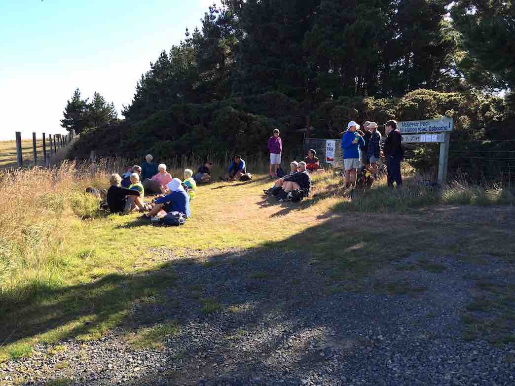
3. 29/8/2018. Hikers. McKessar Track from Foot. E. Leaders: Jim and Betty.
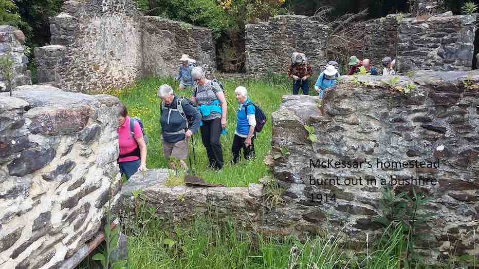
The sun was not shining when we left the car park and as we approached Port Chalmers it looked like it would be a day destined for coffee only. As we continued our journey, there was a marked improvement in the weather as we reached the Purakaunui Railway Park. From the car park the walk was down hill to Sea level then back up the road to the cars for the morning tea break. All the Twenty Two then walked up to our lunch stop at Mopanui Road where we sat with our heads in the cloud. The up hill climb included a breather to marvel at in the relics of the McKessar Homestead. We descended back down the track & into the cars for our refreshment stop at the Plazza Café. Conditions could be described as a little moist. – Betty & Jim Finnie
2. 15/11/2017. Hikers. Purakaunui Station. McKessar Track, Mopanui Road. E. Leaders: Jim and Betty.
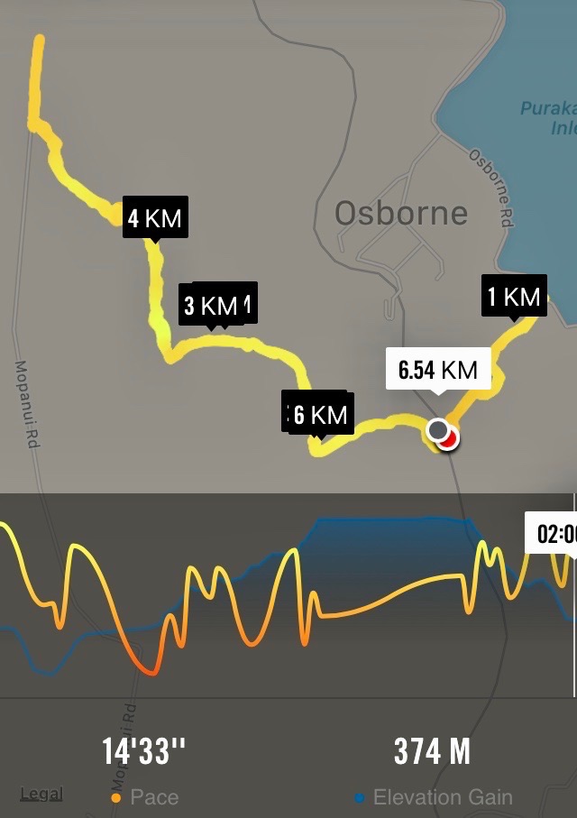
Route map, courtesy Ian.
Starting off from the site of the old Purakanui railway station, a party of twenty hikers made the short road walk down hill to the Purakaunui inlet for an then returned, for the morning tea stop at the cars.
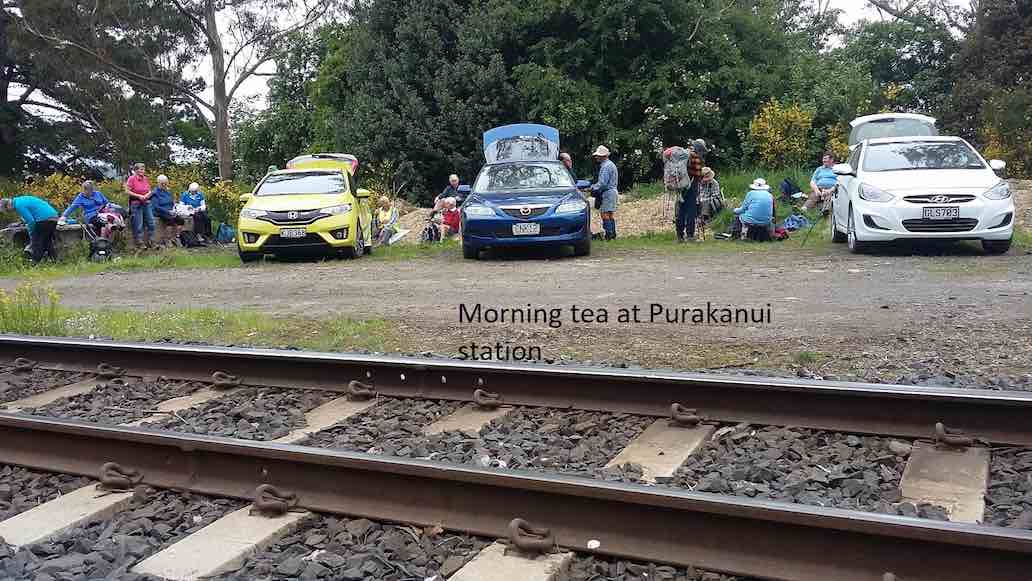
(Clive pic.) [Cars at the station a first for the Club. – Ed.]
(Clive pic.)
An after-lunch
(Clive pic.)
stroll beyond the road end, took us to a point which gave us an excellent view to the north. Little time was required for the pleasant stroll down hill back to the cars, which took us to our refreshment stop at the stadium Plaza cafe. – Betty and Jim
1. 9/3/2016. Hikers. Mopanui Road, McKessar Track, Albert Road. E. Leaders: Bev, Lesley.
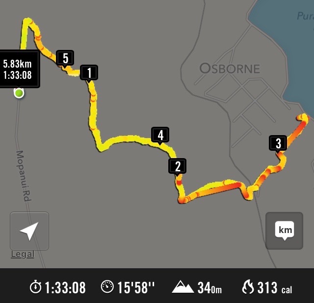
GPS of McKessar trek

Horse Drinking Trough on Mount Cargill Road.

Orokonui Village
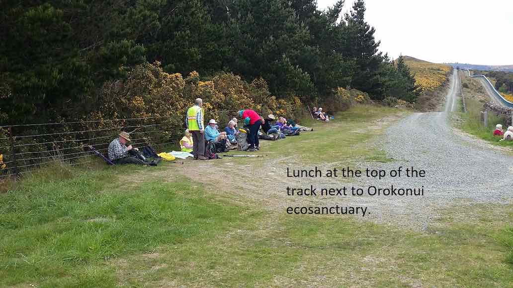
Hikers’ cuppa at top of McKessar Track
Mar 28 2018
69 km from car park.
28/3/2018. Hikers. Balclutha River Walk. E. Leaders: Bev and Lesley.
Route map, courtesy Ian.
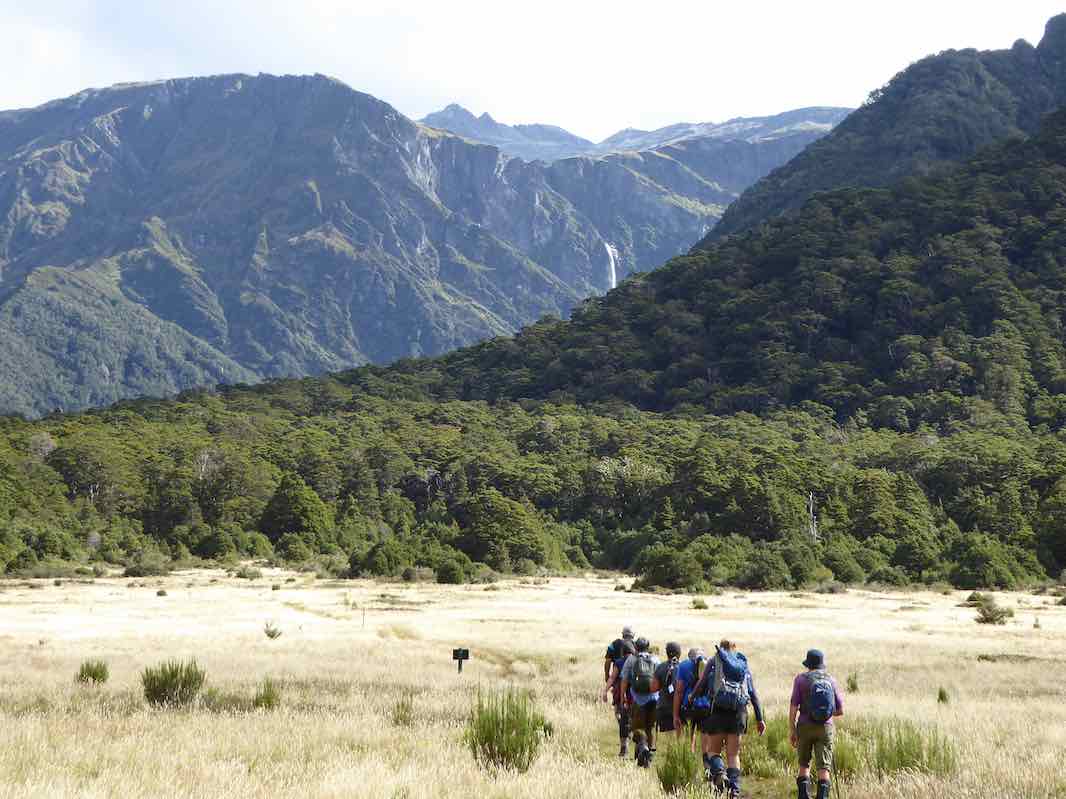
Luckily the day was bright and sunny as we were going a bit further afield for our hike today, to Balclutha. There were 17 met at Naish Park in Balclutha and as it was 10am we sat in the sun and enjoyed a leisurely morning tea before setting out on the walk.
Morning tea at the park. (Clive pic and caption.)
Naish Park is a lovely area with beautiful trees, garden, aviary and childrens play ground.
Naish Park. (clive pic and caption.)
It was originally a market garden and orchard, donated to the people of Balclutha by the Naish Family.
The walk is called the Blair Atholl walkway and goes along the stop banks beside the Clutha river.
Along the flood bank beside the Clutha River. (Clve pic and caption.)
We went to the end of it…
The terminus tree that the leaders made us all circumnavigate before returning. (Kevin pic.)
… and up a side track by a rhododendron dell that must be a great site in the right season. We had a our lunch here. Once again taking out time and enjoying the sun. Then back the way we had come till the track divided and we went along a loop that was closer to the river. Unfortunately where you had to cross an inlet the water was higher than expected. However, some elected to wade across…
Back to the park (some through the ‘ford’). (Clive pic and caption.)
…while the rest of us retraced our steps and followed the path we had started on. We then adjourned to the Heart & Soul café for the after walk social get together. – Bev.
Mar 07 2018
35 km
2. 7 Mar 2918. Both. Clarksbrae, Clarks Junction. Leaders: Jay and Jan.
Route Map, courtesy Ian. Station House to Deep Stream.
On Wednesday 7th March 40 trampers and hikers completed a walk on “Clarksbrae” farm, Clarks Junction. After a 30 minute car ride we arrived on a lovely summer’s day at “Clarksbrae” Farm and parked close to the woolshed. I must say the tidiest and cleanest woolshed I have ever seen.
From there we had to take 6 cars to the end of the walk to shuttle people on completion of the walk.
It was 10.30 when we started
Some cars were hidden in a valley about 10k from Clarksbrae and we set out to find them. We set out across well tended farmland … (Clive pic and caption.)
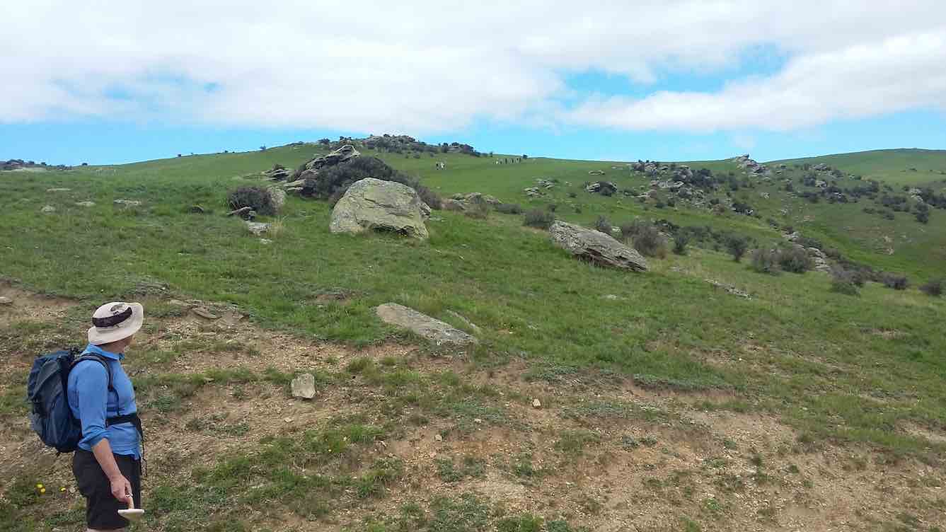
and the walk was on a designated stock laneway. It was a steady but gentle climb through beautiful farmland
… and live stock. (Clive pic and caption.)
and wonderful views of the Maungatua, The Lammermoor Range, the Rock and Pillar Range through to Middlemarch. At the end of the laneway we turned left and walked up to the trig station where we had our lunch at 12.30.
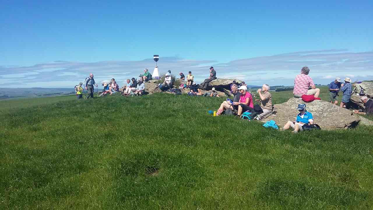
With a late start we missed morning tea but made the most of lunch at the trig point. (Clive pic and caption.)
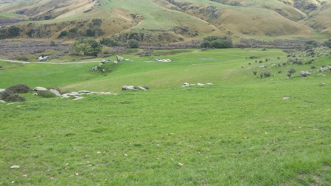
After lunch we followed a track that in places was marked out with painted arrows and warratahs with plastic bags on put in place by the farmer so as we knew which direction to take to get back to the cars. This part of the walk was generally down hill.
Downhill to search for the cars. (Clive pic and caption.)
Hurray, we found them. (Clive pic and caption.)
Many of our walkers filled plastic bags with beautiful fresh mushrooms.
The distance travelled was 11.5ks. Coffee was at the ” Wobbly Goat” in Outram. – Jay and Jan B
30 August, 2017. Hikers. Clarksbrae, Clarks Junction. Leaders: Jay and Jan.
Tramp Report from the hikers group. Our walk today comprising of 21 enthusiastic folk started at “Clarksbrae” Farm, Clarks Junction. Farm owner, Richard Nichol gave permission to us to walk along the stock lane way which was very comfortable under foot. The walk was a gentle climb with three steep short gullies to get the heart rate up a bit. Very doable for all concerned. The scenery encompassed The Maungatua, the Lammermoors, the Rock and Pillar Range and the Kakanui Range. We had lunch at the trig station which gave us 360 degrees views. The walk back was all down hill. All up we walked 10.3ks. – Jay and Jan.
Feb 14 2018
14/2/2018. Report on Mt Aspiring Hut Trip 12-15th February
Eight keen trampers signed up for this trip. Wendy and I tramped in to Aspiring Hut early on Monday 12th February to secure bedding in one room for all of us. Jill, Clare, Janine, Keith, Helen and Phil arrived late in the afternoon after battling a head on Northwest wind and driving rain. This walk was 9km and approx. 2.5 hours. Aspiring Hut is owned by the NZ alpine club and operated by DOC. It was built in 1949 and its exterior is covered in river schist stones. It is about to undergo a refurbishment which includes earthquake strengthening and interior lining. There are 39 bunks altogether in two bunk rooms. Gas cookers are supplied during the summer season. We all soon settled and prepared our meals.
The next morning it was partly cloudy. The scenery from the hut was superb without going anywhere!
Group. (Helen pic and caption.)
We decided to go up the valley to Pearl flat (2 hours). The valley walk is very pleasant through beech forest and open grassland surrounded by high mountains with clinging glaciers.
We then decided to go up to the Liverpool hut (10 bunks). (1134m – Helen). This track was steeper than expected but the team coped extremely well. We walked up through beech forest on a steep track with rocks and tree roots.
Half way up to Liverpool Biv. (Phil pic and caption.)
This took 2.5 hours. The views from above the hut were superb – either looking down onto the valley below …
View from the Hut hill.(Helen pic and caption.)
… or glaciers on Mt Barff and Mt Liverpool. We were also looking across to French ridge hut which is used by climbers to climb Mt Aspiring.
We got back to Aspiring Hut after a 9 hour walk knowing we had done it!!
That night of the 13th the hut and camping area had its record number of guests at 84. We felt like very rare Kiwis!!!
The next morning was perfectly fine – however our legs knew they had worked the day before. Unfortunately Wendy had to leave as she had work early the next day. This time we decided to go up the Cascade saddle track …
Liverpool done, off to the Cascade.(Phil pic and caption.)
… – a pleasant walk through red and beech forest.
Morning tea on way to Cascade Saddle. (Helen pic and caption.)
This finally led up to a lookout after 2.5 hours. (1184m. – Helen). The views of the 2 valleys and mountains all around were amazing, especially looking at Mt Aspiring.
Above the bush line on Cascade Saddle. (Phil pic and caption.)
There were quite a few people heading up to the saddle.
On returning to the hut the ladies enticed the men to go down to the river for a dip. [No pics supplied! – Ed.] This was very, very refreshing especially for those who got under the water!!
Another interesting meal was cooked by all. There were a lot fewer in the hut – the men played poker with hilarity. Someone was heard talking in their sleep!
After breakfast and packing up we headed off down to the car park. The weather deteriorated with the following North west wind very strong – even blowing 2 of us over on the grass. The dust was rising in the river bed. The rain followed and it was quite wet by the time we got to the carpark. Rob Roy glacier was left for another day! We were then off home having coffee and ice creams on the way.
Thanks to all of the team for making it a fun trip.
Also thanks to Eleanor for suggesting the trip but unfortunately was unable to make it.
Dave
Nov 16 2017
The stone-walled house was burnt out by a bushfire in 1914 after the McKessar family had left the district and the farm had been taken over by a neighbour.
George and Emma (Driver) McKessar had lived and farmed there. George was born in 1836 and Emma in 1853 and they had six children. Emma was a child of Richard and Elizabeth (Robertson) Driver. Richard was the first official pilot for Otago Harbour, and she had been born at the pilot house at Taiaroa Head. She died at Purakanui at 47 in 1900 and George at 75 in 1912. – edited from research by Clive Crossman on various websites.
Oct 18 2017
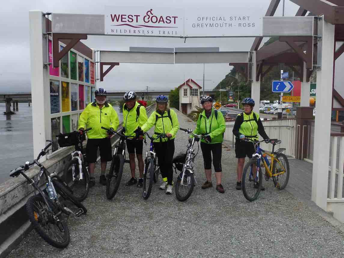
Oct, 2017. West Coast Bike Trip.
Nine happy bikers, set off for the Coast.
To do the famous Wilderness trail- not that we will boast.
First to Kaniere, to drop off all our gear.
At a cottage in the bush – and then we had a beer.
A barbecue for dinner (after happy hour)
Then off to bed we all did go – we needed muscle power.
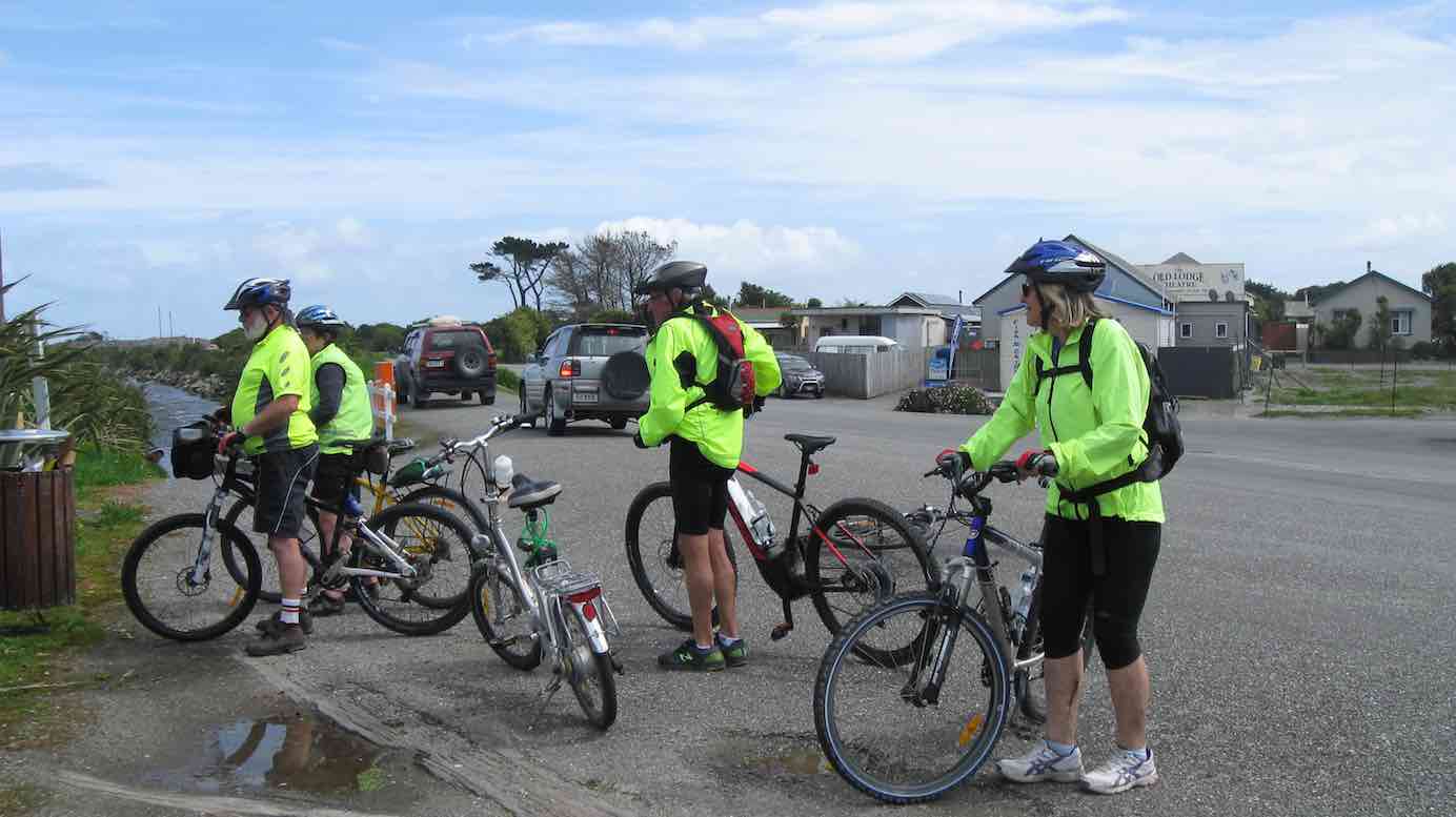
The morning dawned quite sunny, so down to Ross we drove.
To climb upon our bicycles, feeling fit, by jove.
The trail was good to start with, but then there came a hitch.
Jill and bike fell off the trail, right into a ditch. (A wet one)
Up she got, and carried on, but oops, what’s happened now?
A conveyor belt was in the way, right across our bow.
The track was closed, or so they said, to build a bridge one day.
We couldn’t let that stop us! We had to find a way.
The brave, strong men took over. They carried all across.
A dangerous operation, we did it without loss.
To Hokitika we did come, eventually, at last.
And had some lunch, ‘twas well deserved – we really went quite fast.
That unisex toilet, was a wonder to our eyes,
A mural weird and wonderful, it really took the prize.
After lunch we carried on, mostly up-hill now.
At last we reached the cottage, I really don’t know how.
Another night of merriment, more good food and wine,
And in the morning, oh alas, the weather wasn’t fine!
The vehicles taken down the road, Kumara was the goal,
The rain it stopped, the sun came out, and we were on a roll!
Up we went, and up – and up. Judy’s turn to fall –
Right off the trail, it was quite steep, her bike it did a stall.
To Cowboy Paradise we came, I think they’ve got it wrong.
We weren’t even greeted, with rodeo or song.
We carried on, and on and on, mostly now it’s down.
But oops, where’s Keith? He’s lost the trail, what a silly clown!
At last we’re sorted out again – don’t need another stunt.
But what’s this Dave, you silly B, your helmet’s back to front!
Kumara was a welcome sight, comfy huts and all.
And yummy dinner in the pub, we really had a ball.
The final day was misty, and cold about the knees,
But we didn’t seem to mind it, as we zipped among the trees.
Easy riding all the way, right beside the road.
And then along beside the beach, the ocean ebbed and flowed.
Into Greymouth at top speed, Jim and Betty first.
Thinking they were at the back, they (almost) boilers burst!

Nine happy bikers, aches and pains galore,
Headed home with smiles, wishing there was more. – Judy.
Sep 20 2017
17 km from car park.
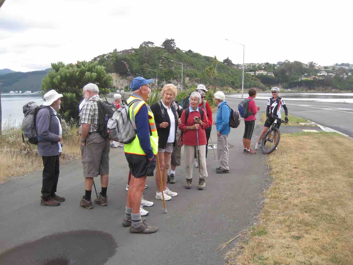
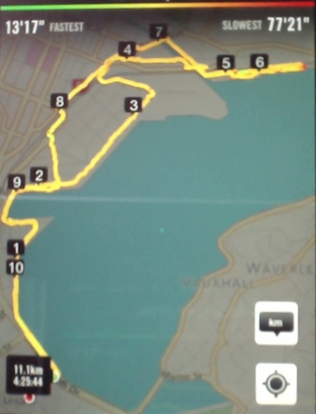
3, 20/9/2017. Hikers. Portsmouth Drive to Marina. E. Leaders: Judy and Dorothy.
Twelve harbour strollers, went to Andy Bay.
We parked beside the inlet – it was a windy day.
Along the Portsmouth Drive we went, trudging in a row.
We passed the harbour molars, and onward we did go.
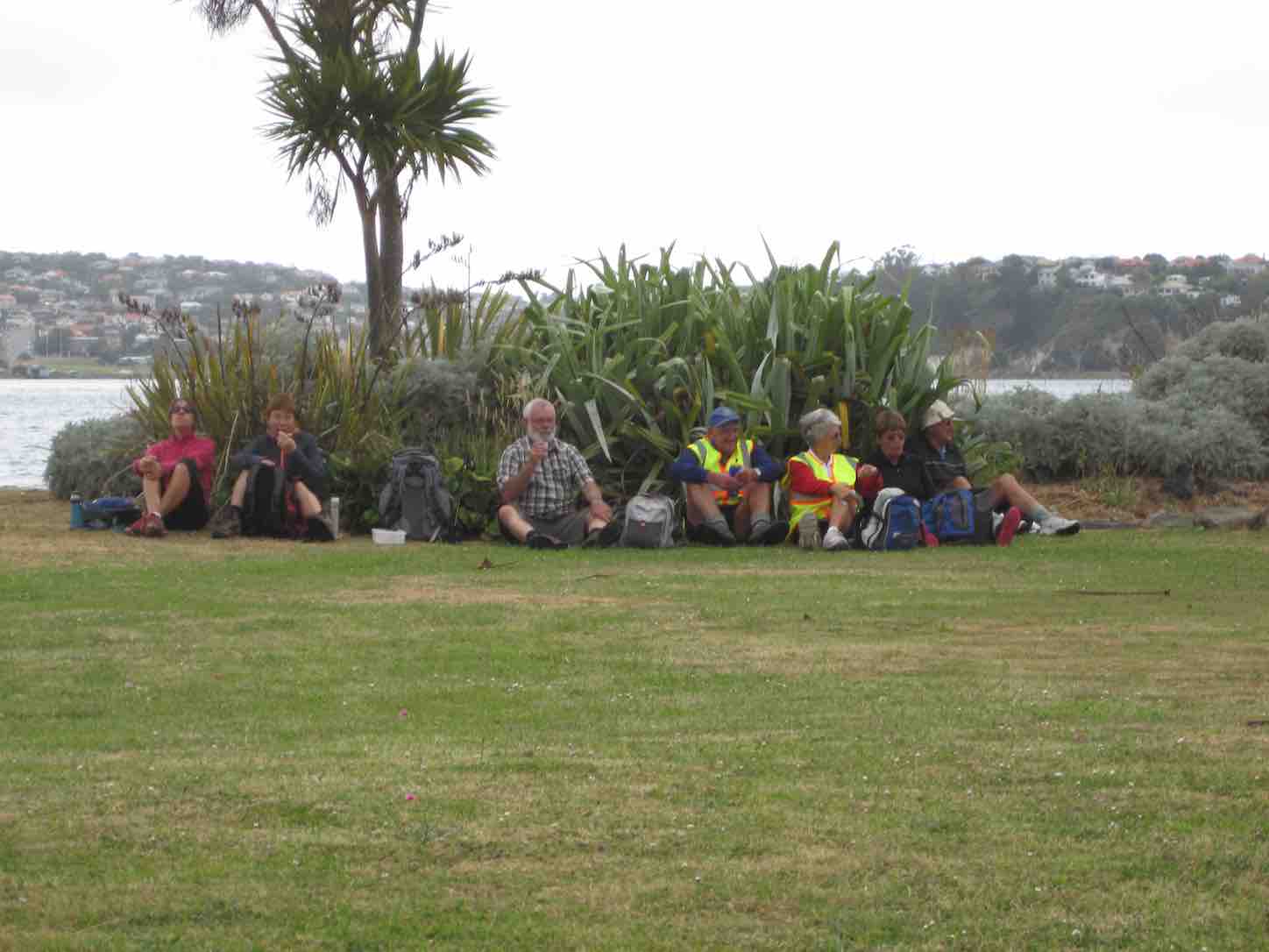
A sunny sheltered spot was found, and morning tea was had,
Relaxing in the sunshine, it wasn’t half too bad.
Then on we went, around the wharves, and round the harbour basin –
We found that walking in the wind, was really somewhat bracin’.
We viewed the plaque in memory of “Neptune”, sunk in war.
She hit a minefield in the Med, and then she was no more.
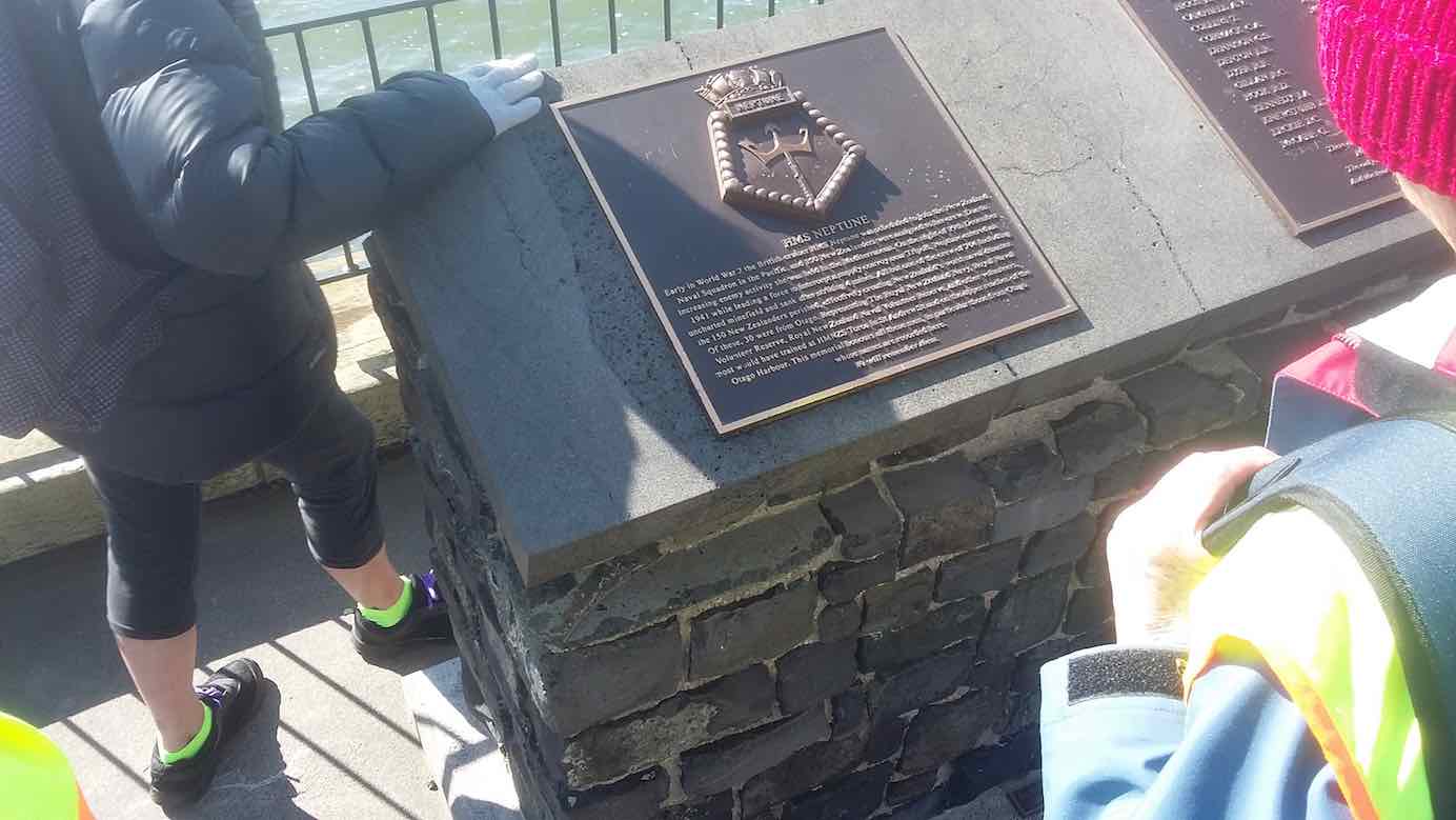
We passed the Neptune memorial at the wharf and some members were able to point to the names of loved ones who were involved in this tragedy. (Clive pic and caption.)
On we went and onwards, across the Leith we strode,
Then Clive led us along the groyne, to where the water flowed.

We took a walk out on the groyne at the boat harbour and nearly got blown away in the 20 knot winds. (Clive pic and caption.)
Back around the boat harbour, some picnic tables found,
For lunch and chatter in the sun, then homeward we were bound.
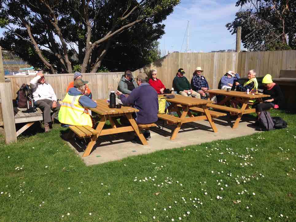
Lunch outside the Yachting Club. (Raewyn pic and caption.)
A cracking pace was soon set up, the wind was at our backs.
Perhaps the increase in our pace, was due to lighter packs?
We viewed a lot of logging trucks, a queue a mile long –
Sending all those logs away, we feel it is quite wrong.
A photo stop was taken, beside the harbour molars –
And so we coined the title, “The Mosgiel Harbour Strollers.”
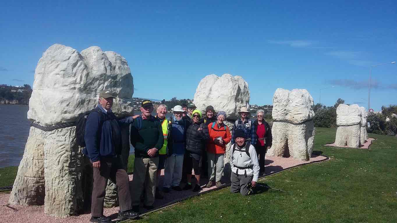
The Molar strollers. (Clive pic and caption.)
The cars in view, we stepped it out and headed fast for home.
A coffee stop at Blackstone – and then I wrote this “pome”….
(Well, try to find a better rhyme!) – Judy.
Stats for the day: 11.7 kms; 3 hours and 4 minutes walking time; 480 calories. – Clive.
2. 14/1/2015. Hikers. Portsmouth Drive to Marina. E. Leaders: Peter and Wendy.
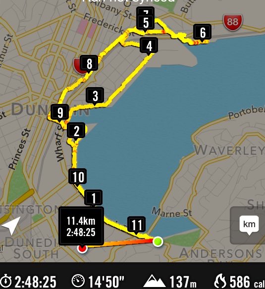
GPS of route
We parked in the carpark by the Bayfield High School. And 21 of us set out.
The bulk of us waiting for others investigate the doings of a suspect prowler back a the carpark and to call the police to investigate. Helen found a passing cyclist friend to chat to.
We walked along Portsmouth Drive past the molars, turned down Kitchener St, huggiing the harbour edge and stopped off for morning tea.
Sheltering from a cold wind for morning tea.
Carrying on, we turned round into Birch St, across the top of the harbour basin then down along Fryatt St almost to its end. Then it was up Wickliffe St, across the railway overbridge, briefly on Anzac Avenue, down Parry …
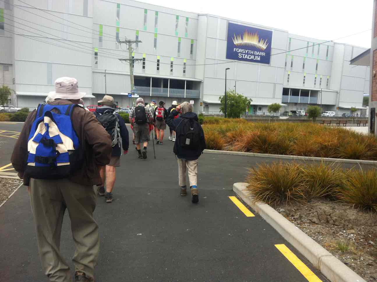
Skirting the Stadium.
…and Minerva Streets to cross the Leith on SH88 bridge, and on the north side to turn under the bridge and out along Magnet St to get to our lunch stop at the Marina.

Again sheltering from a cool wind, this time for lunch.
On our return, we walked the length of Anzac avenue. Then onto the railway station platform, where Dorothy performed a most believable but all too brief strut down the catwalk. Out at the other side, on past Toitu Settlers Museum and along the grassy verge ahead where we stopped, briefly thwarted by the railway bridge overpass pathless on-ramp ahead. So it was across all four laned SH1 Cumberland St, with the assistance of the lights further back. This safely accomplished, it was Les and Peter led us up Water St, along Vogel St, back down Jetty St and onto the pedestrial spiral ramp to get us onto the bridge. Then via Birch St, Buller St and French St we rejoined Kitchener St which took us back out onto Portsmouth Dr and back to the cars. From talking to one or two others, I must say coming to the end of eleven kilometres on hard pavement had taken its toll of leg muscles, on this the first tramp after the holidays. A good walk, not too hot or windy. Thanks to Peter and Wendy for a good start to the year. – Ian.
1. 20/11/2013. Hikers. Midland St, Portsmouth Drive to Marina. Leaders: Bev and Chris.
Route
The walk was most inventive and interesting, leading us along back streets few of us had ventured on before. We parked at the bottom of Midland Street where we could cross onto Portsmouth Drive with the safety assistance of traffic lights. The laying of cable along the walkway forced us onto a less inviting traffic-coned path along the road till we returned to the walkway at the molars.
Molars. The 20 of us are almost all in the pic.
A little further on we turned down to the length of Kitchener St turning left up at its end into Birch St to join Wharf St esplanade and have morning tea on the seats, to admire the inner harbour view as well as a gentleman, lent back on a camp seat, fishing, hat over face, asleep.
A happy surprise was Lex sharing round chocolate marshmellows in anticipation of his 85th birthday the following day.
Then it was up and on again, down virtually the entire length of Fryatt St to turn left up Wickliffe Street and over the elderly railway overhead bridge, down the other side to the right, and to stop and admire (?) the special road-coned entrance/egress of Hall’s work-yard and the still-hooded traffic lights. We gingerly made it across Anzac Ave, across Frederick St, back again across Anzac Ave to join Parry St, make way across the SH88 Leith Bridge very wide pedestrian walkway, down, back, under the bridge and along Magnet St. (4 km)
and the Harbour Walkway (5 and 6 kms) to lunch at the northern end of the map in what shelter we could find from the nor-easterly wind.
We retraced our steps to the SH88 Bridge underpass, this time following the Leith bank up to Anzac Ave (7 and 8 kms)
which we followed right to the St Andrew St lights where we turned down along it to the roundabout, followed Mason St, then into Tewsley St and into Fryatt St to retrace our route alongside Wharf St (9 km), Birch St, Kitchener St and Portsmouth Drive back to the cars. 11 km in all. The harbour wind-blast along Portsmouth Drive almost blew us off our feet. Many thanks to Bev and Chris for a varied and interesting streets exploration around a corner of the harbour. – Ian.