Seacliff Hospital

Sir Truby King, a man of many parts, was for some 31 years superintendent of amental hospital at the village of Seacliff. The setting was superb, but the enterprise got off to the worst possible start. A magnificent-looking series of stone buildings was designed by R A Lawson, whose commission was at the time the largest ever paid in the colony. In Scottish Baronial style, the three-storeyed Oamaru-stone buildings were modelled on the Norwich County Asylum in England, with a 50m tower. Criticism was not limited to the design – day-rooms received little sun, bedroom windows were too high to see the view, and for the 1,273 doors there was an embarrassing diversity of keys. The very foundations proved woefully inadequate for the notoriously unstable site. Not long after the £78,000 contract had been completed, a royal commission was set up which criticised both architect and builder. For all the outcries through the years over the unsafe nature of the buildings, it was not until 1972, nearly a century later, that the last of the patients were finally evacuated to Cherry Farm.

King transformed into a hospital a place the public had hitherto regarded as a gaol. After he became superintendent in 1888, patients were given outside work, greater liberty and more exercise. The use of violence by warders was banned. The Seacliff farm flourished and King’s careful attention to livestock and seed selection drew the resentment of neighbouring farmers who envied his success at A & P shows. Poultry was raised and in 1903 the patients began a fishing enterprise that fed the asylum twice a week and supplied other institutions throughout the South Island. Even attentive to staff, Truby King emulated Johnny Jones in buying land and helping them to finance their own homes. It was while King was at Seacliff that he recognised the importance of nutrition both for mental patients and, as an adjunct to his rearing of cattle, for children.

The asylum’s most notable inmate was Lionel Terry (1847-1952), an Englishman educated at Eton and Oxford who tramped the country in 1901 lecturing on the perils of New Zealand being taken over by the Chinese. In his book of poetry, The Shadow, he extolled the virtues of “pure … unpolluted  northern blood” and saw in the quiet industry of the Chinese a subtle attempt to conquer the country by weakening the Anglo-Saxons with “luxury and idleness”. His book did not sell well. On learning this he made his point more dramatically by walking the streets of Wellington to find and shoot an elderly Chinese, who, he reasoned, was too old to care much about living anyway. He promptly confessed and wrote to the Governor complaining of “alien invaders”. Terry tapped an extensive well of anti-Chinese resentment and his trial caused a sensation. His sentence to death in 1905 was commuted to one of ife imprisonment and he was removed here after setting fire to the gaol at Lyttelton. He escaped on numerous occasions, to be fed, clothed and concealed by his many admirers, some 50,000 of whom signed a petition for his release. Finally King offered Terry a degree of liberty conditional on his not escaping again, terms he accepted for the rest of his life. At the time of his death here in 1952 he wore long flowing robes and long flowing hair, and was convinced he was the second Messiah. (Some of Terry’s poems are in the museum at Waikouaiti.)

Karitane, Huriawa, Watkin and King

Some History. (Can’t recall where I got it from. Sorry.)

Huriawa Peninsula. The peninsula was a superb natural pa site. Volcanic in origin, it rises sheer from the sea and had the twin blessings of a reliable spring and a small cove on its northern side where canoes could be safely beached. It was selected for this purpose in c. 1730 to serve Ngai Tahu under Te Wera, but had in all probability previously been used by Ngati Mamoe. It has excellent views to the north and south, and its natural defences of sea and cliffs is ideally suited for use as a pa.
it was originally call Pa-Katata, a name which is now used only for the rocky knob at the seaward point.

Te Wera had only just been chosen as chief by his Te Ruahikihiki hapu when they became embroiled in continual strife with his belligerent cousins, Taoka and Moki II. Trouble began when Te Wera was accused of practising makutu (wizardry) on his kinsfolk and of killing them. First he sought sanctuary at Purakaunui where Te Rehu, his brother-in-law held sway. Attacked there, the pair made a miraculous escape and arrived at Huriawa to find that a tangi for them had already begun. Together they exacted vengeance and in turn Taoka arrived at Huriawa and proceeded to lay siege. Taoka came by sea and set up camp on the sandspit, Olunepouwera, opposite the peninsula at the mouth of the Waikouaiti river. For six months the siege continued, as the pa had its own water supply, a large store of food including preserved birds, fern root and dried fish, and fishing parties could put out at night to supplement food stored on the well-nigh impregnable promontory. An anxious moment came when one of Taoka’s scouts crept in by way of the blow holes and stole the image of Te Wera’s protecting deity. Despair swept through the pa when Taoka was seen across the river saving it triumphantly above his head. But Te Wera’s tohunga Hautu restored it to the pa, some say simply through the air, by means of a powerful karakia. Finally Taoka was forced to withdraw for want of food as the defenders had denuded the area of vegetables before his taua (war party) arrived. The pa was then abandoned, and its inhabitants settled on the banks of the Waikouaiti river.

Later, Taoka turned his attention to Mapoutahi pa to telling effect. Te Wera eventually left the area altogether and moved south ultimately to die as an old man at Stewart Island.

The most prominent reminder of the history of the peninsula is the extensive terracing on its slopes. The terraces were made to provide level house sites and living and working areas. Remains of defensive banks and ditches can also be seen, though the actual palisade lines can be found only through the scientific techniques of archaeological excavation. In many places midden is exposed (shell, bone, charcoal and stone from cooking and other activities) can be seen in cliff edges, banks and slips. All cultural and historical material including archaeological sites, midden and artefacts are protected under the Historic Places Act 1980 and may not be interfered with in any way.

The blowholes on the peninsula are attributed to a romance. A couple eloped and eventually returned, expecting forgiveness. Instead, their irate families took them to the peninsula and hurled them from the cliffs. The young girl, heavier than her husband, is said to have caused the larger blowhole, that nearest Puketeraki Beach. There are in reality not two but three blowholes, but surviving mythology does not explain the third.

The reluctant missionary: A whaling station opened at Karitane in 1837 and it was here in 1840 rather than at which is now Waikouaiti that the Rev. James Watkin (1805-86) elected to live, despite the fact that he had come from Sydney at the instigation and at the expense of Johnny Jones. The Methodist missionary, who had been praying for a return to Britain, did not relish the experience; he chose for the text of the first Christian sermon preached in Otago, “This is a fearful saying”, and when his successor, the Rev. Charles Creed arrived in 1844 Watkin greeted him with words, “Welcome, Brother Creed, welcome to Purgatory.”

Certainly there was little for Watkin to enthuse over. The settlement was a hotbed of drunkenness, immorality and violence, from which the Maori mainly suffered, and the two-roomed native whare Jones provided for him was hardly suitable for one with a wife and five children. Certainly the nauseated Watkin tried, taking a firm stand against the vices of the Pakeha and the “savage customs” of the Maori. To a degree he succeeded; mission schools were established, converts made and an elementary Maori reader prepared and published. But Watkin was never reconciled to his position and was intensely relieved to sail for Wellington, leaving his degenerate parishioners behind. Tortured by ill health, he continually doubted his own considerable ability and lamented his lack of support and the depravity of those around him. A rare moment of elation came when one of his converts at Moeraki refused to give the census-taker Shortland any information because it was the Sabbath. Of Bishop Selwyn he conceded: “I think he is a good man, as far as his church prejudices will allow.”

Sir Truby King (1857-1938): In later years the settlement blossomed as a seaside resort and owes its geographical form partly to Sir Truby King, who had no sooner built his home on the peninsula than he became fearful that the river might cut through the slender isthmus that ties it to the mainland. He would not hesitate to rouse residents on stormy nights and direct them as they slaved to carry sand and build up the manuka sand-breaks he had placed on the narrow neck. Eventually the breaks were built up to such a degree that the danger passed. King was also the moving force behind the planting of various gums and hardy deciduous trees.

King is perhaps the best known of New Zealand’s medical reformers. Son of one of the first settlers at New Plymouth, he attended university at Glasgow and returned to become Superintendent, first of Wellington Hospital and then of the Seacliff Mental Hospital. A reformer in many fields he is best remembered for his founding of the Plunket Society (named after Lord Plunket, then Governor-General) which in his lifetime saw infant mortality drop by two-thirds, from 88.8 to 30.9 per 1,000 births. It was at his Karitane home that the first Plunket baby was reared. The Royal New Zealand Society for the Health of Women and Children (to give it its full title) remains an integral part not only of the country’s public health services, with Plunket Rooms throughout New Zealand staffed with Plunket nurses trained to educate mothers in child care, but of New Zealand society itself. Its success led to an invitation to King to establish a similar organisation in Britain. On his return in 1921 he became the first Director of Child Welfare and then, until his retirement in 1927 , Inspector-General of Mental Hospitals. Karitane nurses, trained in baby care, help mothers with their children.

The phenomenal success of the Plunket Society and the worldwide acclamation that followed have overshadowed other important aspects of his work. Truby King made major contributions in many fields – nutrition, plant acclimatisation, control of coastal erosion, alcoholism, psychological medicine and medical  jurisprudence. His many achievements in the field of psychiatric medicine include dietary innovations, the establishment at Seacliff in 1898 of the country’s first “open” ward, the early development of the villa-hospital concept, and a study of the influence of dental disease on the physical and mental well-being of psychiatric patients. Change was not easily brought about and Truby King was frequently the centre of controversy, but invariably the soundness of his forcefully expressed views prevailed.

Pineapple and Flagstaff Walk

No. 31 on old hardcopy list of 113 club tramps. “Pineapple Track – Swampy Summit. Year Round”

The hills around Dunedin are superb viewpoints to see the city, coastline and ranges of inland Otago. Flagstaff is one such hill and like Mt Cargill to the north allows the walker to pass through several types of vegetation en route to the summit.

Most of the features seen from the walk have strong historic significance. Beyond Signal Hill, the site of Otakou can be seen. When the first European settlers arrived, this Maori settlement was the largest in the region. In 1817 this ‘kaika’ contained 600 very “fine houses, neatly furnished”. From 1833-1841, a whaling station was operating from here. The whalers’ township, known as Musselburgh was nearer the heads. By 1840, 250 Europeans were living around the harbour entrance. It was from Otakou that the earliest immigrants received their first supplies of fresh meat, milk, butter and vegetables. The region south to the Nuggets and inland by the Clutha to as far as the Lammerlaw Range and West Taieri was bought for European settlement of $4,800.

Almost immediately apparent from the walk is the distinctive layout of the centre of the centre of Dunedin. Charles Kettle and a party of surveyors laid out the streets in 1848, using the special features of the Scottish capital, Edinburgh as a guide. The planned settlement took its name in 1845 from the Highlander’s name for Edinburgh. The town belt, the ribbon of bush threading its way through the suburbs, cutting off the inner city from the suburbs also dates from the early surveys. Immigrants were offered land packages on or before their arrival in Otago. Each consisted of a 1/4 acre (1012 sq m) town allotment, a 10 acre 4 hectare) suburban allotment, and a 50 acre (20 hectare) rural allotment, all sold at the rate of £2 an acre ($9.60) a hectare). The town belt separated the town and suburban allotments. Most rural blocks were on the Taieri Plains.

Kettle’s name was given to Flagstaff Hill, but through common usage the term Flagstaff became accepted and superseded Mt Kettle.

As early as 1925 there was skiing on Swampy Hill and Flagstaff. Sixteen years later an exceptionally heavy snowfall convinced many of the return of very cold winters. Many Otago skiers spent several weekends clearing the hillside of stones and boulders but unfortunately for them the snow never came back.

In these early days of settlement the forests all but cut off Dunedin to the north. Long before a road was made around Mt Cargill, the track known as ‘Johnny Jones’ (the Waikouaiti whaler) track linked the Dunedin area with Waitati via Flagstaff and Swampy. In 1859 snow poles were put up along the track to guide travellers caught out in storm or mist.

A road was made between Whare Flat along the inland flank of the hill to near the saddle between Flagstaff and Swampy Hill in 1870. The settlers at Whare Flat used it to draw their supplies of timber from the bush on the other side of Flagstaff. In later years these old roads fell out of use.

The settlers, utilising a number of small sawmills, ‘cut-out’ much of the bush on the eastern flank of Swampy Hill and Flagstaff. The Pineapple Track at the northern end of Flagstaff passes through such ‘cutover’ forest. From here podocarps were milled to provide local building materials. Only an occasional remnant podocarp remains. Mahoe (whitey wood) is plentiful here while on the forest floor and tree trunks, many species of fern abound. The upper part of the track here includes totara saplings and old stunted broadleafs with twisted limbs, growing in a slightly drier soil. Hounds tongue and “hen and chicken” type ferns hang from the dead tree trunks.

The tussock on the part of the walk from the Whare Flat Road car park (known as the ‘Bullring’) is being taken over by native scrub: flax, manuka and the occasional Olearia – although these get knocked back by fires from time to time. Native orchids are common here, especially in early summer. Skylarks can be heard on this hill from sunrise to sunset.

The summit: An unobtrusive plane table helps point out the many interesting places which can be seen from here. To the north you can see the higher hill of Swampy with its buildings from aviation and scientific experiments, and to its east is Mt Cargill, topped by a TV transmitter. Further away is the city and the drowned valley of Otago Harbour with the Peninsula beyond and the sand dune suburbs of St Clair and St Kilda connecting this with the mainland.

Turning northwards, the track crosses the tussock-covered scenic reserve beyond the summit. In spring and summer, orchids and violets can be seen between the snow tussock. Boulders of volcanic rock are scattered over the hill top, some of which are clustered in lines of ‘stone stripes’ down the hillside.

The tussock grassland now largely covering the summit and upper slopes is only 2-300 years old. Before this , forest covered the entire area. Periodic fires have encouraged the tussock grassland. Snow tussock, mountain flax and Astolia are the most common native plants, while manuka is encroaching into the grassland that fire has not recently reached.

Once into the bush, the track drops through regenerating shrub-land from the signpost at the top of the Pineapple Walk. It was near this spot that in the 1920s a well-known grocer and tramper guiding parties to see the views would pause, and pass around a tin of pineapple. It became a tradition that once empty the tin would be left on a tree or fence post – giving the track the name.

From clearings on this track can be seen Ross Creek Reservoir and the city beyond, also the Mt Cargill television transmitter and the northern side of Leith Valley. Many shrubs are invading clearings from the bush edge. Fuchsia and pepperwood are common. Grazing has determined the nature of this vegetation with only the unpalatable species surviving.

The Booth Road water treatment station sits in a clearing of ornamental plants. A small round concrete tank in the pines on the left of the track halfway down  from this station is also part of the water supply scheme built before the 1950s. A tap near the edge of the bush gives cool refreshing water to the walker on his or her return.

At the Booth Road end of the walkway, the track passes through the Dunedin City Council exotic plantation. Spruce, ash, radiata pine and Douglas fir were planted over 30 years ago as part of growth experiments with these species in the area.

– From DoC hard copy information sheet.

Silverpeaks Route

For many years the Silverpeaks has been a major recreation area for Dunedin people. Since the 1920s excursions have been regularly organised into the hills and some very old huts used by musterers and trampers of earlier days can still be visited.

The walkway follows 15 km of one of the mot popular tramping routes through the Silverpeaks. Continue reading “Silverpeaks Route”

Swampy Ridge Track

This track serves as a link between the Flagstaff-Pineapple Walk and the Silverpeaks Route. It leads across the 739 m high Swampy Summit.


From the top of the Pineapple-Flagstaff Walk the walkway runs north along a 4WD track. It is obvious, unless the fog (a common occurrence) rolls in. On the 4WD track a vivid red soil can be seen at times – this is probably a baked volcanic ash, found near Dunedin and used as a pigment by the Maori. Takou is Maori name for red ochre. Hence the name Otakou (the place of red ochre) from which Otago derives its name.


The road leads to the buildings built by the Post office, Civil Aviation, and Otago University Physics Department. Following this road, the track passes the peat swamps that once trapped humans and moas alike; moa gizzard stones can be found here, but other animal remains seem to disappear in the acidic soil. The track cuttings expose logs and stumps, evidence of the forest which once covered all these hills. Analysis of soils shows they are typical forest soils still capable of supporting trees now as before.


From Swampy Summit, the track follows the old Snowy Mountain track to a saddle between Hightop and Swampy, and on to link with the Silverpeaks Route.


Gleaned from  DoC hard-copy information sheet.

Flagstaff Creek Walking Track

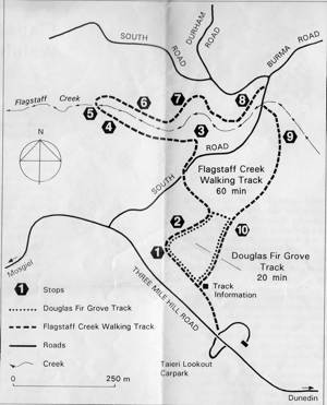
Flagstaff Forest TracksPlanting commenced at Flagstaff Forest in 1906, with introduced trees of a wide variety and type. By 1914 22 different species had been tried, many of them deciduous trees from Britain. These species were unable to compete with weed growth and a switch to evergreen pines was undertaken. Planting from then on was concentrated on the use of Radiata pine, Ponderosa pine, Douglas fir and Larch with a scattering of Spruce in the wetter gullies.
Following WWI there were a number of returned servicemen in need of rehabilitation work and these in the main provided the labour force. During the depression in the 1930s the city made considerable progress in forestry with an ample labour force.
Clearfelling of the first crop commenced at Flagstaff in 1934. Local log sales required approximately 10 hectares per annum to be clear-felled. Two export log trials were undertaken, one in 1959 and the other in 1962.
Export logging on a regular basis commenced in 1969 and continued at a volume of approximately 100,000 cubic metres annually. This reduced to approximately 14,000 cubic metres as a result of the lack of planting between 1940 and 1969. Export logs were sold to Korean, Japanese and Chinese buyers.
With the income and confidence generated by earlier sales the council in 1970 decided to expand its forest estate. Following that decision it added several thousand more hectares making a gross forested estate of 10,000 hectares.

We have a current planting programme of 350 hectares per annum. The replantings and new plantings are in Radiata pine with small annual plantings of Douglas fir and Macrocarpa. All stands have been established with the best quality seed stock available and have been pruned and thinned to produce high quality sawlogs and peelers to maximise the value and the market opportunities of timber produced.

From City Forests Ltd hard copy information sheet

Flagstaff Name

Flagstaff’s original name was the Maori ‘Whakaari’, meaning ‘uplifted to view’. Like many other place-names that were changed in early European times, so was Whakaari. The name Flagstaff was adopted by the early settlers because flags were raised on the summit to signal the approach of coaches from Central Otago. – Department of Lands and Survey, for NZ Walkway Commission.

Bannockburn: Background notes.

Settlement of Bannockburn had its beginnings when the discovery of Hartley and Reilly in 1862 of rich gold deposits in the Cromwell Gorge brought hordes of alluvial miners to the area. These miners were soon to pge out claims along the Bannockburn Creek. Its tributaries and neighbouring streams most of which proved to be extremely profitable.

Continue reading “Bannockburn: Background notes.”

Mount Cargill – Information

Mount Cargill has three peaks (Cargill, Holmes and Zion).


In Maori legend they represent the petrified head and feet of a princess of an early Otakou tribe. The mount was however known to the Maori community as kapaka-tau-mahaka – “snaring pigeons with a string’ – and following European settlement it was given the name of the lay leader of the Otago colonists – Captain William Cargill.


William Lanarch bought the summit of Mt Cargill in 1872. It was then covered in forest, but later several large fires severely reduced the forest cover. Grazing of stock continued over the land, while just to the west several farms started on Pigeon Flat. Following Larnach’s death, the land became a scenic reserve.
– From DoC hard copy information sheet

Taieri River Geology

The Taieri  River cuts through 100 million-year-old breccia containing an almost 1 km layer of greywacke, schist, cobble and pebble breccia conglomerate. This breccia extends as a strip right down the Taieri Plains, to the inland side of the coastal hills as far south as Milton. After flowing through the flood-prone Taieri Plains, the river cuts through the coastal hills to disgorge into the Pacific Ocean by the picturesque fishing village of Taieri Mouth.
– From DoC hard copy information sheet

Dunedin’s Hills’ History

Dunedin’s hills are virtually all of volcanic origin. Several eruptions occurred near Port Chalmers from 10-13MYA. The lava flows from this volcano and its many smaller flank vents extend in a roughly circular pattern, of some 15 km radius, over the sediments.

Subsequent erosion and subsidence have resulted in, among other things, the formation of the Otago Harbour, a gash that runs across the middle of the volcano, separating the island that is now the Otago Peninsula from the mainland. This gash tends in a north-east south-west direction, a direction similar to many of the faultlines of the basins and ranges of Otago and the uplifted Southern Alps. The island became the Otago Peninsula when a build-up of sand drifting up the coast from the Clutha River mouth joined it to the mainland.

The three peaks of Mt Cargill are all of volcanic origin. The Organ Pipes on Mt Holmes are one of the most spectacular landforms still visible. They were formed as a result of the period of volcanism. They were formed into their column shape during the cooling of lavas that flowed across the summit.

Until quite recently, the hills of Dunedin were covered in forests – the bulk of which were rain forest or southern beech forest. Large areas of these forests disappeared some time before European settlement. Repeated burning by the Maori was the major cause of this although the climate also became unfavourable for some trees. Tussock grassland now thrives where these forests once stood, with the Flagstaff Walk crossing a large area of the grassland. Successive fires in the area have prevented regrowth of scrub and forest.

Since whaling stations were set up on the shores of Otago in the early 19th century and in particular since original European settlement in 1848, cutting, sawmilling, clearing and fire have destroyed the greater part of the forest vegetation. Fortunately, pockets of the once extensive forest are still evident in the watersheds of the Leith, Silverstream, Waikouaiti, and at Silverpeaks, Maungatua and Mt Cargill.

Parts of Flagstaff and Swampy Hill have been repeatedly burnt yet change is not as evident as expected.

The rain forest grew from sea level to about 600 m above sea level.

Demands for land for settlement and agriculture quickly reduced this amount of forest. A few remaining areas have not been greatly changed and are found in two distinct belts: Podocarp-hardwood forest grows from sea level to 365m and mountain cedar-totara forest grows up to the bush-line. The Mt Cargill Walk passes through remnant podocarp-hardwood forest. Southern beech forest is confined to small patches hemmed in by rain forest, such as the one seen on the Mt Cargill Walk.

The present forest margins were mainly established over a century ago by a process of deforestation.

While possums and rats are abundant on Mt Cargill, they are rarely seen in daylight by the casual visitor. Much more readily visible is the wide diversity of birdlife. Once yellow-crowned parakeets, kakas and laughing owls lived in these forests. Nowadays, as humans have dramatically altered the area, these birds are gone. Today, pigeons, once driven from the hills by sawmilling, have returned and are a common sight on the walkways, as are bellbirds, grey warblers and tomtits.

Nearer the summit, in swampy gullies, the fernbird with its spine-like tail feathers, is occasionally seen. The eastern Rosella, a many-coloured parakeet released in Dunedin from a visiting ship at the turn of the century adds an exotic flavour to the lower regions of the Mt Cargill Walk.

Throughout the area the Red Admiral and the less common Yellow Admiral butterflies can be seen. At lower altitudes, the small blue butterfly (Lycaena baldenarium), with is purplish wings spotted with black, is abundant. Tussock butterflies, their brownish wings spotted with a large orange area, and the tiger moths, are found in the tussock on the skyline. The adult male tiger moths have black forewings and orange hindwings while the females are wingless and live under rocks.

The basement rock for most of Otago is schist: a flaky layered rock. Along the coast, areas of this schist became submerged about 90MYA, during which time deposition of sediments began. Subsequent uplift, or retreat of the sea has since exposed these sediments. Part of these deposits can be seen in the cliffs below the Tunnel Beach Walk.

– From DoC information Sheet hard copy

Sandymount and Sandfly Bay Information

The  Sandfly Bay-Sandymount area is remarkable for its native fauna and flora and its dramatic coastal scenery. Among the many outstanding natural features are the Sandfly Bay yellow-eyed penguin colony and the 220m-high cliffs of Lover’s Leap, a collapsed sea chasm at Sandymount. The complex, covering about 500 ha is protected for its wildlife and recreational values. The Sandfly Bay wildlife refuge, created in 1908 is the oldest on Otago Peninsula. Its soaring dunes, dark cliffs, heavy surf and rocky islets give it a character rather different from Sandymount’s chasms, low forest and grasslands. Sandymount summit (320m) is the third highest point on the peninsula.

Sandfly Bay, named not for the insect but for the sand blown up by the wind in this area, has some of New Zealand’s tallest  sand dunes which rise for some 100 metres above the beach. With the clearance of coastal forest, windblown sand has migrated inland to create impressive dunes reaching to the summit of Sandymount.

Otago Peninsula was created by a volcano that was active 10-13MYA. Over time, the volcanic peaks were worn down by erosion and Otago Harbour formed along a heavily eroded line of weakness or faulting in the earth’s crust. The exposed rocks in this area are all volcanic, with basalt columns prominently exposed at Lover’s Leap. Both Lover’s Leap and The Chasm were formed when soft lower layers of volcanic rock were eroded by the sea.

Three midden sites, representing early Maori encampments or kaika nohoaka, have been recorded around Sandymount (pikiwhara). There was a Maori settlement here in 1844.

Gleaned from DoC hard copy sheets

Quoin Cliff, Otago Peninsula

Accessed from Pipikaretu Road. 1.20 ret. Tramping track – unbenched. Manager: DCC CAM and private land.

‘Access to Quoin Cliff continues to cause problems, as there is a sign on the gate “Access to Beach closed.” The sign is technically correct. However you may go through this gate to get to the cliff as you are not going to the beach!’ – Quoted from Antony Hamel’s writings.

“quoin” definition: 1. An exterior angle of a wall or other piece of masonry.
2. Any of the stones used in forming such an angle, often being of large size and dressed or arranged so as to form a decorative contrast with the adjoining walls.