 26 June 2024. Trampers. Nicols Creek, Pineapple Track. Grade 4. Leaders: Wyn and Ross Davies.
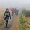
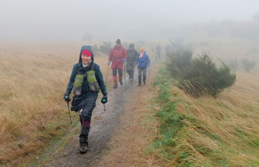
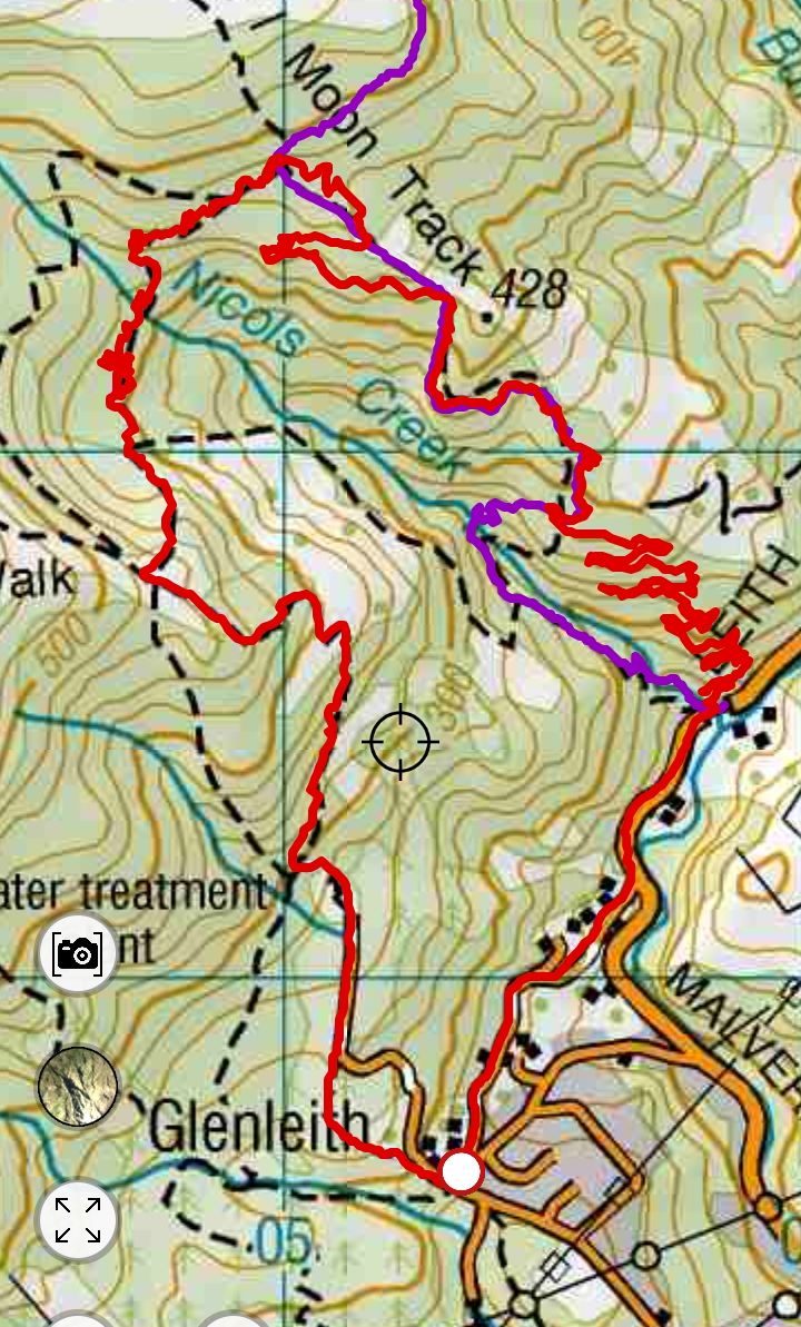
The weather forecasts were not very encouraging. Nevertheless, 12 courageous trampers arrived at the meeting point at Booth Road (bottom of the Pineapple Track) at 9.20am, eager to brave the elements. Or maybe willing? Maybe we were the rain gauge half-empty people? We were up to Plan C by this stage. The advertised trip involved Morrisons Track, and Swampy Ridge and Nicols Creek, first in one direction and then in the other. Morrisons means mud, and with the rain of the preceding days, Plan C was to head up Nicols Creek to the Moon Track to Swampy Ridge and then down the Pineapple Track. The drizzle was persistent, and so was the wind. It was rain jackets, beanies and gloves sort of weather. Eventually we ran out of excuses and headed off at 9.30am.
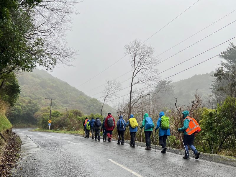
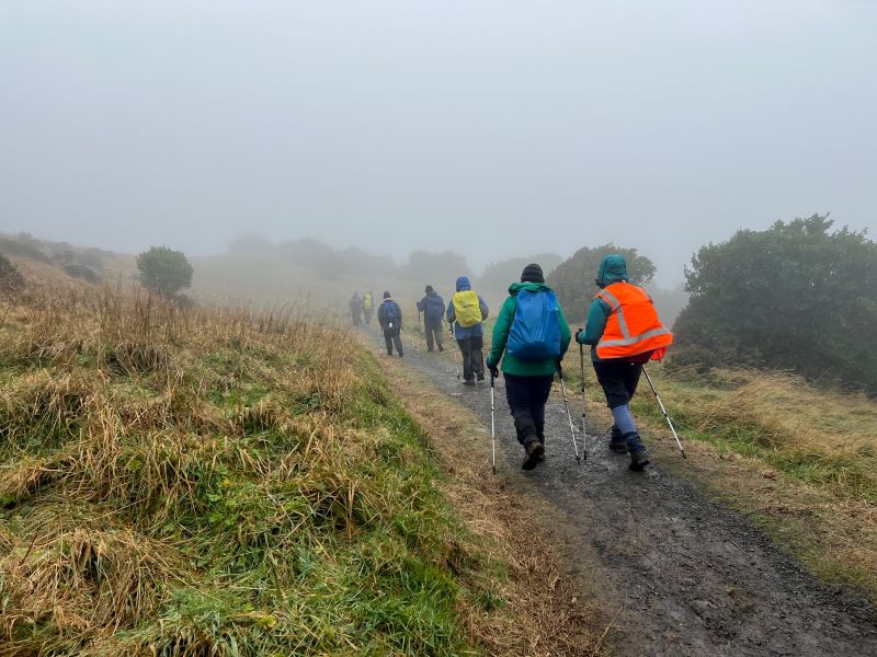
It was downhill for a start, along Islay Road to Malvern Steet and then up Leith Valley a short distance to Nicols Creek. Instead of starting up the usual track to Nicols Falls, we started up the mountain bike track on the other north side of the creek (aka the True Left). This lovely track does not prohibit walkers, and we were hardly like to encounter any mountain bikers on this day. Once in the bush we were mostly sheltered from the wind whistling down the main valley. It’s a track for riding up, so has a gentle gradient and zigs and zags a lot. The switchbacks gave us frequent opportunities to pass the time of day with other members of our group, either ahead of/above us or behind/below us. Much banter was bantered with warm greetings and encouragements as we passed in opposite directions.
The zigging and zagging meant we made slow progress up the ridge but we were happy enough and warming up enough. There was a brief halt while a couple of people retraced some steps looking (unsuccessfully) for a dropped scarf. Eventually we met the track up from Nicols Falls and then reached the Macrocapas, a clump of huge trees below a clump of big rocks. It seemed a bit drier under the trees, so Morning Tea was declared and welcomed.
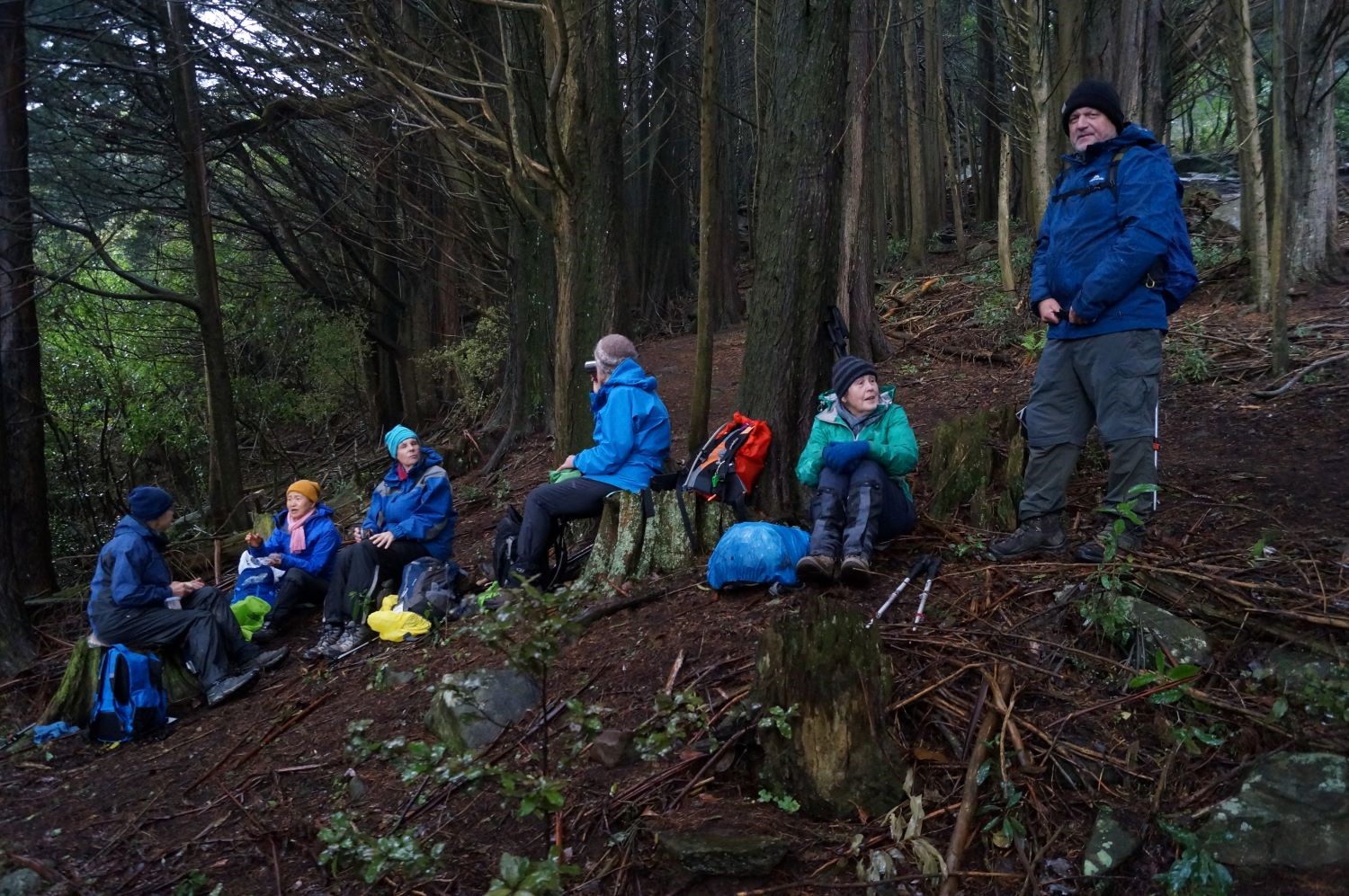
Not for long though. The trees were adjacent to open paddocks where we could see the wind driving the drizzle. We were keen to keep below the ridge line in the bush, and followed more of the bike tracks, still zigging and zagging. By now, Plan D was becoming a thought. Maybe the upper part of the Moon Track was going to be too windy and wet. Maybe the less-travelled tracks that crossed the head of the valley would be a better option. The recce hadn’t included them (if only Sarah was here) but there was growing reluctance for venturing up into the worst of the weather. We reached a point where the topo map suggested there should be a route south around the valley head. It turned out that this is the spot that Antony Hamel called “the intersection” although it looks more like a jumble. A small scout around revealed a big intersection track sign hidden in the jungle. Unhelpfully this pointed down to where we’d come from, and up where we didn’t want to go to! However, it was decided to follow a sort-of route heading away, generally around the hillside. This route (our Plan D) got more distinct the further we went, which was encouraging. The topo map confirmed that we were on a dotted line, the one Antony Hamel called “old cart track”.
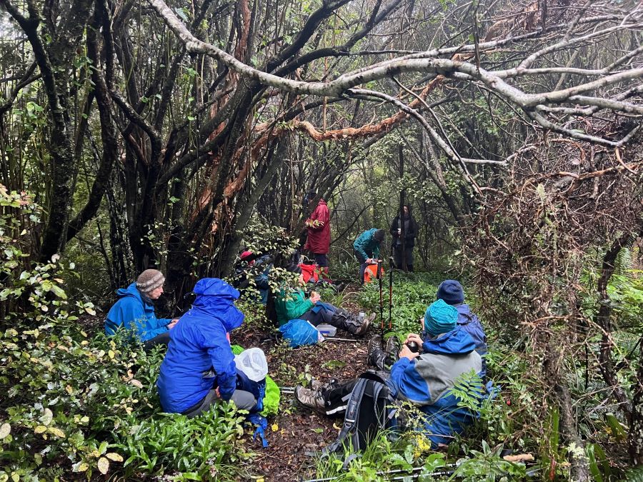
We stopped for lunch at a place that seemed slightly more open, although mostly everything was damp. There was no enthusiasm for lingering and soon enough we were on our way again. The crossing of Nicols Creek needed a bit of care.
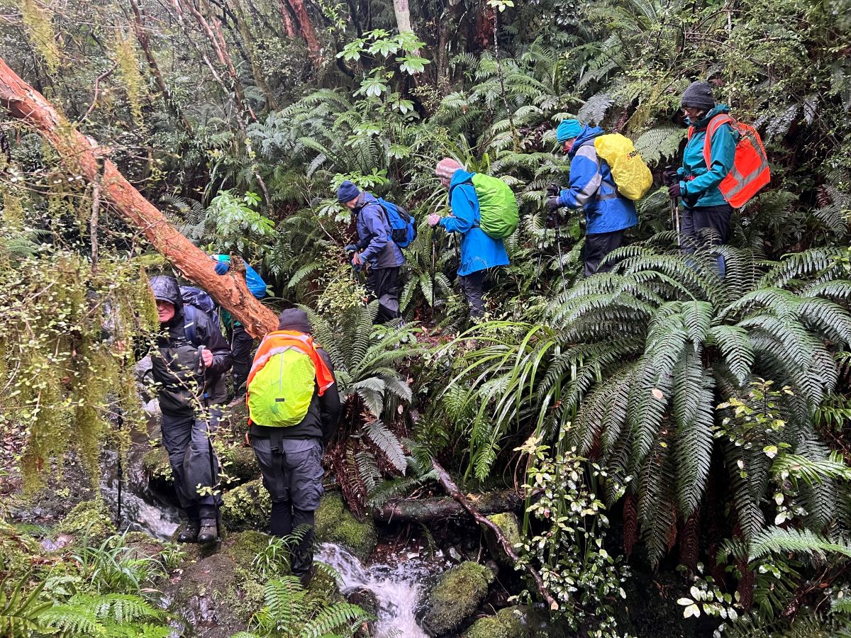
Further around we were looking for another junction, where a track would go down the valley and another (Pepper Tree Track) would climb up to the Pineapple Track. After some more reconnoitring down and up at a possible fork, the up track looked like the track more travelled and the one for us. Pam (and Gwenda) had come up the down track just three days before although she never quite figured out where we joined up with their route. However, it was good to have one person who had been here before. The Pepper Tree Track got more distinct, as it climbed through the Pepper Trees and it didn’t seem long before we were through the broom and onto the Pineapple Track just above Pineapple Point.
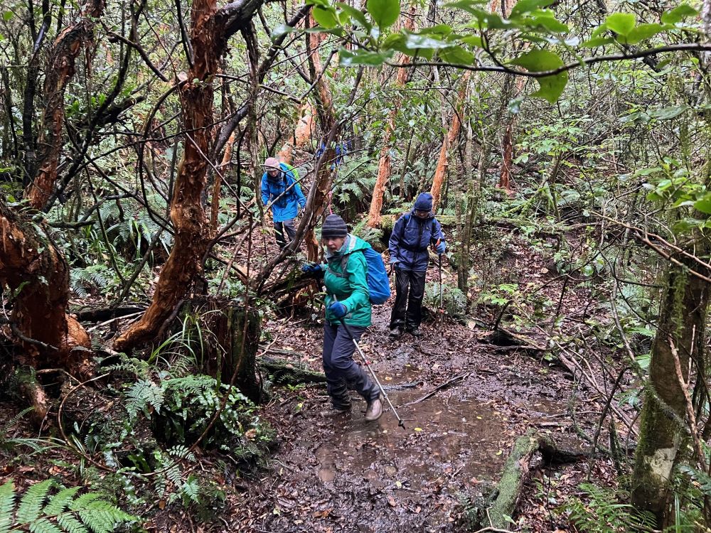
We could hardly see the Point in the murky weather that was hurtling past. We hurtled too, albeit slowly, downwards, eager to escape the cold horizontal drizzle.
The lower we got, the less miserable the weather got. Soon enough we reached the end of the Pineapple Track and the cars at 2pm. There was no enthusiasm for coffee or hot chocolate. Everyone was keen to get home to hot showers and baths. Nevertheless, everyone was happy enough with our adventures in the weather. We’d dodged the worst of it, made the best of it, been somewhere most of us had never been before, and had a mostly good day out. A bit of adversity seems to be good for us. Especially when it stops.
Thanks Sarah for doing the first recce with Wyn, and for sharing your map tracks, and Pam and Gwenda for doing the inadvertent recce. Thanks also to Antony Hamel’s “Dunedin Tracks and Trails” and bless the NZTopo50S phone app – the best $5.99 you could ever spend.
Ross and Wyn
Postscript. The scarf was subsequently found on the track by the owner.
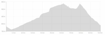
Stats: Moving time 3 hours. Elevation gain 540m. Distance 11km.
Grading: Confirm as a Grade 4 on the day, for the height gain and the rough going on the old cart track.
Links to background information and earlier tramps and hikes to the same area.