May 18 2024
Mountain Road / South Waikouaiti River
2. 15 May 2024. Trampers. Mountain Road/ South Waikouaiti River. Grade 4. Leaders: Graham Thurlow and John Gardiner
 Sometimes my grandmother would say something to me, and I’d ask,
“How do you know that?”
She used to say,
“A wee birdie told me.”
This report is a ‘wee birdie’ (a Fantail) told me tale: –
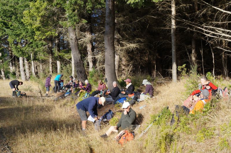
Sitting on my perch, high in my favourite tree near the end of Semple Rd, I watched 23 trampers leave 5 cars, at 10.05am. I assumed they intended to follow the same route as the two in Hi-Vis vests (Graham and John) had walked 10 days earlier.

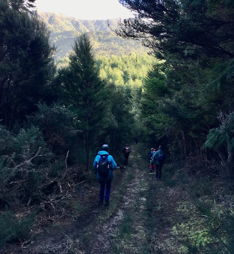
Starting off briskly on Mountain Road Caption and photo Pam
Sure enough they set out, past the locked gate, and up a gentle assent on a 4WD type track, before stopping for morning tea at 10.30am.
Morning Tea in the low morning sun. Caption and photo John
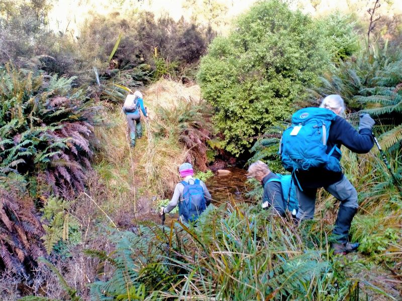
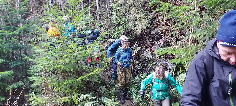
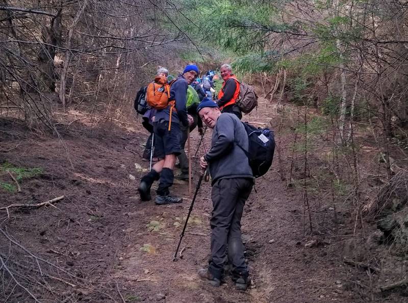
By 10.45am they were on their way again, before turning off the wider track at 11.00am to make a steep descent down to the river. The previous Tail end Charlie (John) led the group for this section. I chuckled (inwardly of course, because Fantails can’t chuckle well) to myself when I saw John leading, thinking “no side tracks on this bit, surely even John can’t get lost!”

Going down “Walker Road” Caption and photo Phil
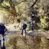
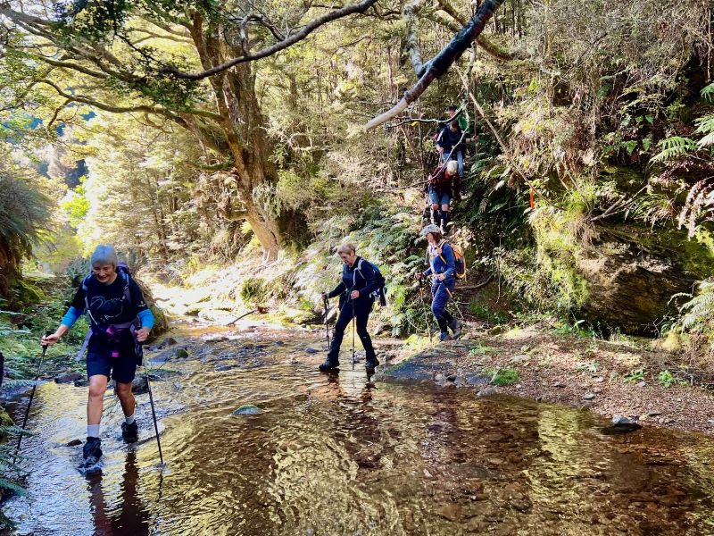
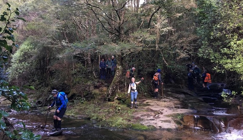
I did notice the group got a little spread out on this section, but a couple of regrouping stops along the way, meant everyone reached the river pretty much together. Boy, was I pleased I can fly watching those trampers crossing the Waikouaiti River South Branch (really just a stream.)

Is this the garden of Eden? Caption and photo Phil
So tricky for them, so easy for me. One of the group was even piggy backed across to avoid getting their new tramping boots wet! The track out from the river was well marked by a cairn the Hi Vis guys constructed last Monday. A useful rope helping everyone scramble up to the main track.
Keeping the feet dry a bit longer Caption and photo Phil
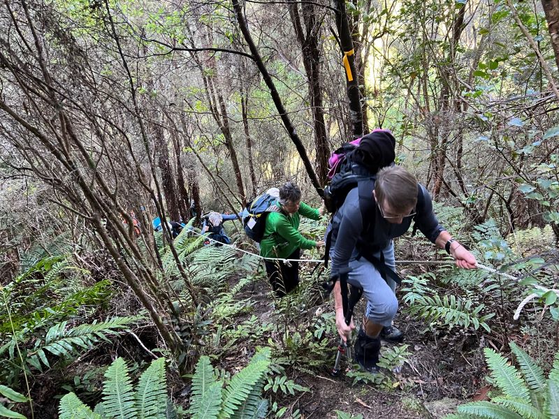
A little help on the uphill climb. Caption and photo Pam
The whole group made good progress on the main track. Us Fantails like to ‘flit and flutter,’ but I had to hold a straight course just to keep up. I really enjoy these guy’s visits, as do my forest friends, the Tomtits (Miro miro, ngiri ngiri) Bellbirds (Korimako) and Brown creepers (Pipipi). We made our friends welcome with birdsong, particularly the talented Bellbirds and Brown creepers. A big thank-you, from all of us birds, to the two Hi Vis guys for cutting back some pesty gorse in places on this section of the track.
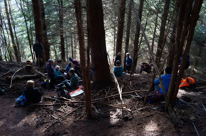
My friends stopped down by the South Waikouaiti River for lunch, dead on 12.30pm, leaving again just after 1.00pm.

Lunch with the sun streaming through the trees. Caption and photo John
The track followed an old water race route, the race itself often only discernible by the remains of the original race’s banks. The track went along the valley, before crossing the river again and initially taking a zig zag course uphill.
No need for “Piggy Backs“ here John ! Caption and photo Pam
The steady uphill climb through a Fir tree forest that followed, seemed to go on and on, for the trampers below! Finally, they arrived at their cars at 2.30pm.
It was sad to leave my forest visitors. They seemed to enjoy their day as much as I had. Ear wagging as usual (weird because being a bird I don’t have ears I can wag) I noted that there were two of the group who were unfamiliar to some of the others. From my lofty tree observation point I’m sure Charlotte and Lisa enjoyed their day out, as much as the others seemed to enjoy their company.
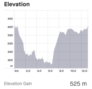
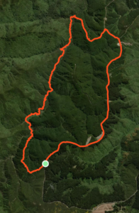
As I warily settled back in my favourite tree (by those cars) I reflected on what a great effort everyone had made,10.67km had been covered, with a traveling time of 3 hours and 35 minutes, elapsed time 4 hours 25 minutes.
Ear wagging again, I overheard that the group were going to the Blueskin Gallery Cafe for coffee before returning home. Now I was really envious of those guys. It’s all very well to be able to fly, but sadly I don’t drink coffee, nor can I eat cake!
So that’s the bird’s tale. If you weren’t on this tramp, you’re telling someone about it, and they ask,
“How do you know that?”
You can always answer,
“A wee birdie told me.” John

1. 28 July 2021. Trampers. Mountain Road/ South Waikouaiti River. M-H. Leaders: John Gardiner and Arthur Heenan
On Wednesday 28th July, 23 weary trampers returned to their cars at 3.00pm. During the day they had tramped 12.72Km over undulating terrain, with an elevation gain of 521metres, to a maximum elevation of 409metres above sea level (Pam’s cell phone figures.)
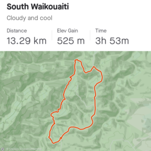
Strava screenshots courtesy Ross Davies
The day began when 5 cars, carrying 23 trampers, met at the “On the Spot ” Shop, Waitati at 9.35am. Here we enjoyed Sarah’s birthday chocolate shout before heading on our way. After negotiating pothole filled gravel roads, by 10.00am we left the cars. We enjoyed a somewhat brisk morning, sheltered from the cool breeze by some beautiful forest, with an abundance of ferns. Morning tea was enjoyed at 10.30am on a downhill section of the track amongst Pine trees. (The seemingly precise, to the minute, timing of these events being more by chance than design!) Here the opportunity was taken for the distribution of my own birthday chocolates.
Morning tea in the pines Caption and photo John
Down, down, down to the Waikouaiti stream Caption and photo Pam
To this point and for the next couple of hours a somewhat rambling track led us into the valley, before roughly following the South Waikouaiti River downstream.
On the track Photo Helen
The track surface was wet and slippery in places, especially at the few small tributary stream crossings, presenting a degree of technical difficulty for some.

Close encounter of the 1st kind with the South Waikouaiti Caption and photo Ross

Close encounter of the 2nd kind with a tributary Caption and photo Ross
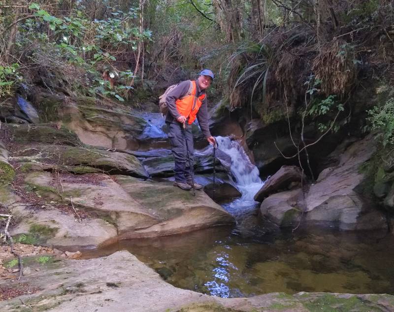
John plumbing the depths of another tributary Caption and photo Ross
By 12.20pm we reached the main river crossing, with wet feet for all. With water over the top of my boots, at one point, for me it was a priority to pack my boots with screwed up newspaper when I got home, to help them dry overnight!
River crossing at the Sculpture Rocks Caption and photo Pam
A distinctive feature of the river crossing here was an unusual “water sculpture “in the limestone rock, caused by erosion, at the mouth of a tributary stream. This river crossing and the subsequent changes of direction to find the opposing track and navigate onto the correct return track, would present a challenge to most. Our leader Arthur’s experience came to the fore here and we didn’t get lost. (It was a challenging day for my own sense of direction!)
The anticipated “uphill slog “classified as “hard” soon followed. The climb through a pine forest on a wide, mostly smooth, pine needle covered track, was technically straightforward though very steep in parts. It was so steep the point was made that it would not be a good track for a quad. bike! (Backward flip threat)
It really was steep… Caption and photo Ross
Here Ross found an old “vintage “golden coloured beer can, which he proceeded to kick up the hill, until it got too much for me! For the last section of the climb, I carried the thing high on one of my poles, evoking Waitati Militia memories for Ross (with a beer can instead of a teapot of course!) By 1.35pm all had reached the end of the track, where lunch was enjoyed at the side of the road. After lunch Ross clipped our beloved “vintage” beer can to a hook on the outside of his pack, for the swagman look. Leaving our lunch, at 2.00pm (precise again), we walked downhill on a surprisingly comfortable underfoot, gravel road, arriving back at the cars at 3.00pm.
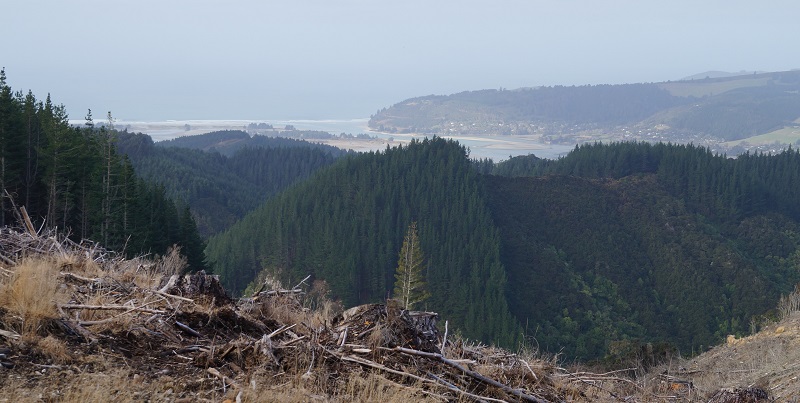
View from the return road Caption and photo John
That’s it. The tramp followed a loop, (just like this report.) A highly enjoyable day with great camaraderie, enjoyed by all, in ideal tramping conditions. A special thank you to my neighbour, Andrew Dunn, who originally suggested the tramp to me. Andrew provided a map, and discussed the route by phone with both Arthur and me. In fact, as soon as he got home from work, Andrew knocked on my door, inquiring how it all went. John Gardiner.