Apr 21 2024
Rosella Ridge
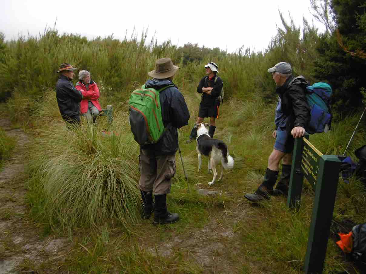
 9. 17 April 2024. Trampers Rosella Ridge. Grade 5.5 Leaders: Ross and Neil
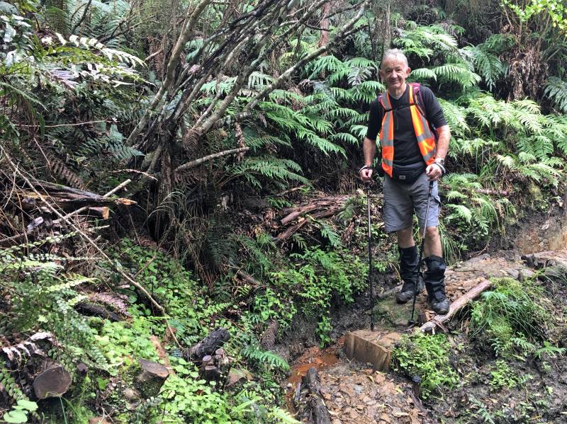
Steep descent down to the Waikouaiti South River. Caption and photo Pam
We followed the ever-improving River Track down the valley, stopping for morning tea at 10:15am. Most of the track was shaded, and despite the blue sky, it was cool by the river. At this point one of us had mislaid their phone. After an unsuccessful 45-minute search we carried on (fortunately the phone was in the car)
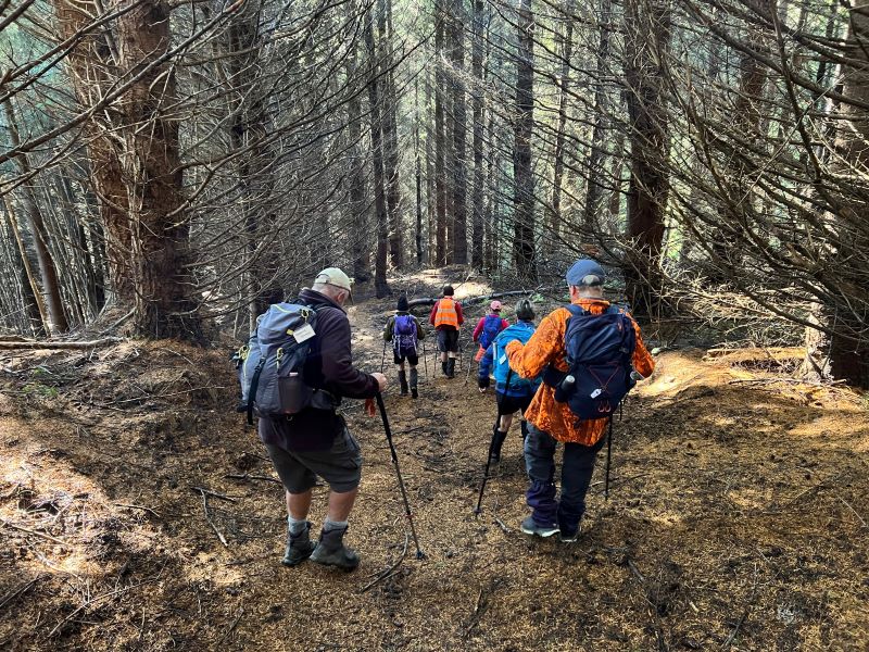
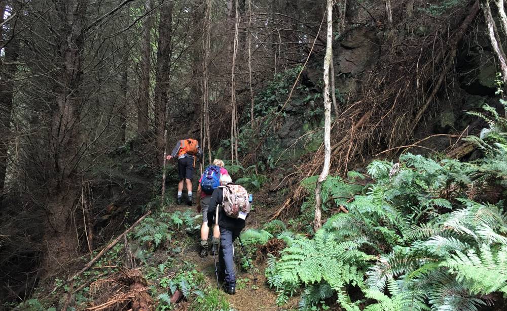
We reached the toe of Rosella Ridge at 11:10am, refuelled and then began the big Up. The River Track is uneven in parts, and the track up Rosella Ridge is even more uneven. And more Up. The initial climb is about 250m. and unrelenting. Then the ridge relents, to more like up and down, gaining height more gradually.
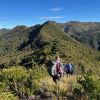
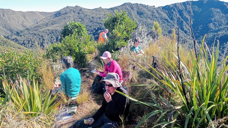
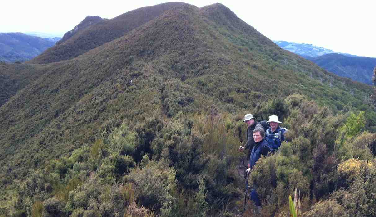
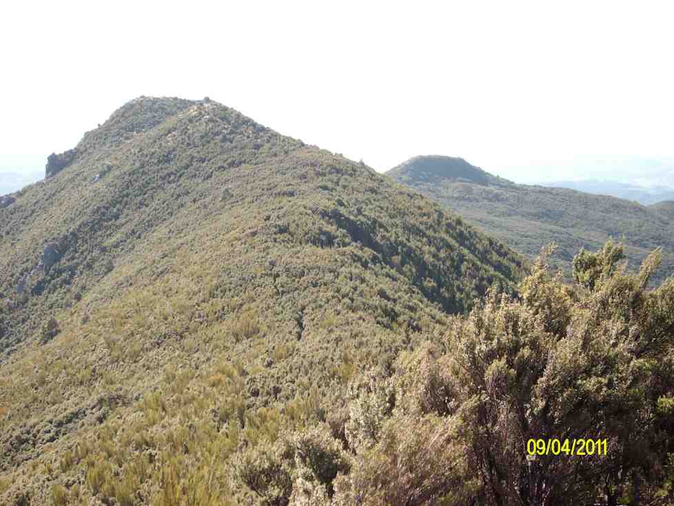
High up on Rosella Ridge. Caption and photo Pam
Rosella Ridge ( and all those ridges!) Caption and photo Pam
Too soon we were ordered to our feet (by me), and it was onwards and upwards.
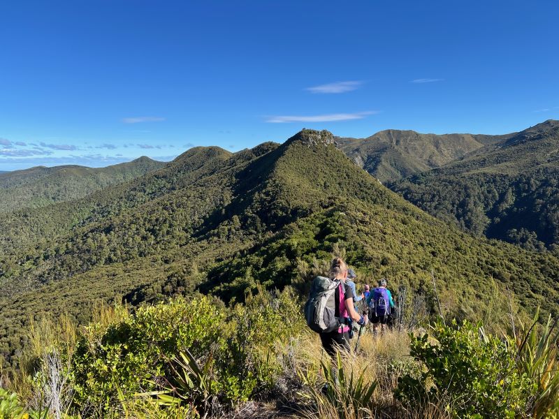
Lunch on Rosella Ridge – Rocky Ridge beyond. Caption and photo Ross
Up the ridge after lunch – at Little Pulpit Rock. Caption and photo Ross
Late afternoon shadows of the Silver Peaks. Caption and photo Pam
Happy to be heading homeward. Caption and photo Ross
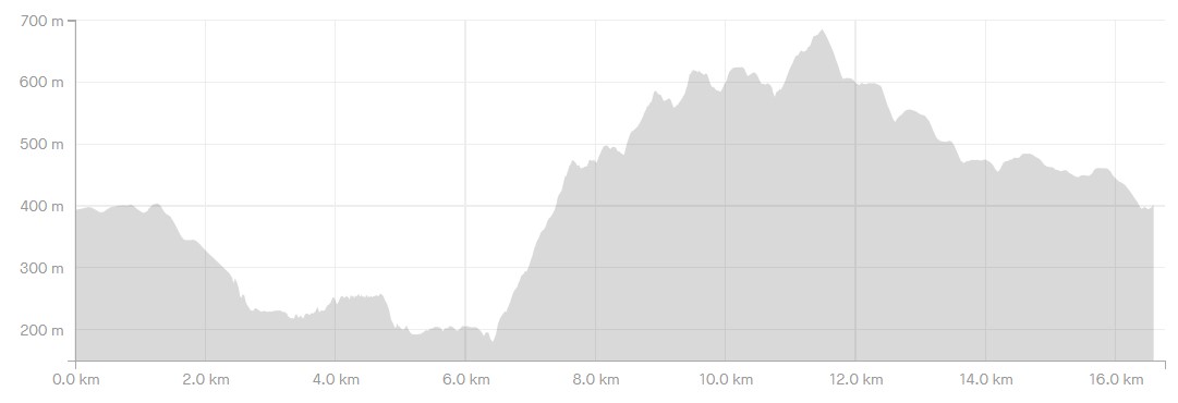
We were out there for seven and a half hours which compares well with earlier trips given our lost time in the morning. Distance 16.4km. Elevation gain 938m. Moving time 5 hours. Average pace 3.3 km/h. Time away from the cars 7 hrs 35 mins.
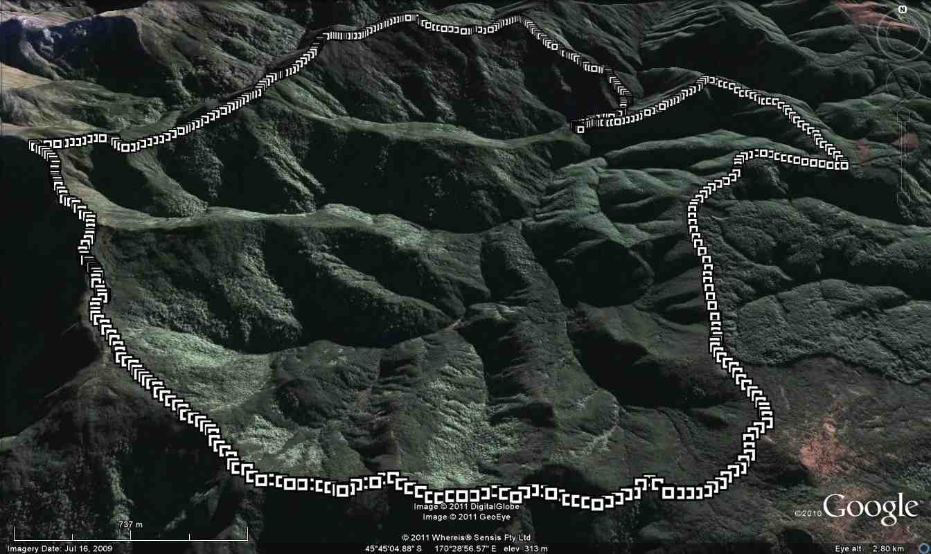
The ups and downs of Rosella Ridge anti-clockwise.
Thanks Neil H. for co-leading and being tail-end Charlie and for our very enjoyable recce. And thanks everyone for being part of this adventure. Well done everyone.
Ross
With a belly full of chocolates (Pam’s Birthday shout) we headed off up the first bit of track (9.25am), but tail end charlie, Ross realised with the job of getting the group organised, he needed to return to his car, to retrieve the poles he had forgotten, left in boot.
Working into first climb, in the distance we could see Mosgiel, as usual in the sun. with an hour gone we stopped at the old Green Hut site for morning tea (10.30am).

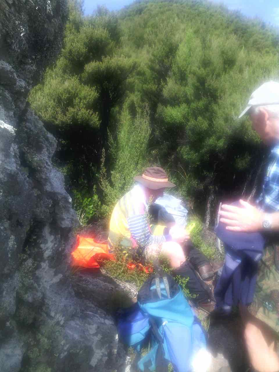
Company for morning tea – Dermot Mayock and … (photo and caption John)
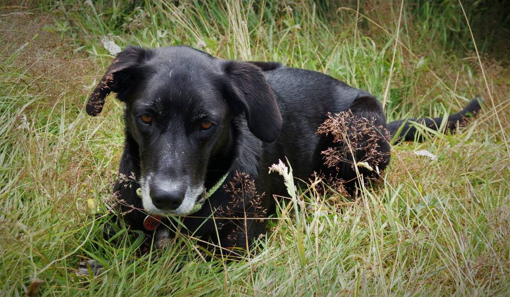
…and search dog Cu Chulainn (photo and caption John)
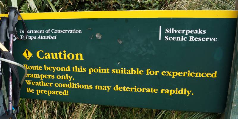
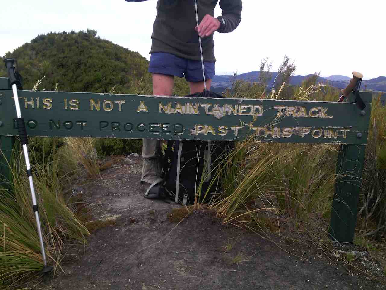
Words of warning at Green Hut site (photo and caption John)
As we passed the turnoff to Rosella Ridge (11.15am), John pulled out a bag of Airplane jubes, singing “Leaving on a Jet Plane” as he explained a John Denver song, with the lyrics written around the Vietnam War.
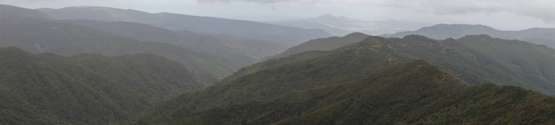
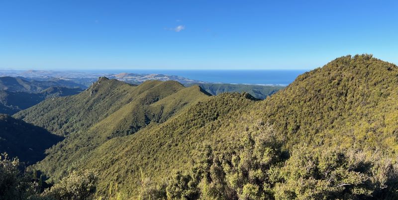
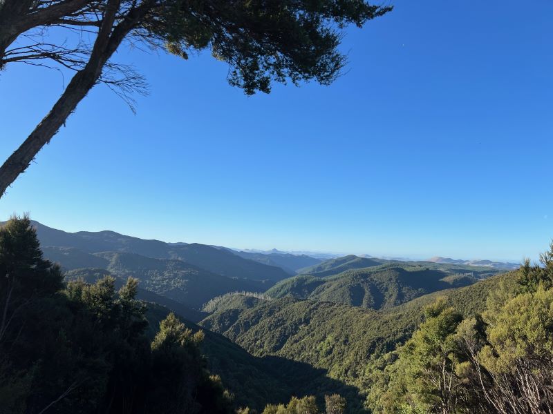
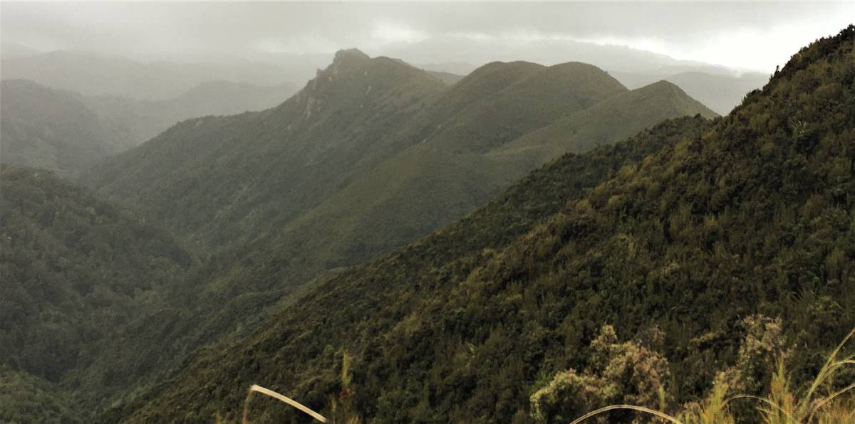
Panorama south – Looking down Silverstream with Long Ridge descending on the right, past Powder Ridge towards the Chalkies. The first ridge on the left is the Greengage Track and beyond that Rain Gauge Spur and the ridges of the Coal Creek Tracks and the Steve Amies Track. On the skyline on the left is Flagstaff, with Saddle Hill in the middle in the distance. In front of Saddle Hill is Mosgiel. (photo John and caption Ross) [click/tap to see full size]
Rosella Ridge – a long, long way to go to the Waikouaiti River South Branch (photo and caption Pam)
Although the clouds had formed around the hills, we could see Pulpit Rock, The Cats Teeth, Devils Gap, Rocky Ridge, Hermits Ridge and Mt Watkins. When we moved along Rosella, to the east were Doctors Point, Waitati Inlet and TV mast.
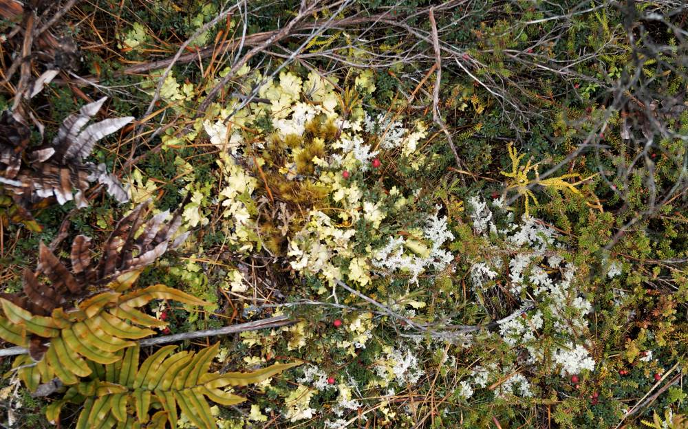
Interesting alpine flora (photo and caption John)
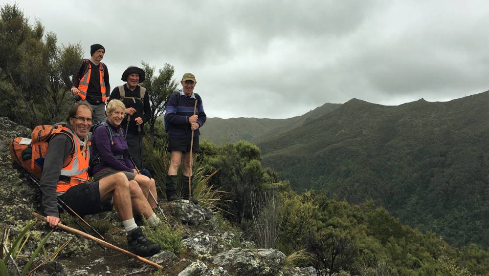
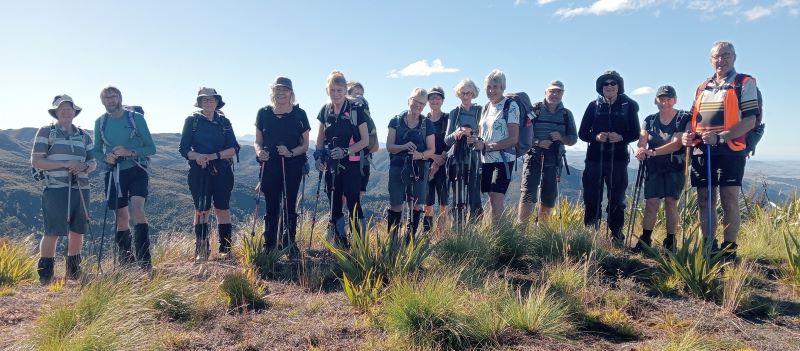
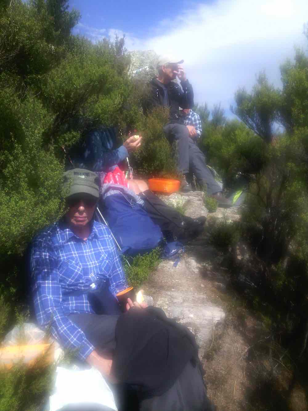
Happy trampers with Rocky Ridge on the right (photo and caption Pam)
Steep descent to the Waikouaiti River South Branch (photo and caption Pam)
This took approx 2hrs. A rest and replenishment required. Up and away, we headed south along River Track above Waikouaiti River, with ongoing work being successfully done by Green Hut Clearing group…
Ross crossing on the boxed stone-filled step – installed by the Green Hut Clearing Group (photo and caption Pam)
Leaving behind Waikouaiti River South and climbing up the remodelled steps through the pine forest to Mountain Road (photo and caption Pam)
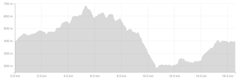
Strava elevation profile. The high point is the top of Rosella Ridge and the low point is the bottom of Rosella Ridge. (screenshot and caption Ross)
As I write the other five may be asleep on the couch, after eating their teas. Although a long tramp, an achievement to walk not only the length of Rosella but back along the river and up through the pines. Magic Day
Thanks, Phil
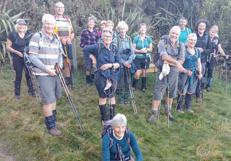
The sky looked promising, despite a forecast for showers, as the group left Mosgiel at 8:15am.After driving to SEMPLE ROAD, 11 keen trampers left the cars at 9:05am on the SILVER PEAKS track. A neat hour got us to the site of the old GREEN HUT,
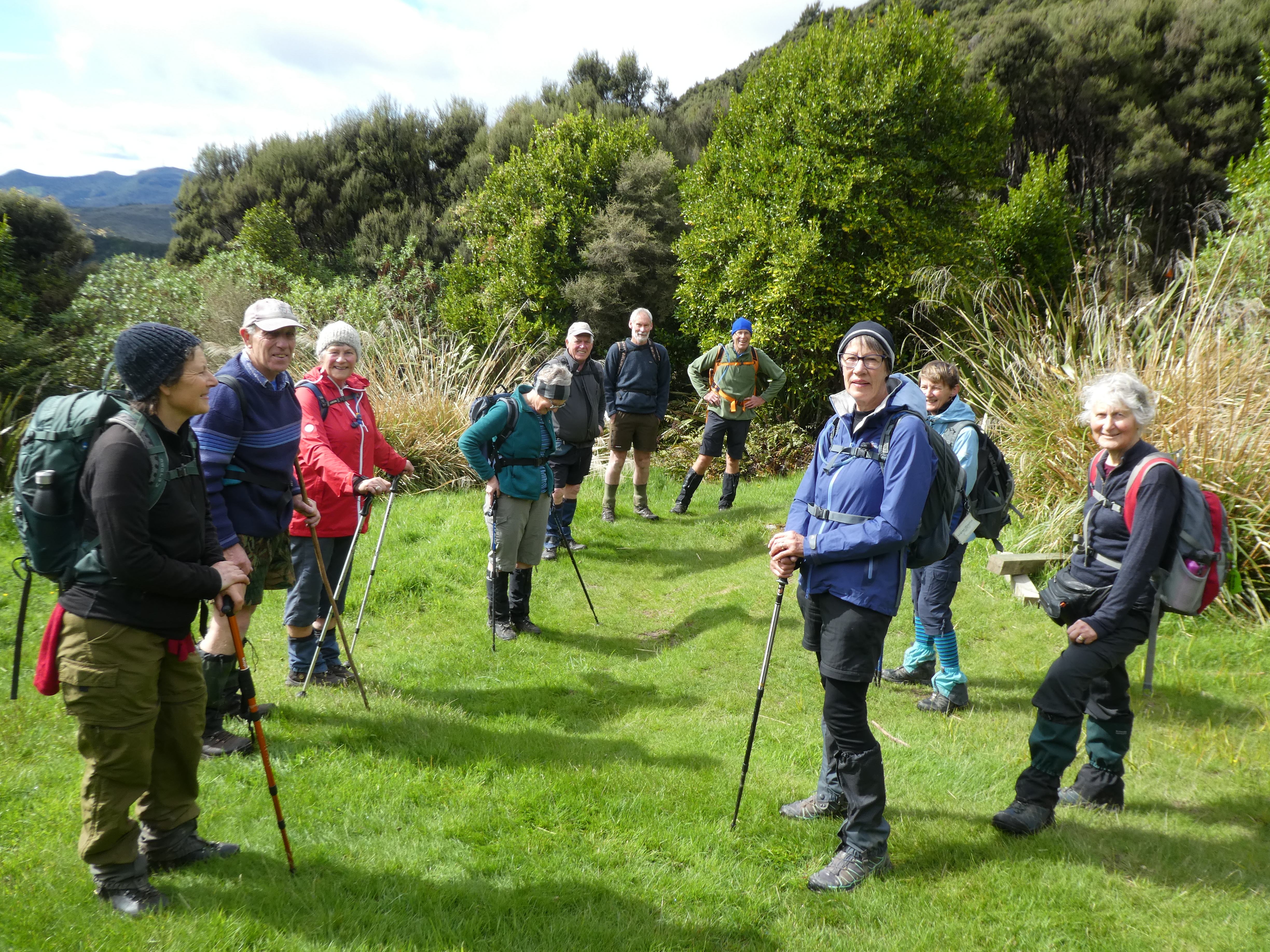
Photo and Caption Gordon – “At the site of the old Green Hut”
but we continued a few minutes more before stopping at a sunny, sheltered spot for a 15 minute smoko break.
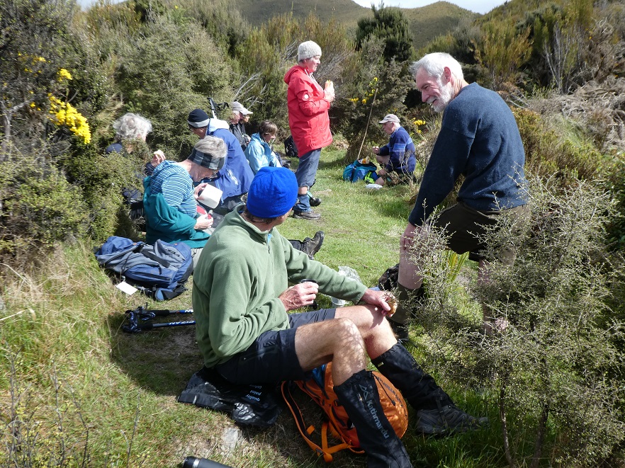
Photo and Caption Gordon – “Morning tea sheltered from the wind”
From here we were quite exposed to the cold Sou-west wind as we carried on up to the top of ROSELLA RIDGE. Lots of cloud about, but sunny much of the time.
It was a relief to be in the shelter from the wind as we started down ROSELLA RIDGE. Our goal for the day was to walk down the fully length of the RIDGE to the river—-something never previously done by our Club, I think.
There were many Peaks and Humps to climb, as sometimes said, we went up and down a lot as we went down!
Sometime after passing LITTLE PULPIT ROCK we came to a tussocky knob in the sunshine, and with views in all directions. We made this our 30 minute lunch stop.
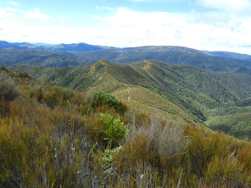
Photo and Caption Gordon – “Just below Pulpit rock looking at where we are going”
A very brief skiff of hail passed over. Anyone quick enough could have enjoyed Iced coffee or Iced tea with their lunch! Some were reluctant to move, but we still had far to go.
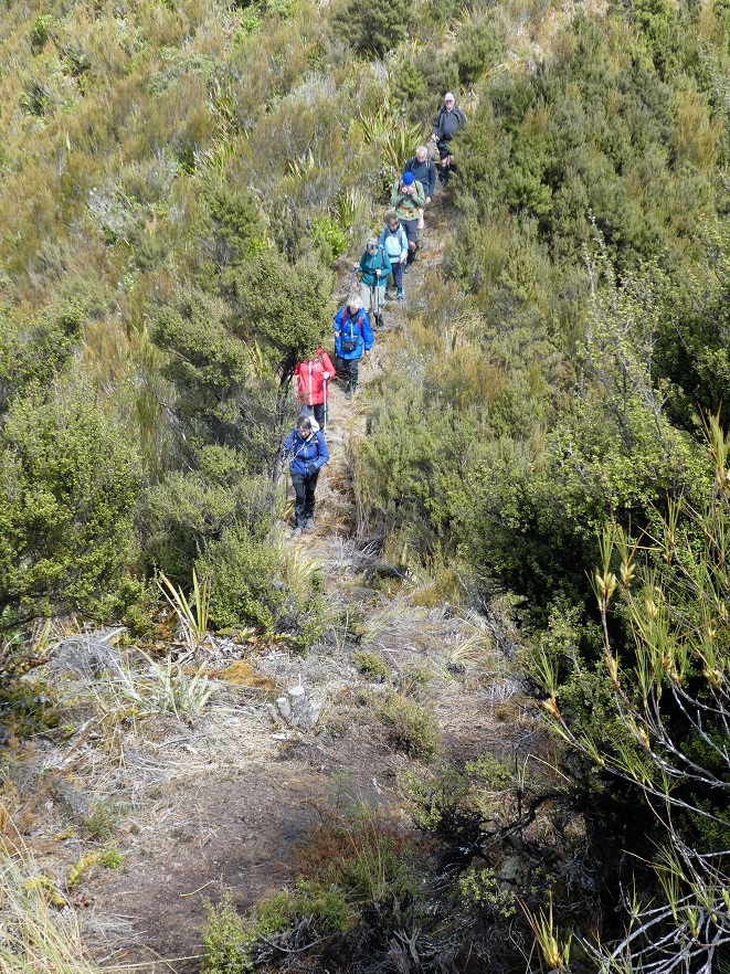
Photo and Caption Gordon – “Heading down Rosella ridge to the stream”
After another hour of descent we reached the very bottom of ROSELLA RIDGE. We had a rest period, before changing direction to follow the WAIKOUITI RIVER SOUTH BRANCH upstream.
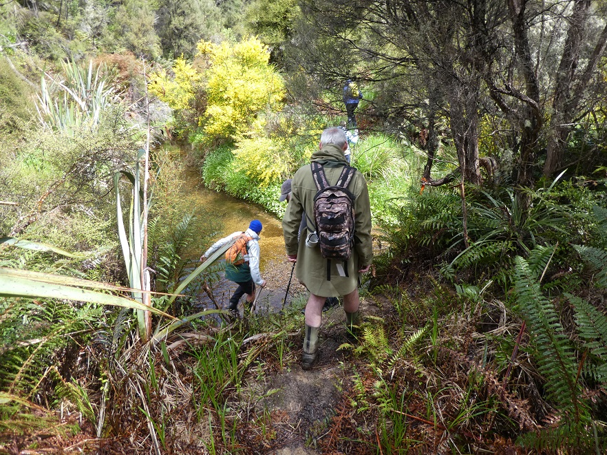
Photo and Caption Gordon – “Finally the stream”
The GREEN HUT CLEARING GROUP have done much work in this area in the last year or two. A major engineering feat has been accomplished at a major climb, by installing a double zig-zag with an easy gradient.
Turning onto the HUNTERS ACCESS TRACK we crossed the river 3 times in quick succession, to begin the climb out. A good rest was taken, with water and energy food consumed, at the bottom.Turning onto the HUNTERS ACCESS TRACK we crossed the river 3 times in quick succession, to begin the climb out. A good rest was taken, with water and energy food consumed, at the bottom.
The first 15 minutes was a stiff uphill climb, Good recently remodelled steps before reaching the dozed Forestry track. No rushing here, with several rest stops.
And then it was much easier going, and quite pleasant with the strong wind in the tree tops high above. We had 2 more short, steeper climbs before reaching SEMPLE ROAD. A few minutes walk had us back to the cars at 4:20pm, for an elapsed time of 7 1/4 hours for the days tramp.
The Leaders estimate of the distance was only a tad out, as we had tramped 20kms. WELL DONE EVERYONE! All were very happy and satisfied with the day; It was good to have achieved such a long and challenging tramp.
My thanks to all of the group and especially HELEN and GARY for being Assistant Leaders.
Art.
6. 24/2/2016 Trampers. Rosella Ridge. Leaders: Heb and Arthur. Ken.
Seven regulars, & one visitor ventured out for this tramp.
As we had a key for the locked gate on Mountain Rd. we decided to leave one vehicle at the top of Walker Rd. & the other one at the start of Green Hut track. So Arthur took some of the party into the first part of the tramp while the car shuttle was taking place, & the rest of us were left to catch up a bit later on in the morning.
The 2nd group had morning tea at the Sleepy Hollow junction, & then carried on up to the Green Hut site, where we dropped our packs, & headed off to find the water supply that Ian told us was down the hill a bit. Even although there had been no rain for some time, there was a pool of water there, with quite a few drips running into it at all times, so handy to know that water is available from this source if needed.
We then carried on up towards Pulpit Rock, catching up with the first group where the track goes around the side of the ridge, before getting to the steep rocky climb up to the start of Rosella Ridge. After a rest stop at the Rosella Ridge sign,
Defaced Rosella Track sign. (Helen pic)
we ventured off along this track to have lunch at the normal spot on the large rock beside the track.
Meal stop (1) (Helen pic)
Meal stop (2) (Helen pic)
After lunch, we made our way down to where the side track drops off into the Waikouaiti River valley, where we had another rest stop, before moving off down towards the toe of Rosella Ridge.
We only got down this track a short distance before we lost the track due to overgrowing bush. So after a look around for the correct way down we decided to retrace our steps to the side track, & go up to Mountain Rd. this way, which required a lengthy road walk to get to the cars, as this exit onto Mountain Rd. is somewhere about the middle of where the the two cars were sitting.
After a long hot day a couple of members were feeling a bit exhausted, so two of us climbed to the road, & armed with vehicle keys, walked to the vehicles, & drove them back to the top of the track, where we got everybody safely loaded up, & headed back to town.
Today was a day when lots of water & rest stops were required, as it was overcast, but hot for much of the time, with the sun coming out later in the day, & this tramp is quite strenuous with lots of climbing.
Our visitor on the day, suffered a few slips & falls, mainly due to the slippery dead tussock lying on the track, but was happily unhurt.
With all the hold ups, we arrived home after 5pm, so it was good that we had an early start of 8:30am.
The main group walked 12.7km, & the two who retrieved the cars walked about another 1 -2 km.
3.1 km/hr
climbed 910m
max elev. 696m – Ken.
5. 28/1/2015. Trampers. Rosella Ridge.
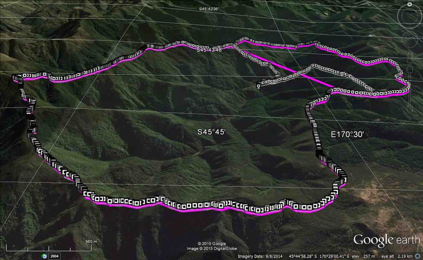
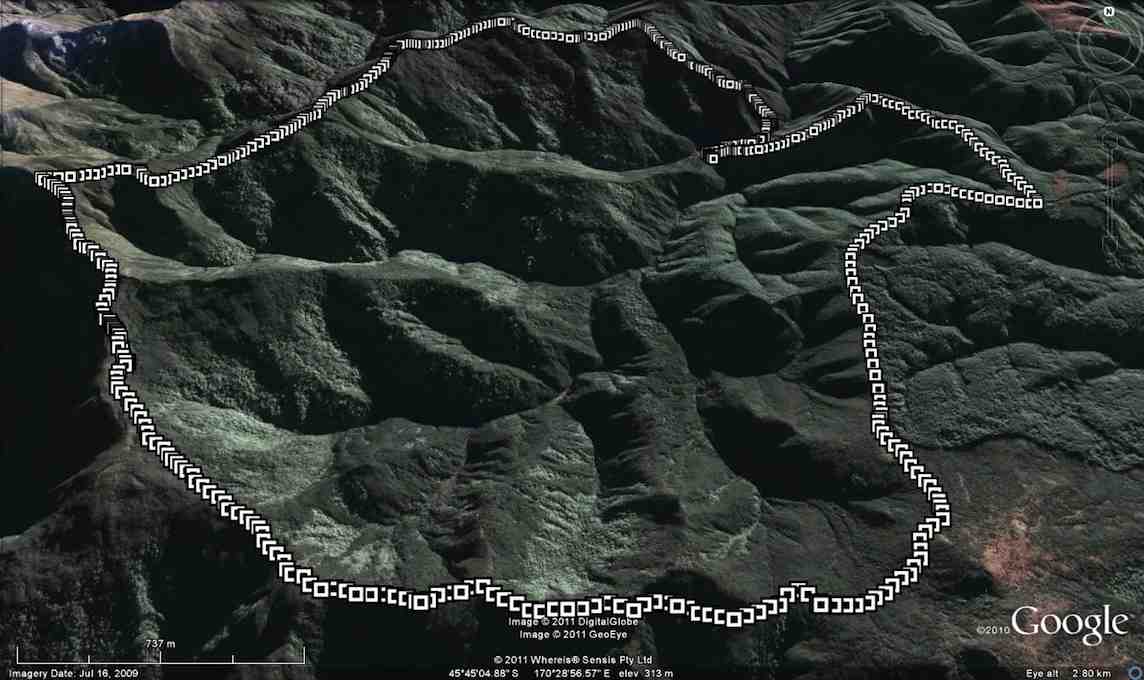
GPS of route, courtesy Ken. We walked 13.7km; Ave speed 3.2km/h; Moving time 4h 18mins; Climbed 857mtrs; Max Elevation 690mtrs.
Top left sharp turn on GPS map is the turn onto Rosella Ridge, which is just below Pulpit Rock. The loop track at the far top right, is the original track that I wanted to do, which is down to the toe of Rosella Ridge, & up the firebreak onto Walkers Rd. As you can see by this picture, the way we went today is quite a bit shorter, but just as challenging.
Ignore the straight line in the picture, it means nothing !!
On a day when the weather looked decidedly dicey, 6 hardy trampers [4 from the club, & two visitors] turned up for the tramp to Rosella Ridge in the Silverpeaks.
As we travelled over the “motorway” we could see that the tops were almost clear at that time, so we thought maybe a good day was in store. As it turned out, the weather was really quite good, & the track surface was dry.
We parked by the first locked gate on Mountain Rd. & walked the short distance back to the track leading to Green Hill/Pulpit Rock. As we made our way along to ‘Sleepy Hollow’ for a morning tea break,
Ready to set off after morning tea break. (Ken pic and caption)
it has started to drizzle very lightly, prompting most to don wet weather jackets. The drizzle didn’t last long, but most chose to keep their jackets on as we made our way up towards Pulpit Rock, & along the first part of Rosella Ridge to our lunch stop by the big rock beside the track.
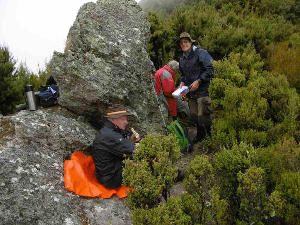
Lunch-spot
After lunch we made our way along Rosella Ridge to the junction where the track drops off the side of the ridge [Hunters Track, from Hamels book]. The original idea for this tramp was to go all the way to the toe of the ridge, & up the fire break onto Walkers Rd.but with dicey weather, & one or two of the party members wanting to not be late back, I decided to shorten the tramp a bit by going this way.
After we reached the bottom of the quite steep drop into the Waikouaiti River, we were faced with a flat area of shoulder high swamp grass with no sign of a track to follow, so we just ploughed our way through this heading to the end of the ridge on the other side where I knew the the track leading up through the pines to Mountain Rd. started. When we found the track, we had a short break to have a drink, discard some clothing in preparation for the climb ahead, & get ‘mentally prepared’ for a lengthy climb out. The top of this track was still holding stagnant water, & the grass was quite long which meant carefull walking to avoid slipping off the high points into the ruts holding water.
Six tired & I hope happy trampers arrived back at the cars, & all agreed it had been a good day, with one of our visitors wondering why his new found muscles were starting to stiffen up so much. – Ken.
4. 22/1/2013. Ken & Dermot. Rosella Ridge to toe and Walkers Road.
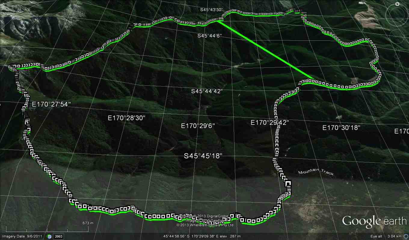
Rosella Ridge to toe and Walkers Road. GPS of route. – Ken.
Dermot & I went all the way down Rosella Ridge today, & then up Walkers Road. Walkers Rd [actually the firebreak track before Walkers Rd.] is just SSOOOoooooo steep & a real killer of a climb.
3. 24/10/2012. Mountain Road, Green Hill. Rosella Ridge, Waikouaiti River, Mountain Road.
We did just over 14km @3.1km/hr
Moving time 4hr 34min
total ascent 1047mtrs.
max elevation 695mtrs.
[Note, added, from Ken on 8/11: We wont get bushed on Rosella ridge again. Dermot Heb & I went up there today, found the correct way through that overgrown bit, cleared it & marked it with pieces of a plastic bag.
When you see how we came unstuck, it’s obvious why it happens. The track appears to go straight ahead, & if you are not observant enough, you miss the proper track which veers off to the right. Anyway, we have partially blocked off the wrong way with some of the cuttings we made from clearing it, so it should be good from now. How many of us were there that day, & we all missed the correct track, so that shows how misleading it was!]
Cheers
Ken
The ridge stretches on.

Lunch at 1.00 p.m. in the sun sheltered from the wind.
GPS of Rosella Ridge, courtesy Ken. Mountain Road is the largely straight route on right of pic. Sharp point upper left is where Rosella Ridge track turns off from Pulpit Rock track. Sharp double-back near middle indicates crossing of South Waikouaiti Stream.

View from lunch stop on Rosella Ridge back towards Silver Peak No. 3. (Ken pic)
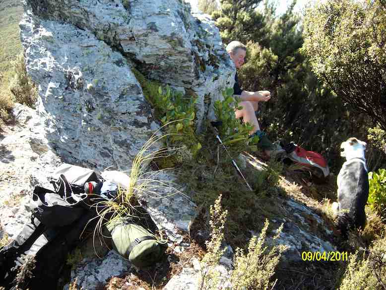
Lunch stop site on Rosella Ridge. (Ken pic and caption)
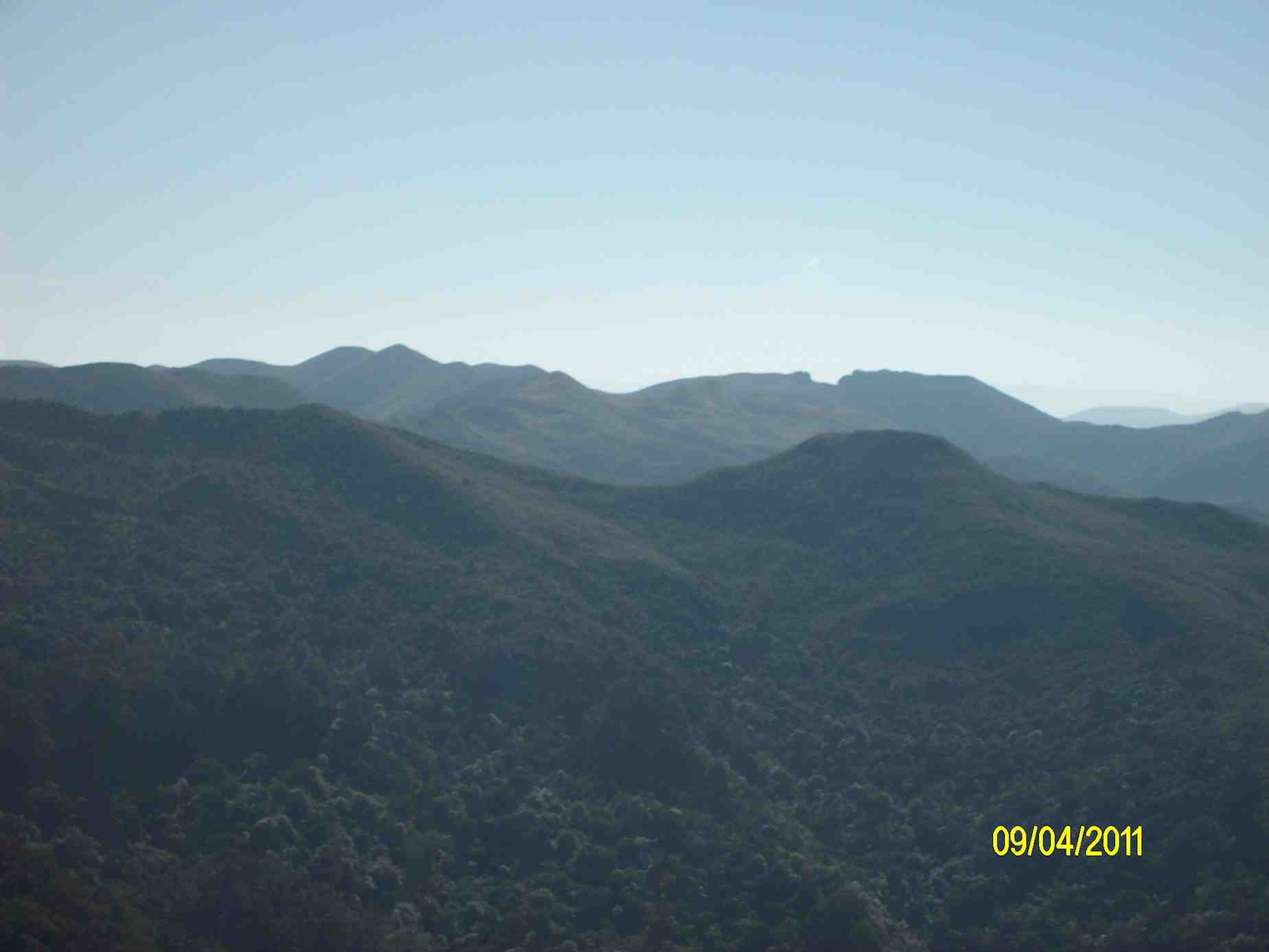
View towards the Gap from lunch stop. (Ken pic and caption)
Faint track we had to follow after lunch. (Ken pic and caption)

Junction of Rosella Ridge track with Walkers and Hunters tracks. (Ken pic and caption)
Brilliant guys! Thanks for posting, Dermot. I’d love to do this when I’m fitter…
Are you fit enough yet Dee ??