Nov 20 2022
Walrus Bridge. Nardoo Scientific Reserve. Little Peak.

Tramp area map
Suggest leave Mosgiel 8.30am to get to ‘Little Peak about 1km above ‘Walrus rock’.
10. 16/11/2022. Trampers. Nardoo Reserve: Walrus Bridge Rock. Grade 3.5 Leaders: Phil Keene and Graeme Souter
Was this going to be one of those on again off again days? Well no as eleven enthusiastic trampers
turned up ready to go at 8.30am… although we were starting to think of a plan B as we travelled through
rain to the Strath Taieri… however lo and behold the weather cleared, Lake Mahinerangi was calm, yay
no wind on the tops, and the clay extension of Lammerlaw Rd through Waipori Station was dry. Tailing
was underway and the lambs were not gambolling, they were bolting and calling to mum. The Hereford
calves had nice clean socks on and were top of the fashion parade.
We set off at 9.45am and shortly practised our fence and gate hopping and climbing to enter the reserve,
where a ‘before’ photo was taken.
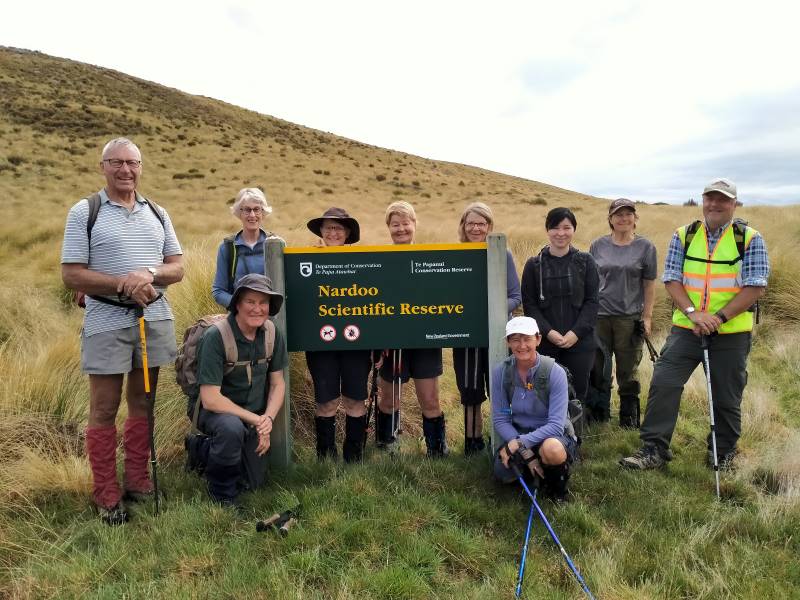
The ‘before’ Caption and photo Phil
We followed the remnants of a graded track that all too soon was lost
in snow tussock country.
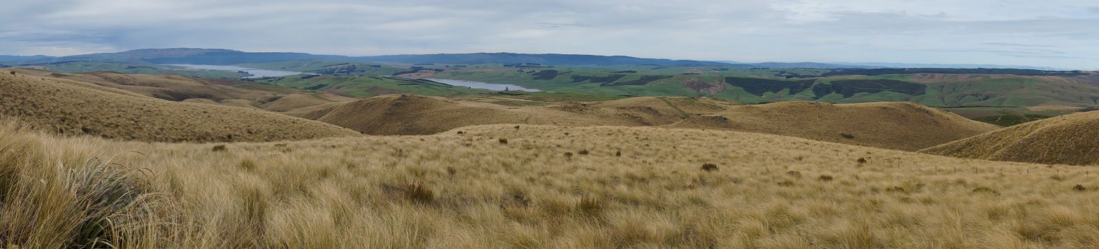
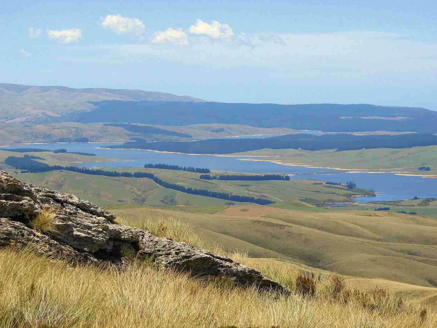
Looking back to Lake Mahinerangi and beyond. Caption and photo John
A short sharp start to the day, before settling in to a steady upward ascent,
closely following each other to eliminate miss-steps and help form a clear ‘track’ to assist the return
journey – would it work?

Where we’re heading (ie. up!) Caption and photo John
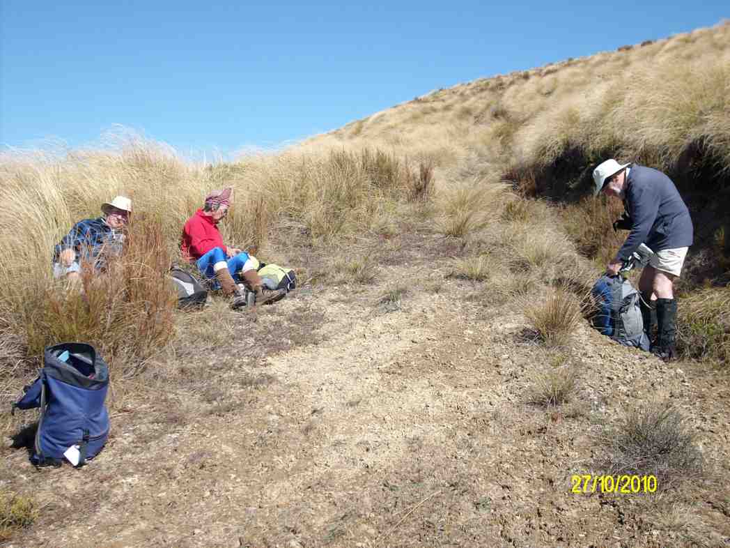
We had morning tea on a rock outcrop festooned with lichen and a soft ‘magic’ yellow carpet of vegetable
sheep…were we already visioning?
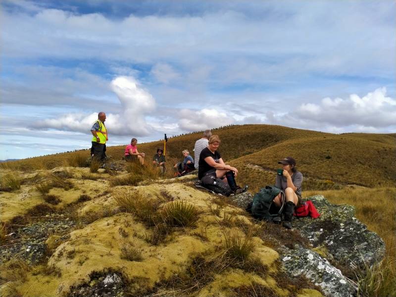
Morning tea on a magic yellow carpet of vegetable sheep Caption and photo Phil
For the balance of the morning we crossed low saddles and followed
a line of drachophyllum that had colonised the initial track and we stayed up on the ‘faces’ zig zagging to
and fro as we got close to the boundary fences. Keep out of the gullies being the mantra of the day.
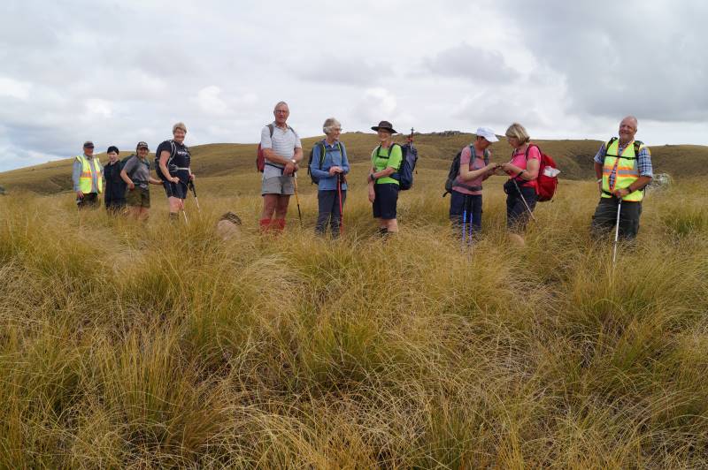
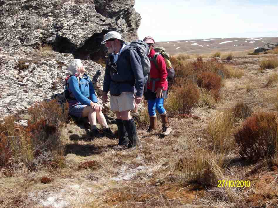
Happy trampers, during a regroup stop. Caption and Photo John
Initially the Blue Mountains dominated the views to the west, then Mt Wendon and higher still the Old
Man Range. Still no wind going by the blades of the wind farm… the tussock was dry to touch.

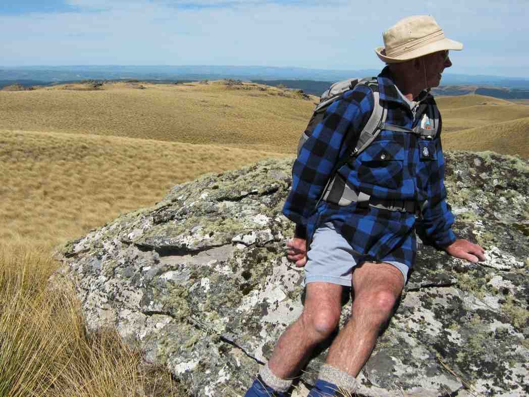
Head to Little Peak, that rock on the horizon. Caption and photo Sarah
We veered to the right near the top and made our way to the Walrus Bridge rock, where with dark clouds
building we decided to forgo Little Rock, and had our lunch right on high noon.

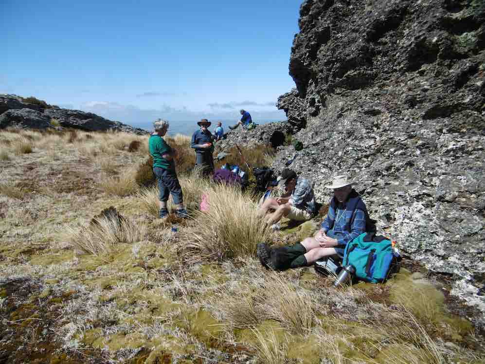
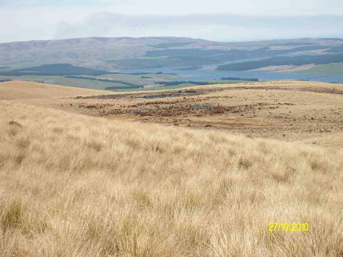
Hidden lake lunch stop. Caption and photo John
No sooner had we sat
down than a few spots of rain became steady rain and rather soggy sandwiches were dealt to. Coats and
covers came out, some of the fit and experienced trampers discovering for the first time that their packs
had built in rain covers…..gee no rain on a Wednesday for 3 years according to Charlie!
Clearly this was now going to be a game of two halves and a determined team set off, the descent much
quicker than that done on the recce, but maybe that was enhanced by the much clearer track created on the
way up – yeah right!
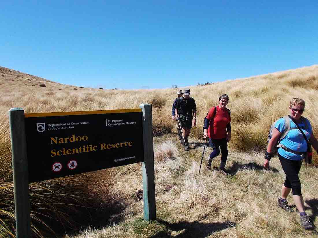
We were back at the cars about 1.30pm having stopped at the Reserve sign for the ‘after’ photo, was this
the same group of happy trampers? Yes they are all smiling!

The ‘after’ Caption and photo Phil
Wet gear was quickly placed into the car boots and the cars were soon steaming up….everyone agreed to
forgo coffee as hot showers and dry clothes seemed the more important…
It was heartening to hear the comment that the GPS map showed that we managed to follow the same
‘path’ both up and down… a testament to the leaders! Thanks to Esther and Neil also for taking their
vehicles that got suitably muddied on the way out…..and to Waipori Station for access.
Phil K
9. 29/1/2020. Trampers. Nardoo Reserve. Leader Phil
17 trampers headed off in to the wild blue yonder in vehicles suited to the terrain; picking up Chris at Lee Stream and then on to and up past Lake Mahinerangi ( according to one translation – ‘ moon glow of the heavens’; the lake being named after the Dunedin Mayor Burnett’s daughter, Neil S commenting he did not know marijuana was smoked back in those days).
We ventured past the windfarm and on down and up past the ‘old’ Waipori Cemetery ( prompting the question from John – where is the ‘new’ Cemetery?), the Lammerlaw bridge crossing and through Waipori Station, following large tractors doing silage on the lower slopes, till we came to the road end – where we startled 3 fine red deer spikers that easily hurdled the fences and raced off down the valley. Gary needed to be restrained and was seen to be frothing at the mouth and muttering under his breath….
Having saddled up we traced around an old water race, one of 16km of races that served the Waipori goldfields, and entered the Nardoo Scientific Reserve ( the sign not being visible from the road end) where a group photo was requested, it being decided we may not look so good if the photo was taken at the end! (this proved to be so true).
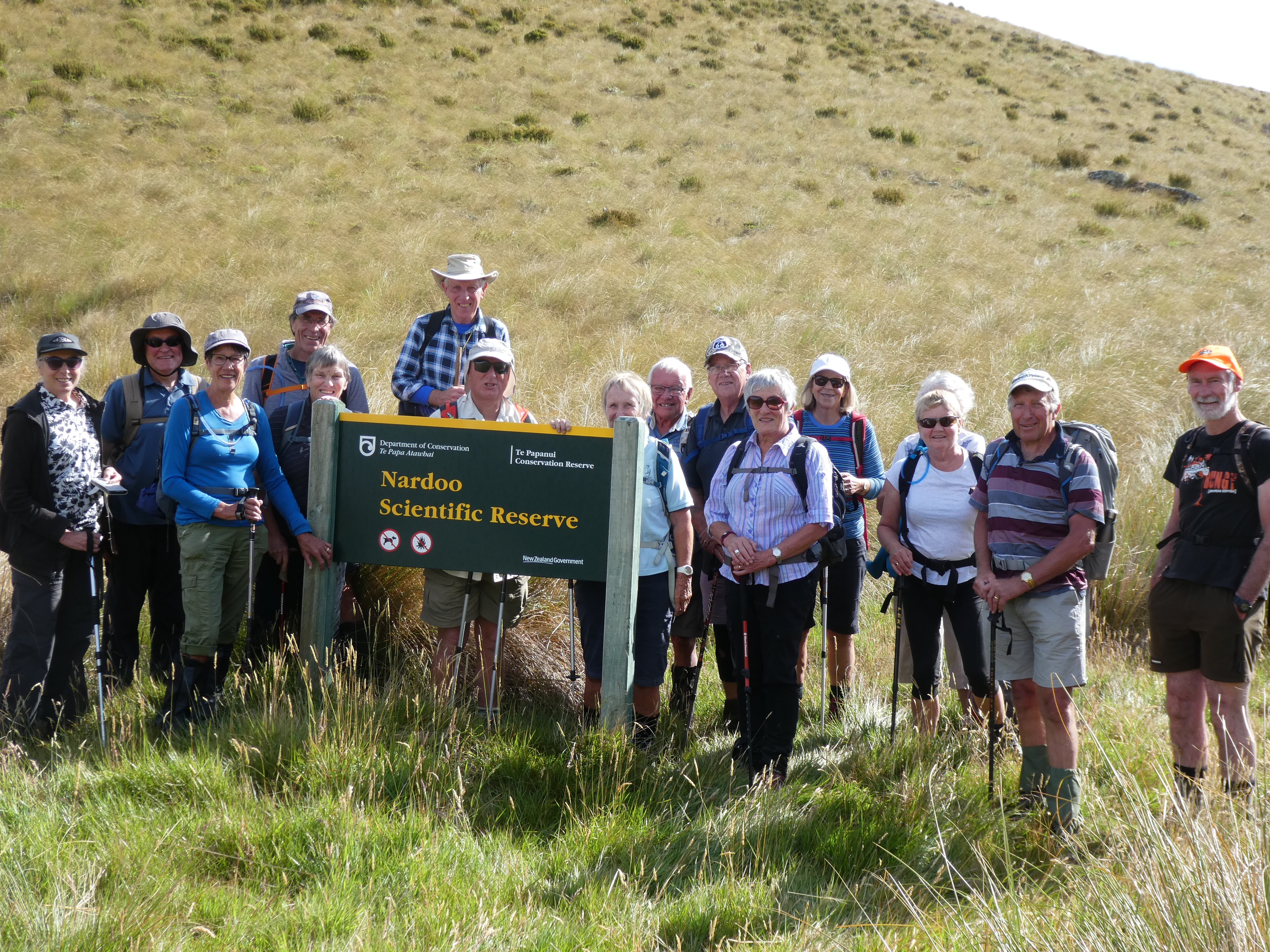
Photo and Caption Gordon – “All 17 and all still happy”
A bit of useless info was provided on the meaning of Nardoo, thanks to Dr Google….a name given in India to a plant powder used in cooking and also called ‘aboriginal flour’ in the West Island, having been extracted from a type of fern……not sure who has the naming rights.
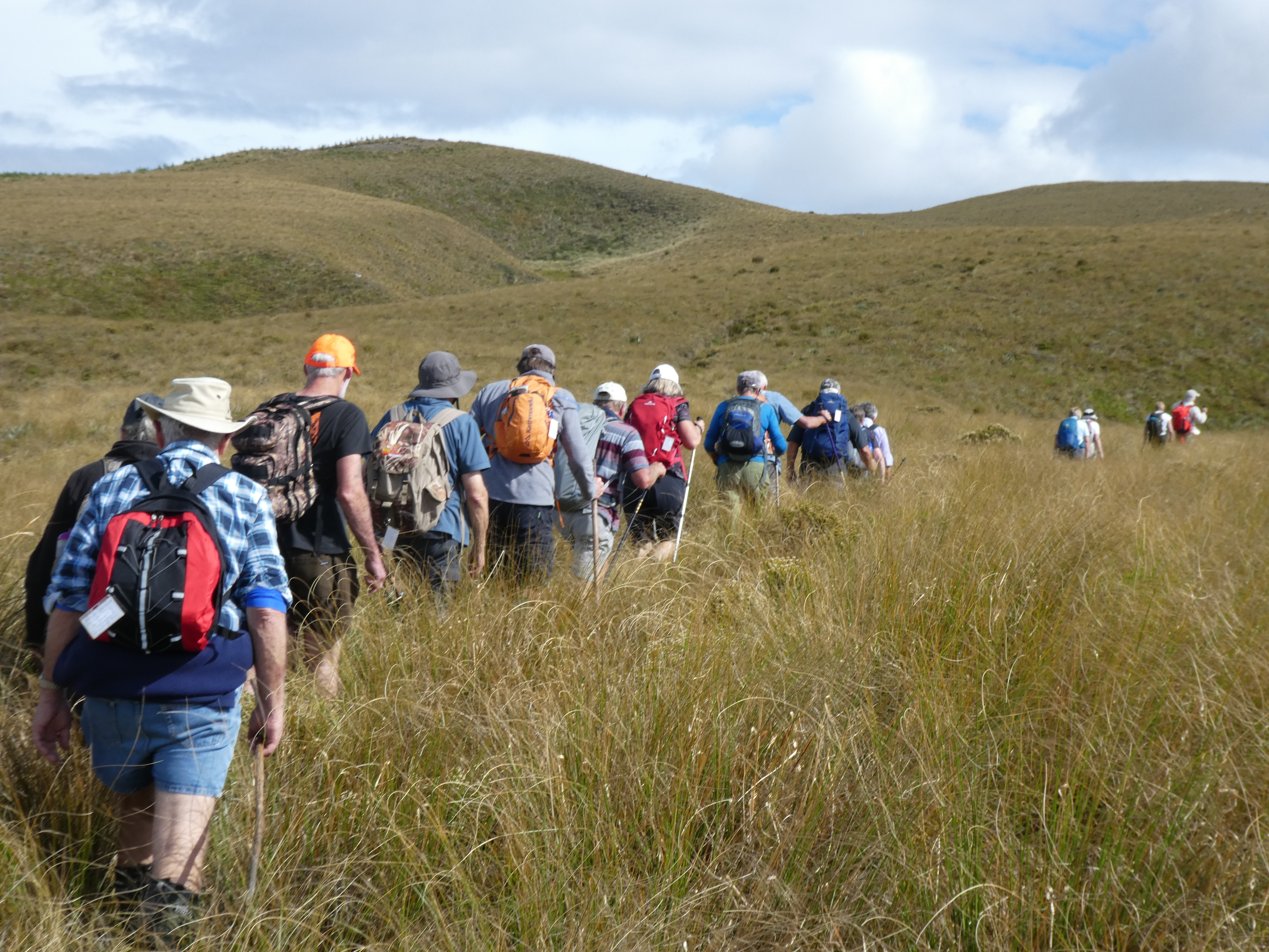
Photo and Caption Gordon – “Heading to morning tea break”
It was then onwards and upwards through a ‘garden’ where over 500 different plants exist, competing with and strangling each other in the process and yes well almost the trampers themselves, as we picked up our feet to negotiate silver tussock and spaniards and ground coprosmas and celmisias, these all punctuated by windflowers and the higher we went the purple orchid, Thelymitra.
Morning tea was provided on the first main rock outcrop where views to the Blue Mountains, the windfarm approaching Lawrence and on around to the Waipori catchment , the Maungatua and to Swampy and Flagstaff and the Silverpeaks were evident. The main route for goldminers in 1861 from Outram, the upper Maungatua and across the upper Waipori River and leading ridge to Gabriel’s Gully was outlined as well as where 2000 folk lived and mined in the 1860’s at Waipori Township.
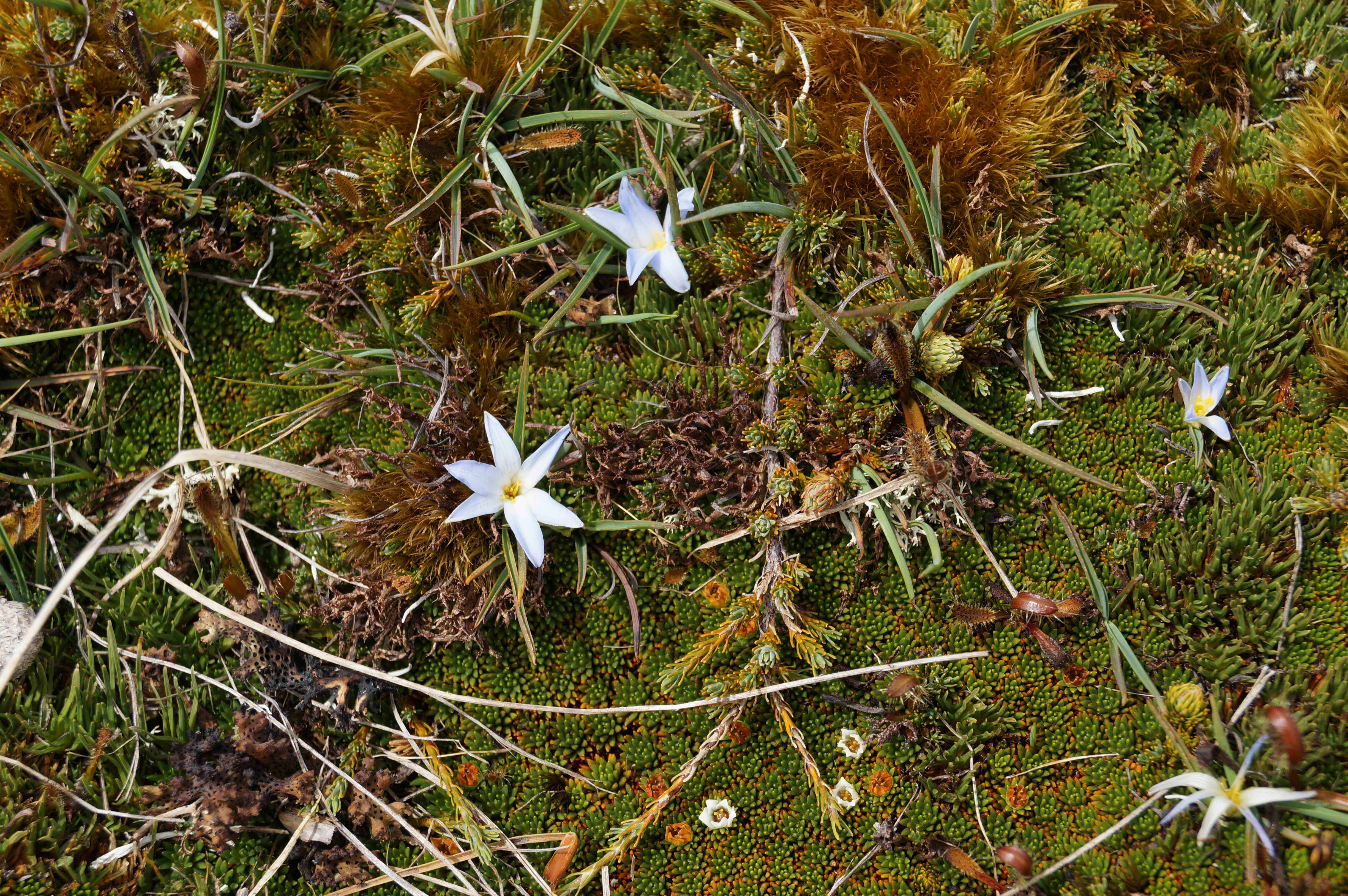
Photo and Caption John – “Pale blue flowers in bloom”
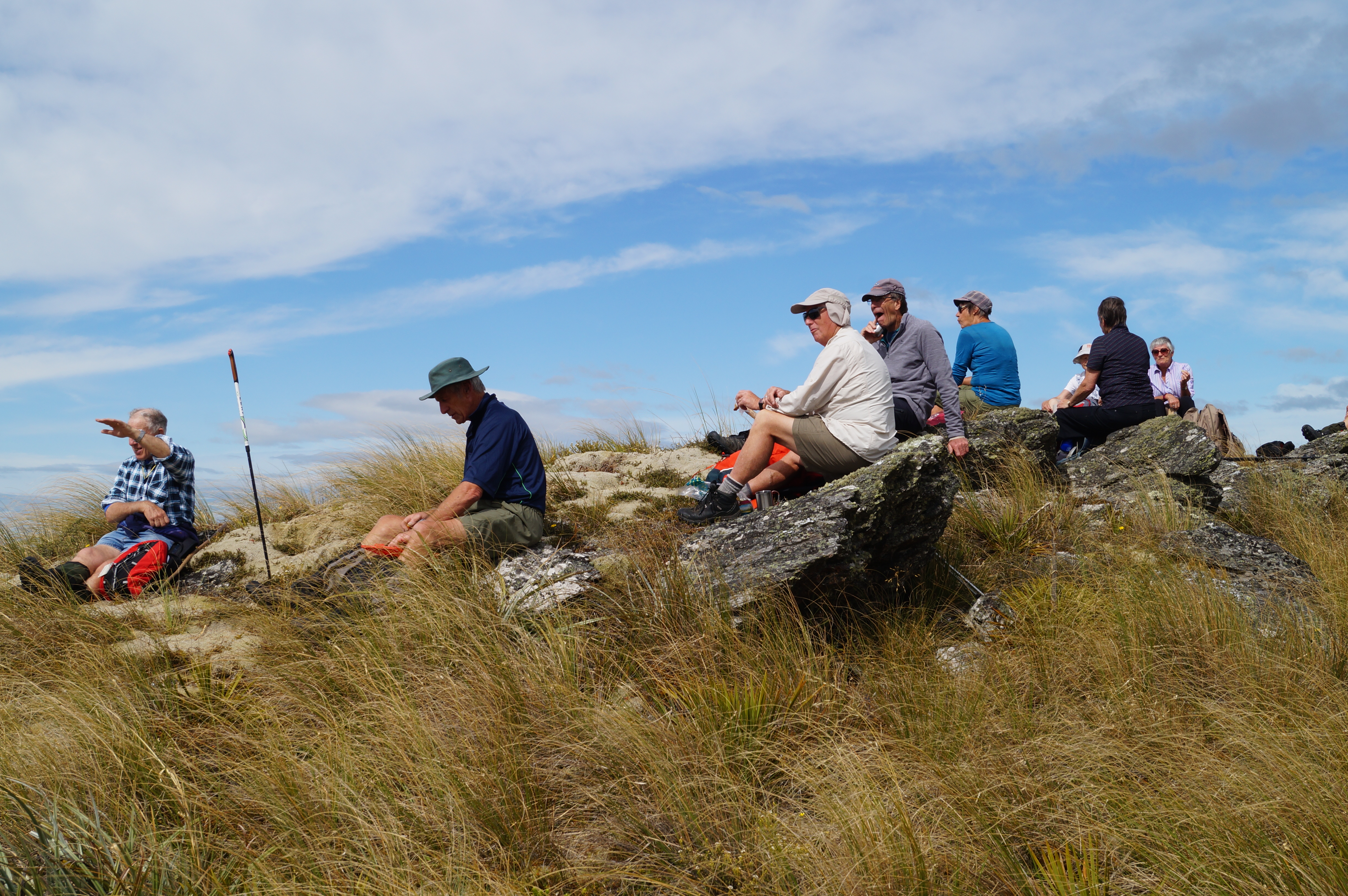
Photo and Caption John – “Morning tea from the first rocky outcrop”
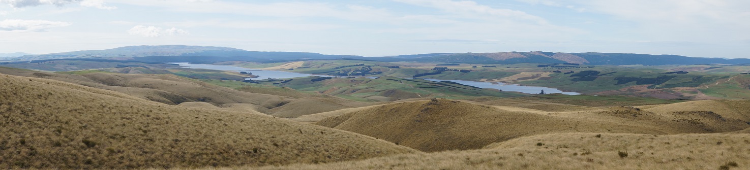
Photo and Caption John – “Lake Mahinerangi from morning tea spot”
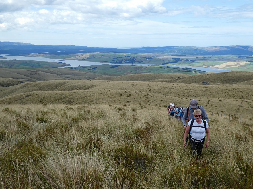
Photo and Caption Gordon – “Heading uphill to Walrus rock”
From then it was a steady ‘zig zag’ pattern across low saddles and up ridges till we made lunch at the base of the Walrus Bridge rock outcrops; the herb fields were parched (as were the trampers), dry and crisp and the models in the group posed for photos in the reflective waters of the tarn under the rock.
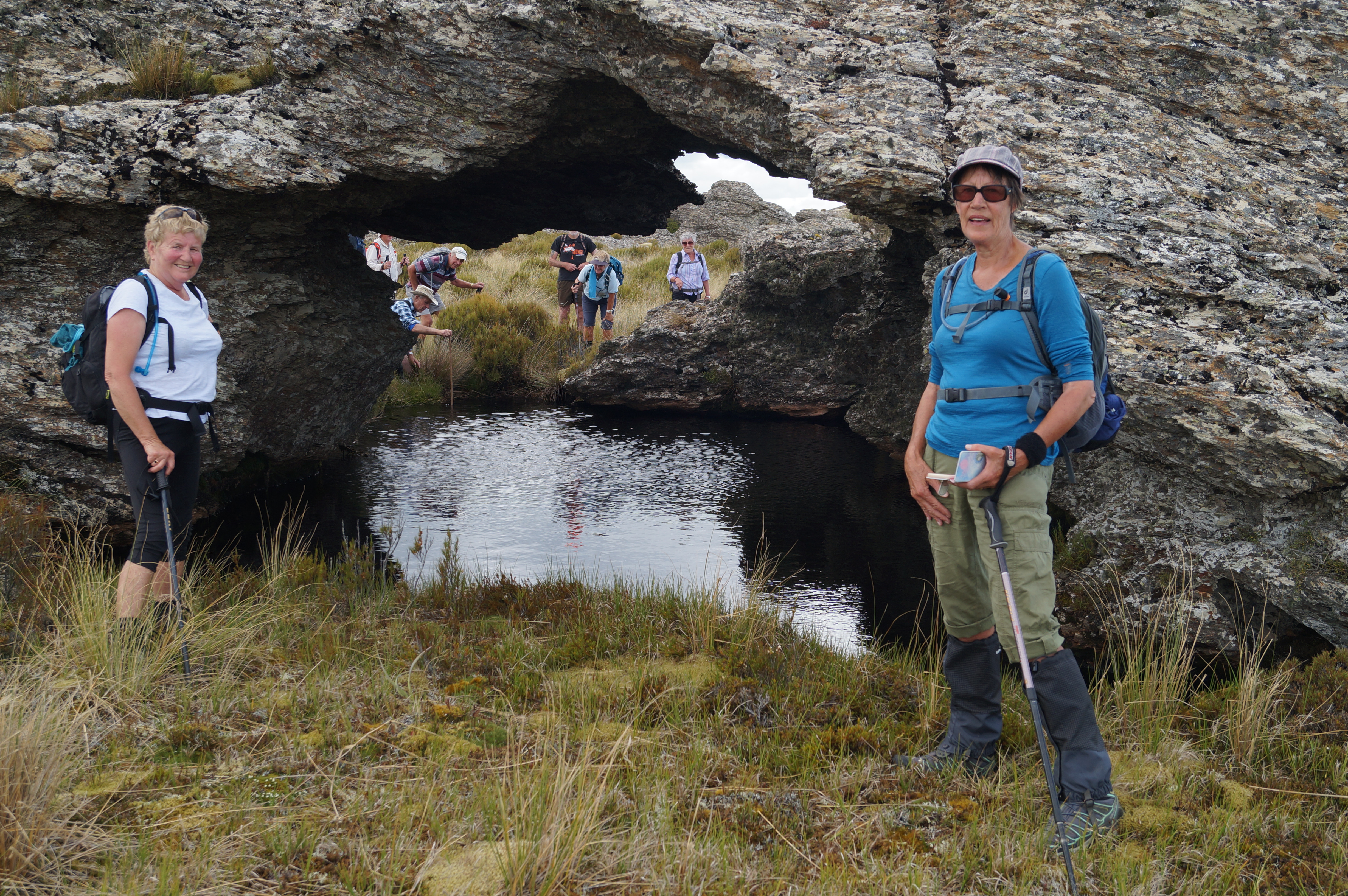
Photo and Caption Gordon – “Models posing in front of the reflective waters of the tarn at Walrus rock!”

Photo and Caption John – “Lunch out of the breeze”
It proved quite easy to ‘rest a while’ in the wonderful environment with the extensive views and silence and to spend time to find the first flowering gentian for the summer.
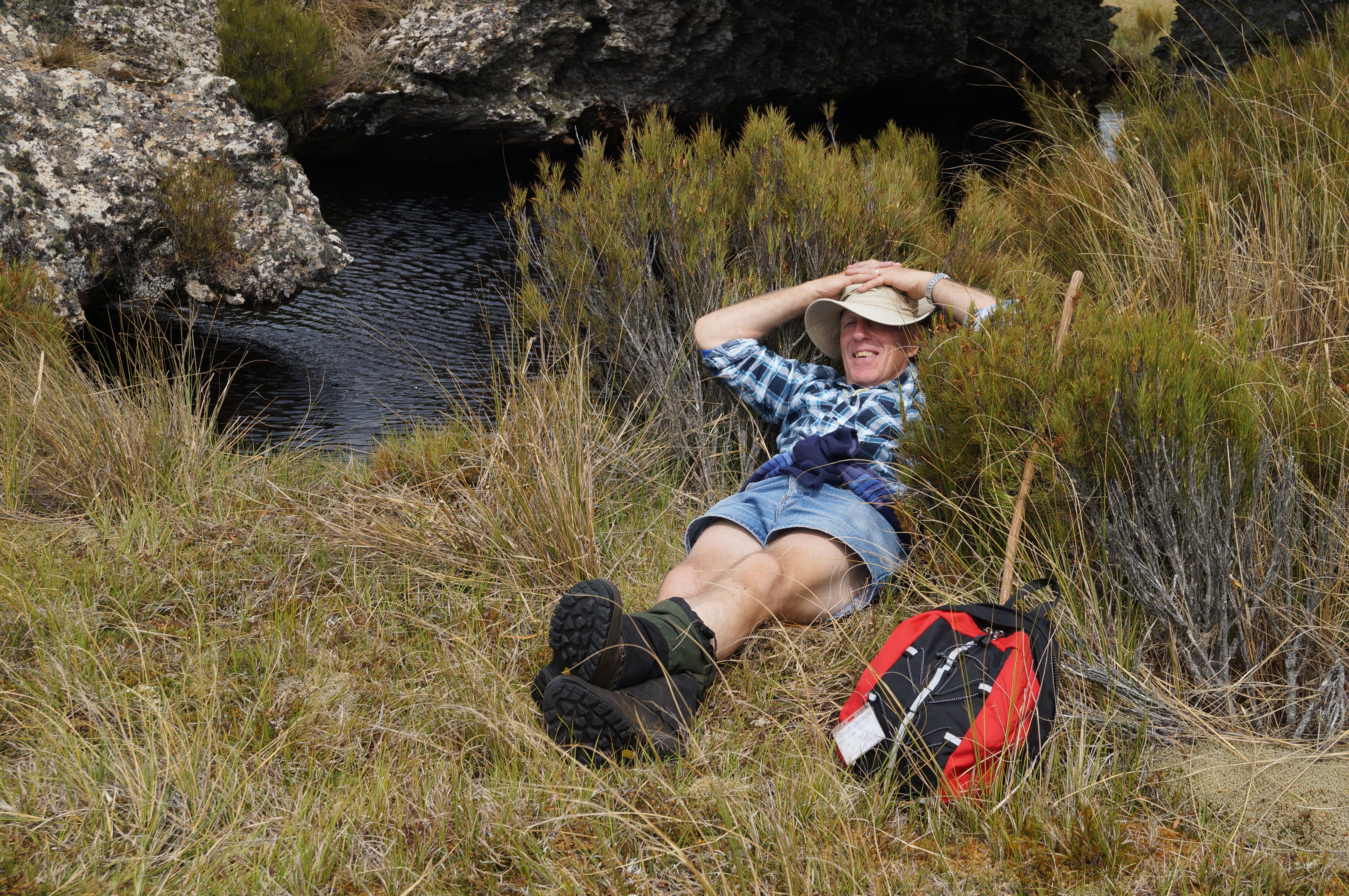
Photo and Caption John – “A well deserved break for Arthur”
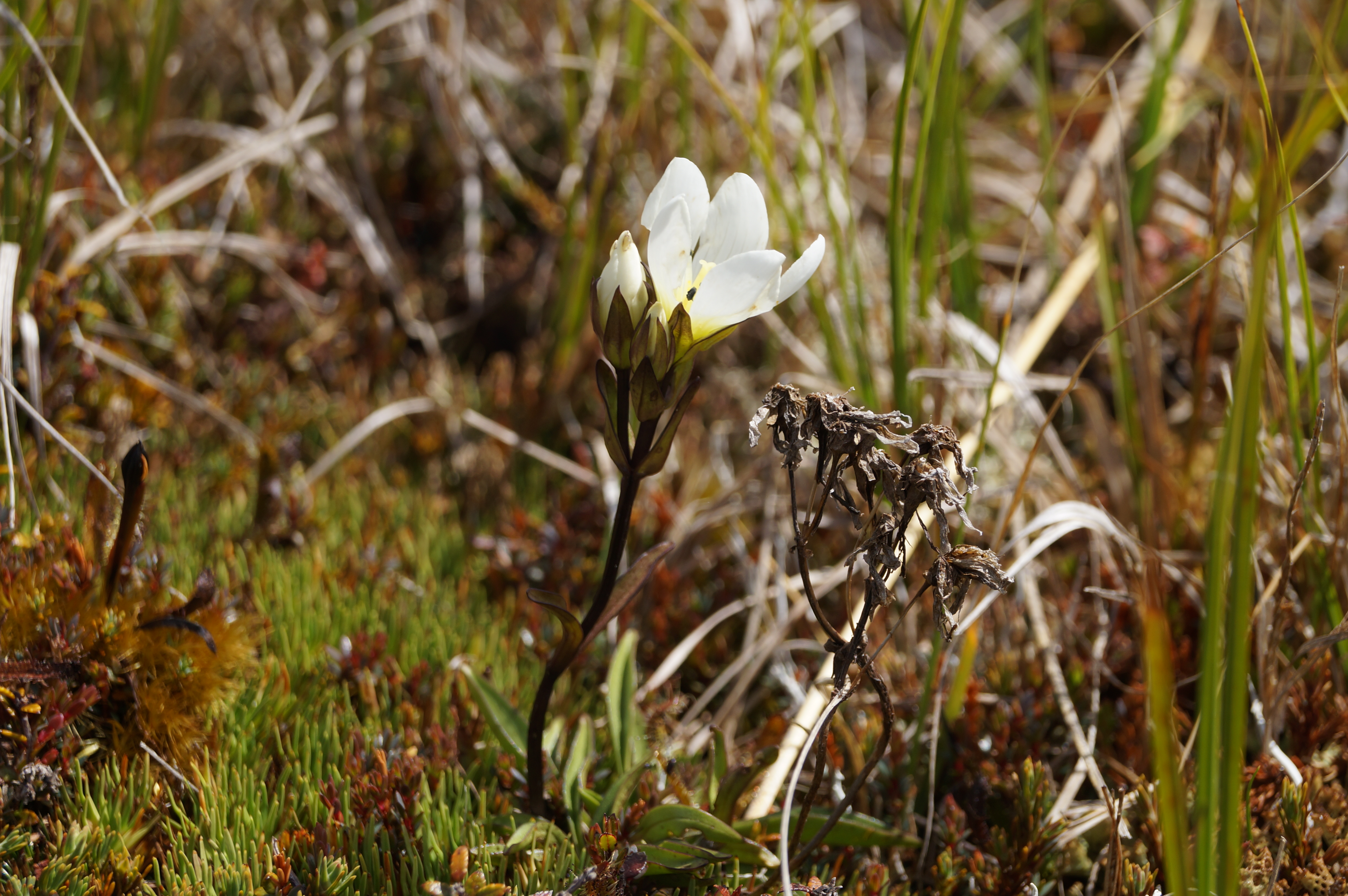
Photo and Caption John – “Beautiful flower believed to be a gentian”
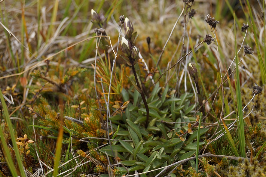
Photo and Caption John – “Small orchids could be found”

Photo and Caption John – “The very fine coral lichen”
A little thought had been given to moving on to Little Peak but it was unanimously agreed that time to return to good coffee and ice cream in Outram was the more important so downward we went trying hard to re trace our upward steps to save energy….which amazingly we managed to do, with only one or two ‘off track’ moments. A benefit of leading was seeing numerous skinks playing chicken……
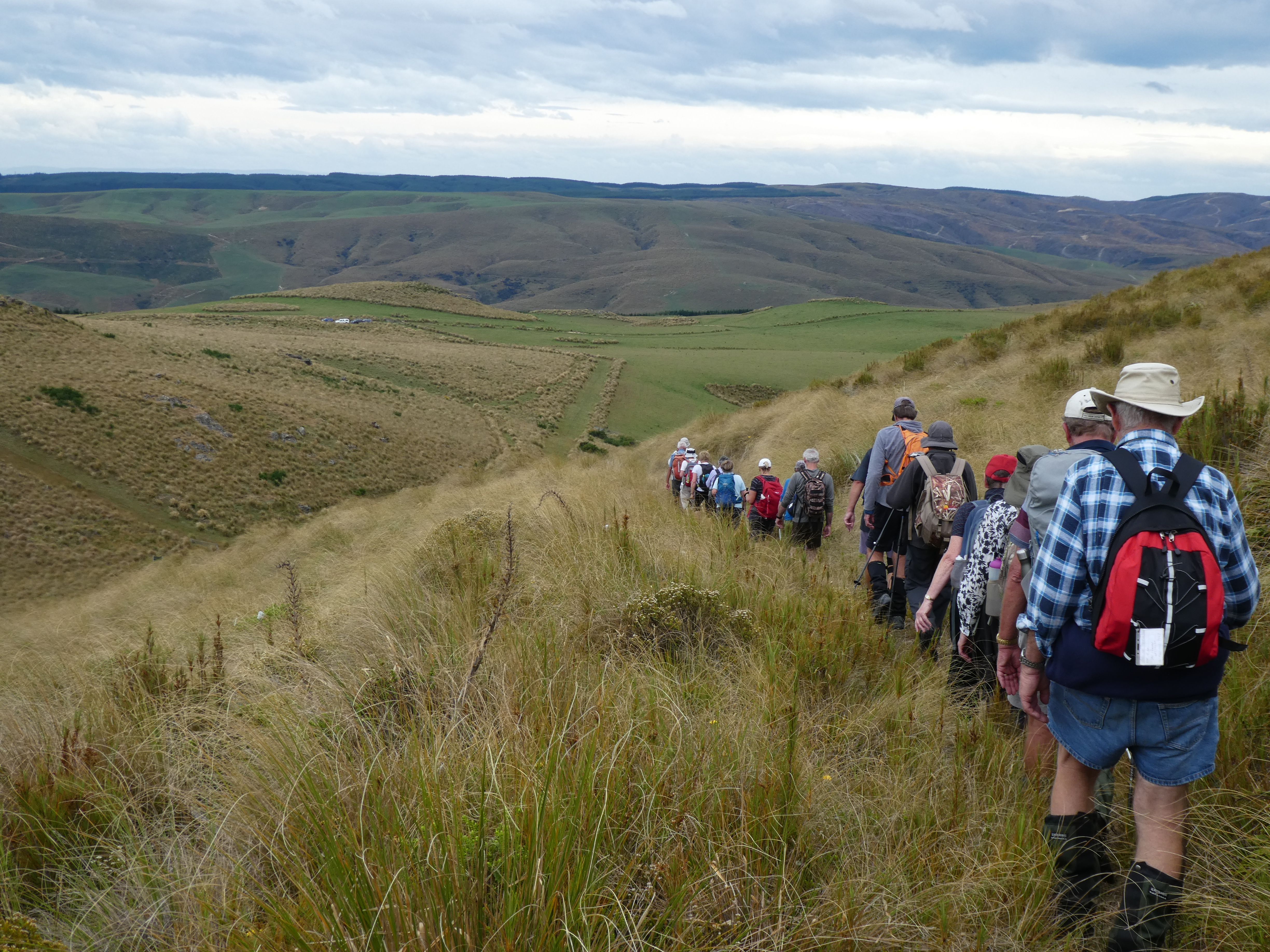
Photo and Caption Gordon – “Heading down to cars and Wobbly goat”
Not too far from the vehicles we were strafed by a low flying Cessna type plane flown by ‘Snoopy’ Morrison who gave us and received the appropriate salutes. Why he did not land on the airstrip to offer some a ride back? We managed to make it back to Outram in time to catch up with Hikers and Ramblers to finish off a great club day out.
For future Nardoo walks a suggestion is to start this walk at 8.30am to give time to get to Little Peak and a return to Outram for coffee and craic. And why not – a quote from our recent European escapade ‘ coffee does not ask difficult questions, coffee understands’!
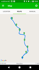
Photo and Caption Phil -” The route that we followed”
Phil

‘’ come on up Bruce, there’s a better view of the mist here”. (Phil pic and caption.)

Walrus Rock. Dave up on top. Rest underneath. (Helen pic and caption.)
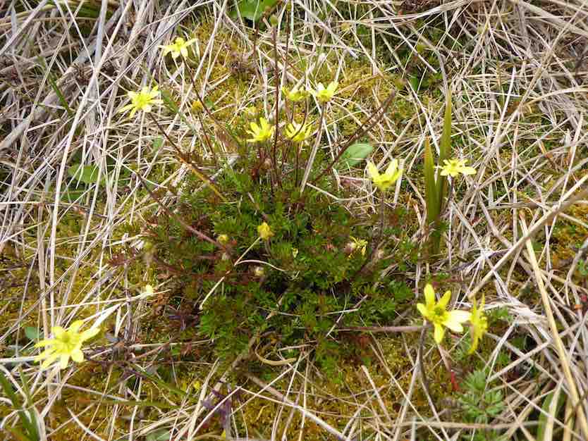
There was a lot of interest in the flower. ‘’Possibly the buttercup ranunculus gracilipis (slender) ( A Mark ‘ Above the treeline’)’’. (Phil pic and caption.)
We retraced our path in the beautiful tussock, downhill now of course, and eventually arrived back at the D.O.C. sign for a photo opportunity.

The group. (Helen pic and caption.)
And so it came to pass the 9 very happy trampers returned to the cars after a very enjoyable day in the tussock.
A brief stop was made at the Waipori Cemetery on the way back. A tranquil place. And Lake Mahinerangi was very low, we could see.
Back at Outram refreshments were obtained at the “Gobbly Woat”.
A few figures now – our day’s tramp distance was 8.7 km. We parked the cars at an altitude of 624 metre, and Walrus Bridge was at 934 metres.
My thanks to all my fellow “tussock jumpers” for such a good day out. – Art.
After a tentative drive along the road from Lake Mahinarangi, past the old Waipori cemetery, desperately looking for any sign that I remembered where we were, we finally arrived at the parking spot where we would start walking from.
As it was already just after 10am, we decided to have morning tea before setting off on our walk. Then it was off along the old 4WD track around to the boundary fence of Nardoo Reserve, where we were puzzled by the fact that the gate was open into the reserve. This was later explained to me by the owner of the surrounding land, who had a legit reason for it being open.
On the way up…

Some great scenery (Heb pic, Ken caption)
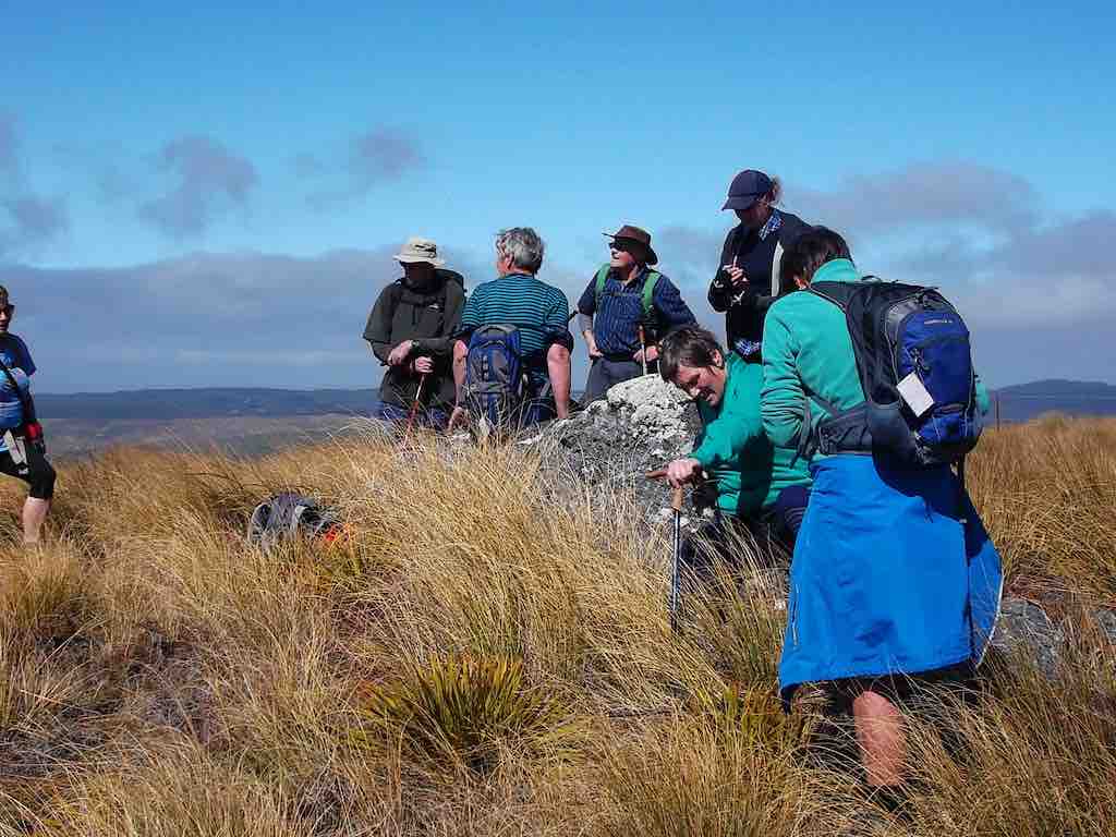
Taking a break on the way up (Heb pic, Ken caption)
After having lunch at Walrus Bridge,
Lunch at Walrus Bridge (Heb pic, Ken caption)
Exiting the reserve (Heb pic, Ken caption)
There were some appreciative comments made about the trip, so I think everybody enjoyed the day out on the open tops. And I for one have some sunburn on the back of the hand I use with my Trekking Pole.Walked 9km
3.1km/h
2h 54mins moving
climbed 382mtrs
max height 972mtrs.

GPS of Tramp. 10km. courtesy Ken.
Morning tea on the zig-zag. (Ken pic)

View of Little Peak just discernable on skyline. About to climb wee hill on our left. 4WD track visible in tussock.
Break at Walrus Bridge. (Ken pic)
Rock where we had lunch. Little Peak rocks in back-ground.
Deep blue of tarns viewed from lunch spot. Lake Mahinerangi. (Ken pic)
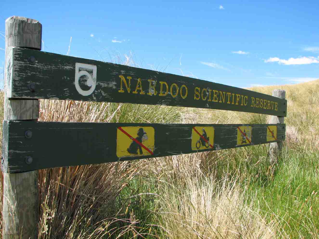
Nardoo sign. (Bill pic)
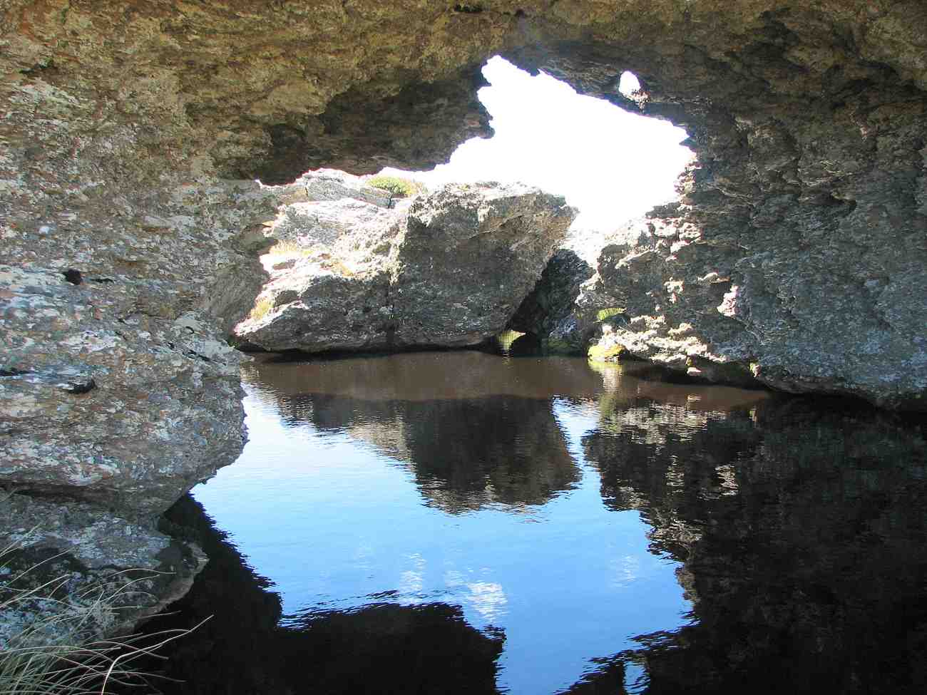
Close-up view under Walrus Bridge/ (Bill pic)
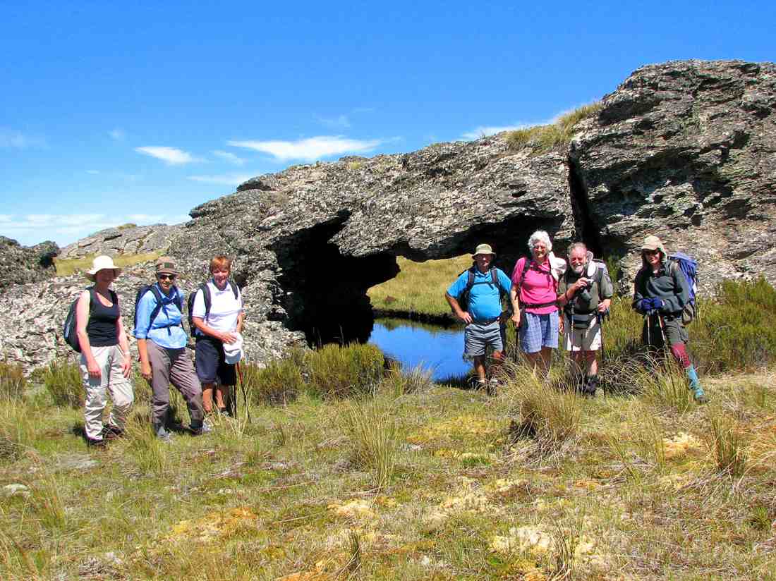
We posed. Emma, Marjorie, Tash, Doug, Hazel, Ian, Bruce.
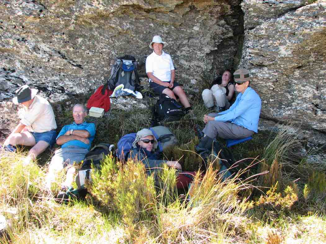
Lunch snooze. Ken, Doug, Bruce, Tash, Emma, Marjorie (Bill pic)

Rock overhang. A walrus? (Bill pic)
Mahinerangi view
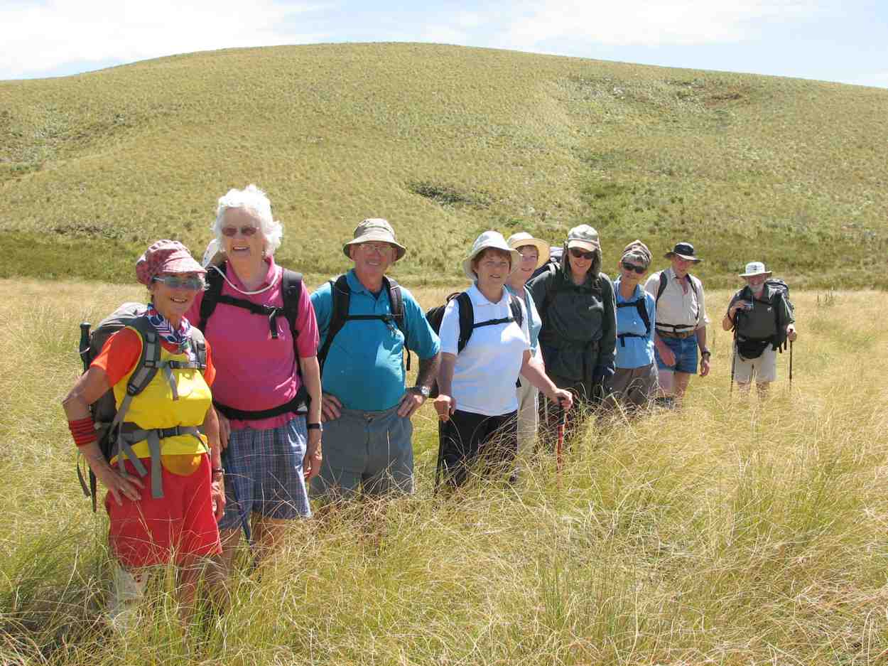
Us on way back down. Ria, Hazel, Doug, Tash, Emma, Bruce, Marjorie, Ken, Ian
Cloud effect (Bill pic)

Walrus Bridge.
Sounds like you 5 had a great time-probably too much for me tho’
Angela