Oct 02 2019
Bus Trip: Millers Flat – Beaumont rail trail / Millennium Track
No. 111 on old hardcopy list of 113 club tramps. “Bus Trip. Walk Millers Flat to Beaumont”
5. 2/10/2019. Both. Bus Trip. Millers Flat/Horseshoe Bend – Beaumont. Rail Trail-Road/ORC Millennium Track-Road. M. Eleanore and Bob.
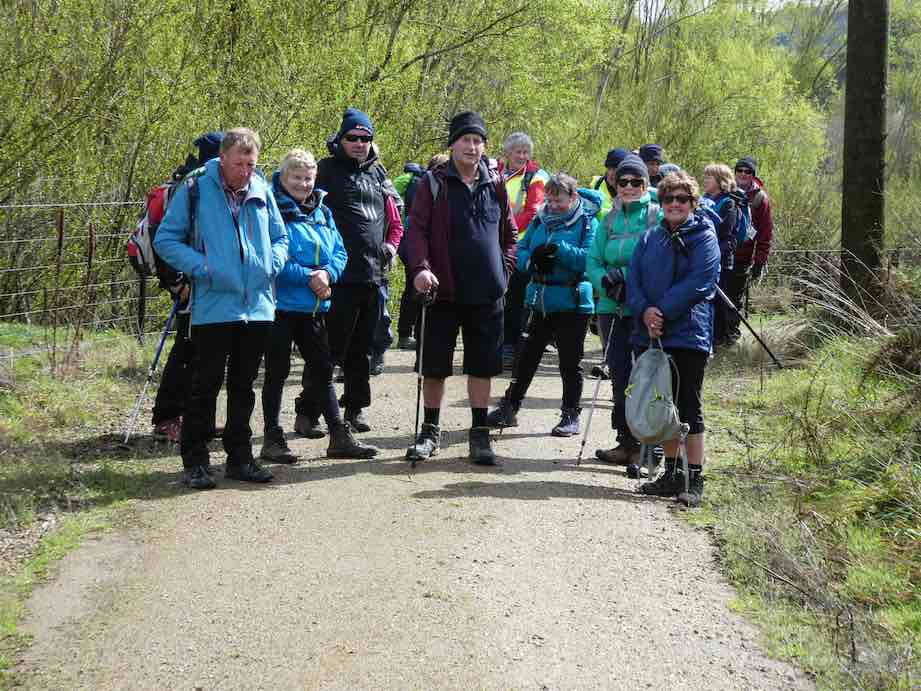
On a chilly spring morning, 45 members assembled at 8:15 a.m. eager to board bus and head Central for a walk along the Clutha Gold Trail.
We arrived at the Island Block entry at 10:10 a.m., luckily to a convenient hay barn where we had smoko.

Is this a farm machinery sale? (morning tea out of the hail). (Phi K. pic and caption.)
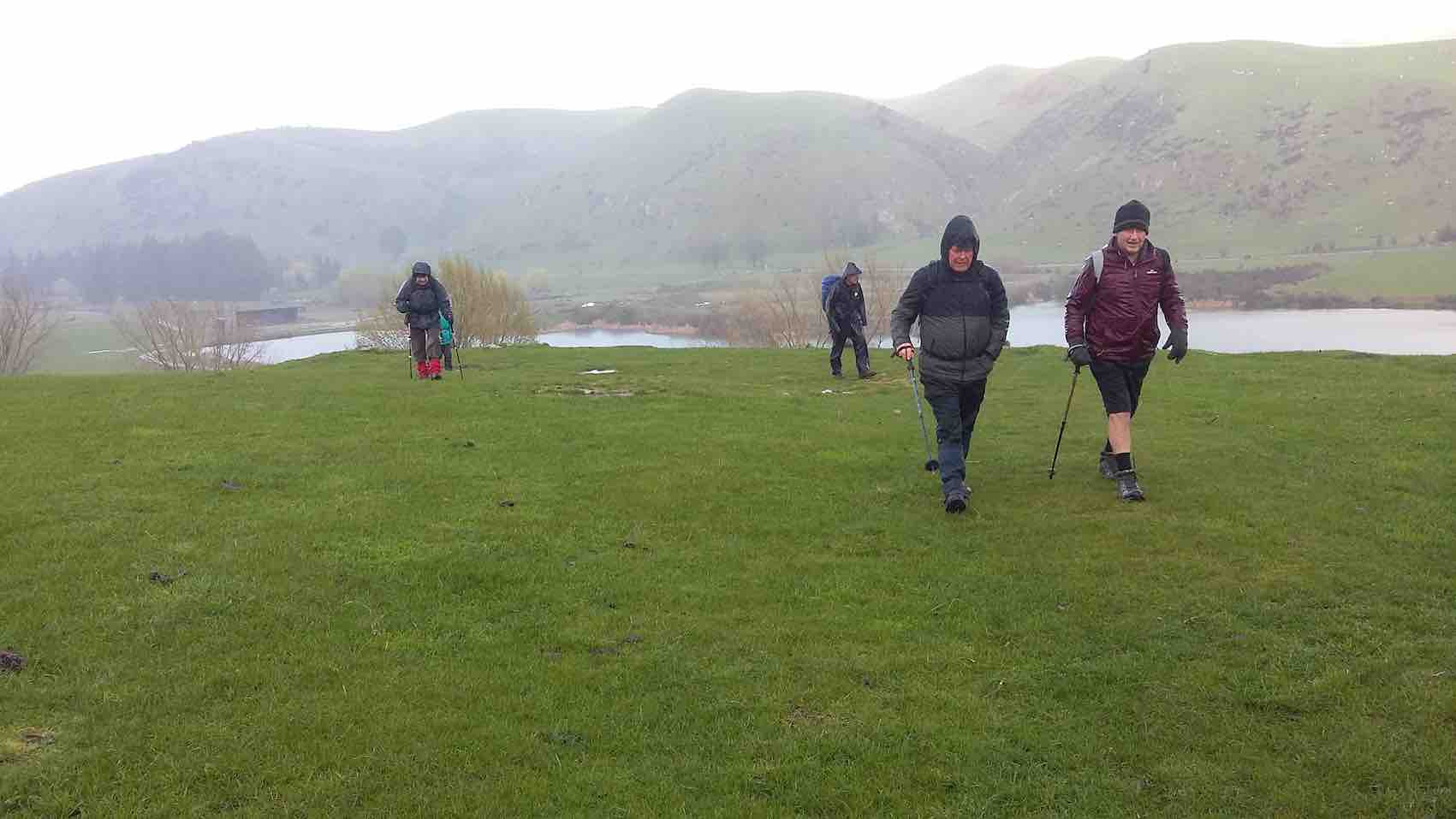
This was followed by a show of hands to see who was keen to layer up and head off in a shower of rain—17 accepted the offer to hike 3km round the hill track …
Starting off in a downpour. (Clive pic and caption.)

10 minutes later sunshine. (Clive pic and caption.)
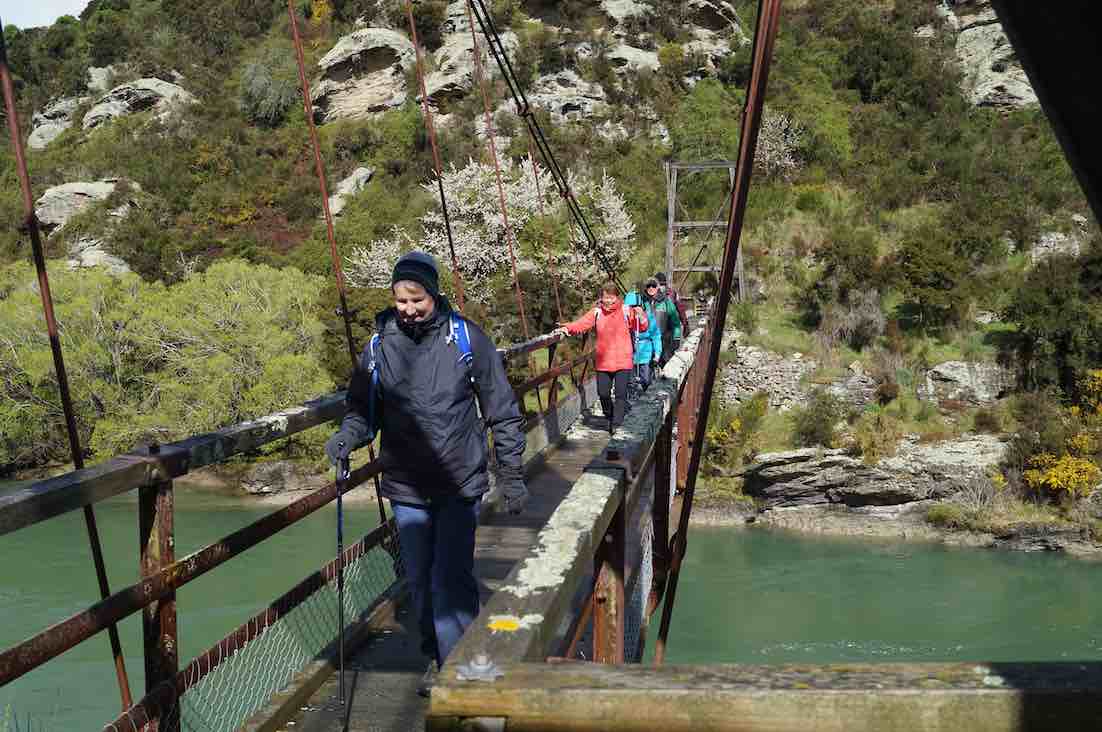
… to the Horseshoe bend swing bridge crossing the Clutha …
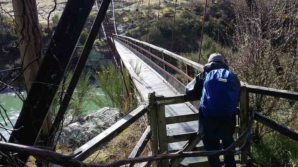
Horseshoe bend bridge. (Clive pic and caption.)
… to meet up with the rest of the group.
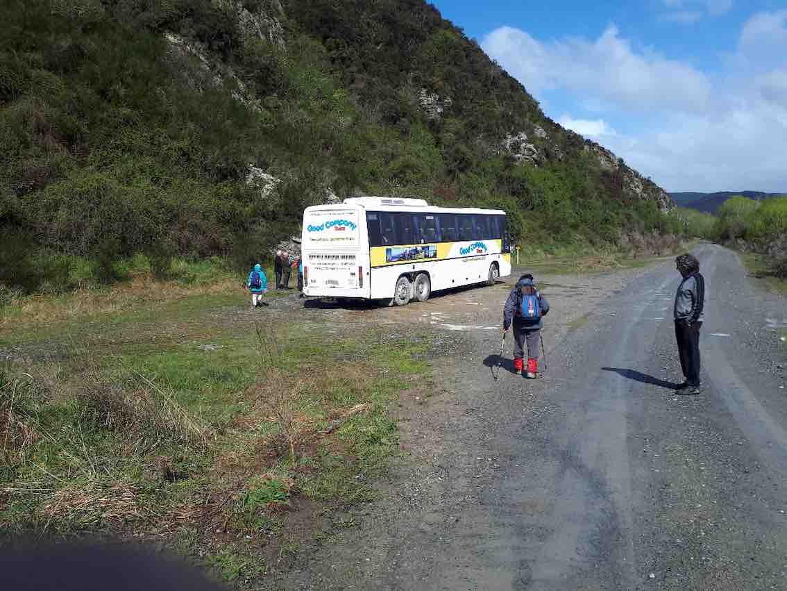
Meanwhile, we travelled to Millers Flat, crossing the Clutha and turned right heading back down the rather narrow gravel road (managed to meet a twin cab and trailer coming our way, he backed off and let us through). We passed the Lonely Grave site, then soon after arrived at Horseshoe Bend. Car Park was probably not designed as a bus turn, however, Wayne successfully manoeuvred his bus turn.
The majority got off in sunshine
Some of the hardy lot heading to the swing bridge. (Gordon pic and caption.)
to head along the trail. Looking back we spotted the first group hot on our heels.
(John G pic.)
The Ramblers were happy to enjoy the bus trip back to Beaumont where some intended to hike along from the bridge and back. I also heard a whisper on the bus, some were happy to try out lunch at the hotel.
We stopped for lunch
Where/when are we stopping for lunch? (Gordon pic and caption.)
by a little old shed and cattle stop at 12:15 p.m. for half an hour firstly in sunshine,
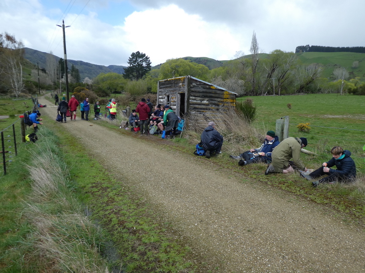
Very handy lunch stop. (Gordon pic and caption.)
followed by another shower (Lots sheltered in the shed).
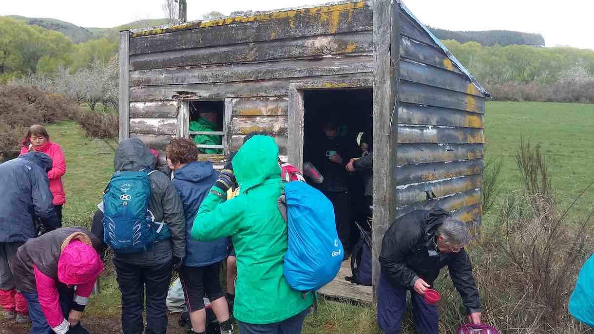
Lunch – no one wanted to eat inside this hut until the hail started. (Clive pic and caption.)
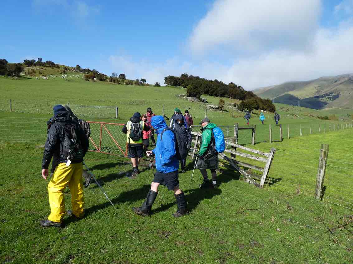
We all set off
Preparing to move out. (Gordon pic and caption.)
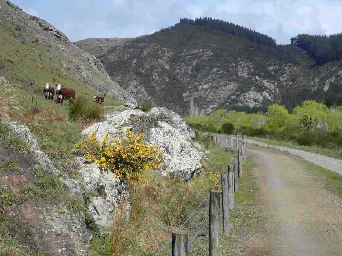
enjoying looking at fresh bright willow leaves, healthy Hereford cows,
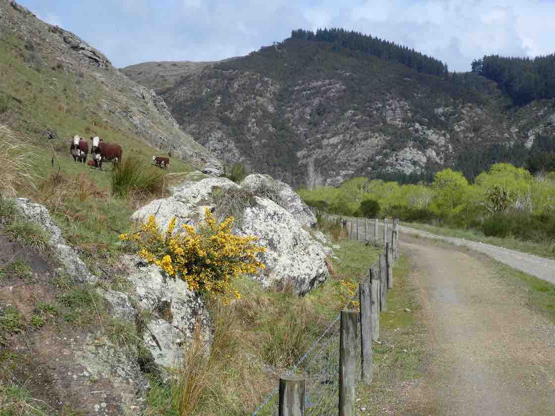
Some interested spectators. (Gordon pic and caption.)
the mighty Clutha,
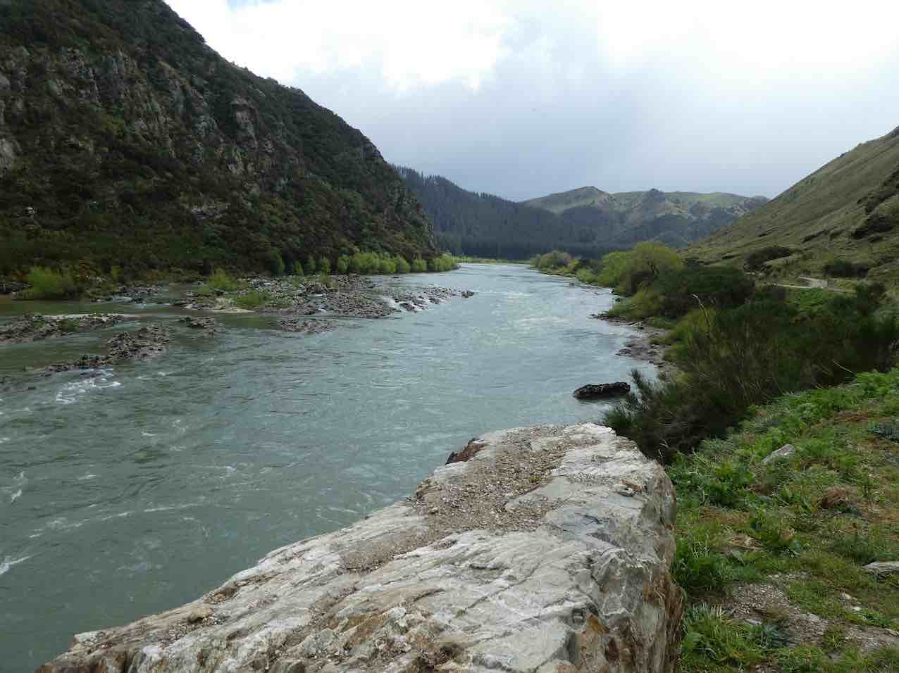
A very full river not far from journeys end. (Gordon pic and caption.)
blossom
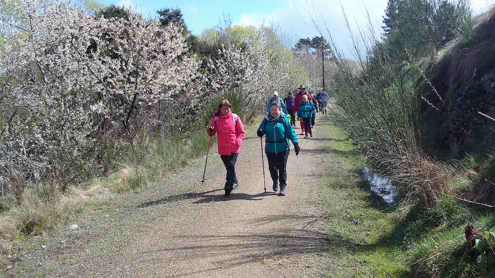
Cherry blossom hike. (Clive pic and caption.)
and particularly the easy grade of the track.
We arrived back to the bus …
We made it. (Eneanore pic and caption.)
… at 3.00 p.m. after a 14km (17km) trot along the trail.
Afternoon tea was pre arranged at the hotel for $10. We were greeted with very friendly staff and a great spread, including scones with jam and cream! YUM. We thanked them and they thanked us for the business. Was great to observe how happy everyone was enjoying catching up with each other. Particularly, with Judy Knox, who was on her last outing before moving to Townsville. I am sure you will come back and visit us Judy. We sure will miss you!!
We arrived home about 5:15 p.m. after a great day out. Thanks to the Club for subsidising the bus.
Eleanore and Bob.

Horseshoe Bend Bridge. (Ken pic)

DoC Information Panel. (Ken pic)

Vie up-stream from bridge. (Ken pic)

View down-stream from bridge. (Ken pic)

Bridge decking viewed from other side. (Ken pic)

“Somebody’s Darling” grave, a bit further down the track. (Ken pic)

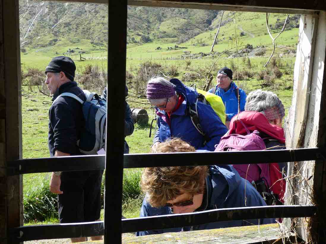
Lunch a little later in welcome shade. (Ken pic?) Foreground: Ian Ken Lex, Neil. Backgroud: Lesley, Angela

Bridge at Horseshoe Bend. (Bill pic).

Bridge, Horseshoe Bend. (Bill pic).

Grave. (Bill pic).

Headstone (Bill pic).

Weed Spraying. Poisonous? (Bill pic).

River View.
On Monday October 10th 1994, 44 members of the Taieri Recreational Tramping Club left Mosgiel at 7.45 a.m. by bus. They travelled to Millers Flat and were taken 8km down the River Road to Mr Jeff Thomson’s farm.
After a talk by Mr High Dickson on local history of the area, we walked over Thomsons Farm to the last suspension bridge on the Clutha River. From there we walked back to the road and stopped at the Lonely Graves for smoko.
After smoko, we carried on down the road which was mainly the now disused Roxburgh Railway Line, and stopped for lunch at about 12.30.
The track was in fairly good condition with a few muddy areas thrown in.
We reached the Beaumont Bridge where the bus was parked at 2.30 p.m. and by 3.00 we were on the way home.
An estimate of the total walk was 16 km and including time for smoko and lunch, the trip lasted for 4.5 hours. We were back in Mosgiel by 5.00 p.m.
Hugh Dickson’s typed notes, 10/10/1994. –
THE RIVER
A few kilometres south of Millers Flat is Island Block, where some thousands of year ago the Clutha, or as it used to be called, the Molyneux, ran in a bed different from where it does today. At that time it occupied a bed on this, the main road side, of the high land. Due to erosion along the other side it changed its course to the bed it occupies today.
There is a project now underway to extract gold from the old riverbed. The overburden is removed and the gold-bearing gravel fed into a dredge floating on a small pond which is moved along as the mining progresses. After the gold is extracted the gravel and topsoil are replaced and the land returned to its natural state. This can be seen from the bus as we pass.
THE GOLD
At the point where we turn the bus on the other side of the river is a site dating back to the gold-rush when in 1863 three Irishmen, James Lundy, James Sullivan and William Ford, acting on local information discovered gold at this spot and pegged their claims. The ensuing gold rush resulted in a settlement growing up called Horseshoe Bend, which had, at the height of the rush, several hundred people living there.
After the easy gold was recovered, mining was continued by the sluicing method, and there is, on the site, a sluice which was made by cutting through a solid rock outcrop. It is about 25m long, about 1m wide at the top reducing to about half that width at the bottom, and up to about 2m deep.
There is also a cave which was converted for living in by building a stone wall across the front. Unfortunately, both these are too overgrown with gorse, broom, brambles &c to be easily seen.
During the height of the rush, the school was across the river at Island Block and the only way the children from Horseshoe Bend could attend was by riding in a primitive chair on a wire cable stretched across the river.
Early this century the only way gold-mining could be carried on was by hydraulic mining which, of course, required a fair amount of capital so there was only one company left at Horseshoe Bend owned by Robert T Stewart. His parents had, for about half a century run an accommodation House at Island Block and in 1913 he designed and built in their memory a suspension bridge which is still there at present and sufficiently in order to be used as a foot- and stock-bridge. It is constructed of heavy steel cables supported on Australian hardwood towers. The rails and decking are also of Australian hardwood and the steel-work made mainly from old railway lines. There is very little rust showing on the steel-work. It is only about 10 minutes walk from the road and well worth a visit. While it is on private land we have permission to see it. It was presented to the local council in 1922.
LONELY GRAVES
About half a kilometre down the road is the site known as Lonely Graves.
It appears that late in 1864 an ex-theological student from Dublin name William Rigney came to work on a claim at Horseshoe Bend. In 1865 work was held up due to a flood on the river and during a subsequent inspection, Rigney found the body of a good-looking young man who has apparently been drowned. After the inquest, Rigney sought permission of the coroner to give the body a decent burial. He selected a site about half a kilometre from the diggings alongside an old Maori track (which later became the railway line) and it is recorded that at the funeral every person from the diggings was present. Later Rigney erected a piece of black pine at the head of the grave on which he had burned the words “Somebody’s Darling Lies Buried Here” and he fenced it off to protect it from wandering stock.
In after years, although he was often away from the locality for long periods, Rigney took an interest in the grave. In 1902 a public subscription was taken up to erect a more permanent headstone and fence . The original piece of black pine is enclosed in a glass case and can still be seen on the grave. At this time Rigney expressed an interest in being buried there too, so after the necessary formalities were completed the plot was proclaimed a cemetery.
When Rigney died in 1912 he too was interred there and his headstone was engraved “Here lies William Rigney, the Man Who Buried Somebody’s Darling”.
When the railway came through in 1925, the Public Works Department, in response to local requests, named the Horseshoe Bend flag station “Rigney”. The site is now preserved as part of the Goldfields Park.
That is the point where we are planning to have our morning tea today. From there to the Beaumont Hotel is about 14 km of level walking which should be an easy 4 hours. So including seeing the bridge, morning tea and lunch, we should be at the hotel about 5 hours after leaving the bus.