Nov 17 2023
Doctors Point area tramps
Distance from car-park to Doctors Point: 38 km.
 25. 15/11/2023. Orokonui Circuit. Grade 3. Leaders: Graeme Souter & Gail Williams
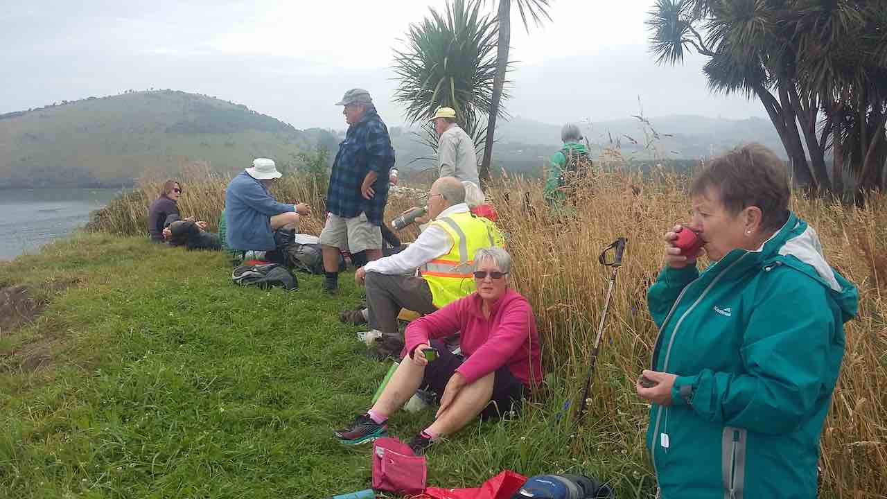
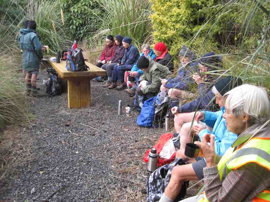
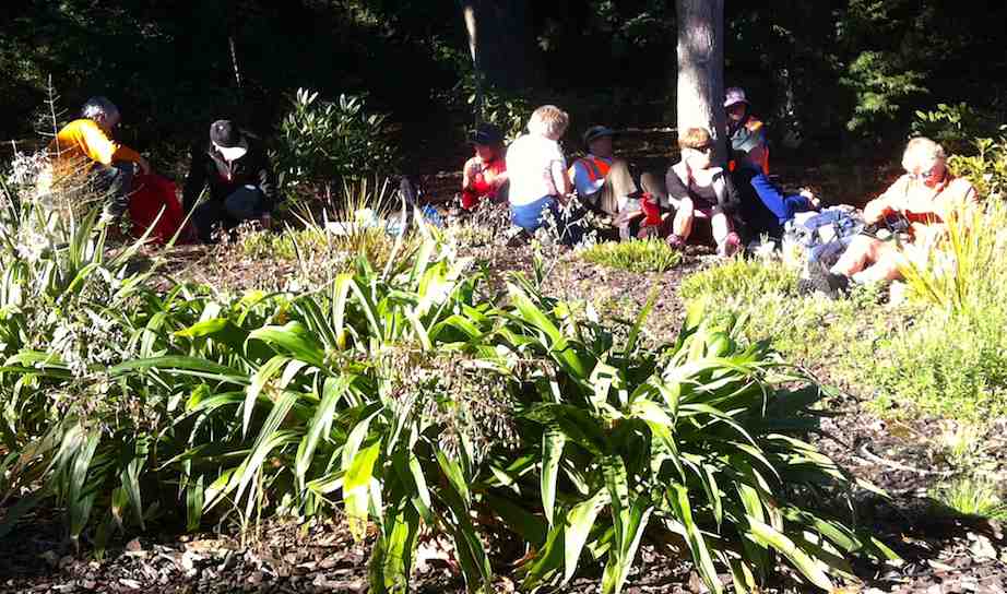
Morning tea on ‘the green’. Photo & caption John
Looking back over Blueskin Bay. Photo & caption Pam

Lunch in ‘the Ruins’ in a forest clearing. Photo & caption John

Regroup out of the wind by the Purakanui swing. Photo & caption John
You can’t take the boy out of the old man. Photo & caption Carol

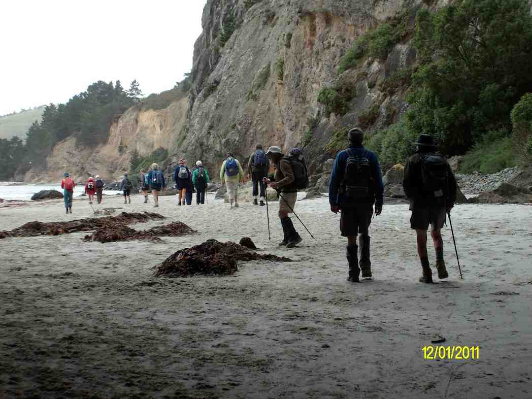
Canoe Beach race against the tide. Photo & caption Pam
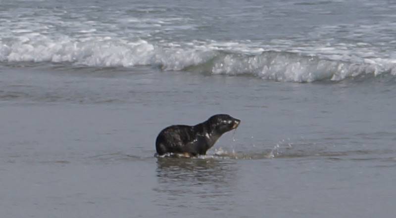
Our path blocked by a sea lion. Photo & caption Pam
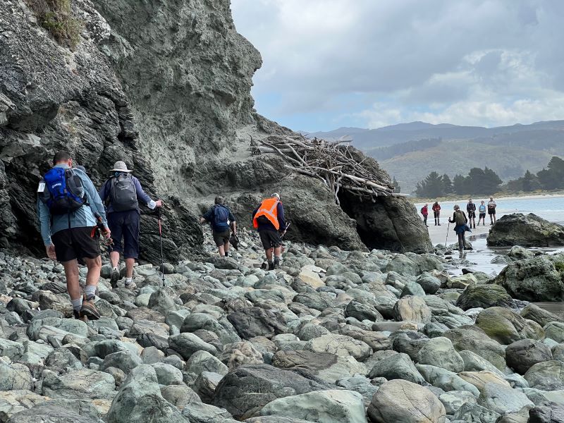
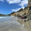
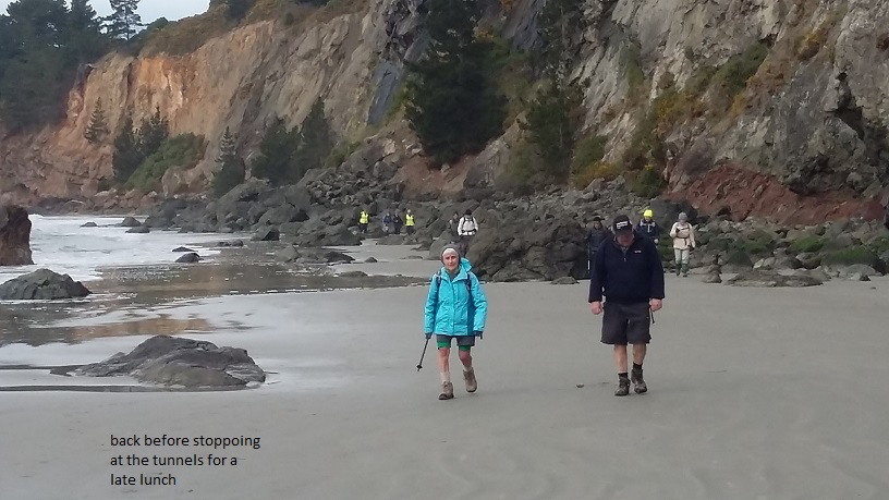
Boulder hopping – Drs Point around the corner! Photo & caption Pam
Graeme
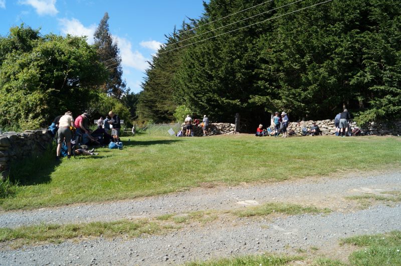
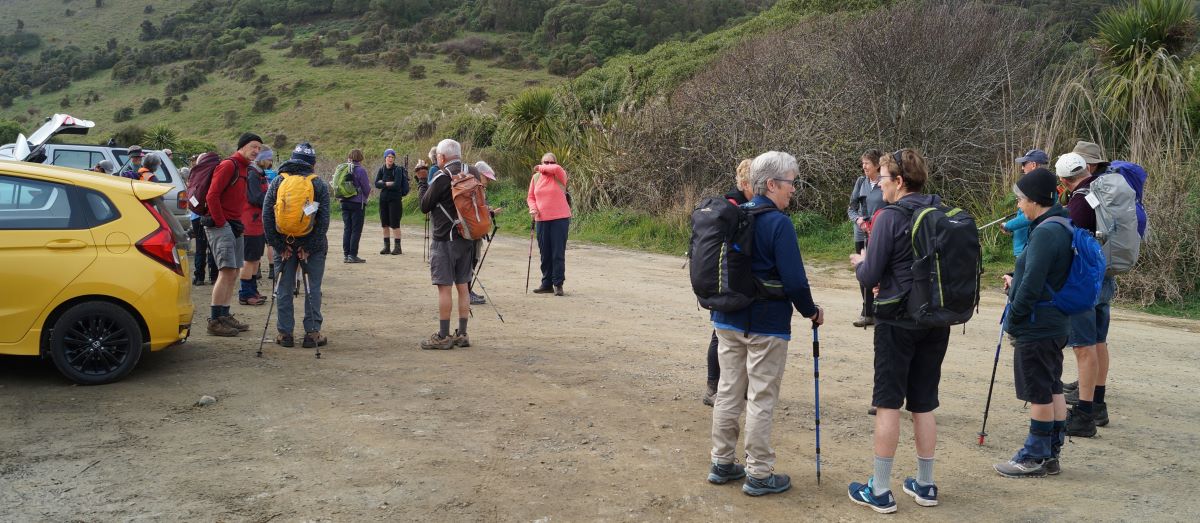
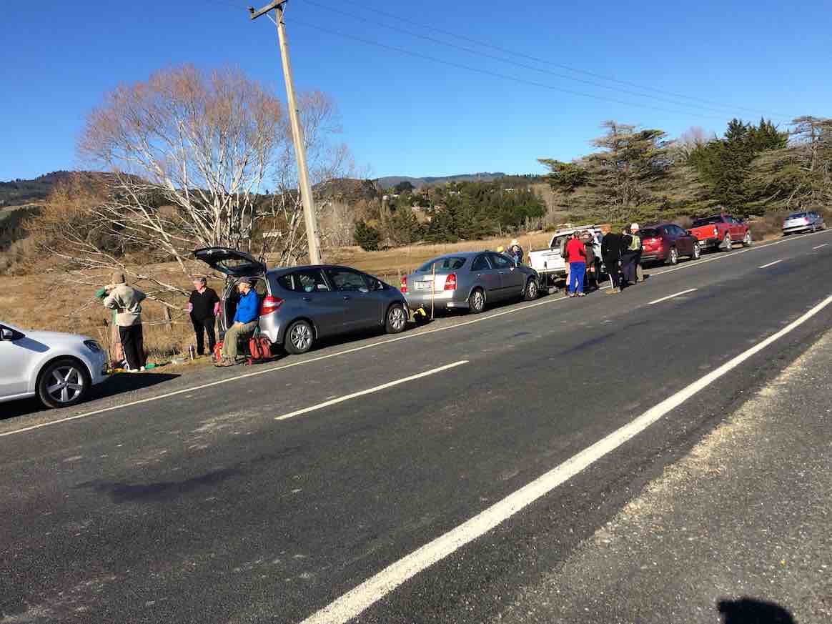
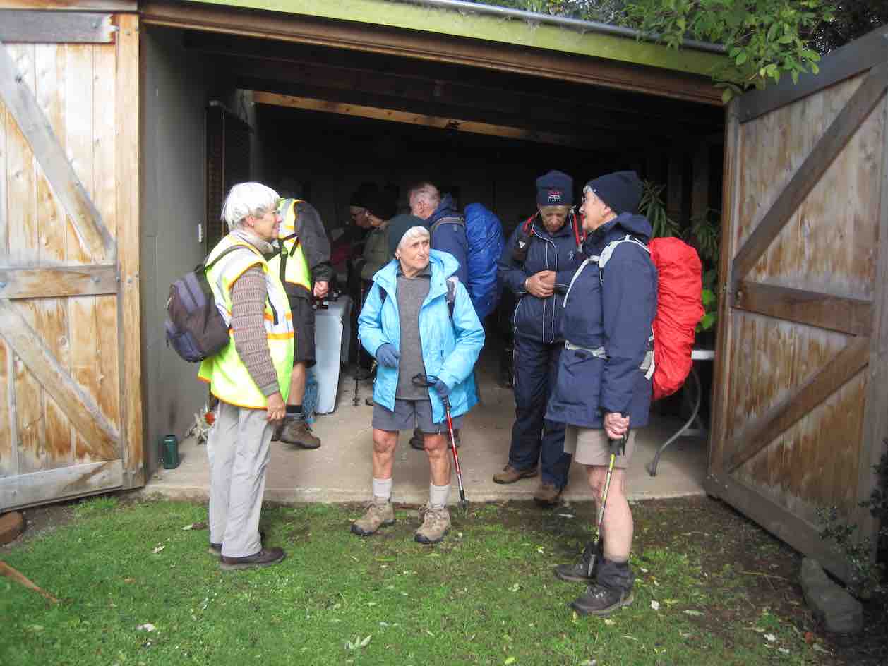
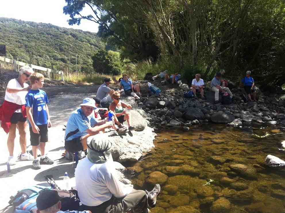
Fifteen hikers, along with the trampers left their vehicles at Doctors Point car park (end of road) at 10.00am on an overcast, but mild and pleasant morning.
Getting ready to leave the cars – photo and caption John
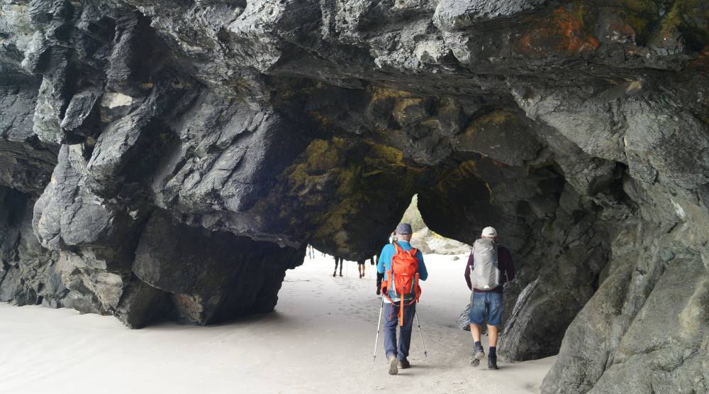
Mind your heads guys – photo and caption John

The other side – photo and caption John
Where’s Mum? – photo and caption John
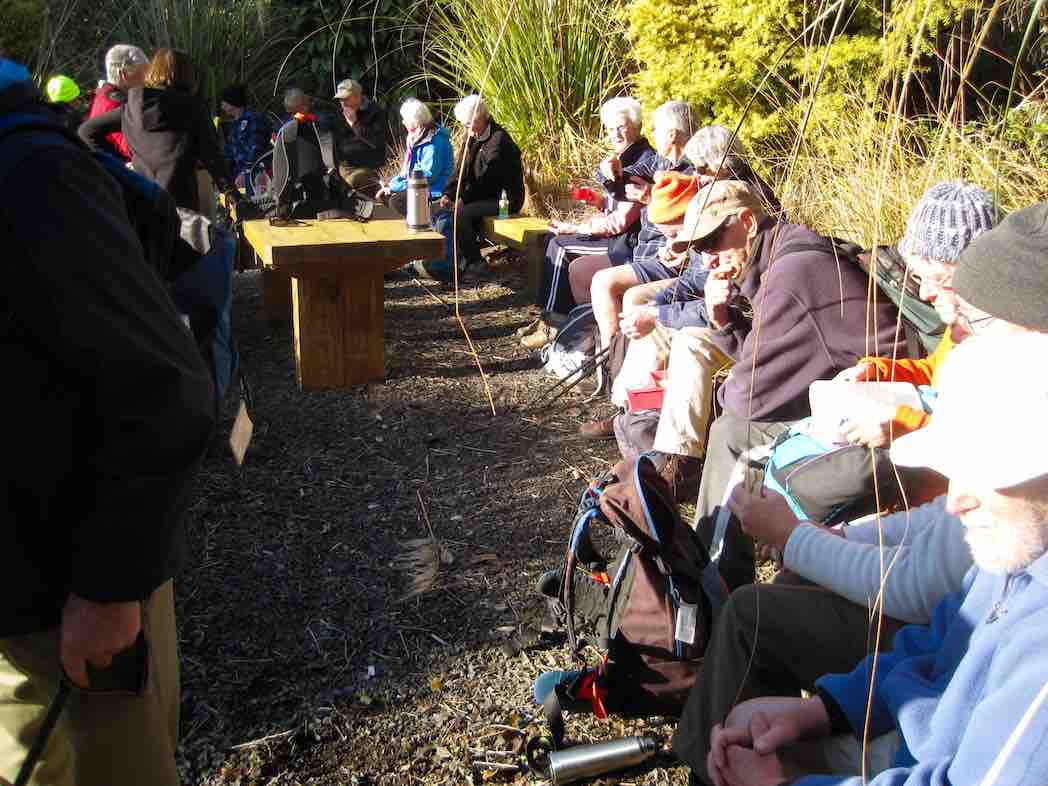
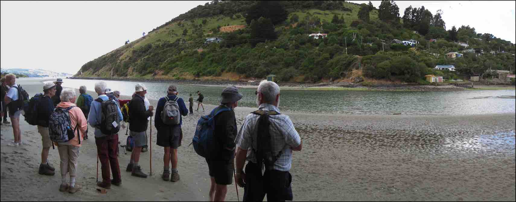
A combined hikers and trampers morning tea was enjoyed at Mapoutahi, where yours truly gave a bit of a rundown on the area’s history, particularly the background story of Mapoutahi Pa’s tragic, gruesome sacking in the 1750’s.
“A Smooth Beach”
Waves continuously wash away footprints.
Like time washes away, leaving you with a clean slate.
A smooth beach
Waves wash away the good, and the bad.
Author – ‘Chase’
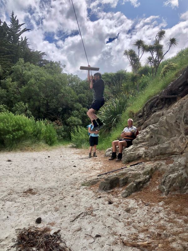
By 10.40am fifteen hikers set out to walk the length of Pūrākaunui Beach, but not before I first enjoyed a tree swing, discovered in a sheltered cove.
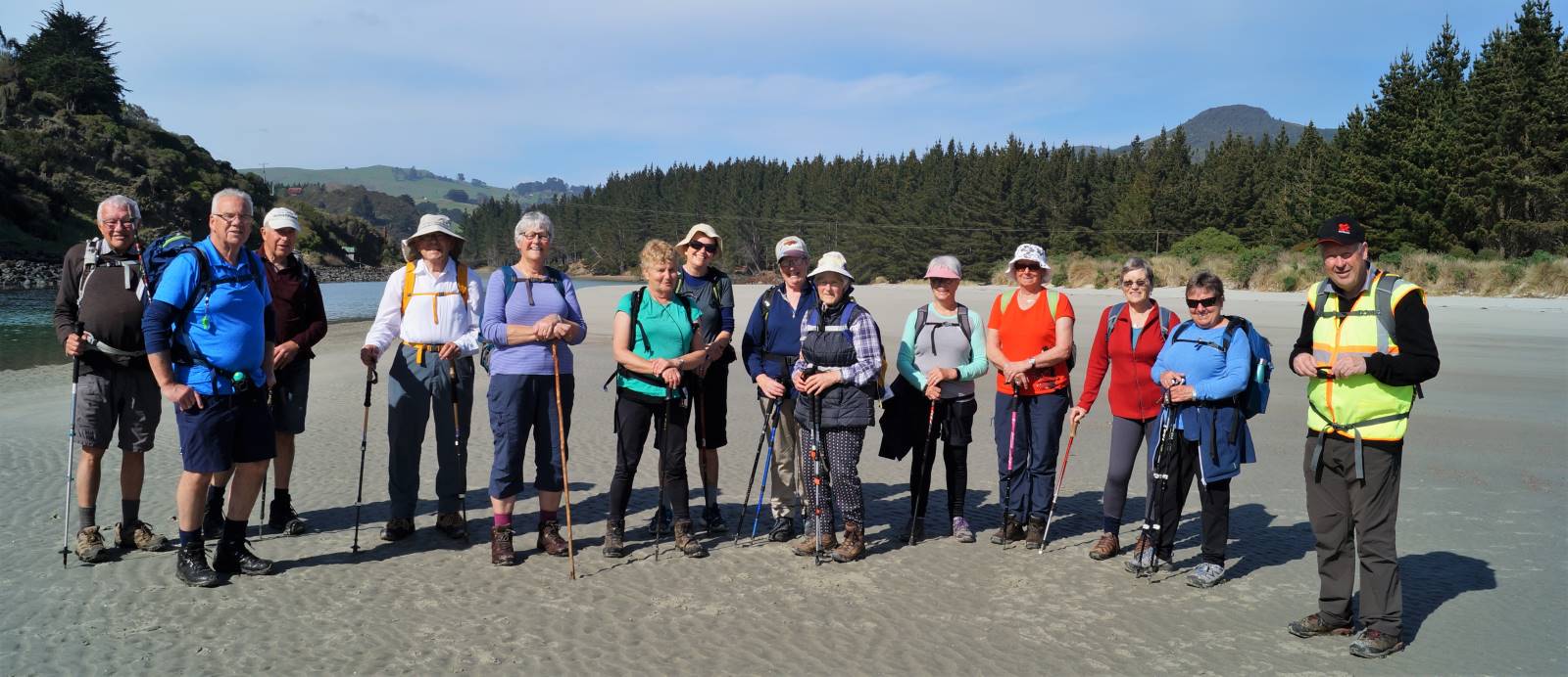
Happy bunch on the beach – photo and caption John
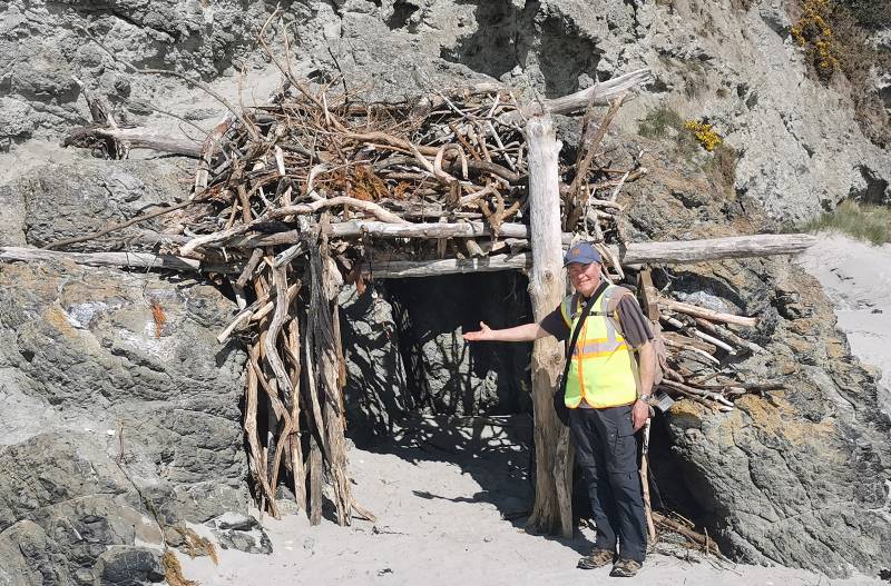
John in his forever home – photo and caption Margreet

The 3 stooges having lunch – photo and caption Margreet
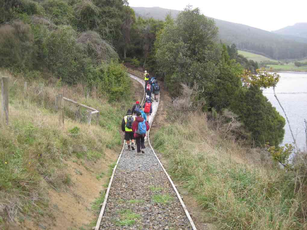
A quick stop at the Opeke Track entrance found it still closed, so it was on to the Doctors Point boardwalk, starting this at 1.05pm.
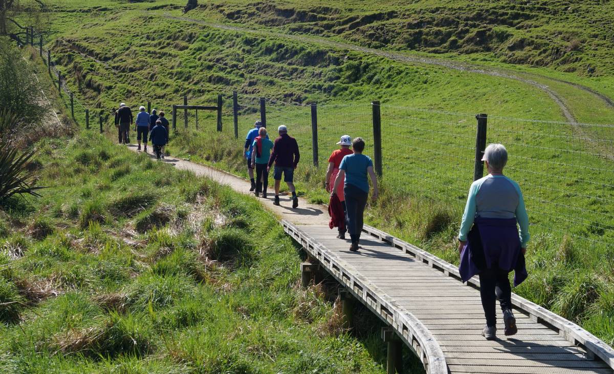
The Doctors Point Boardwalk – photo and caption John
In summary, an enjoyable day, with a bit of everything really! On behalf of Dave and myself, thanks for the opportunity to lead the day’s hike.
“Life’s a Beach.”
John.
Well we had a very eventful morning. Set off at 9am sharp to Blueskin Bay stretch of our days walk. Arriving in good time, to set out in good weather, as the cliffs gave us good shelter from the south west wind.
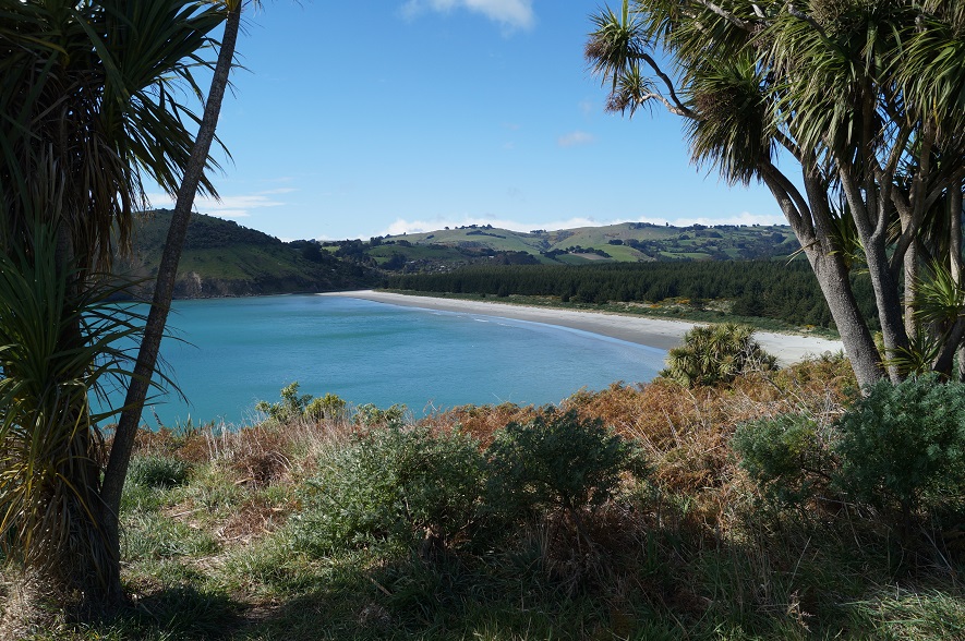
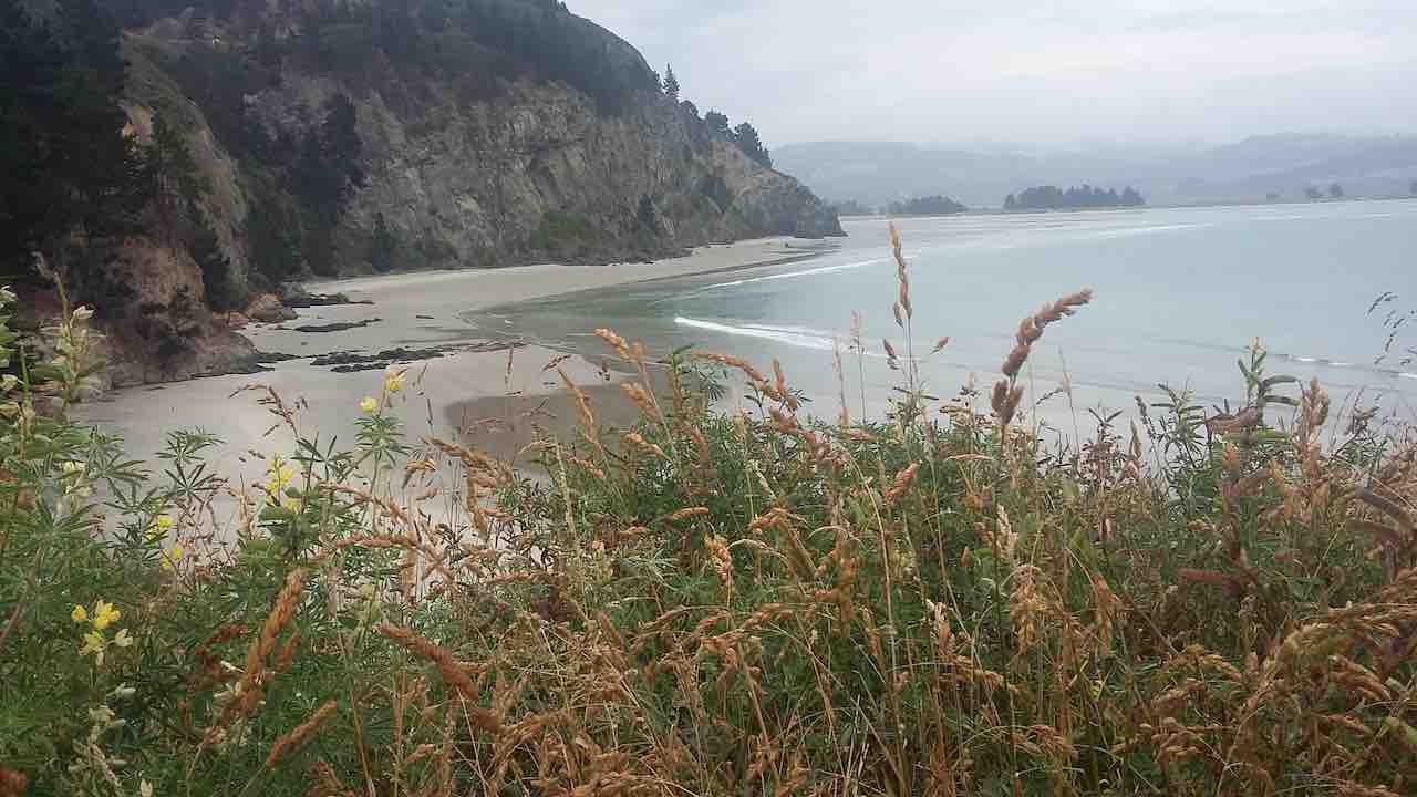
Photo and Caption John – “View of Purakanui Beach”.

Photo and Caption John – “Great craftmanship – railway line, tunnel, retaining wall and stone bridge.”
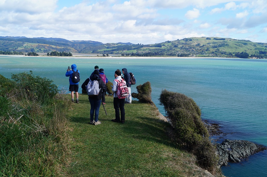
View from the Mapoutahi Pa site.
Spoke to a local who said we would be absolutely fine to walk to the Pa site have morning tea and return. That tide was on the turn and when we got up to the site we did not stay too long. Just as well we were caught by the tide at the rocks before the cave. I was absolutely very concerned, broken bones all over the place. Some took their boots and socks off but others climbed over the rocks and others like me just ploughed through the water. We really had no choice. Betty deserves the medal of the day and Doug just ploughed on through the water.
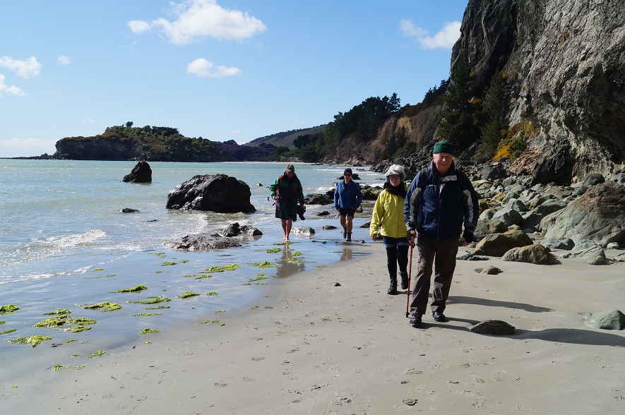
Photo and Caption John – “Wet feet” Well done to everyone and thank you.
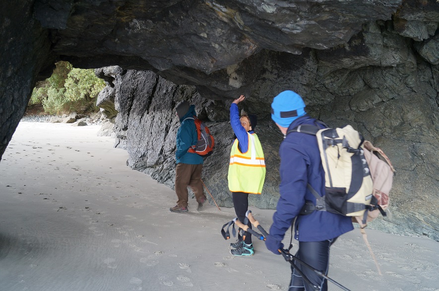
Photo and Caption John – “Through the cave.”
A further walk around the inlet and the view of Doctors Point was lovely seeing all the houses in the bush and the boat sheds. Back to the cars for lunch and in the shelter of the dunes.
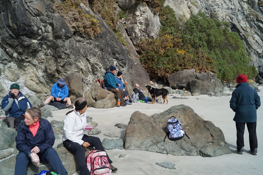
Photo and Caption John – “Lunch on the rocks by the cave”.
Photo and Caption Clive – “Where we are going.”
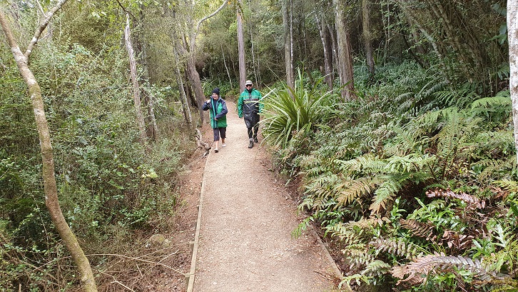
Photo and Caption Clive. – “Board walk.”
The early morning shower made the cancellation of the hike a real possibility, but an improvement in the weather encouraged the 24 hikers to the starting point of our hike. The early section to the Mapoutahi Pa site for the morning tea stop,
Morning tea at Mapoutahi Pa site. (Clive pic and caption.)
showed some amazing changes in the beach with the sand completely stripped away from familiar beach sections and a sand build up in the caves to a height of over a meter.
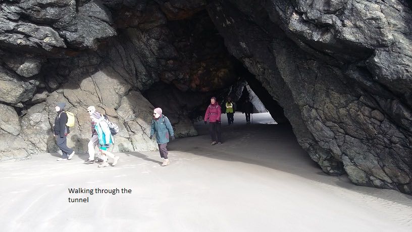
The tunnel. (Clive pic and caption.)
Canoe Beach Dr’s Point.(Clive pic and caption.)
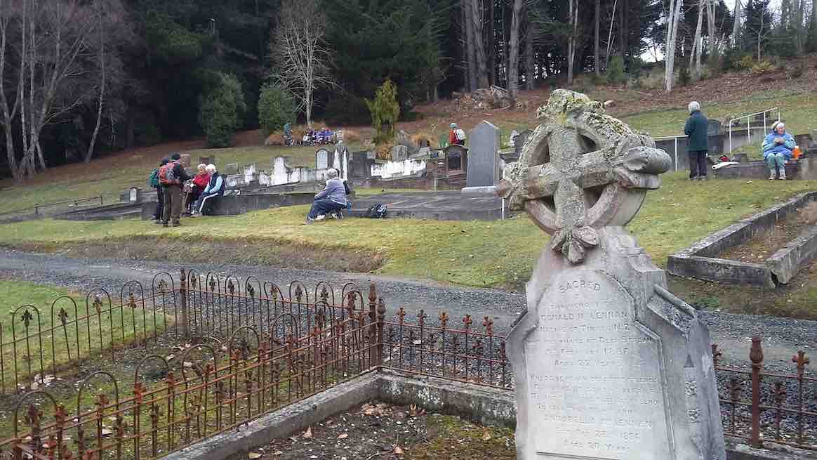
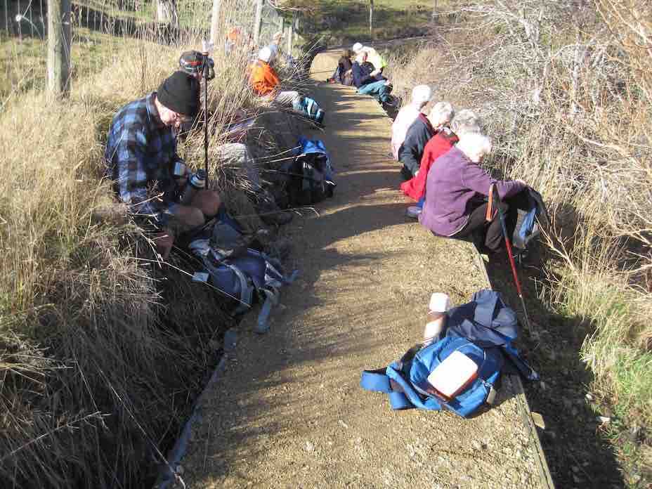
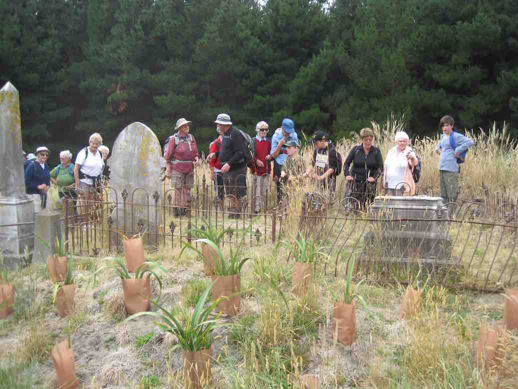
This Pa site provided a good view of the Purakaunui Beach which we traversed in about 15 minutes to the channel, into the Purakaunui Inlet. After a tramp in heavy sand we entered the forest, for a visit to the Purakaunui Urupa ( Cemetery). Early lunch
Lunch at Purukaunui Urupa. (Clive pic and caption.)
was followed by an easy stroll on defined tracks, to connect again with the beach at the junction of the Mapoutahi Pa. The distance to our cars was covered in short order, as there was the sign of a storm brewing, which arrived soon after we were installed in the Blueskin Cafe. – Betty & Jim
This area is a popular one for the hikers. Especially at this time of the year when weather can be somewhat inclement. This Wednesday was one of those days. Dull and overcast, threatening rain. However, 27 turned out and once again enjoyed a pleasant relatively easy walk. The rain did start after lunch but was really only a misty-like drizzle, so not too unpleasant. We parked at Blacks Bridge as usual and had our morning tea before we started as it was well after 10am! Walked down Doctors Point Rd to the far end of the Opeke Track then back along the track, enjoying the views and scenery as we went. Were a bit early at the favourite lunch stop but decided just to have an early, leisurely lunch break anyway.
Then it was back along the road, in the the rain, to Chelivode St. and the start of the Estuary Track. We didn’t waste much time walking this track back to the cars as we were getting rather wet. We still enjoyed the bush, birds and views along the way though and everyone said they’d had a good day out in spite of the weather.
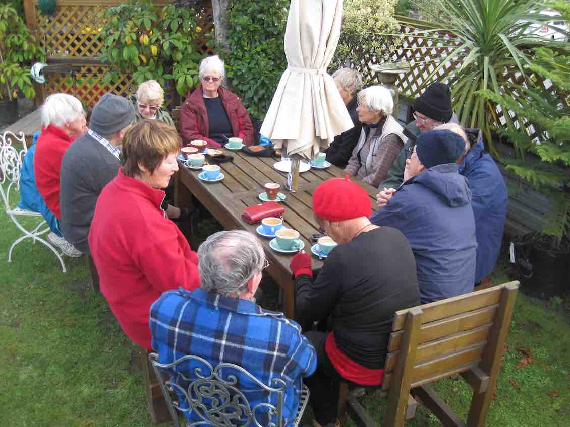
Adjourned to Blue Skin Café for after-hike refreshments and chat. – Bev, & Lesley
The tide was still going out as we made our way along Canoe Beach, through the caves

Clive pic.
to our morning tea stop at the bottom of Mapoutahi Pa.
After a pleasant beach walk,we made our way through the trees to the Maori cemetery.

Clive pic.
We then retraced our steps back to Mapoutahi,where we planned to have lunch. This plan was quickly abandoned,as the incoming tide was threatening our route back to the cars.
Clive pic.
Clive pic.
Quite a few people hadn’t been there before so were interested to have a look around the graves. As it was rather cold though we didn’t linger too long. On down Orokonui Rd. till we reached the little bridge crossing the Waitati river which brought us out onto Killarney St. at the end of which was a new bit of track with some board walk coming out onto Doctors Point Rd. From there it was along the road till we reached the far end of Opeke track. By this time we were all feeling somewhat warmer after a reasonably brisk walk. Then it was down onto the Opeke track. This is a very attractive and interesting walk which gives pleasure to the many people who use it. Locals and visitors alike. Near the end of this track is a short detour into an area that has some seats and great views across Blueskin Bay to Warrington and the other side of STH 1. Ideal for our lunch stop.

Wednesday’s walk was the nicest walk I have done. The plantings of native bush out there is so beautiful and the track was great as well. (Eleanor W pic and comment.)
We had a fairly leisurely lunch and then it was off again

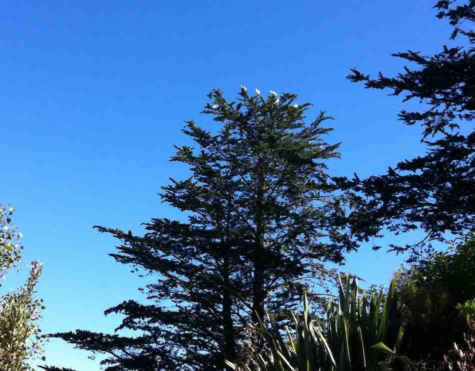
At The cove was the royal blueskin Bay yacht club HQ just below the nesting tree of the Royal spoonbills. (Clive pic and caption.)
Clive pic.
to the end of the Opeke track and back onto Doctors Point Rd. The walk along the road helped to warm us up again as it had got a bit chilly sitting at lunch time!. We turned up Chelivode St. and along to the other end of the Estuary track. This took us back to the car park and the end of what everyone agreed was a most enjoyable and ideal walk for a winter”s day. The Estuary track is a lovely track with bush and birds plus lovely views. We all felt it a suitable one to repeat yearly. The day finished off as usual with coffee break at Blueskin Café. Lesley & Bev
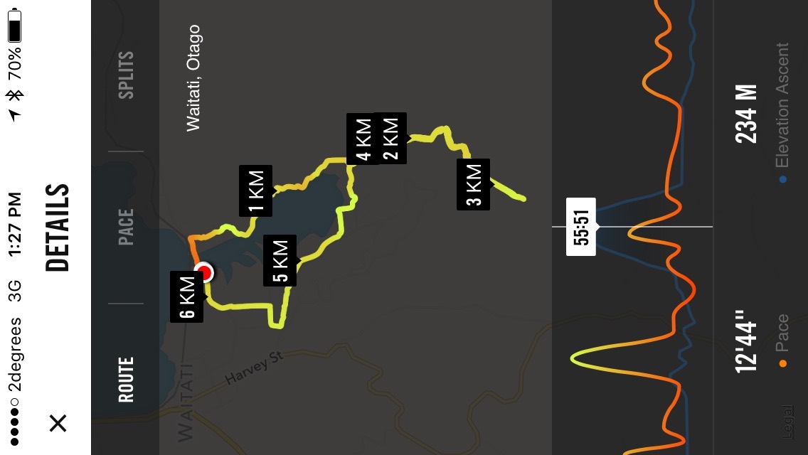
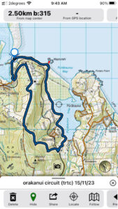
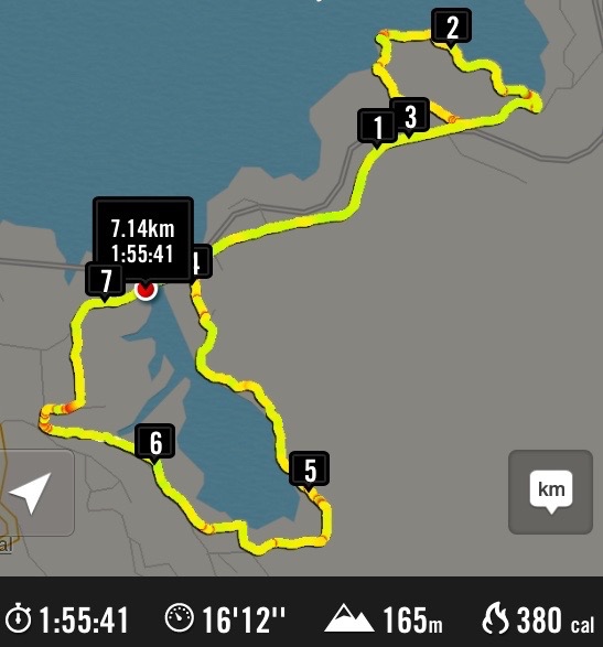
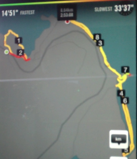
Hikers’ route map around Orokonui Inlet. Nike app updated again. To get all the goodies in, had to save it in landscape, rather than portrait. The “55.55′ is the elapsed walking time spot since start. Altitude and speed indicaters now seem accurate.
Cars at tramp start.
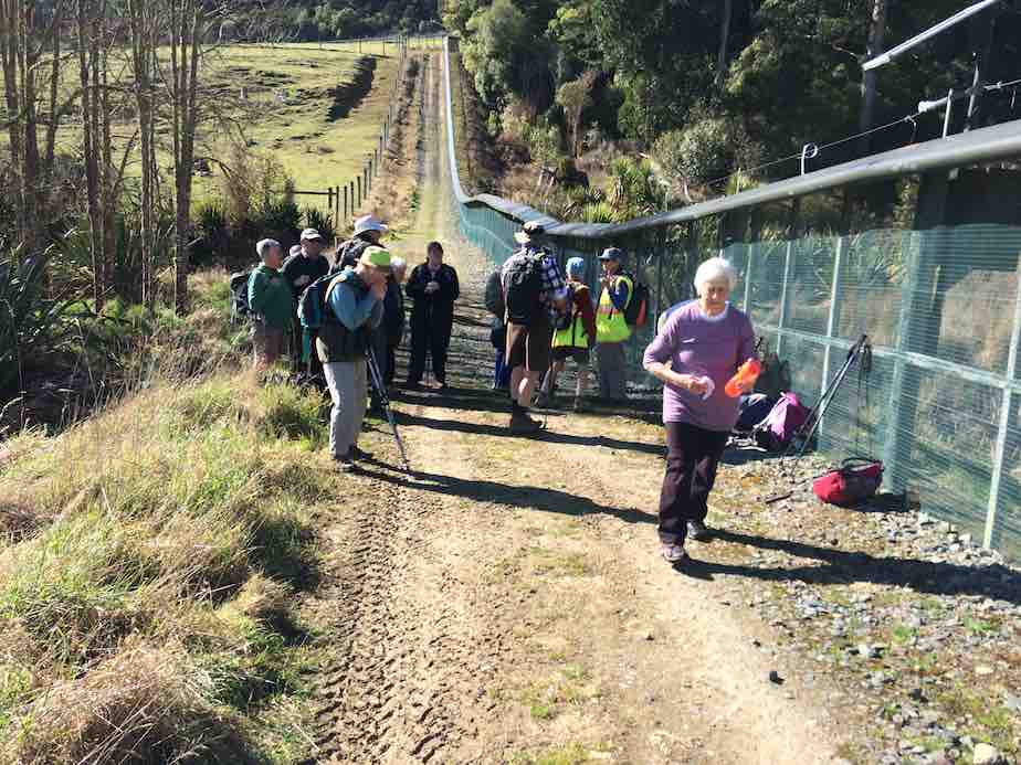
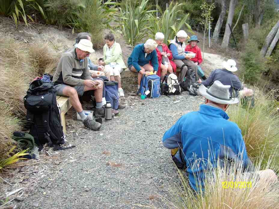
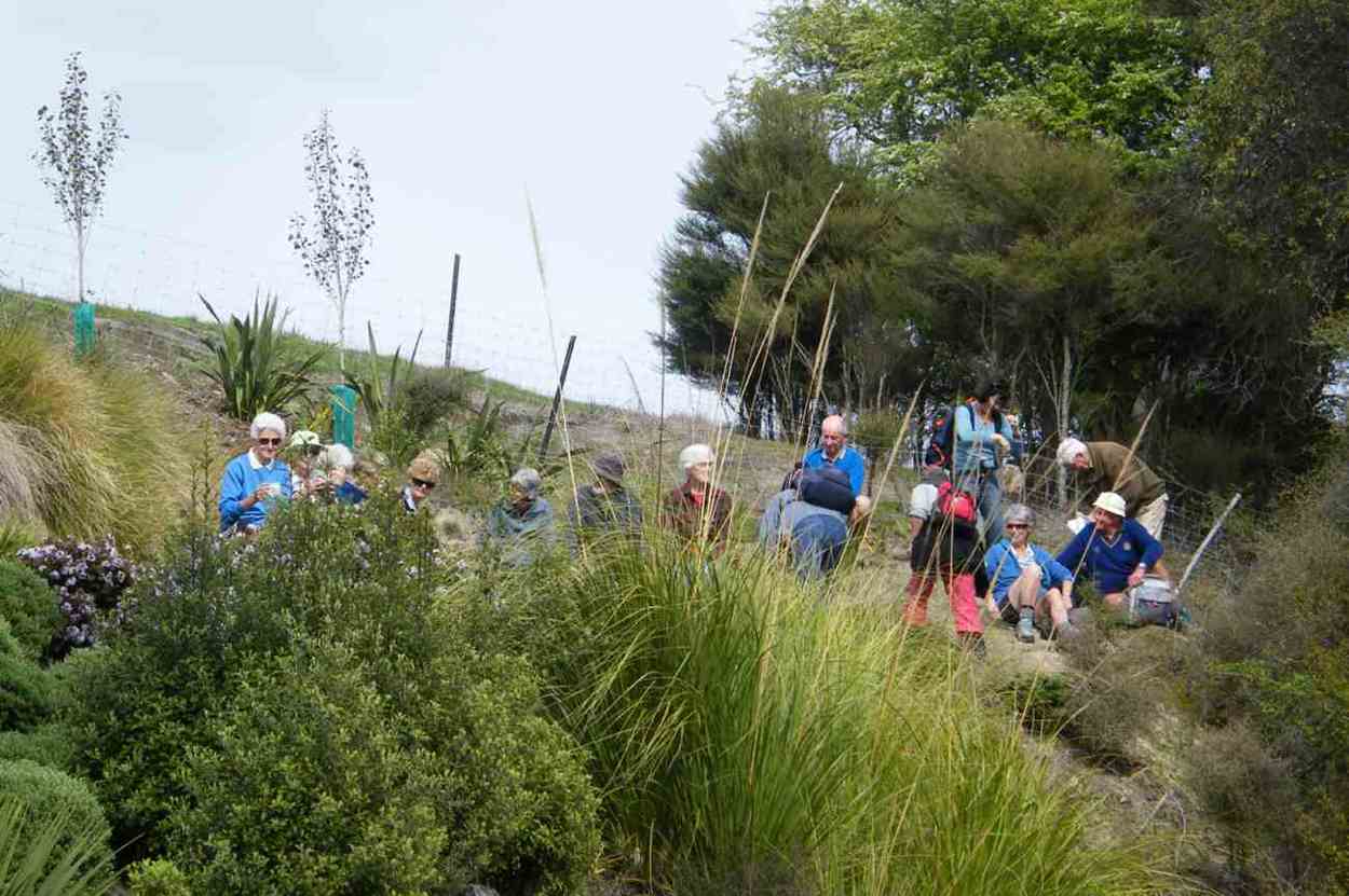
Lunch spot beside Ecosanctuary fence.
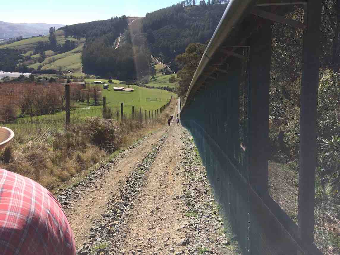
View from further up along fence.
iPhone route map of Opeke and Orokonui Inlets.
Cuppa time in from the further lower entrance. Table, seats and all. (John pic)
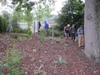
Many who hadn’t been on the last visit to Opeke were struck with the embellishments added to the trackside. The CAR, and small limestone carvings to mention only two. We had parked at the bridge and road-walked between Opeke and the Orokonui Inlet Track.
A calm and sunny spot for lunch. (John pic)
Two birthdays (John pic)
The track crowns the inlet’s head and finishes off along the Orokonui Road. We took the foot bridge across the Waitati Stream to skirt a back-blocks or two …
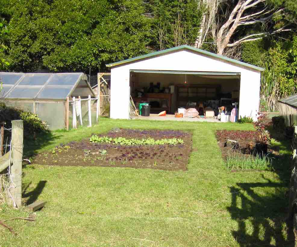
A neat vegy patch on a roadside property which caught the eye (john pic)
… before emerging onto the Doctors Point road and returning to the cars. Lesley and Bev had picked on doing this trek again, foregoing the earlier swap plan of exploring the Old Waitati Road area due to his colder shadiness under the hill. So thanks to Bev and Lesley for opening this newer area to even more Hikers. – Ian.
*** THE POEM ***
OROKONUI ESTUARY WITH THANKS TO LESLIE AND BOB
‘Twas a cold and windy morning – the sane ones stayed in bed.
But fourteen hardy hikers, bravely out were led.
They travelled to Waitati, the river was quite high –
They didn’t fancy wet feet, I can’t imagine why.
Instead, the estuary beckoned, with better shelter there.
With coats and hats and gloves on, they didn’t have a care.
The track was easy walking, through bush and flax and trees.
They lingered over morning tea, sheltered from the breeze.
A grassy bank was found for lunch, it wasn’t even wet.
John took lots of photos, you’ll see them on the net.
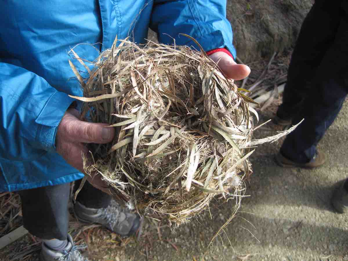
Leslie found a bird’s nest, she took it home to keep.
(I hope the birdies last night, did find somewhere to sleep).
On to Blueskin they did go, for coffee and a talk,
Joined by Jim and Betty, who didn’t do the walk.
Plans were laid for Luxmore, a short two weeks away,
With satisfaction they went home – It was a lovely day.
– Judy
*** THE REPORT ***
Cuppa at the table and seats by the Opeke track. (John pic)
We completed the Opeke circuit – for the first time in this reporter’s experience – in an anticlockwise direction. It’s so revealing viewing stuff when going in the opposite direction. As well, quite a number of improvements were there to be discovered, not least an old wreck of a car…
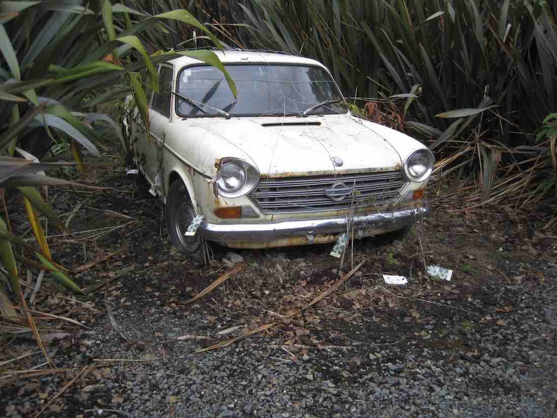
What’s this alongside the track? (John pic)
…tied down and waiting to be wreathed in nature’s verdure – apparently!
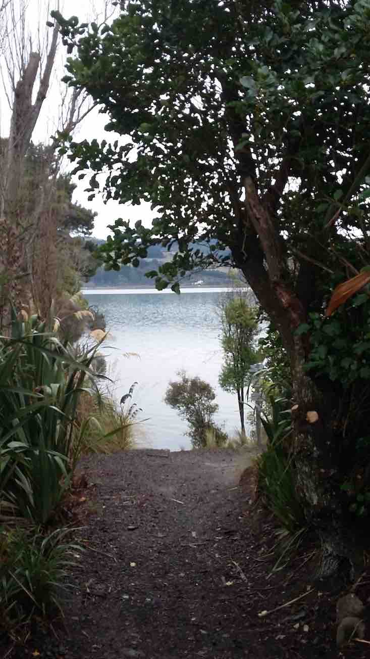
Trekking back from Opeke, we turned off just short of the bridge up Chelivode street, passed a hay-baled house, and turned down a newly-made track to skirt the side of the Orokonui Estuary.
Track (John pic)
The track wound up, down and around through bush and paddock to emerge at the head of the estuary to cross swampy ground…

A walkway across swamp, solidly built to last a lifetime. (John pic)
…to reach the back yard of a number of farm sheds accessed from Orokonui Road. The track diverted down around a paddock or two to soon parallel the Orokonui Road on one side, and a heavily swollen Waitati Stream on the other.
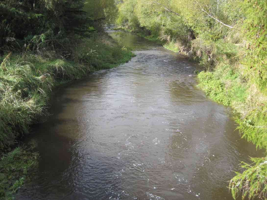
Waitati Stream (John pic)
We lunched on a now sunny bank, still clad however in our parka-covered woolly underlays.

Lunch. (John pic)
Further along,…
The nest referred to by Judy in her poem. (John pic)
..and we crossed the stream via the Erne Street footbridge to walk along Killarney Street and turn into Foyle Street. Here we came across a garaged honesty stall featuring jams and sauces…
Garage (John pic)
…and lingered a while. Then it was out onto Doctors Point Road, back to the cars and to resort to the Blueskin Nursery cafe,…
Coffee at Blueskin. (John pic)
…- all 14 of us, augmented by Jim and Betty who turned up.
Thank you to Lesley and Bev, ably supported by back-marker Bob keeping us safely together, for devising such an appropriate alternative for such a challenging day. – Ian.

GPS of route
Jim and Betty, who had been allocated leadership the last three visits to Doctor’s Point, gave the trip an original twist, – by dint of three recces to get matters precisely aligned to the tide. They led 29 of us to the Mapoutahi Pa site for the tea break.

On former Mapoutahi Pa site. (John pic)
Via the beach beyond the peninsula we turned off into the FWD through the sandhills, past the cliffs and on to the beginnings of the road proper, at the corner of the forestry. Here Jim opened the gate and led us past the following sign.
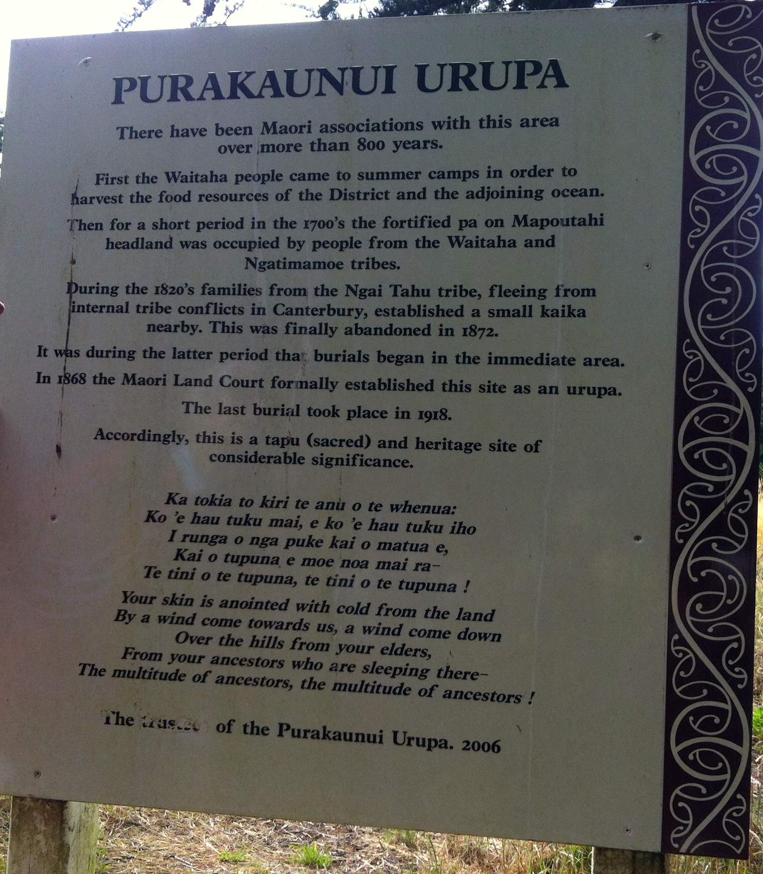
Purakaunui Urupu notice at forestry’s entrance.
Another FWD track led us a considerable distance through the forest to terminate at a historic Maori graveyard.
The Urupu site (John pic)
Betty and Jim then led us on through the forest by a route that they had previously explored and marked (well done!) to take us out to the inlet’s entrance, where there was quite a cold wind persuading several to don more protective garments.
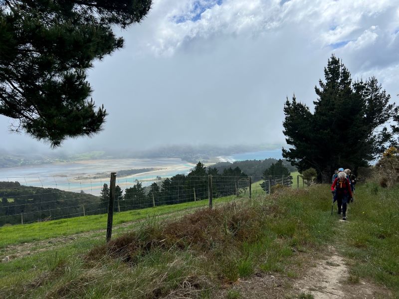
Panorama of Potato Point and Purakauni. (John pic)
Only a little way down towards the beach Jim let us into a well-sheltered spot amongst Marram Grass for lunch, where a warm sun persuaded garment-offing again.

Lunch (John pic)
The return walk along the beach took us over the neck of Mapoutahi Pa peninsula to happily reveal that there was still a stretch of navigable beach at the bottle-neck by the rockfall not yet swallowed up by the incoming tide.
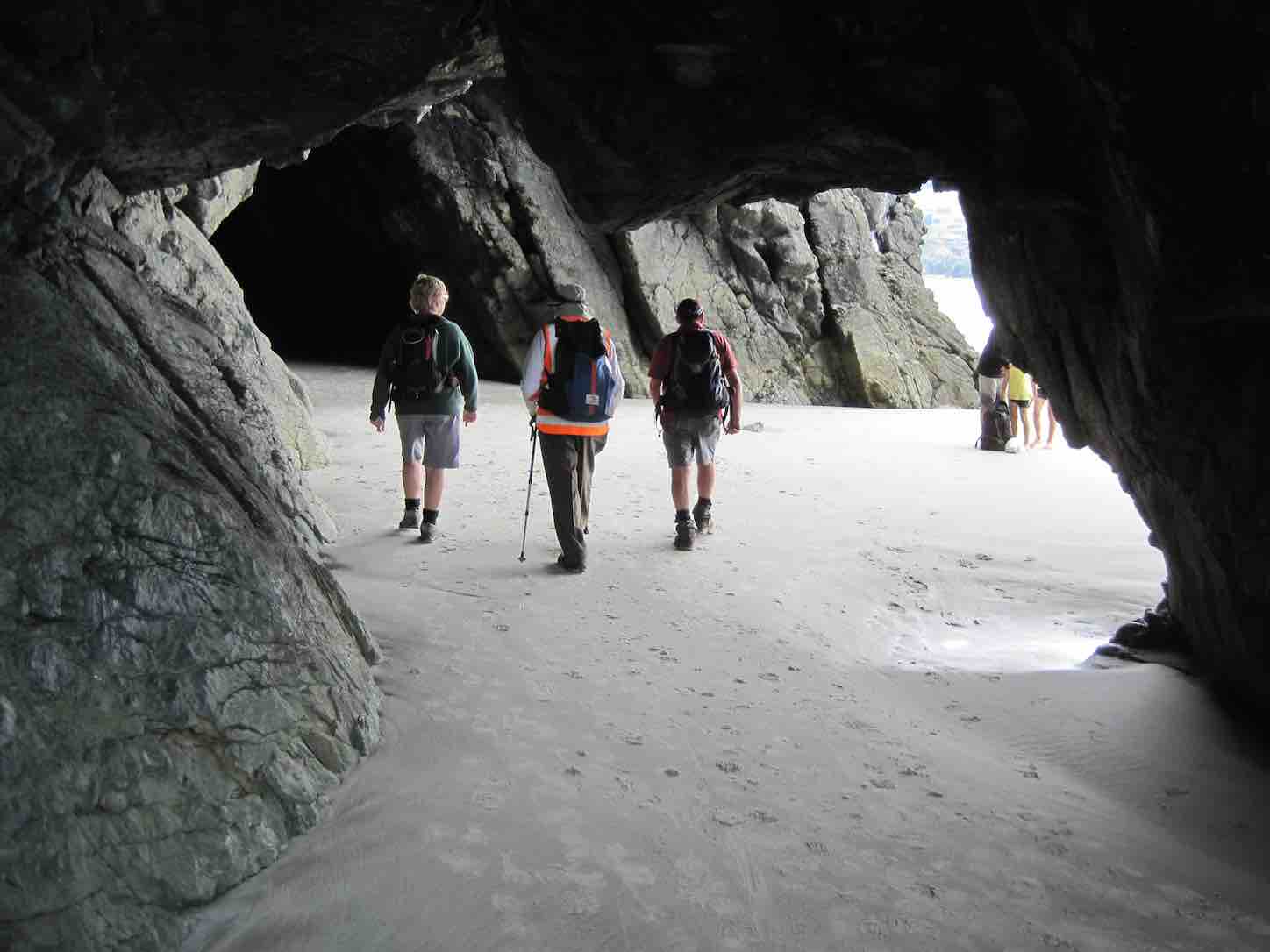
Returning through the cave. Thought this photo worth displaying. (John pic)
A walk back to the cars ended a most satisfying day, with all of us congratulating and thanking Jim and Betty for the quality time they invested into their recce. Thanks to them here, too. – Ian.
14. 2014 Mar 19. Hikers/ Waitati, Opeke Walk, Doctors Point, Mapoutahi Pa, return. Leaders: Arthur and Barbara.
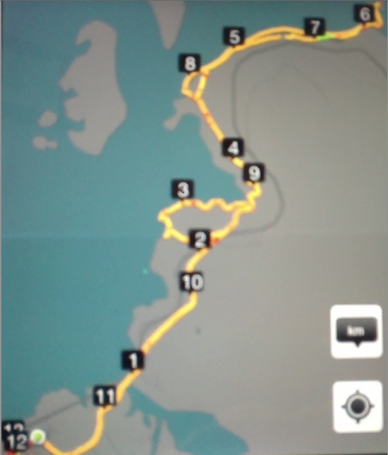
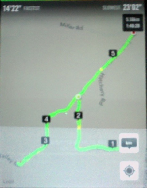
GPS of Route
GPS of routes. First Opeke Walk. Second Drs Point to Purakaunui Inlet mouth, return, 8.53 km total.
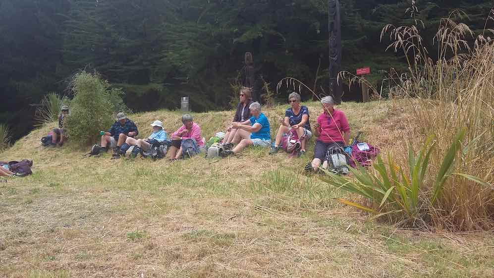
Morning Tea break near Opeke Walk entrance.

Alpacas – shorn!
Herons? in tree down by the water
Route map from iPhoto. (Omits Murray Rd altogether and begins a little time after we left the parked cars when I thought to turn it on). Numbers indicate kms in sequence. So real distance was nearer 7.5 kms.
Early lunch on McIntosh Rd bridge over Waitati Stream.
Lesley was brought up by the old YMCA camp on the Waitati Valley Road, which area we walked past. So she was able to tell us all about the Trout Fish Hatchery and the original and later houses her parents lived in.
10. 12/1/2011. Both. Picnic Lunch. Opeke Walk, Doctors Point, Mapoutahi. Leaders: Bob and Evelyn.
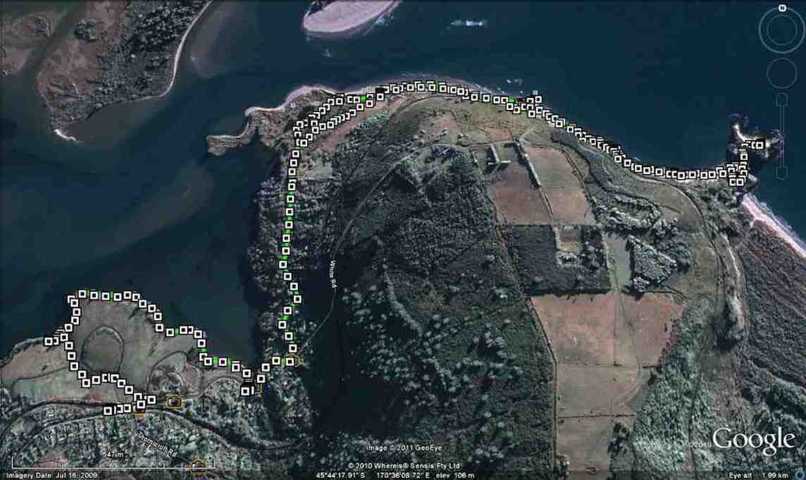
GPS of route, courtesy Ken
Coming through Willowridge’s Opeke reserve upper entrance.
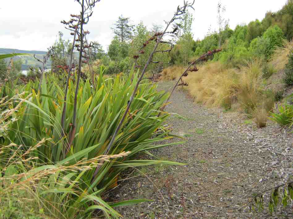
Not the best example of how the claddy flaxes now overhang the track.
Tea break.
On far side of cave. The ebbing tide still covered the beach ahead. Those who ventured further had to scramble over the rock fall to get to Mapoutahi Pa peninsula. The remainder lunched at the cave.(Ken pic)
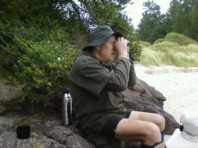
After lunch on the peninsula’s beach, Ken, through a monocular, studies some further club members, who after lunch, were now also tackling the rocks. (Bob pic).

Waitati at the start. Arthur, Barbara, Margaret, Bev, Carmel, Angela.

We start the Willowridge walk. Carmel, Neil, Bev, Margaret, Barbara.

Standing at the Cove. Barbara, Arthur, Elaine, Peter, Angela

About to have a break. Angela, Peter, Arthur, Elaine, Barbara.
We survived the occasional shower passing over and enjoyed just being out.

Walking in the rain
The shelter of the caves was welcome. A flighty fantail flock fluttering in the rocks overhead added interest as we lunched looking out to sea. Excitement rose as towards the end of lunch the incoming tide grew too incoming and prompted a prompt departure.

Lunching in the caves. Arthur, Bev, Barbara, Angela, Margaret, Carmel, Elaine.
We were still ten minutes from the cars when a strong southerly blew heavy cold rain into our faces and reduced the walk to simple endurance. So bad were the conditions, an overtaking ute driver turned back and offered to ferry us back to our cars. Nobly (stupidly?) we declined his compassionate generosity. Despite the weather, we enjoyed the day out and the good company as usual. – Ian
We left the 5 cars near the turnoff into Waitati and walked the road to Doctors Point, noting the fascinating and different properties (Bob M even tried out the portable bath for size and shaped up for compatibility with the crazy gate),

A perpendicular challenge. Bob
enjoying the spring gardens and discussing Blueskin Bay history (did you know there was a plan to drain it for Dunedin’s airport or to make a new settlement out of it?). A detour into
Allan Dippie’s Willowridge Developments private/public park titled “Opeke – ‘Michie’s Crossing to the Cove to Waitere Stream Walkway’ – local residents are welcome to enjoy the coastal walkway and native re-vegetation planting and ecological programme”, was very rewarding, noting the plantings of some 70,000 specimens (he intends it to be 100,000 we were told), talking to the alpacas

Alpacas (Bill pic)
and enjoying the coastal views over a morning cuppa
on some of the many seats also ‘planted’.

Foursome. Bob, Bill, Graham, Bev
A tremendous development we all thought.
We cheerily waved to the travellers on the Taieri Gorge Rail trip to Palmy as we waited for safe passage at Michies Crossing.

Waving to Seasider, Michies Crossing. (Bill pic)
Thence onto the beach, along the estuary, through the caves, past the cliffs, up onto Mapoutahi Pa site where we lunched with great views and enjoyed the usual banter. Some stayed on the beach fearing that the tide was going to turn too quickly for our retreat, but in fact no one got wet feet (well, Pat, you were marooned on a rock for a short time) (and there was a wee wave), and we returned to the cars by the Doctors Point road. The weather was calm and mild and we had enjoyed the great variety of scenes on the 14km journey. – Bob M.
6. 2008 Jan 9. Doctors Point, Mapoutahi Peninsula, round Purakaunui Point return Leaders: Bob & Evelyn
Evelyn and Bob led our first tramp of 2008. It was an easy stroll on a fine day, walking through the cave at Doctors Point at low tide to stop at Mopoutahi Peninsula former Maori pa site for morning tea. Evelyn explained the usefulness of the cabbage-tree (of which there are many there) to Maori for food, although no umu-ti – cabbage-tree ovens – have yet been found on the peninsula.

Canoe Beach by Mapoutahi Peninsula. (Bill pic)
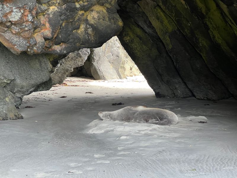
Then it was on along the beach and round the point at Purakaunui Bay. On the inland return route, Bob and Evelyn thoughtfully took us across the mud flats rather than subject us to their recce struggle through the thick grass at the verge. Then it was back to the cave area for lunch.A sleepy seal on the beach rounded off the day for the 15 of us who had enjoyed an easy companionable walk. – Ian

Seal, Doctors Point beach (Bill pic)
5. 2006 Nov 22. Doctors Point.

Sea and sky scape (Bill pic)

Potato Point from Mapoutahi
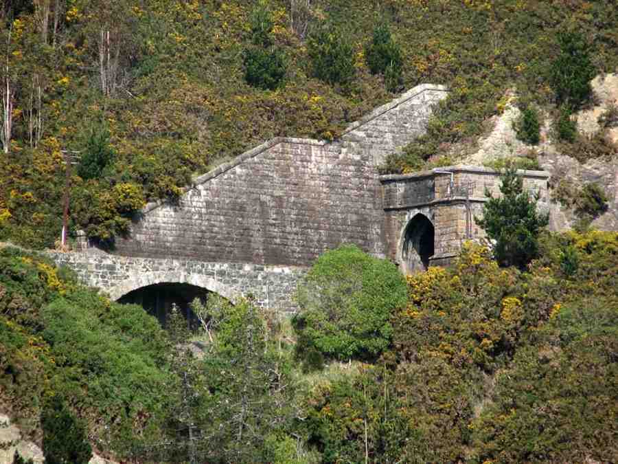
Railway tunnel and bridge from Mopoutahi. (Bill pic)
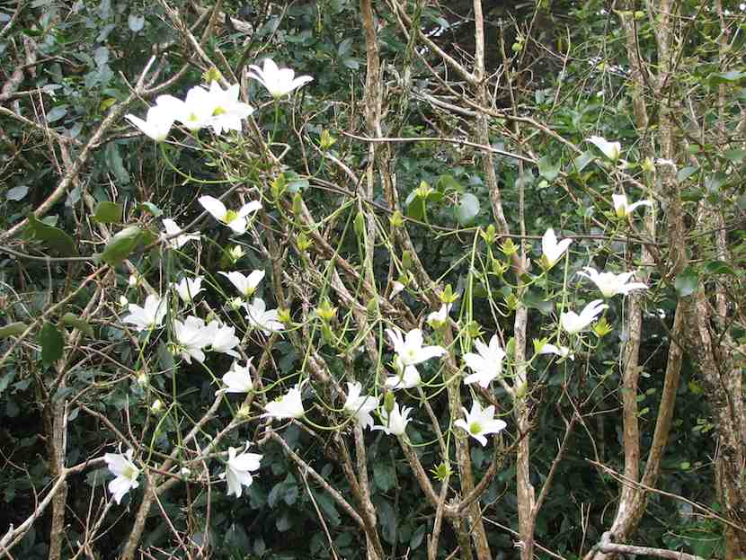
Edelweiss (Bill pic)
4. 2006 Aug 9. Hikers. Doctors Point. Leaders: Lance & Lois, Carmel
3. 1997 Sep 24. Waitati, Doctors Point. Leaders: Shirley McN, Daphne, Pat.