Nov 29 2017
Lamb Hill, Orbells Cave & Fiddlers Hut; ABC Cave & The Gap

Route Map, Bendoran to Orbells Cave/3 O’Clock Creek/Fiddlers Hut, courtesy Art.
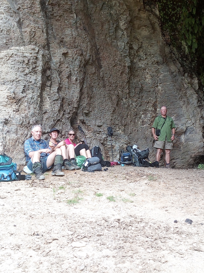
In the cave for a cool place to have lunch. (Helen pic and caption.)
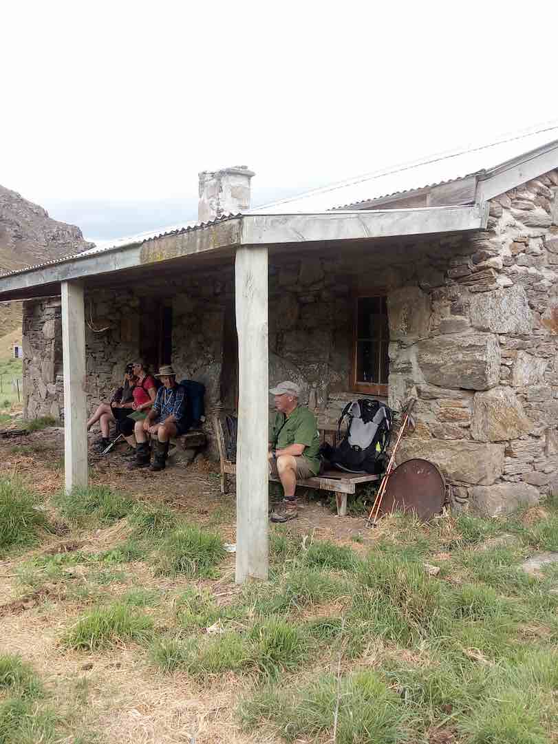
Fiddler’s hut. (Helen pic and caption.)
But sadly the interior had been badly neglected, birds obviously had been the only tenants for some years past.
One long hill awaited us – the climb out from Orbells Creek. The hill seemed to go on forever, but by putting one foot in front of the other, we found the top. But our legs were mighty tired now, and there was only a few hundred metres left to go. And so we arrived back at the Bendoran Hilton …
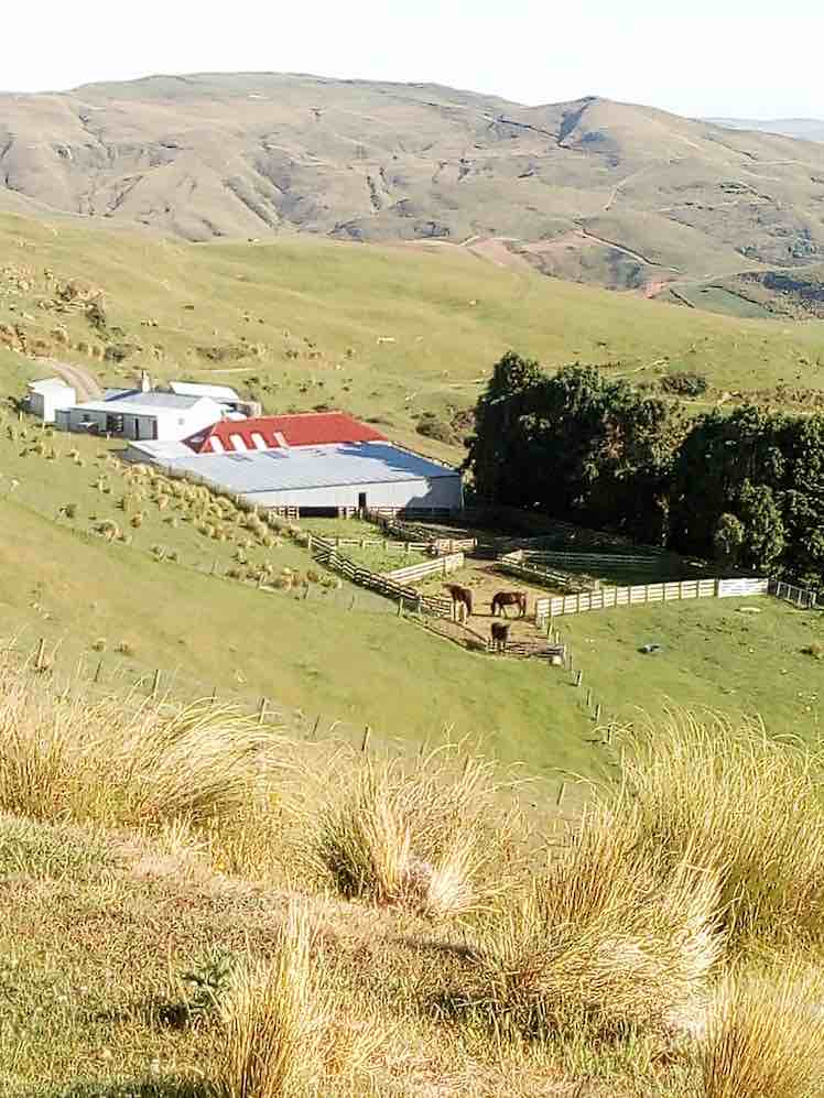
View of Bendoran huts. (Helen pic and caption.)
… just before 5 p.m. A good list down and rest seemed to be the logical thing to do now, so that’s what we did!
All five had thoroughly enjoyed the day. An energetic tramp to equal any other that our club has done. VERY SATISFYING.
11. 8/3/2017. Trampers. The Gap, and ABC Caves. M. Leaders: Arthur and Eleanor.
After a one and a half hour drive from Mosgiel, we arrived at Bendoran Huts. David Malloch the station owner arrived to welcome us and give us a brief history of the 5000 acre property.

Us with David Malloch. (Helen pic and caption.)
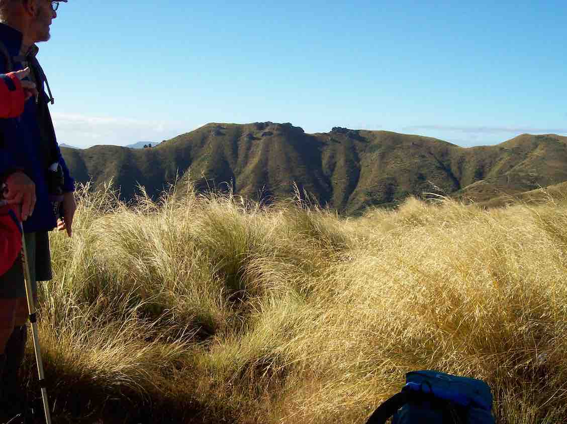
After unpacking and eating lunch, we walked in a cool s.w. wind, overcast with a few skiffs of showers to Mount Misery @ 714 metres.
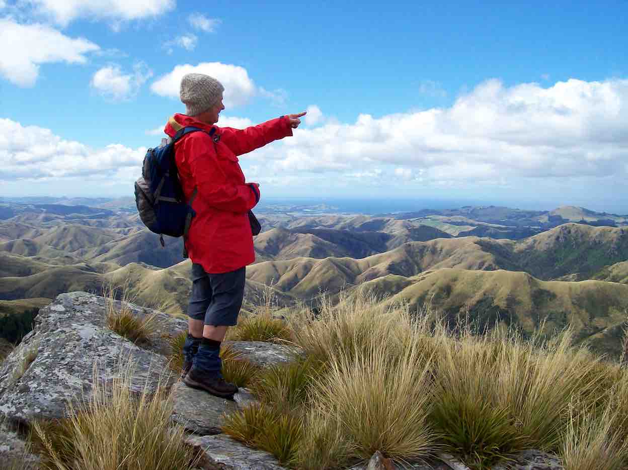
Eleanor on Mt Misery. (Arthur pic and caption.)
A great view for those brave enough to tackle the wind on such a rocky peak. From there we ventured onto “Terry’s Knob” (refer Hamel’s book page 7:13), …

Terrys Knob. (Arthur pic and caption.)
… before returning to Bendoran for drinks and muffins. After lighting up the coal range to heat the water and apple crumble, we then enjoyed home baked Chicken, vege’s and salad. Next job was firing up the open fire, sitting round chatting for the evening.
Before 8.30am next morning we were up and away tramping in ideal conditions for 3 hours to the “Gap” @ 670 metres.
The Gap from morning tea stop. (Arthur pic and caption.)
After numerous photo shots of surrounding valleys, peaks, ranges and the trig, we then headed down onto a new track, where after a lunch stop, we approached the A.B.C. Caves.
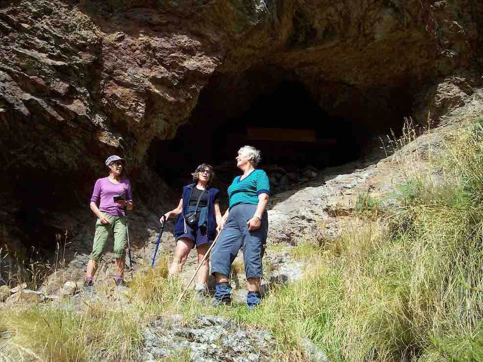
Helen Janine & Eleanor at abc caves. (Arthur pic and caption.)
After a challenging tramp, we were impressed by the cave interior, …
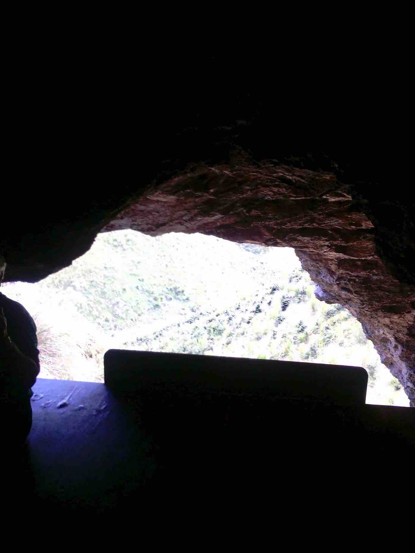
From in ABC cave. (Helen pic and caption.)
… but were disappointed the “visitors book” left no room for our claims to reaching this monumental milestone! We then had to return steeply uphill a little before bush-bashing a track across a gully to join back onto our original track, leading us back to our cosy “Bendoran home”.
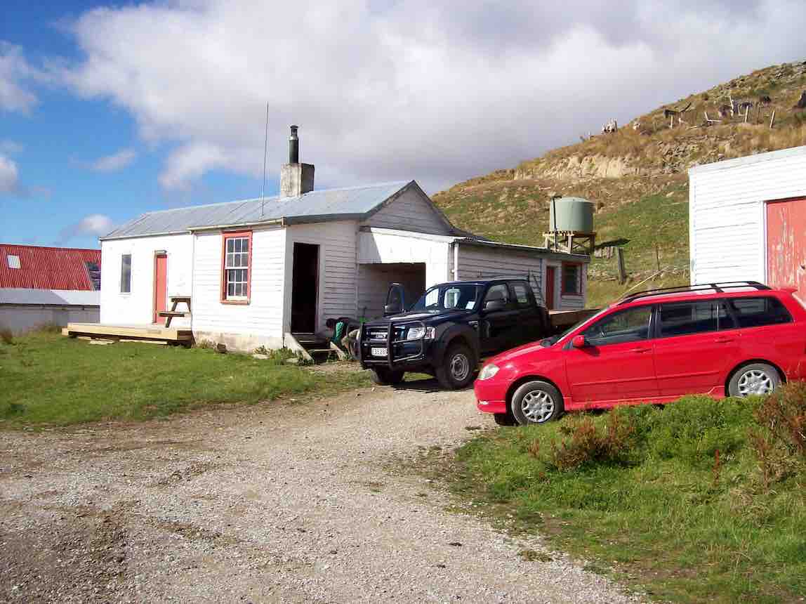
Bendoran where we stayed. (Arthur pic and caption.)
Arriving back @ 4.15pm, we found 2 members (who returned without going to A.B.C. Cave) had the coal range going with the kettle boiling for drinks and a HOT shower!! All fresh and clean again, we dined …
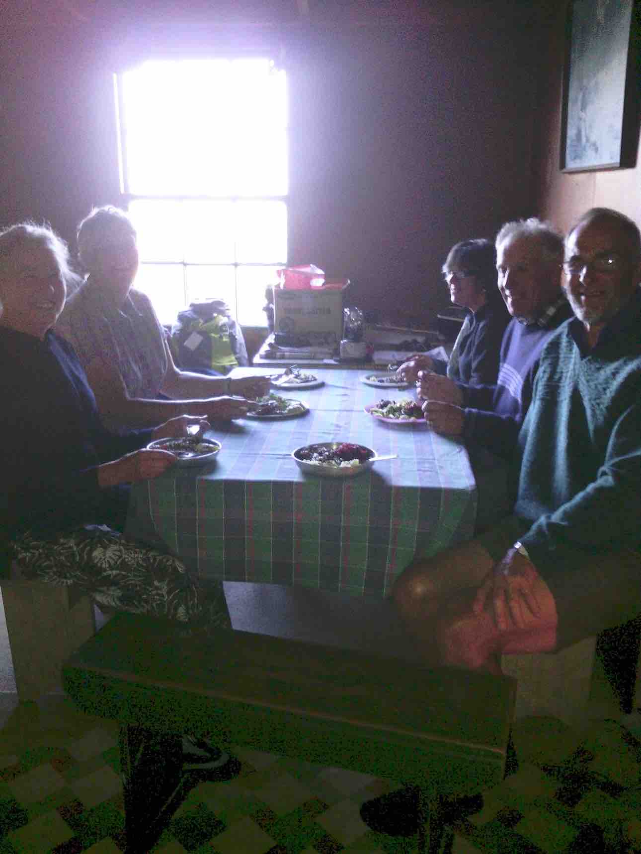
Dinner. (Helen pic and caption.)
… in front of the open fire on beef casserole, new potatoes, peas and salad, followed by brownie and peaches—-not your average tramping food, and certainly above standard accomodation.
It was an exceptional tramping trip for Arthur, Neil, Carol, Helen, Janine and Eleanore, with new tracks and experiences for some of the party. – Janine and Eleanor.
10. 25/3/2015. Trampers. ABC Cave from Bendoran Huts.
On a day when the weather was a bit suspect, we arrived at the Bendoran Huts to see fog in the valleys, but clear around the tops. Because of the distance travelled to get there, we decided to have a late morning tea break,…
Late morning tea stop. (Ken pic and caption)
…at one of the high points on the track. After this, we walked around the road [farm track] to a point at the head of the valley leading to ABC cave, where we arrived for a late lunch in sunshine.
After lunch we more or less retraced our steps back to the cars, with a couple of refreshment stops on the way.
The day turned out ideal for tramping, with just a trace of breeze at times, a little bit of sunshine for lunch, & the temperature just right, & the fog actually lifted during the day.
Next time we do this, it would be a good idea to start early, as it’s a long way to drive, & the road in is all narrow gravel. – Ken.
9. 8/5/2013 Trampers. ABC Cave from Bendoran Huts.
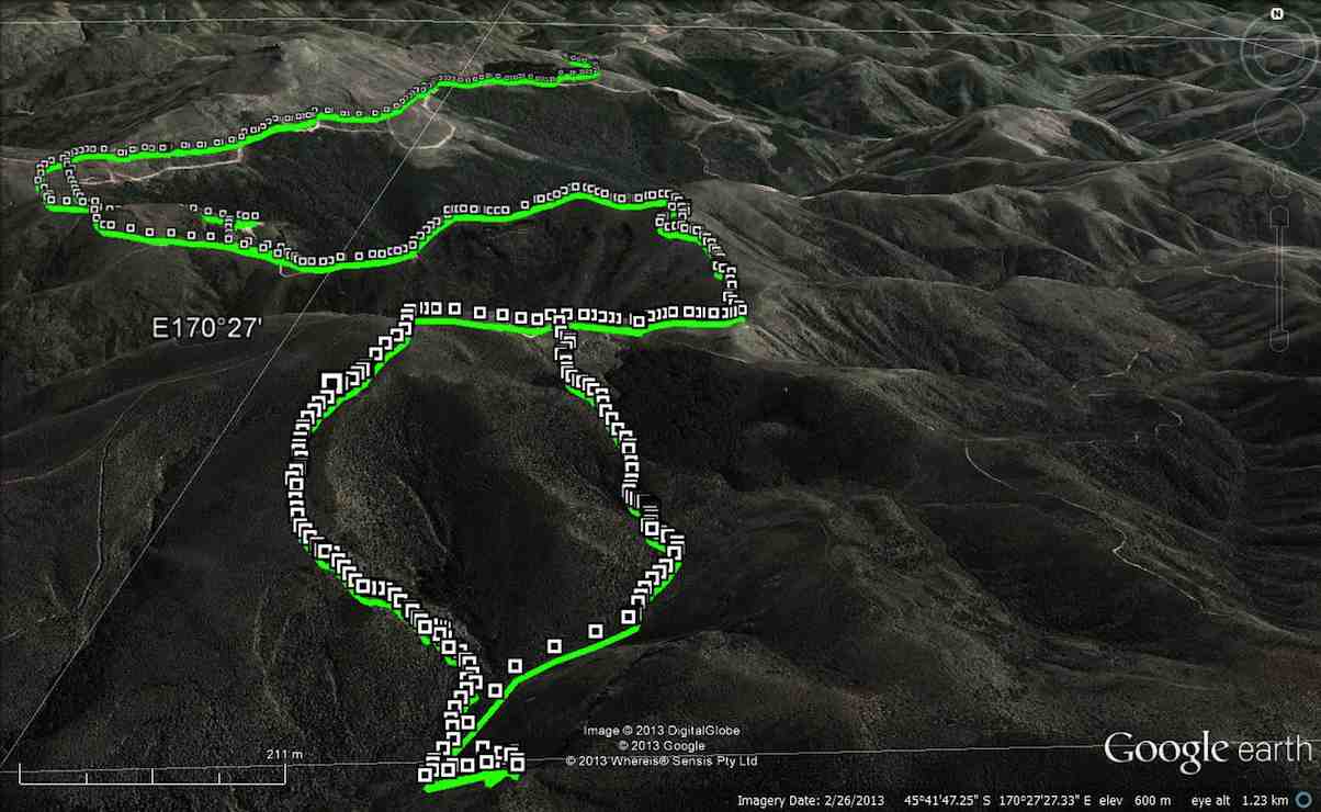
GPS of route, courtesy Ken. We walked 13.6km, 4hrs moving, 2hrs stopped, total ascent 839mtrs, max elevation 701mtrs.
There have been MANY new tracks bulldozed in around the area, making it very difficult to know which track to take. The original idea was to go to the Gap, & then down to the ABC cave, but we were running out of time, due to the distance travelling there, getting held up for about 1/4 hr by a very large mob of sheep with no sign of humans or dogs anywhere. Plus as we didn’t know where to go, we ended up bush-bashing our way down a ridge on the top side of the bush, as you can see by the Google pic. We eventually got down to the DOC track leading between the GAP & ABC, so just carried on to ABC, had a quick drink/snack, & left there at just on 2pm. Then we struggled up another ridge that was a lot clearer than the one we had came down, but it was steep, & it took us an hour to reach the top. From there, it was a relatively easy walk back to the 4wd track that we had left to go down past the bush. One or two of the climbs on the track back to the car were certainly a bit ‘trying’, but we all made it back to the cars OK, & after the drive back to town, got home at just after 6pm.
George didn’t go down the ridge to the cave, so he sheltered for a while, then wandered back to the cars, leaving suitable signs that he had passed that way. There were 7 of us in the group, one of whom was heard to say on the way in, “you think this group is a serious walking group?” so by the end of the day when I asked if they still didn’t think we were a serious walking group, the answer was ” that was a serious walk”. – Ken.
8. 22/2/2010. Trampers. ABC Cave from Bendoran Huts.
GPS of route, courtesy Ken.
It had been many years since any of us had done this tramp, and memories were hazy. So much so, that we parked the cars at the end of Blucher Road, mistaking the shearing shed location there for the actual Bendoran Huts site about six kms further on. So we walked the farm 4WD route to the huts, instead of driving it!
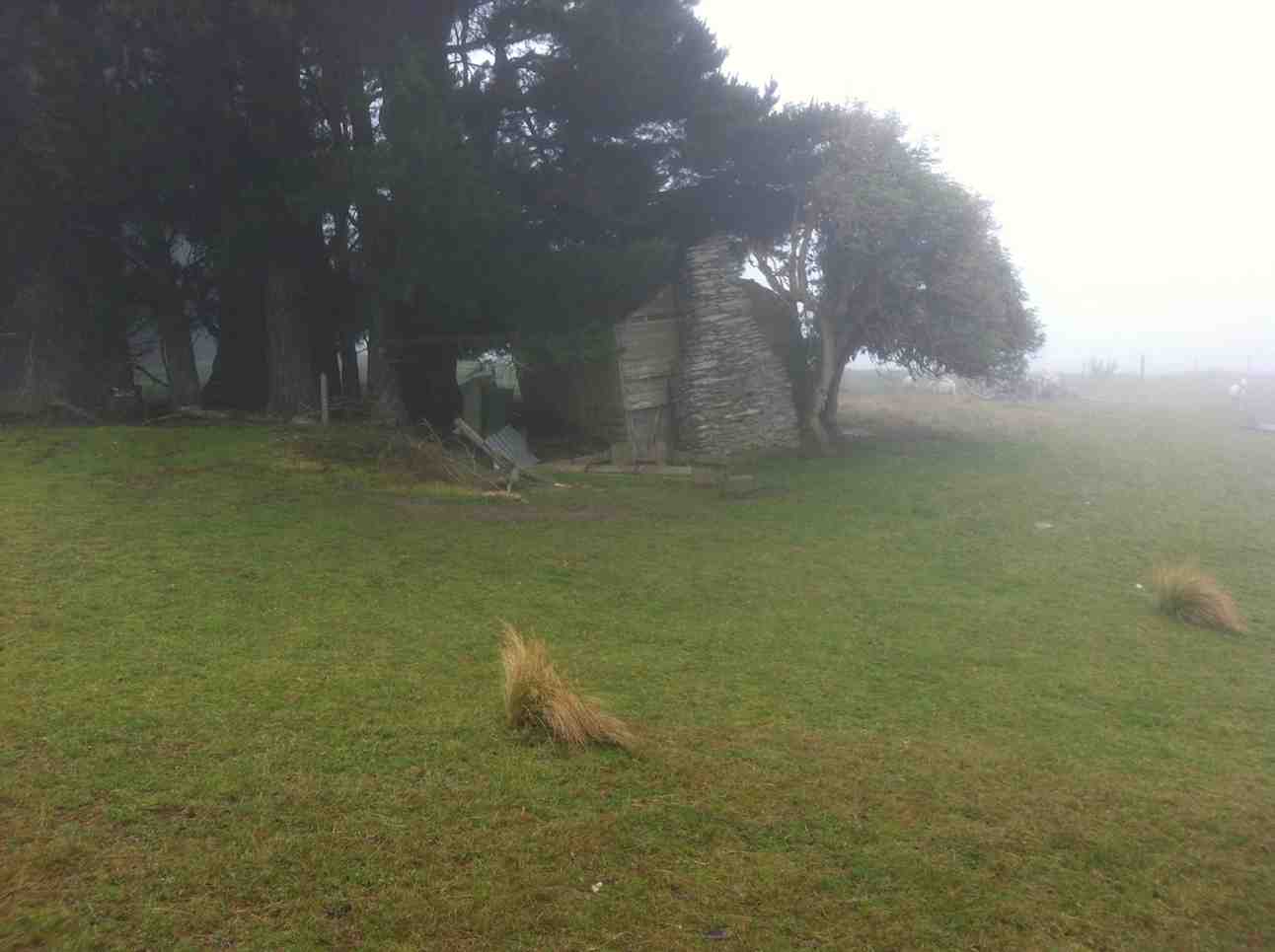
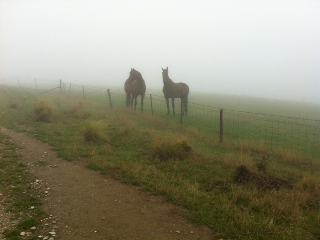
A hut ruin on the route. The fog was round us all the way. But it was dry! A fog, not a mist, as one of us distinguished.
An pic of interest on the way.
Lunch across from one of the Bendoran huts. (Ken pic)

Lunch in lee of the hut. (Ken pic)
Lunch at the old hut.

Orbells Cave from the track.
Running repairs before we start the real climb back out
6. 19/1/2011. Trampers. Lamb Hill to three o’clock creek. Old Stone Hut. Orbells Cave. Medium+.
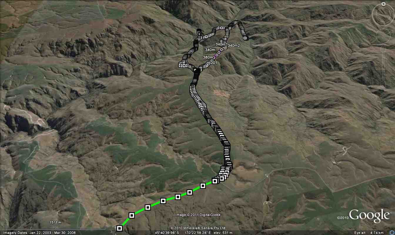
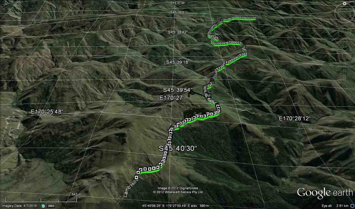
Small scale GPS of route, courtesy Ken.
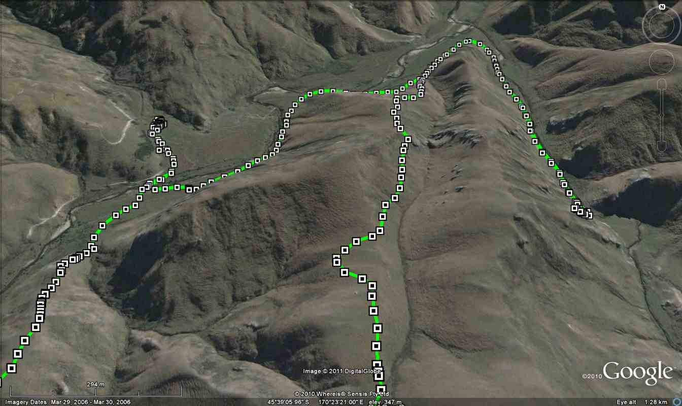
Large scale GPS map of route, courtesy Ken.
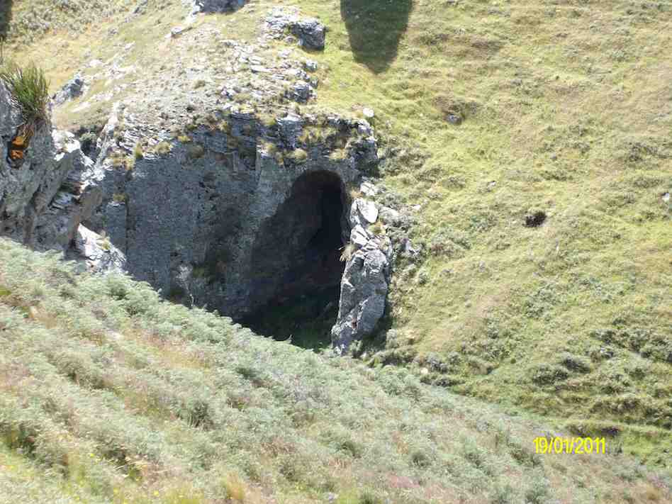
Cute cave we found on the way down to Three O’clock Stream. (Ken pic)
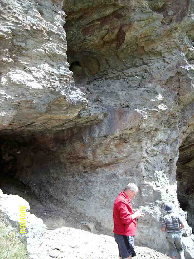
Orbells Caves. (Ken pic)
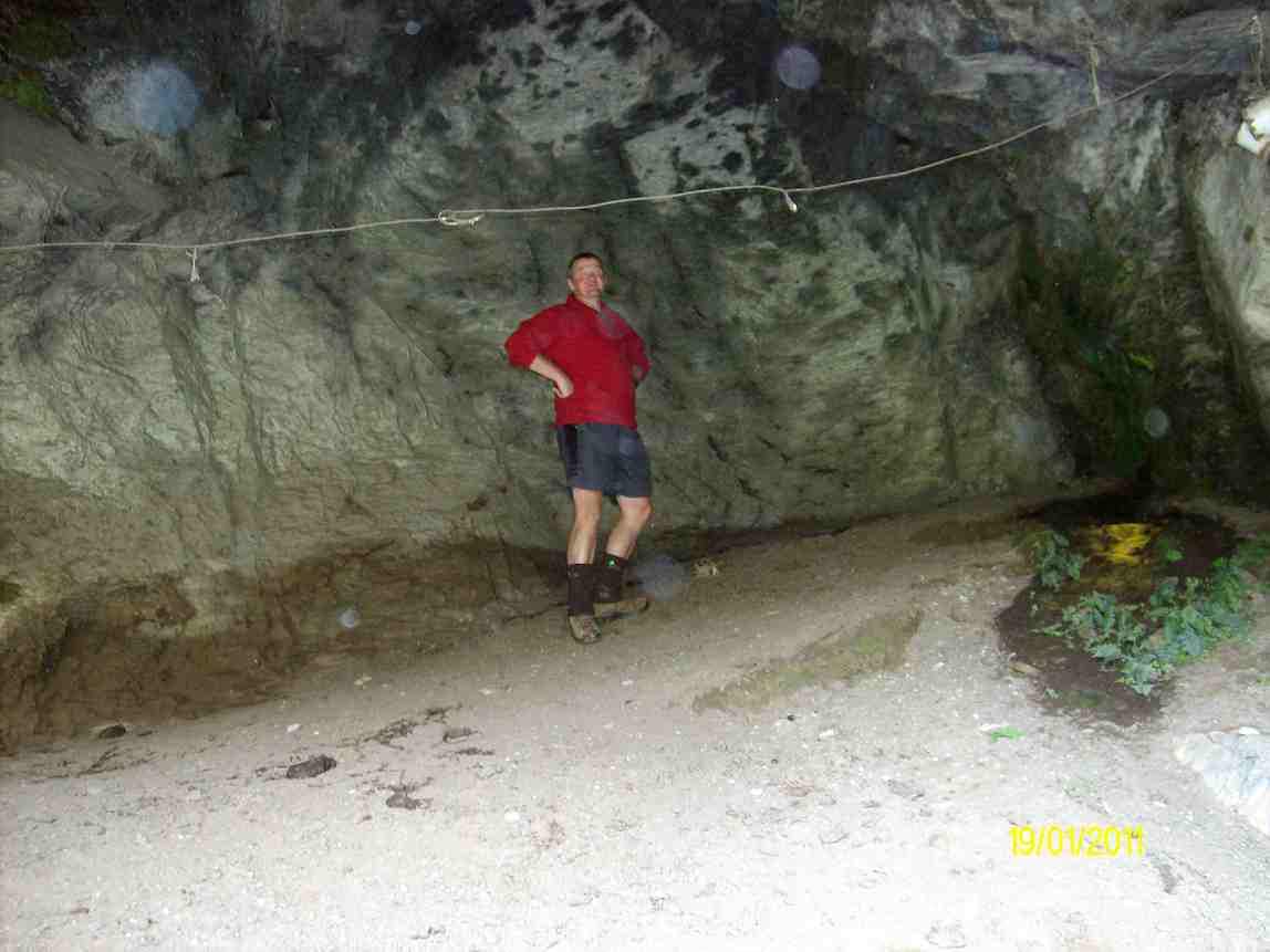
Dermot in the obviously lived-in cave. (Ken pic)
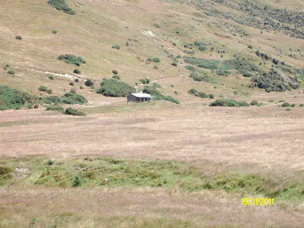
Hut on the other side of Three O’clock Stream. (Ken pic)
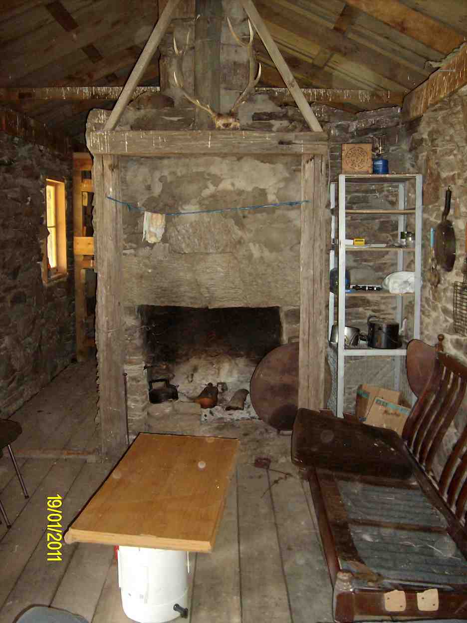
Relaxation area of the hut. (Ken pic)
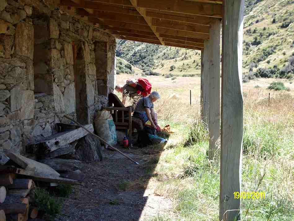
Hazel packing prior to leaving. (Ken pic)
View when we first arrived.
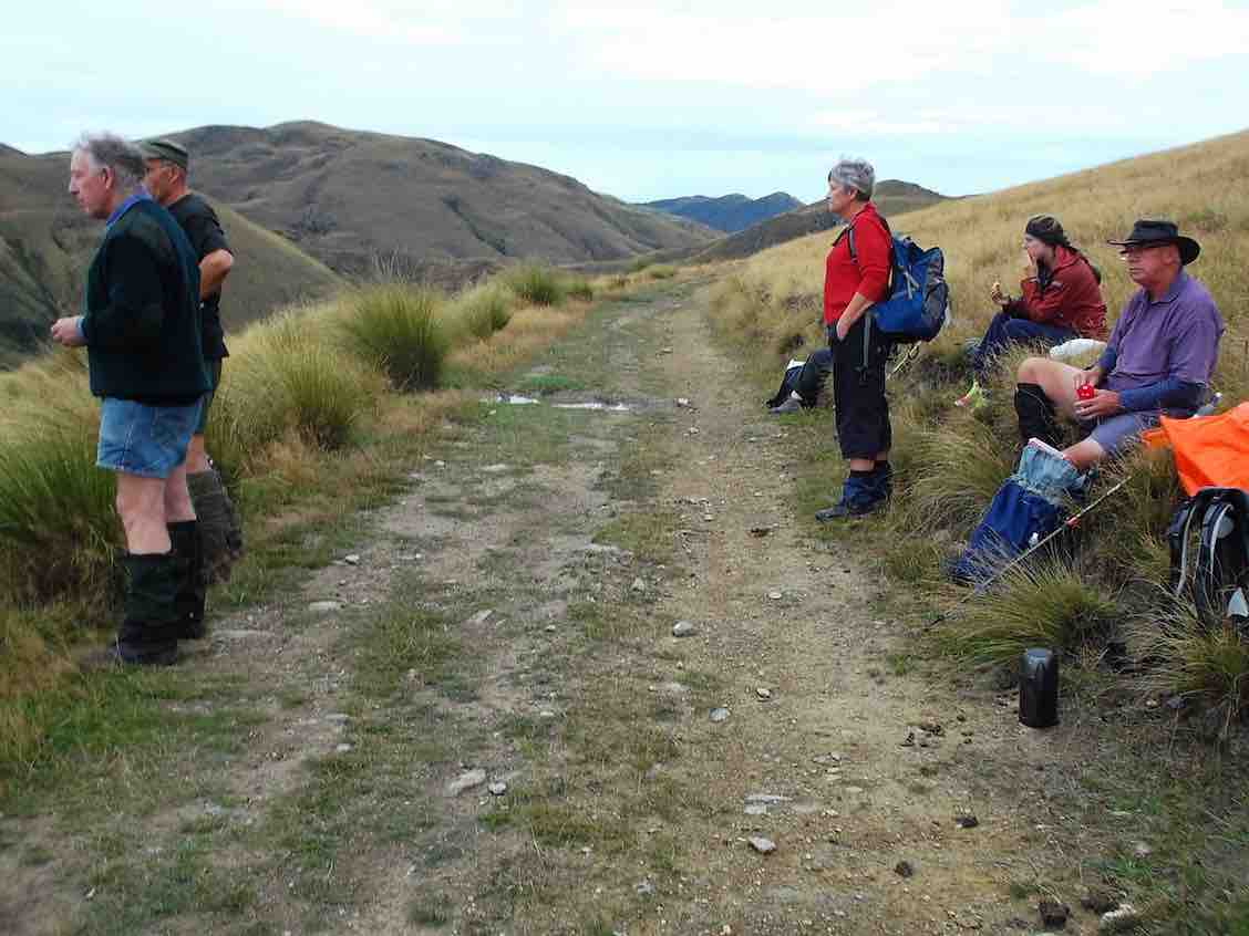
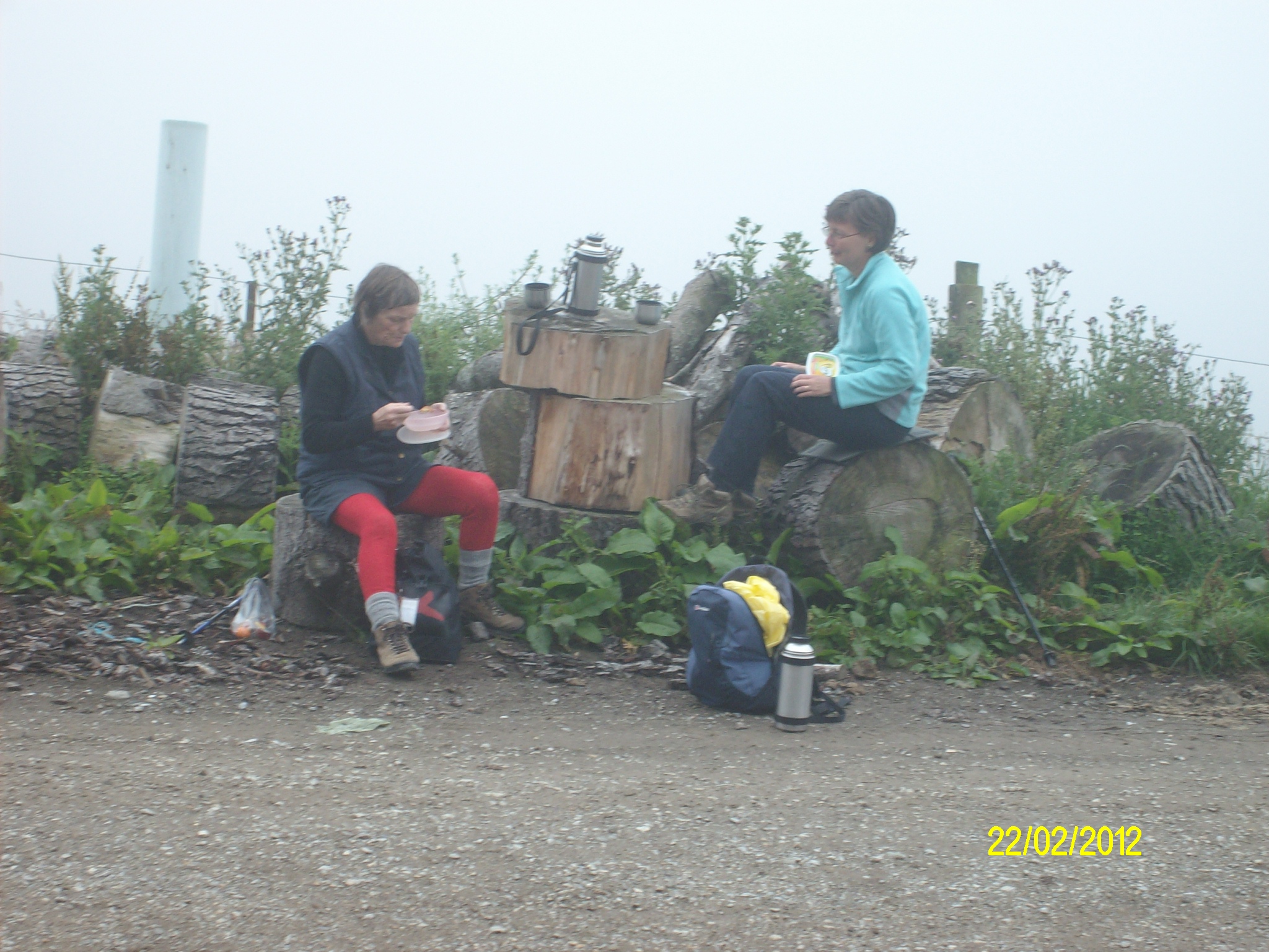
Morning tea break.
Descent to creek
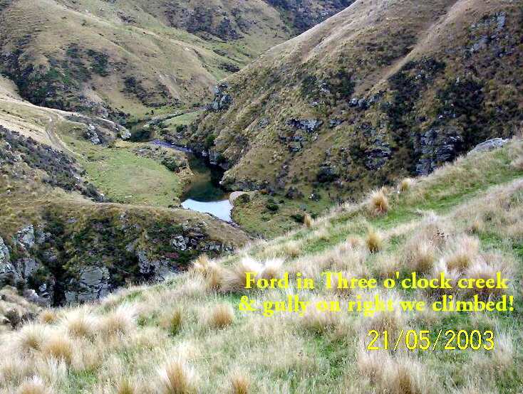
Three O’clock Creek
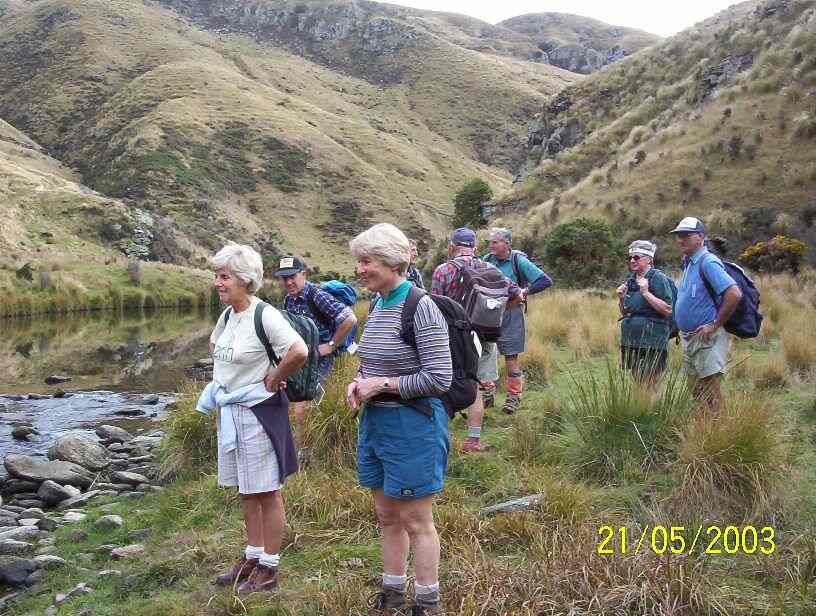
At creek ford.
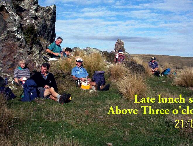
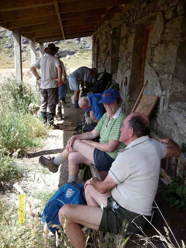
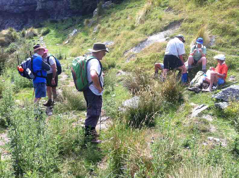
Lunch at top of climb. Pat, Lex, Doug J, Evelyn, Doug M, Bob, Arthur.