Nov 24 2022

Sullivans Dam, Cloud Forests, Escarpment, Cowan round trip

Published by under Trampers,Year round

Cloud Forest and Escarpment

Map: Sullivans Dam, Cloud Forest, Telegraph (Old Bridal) track to Pigeon Flat, Escarpment Track, Cowan Rd, Short Cut to Fox Rd, down to Sullivans Dam – drawn 2002. (Click to enlarge)


10.  23/11/2022. Trampers. Three Peaks, Escarpment, Cloud Forest Loop. Grade 3.5. 26km. Leaders: Clare Noakes, Jill Reid.

Pam IMG_4348 Res 1200

Sunshine start at Sullivans Dam (photo and caption Pam)

15 trampers set out around the lovely track around Sullivan’s Dam but we soon had to turn right up the hill that stated ‘for experienced trampers only’!

John DSC06174 Res 1000

One of many old signs on our route (photo and caption John)

This track is an overgrown mostly-boardwalk that goes up and up through a patch of majestic Rimu, Totara and Miro to the Pylon Road. On the way we passed a bush telephone and a fairy grotto!

Pam IMG_4349 Res 1000

Boardwalks (photo and caption Pam)

Marijke IMG-6455 Res 1000

Telephone box, just in case you need it (photo and caption Marijke)

Morning tea was had under the pylons watching 2 helicopters below us loading up to do some spraying.

John DSC06171 Res 1800

Morning Tea in a clearing (photo and caption John)

After refueling we set off on the escarpment track, firstly through gorse then mud, fallen trees and a rock climb up to the magnificent view from Pigeon Rock.

Pam IMG_4357 Res 1000

Some misjudged their footing! (photo and caption Pam)

Just when we thought the worst was over we came upon 2 huge pine trees crossing the track. However everyone made it safely over, then it was a short scramble up Pigeon Hill to lunch.

John DSC06176 Res 1400

Lunch time hilarity over Neil’s boiled egg (photo and caption John)

Marijke IMG-6462 Res 1800

View from Pigeon Hill – I just love those big skies! (photo and caption Marijke)

The challenge after lunch was to follow the blue ribbons to Mt Cargill, this proved little trouble thanks to some tall scouts who could spot them among the growing pines.

Pam IMG_4369 Res 1600

Down hill from here (Cowan Road) (photo and caption Pam)

Once out on the road with the sky growing darker it was a fast trip down the 3 Peaks track back to the cars where the heavens opened! Good timing team! This is a lovely, varied track with lots to keep you interested. All seemed to enjoy it even the harder parts. Thanks for a great day out – Clare. Continue Reading »

No responses yet

Jul 22 2009

Sullivans Dam

Published by under Hikers

No. 72 on old hardcopy list of 113 club tramps. “Leith Saddle Sullivans Dam. (Green Roof House at Bridge) Year Round”
22/7/2009. Hikers. Sullivans Dam. Medium. Leaders: Lesley G, Bev H.
12/7/2006. Sullivans Dam. Easy. Leaders:  Bob & Nadia, Mary M
20/6/2005. Hikers. Sullivans Dam. Leaders: Frank and Lesley, Eleanor W.
29/8/2001. Alt. Pigeon Flat – Sullivans Dam. Leaders: Nelson and Dot, Wendy J.
14/3/2001. Pigeon Flat and Sullivans Dam. Leaders: Joyce, Mary M, Daphne.
11/8/1999. Sullivans Dam. Leaders: Joyce, Nancy, Pat.
2/9/1998. Leith Saddle Sullivans Dam. Leaders: Joyce, Nancy.

No responses yet

Jul 12 2006

Leith Saddle, Sullivans Dam, Bridle Track, Pigeon Flat

Published by under Uncategorized

12/7/2006 Leith Saddle, Sullivans Dam, Bridle Track Leaders: Bob & Nadia, Mary M
22/9/2003 Leith Saddle, Sullivans Dam, Bridle Track
29/8/2001 Leith Saddle, Sullivans Dam, Bridle Track Leaders: Nelson, Wendy J
1999 Leith Saddle, Sullivans Dam, Bridle Track Leaders: Joyce S, Nancy, Pat

No responses yet

Oct 01 2003

Patmos Avenue, Maxwelton Road, Pine Hill Road, Cowans Road, Bridal Trail, (Pigeon Flat,) Sullivans Dam, Leith Valley Road, Malvern Street.

No. 64 on old hardcopy list of 113 club tramps. “Patmos Ave – Leith Valley – Bridle Track. Year Round”

Cars park Patmos Avenue.
Combined alternatives. Do either clockwise or anticlockwise.
3 km to Bridle trail.
10.3 km O’Connel Road to Patmos Avenue
Total distance: 17.1 km.

(Hikers: turn off Bridal Trail down to Gun Club nr Sullivans Dam.)

1/10/2003. Trampers. Patmos Avenue, Cowan Road, Bridal Track, Pigeon Flat, Leith Valley Road. Medium. Leaders: Sabina, Shirley McN.
1/10/2003. Hikers. Patmos Avenue, Cowan Road, Bridal Track, Sullivans Dam, Leith Valley Road. Medium. Leaders: Eleanor, Val.
13/11/2002. Hikers. Patmos Avenue, Cowans Road, Cowans Road, Bridal Trail, Leith Valley Road. Medium. Leaders: Nancy, Dot T.
13/11/2002 Trampers. Patmos Avenue, Cowans Road, Bridal Trail, Pigeon Flat, Leith Valley Road. Medium+. Leaders: Ian, Barbara McC, Nancy, Dot T
5/6/2002 Leaders: Nancy, Arthur & Barbara, Barbara McC
11/7/2001 Leaders: Colleen, Lex, Peter B
3/5/2000 Leaders: Nancy, Bill & Pat
15/9/1999. Patmos Avenue, Bridle Track. Leaderx: Colleen, Wendy, Sabina.
22/4/1998. Patmos Avenue, Cowan Road, Pigeon Flat, Sullivan Dam, Leith Valley. Leaders: Nancy, Irene, Colleen.

No responses yet

Jul 23 1997

Leith Valley, Nicols Waterfall, Sullivans Dam

Published by under Trampers

23/7/1997. Leith Valley, Nicholls Waterfall, Sullivans Dam. Meet at Duke Street. Leaders: Jack and Rosemary, Daphne.

No responses yet

Nov 22 2023

Leith Saddle, Swampy Spur, Transmitter Tower. Also Rustlers and Burns Tracks

Published by under Both Hikers & Trampers

Information
Click Swampy ridge track for background information.
See also: Leith Saddle and Morrison Tracks
Leith Saddle, Waitati Valley Road, Sawmill Track, Swampy Ridge, Burns Track
Click boardwalk history for account about the original Leith Saddle Track  and the establishment of the boardwalk in 1993.
For our Club’s part in the boardwalk venture see boardwalk for an ODT account of its construction.
See also TRTC Jack Merrilees (who died January 2015)

Cars park off motorway at Leith Saddle yard (alternatively down side road at bridge (restricted space). 25 km from car park.
Walk across side road to track.
Gravelled track 1.5 km. (morning tea on lookout seats a little further on)
Transmitter Tower 2 hours.
Going further: along road past doppler radar to DoC sign.
Right along Rustlers Ridge track to junction with Burns Track.
Through junction and up and round hill on Rustlers Ridge Track. (Lunch on hill)
Down ridge to pipeline. (Alternatively turn right at junction for Burns and down to pipeline)
Turn right along pipeline.
5.5 hours in all.
Burns – Rustlers circuit Maintained by Green Hut Track Group. DCC land.


Img 7887 Res 10035. 22/11/2023. Trampers. Burns/Rustlers Ridge. Grade 4. 25km. Leaders: Phil Morris/Carolyn Pridham.

On an overcast muggy day, 20 Trampers headed to Leith Saddle. We set off down Leith Valley road, and left up Burns Track entrance onto Pipeline Track Continue Reading »

No responses yet

Sep 30 2023

Deep Creek Weir from Old Dunstan Road past Rocklands

No. 2 on old hardcopy list of 113 club tramps. “Deep Stream [Stream crossed out and replaced by Creek] (Rocklands). R Lippers. Cattle.”
No. 56 on old hardcopy list of 113 club tramps. “Deep Creek from Old Dunstan Road. (Rocklands. Year Round”
Est, 50 km from car park.
See Deep Creek Water Scheme Pipeline history.
See further background information behind Deep Stream project

19. Welsh’s Road, Old Farm, Deep Stream Weir. Grade 3 Leaders: Lyn and Di

13 of us set off for the Pipeline, which is just off the old Dunstan trail on Rocklands Station.

We had morning tea under the pine trees where we parked the vehicles. It was a tad cold but we soon warmed up with the walk over the farmland to the pipeline.

Up and up over farmland. Caption and photo Pam

Up and up over farmland. Caption and photo Pam

The countryside is getting more rugged Caption and photo Marjke

The countryside is getting more rugged Caption and photo Marijke

Tramping nirvana, easy level dry track, marvelous views Caption and photo John

Tramping nirvana, easy level dry track, marvellous views Caption and photo John

It was stunning scenery walking to the Weir and back.

Happy Trampers. Caption and photo John

Happy Trampers. Caption and photo John

Pump house and Weir. Caption and photo Pam

Pump house and Weir. Caption and photo Pam

Exploring the engineering feat, the Deep Stream Weir. Caption and photo John

Exploring the engineering feat, the Deep Stream Weir. Caption and photo John

Can you spot the hut Caption and photo Marijke

Can you spot the hut? Caption and photo Marijke

We had lunch in the sun out of the gorge with more room to spread out.

Refuelling. (Pipeline track to the weir in the background). Caption and photo Pam

Refuelling. (Pipeline track to the weir in the background). Caption and photo Pam

Then took the road back to the cars. It was 8.84ks according to my phone.

Some finished the day with a cuppa at the Wobbly Goat. Another great day out.


Continue Reading »

One response so far

Sep 16 2023

Pine Hill, Mount Cargill round trip

Published by under Trampers

Click Mount Cargill history for background information
4. 13/09/2023. Trampers. Pine Hill, Mt Cargill. Grade 3.5, $5, 20km, Leaders: John Gardiner, Dave Roberts

Having already somewhat created a “rod for my own back”, in starting the Wizard of Oz theme in my tramp preamble last week, after some prompting, I’ll try to intertwine the “Wizard” theme into this report. Inevitably particularly pertinent to trampers, some yellow brick road references.

Getting ready to leave the cars - John

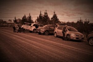
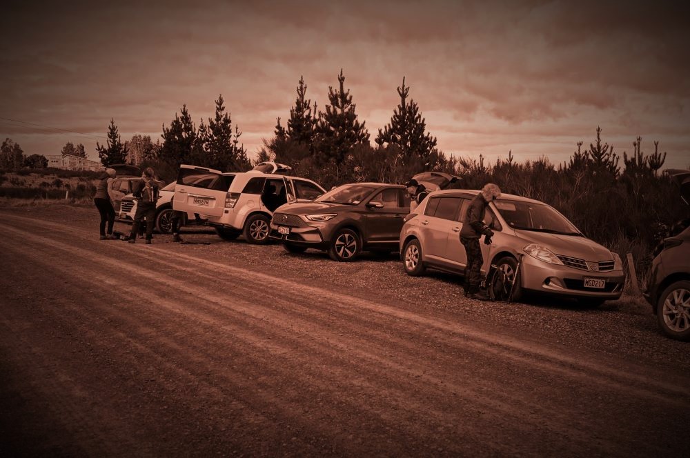
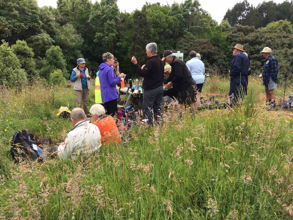
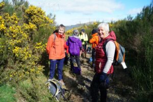
Getting ready to leave the cars (Photo & Caption John)

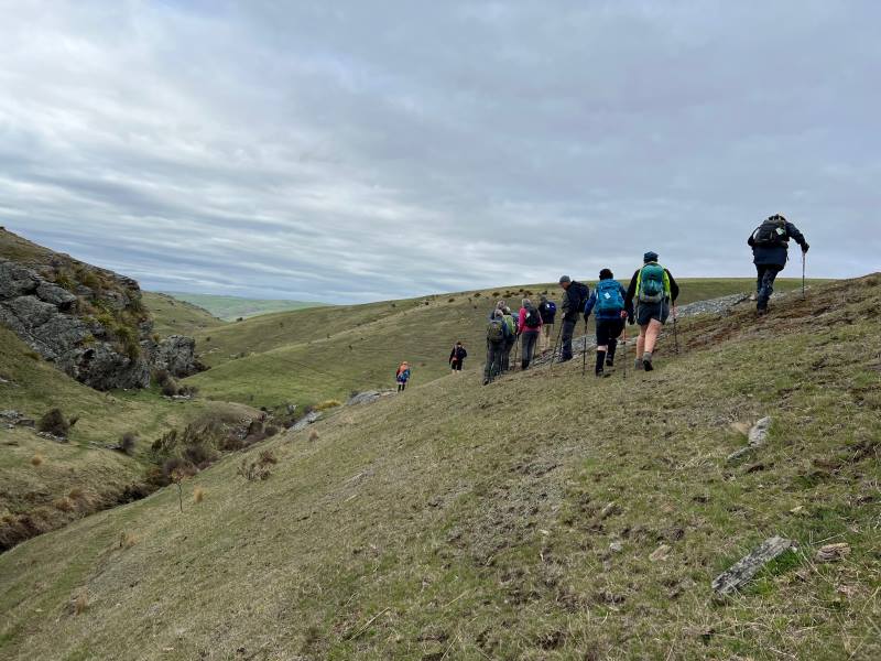
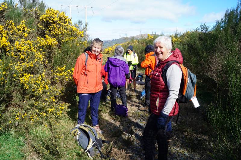
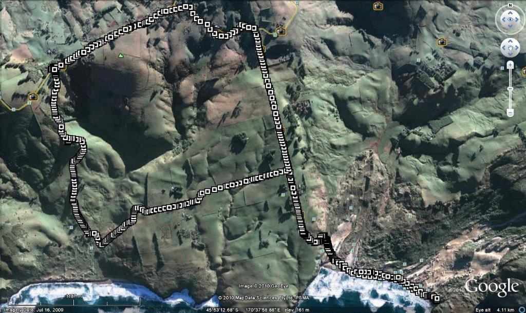
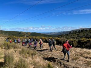
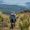
On an overcast morning with a chilly wind, 21 trampers, who arrived in 6 cars, set out at 10.00am, on the start of our tramp in Cowan Road. Like Dorothy at the beginning of her yellow brick road journey, most trampers had no idea where they would venture during the day.

– One interpretation of the “Wizard Fable” is that on life’s journey, tenacity, and perseverance in striving for a goal is a core value.

Following Dorothy to see what lies ahead - Pam

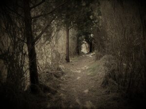
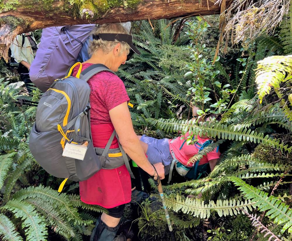
Following Dorothy to see what lies ahead (Photo & Caption Pam)

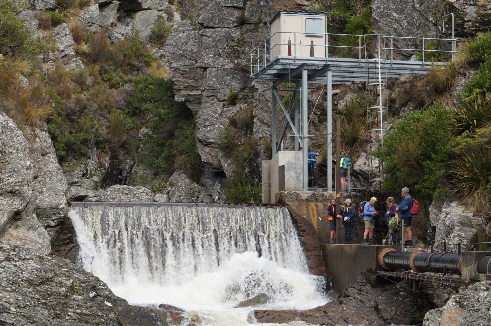
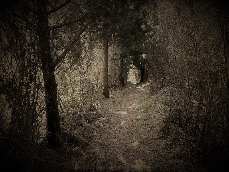
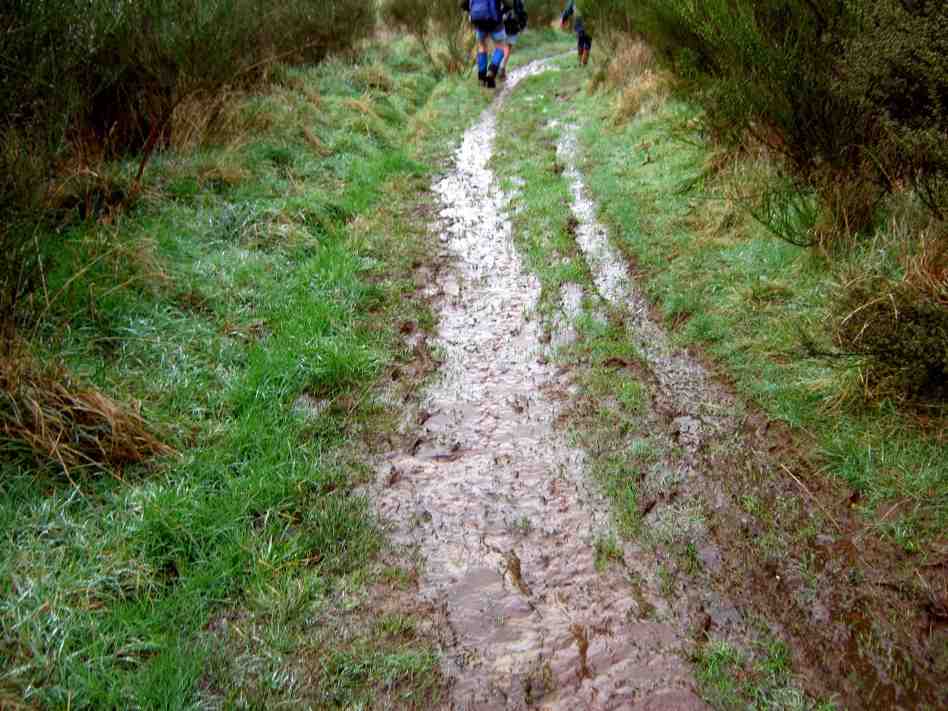
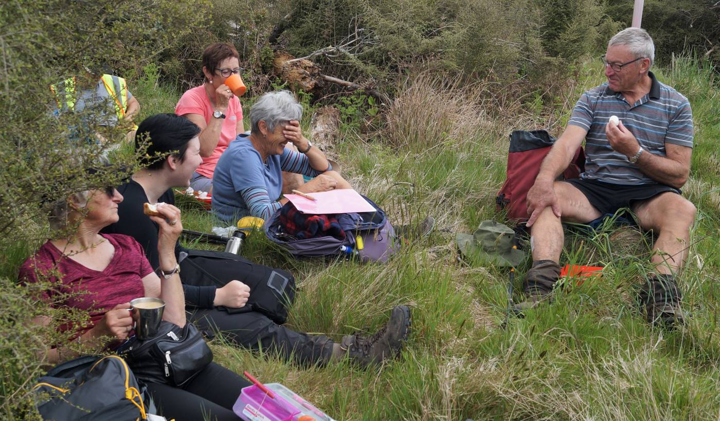
Following the previously described, muddy, gorse lined portal to what lay beneath, morning tea was enjoyed at 10.40am on the lower, wider, gravel road, at a sheltered spot.

About to have morning tea - John

About to have morning tea (Photo & Caption John)

– Some believe the gold colour of the yellow brick road and the green “Emerald City” represent the currency arguments the US experienced in the 1900’s.

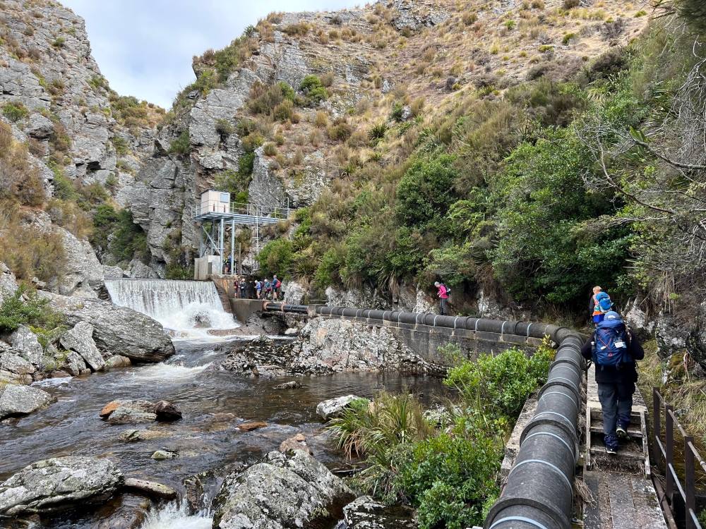
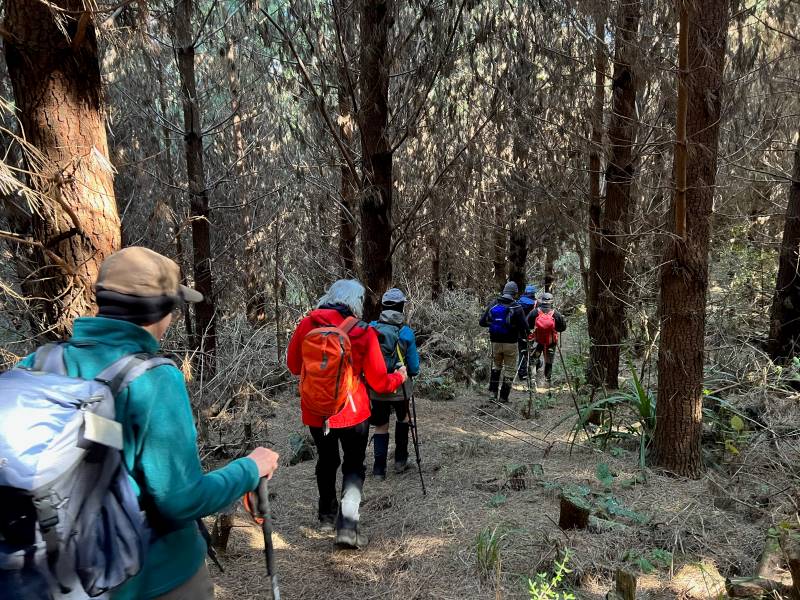
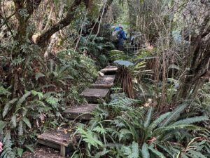
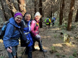
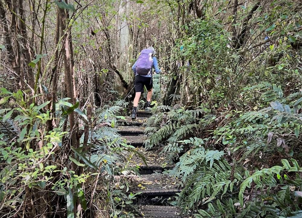
Soon we were on the track leading down through the forest, with a pine needle carpet underfoot, and after following a fence line, we were soon on the gravel road to Sullivans Dam, arriving at 11.20am.

Tramping through the pines - Pam

Tramping through the pines (Photo & Caption Pam)

-During the making of the “Wizard” movie, the snow scene contained fake asbestos based snow that left many on set chronically ill!

Lunch in the sun - John

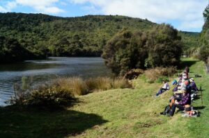
Lunch in the sun (Photo & Caption John)

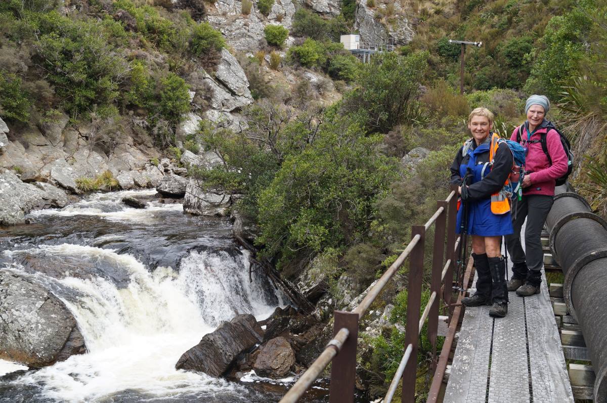
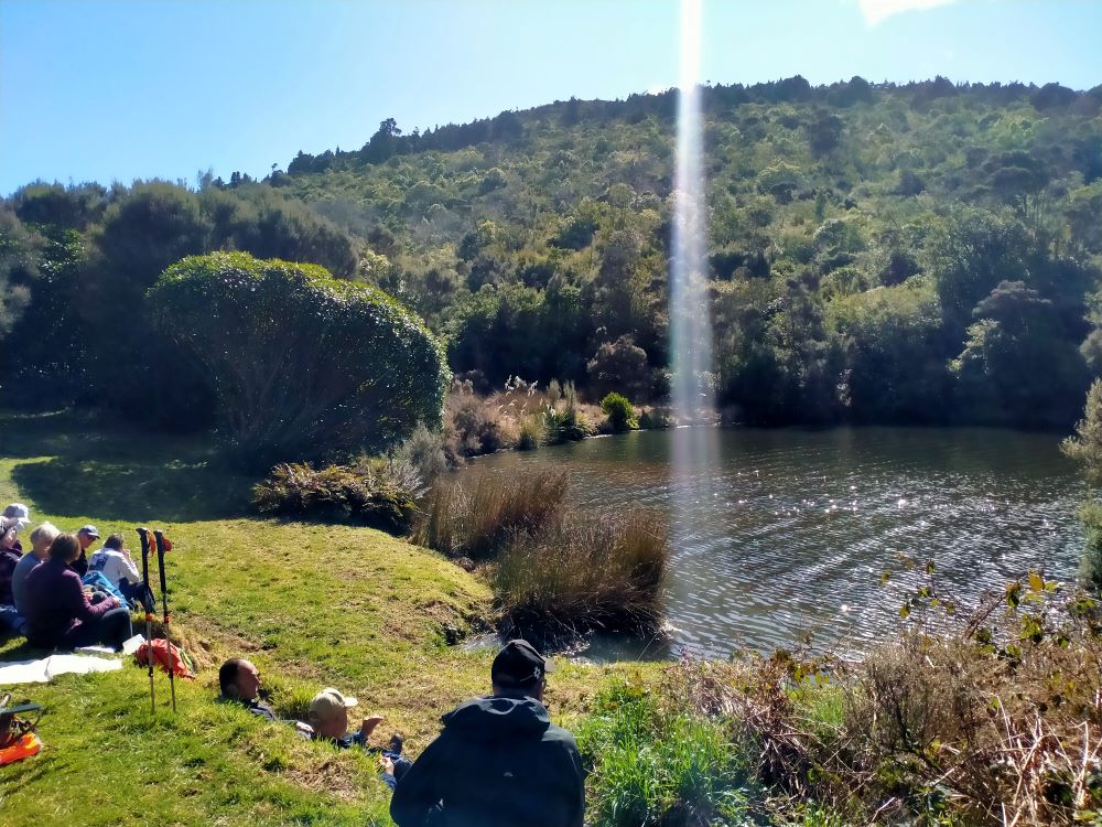
Lunch was enjoyed at the beautiful Sullivans Dam, beginning a little early, at 11.50am, in a sheltered spot. We had reached our destination.

the shaft of light from above made the trout rise to Graeme's delight - Phil K

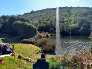
The shaft of light from above made the trout rise to Graeme’s delight (Photo & Caption Phil)

-In the Wizard story the Emerald City is a place to which Dorothy, the tin man, the lion, and the scarecrow journey in order to achieve their various dreams.

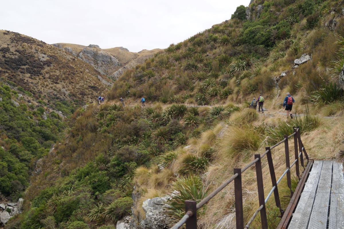
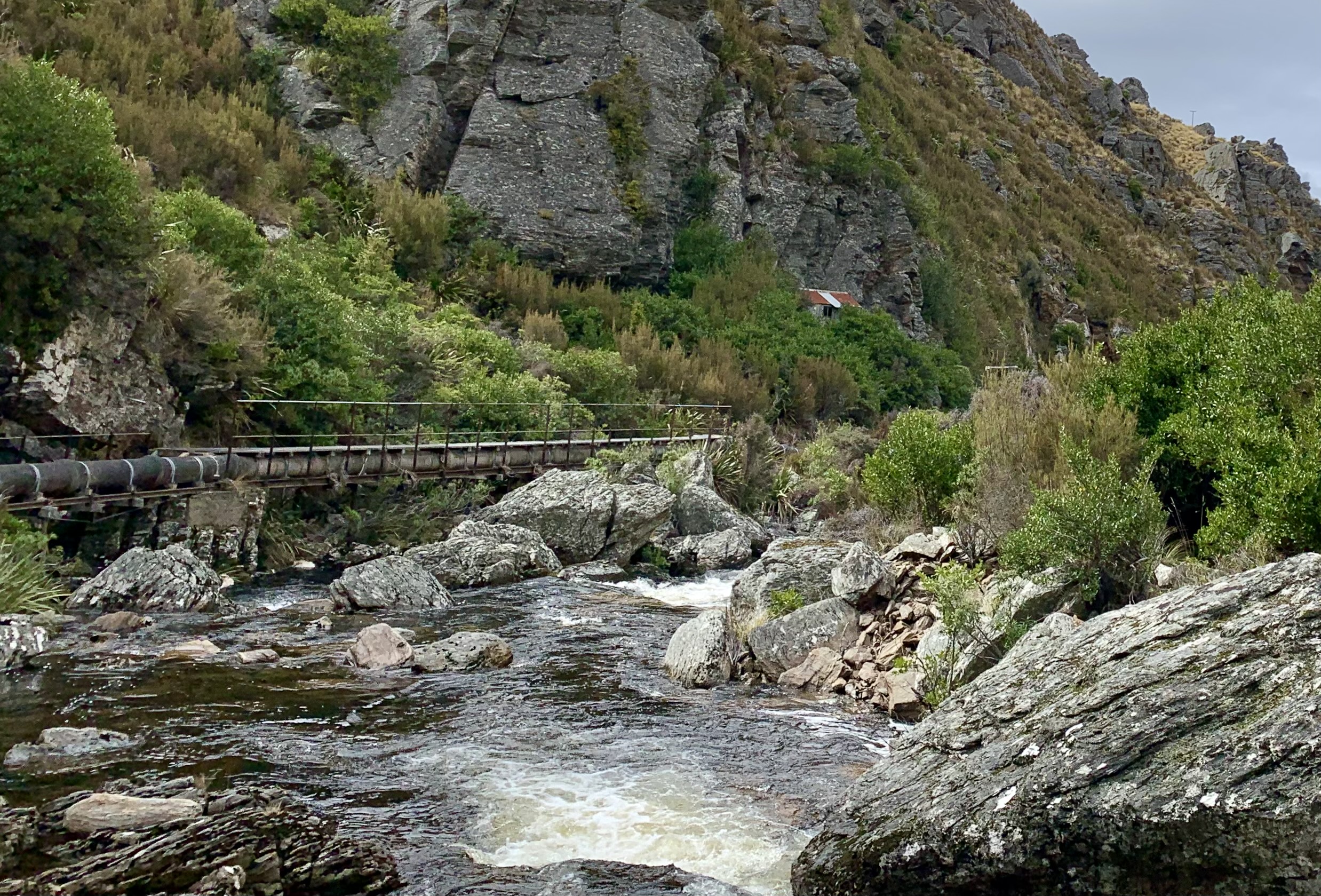
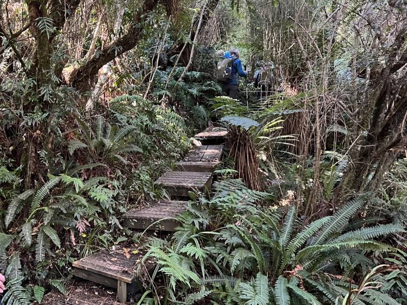
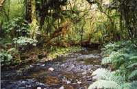
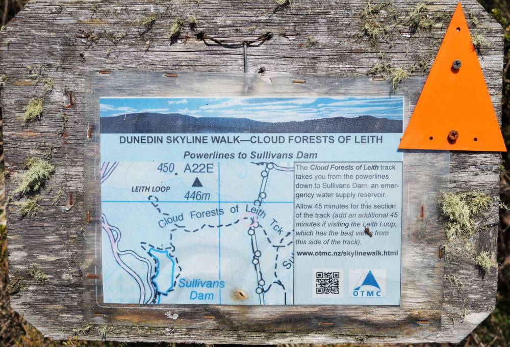
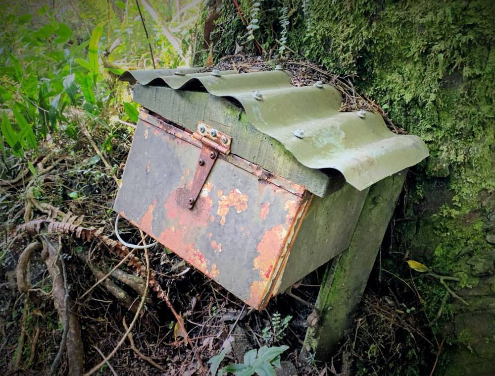
By 12.15pm we were on our way again, walking around the side of Sullivans Dam to the start of the “Cloud Forests of the Leith” track. This track, with it’s many boardwalk sections and beautiful bush (even a ‘bush telegraph’ and Gnome Grotto) adding yet more variety to our tramp.

No “I’m not having problems with my internet banking - Pam

No, I’m not having problems with my internet banking (Photo & Caption Pam)

Creatures of the forest - Pam

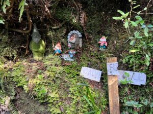
Creatures of the forest (Photo & Caption Pam)

-In the Wizard story the yellow brick road was at times very rough. The scarecrow often stumbled over the yellow bricks, which were very uneven, sometimes even broken, or missing altogether, leaving holes that dog Toto (a West Highland Terrier) and Dorothy jumped across or walked around.

Board walking - Pam

Board walking (Photo & Caption Pam)

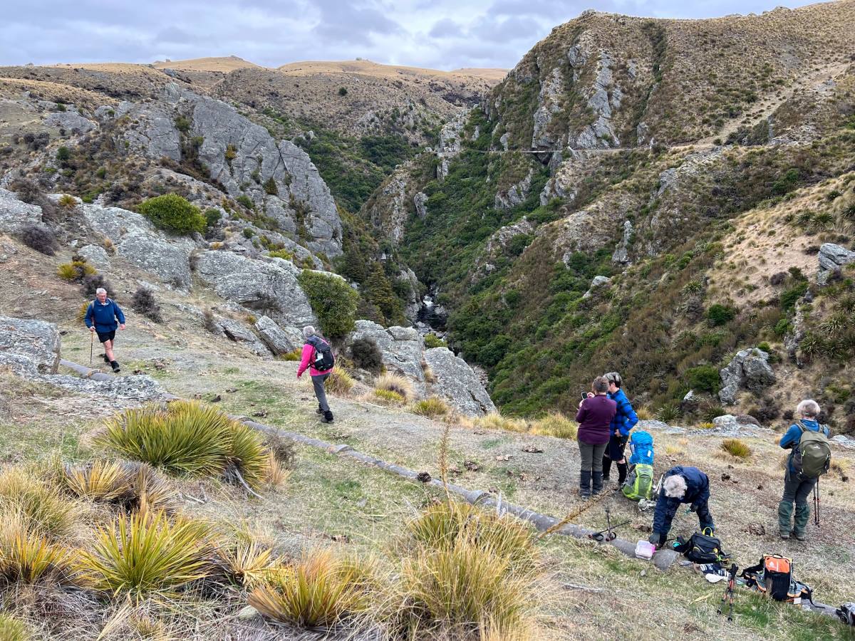
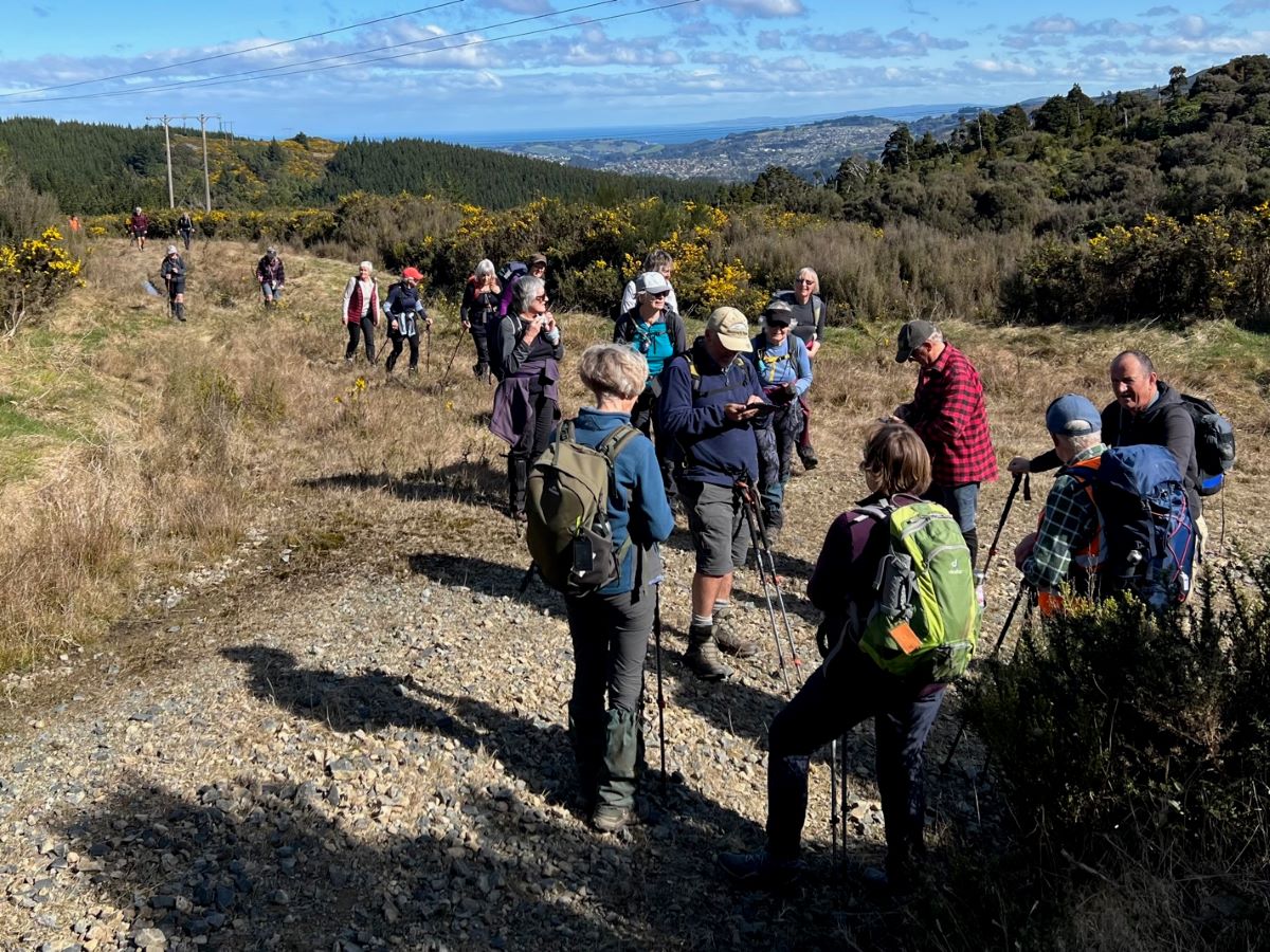
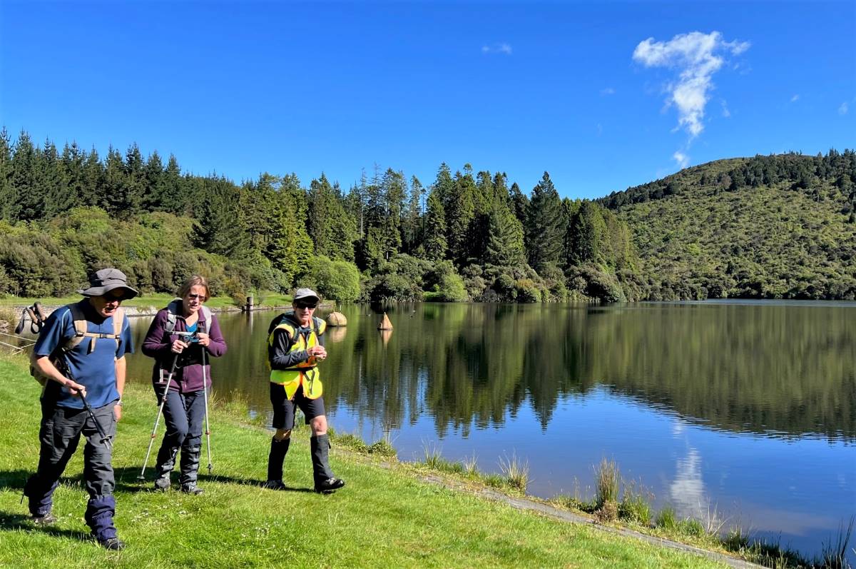
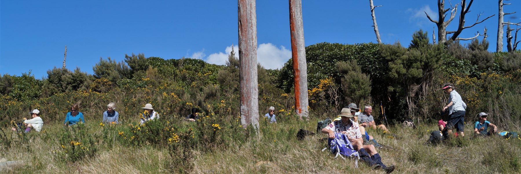
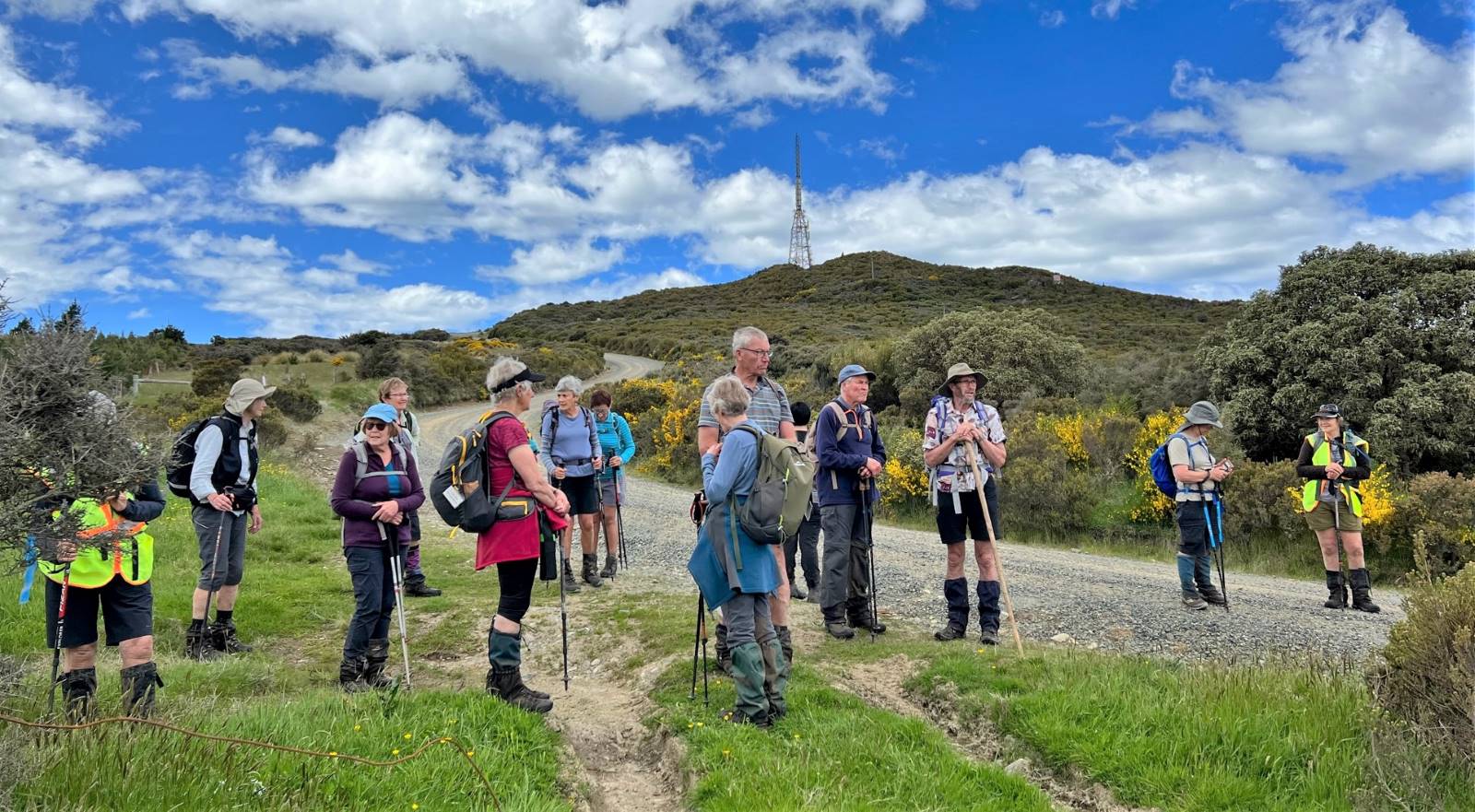
Arriving at the top of the Cloud Forests track by 1.20pm, we regrouped with a magnificent view north to Blueskin Bay and beyond, before following the gravel road to the base of the “portal” gorse lined track.

Regrouping - Pam

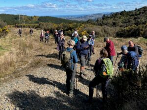
Regrouping (Photo & Caption Pam)

Panorama - Blueskin Bay in the distance - John

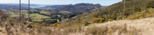
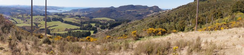
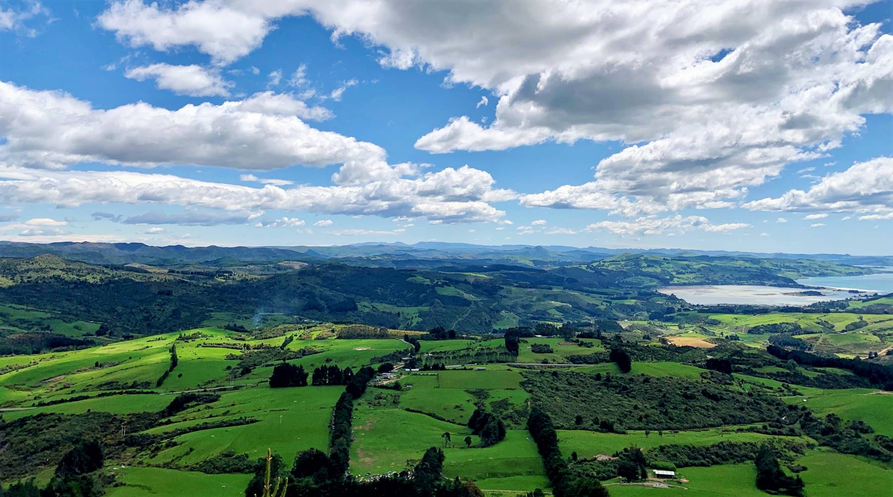
Panorama – Blueskin Bay in the distance (Photo & Caption John)

On this section a navigational error by your’s truly resulted in everyone walking a bit further than necessary to a dead end part of the road. The greatest consequence of this being my embarrassment!

Are you sure we are going the right way - Pam

Are you sure we are going the right way (Photo & Caption Pam)

– In the Wizard story, Dorothy follows the yellow brick road, intending to find the Wizard, who would bestow on her the knowledge to achieve her goal, only to find that she had the answer within her all along.

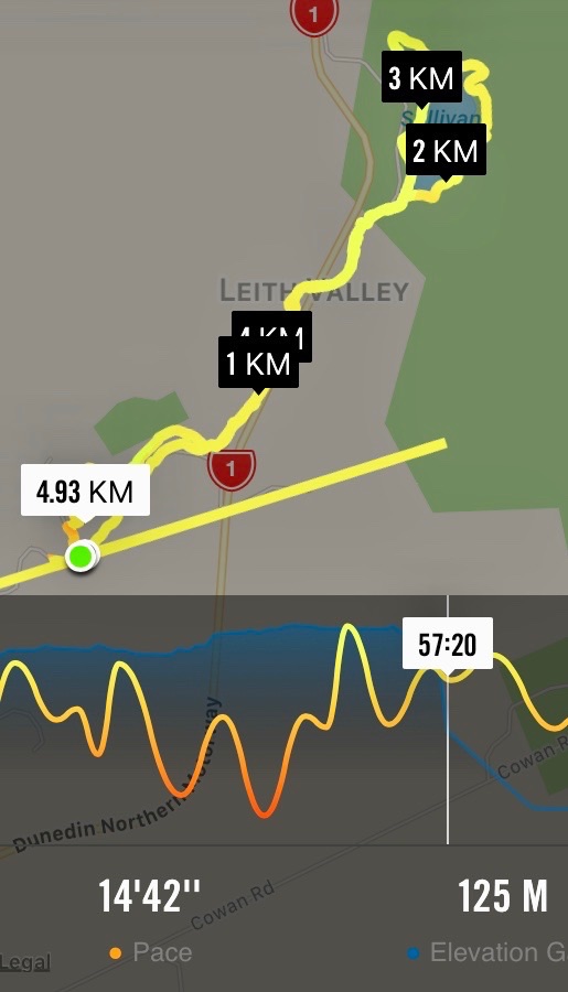
Heading up the gorse lined final section of our tramp took us back to the cars by 2.30pm, having covered approx 8 km. A Grade 3 tramp.

Happy trampers - Pam

Happy trampers (Photo & Caption Pam)

-So where was the yellow brick road? Some believe it is a brick road in Peekshill, New York, where author L.Frank Baum attended Peekshill Military Academy. Others believe it was inspired by a road paved in yellow bricks near Holland, Michigan where Baum spent many summers.

Afternoon tea was enjoyed at the Crocodile Cafe, Dunedin Botanic Garden, on what had developed into a mild , sunny day. As a footnote – I did apply and receive a permit to walk on the City Forests section of this tramp, only to receive a later email, stating that it wasn’t necessary if we stayed on the Escarpment or 3 Peaks tracks.
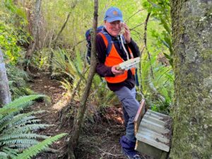
Special thanks to Dave Roberts for acting as tail end Charlie and Graeme Souter for his help with the rece.

– Goodbye yellow brick road.

John Gardiner.

Continue Reading »

No responses yet

Mar 18 2019

Deep Creek Water Scheme Pipeline

Published by under Tramping Areas General Information and tagged:


Background.
The Deep Creek Water Scheme was built during the depression of the 30s.
The Pipeline is 58 years old and 64 km long.
The intake is 675m above sea level.
The catchment is 5420 hectares; mainly tussock with some grassland.
The steel pipeline, lined with bitumen, was in a bad state of repair by the 80s and the leaks were constantly plugged with tapered wooden plugs until it resembled a porcupine.
The authorities were eventually persuaded to renew the worst section, this being done with the aid of a helicopter in 1992. It is a useful supplement to Dunedin’s water supply.
The Pipeline is made of bitumen-lined steel excepting the first 1.4 km which was replaced in 1992 with concrete pipes.
Water quality is variable and often discoloured.
Over the 58 years the yield has dropped from 11,000 cubic metres to 6,800 cubic metres a day.
The water goes to Booth Road Treatment Station and Sullivans Dam.
Replacing the rest of the pipeline is estimated at $20,000,000 and would increase the flow to 17,000 cubic metres a day.
– From a hand-written record in the President’s file and supplemented with other data.

No responses yet

Jan 18 2017

Patmos Avenue, Leith Saddle, Moores Bush

Published by under Hikers

5. 18/1/2017. Hikers. Moores Bush – Sullivan’s Dam. E. Leaders: Bev and Lesley.

Route map, Courtesy Ian. (Ignore straight line.) Moore’s Bush on Thomson Rd, Loop Track,  Leith Valley Rd, Sullivans Dam circuit, lunch, return by Leith Valley Rd.

Morning tea at entrance to Moore’s Bush. (Ian pic and caption.)

DoC sign. (Ian pic and caption.)

4. 19/9/2012. Hikers. Moores Bush, Sullivans Dam. Leaders: Bruce and Marjorie
3. 17/2/2010 Hikers. Thompson Rd, Moores Bush, Leith Valley Rd, Sullivan’s Dam, Leith Valley Rd. Leaders: Bev, Leslie.
Good day to start with but got rather cold by lunch time. However, 12 keen hikers enjoyed a very pleasant, but shortish, day out. What a wonderful little forest Moore’s Bush is.  Where is Moore’s Bush, you ask? Ascend the Leith Valley road out of Dunedin and take a left turn into Thompsons Road, and not far along is the entrance, signposted but fenced, to this Forest and Bird Society property.

Have included the website for anyone interested in looking it up. http://www.ecoimages.co.nz/ForestandBird/mooresbush.html The photos are ones from that site.

Just a short walk to the entrance of Moores Bush for our morning tea and then off we went through the bush. Track rather overgrown and we had to wade through Leith Stream to get to the exit but everyone was interested to see Moores bush and check out what work had been done by the Forest and Bird Soc., over the years. We didn’t see much “bird”, but we loved the “forest”, with  some grand Rimu trees, lots of mature Fuchsia, a Big Red Beech, many mature Lancewoods, heavy undergrowth, and more recent plantings of Totara, Rimu

Young Rimu planted at Moore’s Bush.

and smaller trees and shrubs. Little streams wound through it and also the Leith, which we crossed, most getting wet feet etc, except for Bob who found a fallen branch bridge, and stayed dry, much to the disgust of the others.

Leith Stream running through Moore’s Bush.

Leslie, who led, with Bev, had an old information leaflet about the reserve which spoke of the area as being perhaps the best piece of bush in the greater Dunedin area. It is certainly not large, but it is a gem. There is even a long-drop-lodge near the start if you need it!!

We exited again onto the Leith Valley Road. From there it was up the road to Sullivans Dam with a very pleasant walk round the dam to find a sheltered spot on the motorway side for our lunch as it had turned quite cold. We admired the birdlife on the ‘lake’ and the unusual North Island Cabbage Tree planting. Then it was back down the Leith Valley Rd to the cars. While it was not a long walk, it was varied and satisfying for the 12 people most of whom were discovering new territory. – Bev and Bob. (Amalgamation of two reports. Thank you, Bev and Bob. – Editor)

2. 5/6/2002. Combined. Patmos Avenue, Pigeon Flat, Moore’s Bush. Medium. Leaders: Nancy, Barbara and Arthur, Barbara McC
1. 3/5/2000. Patmos Avenue, Leith Saddle, Moore’s Bush. This incorporates and longer and shorter walk. Starting together. Leaders: Nancy, Pat and Bill.

No responses yet

Oct 26 2011

Leith Saddle and Morrison Tracks

Published by under Trampers

Location: 25 km.
Click Swampy ridge track for background information.
26/10/2011. Trampers. Cars at Thompsons Road. Sullivans, Leith Saddle, Swampy, Morrison Tracks.

GPS. Courtesy Ken. Sullivans Dam Leith Saddle track Morrisons

7 of us met at the parking spot opposite Thompsons Rd. Continue Reading »

No responses yet

Sep 08 2010

Paradise Road, Braidwood Road, Sandfly Bay

Published by under Trampers

8/9/2010. Trampers. Paradise, Braidwood, Sandfly Bay. M. Leadership: Informal.

Tramp Route. (Courtesy Ken). Car parked top LH corner.

Weather looked fine at Mosgiel, but when we four trampers arrived at Sullivans Dam for the Cloud Forest-Escarpment Tramp, we struck a drizzly cloudy shock. For mud and safety concerns we turned back to town and on the way decided to try the Peninsula. We parked at the top of the Paradise Road track and the weather was quite a degree clearer. However, our second shock was to find the track the WETTEST we have ever found it. No one slipped over, (miraculously), but we had to be extremely cautious in placing our feet.

A slippery muddy Paradise Road Track

Continue Reading »

No responses yet