Dec 09 2023

Tomahawk Lagoon and nearby tracks/areas

Published by under Beach,Trampers

Ocean Grove, also known as Tomahawk, is a suburb in the southeast of the New Zealand city of Dunedin. … The suburb was known as Tomahawk until the 1930s, the name not being a reference to the weapon, but rather possibly an anglicised form of the Māori words tomo haka, meaning “dance by a gravesite”.

No. 23 on old hardcopy list of 113 club tramps. “Karetai Rd via Monument from Lagoon. Year round.”

Distance from car-park: Tomahawk: 19 km; Smaills Beach: 22 km;  Paradise Road: 26 km.’

DCC List: 41 Peg Track. Otago Peninsula
Accessed from Oregon St. 3.5 hrs ret. Tramping track – unbenched. Managed: DCC CAM, private land.
Description – This track provides a link between Ocean Grove and Highcliff Road. Access to the track in Ocean Grove is off Oregon Street. An attractive walk around Tomahawk Lagoon then climbs through gorse and native bush. Turn right towards Soldiers Memorial through paddocks with gorse sometimes obscuring the rock walls.

  • Classification – Hard
  • Time – Approximately 45 minutes.
  • Parking – Limited at Highcliff Road. No dogs.
  • Dogs – No

Boulder Beach From Top Of Highcliff Track Pam (square) (100x100)43. 06/12/2023. Trampers. North of Tomahawk. Grade 3. $7. 22km. Leaders: Esther Willis and Julie McKenzie
As hoped, the weather was kind to us, as this tramp would be wasted without being able to savour the spectacular views.

Continue Reading »

No responses yet

Oct 17 2023

St Clair Beach Walks

Published by under Beach,Hikers,Year round

17 km from car park.


17. 11/10/2023. Hikers. St Clair, St Kilda, Ocean Grove. Grade 2, $5, 17km, Leaders: Bruce Spittle/Alex Griffin
IMG20231011111808 RES100x100Nineteen hikers left Marlow Park in sunny conditions at about 0930 after singing happy birthday to Liz Griffin and walked over the Kettle Park Sports field and up a track to the Barnes Lookout.

Continue Reading »

No responses yet

Dec 03 2022

Buskin Track from Bottom Tramps

Published by under Uncategorized

30/11/2022. Hikers. Highcliff Track/Buskin Track/Highcliff Road/Karetai Road. Grade 3. $7. Leaders: Max and Mike W.
Sign on Highcliff Road - Mike

Sign on Highcliff Road (Photo & Caption Mike)

M & M aka Max and Mike demonstrated their commitment to the TRTC by agreeing to lead a hike instead of sitting in front of a TV watching England thrash their Welsh cousins in the FIFA World Cup. I am not sure that this commitment was fully appreciated as shortly after the commencement of the hike there were mutterings of “when are these Poms stopping for morning tea?”
Morning tea looking over Boulder Beach - Helen

Morning tea looking over Boulder Beach (Photo & Caption Helen)

Ten hardy souls ignored the dodgy weather forecast and set off for a hike that took us around a boulder strewn hill with great views down to Boulder Beach and Sandfly Bay before descending down a zig zag poled track to join up with the Buskin Track.
Lookout - Photo Margreet

Lookout over Boulder Beach (Photo & Caption Margreet)

The steep descent was made without incident although some knees were creaking a bit by the time we had got to the bottom of the hill.
Gymnast of the day award was given to Jim Finnie. At the start of the Buskin Jim demonstrated his prowess by performing an impressive backward somersault with a half pike and a reverse tuck. The landing left a bit to be desired and stopped him getting a perfect 10.
Special mention also to Jay who re-arranged some of Max’s clothing after she spotted that he had his hi vis vest on upside down and back to front.
An early lunch was taken at 1130 in a sheltered part of the Buskin Track from where we could see the views of the coast disappearing in the mist and drizzle.

Eleanore Margreet and Betty on the seat with a view - Helen

Eleanore Margreet and Betty on the seat with a view (Photo & Caption Helen)

The Buskin Track does not appear to be used much as the grass was quite long in places with a few areas of thistle and nettles to be aware of.

Bushkin Track - Photo & Caption Mike

Bushkin Track (Photo & Caption Mike)

It was also a wee bit muddy and slippery towards the top where a few planks of wood had been laid.

The group of 9 plus the photographer at our high point - Helen

The group of 9 plus the photographer at our high point (Photo & Caption Helen)

Once at the top of the Buskin, it was a short walk along a private road to Highcliff Road and Karetai Road back to the cars.
The weather was not as bad as forecast. It was overcast with a few drizzle patches and one short bit of “wet rain”. Poms know the meaning of this.

Ponchos the order of the day - Photo & Caption Margreet

Ponchos the order of the day (Photo & Caption Margreet)

Debrief at the cars agreed that grade 3 was about right and that there would not be a coffee meeting on the way home.
As usual, great company and interesting conversation made this an enjoyable hike.
Mike


Continue Reading »

No responses yet

May 27 2022

Buskin Track from Top Tramps

Published by under Trampers

No. 55 on old hardcopy list of 113 club tramps. “Buskin Track, Boulder Beach, Paradise Track. Year Round. Penguins”
Boulder Beach closed December – January during yellow eyed penguin nesting and moulting.

Distances from car-park: Top of Buskin Track 24 km, Glenfalloch 24 km, Macandrew Bay 25 km.


25/05/2022.  Trampers.  Greenacres, Buskin, Paradise Tracks. M. Leaders: Anne and Rod Ward

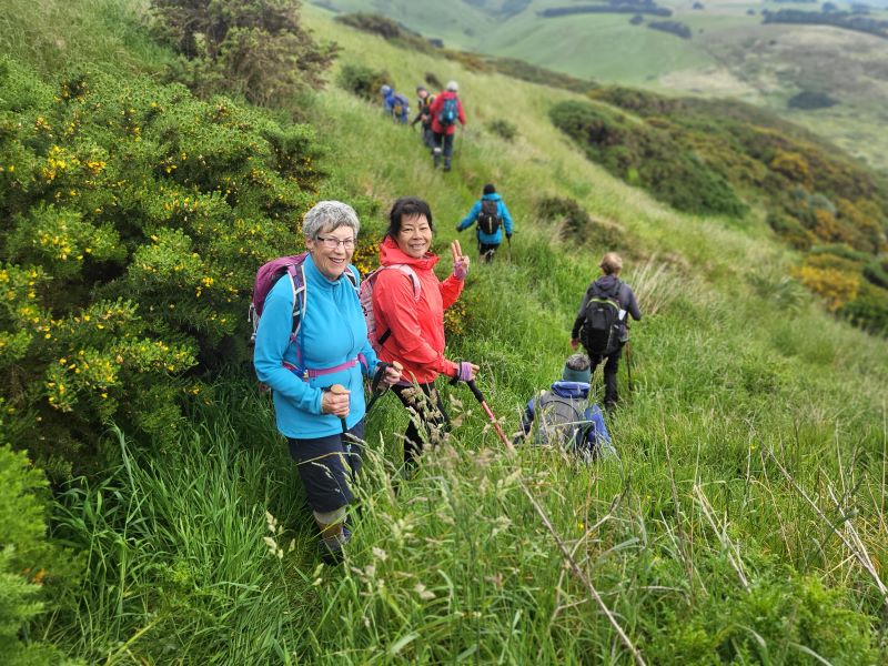
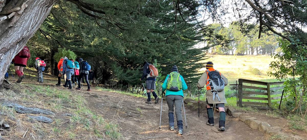
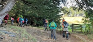
It started as a cold blustery day when we departed from Mosgiel, proceeding down the bay with white caps plentiful on the harbour. 14 hardy souls started the Greenacres Track at 0940.

IMG_2266 Pam Res 1200

Starting off climbing up Greenacres Track (photo and caption Pam)

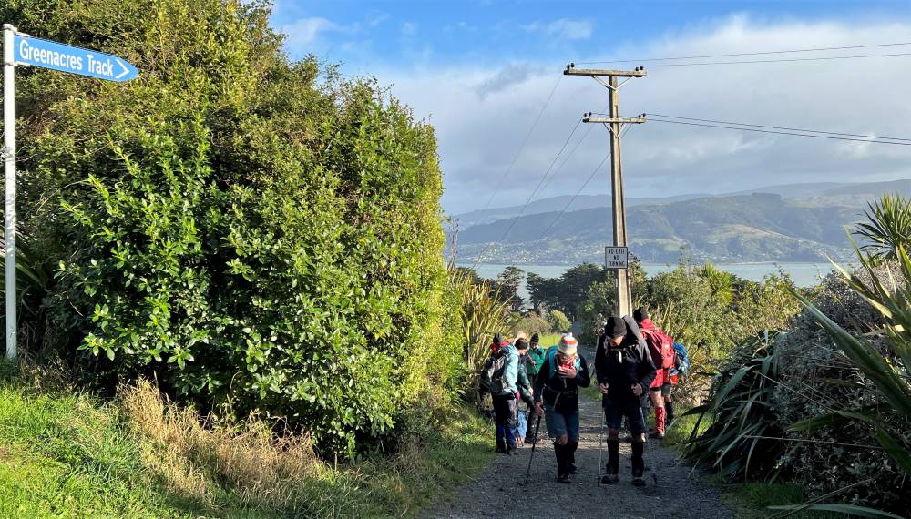
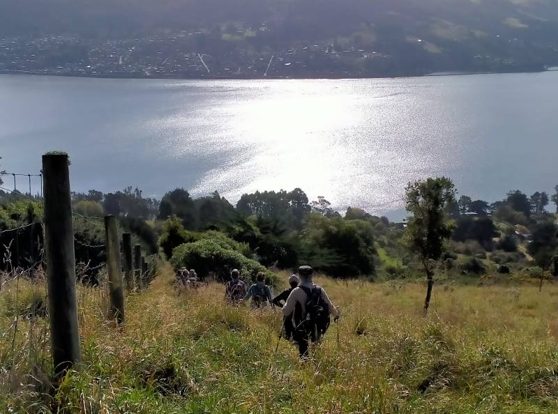
Conditions were better than expected once we started our journey up Greenacres Track and turned right to walk along Highcliff Road to the start of the Buskin Track.

IMG_2271 Pam Res 1000

Top of Greenacres track at Highcliff Rd (photo and caption Pam)

IMG_2275 Pam Res 1400

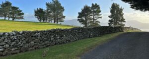
Stone fence standing the test of time (photo and caption Pam)

IMG_3440 Anne 1600

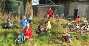
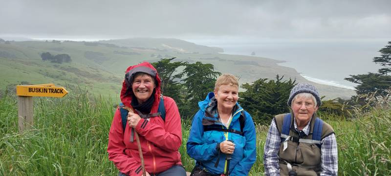
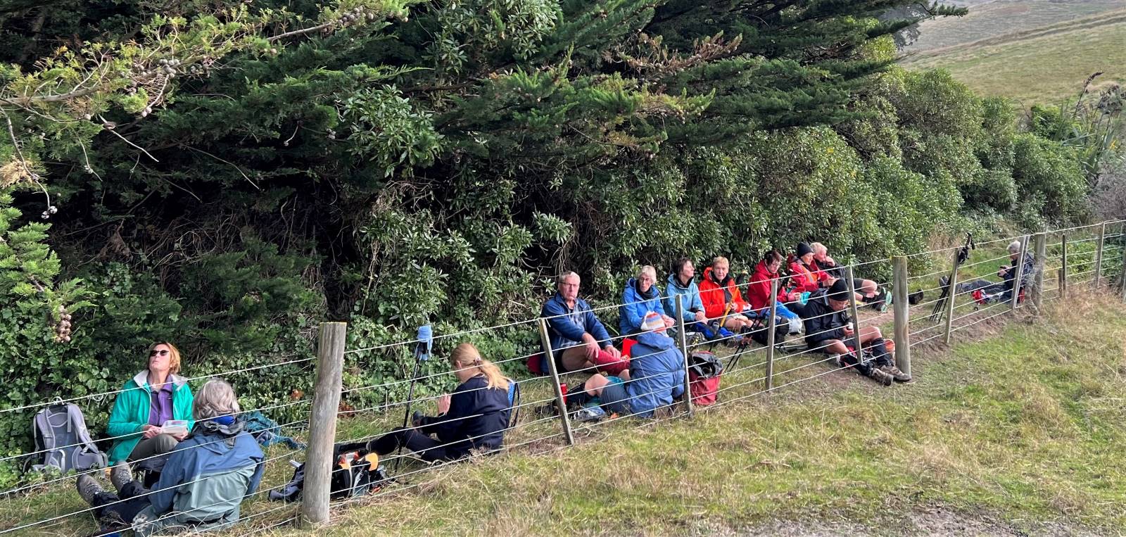
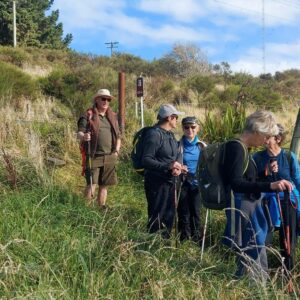
Morning tea stop at top of Buskin Track (photo and caption Anne)

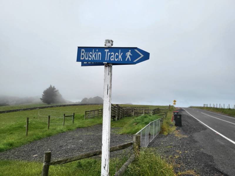
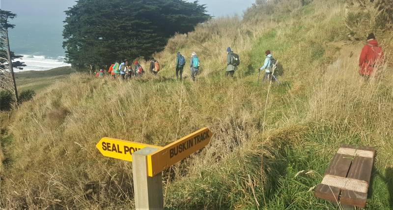
We stopped for a cuppa at the start of the Buskin Track then proceeded down the track to the junction of Paradise Track. Buskin Track was surprisingly sheltered from the cold southerly wind.

20220525_110936 Anne Res 1000

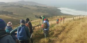
Heading down Buskin Track sheltered from wind towards beach (photo and caption Anne)

20220525_112026 Anne Res 1000

Clearing style at beginning Buskin track (photo and caption Anne)

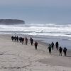
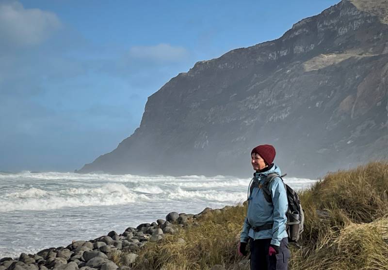
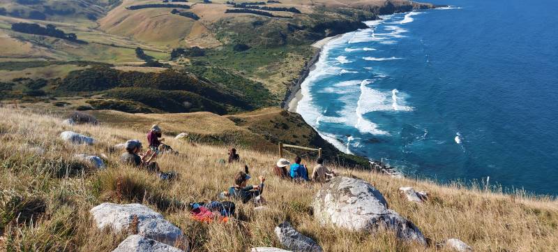
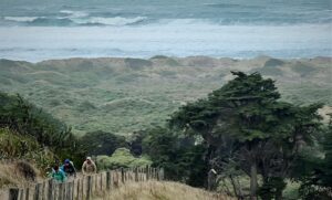
After a side walk to Boulder Beach which was spectacular with crashing waves, foam whipping up the beach and blustery cold wind we returned to a sheltered spot at the start of the Paradise Track for lunch.

IMG_7626 Lyn Res 800

Sarah looking north watching waves (photo and caption Lyn)

IMG_7627 Lyn Res 1000

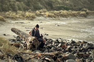
Dave watching huge waves (photo and caption Lyn)

IMG_2296 Pam 1600

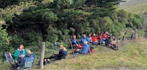
A sheltered lunch spot on Paradise track (photo and caption Pam)

IMG_2297 Pam 1200

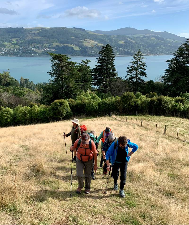
Looking back on Boulder Beach as we climb up Paradise Track (photo and caption Pam)

Ascending up Paradise Track without stopping and a cold southerly on our backs we again joined Highcliff Road then back down Greenacres Track to our vehicles.

Everyone enjoyed the walk and as tramp leader I must congratulate everyone for being so well prepared for the extreme conditions that never eventuated.

Finished our walk at 1440 and headed to “The Duck” at Macandrew Bay for a well-deserved coffee.

Anne & Rod Ward

IMG_2327 Pam Res 1000

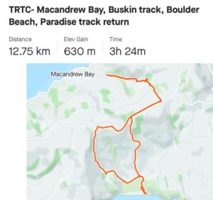
Strava screenshot of tramp by Pam)

(Elapsed time 4h 45m)

13/04/2022 Trampers. Glenfalloch and Beyond. M Leaders: Pam and Helen

Glenfalloch’s name is Gaelic and means “Hidden Valley”.  Glenfalloch was established in 1871 by George Russell. It covers 12 hectares (30 acres). In 1917 Philip Barling purchased Glenfalloch and it was opened to the public by his son in 1956. It was brought by the Mills family in 1960 and in the late 1960’s the Otago Peninsula Trust purchased the property.  We can be very grateful to have this asset to enjoy every season of the year.

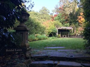
9.40am saw Phil and his harem of nine set off through the woodland gardens of Glenfalloch following a path which took us to the Bridal Lawn, over the Russell stream bridge to admire the ferns and woodland foliage before climbing up many steps to a four-wheel drive track and the start of our first big ascent.

Bridal Lawn Pam

Glenfalloch in autumn Caption and photo Pam

As we steadily climbed, this track petered out into a single overgrown track which took us to the boundary line.

Steep Marijke

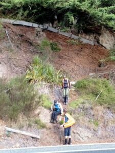
There were some steep uphills after leaving the Glenfalloch grounds Caption and photo Marijke

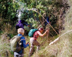
Here we pushed our way through low Manuka branches to the fence where packs and poles were thrown over before we squeezed through the wires.

there was a track here phil

“There was a track here when I did the recce” Caption and photo Phil

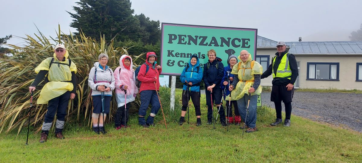
Then it was a steady zigzag climb up Claremont Farm to just below Highcliff Rd where we stopped for morning tea while enjoying the great vista’s back over the city, the sparkling water of the harbour and to Port Chalmers and beyond. Jill D’s birthday treat of easter eggs got us going again walking up Highcliff Road for 15mins to Penzance Kennels and the start of Buskin track.
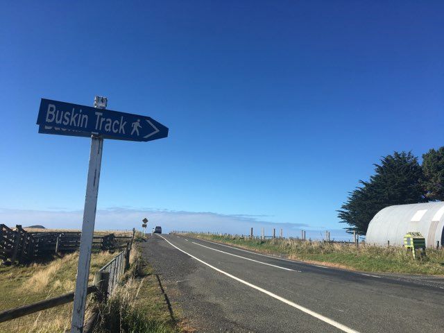
Buskin Track Sign

Buskin track sign

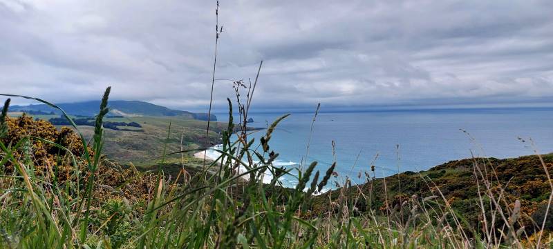
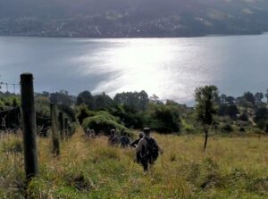
This track weaved its way down the side of the hill, again with spectacular views now of the Pacific Ocean and rolling farmland out to Sandfly Bay. This single file track was mostly grass with the odd churned up muddy patches trampled by cattle, but some boards had been placed in situ. We eventually came to a junction with Braidwood track to Boulder Beach and Highcliff Track to the right. We continued on the Highcliff track through clumps of macrocarpa trees until we came out in the open again.

Marijke old trees

What stories these old trees could tell! Very impressive huge trunks. Caption and photo Marijke

The track weaved its way towards the sea and then suddenly it was a steep grunt up to the top to the White Rocks (lichen covered) for lunch.

Look where we are climbing Phil

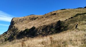
Look where we are climbing – to Highcliff Caption and photo Phil

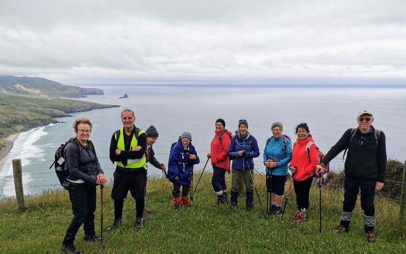
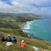
Again, enjoying spectacular views over Boulder Beach, towards Sandfly Bay and Mt Charles, Phil handed around chocolate treats from Betty and Jim (thank you soo much).

Helen lunch

Beautiful lunch view looking down to boulder beach Caption and photo Helen

With the sugar rush we were off again and, as we walked around a corner, the views changed again to Tomahawk, St Clair Beach and Black head. When Highcliff Track finished, we continued on Karetai Rd to where it meets Highcliff Rd.  A 20-minute walk down Highcliff Rd brought us to the unmarked District Track.

District track Helen

Starting place for the District Track Caption and photo Helen

Once Phil cleared the grass around the stile, we scrambled down through long grass following the fence line for 20 mins to another stile and from there continued through trees towards Portobello Road.

District Track Phil

From sea to shining sea Caption and photo Phil

A very steep final descent brought us onto Portobello Road.

Last steep descent Phil

Nearly back to where we started. Caption and photo Phil

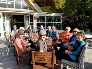
We had a 20 minute walk on the shared pathway to Glenfalloch where we were joined by Raewyn, Claire and Jan for coffee, cake and ice cream on the deck in the last rays of sunshine.

Phil's Harem

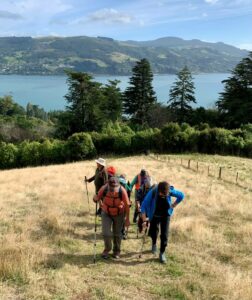
Phil’s harem Caption and photo Phil

Thank you Helen for filling in at the last minute as Tail End Charlie and to Jason allowing us access through Claremont Farm.  Pam Cocks

Track Route Pam

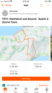
Tramp map courtesy Pam


Continue Reading »

No responses yet

Apr 10 2024

Upcoming Trips

Published by under Both Hikers & Trampers

Link to Trip Organisation Guidelines for leaders and trip participants.
Link to Track Grading information.
Link to Copy of Trip Programme for printing.
Gradings are provisional and may change following recce. Distances are for road travel from Mosgiel car park. Costs may change with fuel price fluctuations and distance changes. This page has all current updates.
Last updated 7/04/2024.


Wednesday 17 April.
Trampers. Rosella Ridge.
Yellow Ridge – Gap. Grade 5.5. $12. 42 km. Leaders: Ross Davies/Neil Hodgkins.  *** Meet time for Rosella Ridge tramp is 7.45 am. at carpark for 8 am. departure. ***
Hikers.       Bullring/Ben Rudd/Flagstaff. Grade 2.5.
$5. 15 km. Leaders: Max Wilson/Mike Webb. (Meet usual time.)


Wednesday 24 April.
Trampers. Frasers Road/Southern Resevoir. Grade 2.5.
$5. 16 km.  Leaders: Gwenda Farqharson/Graeme Souter.
Hikers.       Graham’s Bush. Grade 3.
$8. 27 km. Leaders: Maria MacNee/Theresa White.


Beginning of Next Programme

Wednesday 1 May.
Combined.    Pyramids/Victory Beach. Grade 2.5. $10. 38 km. Leaders: Jenny Wilton, Alison Kim, Janette Abbot, Adrienne Ensor. Alex Griffin

Continue Reading »

No responses yet