Oct 21 2023

Maia to Port Chalmers

Published by under Hikers

1. 18/10/2023. Maia to Port Chalmers. Hikers. Leaders Mike and Max

image RES100x100Once again Max and Mike showed their dedication to the TRTC by leaving a delicately poised England v Italy football match on TV to catch a bus to Maia to meet up with the hiking team who were assembling by the parking area at the Maia bus stop on SH88. Continue Reading »

No responses yet

Sep 06 2022

Port Chalmers and environs

Published by under Hikers

Click Dunedin’s Hills’ History for background Information.
30 km from car park.
24. 31/08/2022 Hikers. Port Chalmers. Leaders: Michael Webb and Bruce Wright M.
On a typically beautiful Port Chalmers day with no hint of Mosgiel type frost, 32 hikers met at the Back Beach car park for what some thought was going to be a gentle stroll visiting some historical sights in West Harbours hidden gem.
The first hill climb on the track from Back Beach to Island Terrace cut short the usual discussing of sore hips, knees, dieting, prostate problems, midnight trips to the loo, hot flushes, ungrateful children, recalcitrant grandchildren, the Mayor and Jacinda.
Oh what a beautiful day Ady

Oh what a beautiful day Caption and photo Ady

It was during this first ascent of many hills that the first mumblings of mutiny were heard. The leader took this on board, totally ignored it and proceeded to lead the group up to Hotere Hill via Campbell Buchanan lane where we had morning tea.
Morning tea in Ralph Hotere Garden

Morning tea in Ralph Hotere Garden
Caption and photo Helen

We then descended a track to Back Beach for a relaxed stroll alongside the harbour where Faye revealed herself to be a “legend” with her lecture on oven cleaning.
Boat shed on Back Beach Michael

Boat shed on Back Beach Caption and photo Michael

Stone boat 2

Stone boat – how many just walked by? Caption and photos Phil

Stone boat 1 Phil

A walk up Currie Street to see some historic buildings including the old Buffalo hall was followed by a welcome comfort stop at the Port Chalmers Library. Another steady ascent took us to the Lady Thorn dell for lunch.
Neil will give anything a go - once Phil

Neil will give anything a go – once. Caption and photo Phil

Yet another climb took us to Scott Memorial before crossing the road for our last uphill leg before descending through some bush and a track past the old cemetery back to Port Chalmers.

The town Helen

The town Caption and photo Helen

Refreshments were taken at The Galley where one unnamed lady ordered a Bloody Mary. Due to the many steep tracks and hills in Port Chalmers this could possibly be a Grade 3.  The hike was 8km. Michael Webb

Continue Reading »

No responses yet

Jun 06 2001

Port Chalmers, Deborah Bay

Published by under Hikers,Year round

All weather. Overgrown.

6/6/2001. Port Chalmers, Deborah Bay. Easy+. Leaders: Bill H, Lesley S, Winnifred
7/6/2000. Deborah Bay. Leaders: Bev H, Les & Margaret
12/7/1995. Port Chalmers. Deborah Bay. Easy+. Leaders: Shirley, Bev H, Ria H, Jean A

No responses yet

Nov 13 1996

Port Chalmers Rangi Park

Published by under Hikers

21/5/1997. Port Chalmers, Back Beach, Rangi Walkway. Leaders: Daphne, Les and Mavis.
13/11/1996. Port Chalmers Back Beach – Rangi Park Walkway. Return trip. LeadersL Les and Mavis, Daphne.

No responses yet

Nov 12 2023

Portobello, Clarks, Sheppards, McArthny, Varleys Hills

Published by under Trampers

Distance Portobello from car-park: 32 km.

Map of area


Img20231108124710 Square Res100x10013. 8/11/2023. Hikers. Varleys Hill-Hereweka Track. Grade 2.5. $9. 32km. Leaders: Jan Butcher/Jenny Finnerty

22 hikers set off on a cloudy morning for the Portobello Community carpark. Continue Reading »

3 responses so far

May 15 2022

Portobello, Hatchery Road, Quarantine Point.

Published by under Hikers

32 km from car park
10. 11/05/2022. Hikers. Portobello Aquarium Leaders: Jim and Lester

It was different to be one of the only 2 for refreshments after a pleasant walk on Hatchery Road at Portobello.  It was at the Aquarium’s marine studies centre that our group of 15 were afforded a very interesting presentation by Tamlyn Somerford on their ongoing research that is currently being carried out.

touch tanks

Gathering around the Aquarium ’Touch Tanks”
Caption and photo Raewyn


Jay

Jay with a starfish Caption and photo Raewyn

68D0DC77-841A-46D1-ADE4-B01226F7066A

View from the Peninsula track back to the Aquarium Caption and photo Raewyn

Our trip by bus from the Edgar Centre was a change of outlook from traveling by car.  It was a very pleasant day for what was a short walk to a laid-back lunch stop looking out to Taiaroa Heads.

Margreet

Below is a photo of 4 hikers (plus me – I took the photo) who did the extra hill today beyond Portobello at lunchtime Caption and photo Margreet

Back in Portobello waiting for the return bus seemed the perfect time to fuel up on ice cream.

Leaders were Lester & Jim


Continue Reading »

No responses yet

Mar 15 1987

Quarantine Island: Botanical Report

P N Johnson, Botany Division, DSIR, Dunedin March 1987

Quarantine Island has a fenced 1.4 ha of low Halls totara – broadleaved forest in excellent condition, plus other native scrub and coastal communities. …

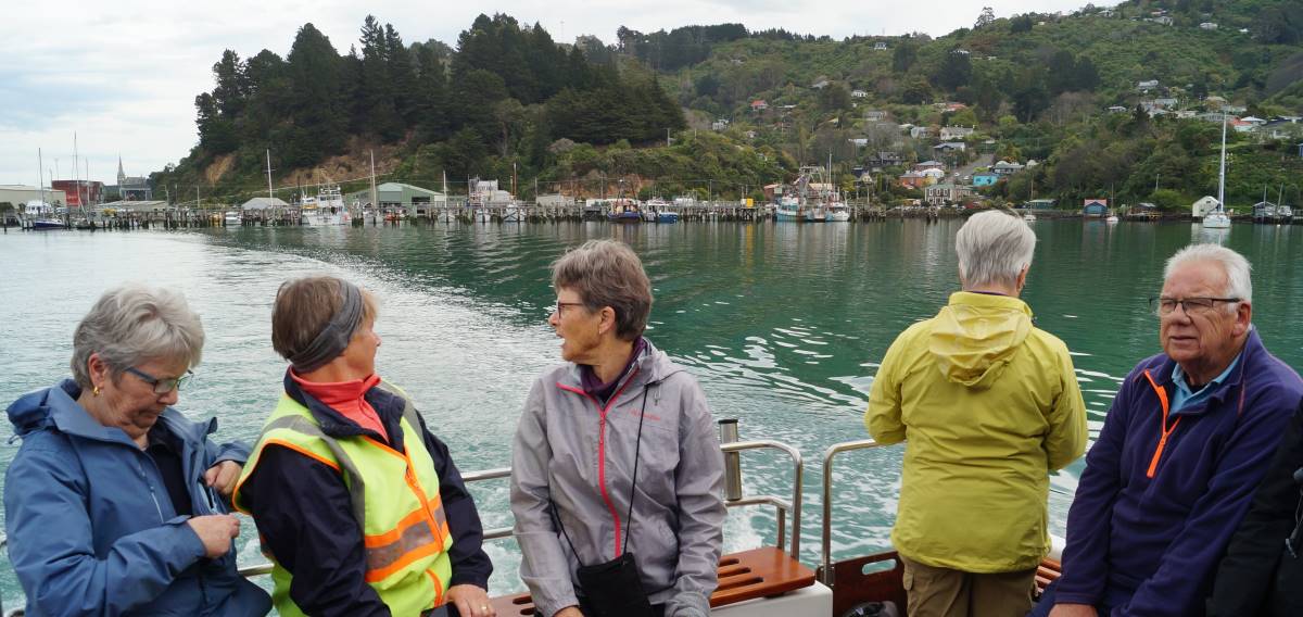
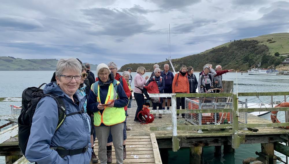
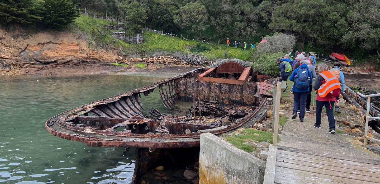
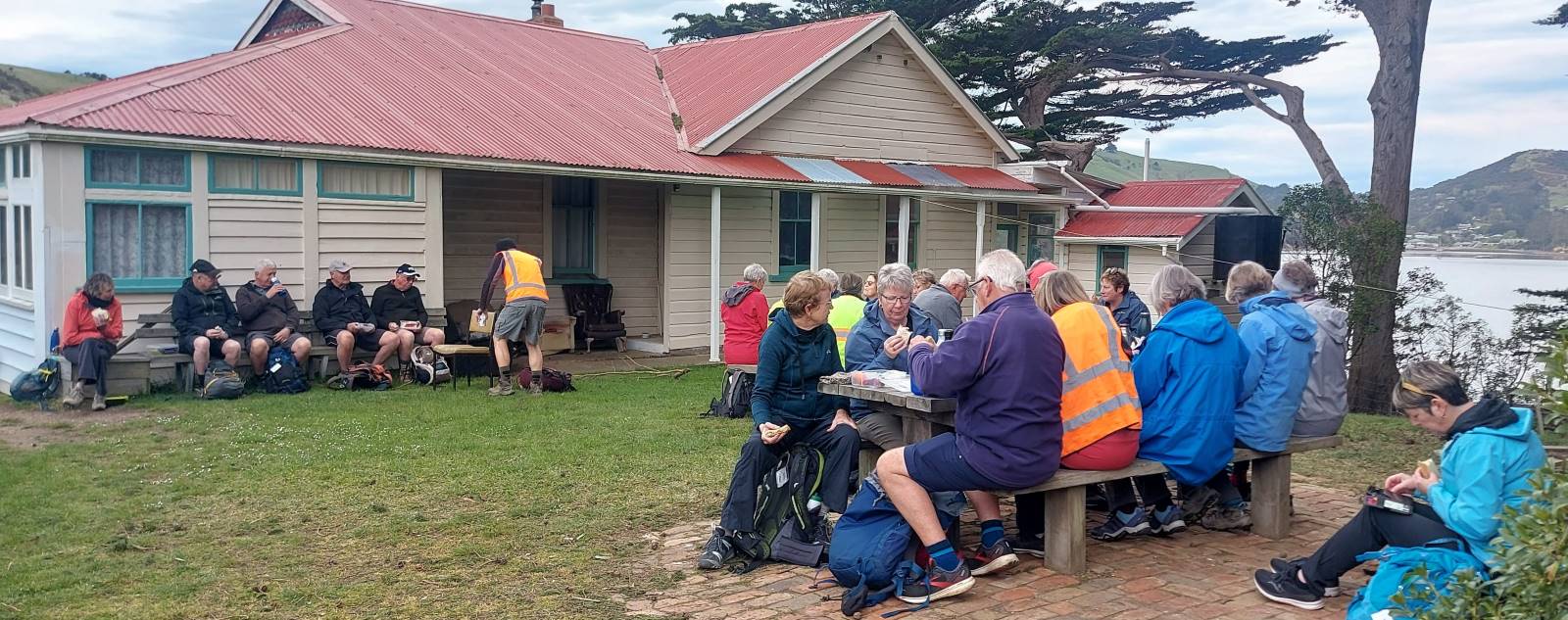
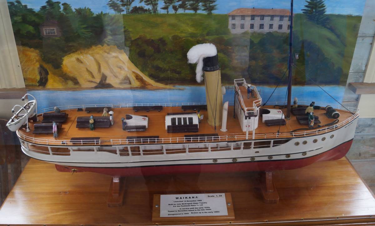
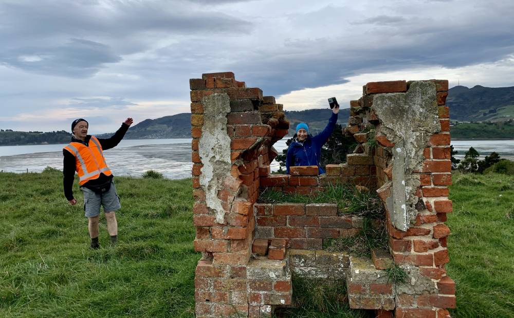
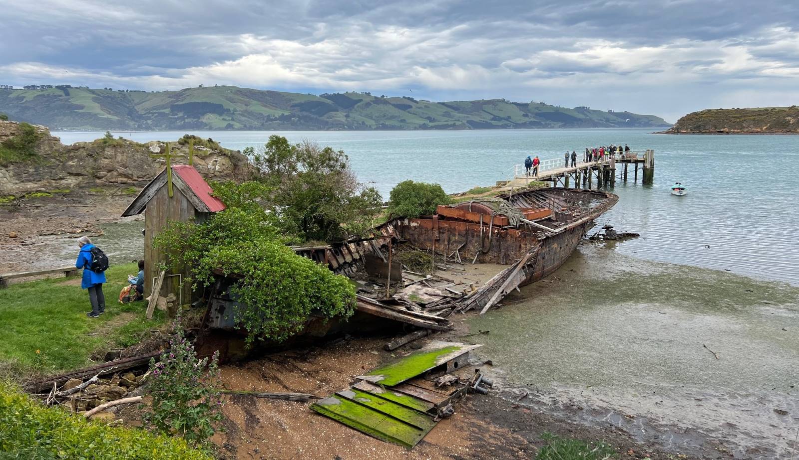
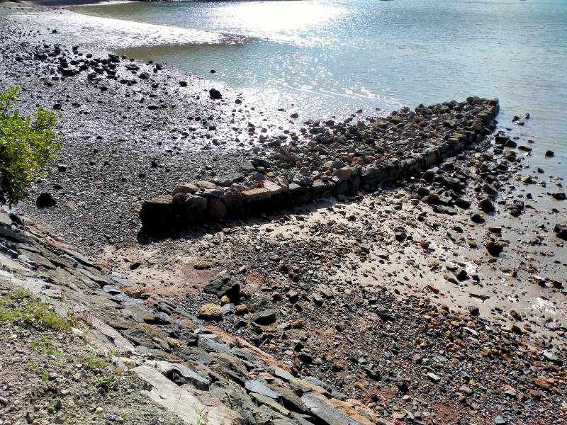
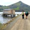
Quarantine and Goat Islands owe their origin to former spurs drowned with the sinking of valleys now occupied by Otago Harbour. Both were used for quarantine purposes in early days of European settlement, and are Crown Land, formerly managed by Health Department. Goat Island has now largely reverted to native low forest and scrub. … Quarantine Island is leased to the St Martins Island community, who maintain a house and other buildings on the eastern headland, and graze sheep over most of the island, except in a fenced-off portion of bush, facing south at the western end. Historical remnants persist in the form of one of the old quarantine buildings, a small graveyard, chimney and flagpole remnants and old wrecks at the boat landing. The island is c. 17 ha in area, and reaches 58 m at its summit. There are two pylons on the crest, carrying electricity from Port Chalmers to Portobello.

Broadleaved – totara forest. This comprises most of the c. 1.4 ha fenced-off area to which sheep do not have access. The canopy, mostly about 4m tall, comprises Halls totara, broadleaf, ngaio, kohuhu, lancewood, peppertree and divaricating shrubs. These last two become more common in the understorey, especially Melicope simplex and Coprosma areolata. Traces remain of shrubs which would previously have been more common: Corokia cotoneaster and Helichrysum aggregatum, while the abundance of mahoe saplings 1m tall indicates that this species will become more common in future. Ground cover is dense, despite the dry stony soil, with Asplenium lyallii, shield fern, Carex forsteri and Libertia ixioides. Creepers are also abundant below and upon the shrubs, especially Scandia, Calystegia, climbing rata, Parsonsia and Clematis paniculata. Condition of this forest is very much better than adjacent grazed forest, or any similar forest remnants on mainland sites on Otago Peninsula.

Cabbage tree – coprosma – totara forest. An eastern portion of the fenced-off bush, probably more open at the time stock were excluded, has cabbage trees above a mixture of windswept totara and Coprosma propinqua scrub. Former grassy openings illustrate the process of regrowth of scrub and forest.  The grasses browntop and cocksfoot of the former pasture are being invaded by bidibid, Coprosma propinqua shrubs, and the tall palatable grass Hierochloe redolens.

Flax, some of it possibly planted, is establishing vigorously from seedlings, even among long rank grass, and there are healthy saplings 1m tall of Olearia avicenniaefolia, lancewood, kohuhu and Hebe elliptica.

Coprosma – mixed scrub. Shady faces of the southernmost headland have dense 2-3m scrub of Coprosma propinqua, Halls totara, Melicope, kowhai, ngaio and creepers (mostly Muehlenbeckia australis).

Flax – Hebe scrub. Above the sea shore, in a zone below forest or in patches below pasture, flax grows densely with Hebe elliptica shrubs, and scattered ngaio trees. Patches of bracken are present on some small spurs.

Pasture. On the island crest the main components are browntop, crested dogstail and white clover. Patches of rushes (Juncus gregiflorus, J distegus) occur on moist gentle slopes. Dry crests encourage infestations of barley grass and Scotch thistle (especially common at the south-east end). On sunny faces, Rytidosperma unarede and sweet vernal are common grasses and there are a few patches of silver tussock on upper parts of northern faces. Western faces hold thin, dry, erodible soils between rock outcrops and ledges. Grazing here is heavy, so that the native coastal tussock Poa astonii is reduced to a stubble.

Carex sedgeland. A few small seeps have tussocks of Carex appressa and in one place the tall blue coastal sedge Carex trifida which is of very local occurrence on Otago coasts.

Coastal rocky banks. Some of these are draped with native ice plant, though trampling and grazing prevent this moving up-slope onto ground accessible to sheep. Poa astonii tussock and Linum monogynum are characteristic of rocky outcrops, with other native herbs such as Wahlenbergia gracilis. Easter orchid (Earina autumnalis) surives as a clump atop one northern coastal detached boulder. Crumbling loess banks near the houses have become covered with garde escapes – wallflower, shrubby stonecrop, marguerite daisies and periwinkle.

Coastal herb field in wave-splashed zones. There are small areas of turfy coastal herbs such as Toula dioica, Puccinellia stricta, Crassula moschata, native celery and glsswort. Beach heads become colonised by Atriplex hastata growing among drift and flotsam.

Island at NW corner. Being inaccessible to sheep, this little island illustrates the density and diversity of native plants which would otherwise occupy all opens sites close to the coast. Above a fringe of coastal herb-field is a terrace sward of knobby club-rush, holy-grass, Elymus, Dichelachne and Linum. The rocky sides have dense low Hebe elliptica, tussocks of Poa astonii, mats of native ice plant and the coastal fern Asplenium obtusatum. On the crest, compact shrubs of Coprosma propinqua shelter an infestation of ivy and periwinkle.

Planted trees. As well as the usual macrocarpas typically planted for shelter, there are groups of pines (Scots pine round the graveyard, bishop pine and radiata on the SW grassy promontory). There is a line of Arizona cypress here too. Along the north side are a few trees of Lawsons Cupress, at least two trees of brush wattle on one spur, and a few kowhais which have survived despite the crude netting fences which one protected them. One red beech has been planted near the summit. None of these tree species appear to be spreading naturally.

No responses yet

Apr 10 2024

Upcoming Trips

Published by under Both Hikers & Trampers

Link to Trip Organisation Guidelines for leaders and trip participants.
Link to Track Grading information.
Link to Copy of Trip Programme for printing.
Gradings are provisional and may change following recce. Distances are for road travel from Mosgiel car park. Costs may change with fuel price fluctuations and distance changes. This page has all current updates.
Last updated 7/04/2024.


Wednesday 17 April.
Trampers. Rosella Ridge.
Yellow Ridge – Gap. Grade 5.5. $12. 42 km. Leaders: Ross Davies/Neil Hodgkins.  *** Meet time for Rosella Ridge tramp is 7.45 am. at carpark for 8 am. departure. ***
Hikers.       Bullring/Ben Rudd/Flagstaff. Grade 2.5.
$5. 15 km. Leaders: Max Wilson/Mike Webb. (Meet usual time.)


Wednesday 24 April.
Trampers. Frasers Road/Southern Resevoir. Grade 2.5.
$5. 16 km.  Leaders: Gwenda Farqharson/Graeme Souter.
Hikers.       Graham’s Bush. Grade 3.
$8. 27 km. Leaders: Maria MacNee/Theresa White.


Beginning of Next Programme

Wednesday 1 May.
Combined.    Pyramids/Victory Beach. Grade 2.5. $10. 38 km. Leaders: Jenny Wilton, Alison Kim, Janette Abbot, Adrienne Ensor. Alex Griffin

Continue Reading »

No responses yet

Mar 24 2024

Harbour Cone, Broad Bay, Turnbulls Bay, Bacon Street, Peggys Hill, Broad Bay

Published by under Trampers and tagged:

No. 49 on old hardcopy list of 113 club tramps. “Harbour Cone, Peggy Hill Larnach Castle – Farm”. Location: 32 km.
Broad Bay Future Forest – background information.
Trampers park cars at Broad Bay. DCC Public Land; Hikers park at top of Bacon Street.

Start Track Square20. 20/03/2024. Hikers. Broad Bay Future Forest (New Hike), Grade 2.5.  30 km. Leaders: Jenny Flack, Vivienne Manning.

Twenty hikers gathered at the end of Bacon St for this new walk. Continue Reading »

No responses yet

Feb 24 2024

Waihola Walk.

29 km from car park.


4. 21/02/2024. Hikers. Waihola/Milburn Area. Grade 2 Leaders: Bill and Jill

Bridge Square Thumb
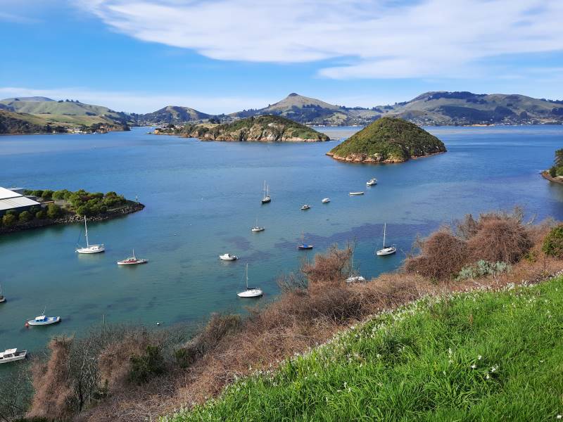
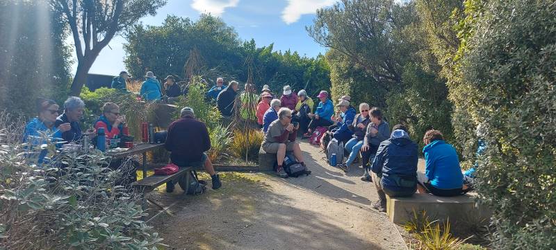
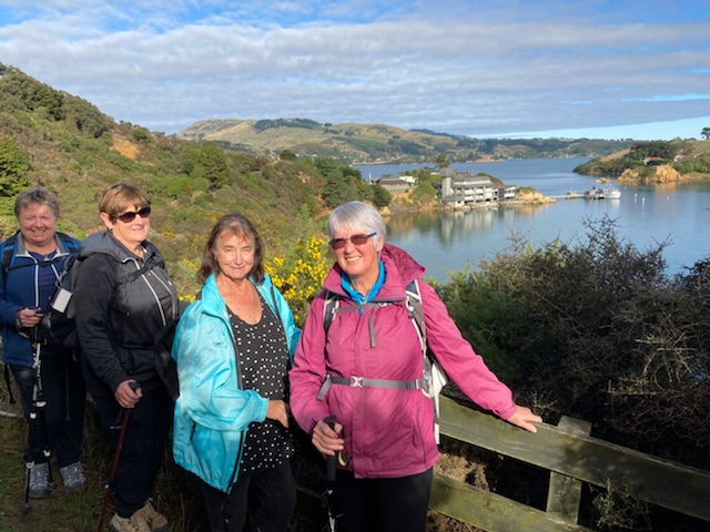
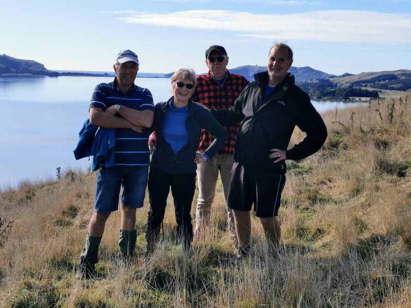
22 hikers assembled at a car park in Limeworks Road, Milburn on a rather grey morning with a cold head on sou’wester blowing into our faces. After traversing a farm track, we joined the Clutha Gold Trail in Circle Hill Road and began what Jill quite accurately described as a day of quirky bridges and old fossils!

Continue Reading »

3 responses so far

Feb 10 2024

Heyward Point, Kaikai Beach, Whareakeake Road

Published by under Beach,Farm,Hikers,Trampers

No. 86 on old hardcopy list of 113 club tramps. “Heyward Point – Melville’s Farm Farm”. 40 km from car park.

Part: Tramping Track, Managed by DOC. Rest: Not during lambing Sept-Nov. Seek Permission.

20. 7 February 2024. Combined hikers and trampers. Aramoana – Heyward Point.
Aramoana Rock SmallHikers: Leaders Heather and Val Cayford

‘Pathway to the Sea” – 7th February 2024 at 8.45am on a grey overcast morning with slight drizzle 15 hikers left Peter Johnstone Park and arrived at the small coastal settlement of Aramoana at approx. 9.45am – a peaceful place with 260 permanent residences as of 27th January 2024. Continue Reading »

One response so far

Feb 03 2024

Mihiwaka, Mount Kettle, and Cedar Farm

Published by under Read More issue,Trampers,Year round

30 km from car-park. No permission needed to reservoir. Cedar Farm: Seek Permission DCC Forestry.


29. 31/01/2024 Mihiwaka/ Mount Kettle. Trampers Grade 4 Leaders: Pam and Diane

Square Res11 trampers left PJ Park at 8.45 and meet up with 5 Dunedin trampers on Borlases’s Road, Port Chalmers. We continued onto Blueskin road in misty weather which got thicker as we drove up to park 1km north from Cedar Farm Forest carpark (CFF) A car was left at CFF carpark to ferry drivers back to their cars at the end of tramp. Continue Reading »

2 responses so far

Nov 22 2023

Leith Saddle, Swampy Spur, Transmitter Tower. Also Rustlers and Burns Tracks

Published by under Both Hikers & Trampers

Information
Click Swampy ridge track for background information.
See also: Leith Saddle and Morrison Tracks
Leith Saddle, Waitati Valley Road, Sawmill Track, Swampy Ridge, Burns Track
Click boardwalk history for account about the original Leith Saddle Track  and the establishment of the boardwalk in 1993.
For our Club’s part in the boardwalk venture see boardwalk for an ODT account of its construction.
See also TRTC Jack Merrilees (who died January 2015)

Cars park off motorway at Leith Saddle yard (alternatively down side road at bridge (restricted space). 25 km from car park.
Walk across side road to track.
Gravelled track 1.5 km. (morning tea on lookout seats a little further on)
Transmitter Tower 2 hours.
Going further: along road past doppler radar to DoC sign.
Right along Rustlers Ridge track to junction with Burns Track.
Through junction and up and round hill on Rustlers Ridge Track. (Lunch on hill)
Down ridge to pipeline. (Alternatively turn right at junction for Burns and down to pipeline)
Turn right along pipeline.
5.5 hours in all.
Burns – Rustlers circuit Maintained by Green Hut Track Group. DCC land.


Img 7887 Res 10035. 22/11/2023. Trampers. Burns/Rustlers Ridge. Grade 4. 25km. Leaders: Phil Morris/Carolyn Pridham.

On an overcast muggy day, 20 Trampers headed to Leith Saddle. We set off down Leith Valley road, and left up Burns Track entrance onto Pipeline Track Continue Reading »

No responses yet

Nov 17 2023

Signal Hill tramps

Published by under Trampers,Year round

Distance Chingford from carpark: 20 km.
Follow Old Main North Road to Cleghorn Street which has the best view of the harbour. Walkway sign.
Walk starts starts at the gate on right, up McGregors Hill. Beyond stile Pine plantation on 3rd stile at summit.
Gravel road 10 minutes to end. Locked gate. Last stile. Signal Hill road.

15 Nov Signal Hill Harbour View With Hikers. Square Small Janette19. 15/11/2023. Hikers. Cleghorn Street to Signal Hill. Leaders Pam Clough and Jay Devlin

23 keen hikers gathered on a beautiful day at the Bottom of Cleghorn St where we made our way up the gravel road to the beginning of our walk which was firstly over farmland. Continue Reading »

No responses yet

Oct 05 2023

Quarantine/St Martins Island

Published by under Both Hikers & Trampers,Camps

*Click this Wikipedia entry on Quarantine Island, if you wish.
*Click here for a PDF fact sheet of the original Quarantine Island
*And here is the St Martin Island Community web page. Click the photo at the bottom to see original buildings!
*Click a quarantine-island-botanical-report for a (bit dated) 1987 report on the island’s vegetation, if you like.
30 kms PJP to Back Beach.


5.  4/10/2023.  Combined. Quarantine Island. Grade 2, Leaders: Ross and Wyn Davies, Maria MacNee, Jenny Finnerty.

Twenty-eight trampers and hikers enjoyed a great day out with calm and temperate weather, a little cloudy, not the blue skies and sun the forecast promised. Perfect weather though for the crossing to Quarantine Island. Our day had started with a little confusion regarding numbers and meeting places but we all managed to get ourselves to Back Beach carpark safely (Julie and Viv might tell a few tales about their driver though, lol).
We walked off for morning tea in Lady Thorn Dell…

DSC06903 John Res 1200

Morning Tea at Lady Thorn Rhododendron Dell. (photo and caption John)

… where we enjoyed fabulous views of the busy Port Chalmers.

DSC06904 John Res 1800

Panorama – Port Chalmers on a quiet day. (photo and caption John)

Great photos and history on display at the lookout platform. Little remains of the dry dock and ship building industry that once provided for a vibrant community in the 19th and 20th centuries.
From Lady Thorn Dell we enjoy a leisurely meander through the town cemetery which it has to be said seems to hold an unhealthy interest for those of us still in the land of the living? Indicative of the average age of our enclave perhaps…? Nonetheless, interesting history to be gleaned from those old stones and bones.

DSC06914 John Res 1200

Touring the Port Chalmers Cemetery. (photo and caption John)

image_50402305 Marijke Res 1200

Lovely view from Port Chalmers Cemetery (photo and caption Marijke)

Coming back down to the Port we get a stunning glimpse of Carey’s Bay…

DSC06921 John Res 1000

First glimpse of Careys Bay. (photo and caption John)

… before heading back to the wharf and Boiler Point where Captain John welcomes us aboard the island ferry the “Vivienne J”. After John treats us to a grand jaunt around the harbour basin (greatly appreciated by all on board)…

20231004_113119 Ady Res 1400

Beautiful Deborah Bay (photo and caption Ady)

DSC06924 John Res 1200

“Touring” Carey’s Bay. (photo and caption John)

…we “set sail” for the island, not bad value at $20 return! One wag commented that “It was very nice of Bruce to organise a cruise for Jenny on her birthday….”

image_50727937 Marijke Res 1000

Birthday Girl and her “guests” arrive at Quarantine Island (photo and caption Marijke)

Arriving at the jetty on the island, the skeletons of the Waikana…

IMG_7273 Pam Res 1600

“Touring” Carey’s Bay. (photo and caption Pam)

… and the Oreti form a kind of decaying guard of honour as we head up to the Lodge for lunch.

image_3 Helen Res 1600

Lunch (photo and caption Helen)

After lunch we explore the island starting with the restored Married Quarters building in which is housed a beautifully modelled miniature of the Waikana as she was when in service as a harbour ferry.

DSC06952 John Res 1200

Harbour Ferry “Waikana” as she once was. (photo and caption John)

Regenerating native bush rang with the sound of native bird life as we enjoyed an easy 30-minute walk around the island.

IMG_7298 Pam Res 1000

The “Sail” Shaped Chapel. (photo and caption by Pam)

DSC06958 John Res 1200

Inside the Chapel. (photo and caption John)

image_50429953 Marijke Res 1200

Just the same as it was during a previous visit when I did a quick sketch (photo and caption Marijke)

image_6483441 Marijke Res 960

This drawing was from the same viewpoint (drawing and caption Marijke)

image_50433281 Marijke Res 1000

Remnants from the old Hospital (photo and caption Marijke)

DSC06962 John Res 1900

Panorama – Looking back to Goat Island and Port Chalmers. (photo and caption John)

Our walks included visiting the sad sight of the island’s cemetery where the remains of 72 immigrants lay, half of them children, in unmarked graves. The small mounds are especially evocative. A sobering reminder of the fate of many immigrants who survived the arduous journey from the other side of the world in search of a better future, only to perish of scarletina and other deadly diseases in quarantine before they even set foot on the mainland.

IMG_7303 Pam Res 1600

Waiting on the jetty. (photo and caption Pam)

Heading back across the harbour our day is nicely rounded off by afternoon tea at the Santosha Cafe in the Port.

image_1 Helen Res 1200

Coffee (photo and caption Helen)

A wonderful day out enjoyed by all.
Maria Continue Reading »

No responses yet

Next »