Apr 13 2024

Chain Hills-Friends Hill Tramps

Published by under Hikers

No. 102 on old hardcopy list of 113 club tramps. “Friends Hill Chain Hills Year Round”. Background information on Saddle Hill Hotel


Img20240410112925 Thumbnail147. 10/04/2024 Highland Park to Friends Hill.  Grade 2.5. Leaders: Margaret Maxwell/Kay Seddon.

With nervous trepidation, Kay and I met at Peter Johnson Park to meet all you gorgeous hikers. We thought there would be about 8-16 willing participants.


Continue Reading »

No responses yet

Oct 14 2020

Tramps associated with Saddle Hill, (Makamaka)

[No. 7 on old hardcopy list of 113 club tramps. “Creamery Rd. Ocean View. C Hughes. Farm. Lambing.”
Not during lambing September to October.
USE STILE AT END OF CREAMERY ROAD.
No. 84 on old hardcopy list of 113 club tramps. “Taieri View (Blairs) (East Taieri) Farm”
No. 104 on old hardcopy list of 113 club tramps. “Old Brighton Rd – Clevelands – Saddle Hill (See George Haggie) Farm”]


41. 14/10/2020. Trampers. Leaders: Jill Dodd and Peter Gillespie

If we were to believe the weather forecast for Wednesday, some people would have been deterred by the gale force winds, rain and snow down to about 400m but no, 15 hardy trampers set off from the carpark by the bridge on Stage Coach Rd. We walked up to Saddle Hill Rd in the full force of a very strong south  west wind. Even though  we had amazing views over the Taieri plains and beyond it was hard to find a slightly sheltered spot at the lookout for morning tea . Carrying on past Jaffreys hill to Scurr road where we descended to Ronganui (place of the soul) the property of Colin Mackintosh and Marjorie Orr, who escorted us through their property .
IMG_9282res

Photo and Caption Wendy – “Colin McIntosh and Marjorie Orr”

This is a little hidden treasure. A QE11 Covenent area on the east side of Saddle Hill. There is 20 hectares of regenerating native coastal forest Totara, Rimu, Kahikatea, Miro, Matau and Kanuka.

IMG_9276res

Photo and Caption Wendy – “Natives everywhere”.

Another 20 hectares of liquorice all sorts – a collection of exotic trees – Eucalyptus species, Macrocarpa, Californian Redwood, Tasmanian Blackwood and Pinus Radiata.
Bird song was all around us as we traversed the tracks and bridges  meandering the property. This is all maintained by the owners who are the guardians of the land.
IMG_20201014_124651res

Photo and Caption Sarah – “The walk through the bush was special.”

The previous owner had done the planting of the exotics and the little stream the Murray River named after him.(His wife was a member of our tramping club -Eleanor Watt)
The stream was a very vivid orange colour and when Dave broke the dam!  (of a couple of sturdy branches) the water movement was quite sluggish and gel like.
IMG_9272

Photo and Caption Wendy – “Dave removing the dam.”

It is an iron ore residue from the now disused coal mines that are on the hillside .
A real surprise for us all was when Colin dug into an old rotten log where he finally found a Peripatus a living ancient velvet worm like creature. These worms have been around for 500 million years and found throughout NZ.
IMG_9267

Photo and Caption Wendy  – “Finding peripatus in old logs.”


These slightly blueish insignificant small creatures with 15 pairs of legs and 2 front antennae  exist in this undisturbed environment but had created much excitement with the researchers at the museum when 1st found here. Lunch in the forest at a designated picnic area so very sheltered we were oblivious to the outside world.
IMG_20201014_121008res

Photo and Caption Sarah – “Lunch in a designated spot”.

The walk concluded by reading a poem, dedicated to the greatness of trees, and looking at the 30year old kauri tree.

IMG_9278res

Photo and Caption Wendy – “The poem”.

IMG_0537res

Photo and Caption Jill – “The 30 year old kauri tree.”

IMG_9257 (1)res

Photo and Caption Wendy – “Outstanding views!”

There was a car shuttle back to the bridge but we probably tramped about 14 kms and the rain (apart from a quick shower) stayed away till after we had our coffee and  debrief at Blend.   Only a week late from the expected visit of Judith Collins and her team and they still had cheese rolls in the cabinet!
An interesting day shared by some very passionate landowners so close to home.

40. 16/3/2019. Hikers. Saddle Hill. Leaders: Bob and Jenny.

Today was my 1st official time at being “the Tail end Charlie” with fluro jacket.
I’m often at the back but not with a fluro.. there were 21 hikers and our 3 lovely ramblers. I think I got the numbers right???
We met in a paddock in McMasters Road. I presume Bob had permission?
The hike up the Saddle was the one that the Rotary had done as a fundraiser for the Mosgiel Pool. We had morning tea at the entrance to the scrub area,after which we climbed up a stoney track.It was good workout for us all. We came out to a clearing with fabulous views of wonderful coast line. Quite a few minutes were taken to enjoy and then we carried on up to the top for a photo shoot.
Alexc

(Alex photo.)

More panoramic views were taken in before we went down the hill,out of the cool breeze, and had a leisurely lunch looking out over the Taieri. We then wandered down the hill and out onto Saddlehill Road and back to the cars. Coffee was at the Village Green. Thanks Bob. – Jenny.

39. 19/9/2018. Trampers. Saddle Hill circuit. Leader: Eleanor.

On a very warm spring morning 14 trampers set off from Quarry road and walked up Coal Stage and Saddle Hill roads then down McMaster road.  Enjoying a great display of Kowhai in full bloom, also a mix of blossom and animals along the way.  One member recalls riding horses as a girl on a property we passed.

Just the best Kowhai forest around. (Phil pic and caption.)

We enjoyed smoko break overlooking the ocean.  At this point with the sun shining brightly upon us, we decided to do an add on.

Welcome morning tea break after earlier start. (Gordon pic and caption.)

Turning onto Old Brighton road we headed to Fairfield, then crossed over to Flower street walked up the couple of hills crossing a stile into the water tank paddock.  Once again (on both sides of the rather steep stile) with more great views, lunch and chatting was enjoyed.

View of Kaikorai Valley from lunch. (Gordon pic and caption.)

Donkeys on Chain Hill road. (Gordon pic and caption.)

We then walked along Chain Hill road and back down Quarry road to our cars.

View of Mosgiel from overbridge. (Gordon pic and caption.)

Blend was the chosen coffee shop, we enjoyed catching up with 2 members unable to tramp on the day.
We reckon we walked 15 km, give or take a little.
Great to be back out with such an enthusiastic group of friends.
– Cheers Eleanore

(12/2/2017.)

Route map

Continue Reading »

No responses yet

Oct 17 2022

Frasers Gully

Published by under Hikers,Year round

No. 92 on old hardcopy list of 113 club tramps. “Frasers Gully – Brockville Rd Year Round”

16 km from car park.


31. 12/10/2022. Frasers Gully and Friends Hill. Leaders Jay and Jan

On a fine morning, not too hot for our climb up Friends Hill, 19 hikers commenced our hike from PJ Park along the Silverstream, turning up a greenway onto Centre Road and over to Hagart Alexander Road until we came to a track taking us along to Wingatui Road, stopping to pat a couple of handsome horses and spotting a couple of rabbits along the way.  From Wingatui Road we turned left into Gladstone Road where we stopped at the Wingatui Raceway to fortify ourselves with morning tea before the climb.  It was a pleasant day for the climb thankfully and we took our time, stopping frequently to admire the panoramic view behind us!  We were pleased to eventually reach the top about 12.15pm and settled comfortably down with a stone wall to rest our backs on, to relax and eat our lunch.  After lunch it was all down.  We walked down the road a little, turned right down a track between farmland and on down past the Water Treatment Plant, along Dalziel Road and into the commencement of Frasers Gully track.  This track was in great condition despite a bit of rain the day before and after an hour 10 minutes arrived at the bottom of the hill with a lovely big comfortable bus awaiting to take us back to PJ Park.  The trip was 15ks which the body felt as it was a little longer than we were used to.  However we survived, and some of us adjourned to the Wooden Table for refreshments and a chat about the day.

12 Oct Friends Hill Morning tea at Wingatu Racecourse Ady

Morning tea at Wingatui Racecourse (Photo & caption Ady)

12 Oct Friends Hill Going up hill Noi

All uphill (Photo Noi)

12 Oct Friends Hill Great views noi

Great views (Photo Noi)

12 Oct Friends Hill Going over the stile Noi

Re grouping at the gate (Photo Noi)

12 Oct Friends Hill Frasers Gully lunch Noi

Lunch time (Photo Noi)

12 Oct Friends Hill Frasers Gully Margreet

Frasers Gully (Photo Margreet)

12 Oct Friends Hill Margreet

Frasers Gully (Photo Margreet)

12 Oct Friends Hill Strava map

Jan and Jay

Continue Reading »

No responses yet

Oct 06 2022

Abbotsford and Environs

Published by under Hikers

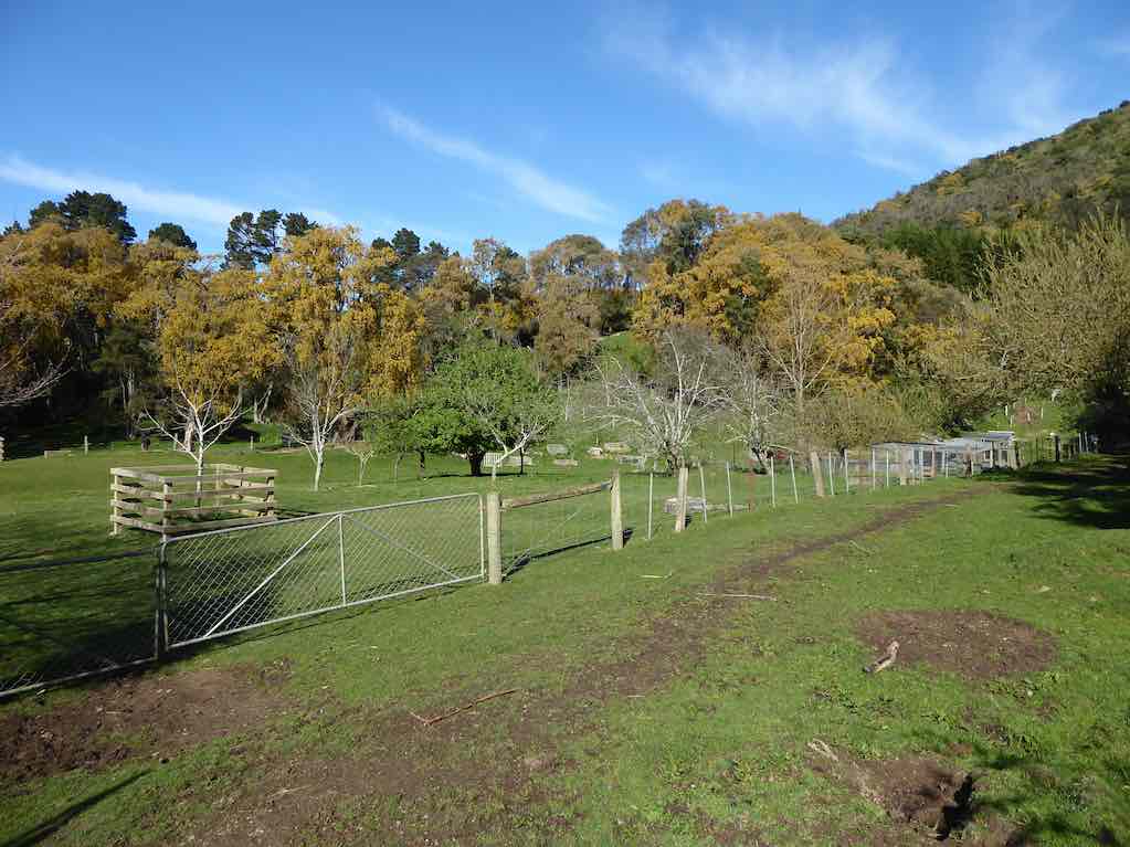
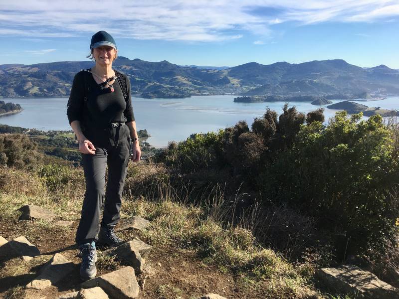
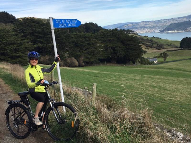
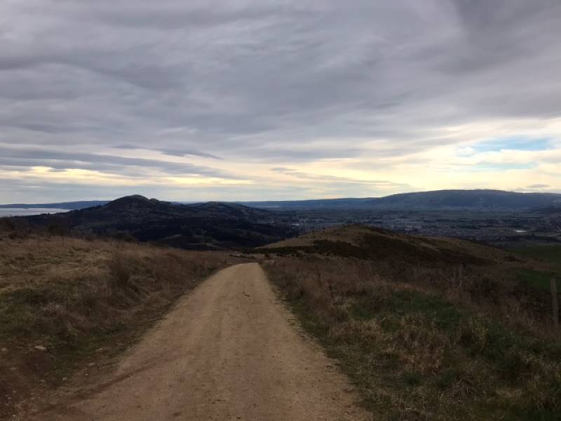
Chain Hills Track. Accessed from Chain Hills Road. 30 min. Tramping Track. – benched. Manager: DCC CAM and private land.


19. 5 October 2022. Combined. Green Island/Abbottsford and surrounds. Grade 3-3.5. $5. Leaders: Phil & Colleen, Raewyn & Jenny F.

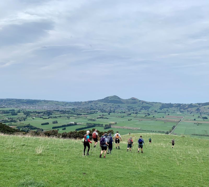
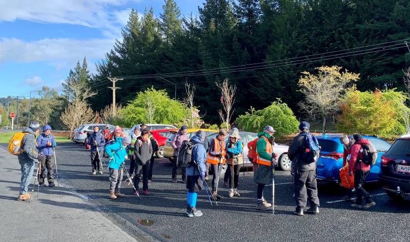
With weather forecasts of snow and strong winds fresh in their minds, 24 hardy walkers gathered at the Village Green, some hoping no doubt as we walked passed the cafe that we were going for an early fix.

An even better turnout at the Sunnyvale car park - Marijke

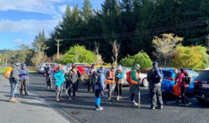
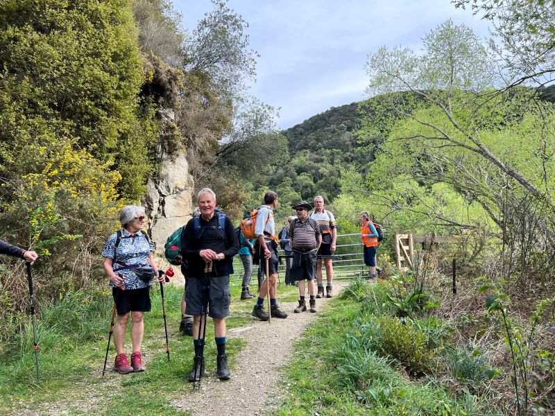
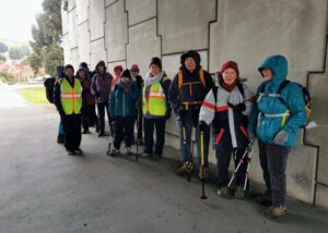
A good turnout at the Village Green, despite a dubious forecast of icy snow-showers and cold conditions (photo & caption Marijke)

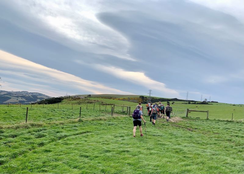
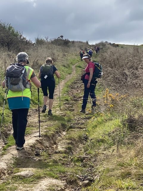
But to no avail as we immediately had to climb Thomson Street, short and not too sharp for our first huff n puff for the day. Immediately there were good views of the south end of Green Island, Estuary and Saddle Hill. On the far side, the ridge outline of Green Island Bush Rd, and the farm we did our recce through,(would the weather let the trampers make it that far?)

Now this is how a recce should be done! - Phil

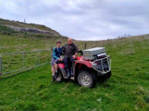
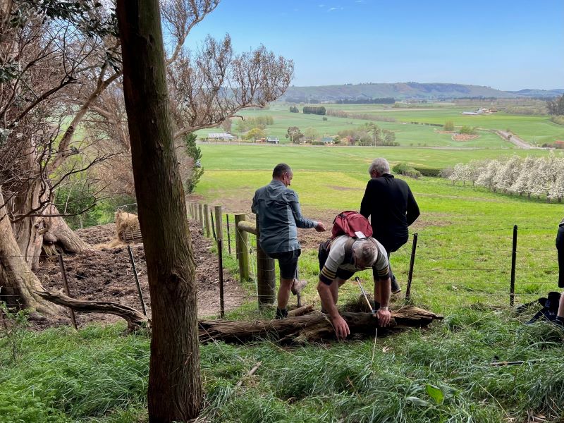
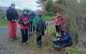
Now this is how a recce should be done! (photo & caption Phil)

Gardens in the area were festooned with blossom and bright ground cover and we all admired the Abbotsford home for wayward boys, it looked pretty good to the writer.

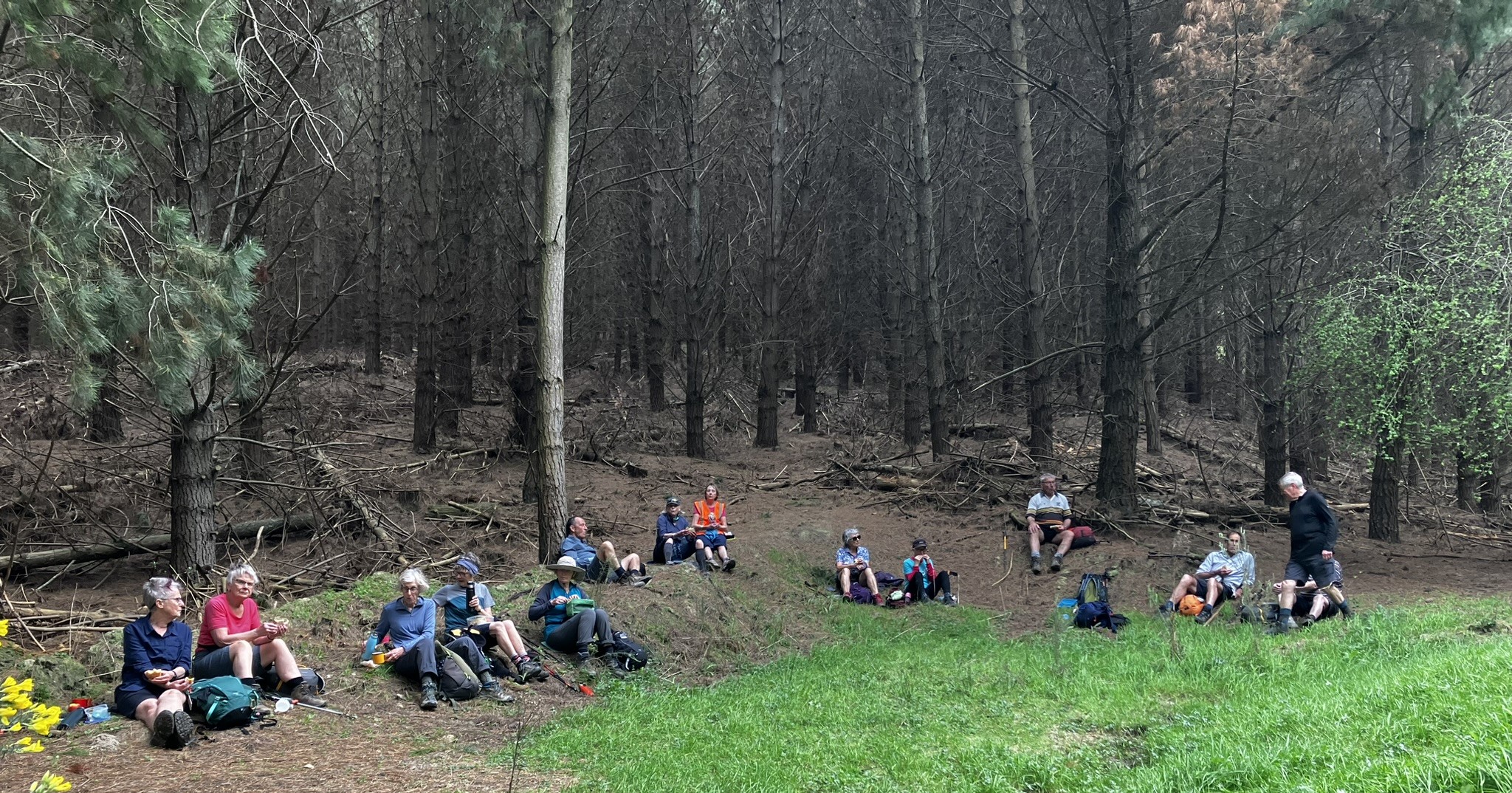
Walking through the new subdivisions, (once the playground of post war GI and Abbotsford lads), everything seemed much grander than back in the day. The natural storm-water basin was a delight with native plantings, and the entrance to the subway under the railway was a feature, painted by pupils of the school. A suggestion was made that some may want to take a little more time to walk Abbots Hill Rd while others stayed in the school playground for morning tea.

Morning tea at the Abbottsford School for some of us, with lovely treats from Jenni & Bruce

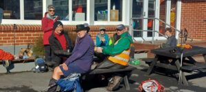
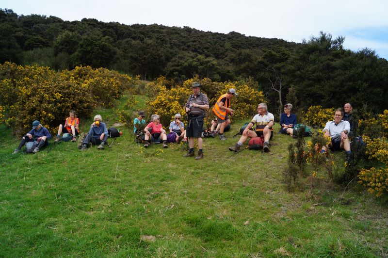
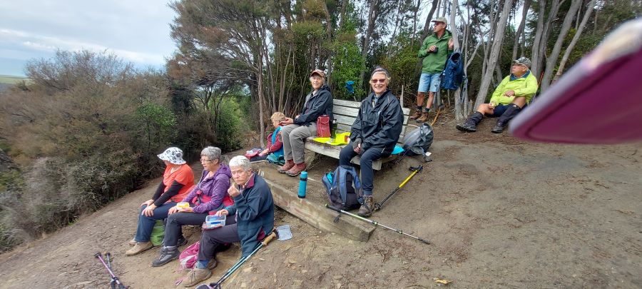
Morning tea at the Abbottsford School for some of us, with lovely treats from Jenni & Bruce (Photo & caption Helen)

Mmm the majority headed off in the first group! Many thanks to Jenni and Bruce for the ‘sweets’ and congrats again for the milestone anniversary and birthday.

Down Abbotts Hill - Marijke

Down Abbotts Hill (photo & caption Marijke)

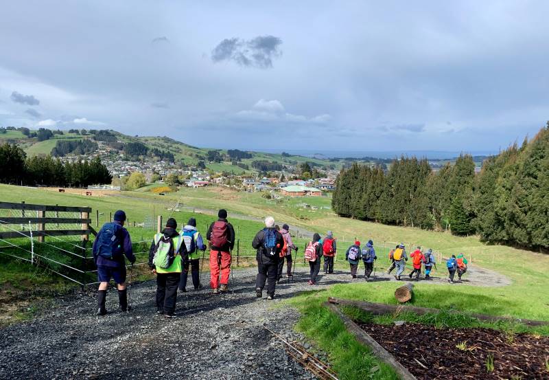
Following morning tea the groups reunited to reach the top of Abbots Hill, and descend down the land that was the top of the now (in)famous Abbotsford slip in August 1979.

Houses were on this landscape before the 1979 landslide - Pam

Houses were on this landscape before the 1979 landslide (photo & caption Pam)

With the agreement of the lifestyle owners we were able to eliminate many of the fences encountered on the recce, and take in the views. Having stayed together to the upper rugby grounds of Miller Park, the two groups split with the trampers heading down, through the tunnel under the motorway and up the other side of GI to the GI Bush Rd, whilst the hikers would move south up Neill St and down into the town via the motorway overhead footbridge for lunch. For the trampers more information on the slip was shared in the area of what was the lounge of the writers house, built by his parents in 1942.

Abbotsford slip with the 'old' Keene house in the middle of the soccer field - Phil

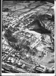
Abbotsford slip with the ‘old’ Keene house in the middle of the soccer field (photo & caption Phil)

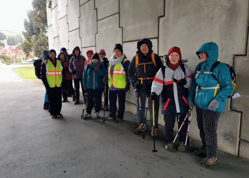
Following lunch on the reserve ‘in town’ and with advancing stormy clouds the Hikers decided to head to the Village Green, along the way finding shelter from the storm under the motorway overhead bridge.

Taking shelter from the snow shower - Margreet

Taking shelter from the snow shower (photo & caption Margreet)

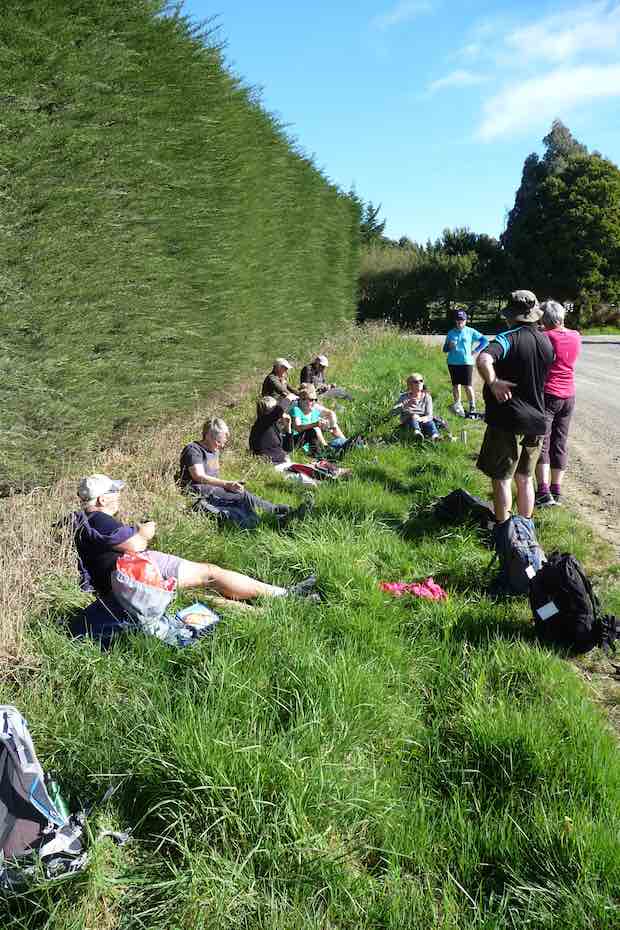
At the same time the Trampers ascended Church Hill Rd and took some very deep breaths near the top as the winds and hail hit; thankfully we saw out the worst of it and carried on to GI Bush Rd where apart from one more brief flurry requiring shelter behind the Hawthorn Hedges,

Sheltering from the storm

Sheltering from the storm behind a hawthorn tree (photo & caption Helen)

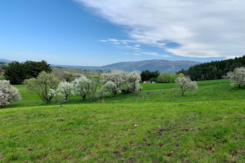
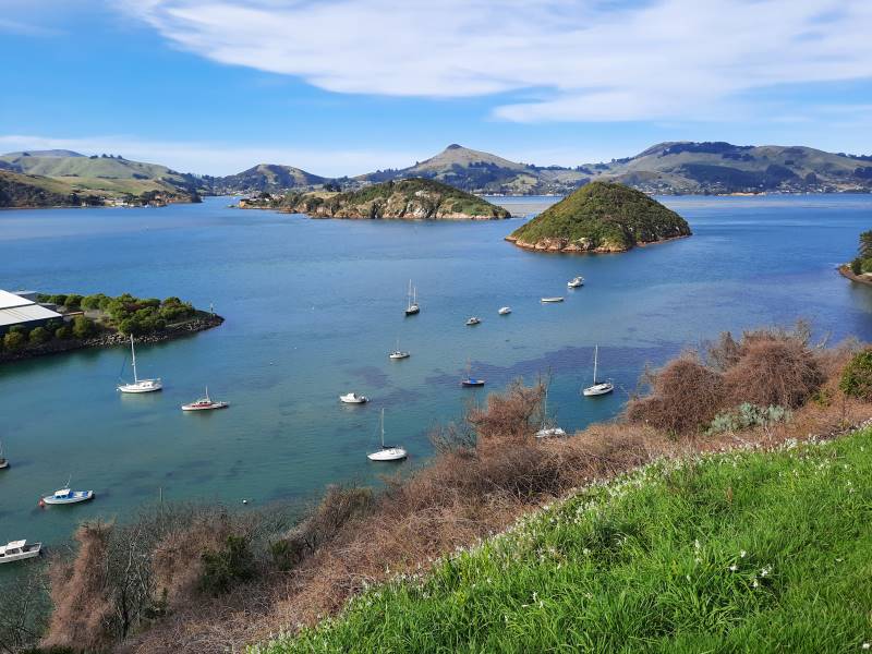
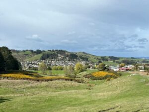
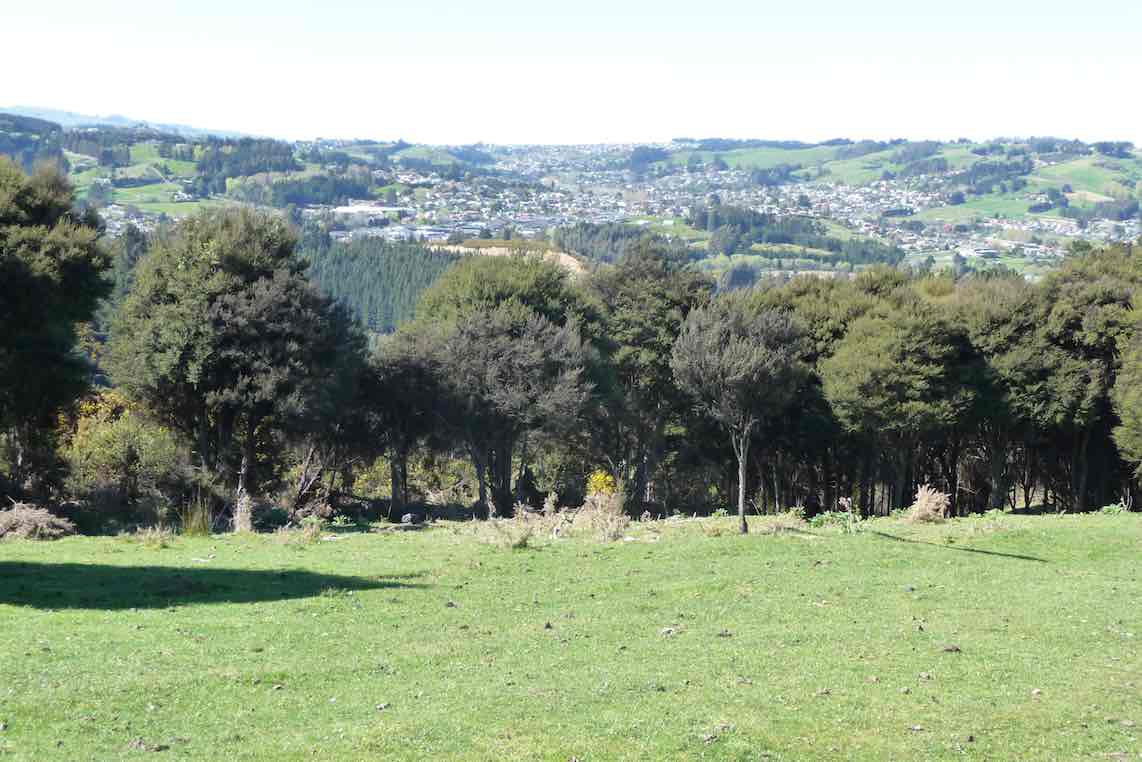
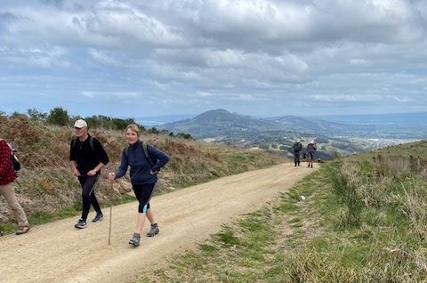
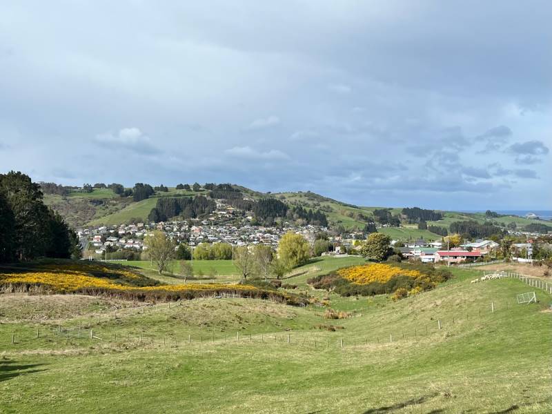
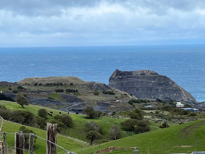
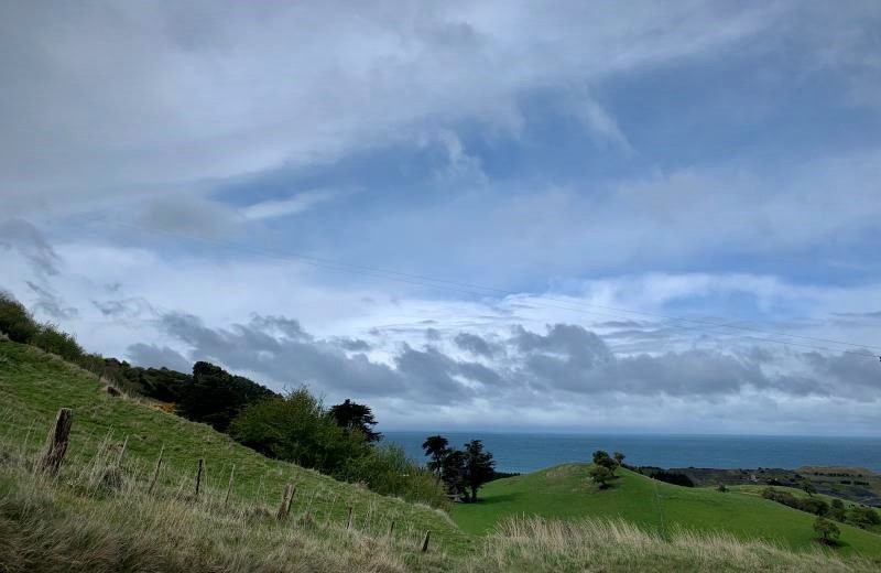
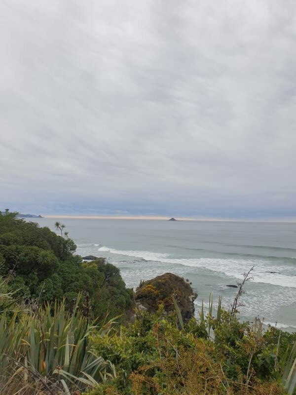
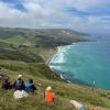
and passing the memorial to the site of the first GI school in 1853, we were rewarded with literally some breathtaking views of the Maungatua, the Saddle and the ocean, including Green Island and Blackhead, the latter more like a battleship viewed side on.

Blackhead Quarry getting smaller - Pam

Blackhead Quarry getting smaller (photo & caption Pam)

Wrapped up against the polar blast with Ocean View and Brighton beaches in background - Pam

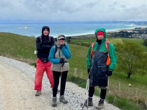
Wrapped up against the polar blast with Ocean View and Brighton beaches in background – Pam

As the sea comes into view, that sky looks ominous - Marijke

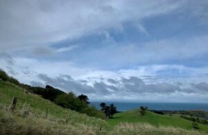
As the sea comes into view, that sky above looks ominous (photo & caption Marijke)

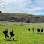
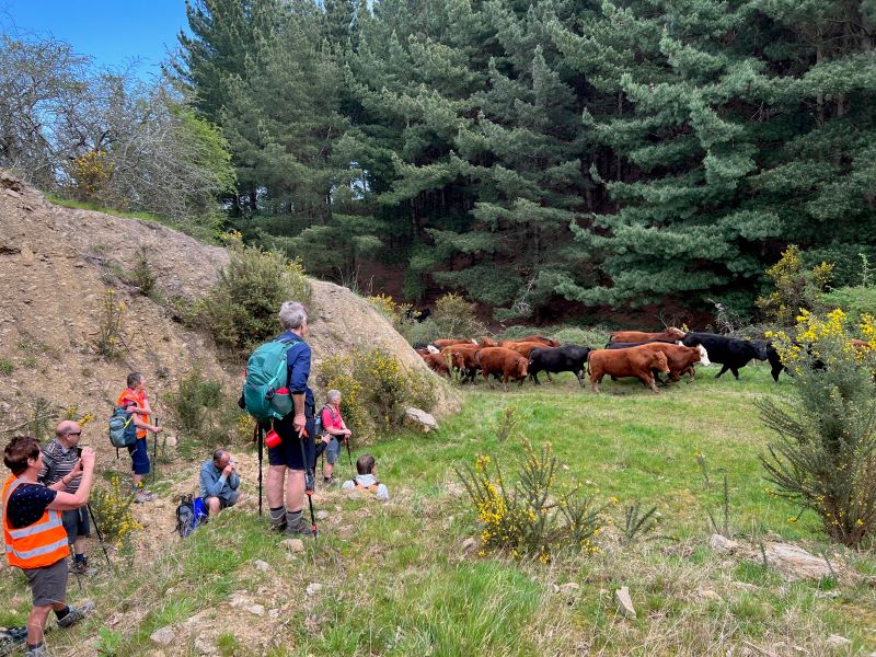
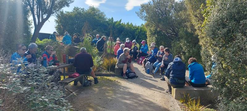
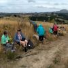
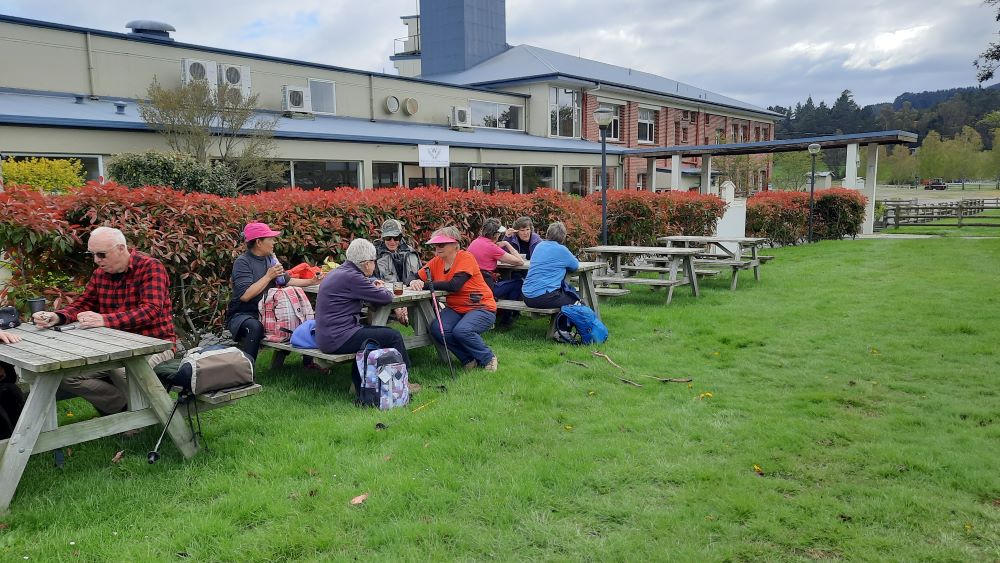
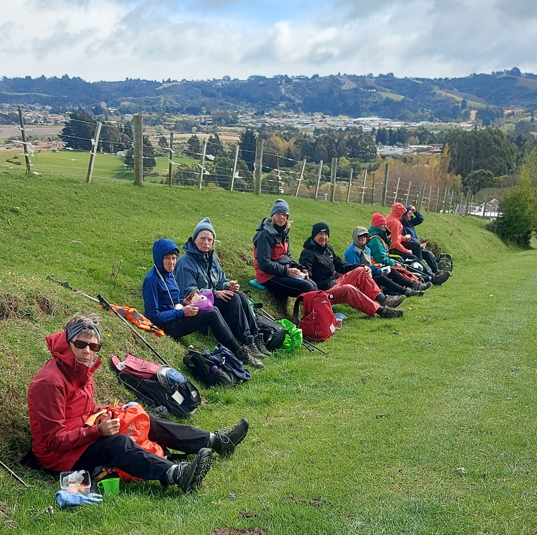
Our kindly farmer had undertaken some inventive gate fixing to make the entry onto the farm much easier than on the recce, and we were able to enjoy plenty of views as we ambled and shambled down through the farm, the lambs gambolling in the breeze…..(with apologies to Wordsworth). We lunched on a sunny bank near the farm buildings, before heading to the Village Green ‘through town’.

Lunch - Helen

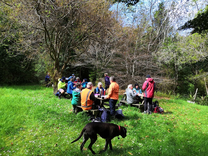
Lunch (photo & caption Helen)

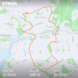
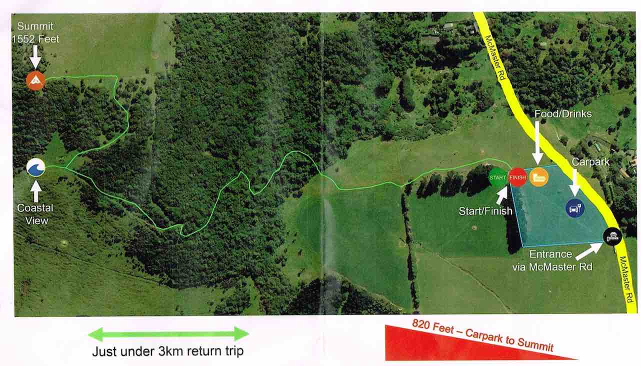
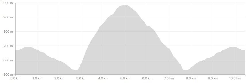
This was a rewarding day and of course all cobwebs were well and truly blown away. For the trampers a solid Grade 3, just on 12km and 350 altitude gain, while the Hikers were Grade 2 and 8km. Well done everyone and special thanks to the landowners involved for allowing access to build a great round trip.

Map - Phil

Phil for Raewyn, Jenny F and Colleen

Continue Reading »

One response so far

Aug 27 2021

COVID-19 Lockdown Week 2 August 2021

Published by under Uncategorized

The photos for this post were taken in the week to noon Thursday 26th August.

Club members have been out and about walking and on their bikes in lots of beautiful places in their local areas. We have been so lucky to have good weather.  Many have also achieved great things working and relaxing in their gardens and around home.

Our sympathies go to Ady for her flood.

Thank you Jenni for offering a mask to anyone in need.

Enjoy the following photos.  Chris Wither

Neil H bike joke      Neil H Silverstream Taieri

Pictured here is me going with the flow just like the Silverstream and the Taieri river. This current picture shows the confluence. I biked along the bank – and banked on my bike to get me home which it did. kkkkkkkkkkkkkkkkkkkkk ie 21kms Photo and caption Neil Hodgkin

Bruce car clean

All beautifully cleaned just waiting for an outing Photo and caption Bruce


Jenni masks

If anyone wants a mask let me know and can leave in letterbox for you. Jenni

Gordon gardening

First spud planting Photo and caption Gordon

Gordon biking

Alternative exercise Photo and caption Gordon

Marjke Harbour cone recce Marjke the wall Marjke wattle

Above On the Harbour Cone recce and on a  morning’s bike ride. Morning tea time underneath a lovely flowering wattle and cruising past the now famous wall! Below My water feature finally completed during the lovely lock-down spring weather, another long-term project! Photos and captions Marijke 

Marjke water feature

Michael frost free day in PortMichael Webb PC

As usual a beautiful frost free day in Port. and Morning ramble around Back Beach.  Photos and captions Michael 

Dianne seal Brighton

An early morning visitor at Brighton Beach Photo and caption Dianne

Dianne beach view

Our beautiful Ocean View coastline Photo and caption Dianne

Neil Different type of track work

Different type of track work Photo and caption Neil Morrison

Sarah bike and walk

Went for a bike ride and came across a track we just had to walk Photo and caption Sarah

Sarah track artwork

Art work by the wonderful track clearer. Photo and caption Sarah 

Helen bike Gladstone Road

Helen biking on Gladstone Road Photo and caption Phil

Phil reading    Helen in her happy place

Phil relaxing and Helen in her happy place.  Photo and caption Phil                     

Yan beautiful weather Yan Karatai

Loving my new push bike . Was going down the Karatai track but was warned about an irate farmer so went back up again. 

Hope everyone is enjoying this fabulous weather. Photos and captions Yan 
Jan garden

Not exactly an enjoyable way of spending the afternoon as had sharp thorns to contend with, but had to be done as arborist can’t get here. Another job ticked off the list!! Caption and photo Jan

Simpsons biking suburban mosgiel

Biking in suburban Mosgiel. Looking wistfully at the hills and wishing we were out tramping!!! Margreet and Neil Photo and caption

Ocean view

Alex Griffin enjoying Ocean View beach on a typical sunny day. Photo and caption Alex

Janice fire

Lockdown part 2 – burn up of pruning from big property tidy up during 2020 lockdown . Caption and photo Janice

Pam C biking Pam C walking

Biking and walking in my neighbourhood Photos and captions Pam Cocks 

You asked for it

Anon You asked for it! Here it is! 🤭🤣🥰

Shona sky    Shona

Hi Team, Photos from Friends Hill Road on Sunday Photos and message Shona 

John camelia John dog

Time to reflect in lock down.  A bit sombre perhaps, but today would have been Denim’s 17th birthday. A Golden Labrador, he was my son’s guide dog for 8 years, and my pet for 5 years in his retirement. Put a Camellia flower, from the garden, on the plaque where his ashes are buried, and looked through Denim’s photo file on my computer today. R.I.P. Denim.   John Gardiner photos and message 
Clive

The water tower on the top of the ‘Mosgiel’ Hill is useful for getting exercise walking up hill. Photo is of me walking up the steps in McFadden Drive to the water tower. Photo and caption Clive

Ady water water water

Water Water Water This has been my work since Saturday. Burst hose washing machine Friday night. 1 inch in garage. Caption and photo Ady

2 responses so far

Mar 23 2024

Hereweka Harbour Cone Future Forest – Background Information

Start Track SquareThe Hereweka Harbour Cone block of 328ha where the Future Forest is, was bought by the DCC in 2008. Since 2015 it has been managed by the Hereweka Harbour Cone Charitable Trust Continue Reading »

No responses yet

Mar 16 2024

Evansdale, Careys Creek, Honeycomb, Rongomai

Published by under Trampers

Location: 37 km.
From Evansdale Glen. Route. DOC. Stream crossings. Preferably February when water most likely to be low.
Track up Careys Creek alone: an easy walk.

Click information on the Seacliff Dam, historical creek track and pipeline.


Img 8974 Thumbnail
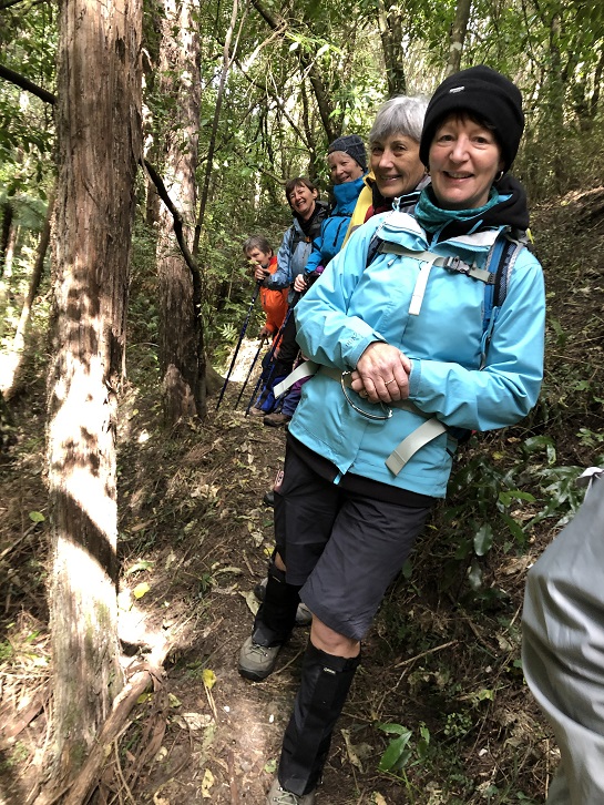
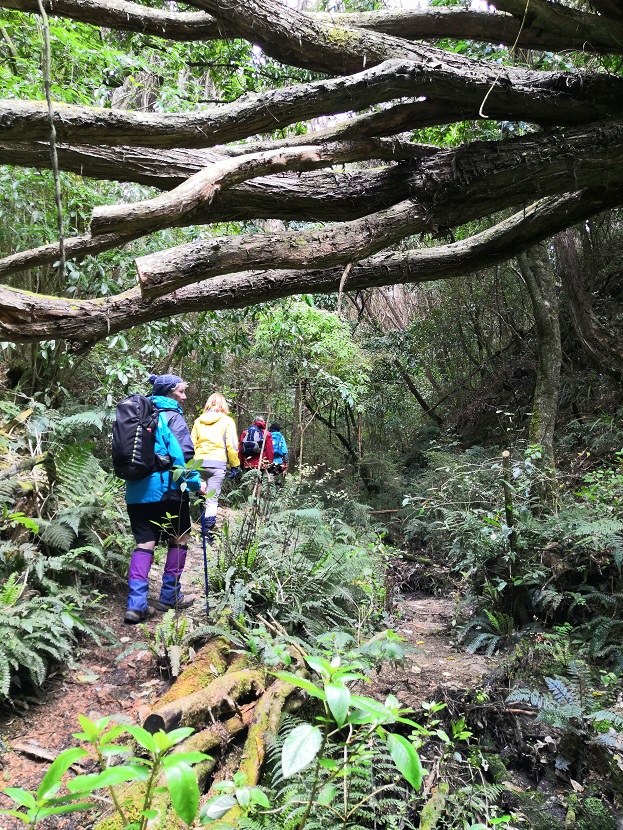
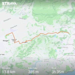
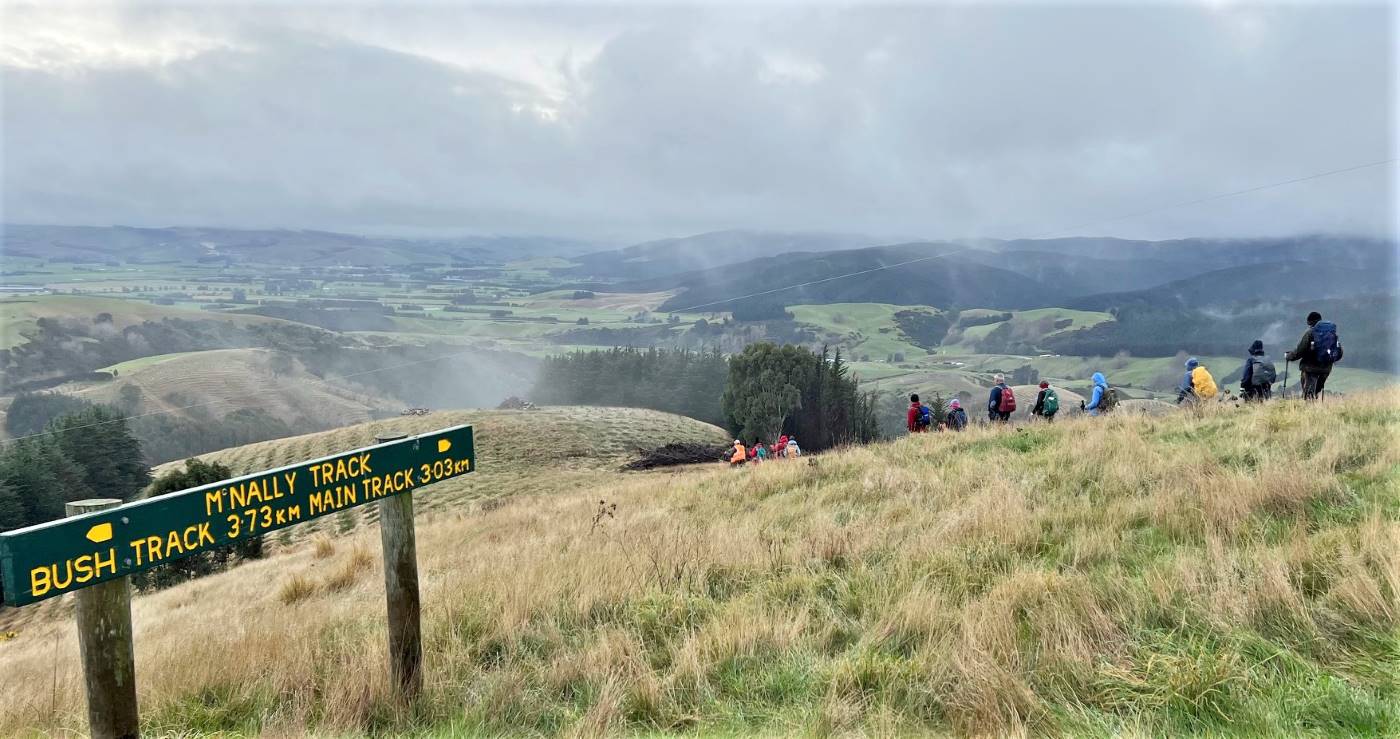
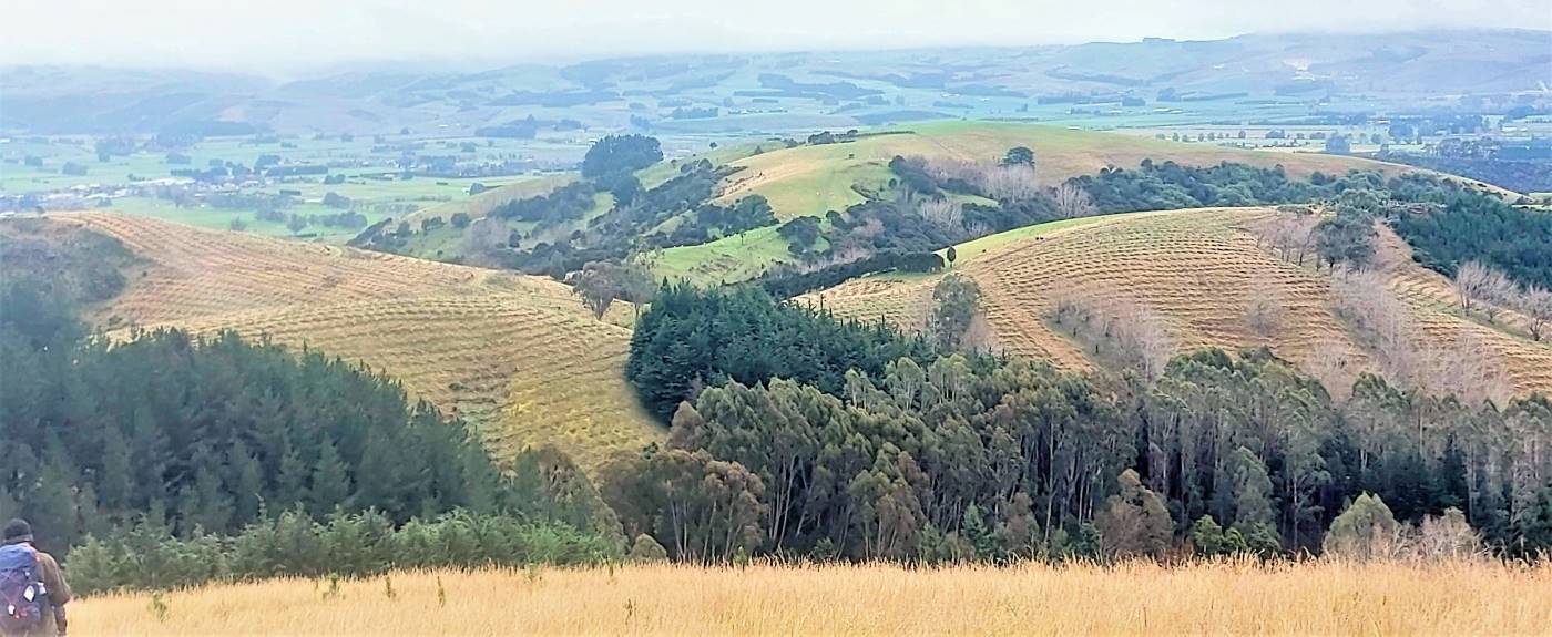
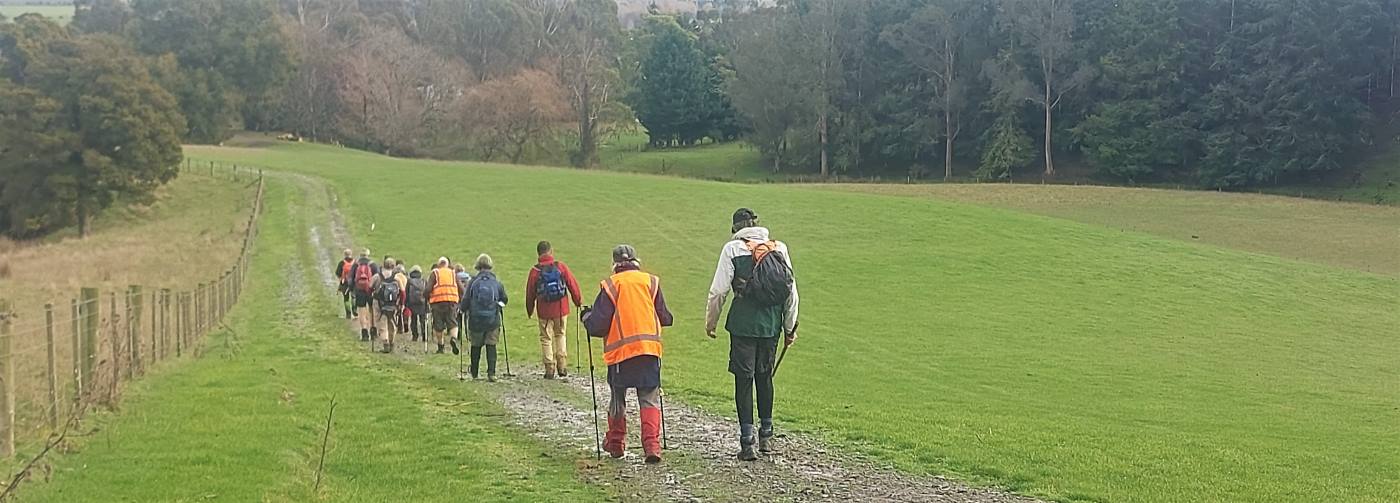
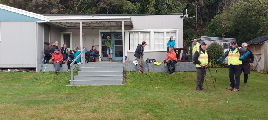
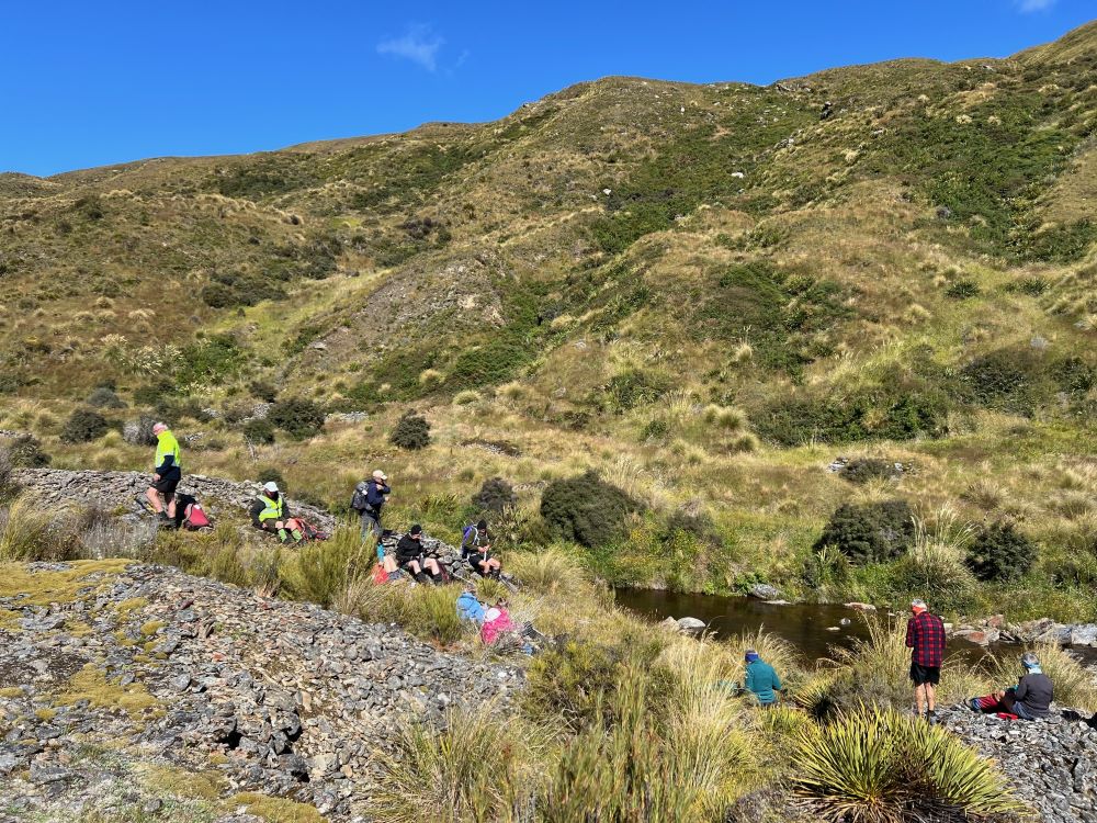
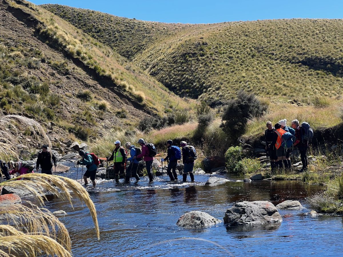
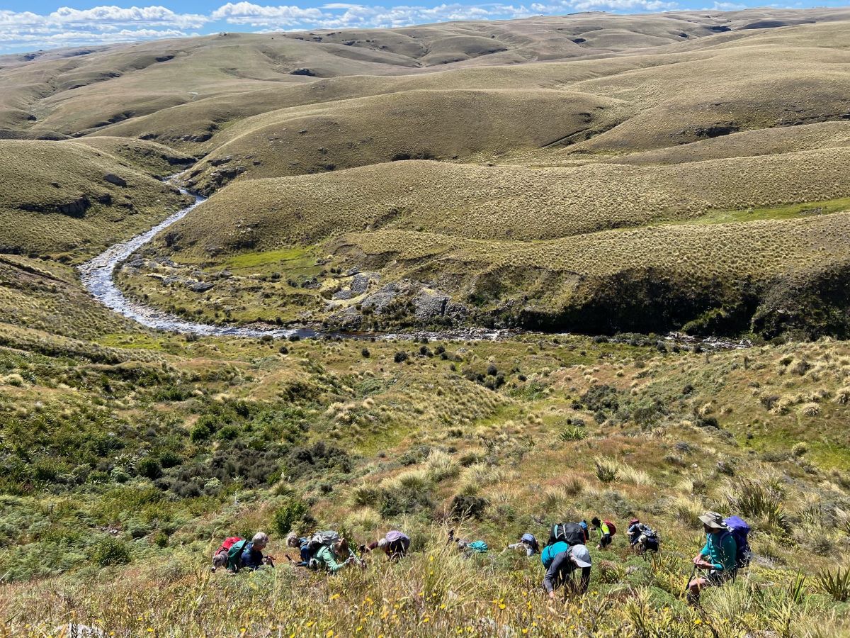
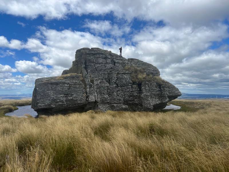
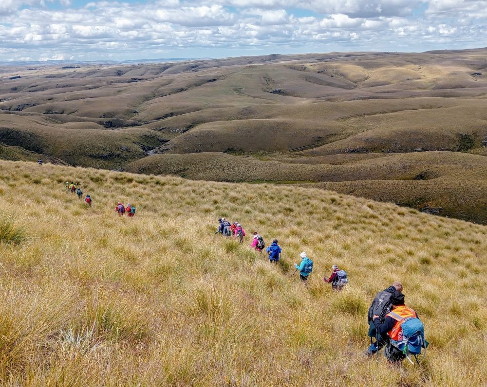
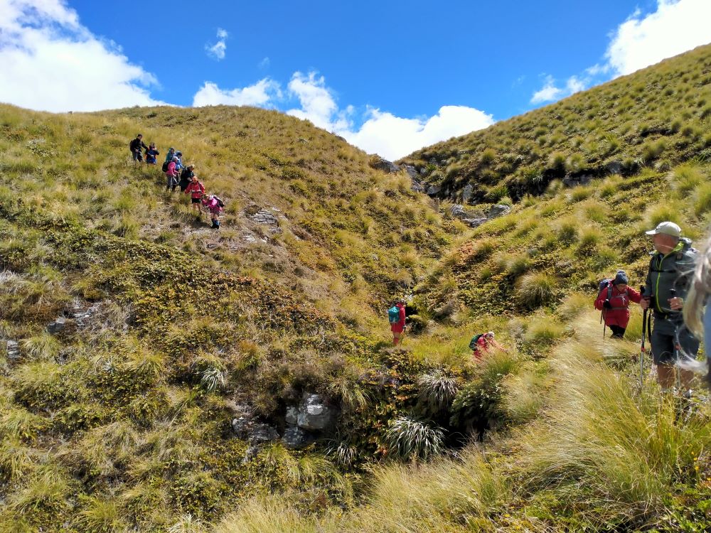
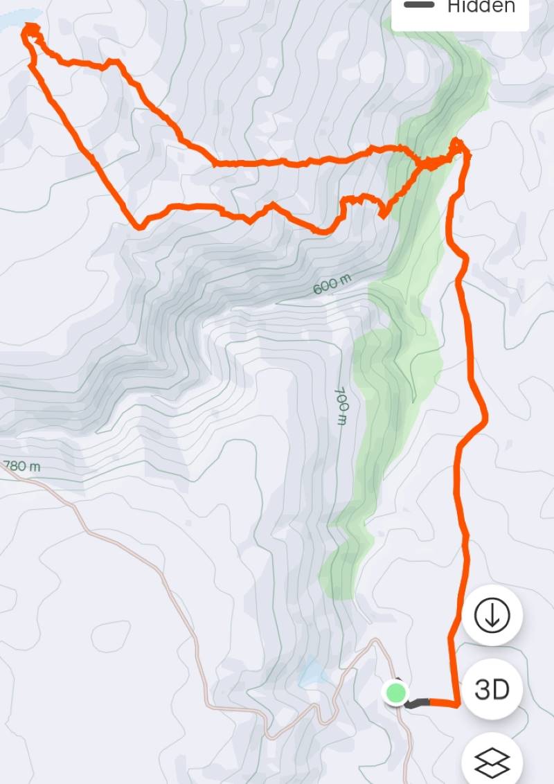
17. 13/03/2024. Trampers. Carey’s Creek, Rongomai, Honeycomb Tracks. Grade 3.5. $11. 39km. Leaders: Pam Cocks, Graeme Souter.
After a few concerns about the weather earlier in the week we were greeted with a cracker of a day. The Dunedin crew met at Woodhaugh Gardens as usual with our team leader deciding she simply must put on a pair of leggings to protect her legs whislt she “crushed” the overgrown grass that greeted us on our recce the previous week.

Continue Reading »

One response so far

Feb 24 2024

Waldronville

Published by under Hikers

10 km from car park.


20240214 125001 Square 10014. 14 February 2024. Hikers. Waldronville Wander. Grade 2. $5. 10km. Leaders: Phil Keene, Helen Morris.

After leaving PJ park right on time and catching up with the locals at the Estuary, 24 Hikers set out in orderly fashion back down the road towards Waldronville and crossed over into Island Park through the new gate, noting the sign ‘ no dogs allowed’. Must be to keep all the professional dog walkers out? Continue Reading »

No responses yet

Jan 27 2024

Ship at Anchor, Lammermoors, Deep Stream, Gold tailings, Mahinerangi

Lake Mahinerangi. From Eldorado Track, Cox’s Reef, Cosmopolitan battery, Timber Gully Waterfalls, old gold workings. (data lacking)
No. 8 on old hardcopy list of 113 club tramps. “Ship & Anchor. Lake Mahinerangi. George. Year round.”
No. 3 on old hardcopy list of 113 club tramps. “Eldorado Track. (Waipori.) Year Round.”
50 km from car-park. ( 54 km with Eldorado Track. Locked gates. Key from DCC Water Dept.)
Long tramp. Tussock now heavy. Summer too hot? Autumn may be preferable.
5) Appropriately Named “ Ship At Anchor “ Pam (square)14. 24/01/2024. Trampers. Ship at Anchor. Grade 4.5. $14.  Leaders: Phil Keene/Gary Mort Lyn Keene.
18 keen trampers turned up and left right on time at 8.30am in 4 vehicles, stopping briefly in Outram for tramper No 19, then travelled through the rolling uplands to above Lake Mahinerangi, before turning right up the El Dorado track, right to the end, through mobs of daggy sheep, the windfarm, the Blackrock Scientific Reserve and finally through the locked gates of DCC 3 Waters with the cameras keeping an eye. Ross was in charge of the key and maybe had a pinch of hypothermia by the time he was back in the car. Brrr would we find our riches at El Dorado?
Some Words From The Wise, Before We Set Off Ross

Some Words From The Wise, Before We Set Off (Photo & Caption Ross)

It was 10am before we set off walking, the group happily forgoing morning tea until we arrived 45 minutes later at the Chinese Diggings situated on the east bank of Deep Stream which was up a little following rain the prior day.

1) Fuelling Up At Deep Stream Before Ascending The Hill Behind Pam

Fuelling Up At Deep Stream Before Ascending The Hill Behind (Photo & Caption Pam)

Mmm NZ Topo 50 is telling us we have to go west and will have to cross. The thought of this seemed to necessitate a continuous stream of walkers, single file, into the bushes. Thankfully they all came back and with a little help from our friends we all crossed, with wet feet and knees to the other side.

2) “ Follow The Leader” Across Deep Stream Pam

“ Follow The Leader” Across Deep Stream (Photo & Caption Pam)

Thus began a steep ascent with a new pathway selected every few steps, not to mention the need for a breather at fairly short intervals!

3) Scrambling Up The Lammermoore’s To Admire The Expansive Landscape Pam

Scrambling Up The Lammermoore’s To Admire The Expansive Landscape (Photo & Caption Pam)

Big Sky Shadows On The Land Marijke

A Big Sky With Cloud Shadows On The Land (Photo & Caption Marijke)

2 Climbing Every Mountain Phil

Climbing Every Mountain (Photo & Caption Phil)

The ascent was followed by steady to steep ridge-line walk keeping to the true left of a stream, before crossing over nearly at the head, and finally over the last brow of a hill to arrive after 2 hours from morning tea, of fairly serious tramping, at the Ship at Anchor;

4 At Last The Ship At Anchor Phil

At Last The Ship At Anchor (Photo & Caption Phil)

5. Lunch In The Lee, Sheltered By Tussock Phil

Lunch In The Lee, Sheltered By Tussock (Photo & Caption Phil)

thankfully we had not missed the boat and it provided good shelter along with the snow tussock from the fresh westerly that had been present all morning.

5) Appropriately Named “ Ship At Anchor “ Pam

Appropriately Named “ Ship At Anchor “ (Photo & Caption Pam)

Our departure was not too long with those who had not previously been here circumnavigating the Ship and we all followed a course on the true right of the stream down another ridge-line, initially made ‘easy’ by a water course shaped I think by ancient shovels?

Heading Down The Highway Ross

Heading Down The Highway (Photo & Caption Ross)

With the possibility of a precipice emerging in front our leader tacked left just in time onto another ridge that steeply descended towards a man made watercourse, scout Graham finding the appropriate gang plank onto the other side. It would be fair to say knees were now creaking as we traversed parallel with the contours dropping every now and then towards the crossing of Deep Stream. According to the leaders timepiece we took longer down than up, just like the Grand Olde Duke of York……oh dear!

6. Mmm Did It Take Longer To Go Down Than Up Phil

Mmm Did It Take Longer To Go Down Than Up (Phot & Caption Phil)

If feet and knees were by now warm and dry they were wetted again and with all crossing safely we re-grouped and took off up the prairie back to the cars, this being quite a steady upland walk!

7 If You Start With Wet Feet You Might As Well Clean The Boots Again When You Finish, Gentlemen Abound Phil

If You Start With Wet Feet You Might As Well Clean The Boots Again When You Finish, Gentlemen Abound (Photo & Caption Phil)

We departed paradise at 4.30pm arriving back in Mosgiel at 5.30pm. Rumour has it that the hydrotherapy pool has been busy since the trip, no wonder. The expansive and varied landscapes are so much more rewarding when set in such a remote and wild environment. Because of the access restrictions at the Weir this was the first time travel to the Ship at Anchor had been done this way. Distance 10.47km, elevation gain 661m, moving time 3:25;59, calories 1,016. And I’m sticking with grade 4.5.

Thanks to everyone for supporting each other so well.

Phil K

Screenshot Phil

Ship at Anchor route (Screenshot Ross)

Screenshot 2024 01 25 142142 Ship At Anchor Profile

Ship At Anchor Profile (Screenshot Ross)

Continue Reading »

No responses yet

Dec 09 2023

Tomahawk Lagoon and nearby tracks/areas

Published by under Beach,Trampers

Ocean Grove, also known as Tomahawk, is a suburb in the southeast of the New Zealand city of Dunedin. … The suburb was known as Tomahawk until the 1930s, the name not being a reference to the weapon, but rather possibly an anglicised form of the Māori words tomo haka, meaning “dance by a gravesite”.

No. 23 on old hardcopy list of 113 club tramps. “Karetai Rd via Monument from Lagoon. Year round.”

Distance from car-park: Tomahawk: 19 km; Smaills Beach: 22 km;  Paradise Road: 26 km.’

DCC List: 41 Peg Track. Otago Peninsula
Accessed from Oregon St. 3.5 hrs ret. Tramping track – unbenched. Managed: DCC CAM, private land.
Description – This track provides a link between Ocean Grove and Highcliff Road. Access to the track in Ocean Grove is off Oregon Street. An attractive walk around Tomahawk Lagoon then climbs through gorse and native bush. Turn right towards Soldiers Memorial through paddocks with gorse sometimes obscuring the rock walls.

  • Classification – Hard
  • Time – Approximately 45 minutes.
  • Parking – Limited at Highcliff Road. No dogs.
  • Dogs – No

Boulder Beach From Top Of Highcliff Track Pam (square) (100x100)
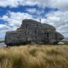
43. 06/12/2023. Trampers. North of Tomahawk. Grade 3. $7. 22km. Leaders: Esther Willis and Julie McKenzie
As hoped, the weather was kind to us, as this tramp would be wasted without being able to savour the spectacular views.

Continue Reading »

No responses yet

Oct 28 2023

Shannons Farm Walk

Published by under Both Hikers & Trampers

Distance from PJP car park 48km.


3. 25/10/2023. Trampers.  Cairn Valley/Shannon, Grade 3, 48km. Leaders: Heather Kirk, Diane Paterson.

Walking through lush grassLovely sunshine greeted 30 keen trampers for a good day’s walk on Cairnvalley Farm Shannon. Strath Taieri offers something different in scenery with tussock hills, huge rock formations and at this time of the year fresh green vistas of paddocks and Continue Reading »

No responses yet

Sep 23 2023

Nicols Farm (formerly Michelles Farm), North Side Taieri River, Outram

Published by under Farm,Trampers

No. 87 on old hardcopy list of 113 club tramps. “Michelle’s Farm Outram Farm”.
11 km from car park.
Park under Outram Bridge. Contacts: Seek 3 permissions.
Proceed east side of Taieri River along gravel road to gravel pit.  Bear right uphill to power lines. Follow generally along grass farm tracks to top of hill.
Landmarks: Trig marker on right; also obvious paper road between two fence lines; Long barn on right (good for lunch stop); large wool shed on top of hill straight ahead (this is still on Hyslop’s property).
Straight on access is to Taioma Road but we don’t usually go that far!
Plenty of mushrooms in April – take a bag!


15. 20/09/2023. Trampers. Nichols Farm. Grade 4. Leaders: Jill Reid and Julie McKenzie
15 intrepid trampers parked under the Outram bridge. As we walked along the Taieri river wind in the willows gave us warning of a breath-taking day!
Trampers 20 Sep Nichols Farm On the track above the Taieri River Pam

On the track above the Taieri River. Photo & caption Pam

Trampers 20 Sep Nichols Farm Morning tea John

Morning tea with the pretty yellow flowers. Photo & caption John

After ascending a narrow track through scrub we made our way along a ridge on Craig Nichol’s property. Any conversation was ‘gone with the wind’. To quote Evel Knievel “ I love the feeling of fresh air on my face and wind blowing through my hair” – certainly true today!

Trampers 20 Sep Nichols Farm Those windblown skies were impressive Marijke

Those windblown skies were impressive. Photo & caption Marijke

We decided not to go to the trig – the howling wind spoke to us and we found our way down to a pocket of native bush. The relative calm here was a welcome respite from the punishing wind on the hill top.

Trampers 20 Sep Nichols Farm Lovely view of Mosgiel's iconic Saddle Marijke

Lovely view of Mosgiel’s iconic Saddle. Photo & caption Marijke

Trampers 20 Sep Nichols Farm Coming down off the windy hilltop to the sheltered gully Pam

Coming down off the windy hilltop to the sheltered gully. Photo & caption Pam

Trampers 20 Sep Nichols Farm Lunch spot Jill

Lunch spot. Photo Jill

Walking roughly parallel to SHW 87 we headed back towards Outram. Thank you farmer Neil for herding a mob of cattle out of our path.

Trampers 20 Sep Nichols Farm Keeping our distance for the herd Pam

Keeping our distance for the herd. Photo & caption Pam

Throwing caution to the wind we walked through a Douglas fir plantation, then a large stand of eucalyptus – fortunately there were few recently dropped branches! The only reportable incident was Diane being blown backwards whilst pivoting on a gate – luckily she was caught by the two behind her ( I rue a missed photo opportunity!)

Trampers 20 Sep Nichols Farm Beautiful spring scenery with cattle sheltering in the trees (very wise) Marijke

Beautiful spring scenery with cattle sheltering in the trees (very wise). Photo & caption Marijke

Trampers 20 Sep Nichols Farm Lower Neil Pam

Lower Neil. Photo & caption Pam

Trampers 20 Sep Nichols Farm Happiness is tramping with friends Pam

Happiness is tramping with friends. Photo & caption Pam

A nice hill climb took us to wide track Craig recently had dug out back down to the Taieri river, and we were at the cars by 3.00 pm.

A great day out and many thanks to Julie McKenzie and Pam Cox for your assistance.
Distance walked – 13.5 km
Jill Reid

Continue Reading »

No responses yet

Jun 30 2023

McNally Walkway

Published by under Hikers

No. 83 on old hardcopy list of 113 club tramps. “McNally Track, Milton. Year Round”
44 km from car-park.
Access: Milton M 91km ret. Opposite Presbyterian Church, turn left at Ossian Street and follow on down Moore and Tokoiti Streets to Cemetery near which is the entrance to the McNally Walkway. Park cars by the side of the road.
Potential for Combined trip.


20. 28/06/2023. Trampers. McNally’s Walkway. Grade 2.5. Leaders: Graeme Souter, Yan Campbell

Hopefully, Constable Tom McNally would have appreciated that 17 hardy trampers weren’t deterred from following the walkway named for him. A night of heavy rain and inconclusive forecasts for the day had caused Graeme a restless night, trying to decide whether to cancel or change the tramp. Much of the trail is quite exposed passing through paddocks and would have been pretty miserable in a downpour. It wasn’t actually raining at Peter Johnstone Park at 9:15 and the sky seemed to be lightening to the south. We split into four cars and headed for the cemetery at Milton and the beginning of McNally’s Walkway.

DSC06755 John (2) Res 1200

Getting ready to leave the cars (photo and caption John)

We set off in a very light rain along a fence line of the first paddock. The ground and grass were certainly wet and it was a steady climb to our stop for morning tea in a sheltered spot with a bench. There was a great view of the Taieri Plain but the hilltops were still shrouded in cloud and would remain so.

20230628_103910 Barbara Res 1200

Morning tea on McNally Track (photo and caption Barbara)

20230628_104104 Helen Res 1200

Morning tea (photo Helen)

By the time we set off again the rain had stopped and the only drips were from the overhanging trees.
We took a slightly different route from other years, turning onto the Kowhai trail for the rest of the climb. It passed through a mix of native and introduced trees before opening up into paddocks of newly planted pines. By this time, we could see the summit and the haybarn where we’d have lunch. There was just one more climb before we made ourselves comfortable and ate.

IMG_6481 Pam Res 1400

Lunch among the bay bales (photo and caption Pam)

IMG_6482 Pam Res 1400

McNally’s Track Summit (photo and caption Pam)

After lunch we headed downhill through quite long grass which soon became a clear path at least for those of us at the back. At this point the sun broke through and this clearer light made a remarkable pattern, contrasting the long fading grass with the small green pines.

image Helen Res 1400

All the new planting of the pine trees (photo and caption Helen)

Once we were through this, there was only one more steep pitch up through some trees. From then on the walk was steadily downhill coming out onto Cemetery Road and just a short distance from the cars.

20230628_132148 Helen Res 1400

On the last stretch of the tramp (photo and caption Helen)

After changing out of our muddy boots and gaiters we made our way to The Black Swan in Waihola. By this time the weather was fine enough to sit outside.

IMG_6487 Pam Res 1200

Camaraderie at Black Swan Cafe (photo and caption Pam)

The day had really turned out well. Thanks Graeme.
Yan
Continue Reading »

No responses yet

Apr 01 2023

Taieri Mouth

Published by under Hikers

No. 78 on old hardcopy list of 113 club tramps. “Knarston Park Sth Coast (Ask Jean Young) Farm”

Location: 31.5 km.


15. 29/3/2023. Millennium Track, Taieri Mouth.  Leaders Dave and Mike

I seriously questioned my sanity on the drive from sub tropical Port Chalmers to Mosgiel for this weeks walk. The torrential rain and hailstones on the Southern Motorway left me with a sense of foreboding. However, 17 hikers eventually assembled at the meeting place at Knarston Park on Taieri Beach for what turned out to be a really enjoyable walk with the predicted rain showers non-existent.

Morning smoko was held on the verandah at Jay’s river mouth crib where we could admire the house extension at one neighbouring property and the dismantling of a Kauri boat on another.

29 Mar Hikers Millenium Track morning tea Helen

Morning tea at Jay’s crib. Photo & caption Helen

From there it was a pleasant river side walk on the Millennium Track and boardwalks before starting the grunt up the hill to the welcome seats where we had lunch before re-tracing our steps back to the cars.

29 Mar Hikers Millenium Track On the track Mike

Millennium Track. Photo & caption Mike

29 Mar Hikers Millenium Track Taieri view Helen

View from the lunch seat. Photo & caption Helen

29 Mar Hikers Millenium Track Lunch Helen

Lunch. Photo Helen

Consensus of opinion is that the grade should be re-classified as a 3.5 as Sir Edmund Hillary got a Knighthood for climbing hills that steep. The return to the cars was achieved without mishap and tiffin was taken by some at the Brighton Cafe.

Thanks to Dave Roberts for leading at a leisurely pace that made the uphill sections enjoyable. Total distance walked was 9.5km

Mike Webb

Continue Reading »

2 responses so far

Sep 06 2022

Port Chalmers and environs

Published by under Hikers

Click Dunedin’s Hills’ History for background Information.
30 km from car park.
24. 31/08/2022 Hikers. Port Chalmers. Leaders: Michael Webb and Bruce Wright M.
On a typically beautiful Port Chalmers day with no hint of Mosgiel type frost, 32 hikers met at the Back Beach car park for what some thought was going to be a gentle stroll visiting some historical sights in West Harbours hidden gem.
The first hill climb on the track from Back Beach to Island Terrace cut short the usual discussing of sore hips, knees, dieting, prostate problems, midnight trips to the loo, hot flushes, ungrateful children, recalcitrant grandchildren, the Mayor and Jacinda.
Oh what a beautiful day Ady

Oh what a beautiful day Caption and photo Ady

It was during this first ascent of many hills that the first mumblings of mutiny were heard. The leader took this on board, totally ignored it and proceeded to lead the group up to Hotere Hill via Campbell Buchanan lane where we had morning tea.
Morning tea in Ralph Hotere Garden

Morning tea in Ralph Hotere Garden
Caption and photo Helen

We then descended a track to Back Beach for a relaxed stroll alongside the harbour where Faye revealed herself to be a “legend” with her lecture on oven cleaning.
Boat shed on Back Beach Michael

Boat shed on Back Beach Caption and photo Michael

Stone boat 2

Stone boat – how many just walked by? Caption and photos Phil

Stone boat 1 Phil

A walk up Currie Street to see some historic buildings including the old Buffalo hall was followed by a welcome comfort stop at the Port Chalmers Library. Another steady ascent took us to the Lady Thorn dell for lunch.
Neil will give anything a go - once Phil

Neil will give anything a go – once. Caption and photo Phil

Yet another climb took us to Scott Memorial before crossing the road for our last uphill leg before descending through some bush and a track past the old cemetery back to Port Chalmers.

The town Helen

The town Caption and photo Helen

Refreshments were taken at The Galley where one unnamed lady ordered a Bloody Mary. Due to the many steep tracks and hills in Port Chalmers this could possibly be a Grade 3.  The hike was 8km. Michael Webb

Continue Reading »

No responses yet

Next »