Jun
14
2017
No. 82 on old hardcopy list of 113 club tramps. “Old Stone Barn Clarendon Farm”
38 km from car park
Associated farm on Cullen Road has new owner requiring signing in and out, and therefore no longer viable as a round trip. [Edit.]
14/6/2017. Clarendon, Cemetery,Sinclair Wetlands, Berwick Camp. Leader: Eleanore.
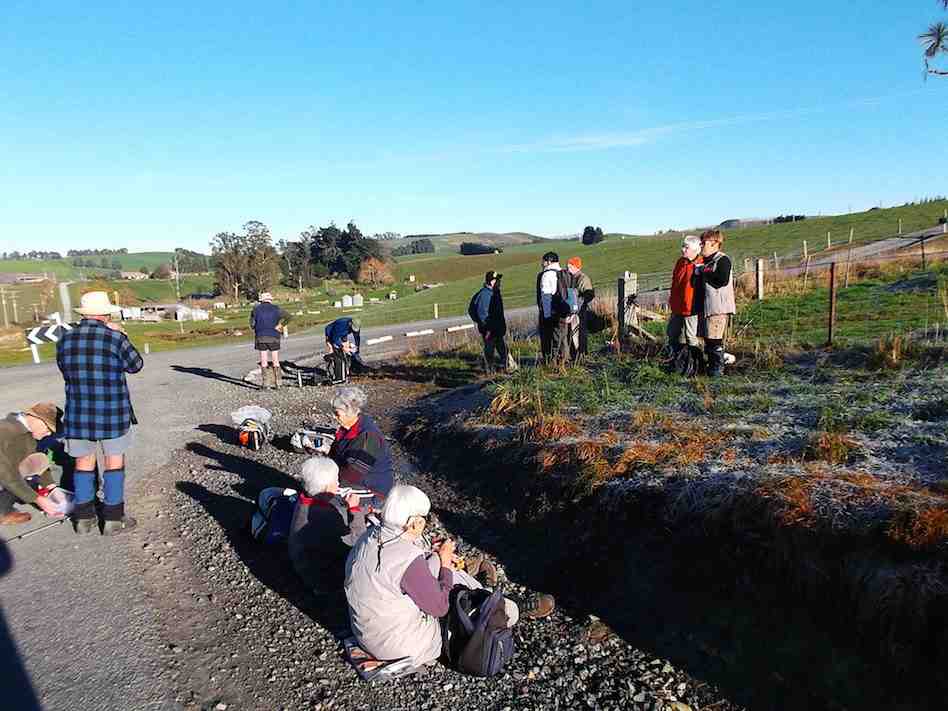
Today 7 hardy (maybe silly) trampers drove to Phosphate corner at Clarendon, then along Berwick road, parked up and walked up the hill to the Cemetery (my Great Great and Great Grandparents, some Siblings and Children from Sinclair family are buried there.
We then drove further along Berwick road, parked and proceeded up the track to the hay barn for smoko.
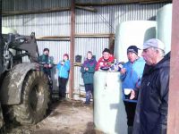
Shed for morning tea out of the freezing wind. (Helen pic and caption.)
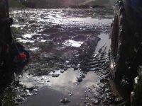
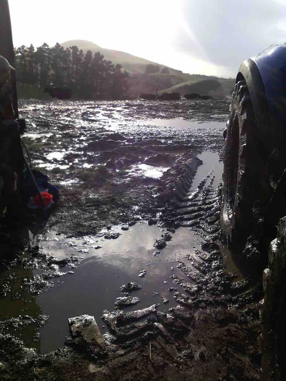
Mud to get to the shed. (Helen pic and caption.)
We all decided it would be no fun climbing round and up Mary Hill with frequent showers and a bitterly cold wind.
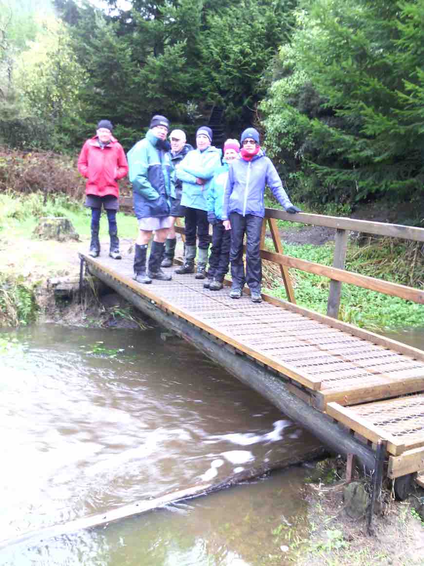
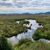
On the way back we briefly stopped at Sinclair Wetlands then drove into Berwick Camp, a year 8 class was there on camp, talked with the Activity Coordinator and strolled up to the dam.
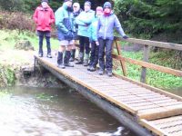
On a bridge at the Berwick camp. (Helen pic and caption.)
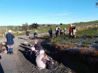
It was plain to see what fun the young students were having, particularly when having a turn driving round with a leader in an old converted type of Land Rover in the mud.
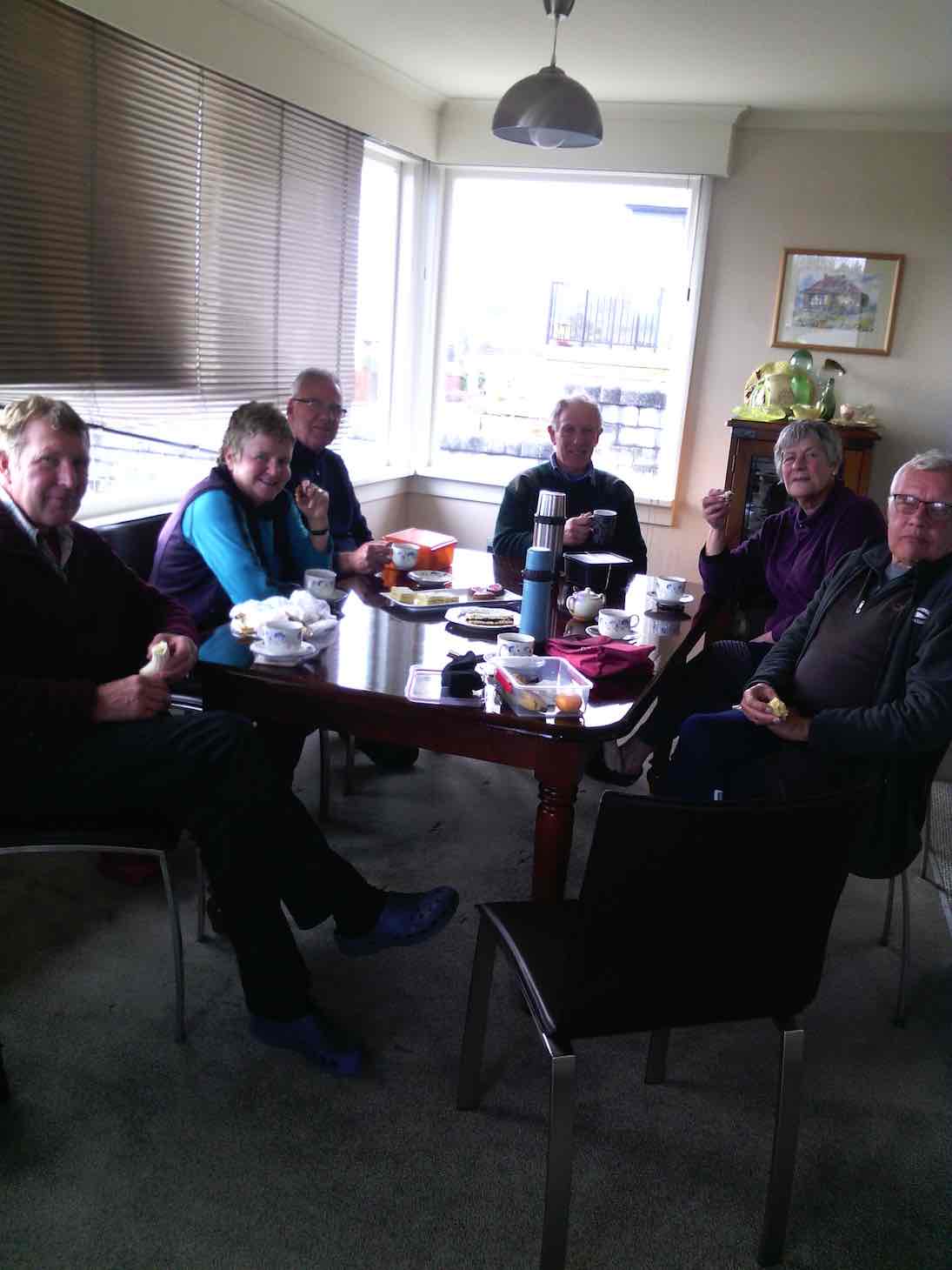
So after all this strenuous activity we journeyed on to eat lunch (and cake) at a little hilltop cafe in Clyde street. – Eleanore.
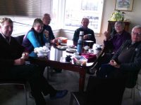
Lunch at Eleanore’s with a lovely warm fire and cakes which were enjoyed by us all. (Helen pic and caption.)
24/4/2013. Hikers – and a few trampers. Limesprings Farm, McNeil Rd, Whale Museum, and return back through Farm by a different route. Leaders: Jim and Betty.
Route, unfortuately stopped at Whale Museum, for some inadvertant technical reason! Cattle track up middle, McNeil Rd and extension at top.
The overcast day succeeded a wet 24 hours, and several trampers joined us after cancelling their bush walk up Raingauge Spur for safety’s sake. We parked the cars halfway along Driver Road and walked on to enter Limespring Farm.
Continue Reading »
Apr
05
2024
Official Sinclair Wetlands website.
From car park, via Clarendon: abt 35 km.
 5. 04/04/2024. Combined. Sinclair Wetlands. Grade 1.5. Leaders Ady, Linda, Dave and John.
It’s said that there are more bacteria and microscopic life in one glass of water, than there are grains of sand on the planet. (Neither figure being accurately calculable of course.) A good introduction to the Sinclair Wetlands. Teaming with life, yet most of it out of plain sight. Continue Reading »
Jun
04
2014
No. 90 on old hardcopy list of 113 club tramps. “Round Hill – Milburn (George) Farm”
42 km from car park.
2/6/2014 Both. Fort Hill, Barnes and Circle Hill Roads, Milburn. Moderate. Leaders: Ian, Ken
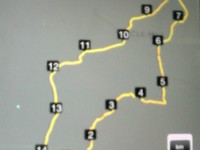
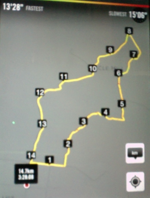
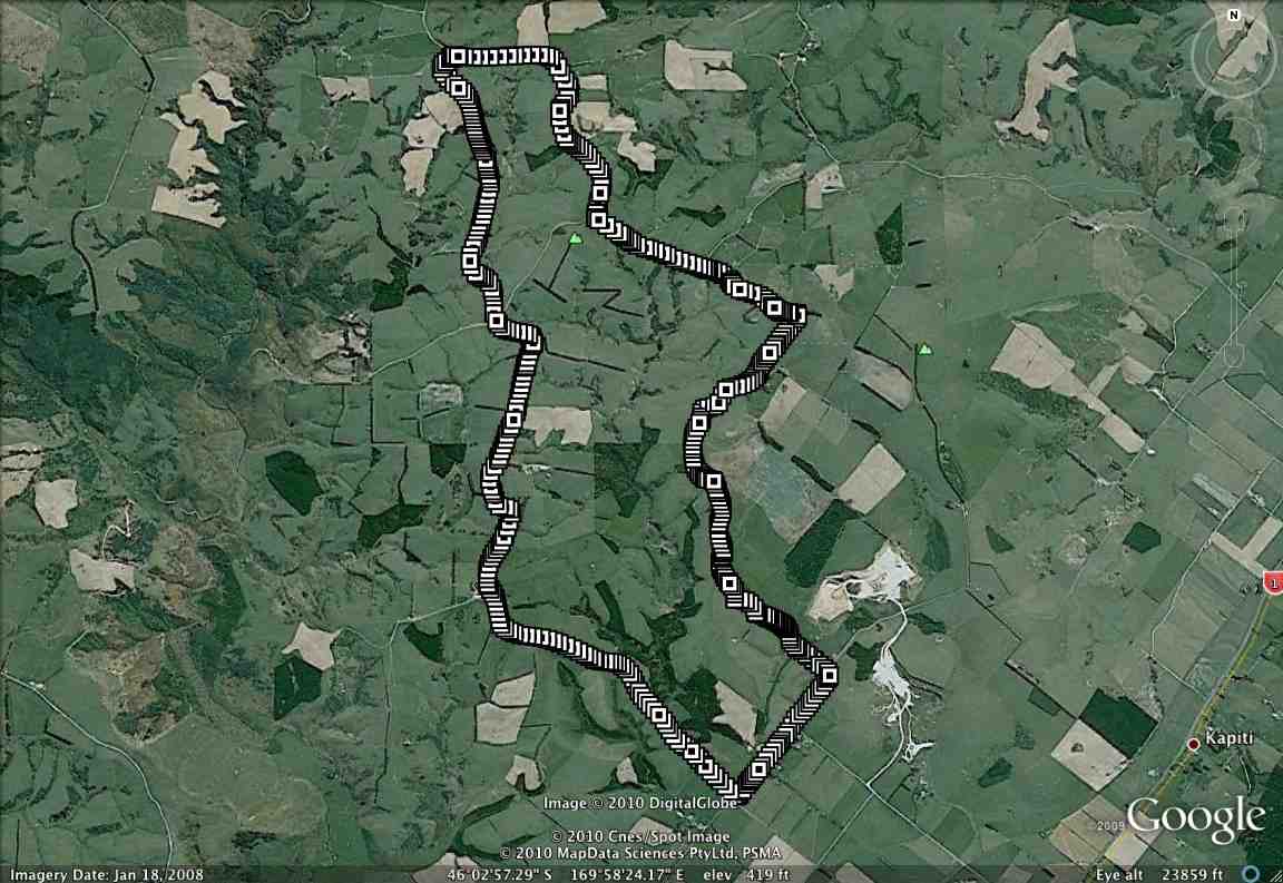
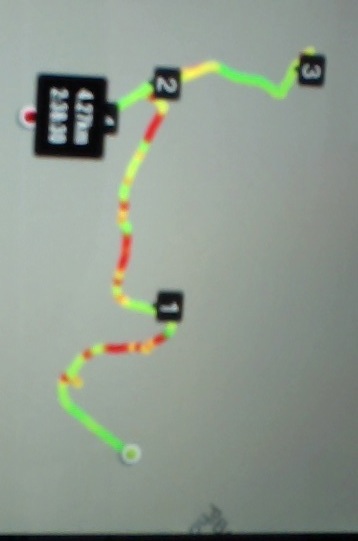
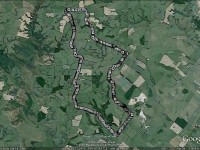
iPhone GPS of route. Shows shorter than actual because I forgot to turn it on until after the first half km! See also Ken’s GPS for his 2010 route map.
Twenty-six turned out for a sunny first tramp for the winter, on back country roads amongst lovely rolling hill farms to the west of Milburn.
Morning Tea at the Finch Road turnoff from Circle Hill Road. (Heb pic)
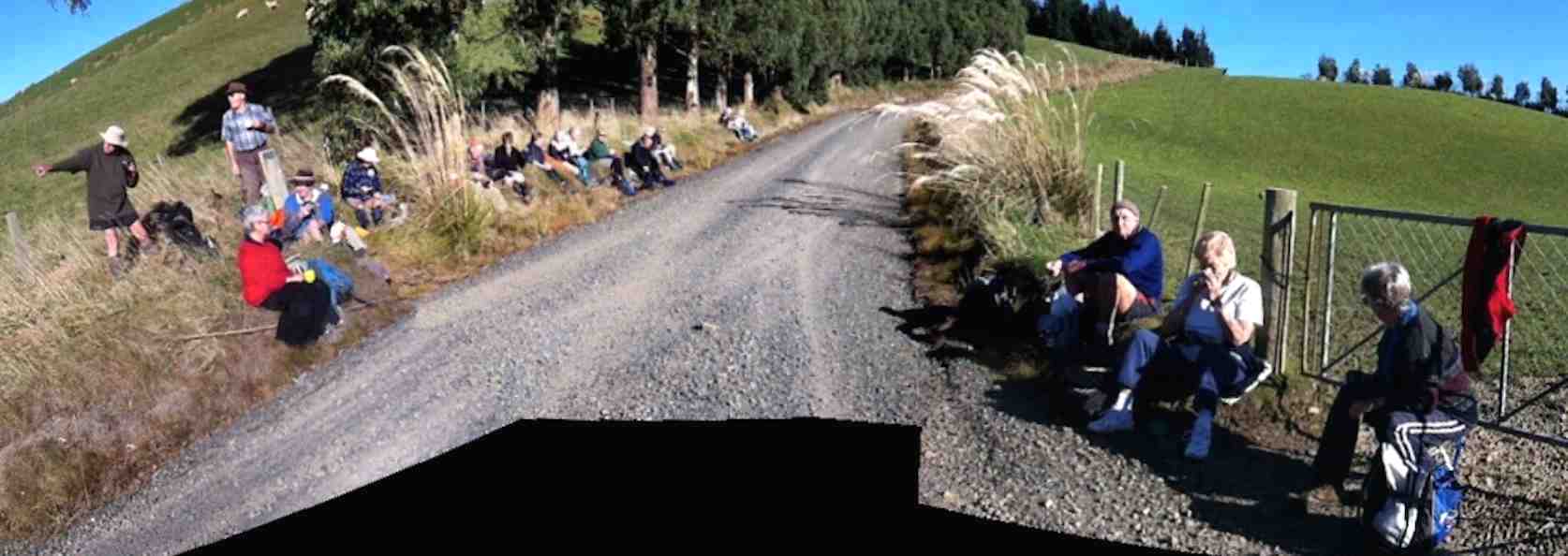
We lunched where Fort Hill Road ended at a T-junction with Barnes Road, which stretched left to meet Circle Hill Road, and right to form to form a larger route to also turn down Circle Hill Road at its end where both these roads joined to form Douglas Road.
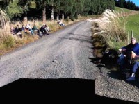
Panorama pic. (The black bit at pic bottom results from my inexpert handing of my panoramic app.) Lunch. Here, Barnes Road goes ahead (in the pic) for the shortcut route and to the right for the longer route.
Ken supplied this report regarding this spot. Thanks Ken. : “The people that did the longer walk, covered 15.2km; Moving time 3hrs 9min; We climbed 374mtrs. I guess the ones that took the shortcut walked about 11km.
I base this on the time taken for us to walk around the longer loop, & the ave speed was 4.8km/hr, & it took us nearly an hour to walk around the loop.”
As said before, the day was sunny and calm, and each ample time to make the climbing bits at bits own pace.
Just a personal thought for road walks. With the growing practice of wearing, and of availability of high-viz vests, a good idea would be for more than just the leaders to be wearing them.
And lastly. What is becoming the customary coffee stop was enjoyed this time at Waihola’s Black Swan. – Ian.
1/9/2010 Both. Fort Hill, Barnes and Circle Hill Roads, Milburn. Moderate. Leaders: Ian, Ken
GPS of route. The short-cut can be readily picked out. (Courtesy, Ken).
Continue Reading »
Mar
24
1970
South of Lake Waihola in the region known as Waihola Gorge, a road branches off the Main South Road by the brick Ewing Phosphate Company building. At the end of this, a left-hand turn marked ‘Drivers Road. No Exit’ leads to this stable where Mr P J Heffernan, owner of Horseshoe Bush Estate since 1967 keeps his racehorses.
This stable, completed in 1884 with stone from the hill behind, took two years to build and consists of 12 stalls, 2 loose boxes, living quarters for two men, harness and storage rooms. The concrete floor laid over 18 inches of blue metal hammered into the swamp ground, the joinery by Mr Littlejohn of Milton and the masonry by Mr Lothian of Burnside are still in excellent condition; and the original spouting and Scotch iron roofing are still there. …
… It was built for Henry Driver who, born in the U.S.A. came to Otago as a youth from the Australian gold diggings. A merchant in Dunedin, he served on the first City Council and the Provincial Council and for a number of years was the member for Roslyn in the House of Representatives. …
… in 1884 he retired from public life. With the eye of a perfectionist, he supervised the completion of the stable and the area adjacent to it was divided into eight 22-acre paddocks with hawthorn hedges, each one with a heavy oregon gate with a number. …
… W H Valpy [when he] settled on the property in 1853, calling it ‘Horseshoe Bush’. …
… Another point of interest at ‘Horseshoe Bush’ is the ‘mound’, Waihola Gorge (now Clarendon) cemetery, which is on top of the knoll reached through a gate where the road marked Circle Hill joins the Clarendon-Berwick road. There are several unmarked graves, but names of several well-known families and people in the area can be read on the remaining tombstones. These include Yorston, Young, Bell, Fryer, Sinclair, Sutherland, Craigie, Donald McMaster, Rev. John McNicol and H B Flett. – “More Taieri Buildings” by Daphne Lemon, 1972.