Apr 21 2024

Bull Ring, Ben Rudd

Published by under Hikers

Location: 15 km.
Click Ben Rudd Article for background information.
Click Pineapple Track for background information.
Click Pineapple and Flagstaff walk for background information.
See Flagstaff Name for its origin.

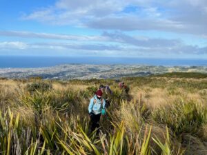
Square 100 Great View Over The City4. 17/04/2024 Bullring/ Ben Rudd/ Flagstaff Grade 2.5 Leaders: Mike and Dave

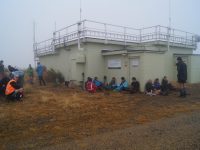
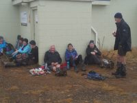
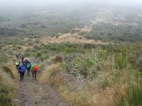
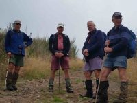
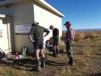
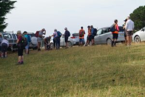
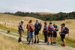
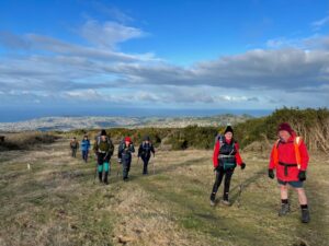
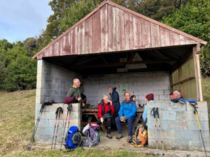
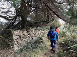
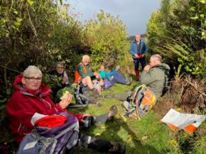
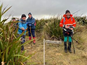
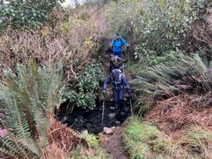
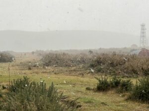
On a cloudless but slightly chilly morning 29 hikers assembled at the Bullring carpark on Flagstaff/Whare Flat Road where Sandra, a new member of the group was introduced and welcomed by Phil.


Continue Reading »

No responses yet

Jun 25 2020

Bull Ring, Swampy, Nicols, Pt Pineapple, Davies, ret

Published by under Trampers,Year round

No. 80 on old hardcopy list of 113 club tramps. “Bull Ring – Whare Flat. Swampy Year Round”
Click Dunedin’s Hills’ History for background information.
Click Swampy ridge track for background information.
Click Pineapple Track for background information.
Click Pineapple and Flagstaff walk for background information.


Nicols Creek circuit Maintained by Green Hut Track Group. DCC land.

Pineapple Track—the curious name of this track originates from a tradition involving a local grocer in the 1920’s.  He guided parties up a track in this area and would provide tinned pineapple as a refreshment at the top.  The empty cans were left as litter.

24/6/2020 FLAGSTAFF   WALKWAY   ONTO   SWAMPY   RIDGE   TRACK   and   RETURN. Leader Eleanore
After a couple of head counts our group of 24 (including 3 new faces) arrived at the Bull Ring at 10am to a very foggy morning.  As well as us,  staff were parked up waiting to spread gravel on Pineapple and Firebreak tracks, that was to be dropped by helicopter.  We commented that it would be something new to look at as we were walking.

After a short sharp climb we arrived at the Plane Table marked by a drainpipe at a height of round 660 metres for smoko, still in fog and no views we headed off again down and around to the Pineapple junction, passing by damage caused by a fire last year.

DSC04037res

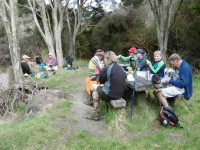
Photo and Caption John – “Morning tea – not to be MIST!”

This section of the Pineapple track was wet and slippery along with the odd patch of icy puddles, we had to make sure we kept our feet firmly on the ground!!

P1010563res

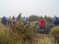
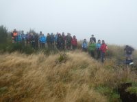
Photo and Caption Gordon – “You couln’t have MIST this group of trampers.”


P1010567res

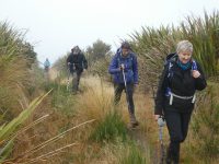
Photo and Caption Gordon – “Still slogging up hill!”

We arrived at the junction of Swampy and Firebreak tracks at 11am, then continued through more mud, noticing quite a lot of broom had been recently cut down—-thanks to those concerned.


After some climbing along the way, passing Moon, Powerline, and Telecom Microwave Station tracks, we arrived at the Aircraft Navigation Station at the Swine Spur junction at 12:15pm.  Up till now, the only sight to be seen was the person in front of you!!  Occasionally, one hoped for the fog to lift,  so the amazing views could be enjoyed—so far, not happening.

DSC04038res

Photo and Caption John – “Lunch at Swampy summit.”


DSC04040res

Photo and Caption John – “Gotcha Dave!”

At 12:40pm, after a shortened lunch it was time to head for home, negotiating the slippery, slidey slopes along the way reaching the Firebreak junction in 1 hour, we took the shortcut back onto Flagstaff track, and enjoyed the mostly downhill walk to the cars, arriving at 2:30pm.

P1010573res

Photo and Caption Gordon – “Homeward bound.”

The boots covered a good 13kms.

This was the first tramp with the Club I have  been on that the fog never lifted the entire day.   We were ready for coffee,  cake and a yarn to celebrate our achievement at Blackstone Cafe.

As always, I hope you all enjoyed the day as much as I did.
Eleanore

Continue Reading »

No responses yet

Feb 14 2018

Bull Ring, Flagstaff Walkway/ Pineapple Track

Published by under Both Hikers & Trampers

Location: 13.3 km from car-park. Click Dunedin’s Hills’ History for background information. Click Pineapple Track for background information. Click Pineapple and Flagstaff walk for background information. See Flagstaff Name for its origin.

14/2/2018 Trampers. Flagstaff.

The main tramping group was away this week in camp at Aspiring Hut, but 6 of those left at home felt the need for their usual Wednesday tramp, so decided to go and do something about it.

An early shower at 8.30 am, and low cloud in Mosgiel didn’t look very promising but as we drove up the gravel road to the Bull Ring our cars were raising dust.

The day was overcast and very pleasant, with a very slight breeeze increasing only a little in the afternoon. No cloud to bother us.

The summit of Flagstaff was our first objective and from where we viewed a helicopter operating from beside the Firebreak Track. It was transiting close to us, and spraying somewhere low down in the Nichols Creek area apparently – out of our view.

Morning tea was taken at the junction of the first cross track to the Firebreak. During our stop, 2 hidden birds, only metres away, were calling – a single “click” sound. After a time one flew a few metres and was briefly visible before going back into cover. My guess was that it was maybe a Fern Bird? Are there any ornithologists out there who can confirm if there are any Fern Birds up on Flagstaff?

We continued along the Pineapple Track to the next junction, and turning left crossed to the Swamp Ridge Track, to follow it to Swampy Summit.

We travelled at an easy pace, stopping for a rest at times at the top of the steeper bits. Eventually we came to the top of the Swine Spur Track, and followed it down about 50 metres to admire the recently erected track sign – well done Ian H.

It was 12 noon now and it was decided democratically by one person (not me) that we would stop here and have our lunch in the shelter of the Airways building.

Afterwards we retraced our steps back along Swampy Ridge and then the Firebreak Track …

Margreet pic.

… to finish at the Bull Ring. Again our pace was easy and pleasurable allowing plenty of time for taking (by some anyway).

On returning to Mosgiel we all adjourned to the Blackstone Cafe for after tramp relaxation.

In summary it had been a very enjoyable day out for the six of us, and we had some good exercise in travelling the 13.5 km. – Art.


29/4/2013. Trampers. Bullring, Skyline, Swampy.
As it was such a nice looking day after all the wet weather we have had, it was decided to stay in the sun for the day. So we went to the bull ring with the intention of going to Hightop. We took the long way around by going up the Skyline track, & along the tops to the junction with the track up to Swampy summit, & down to Booth Rd. The track up to Swampy summit was in quite good condition, but it doesn’t get any less steep as time goes on !!! On the way up the Skyline track we stopped at the NEW seat overlooking the city [which was covered in fog on this occasion] for morning tea. Lunch was held at the last Airways building …
Lunch time. (Heb pic, Ken caption)

Lunch time. (Heb pic, Ken caption)

… just at the start of the Swampy Ridge track leading over to the Green Hut track. A few of us walked down to the University research building during our lunch break, just to be able to say “I’ve been there”. After lunch it was decided that we would return to the cars by the same route, so we set off to the accompanying display from a helicopter …
Chopper topping up with spray for gorse. (Heb pic, Ken caption)

Chopper topping up with spray for gorse. (Heb pic, Ken caption)

… that was spraying gorse & broom at quite low levels. it was a brilliant day out, …
Great day

What a great looking day !!

… with no wind, & glorious sunshine all day, which had us discarding clothing to keep cool.
Looking forward to many more days like this.
Walked 16.6km; moving time 4hrs; ave speed 4.1km/hr; climbed 658mtrs; Max height 749mtrs. – Ken
9/4/2014. Hikers. Bullring, Flagstaff Forest, Firebreak, Flagstaff walkway. E. Leaders: Bruce and Marjorie.
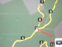
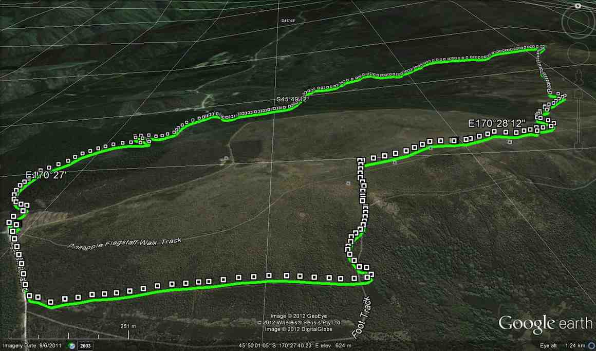
GPS of route

GPS of route. Decipherment!: ’10’ denotes start/finish. Disregard the red overlay and read ’11’ as ‘1’ Otherwise fairly readable.

Cars met at the Bullring.
Of special interest was the presence with us of Continue Reading »

2 responses so far

Nov 21 2012

Bull Ring, Spiers Rd, McQuilkan, Jim Freeman

Published by under Trampers


Bullring, Spiers Rd, Skyline, Swampy, McQuilkans, Whare Flat Rd. We travelled 10km; Moving ave. 3.5km/hr; Moving time 2h 50m; Total ascent 491mtrs.

Only 4 trampers went on this walk, which was very uneventful, until we couldn’t find the Jim Freeman track going back up to Ben Rudds shelter. We must’ve walked past it but didn’t see it. After looking around a bit we set off back up the road to return to the cars, vowing to do a recce from the top, to find where the Jim Freeman track meets up with McQuilkans track. – Ken.

No responses yet

Jun 30 2010

Bull Ring, Flagstaff Walkway, Pineapple, McGoun, Davies, return.

Published by under Trampers

Location: 15 km.
See Flagstaff Name for its origin.
30/6/2010. Bull Ring, Flagstaff Walkway, Pineapple, McGoun, Davies, return. Moderate. Leaders: Hazel, Ria.

Lunch on the lower Davies before getting up to the bush. George is proud of his new longjohns. (Ken pic)

Continue Reading »

No responses yet

Feb 21 2007

Bull Ring, Freemans, Swine Spur

Published by under Trampers

Location: 15 km.
Click Swampy ridge track for background information on the area.
21/2/2007. Trampers. Bull Ring, Freemans, Swine Spur. Medium+. Leaders: Jacqui, Judy G.

No responses yet

Aug 21 1996

Bull Ring, Pineapple, Booth Road, return

Published by under Hikers

Location: 15 km.
21/8/1996. Bullring, Pineapple, Booth Road, return. Average+. Leaders: Les W, Ted, Johanna.

No responses yet

Mar 24 2024

Harbour Cone, Broad Bay, Turnbulls Bay, Bacon Street, Peggys Hill, Broad Bay

Published by under Trampers and tagged:

No. 49 on old hardcopy list of 113 club tramps. “Harbour Cone, Peggy Hill Larnach Castle – Farm”. Location: 32 km.
Broad Bay Future Forest – background information.
Trampers park cars at Broad Bay. DCC Public Land; Hikers park at top of Bacon Street.

Start Track Square20. 20/03/2024. Hikers. Broad Bay Future Forest (New Hike), Grade 2.5.  30 km. Leaders: Jenny Flack, Vivienne Manning.

Twenty hikers gathered at the end of Bacon St for this new walk. Continue Reading »

No responses yet

Mar 23 2024

Track Clearing

Published by under Track-clearing

Track Clearing Square26. 20/03/2024. Trampers. Track Clearing. Grade 3. $5. Leader: Phil Keene.

Reporting on track clearing 20 March and 22 February 2024. Since our last report we had a working bee on the 22 February when we commenced work on trimming and machining the Porkies Track which heads uphill off the Possumbusters track. Continue Reading »

2 responses so far

Feb 03 2023

Quoin Point Bull Creek

Published by under Beach,Both Hikers & Trampers,Farm

No. 79 on old hardcopy list of 113 club tramps. “Quoin Pt – Bull Creek – Farmland (see George) Farm”

45 km from car park.
“quoin” definition: 1. An exterior angle of a wall or other piece of masonry.
2. Any of the stones used in forming such an angle, often being of large size and dressed or arranged so as to form a decorative contrast with the adjoining walls. Seek permissions. 03 –
Coast and farm walk. Bull Creek nature walk to waterfall (tiny!) recommended.

16. 1/2/2023. Quoin Point to Bull Creek. Combined. Leaders Bruce, Alex, Helen and Phil.

Thirty-one keen walkers headed south and after regrouping at the turnoff to Quoin Point road parked in a paddock opposite the wool shed at the end of the road where lambs were being drafted.
1 Feb Bulls Creek Keen to get started John

Keen to get started. Photo & caption John

We followed the farm road leading down the hill towards Quoin Point and then turning right opening closing gates where appropriate before stopping after 15 minutes near an inlet with a choice of sun or shade. Shade was more popular.
1 Feb Bulls Creek Morning tea near Quoins Point Phil

Morning tea near Quoins Point. Photo & caption Phil

We continued across the paddocks and paused for a time near a caravan and new home above it on the hillside with natives planted in two paddocks while Bruce chatted to the land owner Peter O’Connor of Riversdale. Peter said he was happy for trampers to traverse his property and did not need to ask his permission in the future. The two paddocks are linked by a pipe gate and the best exit to the beach and Bull Creek was at the far corner nearest the sea of the second paddock. The path goes down the hill over some grey rocks and then along the coast to Bull Creek. He plans to mow a track across the lower part of his property in about two years to make access easier.
1 Feb Bulls Creek Neil on gate duty again John

Neil on gate duty again. Photo & caption John

1 Feb Bulls Creek An example of the beautiful farm gullies, planted in natives John

An example of the beautiful farm gullies, planted in natives. Photo & caption John

1 Feb Bulls Creek Local's dog, keen to come with us John

Local’s dog, keen to come with us. Photo & caption John

1 Feb Bulls Creek Going to visit the house on the hill Phil

Going to visit the ‘house on the hill?’ Photo & caption Phil

1 Feb Bulls Creek Happy trampers Pam

Happy trampers. Photo & caption Pam

1 Feb Bulls Creek Around the corner to Bulls Creek Pam

Around the corner to Bulls Creek. Photo & caption Pam

1 Feb Bulls Creek Watching over Bulls Creek Pam

Watching over Bulls Creek. Photo & caption Pam

We had lunch on the North side of Bull Creek in case the rising tide cut us off. A seal was spotted in the water at Bull Creek and another mammal seen in the distance on the rocks on the way back. Clare’s family had built a dam across the creek so that the seaweed in the creek could be flushed out once the dam broke.
1 Feb Bulls Creek Time for lunch John

Time for lunch. Photo & caption John

1 Feb Bulls Creek Bus iconic tree and three T.R.T.C. icons John

Bulls Creek iconic tree and three T.R.T.C. icons. Photo & caption John

Clare kindly arranged for 3 of the party to travel back by car; a 25 minute journey going near Milton.
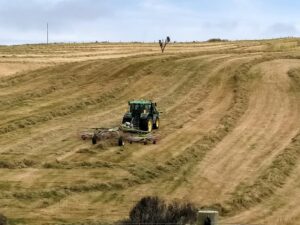
The weather remained fine. Distance 13.56 km, Climb 384 m. We started walking at about 10 am and were back to the cars at 3 pm. There were many views of the coastal rocks. Hay tedding was in progress on one paddock and for the others the hay had been cut and baled since the recce.
1 Feb Bulls Creek Very precise windrowing Phil

Very precise windrowing. Photo & caption Phil

Future walks on the property might be considered for mid-February or after when the sheep are likely to have been shorn, the lambs drafted and the hay cut which makes walking easier. Thanks to the co-leaders Alex Griffin, Helen Morris and Phil Morris for their valuable leadership. Also to Neil for his opening the gates, waiting for the last person to go through and then, remarkably, being in position to open the next gate. He was also better at spotting where the next gate in paddock was, possibly due to his eyes operating at a higher elevation. Thank you again Neil. Our thanks are also due the land owners Alan Shaw, Gwen Lane and Peter O’Connor for their kind permission to be on their properties and to Clare for her local knowledge of the area and assistance with offering transport back to the cars for three persons.
Because the Brighton Café closes at 4 pm the group was given the opportunity to make their own choice for coffee, such as at Waihola or Mosgiel, or an ice cream at Brighton.
Bruce Spittle

Continue Reading »

No responses yet

Oct 05 2016

John Bull Gully Track and Millennium

No. 38 on old hardcopy list of 113 club tramps. “John Bull Track to River. J Shaw. Year Round”

Location: 31.8 km.

Click Taieri River Geology for background information.


17. 5/10/2016. Hikers. Millennium-John Bull; Taieri Ferry to Taieri Mouth. Bus at both ends. M. Leaders: Bob and Doug.
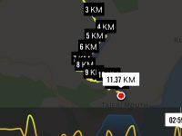
Map of route Taieri Ferry to Taieri Mouth. 3.3km Ferry Bridge to Wardells Cottage; about 5km to seat; about 3km to track end; about half km to bus at T.M. Bridge.

Map of route. 3.3km ferry bridge to Wardell cottage; about 5km to seat; about 3km to track end; about half km to bus at T.M. bridge.

Millennium Track – combined trip Wednesday 5th October 2016-10-05

A dampish morning did not deter 40 intrepid club members who boarded the bus at the Bush Rd car park promptly at 9am.  Packs were stowed in the luggage compartment and our driver Richard transported the happy crew out to Highway 1 and along to Henley and the start of the track – well, almost the start.  24 hikers disembarked in persistent light rain and trudged along the road for 45 minutes to a morning tea stop on the veranda of the white house just over the style, at the true beginning of the track.

The remaining 16 bods (and  the bus) departed for Taieri Mouth.
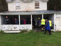
 

Sheltering from the rain for morning tea in the old Wardell's crib verandah.

Sheltering from the rain for morning tea in the old Wardell’s crib verandah.

The upward plod soon began and we were glad it wasn’t too hot.  The light rain continued but there was no wind and it was pleasant for tramping.  It was lovely in the bush with plenty of bird song and glimpses of the river below as we climbed.

A couple of solid hours saw us at the junction down to John Bull Creek, where it was unanimously decided not to descend, but to press on to the top for lunch.  Which we did, collapsing gratefully for welcome food and drink.  The rain had stopped and a pleasant break was had, with chocs to celebrate Alec’s recent birthday.
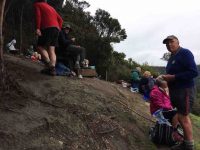
Lunch at the seat. Rain stopped at last.
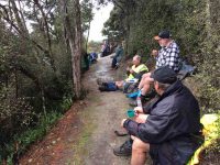
Lunch at the seat. Rain stopped at last.

Lunch stop viewed from another angle.

Lunch stop viewed from another angle.

Then down, and down, with a few inadvertent sit-downs, and the loss of a couple of impatient members who tried to take the direct route….it was quite slippery.  No harm done, and we were soon back by the river for the last plod out to the road.  The bus parked by the bridge was a welcome sight.

Nine cheerful souls on the bus had had a pleasant few hours meandering round Taieri Mouth and catching up on gossip, and there was no sign of the hardy seven trampers.

Thanks to hiking leaders Bob and Doug and tramping leader Arthur.  It was a great day out, well-supported and enjoyed by all, and rounded off with a riotous session for coffee for 23 at Topiary.  – Judy.
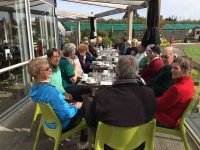
Coffee at Topiary. 22 in the sun.

Coffee at Topiary. 23 in the sun.


16. 13/7/2016. Trampers. Millennium and John Bull from Henley. M. Leader:  Arthur.
Two cars transported 9 trampers to begin the day’s adventure. The mild temperature was welcome, the sky overcast with northerly breezes.
We left the car-park at 10.00 a.m. and waked for about 10 minutes, to have morning tea at the picnic spot on the riverbank.

Continuing on it was up and down, as the track flows, and then up to the high up seat where we stopped for a little while. This spot overlooks the river to advantage
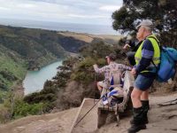
Another river view. (Margreet pic and caption.)

Another river view. (Margreet pic and caption.)

and also views away to the north too.
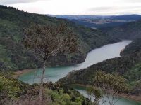
View from the top. (Margreet pic and caption.)

View from the top. (Margreet pic and caption.)

For example, Mount Cargill stood out in all its glory, with its mast on top.

The track was now downhill, the trampers intelligently noting that it would be the opposite on the returning journey. We came to a small wind-blown tree across the track, but Neil M. wrestled mightily with it and it was a problem no more.

An hour after leaving the high up seat we reached the track’s end. We were invited to have our lunch outside at Jay’s nearby house (she didn’t have the key with her), which we found a most pleasant and suitable place. – Thanks, Jay.
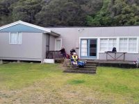
Lunch on the verandah of Jay's Bach at Taieri Mouth. (Margreet pic and caption.)

Lunch on the verandah of Jay’s Bach at Taieri Mouth. (Margreet pic and caption.)

A half-hour’s lunch and rest stop, and the party was on the track again. Grim determination was noted now, and with little talking, a fast pace was set, and we were back at the high up seat in an hour uphill – the same time as it had taken going down.
It had just come on to rain, so a brief regroup was taken under the trees, coats on, etc. The view being ignored now, downhill, and we were back at John Bull gully – just as the rain stopped and the sun came out.
Up the zigzag, and along, and down, etc., saw us back a the car park at 3.35 p.m.
The DoC sign at the car park stated that it was 9.3 km to Taieri Mouth but Margreet’s electronic gizmo said that we had done 16.2 kms.
Whatever distance we walked, we can say very definitely that “we went there and back”. A satisfying day’s tramp.
Blustery wind and rain welcomed us back to Mosgiel. No time for coffee today! – Arthur (substitute leader for Helen – off sick.)

15. 9/9/2015. Trampers.  John Bull and Millennium from Taieri Mouth.
This tramp was done in place of the one scheduled, as I could not get permission from the farmer to do the tramp that was on the program.
Ten of us arrived at the Taieri Mouth car park, & set off along the riverside track. We had quite a late morning tea stop at the wooden seat at the top,…
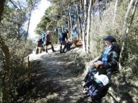
Cuppa

Cuppa (Ken pic)

…before going down to John Bull Gully, where we had a short break. Then it was on along the Millennium track towards the Henley end. We arrived at the picnic spot down by the river, & had lunch there…
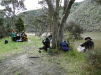
Lunch1

Lunch1 (Ken pic)

Lunch2

Lunch2 (Ken pic)

…before setting off to do the remainder of the track, though to Wardells Cottage, & the car park beyond. [just to do the full track distance]
After a short break here, it was back the way we had come. We stopped at the seat at the highest point again for a rest & refreshments, after climbing the quite steep track up from John Bull Gully. We then made our way back to the cars at Taieri Mouth.
The weather was fine all day, but the track was quite muddy in places, & care is needed on the downhill muddy slopes.
It was good to hear the comments from some, that they had enjoyed the walk.
Although many in the group had walked both tracks in the past, it was the first time that quite a few of us had walked the full distance, there & back.

Walked 16.4km; ave 3.8km/h; moving time 4h 15mins; climbed 760m. – Ken.

14. 21/12/2011. Trampers. John Bull and Millennium from Taieri Mouth.
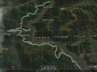
GPS. Taieri Mouth John Bull Gully Millennium Track. Courtesy Ken.
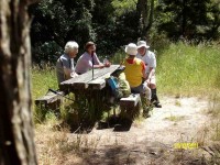
Lunch. (Ken pic and caption)
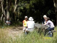
Lunch2. (Ken pic and caption)

13. 8/12/2010. Trampers. Taieri Mouth to Wardells’ Cottage, return. H.
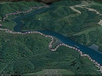
GPS of route, courtesy Ken.

The day was a bit cold and windy with some promised rain. A vote taken at the Taieri River mouth bridge was two to one (the writer was the ‘one’) with two abstentions to do the more sheltered John Bull Gully track instead of the scheduled Akatore beach walk. Aerobically it was certainly more beneficial with its plentiful provision of ups and downs. Continuing on to the Millennium Track to Wardells Cottage as well provided us with an all-up 18 km work-out which we all enjoyed. There was some spring grass overgrowth in places and the odd fallen tree. Some scrub cutting had been started There was some school group or other on inflatables out on the Taieri.
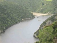
Distant shot of inflatables on river

12. 15/4/2009 Hikers. John Bull Track. Leaders: Lesley S, Bill H, Fred.

The hikers’ walk from Taieri Mouth on the John Bull track took a turn for the worse when 2hrs into the walk Elaine had to stop because of chest pains etc.
Leaving Elaine in the professional care of Bev, Lesley G and Neil, the remaining 10 carried on to higher ground to try and get cell phone coverage. This proved more difficult than anticipated and it took Lesley S to search for higher open area off the main track before finally making contact with the emergency service.
After the helicopter landed a paramedic ran down the track to where Elaine was lying. After her condition was checked and she was stabilized, she was attached to the paramedic and winched through a small gap in the bush canopy into the helicopter. – Fred
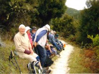
Morning Tea

Morning Tea. Neil, Evelyn, Bob, Lesley, Chris, Fred, Margaret. (Elaine pic)
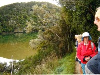
Calm Taieri

Calm Taieri. Lesley, Margaret, Evelyn, Les. (Elaine pic)
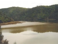
Taieri reflection (Elaine pic)

Taieri reflection (Elaine pic)

Update from Elaine.

Hello Ian

I have been overwhelmed with kindness from the tramp club since the event on the John Bull track.
Would you be able to convey my thanks to the members of the club who helped as a great team in my dramatic exit from the track  which I don’t really remember.
The quick action of Bev, Lesley and so. I have found out the support of Neil in keeping me warm. And Lesley S who found cell phone coverage.
Chris who rang  her husband in Brighton who  linked it all together and the tramper who had the white shirts on that lay in the open area for the chopper.
ED at the hospital told me later that I was very lucky that I had had such great care.
They did a battery of tests –  CT Scans  but the last test I had was the Head  Scan. (That was purely because I was a member of the TRTC –  “Just joking”  they said.)   I had previously told them about the mad wet day that we did to Dr Point in the rain.
It has turned out great in the end. They said I can carry on tramping as usual next week If you will have me back?
Kind regards to every one – Elaine.
11. 16/5/2007. Hikers. John Bull from  Taieri Mouth. Medium. Leaders: Dot B, Lesley G.
10. 15/10/2003. Medium. John Bull Gully from Taieri Mouth. Medium. Leaders: Jack and Rosemary.
9. 5/9/2001. Combined. John Bull Track. Leaders: Frank and Lesley, Pam.
8. 1/11/2000. John Bull Track. Leaders: Doug M, Hazel, Jean.
7. 16/6/1999. John Bull Track. Leaders: Lance and Lois, Judy C.
6. 18/11/1998. John Bull Track to river. Leaders: Dot B, Doug and Ngaire.
5. 8/7/1998. John Bull Gully and return. Leaders: Bev H, Bev McI.
4. 4/6/1997. John Bully Gully. Leaders: Joyce, Nancy, Eleanor.
3. 14/2/1996. John Bull Gully. Leaders: Dot and Eric.
2. 6/4/1994. John Bull Track, then over paddock to Waihola Road, back on John Bull Track. Medium. Les S, Bill H, Doug and Ngaire
1. 17/2/1993. Taieri Mouth Bridge to John Bull Flat. Average. Leaders: Eric and Dorothy, Joan H, Chris.
One response so far

Oct 02 2013

Bus Trip: Roxburgh and Bullock Track

Published by under Both Hikers & Trampers,Bus Trips

2/10/2013. Bus Trip. Roxburgh. River Walk, bridge to Pinders Pond. Leaders: Chris and Dot.

The first thing to say is Bravo to Chris and Dot for their planning a most interesting tramp; and providing Continue Reading »

No responses yet

Feb 18 2009

Sawmill Road, Gortons Farm, Finlayson Road, Kennedys, John Bull Gully Track, Taieri Mouth

Published by under Trampers,Year round

No. 77 on old hardcopy list of 113 club tramps. “Sawmill – Taieri Mouth Rd Return John Bull (fish) Year Round”
Location: 33 km
18/2/2009. Trampers. Sawmill Road, Gortons Farm, Finlayson Road, Kennedys, John Bull Track, Taieri Mouth. Medium+. Leaders: Keith, Glenice
Park at Knarston Park.

(Click to enlarge)
Sawmill Rd, Jn Bull Route Map

This time we left the cars at Knarston Park and walked around Moturata Road to turn up Sawmill Road and through Gortons Farm, in one of whose buildings, still there, Lex and Ian recalled attending their church’s Easter Weekend retreats in the 1940s!

Crayfish Pots

Crayfish Pots

Continue Reading »

No responses yet

Apr 21 2024

Upcoming Trips

Published by under Both Hikers & Trampers

Link to Trip Organisation Guidelines for leaders and trip participants.
Link to Track Grading information.
Link to Copy of Trip Programme for printing.
Gradings are provisional and may change following recce. Distances are for road travel from Mosgiel car park. Costs may change with fuel price fluctuations and distance changes. This page has all current updates.
Last updated 7/04/2024.


Wednesday 24 April.
Trampers. Frasers Road/Southern Resevoir. Grade 2.5.
$5. 16 km.  Leaders: Gwenda Farqharson/Graeme Souter.
Hikers.       Graham’s Bush. Grade 3.
$8. 27 km. Leaders: Maria MacNee/Theresa White.


Beginning of Next Programme

Wednesday 1 May.
Combined.    Pyramids/Victory Beach. Grade 2.5. $10. 38 km. Leaders: Jenny Wilton, Alison Kim, Janette Abbot, Adrienne Ensor. Alex Griffin


Wednesday 8 May.
Trampers. Goldfields, Lawrence. Grade 4. $21. 81 km (distance PJP to Lawrence). Leaders: Anne Ward, Di Bezett, Lyn Keene.
Hikers. Macandrew Bay, Greenacres. Grade 2. $7. 24 km. Leaders: Jill Dodd, Katrina McKenzie.

Continue Reading »

No responses yet

Jul 16 2021

Possum Busters and neaby tracks tramps

Published by under Trampers

No. 67 on old hardcopy list of 113 club tramps. “Swampy – Jim Freemans – (J Roy) Summer”


16. 12/07/2023. Trampers. Westside of Flagstaff. Grade 3. Leader Lynley.

10 brave souls came out to fight the elements. Thank you to John Fitzgerald helping me to do the tramp as I was unable to get recce done in time. Starting at the top of Spiers Road on to a scruffy piece of farmland we had amazing views over Dunedin.

12 July Trampers Flagstaff Dressed for the cold Pam

Dressed for the cold. Photo & caption Pam

We passed a lovely rock wall made by Ben Rudd with a steep climb through flax and scrub. We joined Flagstaff then down to Ben Rudd shelter for a well-earned morning tea.

12 July Trampers Flagstaff Among the flax on Spiers Track Pam

Among the flax on Spiers Track. Photo & caption Pam

12 July Trampers Flagstaff Morning Tea at Ben Rudd's hut Pam

Morning Tea at Ben Rudd’s hut. Photo & caption Pam

12 July Trampers Flagstaff One of many “stone walls” built by Ben Rudd (1870’s) Pam

One of many “stone walls” built by Ben Rudd (1870’s). Photo & caption Pam

We proceeded to Possum track on to McQuilkans Track where found a sunny spot for lunch.

12 July Trampers Lunch enjoyed on McQuilkans Track Pam

Lunch enjoyed on McQuilkans Track. Photo & caption Pam

12 July Trampers Flagstaff ...and up on to Swampy Ridge Track Pam

…and up on to Swampy Ridge Track. Photo & caption Pam

12 July Trampers Flagstaff This stream was crossed multiple times Pam

This stream was crossed multiple times. Photo & caption Pam

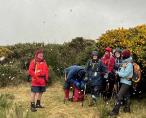
Missing out on rain, we had a few snow flurries looking like fairy land but very cold on top of Flagstaff. A good day had by all 6 hrs in total.

12 July Trampers Flagstaff And it snowed Pam

And it snowed. Photo & caption Pam

12 July Trampers Flagstaff No shelter here to regroup. Pam

No shelter here to regroup. Photo & caption Pam

Lynley. Continue Reading »

No responses yet

Next »