Jun 01 2016
Akatore Forest
8. 1/6/2016. Akatore Forest Both Groups. M. Leaders: Bruce and Marjorie.
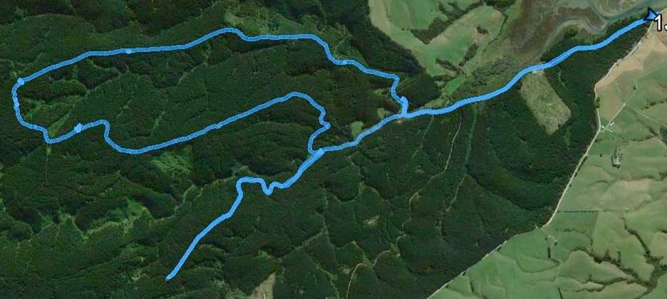
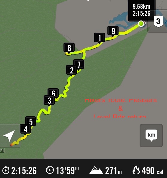
June 1 2016 Akatore. Trampers’ Route map, courtesy Bruce. [Closer detail, Ed.]
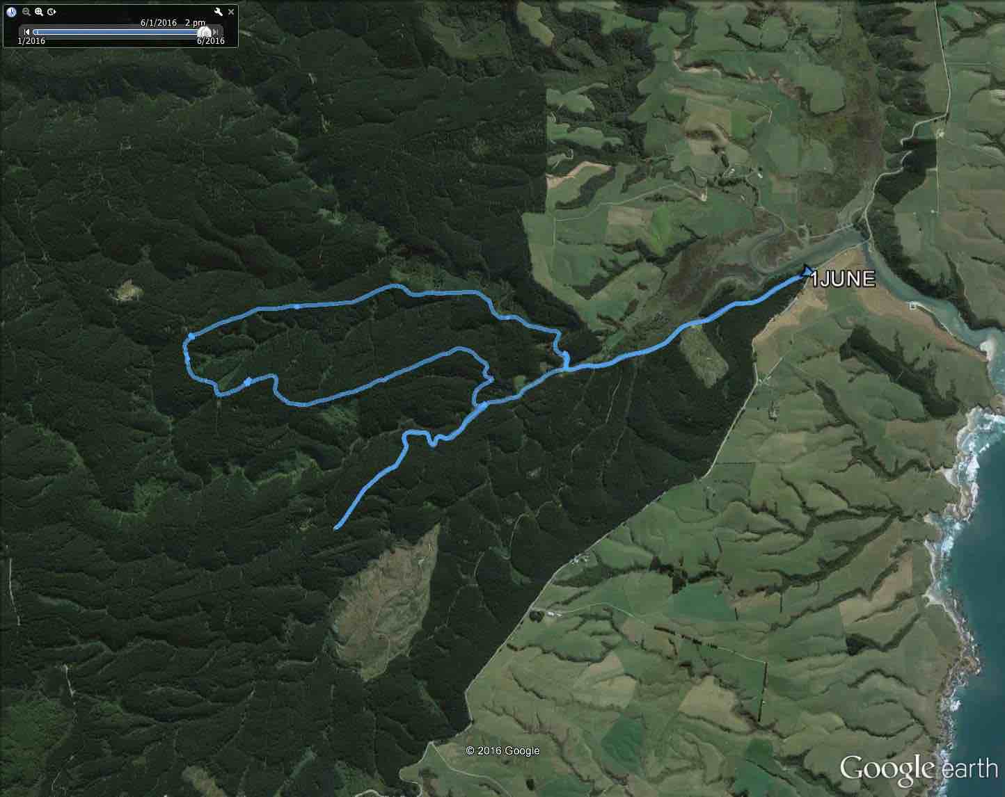
June 1 2016 Akatore. Trampers’ Route map, courtesy Bruce. [Wider context, Ed.]
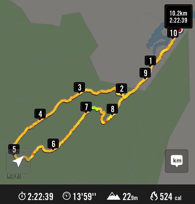
Hikers’ route map. Akatore Forest.
Akatore tramp 1 June 2016.
We obtained the access permit for the recce, on Saturday 21 May 2016, from the Wenita website at http://www.wenita.co.nz/use-the-forest/. The only limitation on numbers mentioned on the access permit was 4 hunters per permit. We obtained the permit for the tramp on Wednesday 1 June from Ian at the Wenita office, 11 Hartstonge Ave, Mosgiel, on Tuesday 31 May. Permits for entering the forests at the weekends can be obtained online. Wenita like to issue weekday entry permits at their office in the preceding week so they know what forestry operations will be taking place. No number limitations were mentioned on the tramp permit for 1 June in contrast to the limit of 15 that has been on some permits in the past.
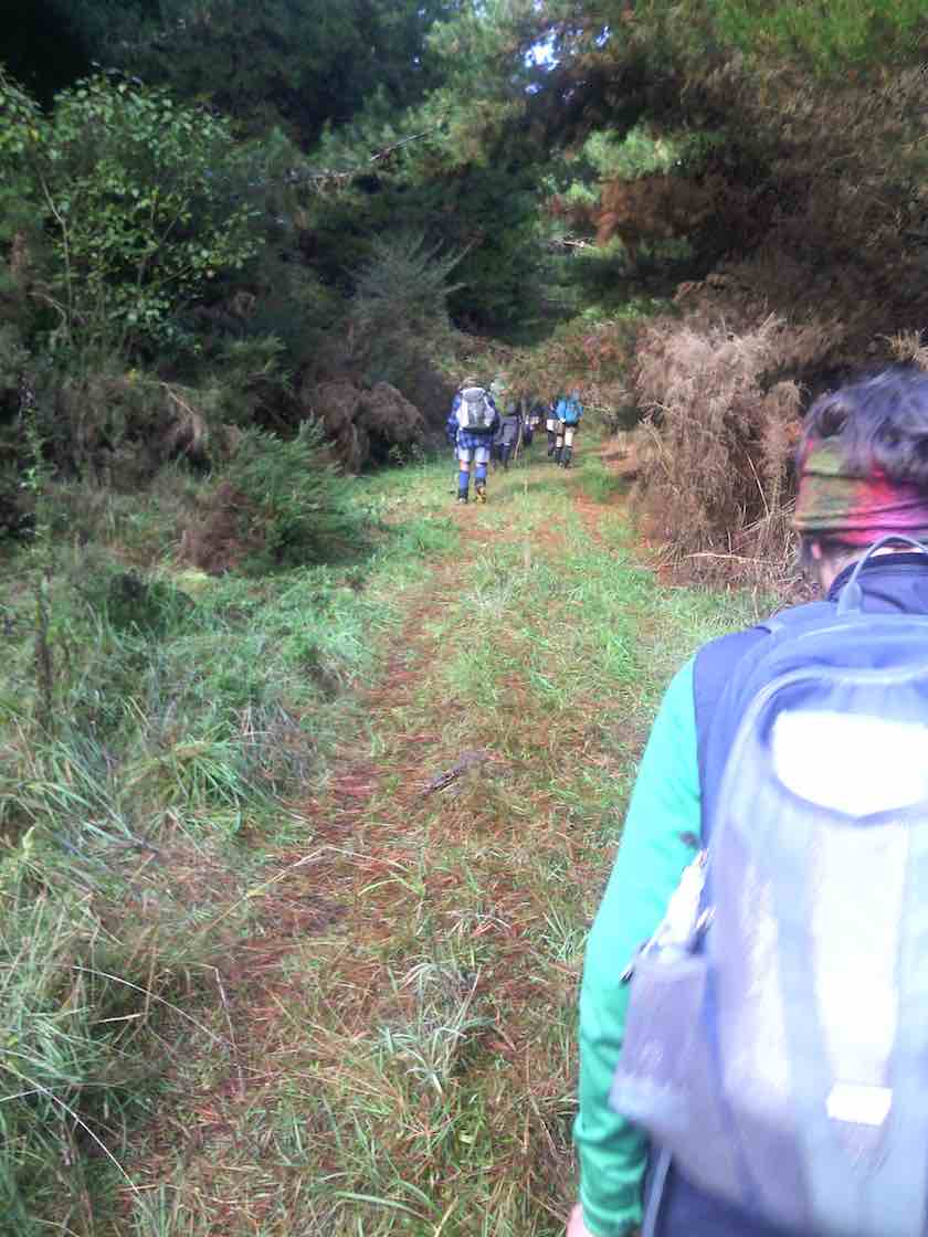
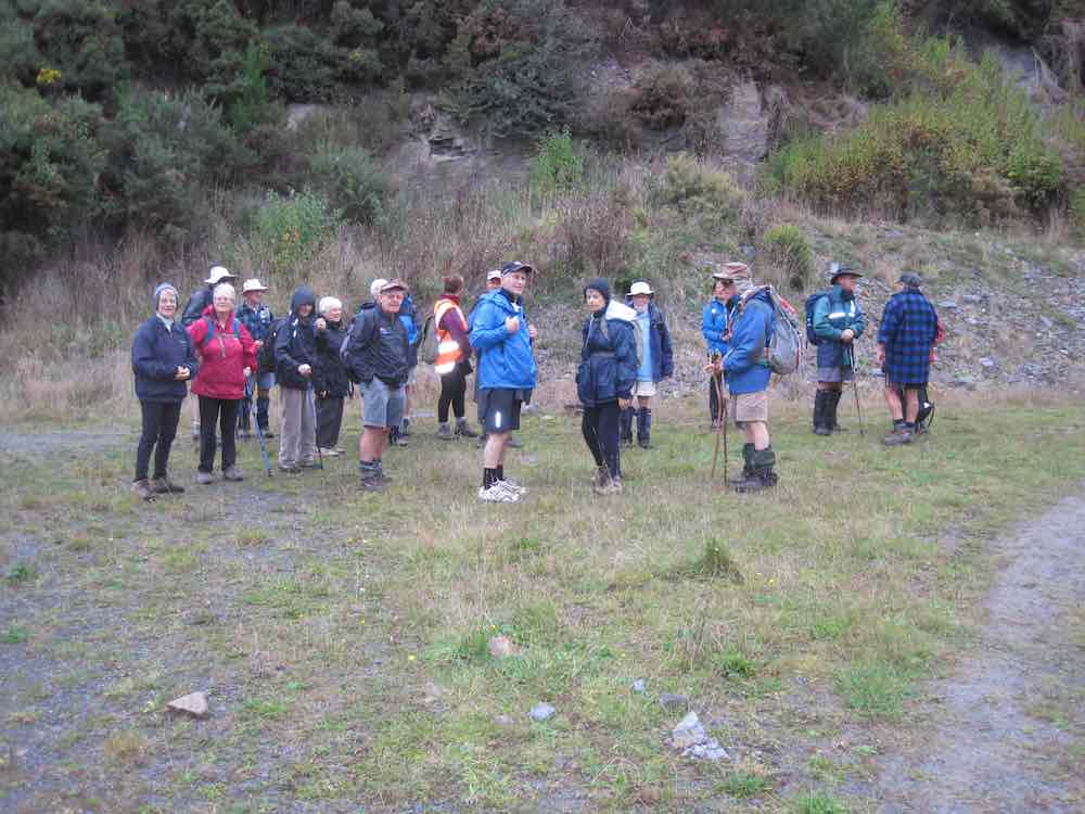
35 trampers set off along Pleasant Road from the gate approximately 400 m south of the Akatore Creek bridge, approximately 6 km south of the Taieri Mouth Bridge at Taieri Mouth. We had morning tea, after approximately 2.25 km, near the bridge at the junction of Pleasant and Boundary Roads.
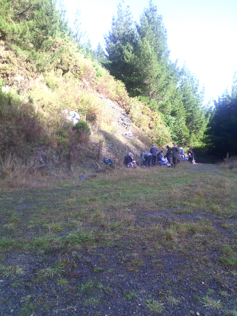
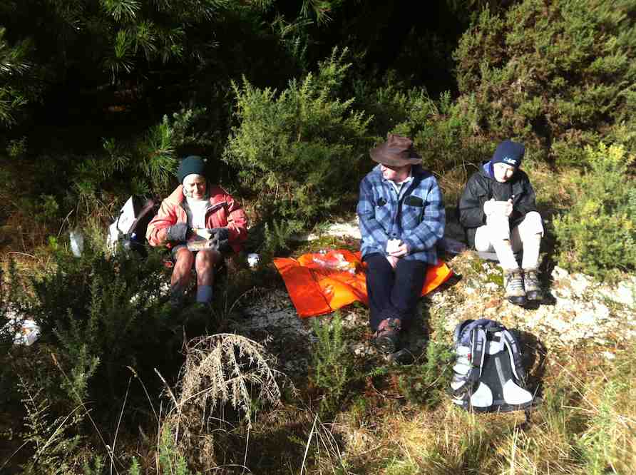
Sunny spot for some having morning tea (Helen pic and caption)
After morning tea we climbed the gradual ascent on Centre Road for approximately 3.75 km to the turnoff to the left onto Staircase Road.
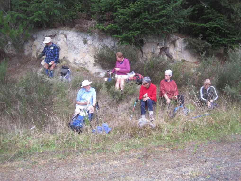
We lunched at 12.30 pm on Staircase Road in a rather chilly situation after negotiating the major obstacle of the day, a large wind-fallen tree.
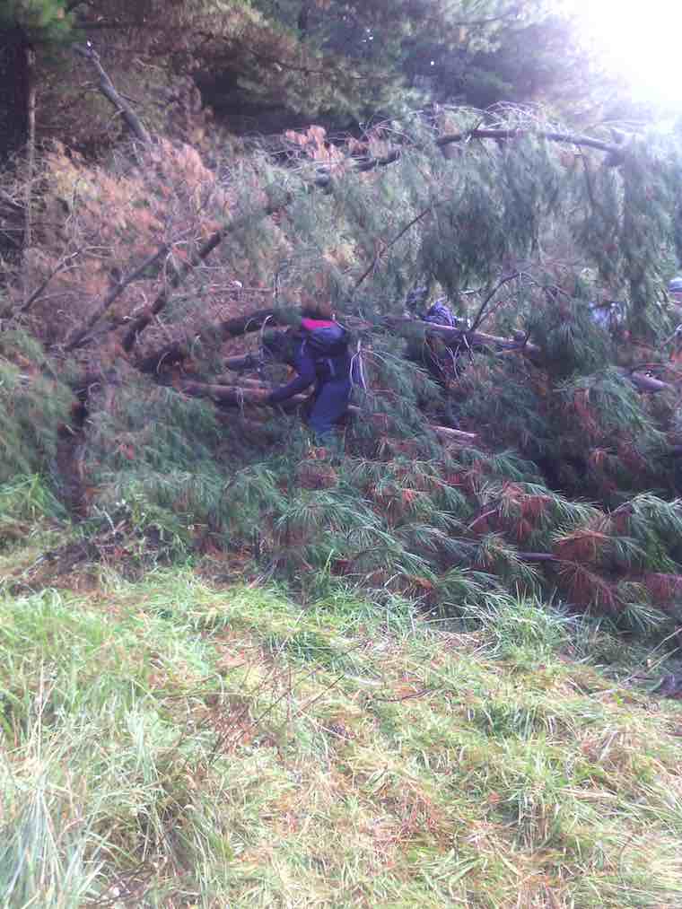
Lots of fallen trees on track. (Helen pic and caption)
After lunch we proceeded for the remainder of Staircase Road …
Muddy underfoot in parts. (Helen pic and caption)
… (total approximately 3.75 km) to the junction with Pleasant Road.
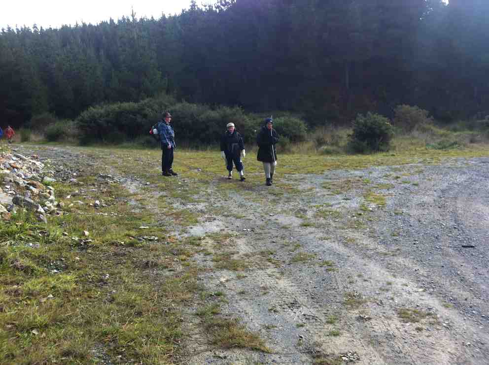
The main group proceeded with Marjorie back to the cars by the gate while a smaller group followed Bruce up Pleasant Road for approximately 1.5 km to the junction of Pleasant Road and Kamahi Road before getting back to the cars at approximately 2.45 pm.
The day was generally quite cold and keeping moving helped for staying warm. No rain fell but the tracks were mostly in the shade and there was some wind at times.
Coffee followed at Wals. Distances: approximately 12 km without the Pleasant Road dogleg; 15 km with the dogleg.
– Bruce and Marjorie.
7. 6/5/2015. Akatore Forest Both Groups. M. Leaders: Bruce and Marjorie.
The 10k Group
The 10k group’s route map
The 10k group of 10 parked on the right approximately 200 m past the Akatore Creek bridge…
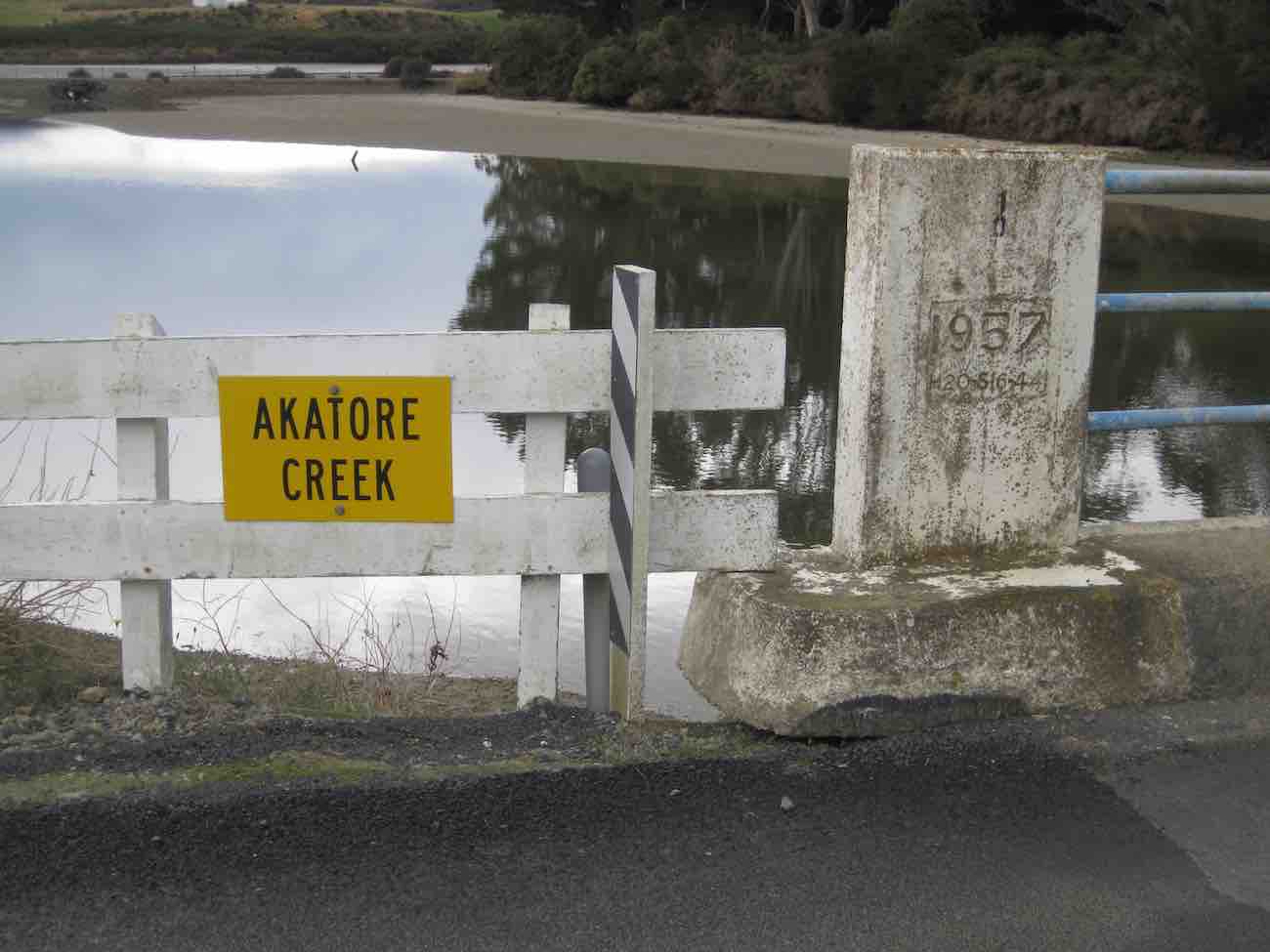
Confirmation of the calm day. Akatore Creek Bridge (John pic, taken after tramp)
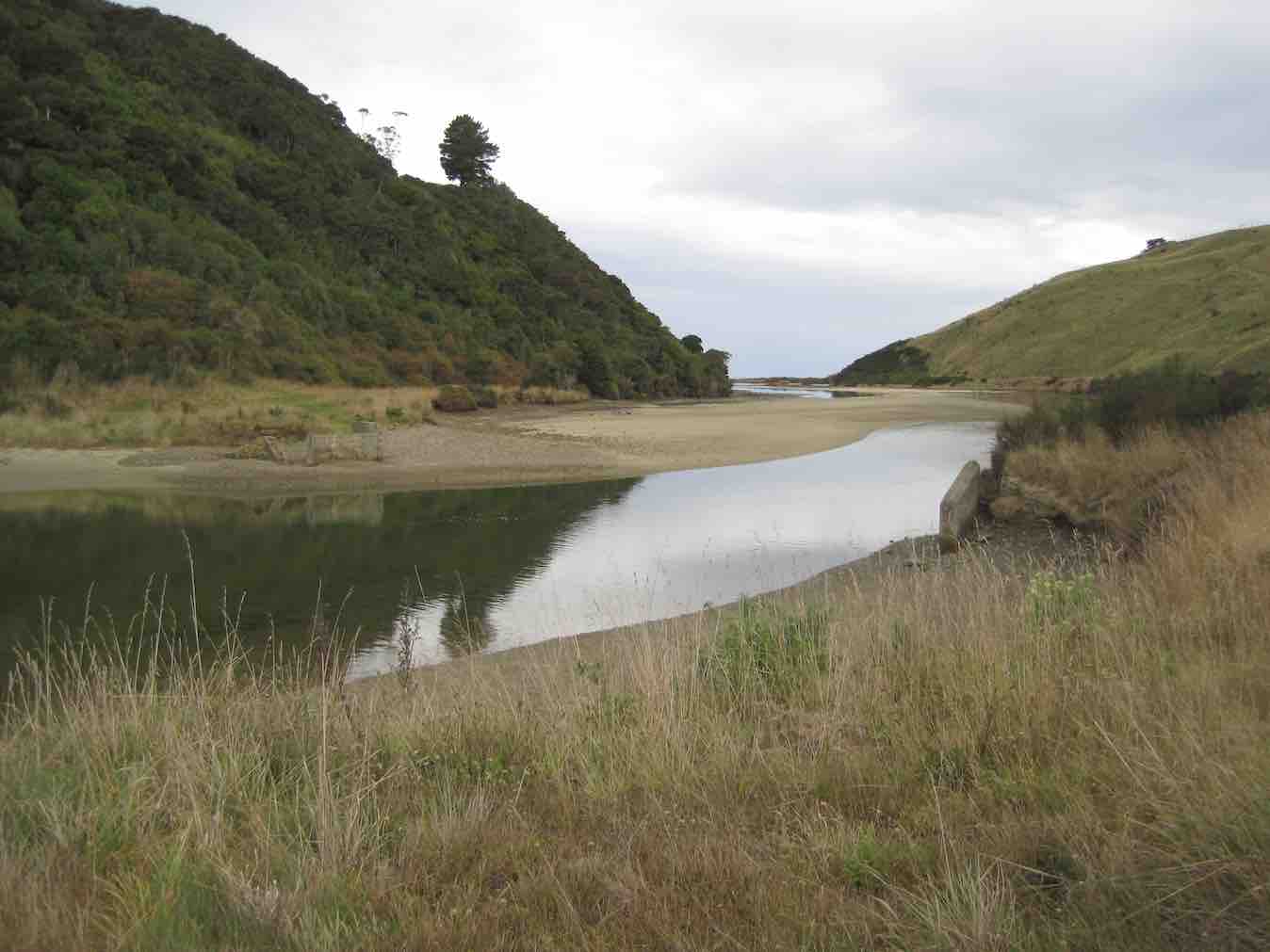
Further calm. Looking out to sea, from the Akatore Creek Bridge. (John pic, taken after tramp)
…on the Akatore road, went around the locked gate and walked 1.41 km along Pleasant road to the junction with Level road where the party stopped for morning tea.
Some of the “Ten”. (John pic)
They then turned left into Level road and proceeded 3.07 km up the road to where a road comes off on the right to a hill top (about 150 m before the junction of Level road and Mailbox road. Some went up this road to look at the view. They then returned down Level road and turned left into Pleasant road and proceeded 0.41 km along this road to the bridge area for lunch. They were surprised to meet the 10 in the 14k group standing on Pleasant road beside the turnoff on the right to the concrete bridge.
Meeting (John pic)
Both groups had lunch together 150 m up Boundary road. Some sheltered under pine trees to shelter from a few spots of rain which did not persist. After lunch the 10k group returned along Pleasant road for 1.82 km to the cars. The weather was pretty good overall with only a little very light rain and generally warm temperatures. A few fantails were seen. Total distance approximately 10 km, climb approximately 120 m.
The 14 km Group
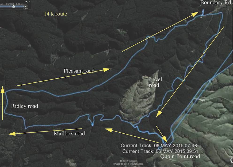
The 14k group’s route map, courtesy Bruce.
The 14k group of 10 parked on Quoin Point road, 3 km south of the Akatore Creek bridge. (It is easiest to turn at the widest part of Quoin Point Road at the junction with Akatore road and back up Quoin Point road and then parking on the left facing Akatore road. )
We walked 200 m down Akatore road, heading north towards the Akatore Creek bridge, and then turned down Mailbox road, on the left, past the locked gate for 1.07 km to the junction with Level Road. We turned left to remain on Mailbox road and, after 1.21 km, passed Serpentine Road branching off on the left. We stopped at the junction with House 21 road, 780 m past the Serpentine road junction, for morning tea. After morning tea we continued on Mailbox road for 1.48 km to the junction with Ridley road where we turned right and proceeded for 940 m before turning right into Pleasant road. We went down Pleasant road through the forest for 4.67 km arriving at the bridge area about 12.20 p.m., a minute or so before we met the group of 10k trampers. We had lunch with them. After lunch we waited for them to depart before proceeding along Pleasant road again for 410 m, turning right into Level road for 3.07 km, and then turning left into Mailbox road again and walking uphill for 1.07 km back to Akatore road, and then 250 m to the cars in Quoin Point road. We saw a tomtit and some fantails. Total distance approximately 15 km, climb approximately 400 m. – Bruce.
6. 13/3/2013. Akatore Forest Walk via Mailbox Road entrance. Leaders: Bruce and Marjorie.
On a calm mild day after crossing the Taieri River at Taieri Mouth and then Akatore Creek we proceeded south for about 3 km on Akatore Road and parked on the left hand side of the road about 70 metres past Mailbox Road on the right just before Quoin Point Road on the left.
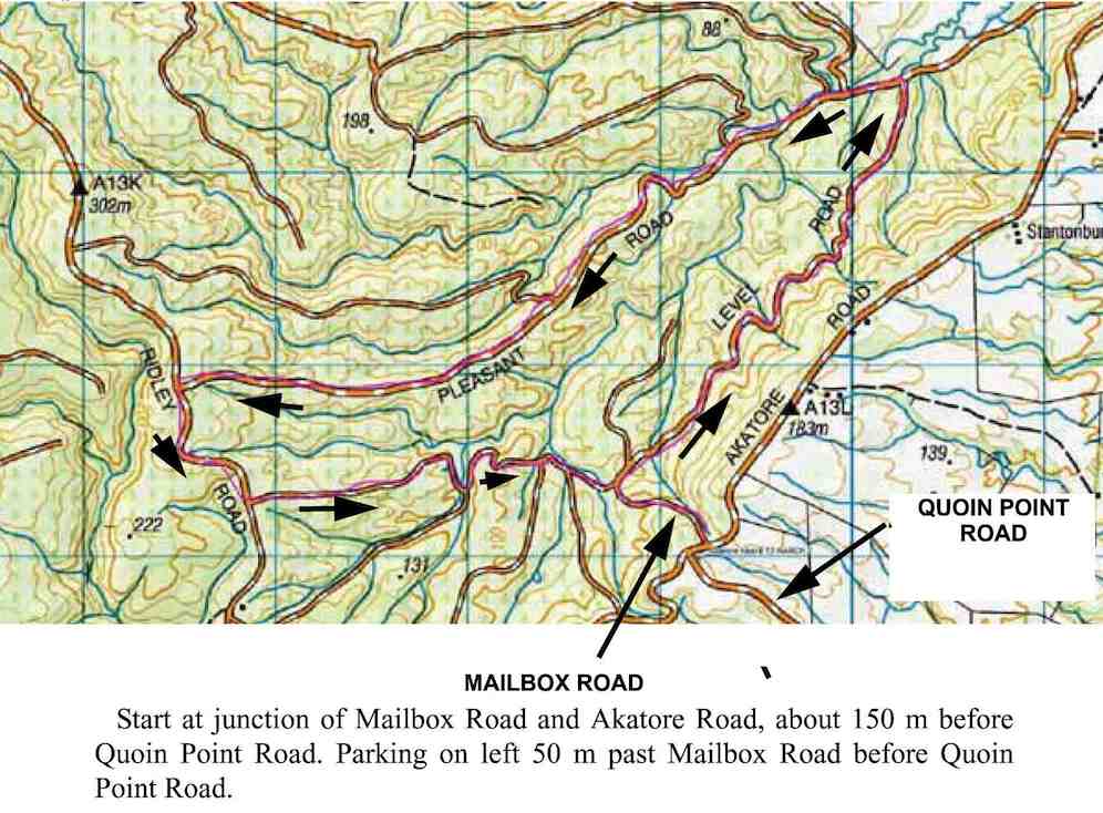
GPS of Route on Topo map courtesy Bruce
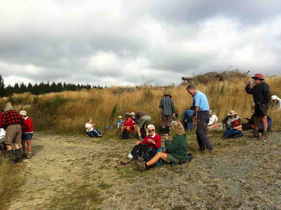
Morning Tea
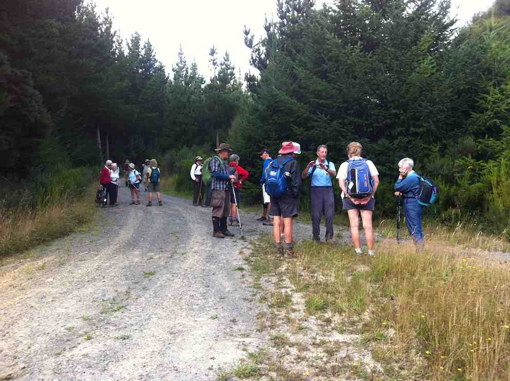
Along Pleasant Road
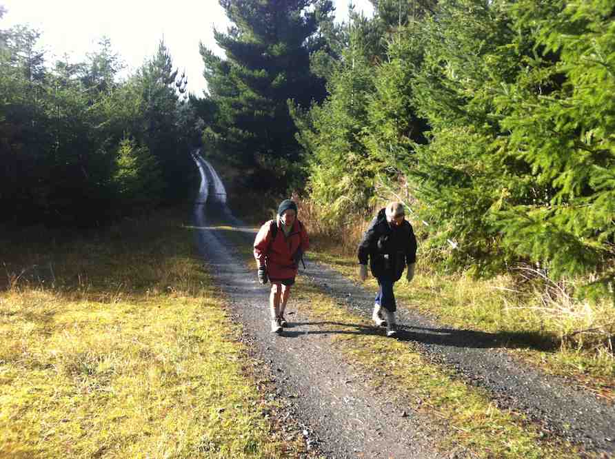
Along the road
Lunch
Where the clockwise loop ended. (One of the more clouded moments.)
4. 26/2/1997 Akatore South Side. Leaders: Jack M, Hugh, Mary L.3. 3. 7/8/1996 Akatore Farm Walk. Average. Leaders: Jack M, Jean A, Ria H