Apr 07 2023
Gabriels Gully, Lawrence. Bus Trip
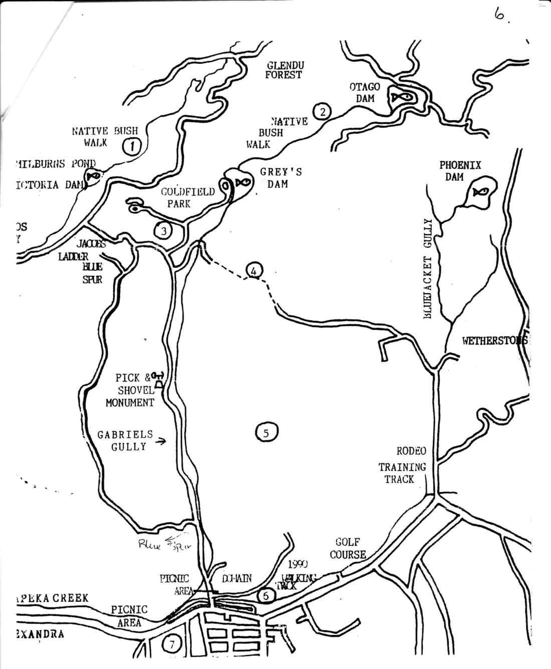
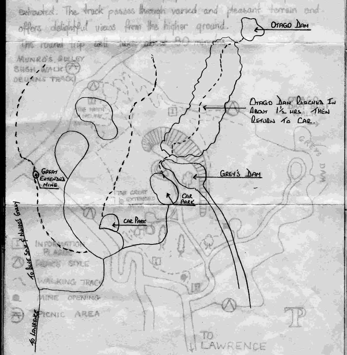
Map No. 2. Otago Dam
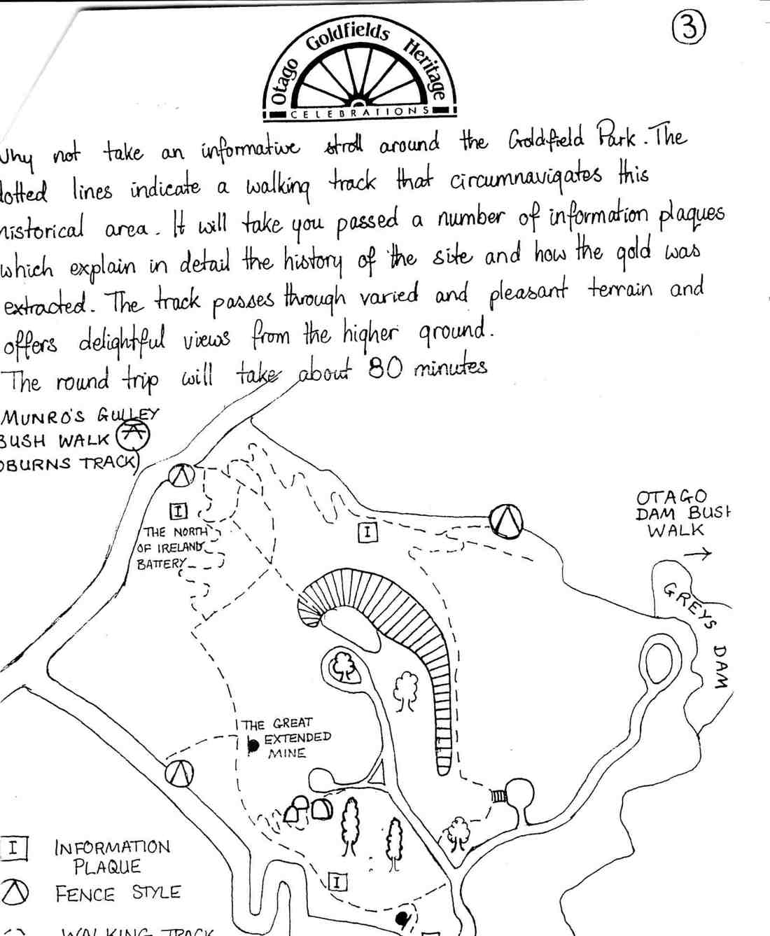
Map No. 3. Munro’s Gully Bush Walk. Oburns Track.
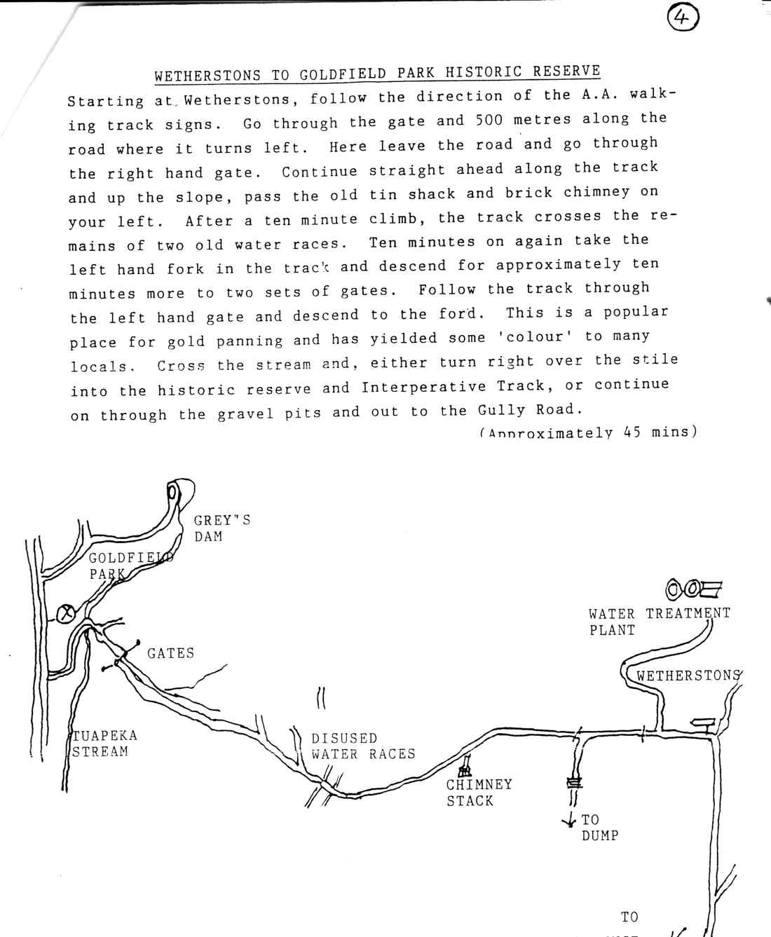
Map No. 4. Wetherstons to Goldfield Park Historic Reserve.
7. 5 April 2023. Combined. Gabriel’s Gully, Lawrence. Grade 4 (trampers) & Grade 2 (hikers). $20. Leaders: Phil Keene (Trampers), Jan Butcher (Hikers)
Hikers’ Report (scroll down for Trampers’ Report):
At 8.45am we travelled in convoy with the trampers to Lawrence, where we had a comfort stop before continuing onto Gabriel’s Gully. Halfway down the road the brakes were on as we came across a large STOP sign and barriers preventing us from going any further.
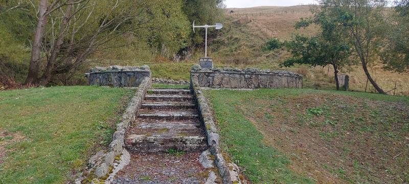
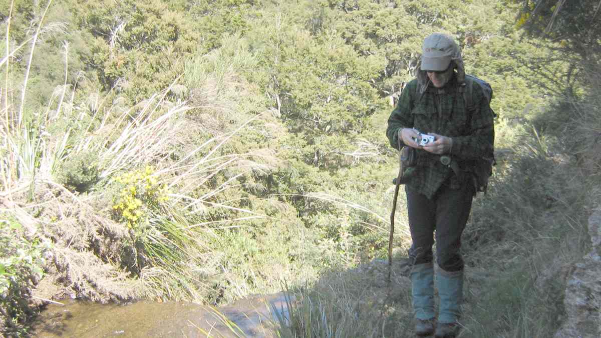
Monument to Gabriel’s Gully (Photo & Caption Helen)
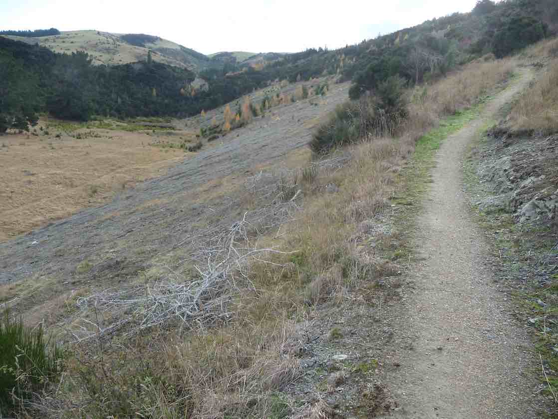
It turns out contractors were cleaning up a large tree which had fallen across the road, so we retraced our steps back to Blue Spur Road, a gravel road taking us up and up, around and down, meeting up with Munro Road and down into Gabriel’s Gully. Whew!

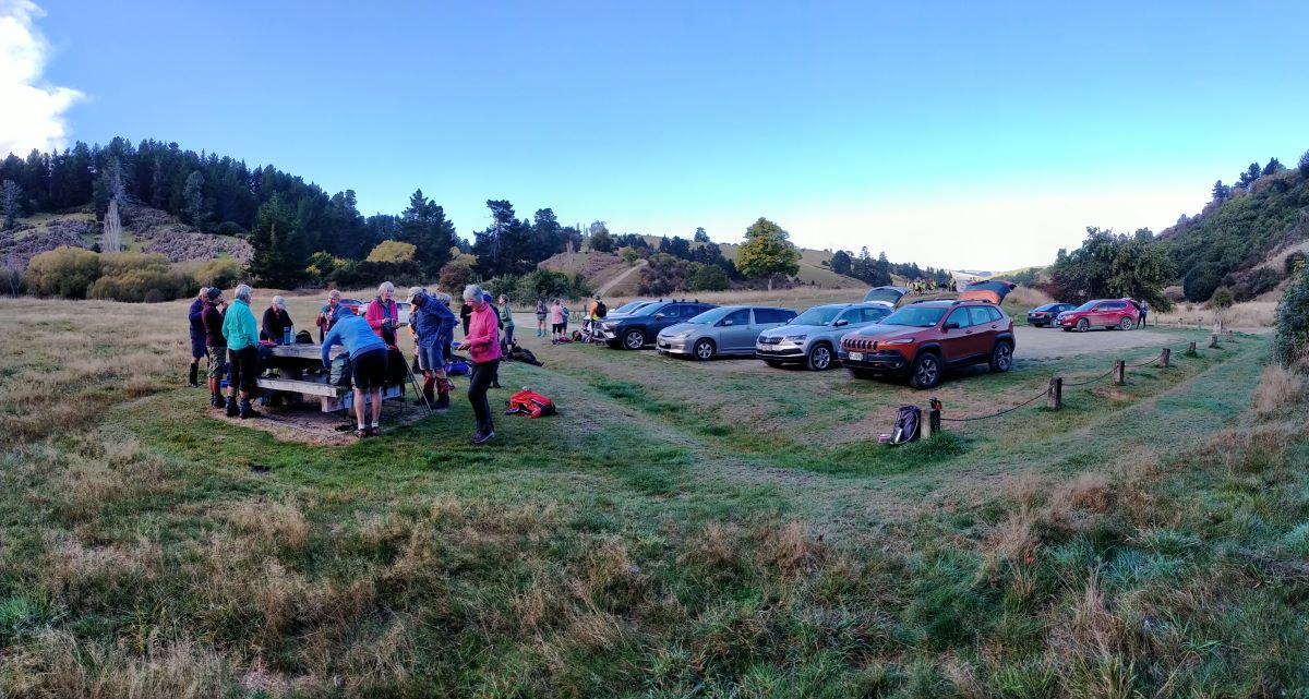
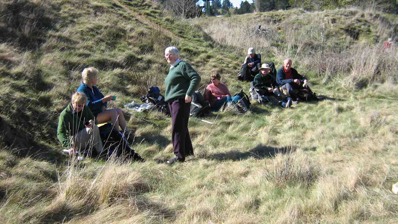
Getting ready to start our journeys (Photo & Caption John)
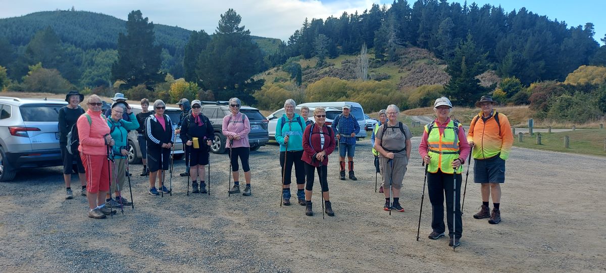
Hiking group at the start (Photo & Caption Helen)
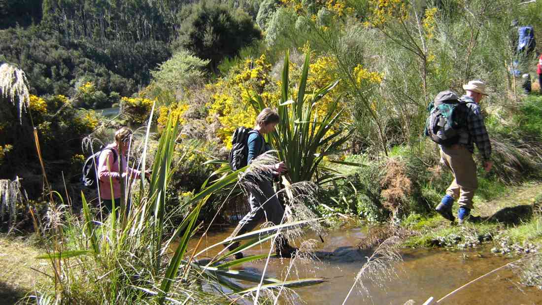
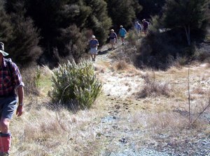
We all had morning tea on arrival and then said goodbye to the trampers as they set off in another direction and 19 hikers commenced the Interpretation Loop Track.

Pretty in pink (Photo & Caption Margreet)
The first 20 minutes was up and up and a couple of “breathers” needed but soon we reached the top with great views over the Gully floor below.
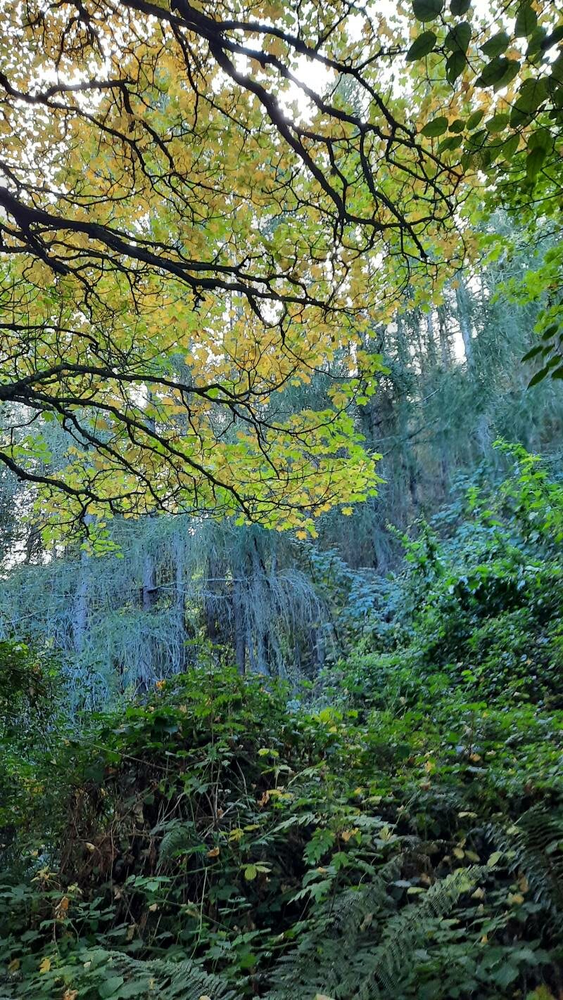
Looking up into trees at Racemans Hut (Photo & Caption Ady)
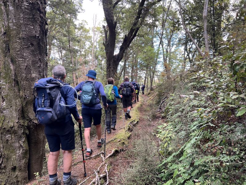
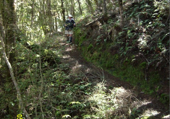
We continued around the well-groomed ridge walk and down Blue Spur/mining sites checking out the information stations along the way and stopping at points of interest.

Cave (Photo & Caption Helen
It was then back down the hill to our cars and a short walk along the road to Grey’s Dam where we sat under a large tree to enjoy our lunch break, after which we dropped our packs back at our cars and took a short walk around the gully floor.
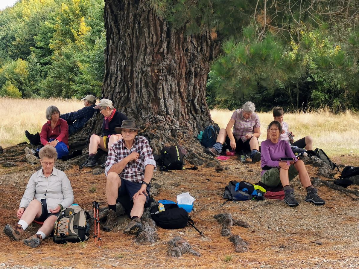
Lunch stop (Photo & Caption Margreet)
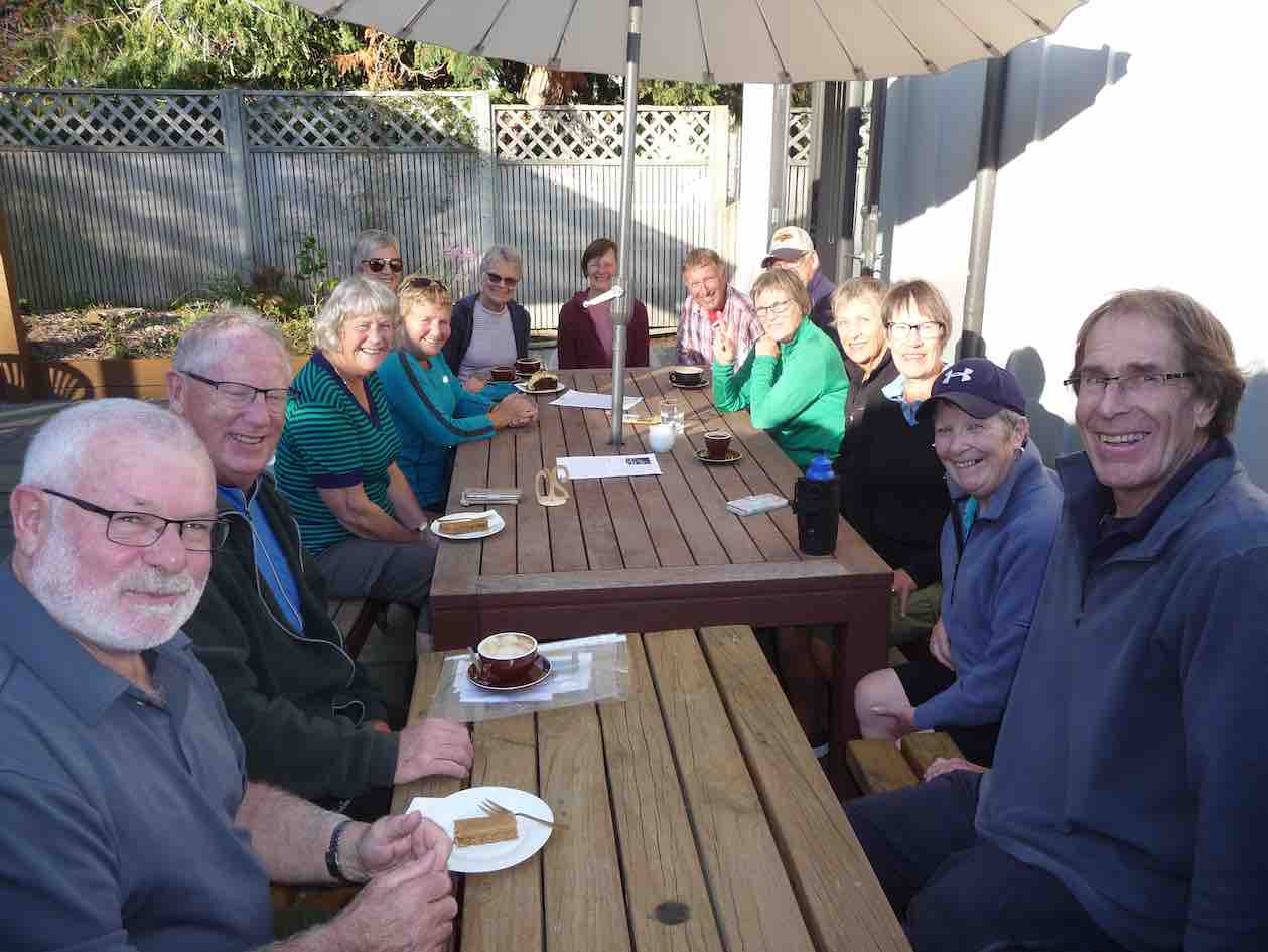
Fortunately, the return road was cleared and we stopped off at the ‘Prospector’ for refreshments before returning to Mosgiel. The weather played its part – not too hot and no wind to speak of. A very enjoyable 4ks walked on the day.
Jan and Jay
Trampers’ Report:
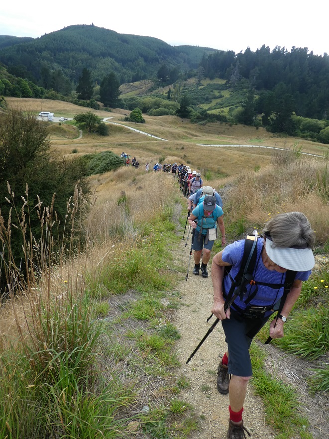
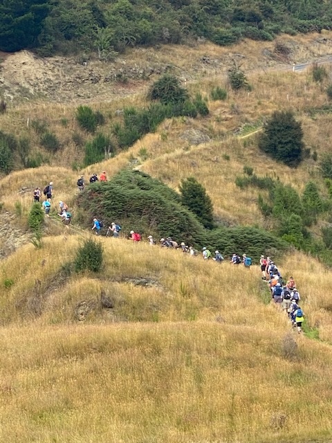
32 very keen walkers set out on time, in 8 vehicles, to make their fortune in the hills of Central Otago; we suffered all sorts of setbacks as traffic delays, or ‘hold ups’ frustrated us. Most of us felt better for the stop on the corner in Lawrence; and some just had to get that takeaway coffee…..another ‘hold up’ on the road up to GG with a sign that had multiple meanings and road block. On up around the bend Jan B walked and got the low down (tree clearance) so the cars did an about face and detoured over Blue Spur – once farmed by Chris and Ant Wither and down into GG. Chris outlined the local well known activity of sheep rustling, and apparently ‘not just back in the day’.
Once again Gabriels Gully the centre of the world (Photo & Caption Phil)
With a school group also present the GG car-park really did feel as if another gold rush was underway. The delays did not lessen the need for morning tea, as the sun was shining, but we were finally off on our way by 10.45am.
13 trampers skirted the SW ridge of GG, through the man-made landscape now dominated by Sycamore trees, feeling very much at home here as well as adding a nice splash of Autumn, passing the mine tunnels and North of Ireland battery. Some of us musing where was the South of Ireland battery?
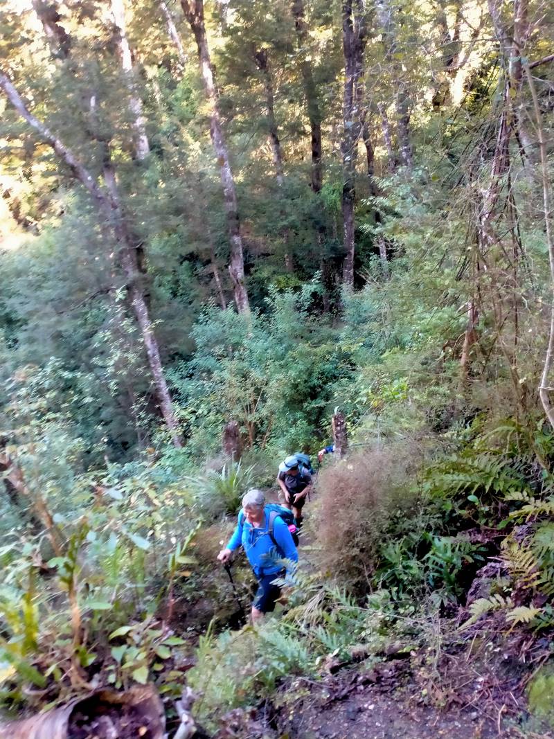
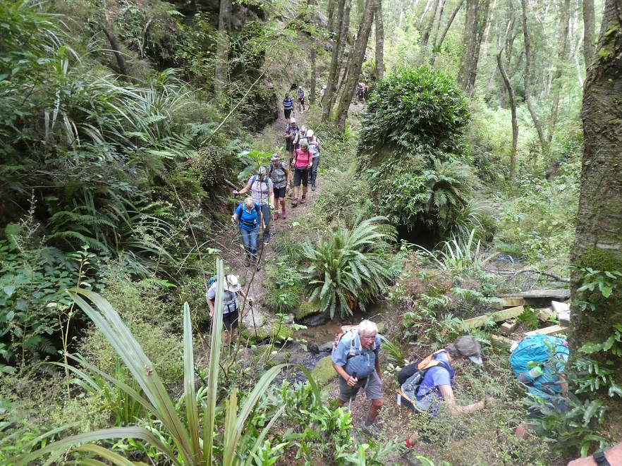
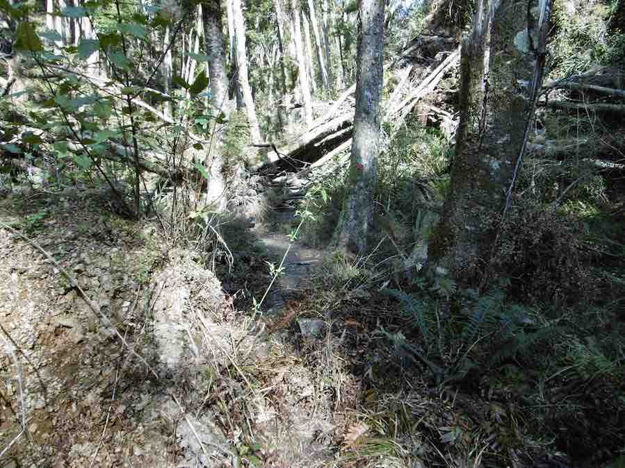
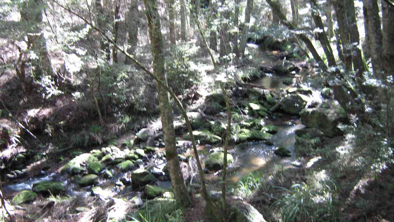
We crossed Victoria Road, the main entrance to the Glendhu Forest and on past Victoria (Milburn’s) Dam and started the steady ascent, initially through a larch forest, then up through the remnant beech forest and gorge/ ravine/gully of the Munro track.
Munro Gully jungle (Photo & Caption Phil)

What’s so interesting up there in the jungle? (Photo & Caption Marijke)
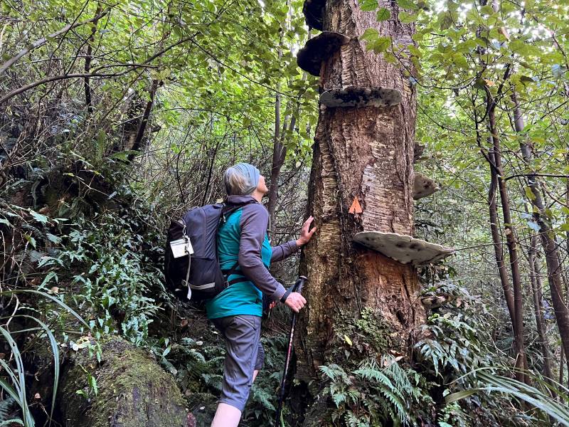
Admiring the “Shelf Fungi” growing on this dead tree (Photo & Caption Pam)
Trampers walking beside the “Water Race” (Photo & Caption Pam)
Progress was tempered by the intimate feel of the walk, as well as the little dips into streams (they looked gold bearing to me) then the challenge of all those man made steps.
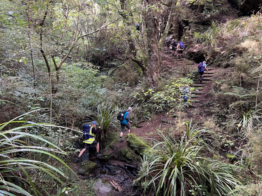
Trampers on Munro’s Track (Photo & Caption Pam)
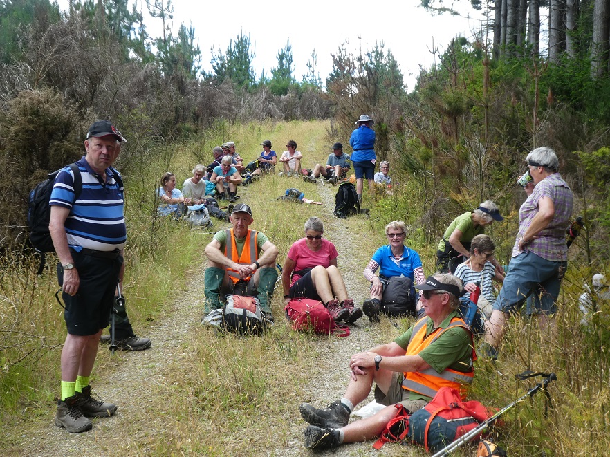
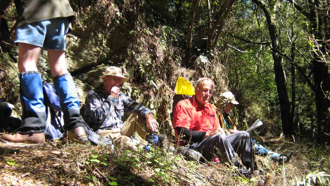
Finally, we emerged into the Glendhu pine forest and onto road 21, are we at the top yet? being a common question. The answer being ‘no not yet, we’ll just go up and around the bend a little way for lunch, which will give a lovely view into the West, Blue Mountains and all’. And of course, this happened as planned.
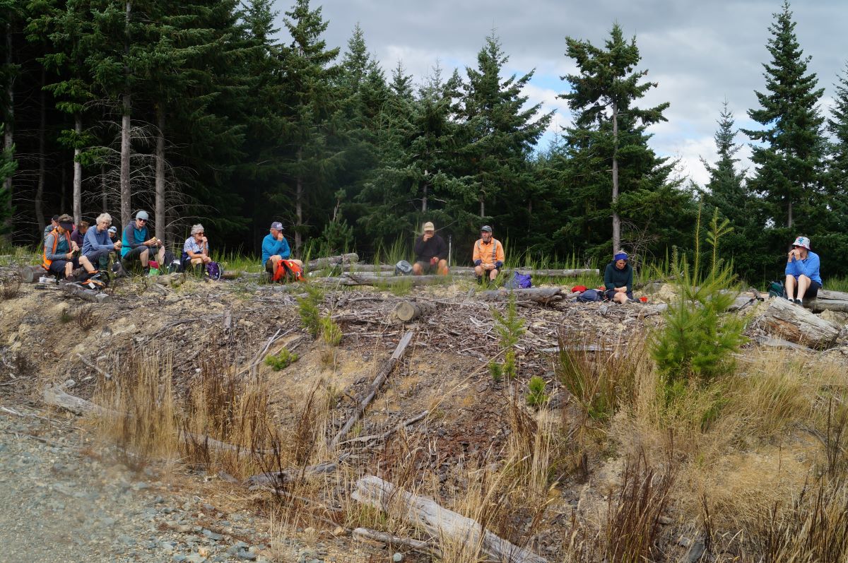
Lunch stop in a forestry clearing (Photo & Caption John)
After lunch we continued the steady ascent, mostly now on Victoria Road; no trucks came past to enjoy our bright coloured tops…..We took the first turn on the right into Road 22 and continued down, shambling through fir and gum forest and along the very well maintained forestry roads and drainage systems.
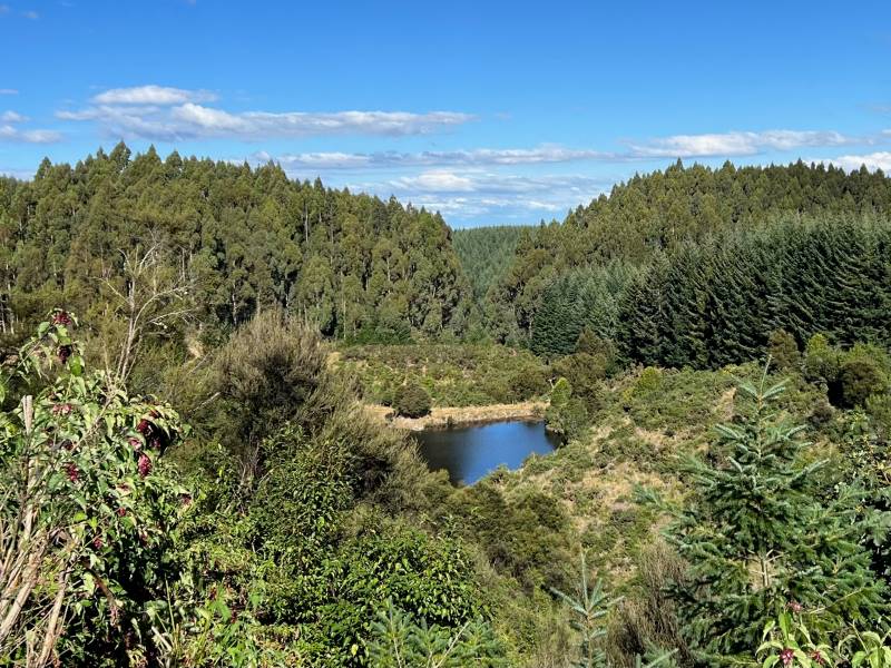
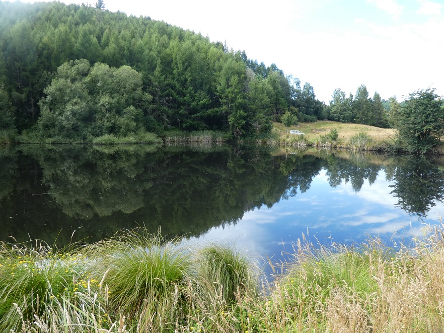
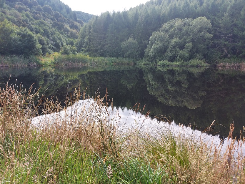
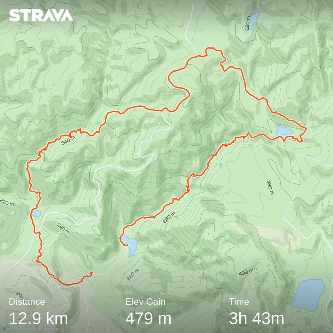
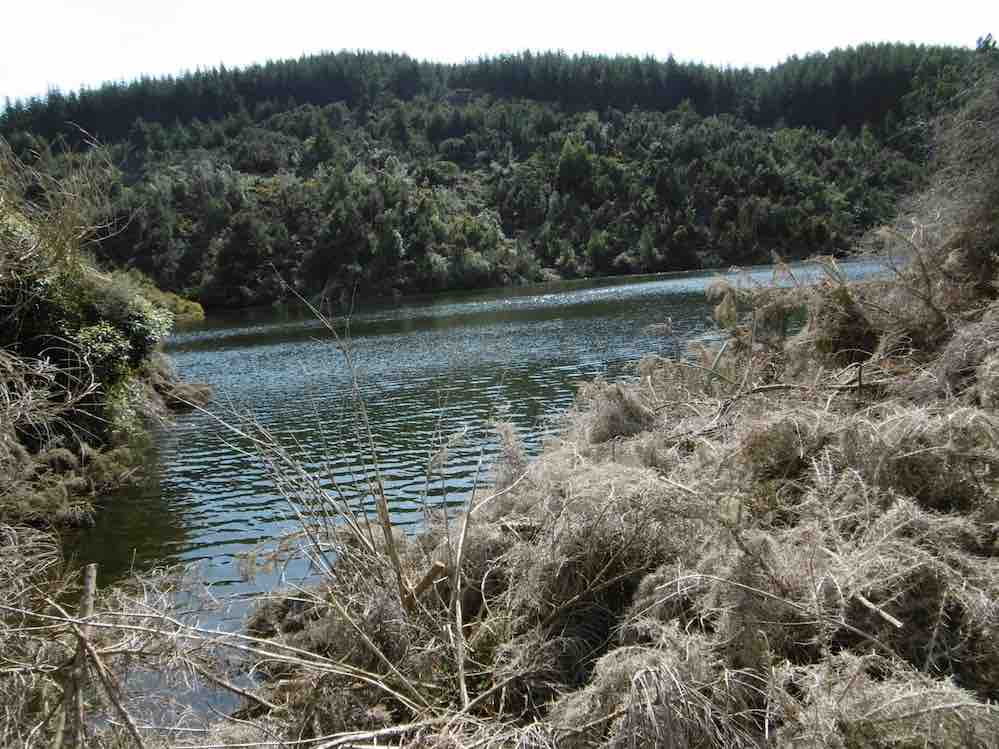
Looking down to the Otago Dam (Photo and Caption Pam)
Upon a slight rise in the road, we enjoyed a view down into Otago Dam which was full to the brim as usually there is just a trickle of a stream.
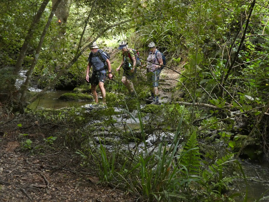
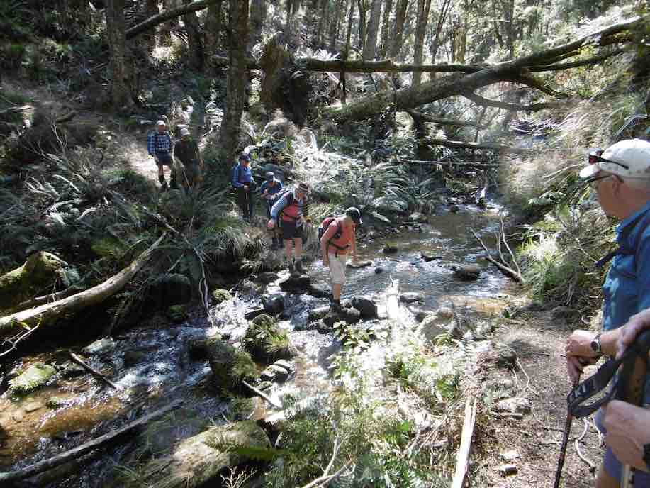
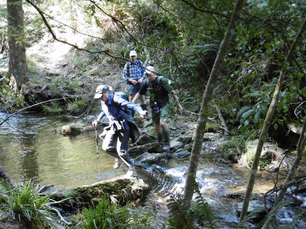
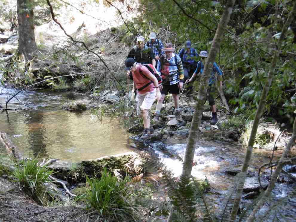
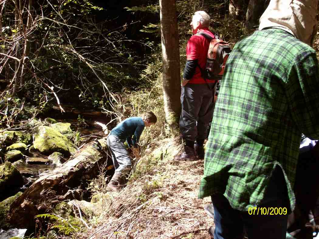
The entrance onto the Dam is now much clearer than other recent club forays and we stopped to pose, as you do in these sorts of places. From here it was a slow and steady descent through beech forest for a couple of hours, as a little care was required on the steeper parts, as well as completing half a dozen stream crossings, and of course the banter about the number of flood warning signs there were and how many hundreds of metres did each sign say?
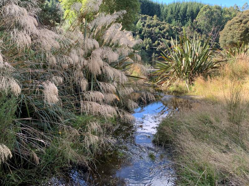
Interesting creeks, luckily none were flooded! (Photo & Caption Marijke)
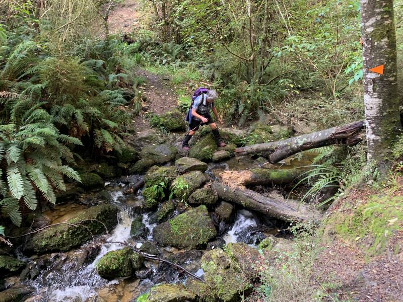
Chris negotiating another creek crossing (Photo & Caption Marijke)
As we emerged around Grey’s Dam into the bright open car-park many mused on the fact ‘that last time this was where the bus was parked, and we took our boots off and lay in the sun…..’
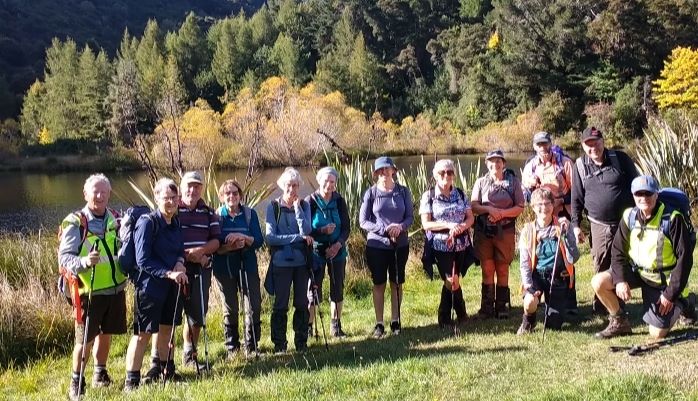
Greys Dam group photo (Photo & Caption Phil’s camera assistant)
Grey’s Dam without the group, what a lovely spot! (Photo & Caption Marijke)
After the inevitable team photo with the autumn coloured back drop, we set off for the last ten minutes of walking to the cars, where we did take our boots off; the general consensus being it was to be each car for itself back into Lawrence (the tree had been cleared) and get an ice cream on the run which we did do, helping us to get back to PJ park at 4.45pm, just as the first bus pulled in to take folk to the Rod Stewart concert. For those that went, is he still sexy? Is he still sailing? Did Cyndi just want to have fu-un?
Happy Trampers posing (photo & Caption John)
A great day out, thanks to the drivers especially and to Rayonier Matariki Forests for access to Glendhu Forest. For the trampers 11km, walking time 4 hours 30 minutes, 350 m altitude gain and I’m sticking with Grade 4.
Phil
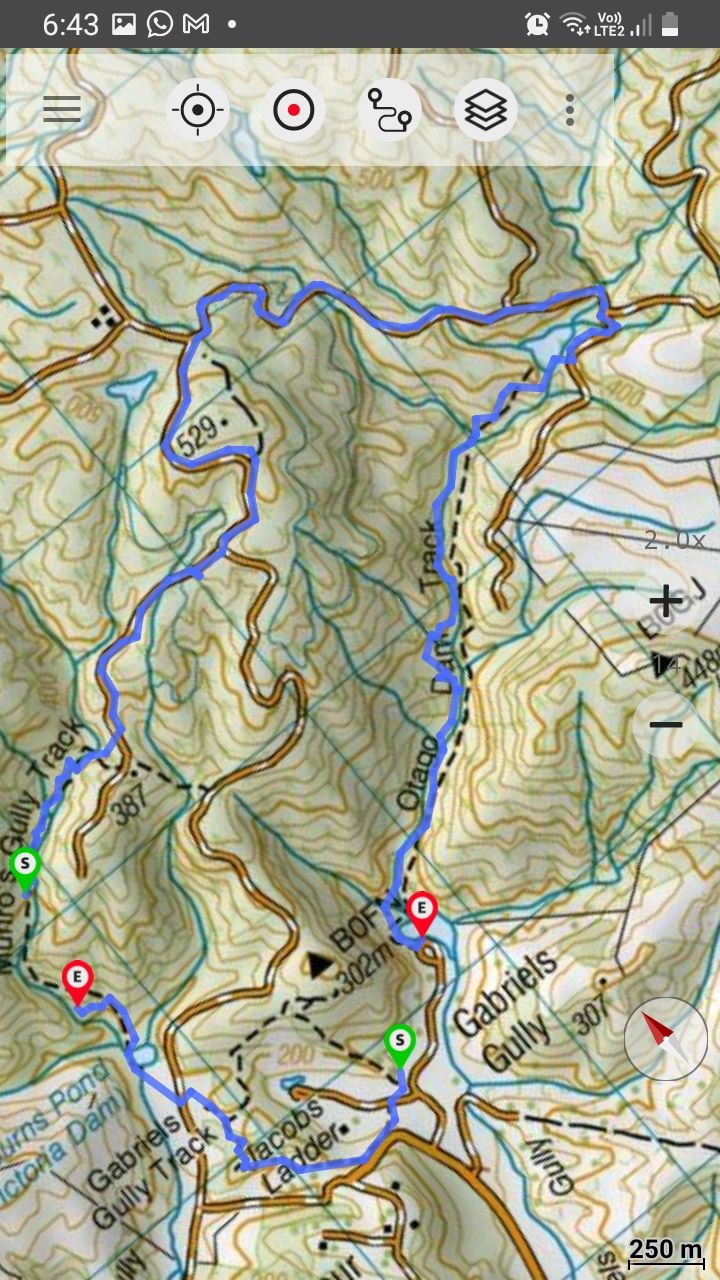
Walk map – Phil
6. 3/2/21. Combined. Gabriel’s Gully/ Munro Gully Track/ Glendhu Forest
Gabriel’s Gully: Lawrence 3 February 2021
Well then, what about the best laid plans of mice and men…… thanks to everyone for being early, and money in the bank, but we were undone by an accident near Burnside that held the bus up! Fortunately there was no walk out, and once it arrived, everyone jumped on board to go for a ‘walk about’ at Gabriel’s Gully, on a near perfect day, not too hot & not too cool. Just perfect you might say.
Richard the bus driver did his best to get us back on schedule, and after a short stop at the corner in Lawrence, we arrived at Gabriel’s Gully just after 10am; so naturally the 40 participants partook of morning tea and readied for the walking, as you do!

“Morning tea on arrival.” – Photo and Caption Clive
With map in hand the 7 (including the driver) in the Jan Team (thanks Jan B and Jan Y) headed up the hill to undertake the Interpretive Track, and to spend an hour or two absorbing the history of the area.
The remaining 34 headed to Munro’s Gully on the opposite side of the Gully, with the groups able to wave to each other, almost ‘Bon Voyage’ like at a wharf.
“Off we go!” – Photo and Caption Gordon
“Follow the person in front around the loop.” – Photo and Caption Noi
Passing both an old Mine Shaft and the North of Ireland Battery, the self-named Team B (29 walkers) led by Phil, opened up a bit of a gap on Raewyn’s Team A (5 walkers).
“Underground mine shaft.” – Photo and Caption Noi
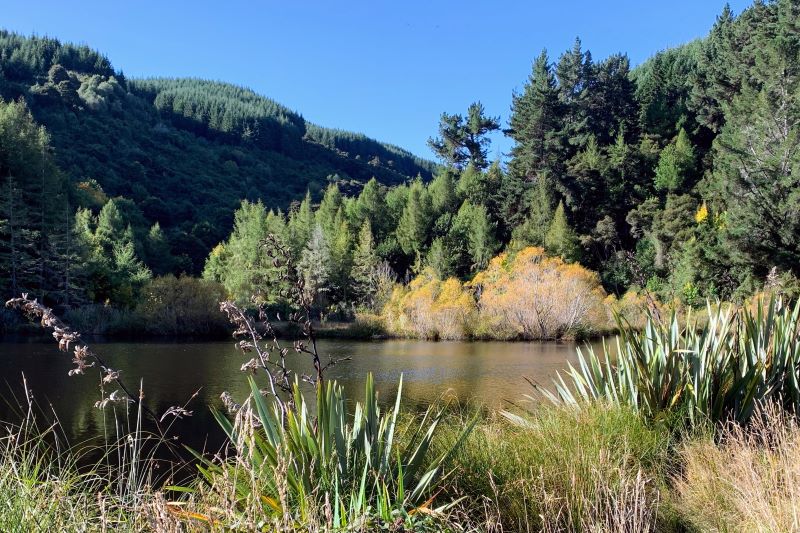
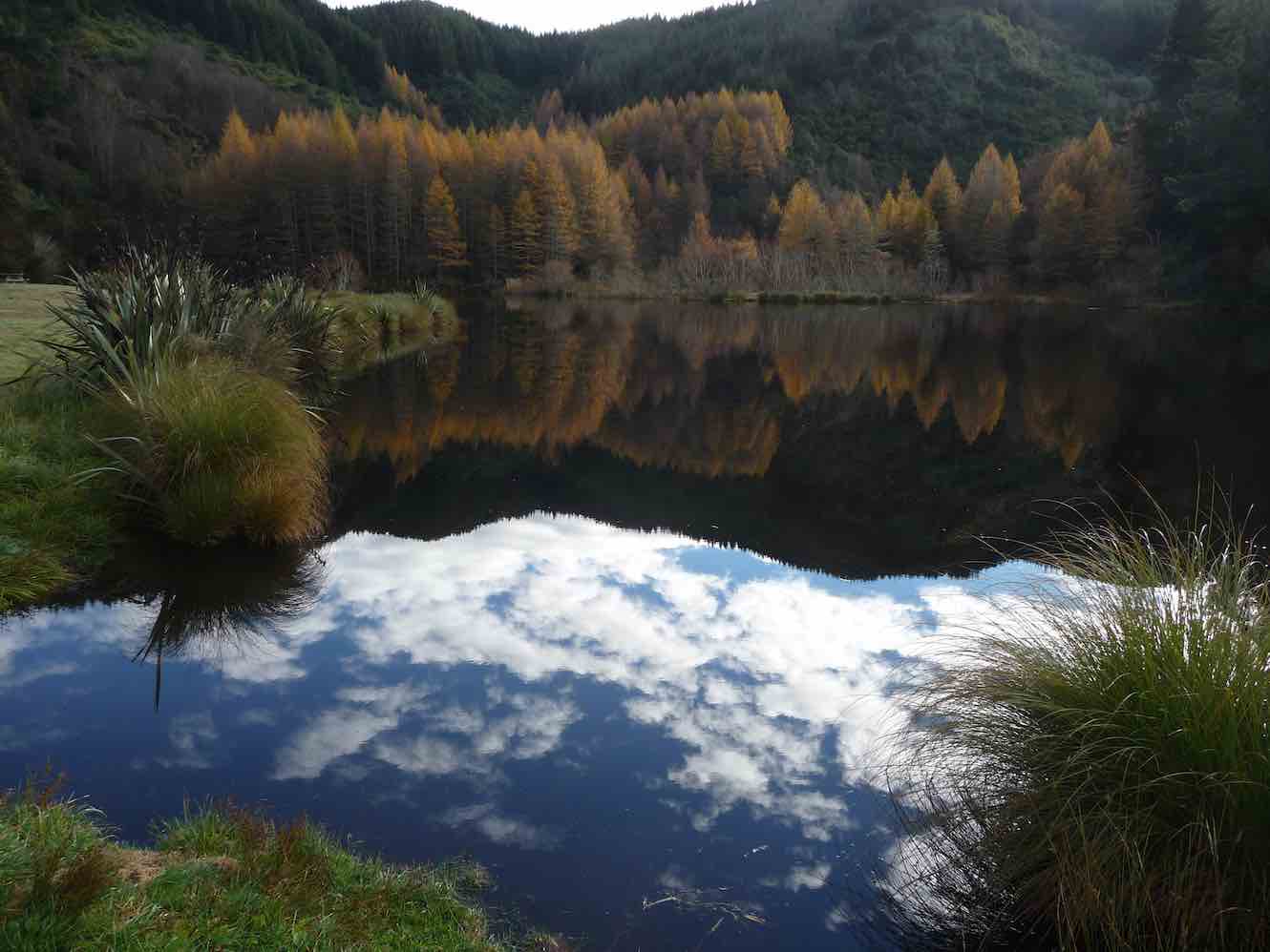
Crossing Munro Road and heading for Milburn’s (Victoria) Dam, there was time to stop & take in the reflections, no hint yet of any early autumnal colouring.
“Victoria Lake.” – Photo and Caption Gordon
From the Dam it was a steady ascent through the lovely beech forest, with those pesky red Rowan berries trying to outdo the red colouring on the native Horopito (pepper) trees.
Some impressive bracket or shelf fungi were visible (Ganoderma); in days of old, these were sent back to China by early immigrants apparently having amazing medicinal properties; at a more practical level they are rock hard and used for intricate wooden jewellery. They attack the diseased heartwood of a still living tree.
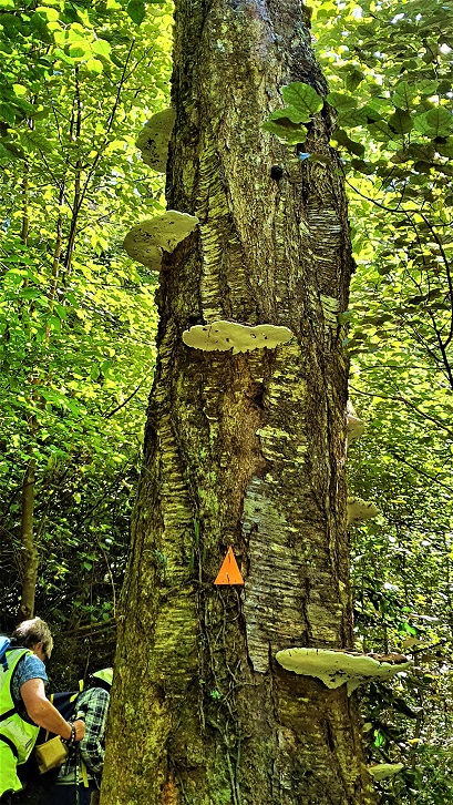
Bracket Fungi on some of the trees.” – Photo and Caption Clive
The rise and fall of the track gave time to take in the babbling brook, ferns, mosses etc and the dappled light was well, beautiful. For Team B we were welcomed about 2/3 of the way up by some Falcon screeching, with some brief sightings – this was in the same place as the week before recce, where 3 came much closer and all being very visible. I was reminded in this time and place of Wendell Berry’s lines “Always in the big woods when you have left familiar ground, and step off alone in to a new place there will be, along with feelings of curiosity and excitement, a little nagging dread. It is the ancient fear of the unknown and it is your first bond with the wilderness you are going into”.
“Terrific Bush” – Photo and Caption Gordon
After an hour and a bit, pine cones were lying on the track, an indication we were getting near Glendhu Forest, ‘the top’ and not long after, we emerged on to Road 21, the lunch spot right on 12 noon. Most sat on the road with feet downhill, almost meant to be!
“Lunch.” – Photo and Caption Gordon
The arrival of Team A gave rise to enthusiastic acclamation – well done! After some chit chat, 4 of Team B were welcomed into Team A. They returned to the Gabriels’ Gully car park via Cornishman’s Dam, down through the forest beside water races to Pollard’s Dam and then followed the Interpretive track to their destination. Once reconnecting with Jan’s Team they all drove off to Lawrence to enjoy the local delights.
This left 25 in Team B, and so we headed off up through Glendhu Forest on Road 21 thence Victoria Road. At the top, this provided great views of West Otago and I think Northern Southland in the murky distance. Thence down Road 22 through a delightful archway of Douglas Fir and at the intersection of Roads 22, 23 and 24, we found a ‘yellow ribbon tied around a wineberry tree’. Amazing.

“On the road to the top.” – Photo and Caption Gordon.

“Heading down to Otago dam.” – Photo and Caption Gordon
Peter led and held some branches whilst Phil snipped away with secateurs, and soon enough found the grassy track out and on to Otago Dam.
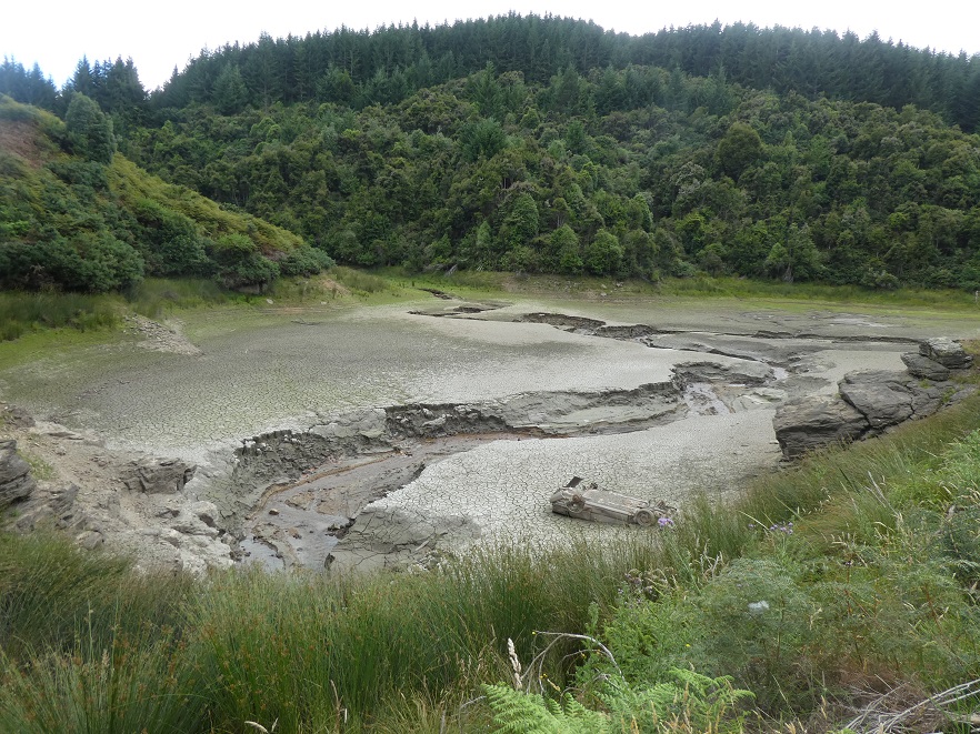
“The dam Honda and all!” – Photo and Caption Gordon
We had a well earned 5 minute or more break here, the natural beauty and features of the area distracted by the local traffic control officer inspecting the Honda vehicle (upside down and buried in the silty base of the Dam). Naturally this gave rise to important questions in life, such as how did it get there, did a helicopter drop it, what year and model was it, was it 4WD etc?

“Beautiful but not really for lunch!” – Photo and Caption Helen.
As no answers were forthcoming we wandered off and descended down the Otago Dam track; downhill all the way, but interrupted by flat water race, flood zone tracks and 6 stream crossings, (some almost suited to meeting Friar Tuck coming the other way).
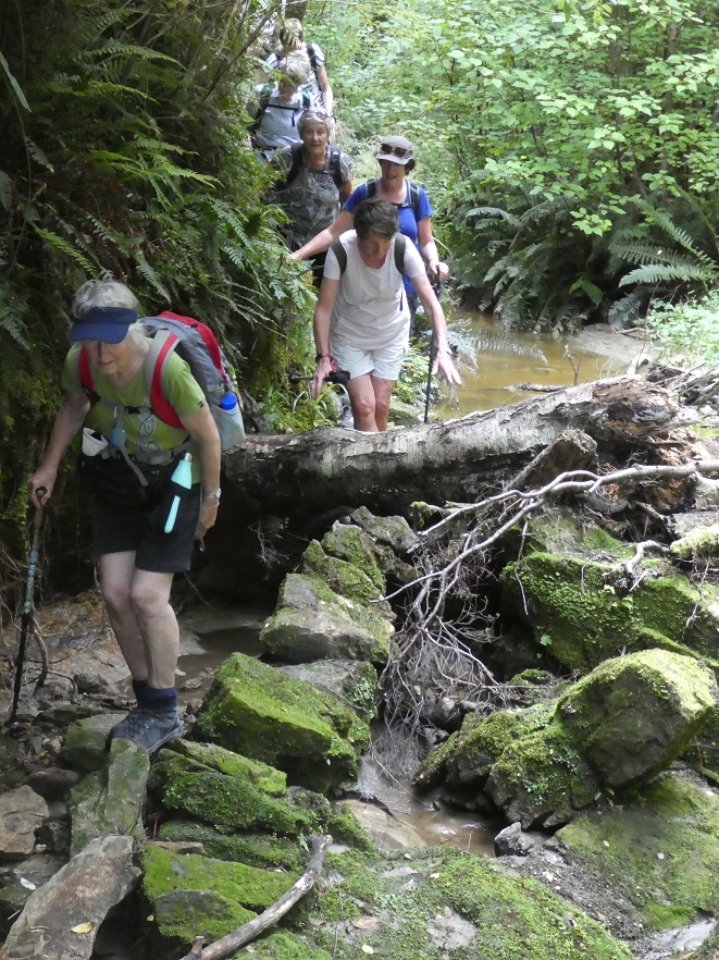
“One of the obstacles heading down.” – Photo and Caption Gordon
“Old water races leading from the dams on the way down.” – Photo and Caption Clive
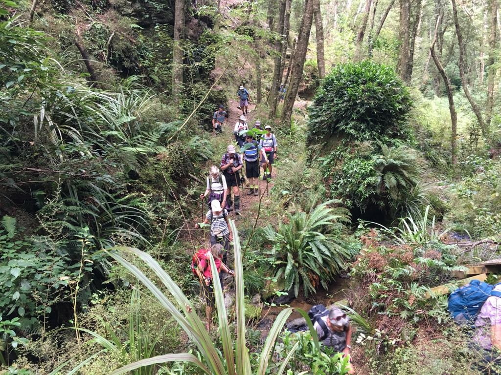
Photo and Caption Pam
“Final crossing.” – Photo and Caption Gordon
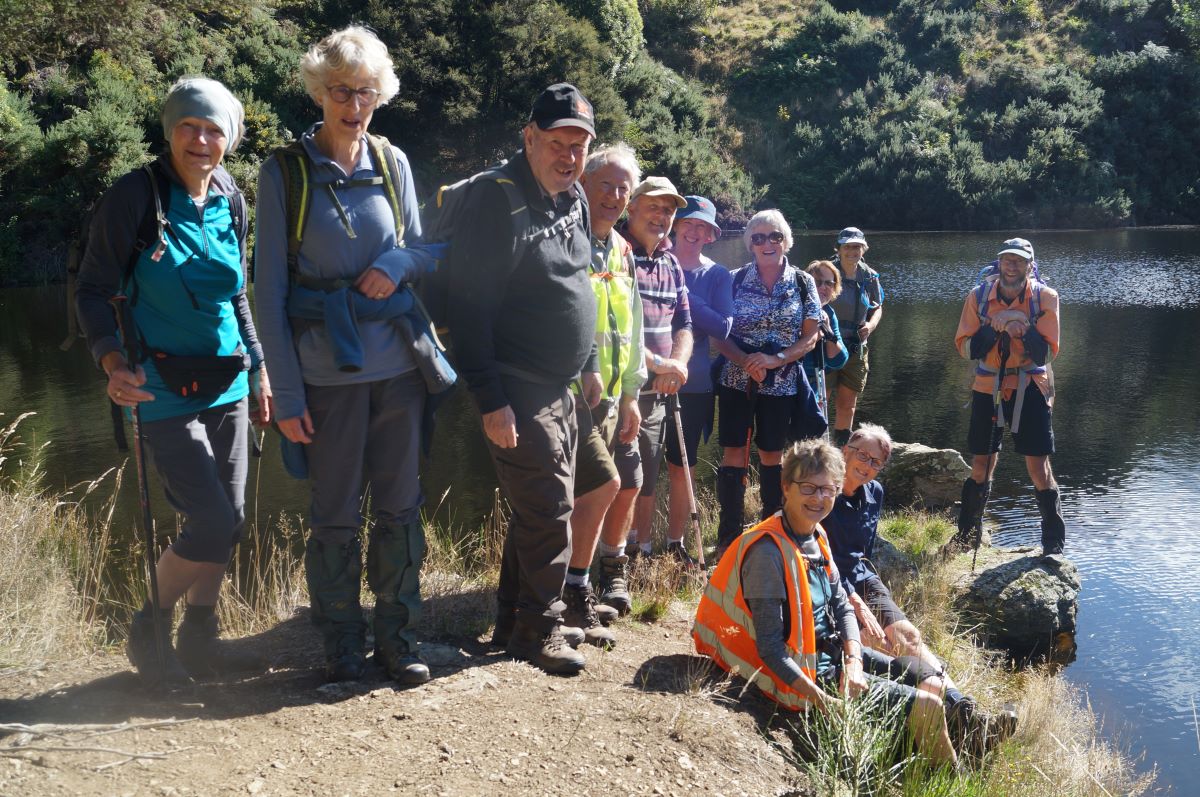
It was heartening that just over an hour of walking we glimpsed the sparkling waters of Grey’s Dam through the dappled trees and at 3.15pm were warmly greeted by Richard; the grass was cut, the sun was shining and ah well we could have done some sun bathing here for an hour or two, or indeed had a well earned beer or two.
“Beautiful reflections.” – Photo and Caption Helen

Photo and Caption Pam
But to no avail we needed to return to Lawrence for well earned ice creams, coffee and cake, with all shops being supported by our patronage, and of course, and more importantly, to catch up with Team Jan and Team A, who had all made it ‘home’ safe and sound.
“From Team Jan
“A relaxing trip home.” – Photo and Caption Jan B
“Homeward bound.” – Photo and Caption Noi
Soon enough it was ‘all aboard’ and ‘mind the gap’ (I have always wanted to say that) and we set off to Mosgiel at 4pm, arriving at the car park at 5pm.
Due to the modern miracles that are GPS and Fit Bit apps, there was naturally a very wide discrepancy in the distance covered by Team B, ranging from just over 9km to nearly 13km. Given the positive nature of the feedback the day was very successful, so it is suggested we return sooner rather than later (maybe with an independent referee from the America’s Cup regatta to adjudicate?). Team A covered just over 6km.
Team B’s route.” – Photo and Caption Phil
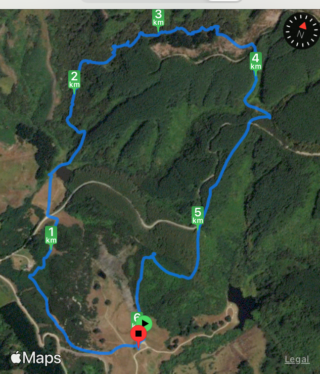
“Team A’s route.” – Photo and Caption Phil
We are sorry the Vintage Club visit didn’t eventuate for those interested, it appears they forgot.
Thanks again to the two Jan’s, Linda and Ross for supporting us on a great day out, and to Rayonier/ Matariki Forests for allowing us in to Glendhu Forest.
Phil
5. 22/5/2019. Trampers. Weatherstons/Blue Spur (Gabriel’s Gully)/ Munro Gully Track/ Glendhu Forest/ Weatherstons Phil
You can’t beat Kiwis for turning up on time to start a tramp ….we may have even been a minute or two early leaving, so keen to get going….and yes red sky at dawn shepherds warn is just an old wives tale.
17 folk emerged from the cars at the Lawrence Loos before heading out to Weatherstons (population in 1862-500), off the Waipori Rd and we were on the walk at 9.45 am in a less than balmy 6 degrees, so we decided to walk up to the ridge for half an hour to find the sun to have a cuppa; this would not be the first time the craic would abate on a hill……on along the ridge we shambled giving good views of the hills and ridges that had been washed away by the mining activity…. then we dropped off quite quickly in to Gabriel’s Gully, the majority entering through a high quality fence, with the barbed wire held high by some real gentlemen in the group!
First stop was a small detour to take in the reflections and tree colours at Greys Dam
Greys Dam. (Gordon pic and caption.)
and from there we moved up and around the track at the base of Blue Spur, the manmade landscape reminding one of the Arches National Park in the good old USA. On past the Northern Ireland Battery and then it was across Munro Rd to the start of Munro Gully track (population in 1862-500!). Population today 1 dead pig in the middle of the track who’s gut and entrails having been devoured by the ‘hound of Gabriel’s Gully’. There was still some colour in the trees over Victoria Dam to offset the gruesome find.
Munro Gully track was a steady to steep in places 50 minute ascent through native forest, with a good sprinkling of red and mountain beech, ferns, astelias, red berried coprosma (yummy). Regular forest glades allowed time to regroup as well as start up the craic again. Bird life was good on the sunny side of the street. Lunch was taken slightly ahead of the guides predictive time, on the edge of Glendhu Forest, as the pine needles were dry and it was sunny, and well some smiles were more like grimaces as we finished off the last of the steep stuff.
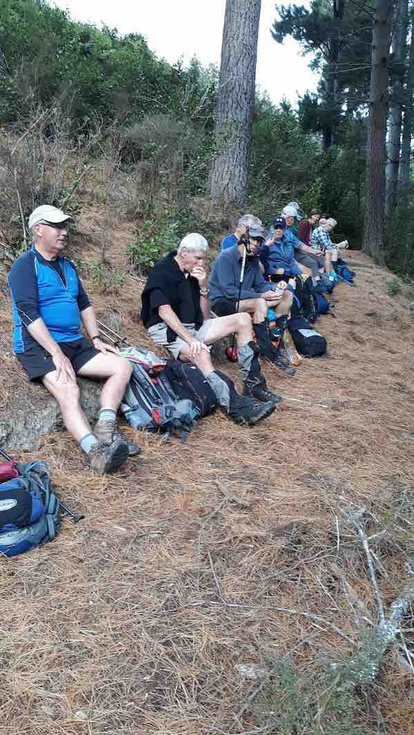
Some at lunch. (Helen pic and caption.)
It was a pleasure to walk on pathways of thick beech leaves, and later pine needle.
Post lunch immediately brought some negative feedback as we were still heading up a hill! But then it was onto and down and around Cornishman’s Dam to emerge on Munro Rd thence back into Glendhu Forest and following ridge and water races quite steeply we ‘sped’ downhill; some impressive remnant piping systems were still viewable and the depth of the races stirred memories of WW1 trenches; it was at this point we became aware of eyes in the forest following us. Yes the famed Gabriel’s Gully herd of black mink coated goats were almost playing chicken with us, dad wives and kids all shambled off in due course – as did we!
We emerged in to a golden coloured forest and climbing a style dropped in to Pollard’s Dam which was dry – phew. After soaking up more history we detoured into the Raceman’s Cottage site for more history, with some plant life remaining from the cottage garden.
Family names of Racemen of that time were familiar to an attendee of Green Island primary school in the early 1950’s.
From here it was a steep drop off back into Gabriel’s Gully
A hill of Sluicing tailings. (Gordon pic and caption.)
and a quick breather, but not wanting for folk to get too comfortable we were soon up and at it again, the walk back over the ridge to Weatherstons seemingly so much quicker on the return journey, maybe it was the smell of the coffee n cake wafting up the valley from 26 On Ross, which we were all highly complimentary of,
26 on Ross St.Great end to Great tramp. (Gordon pic and caption.)
and yes the loo had the most vicious but effective hand drier in the whole wide world. Art can also attest to a great ice cream at the corner shop.
17 trampers returned to Mosgiel, commenting it was good to feel a little stiff and sore, a moderate level of comfortable discomfort. The linking together of a number of stand alone walks in to one had made for a day of history, interest and variety and it was almost unanimously agreed to be a walk of just under/ or over 15 km – or thereabouts! – Phil.
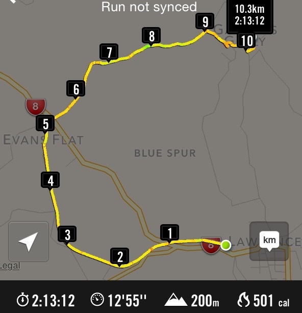
GPS of Hikers’ route: Rail Trail, Munro and Blue Spur Roads. (Add 0.22 km to route as slow to switch on the Nike app at the start.)
Hikers started off along the trail about 9.50am and walked for about ½hr till we came to suitable place to sit and have a welcome cuppa …
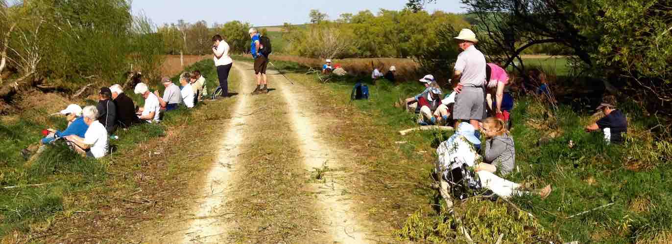
Cuppa stop.
…before carrying on to where the trail crosses the main road to carry on to Roxburgh.
Evans Flat sign on trail where it crosses SH8, and where Munro Road begins across the highway.
Here we stopped to sort out those who felt they had walked far enough from those who wished to carry on along Munro Road to Gabriels Gully.
There were 8 who opted to wait for bus to take them to Gabriels Gully where they had their lunch and waited for rest of us to walk there via Munro Road. They found it hard to find a place out of the gale force wind to sit and enjoy their lunch but did find somewhere reasonably sheltered in the end.
The remaining 21 hikers set off about 11.30am along Munro Road having decided to try and find a suitable place to have lunch about 12.30pm. Wind by this time was getting worse but we did find a reasonable place with some shelter from wind and sun, which by this stage was getting pretty hot. From here those that were going to do the Interperative track when they got to Gabriels Gully, 15 of them, set off before the remaining 5 of us who had decided we would just take our time doing the rest of walk to Gabriels Gully. Well, taking our time was not an option but a necessity! The wind kept coming in violent gusts that were threatening to bowl those of us of smaller stature completely off our feet. It was a case of us hanging on to each other to keep our feet on the ground! What a very welcome sight it was to get to top of hill and see the bus waiting for us at end of road. We had walked about 11km and with battling the wind as well as the walk, it felt like it.
By this time only the trampers had yet to be picked up and that had been arranged for 2.40pm. As it was only about 2pm bus took us back to Lawrence where we all went to various places for refreshment of choice, a look round shops or whatever one felt like doing to fill in time till 3pm when we were due to leave.
All back in bus and ready to set off for Mosgiel by just after 3pm. A tired but happy group who all agreed we had had a good day out in spite of wind and heat. – Bev.
Trampers’ Report.
After an uneventful bus trip to Lawrence, the bus dropped 9 trampers at Greys Dam in Gabriels Gully, where we had morning tea, before tackling the track up to the Otago Dam …
1. Otago Dam away above Grabriels Gully (Ken pic and caption)
… high above where we were. As the track had a closed sign on it, there was some questions as to whether we could negotiate it all the way up.
I was pleased to see the first creek crossing was low enough to get across without getting wet feet, however one party member [who shall remain nameless] decided she would tackle a slippery rock, & came off 2nd best, ending on her knees in the creek. No damage was sustained, except to her pride.
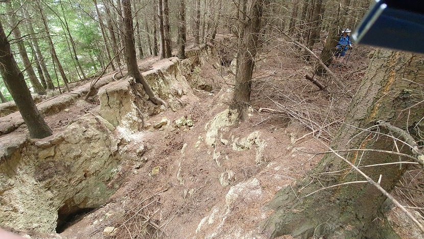
As we made our way up the track, the storm damage was very evident to see,
4. Track conditions- not all like this! (Ken pic and caption)
but there was nowhere we got held up due to fallen trees etc. as the track had been mostly cleared so you could at least keep going.
There are about 5 creek crossings to negotiate, but we all made it safely, with lots of encouragement, & directions on where to put feet, & what to hang onto.

5. A balancing act (Ken pic and caption)
8. Will we all make it with dry feet (Ken pic and caption)
13. Can I run on water (Ken pic and caption)
On reaching the top at the Otago Dam, we all had a look at the very nice waterfall at the outlet of the dam, then we crossed over the outlet, & walked around the track along the side of the dam to get a better view. We then walked back down the track about 50mtrs. to a sheltered spot [it was blowing rather hard] for lunch.
After lunch we made our way back down the track, tackling the creek crossings with renewed apprehension,
12. thank god it’s the last one (Ken pic and caption)
& eventually arrived back at Greys Dam, where we had a short break before walking back to the car park in Gabriels Gully, & starting on the interpretative track around the gully perimeter,
14. Remains of Stamping Battery (Ken pic and caption)
ending up back at the car park just before the bus arrived to pick us up for the return trip home.
A stop for ice cream in Lawrence was enjoyed by most, before setting off homeward bound.
It was mentioned to me that the day was enjoyed very much, & that some were surprised by their fitness level.
Walked 9.4km
3.6km/hr
climbed 777mtrs.
max elev. 409m – Ken.
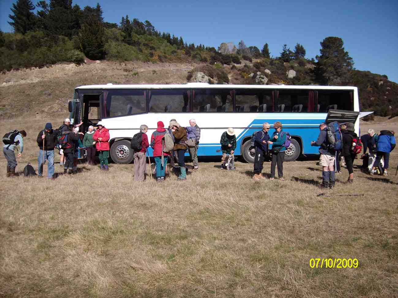
Disembarking from our 53-seater bus (Ken pic)
Morning Tea near bus.
Stream scene
Preparing for lunch.
Lunch
Bruce on the crest of a deep waterfall
Crossing stream. The Otago Dam on the left, waterfall just out of sight to the right.
Ian descending Munroe Gully Track. (Ken pic)
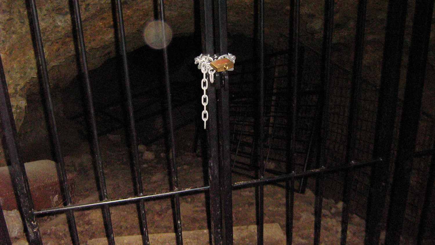
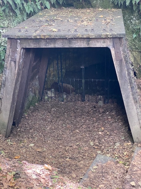
Mine entrance with new padlock on gate

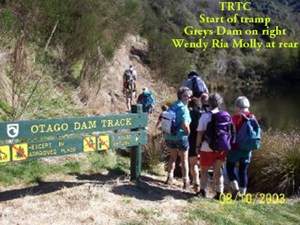
Wendy Ria Molly. Otago Dam Track start. Greys Dam on right
Greys Dam
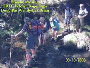
Stream Crossing below Otago Dam. Doug Pat Wendy Lex Brian
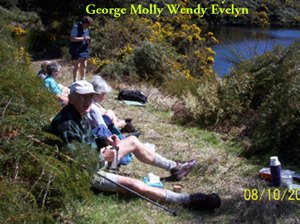
Lunch Otago Dam. George Molly Wendy Evelyn
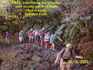
Munro Gully mud. Pat Wendy Ria Doug J, Lex Doug M
Steep descent from tailings. Doug Bill Pat Wendy Bob Arthur
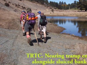
Sluice bank nr end. Doug M, Doug J, Lex, (who?)
Great photos…looked like a great day and interesting tramping. Sorry I couldn’t be there but still can’t walk on uneven ground.
Yeah, it’s tough. We miss you badly. Thanks for the post appreciation.
It WAS a good day.